As a kid, I had been entranced by the pictures of sand dunes and forts in school textbooks and children’s magazines. One particular image from a Tinkle issue – a coloured sketch of the Vijaya Stambh at Chittorgarh fort had stuck in my mind, and in 2013, on one of my solo trips, I finally set foot on the Chittorgarh fort, and was absolutely spellbound by the location atop a table-top hill and the scale of the area bounded by its imposing walls. I have explored Rajasthan further, making it a point to explore at least one new place every year. Until before the pandemic struck, I had visited almost every major city of Rajasthan and then some.
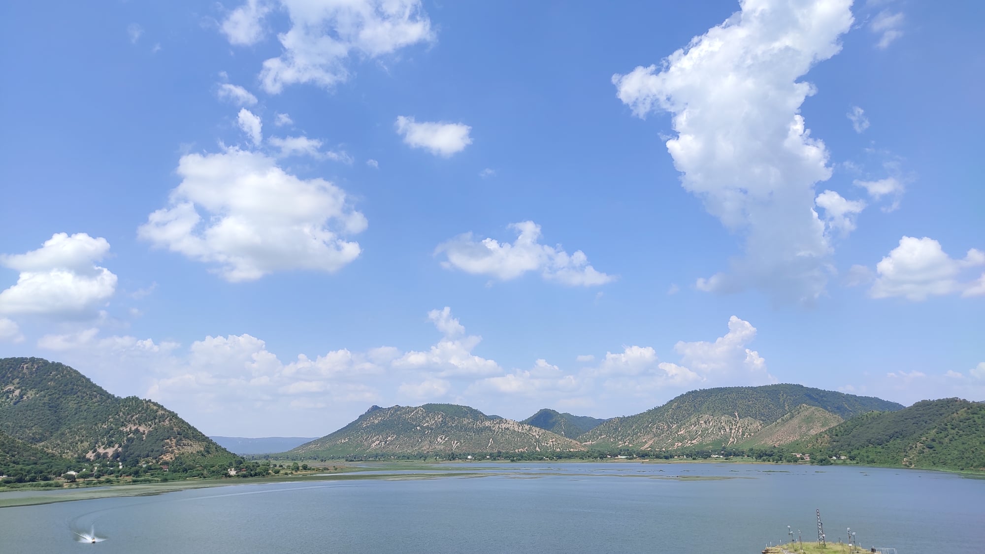
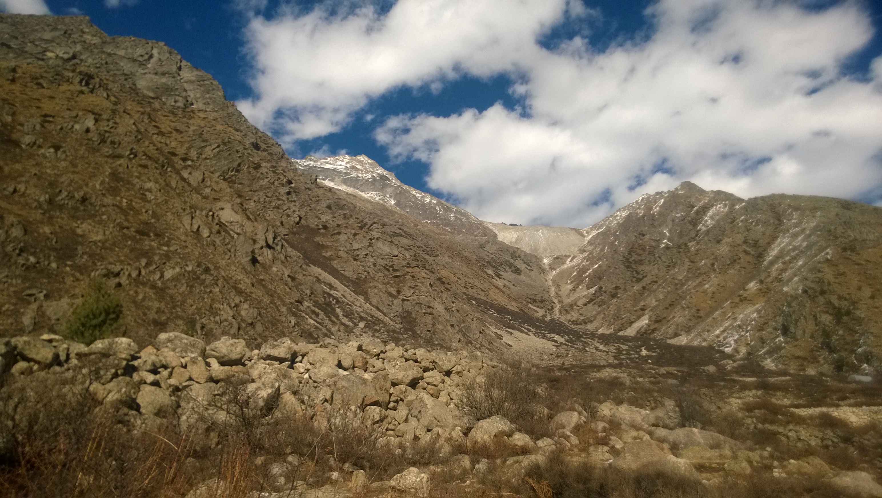
However, it has never been about the destination as far as Rajasthan is concerned. Looking through the State Roadways bus windows, or craning the neck out from cabs and fancily decked-up auto-rickshaws, I have often marvelled at the intriguing shifts in landscapes – straddled by the Aravallis intercepting you shortly after you have entered from the East, with its table-top ranges swishing across like stripes of a tiger, some covered in a rich green cloak, yet others balding with their denuding rocky surfaces exposed, flanked now by swathes of lush green agricultural land, now turning light brown or pink or yellow with short lean trees strewn around as if social-distancing since time immemorial, then slowly turning golden as the ground surface mutates into waves of sandy dunes of the Thar. Abandoned forts and fortress walls crown hill tops every few scores of kilometres. Further south near Mount Abu, the Aravallis look nothing short of a slice from the Western or Eastern Ghats.
There is also a vast Salt Lake (Sambhar) somewhere at the edge of the desert in the heart of Rajasthan. Villages only turn up after long sprees of nothingness, and even then they are a collation of a handful of houses. Dried river channels cross your path occasionally, their sandy beds hinting at an older time of more abundance. Camels trundle along serenaded by their handlers, their upturned mouths betraying an indifference towards their dreary lives. Nomadic herders appear out of nowhere with flocks of little sheep and goats. Deeper in the desert, if you’re lucky, you may spot a monitor lizard or a hyena lurking amidst the shrubs.
Siliserh Lake, Alwar
Bissau, ShekhawatiFatehnagar, Shekhawati
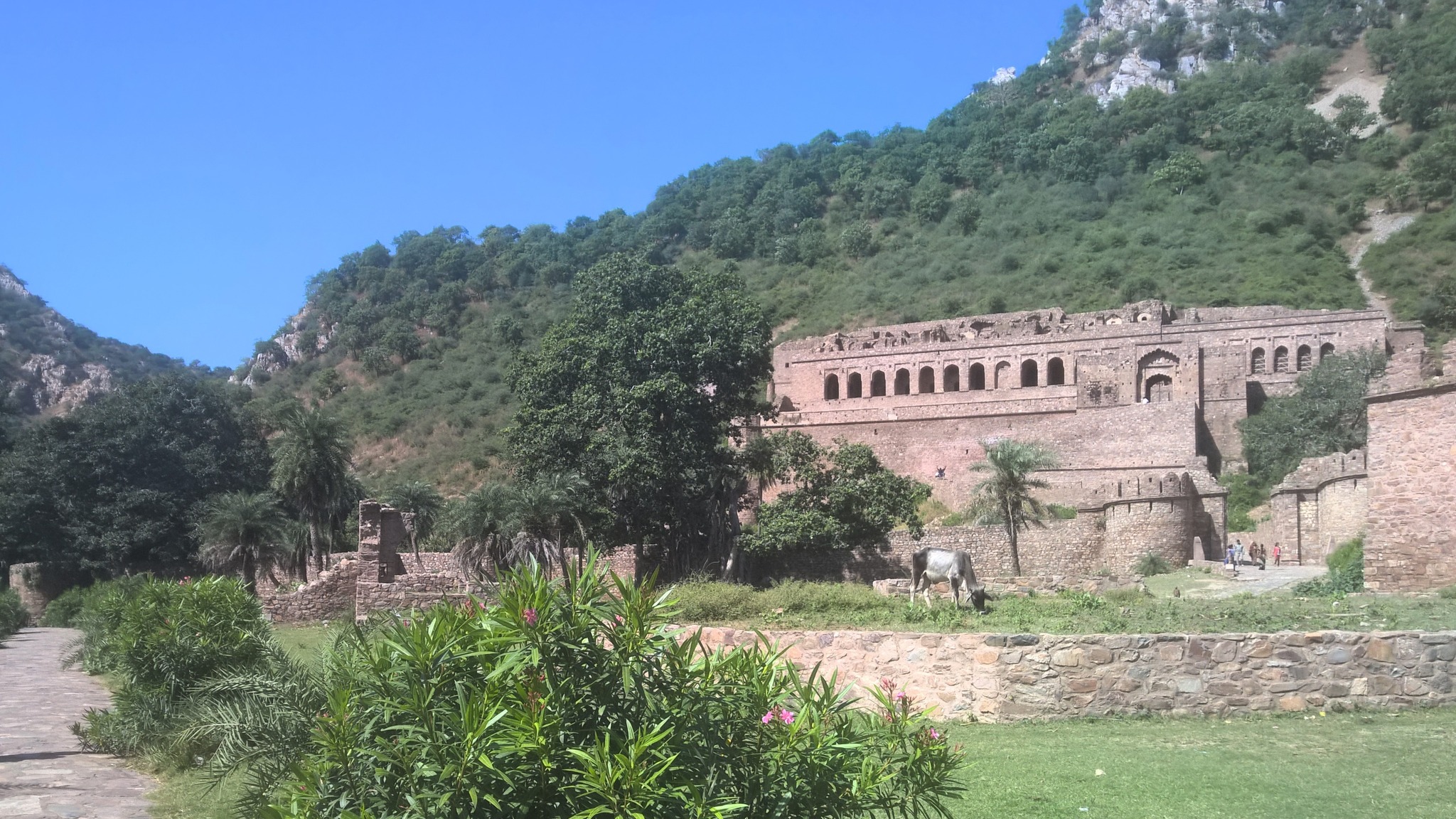
Bhangarh
Gadwaji, AlwarAlsisar, Shekhawati
In all of my trips prior to the pandemic, I have often been constrained by the mode of transport. There have been points or locations on the routes, which I have earmarked to return to later at my own leisure, since stopping by then was not an option. There have been roads emanating from the main roads that have often left me wondering as to where they led to. Now at 35, after learning to drive, I finally have the wherewithal to indulge in the fantasies that I harboured while travelling in my erstwhile cloistered fashion. This is an album to celebrate the many facets of the Rajasthan landscape that I have chanced upon on my most recent and some of my very first ever self-driving trips, which will hopefully be enriched with future trips.
In August-end, a full month after the 2nd vaccine shot, we finally gathered the courage to venture out on a 1000+km road trip. It would also be my first ever 1000+km driving on my own, after having learnt driving a few months prior. Moving to the suburbs of Gurgaon has meant that I now live at the gateway to my most favourite area of this great country – Rajasthan (though it only ties with Odisha for my affection!). So, it was only natural that my first long drive be to places in Rajasthan that have been on my bucket list for ages now.
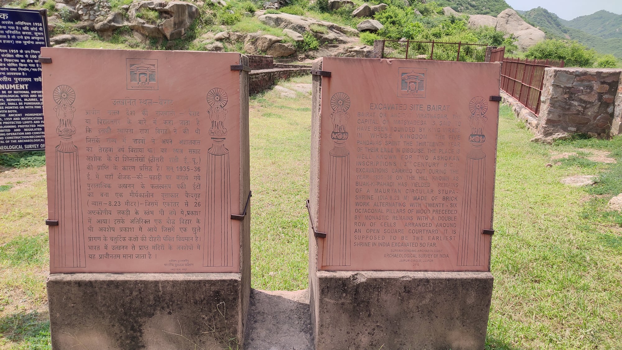
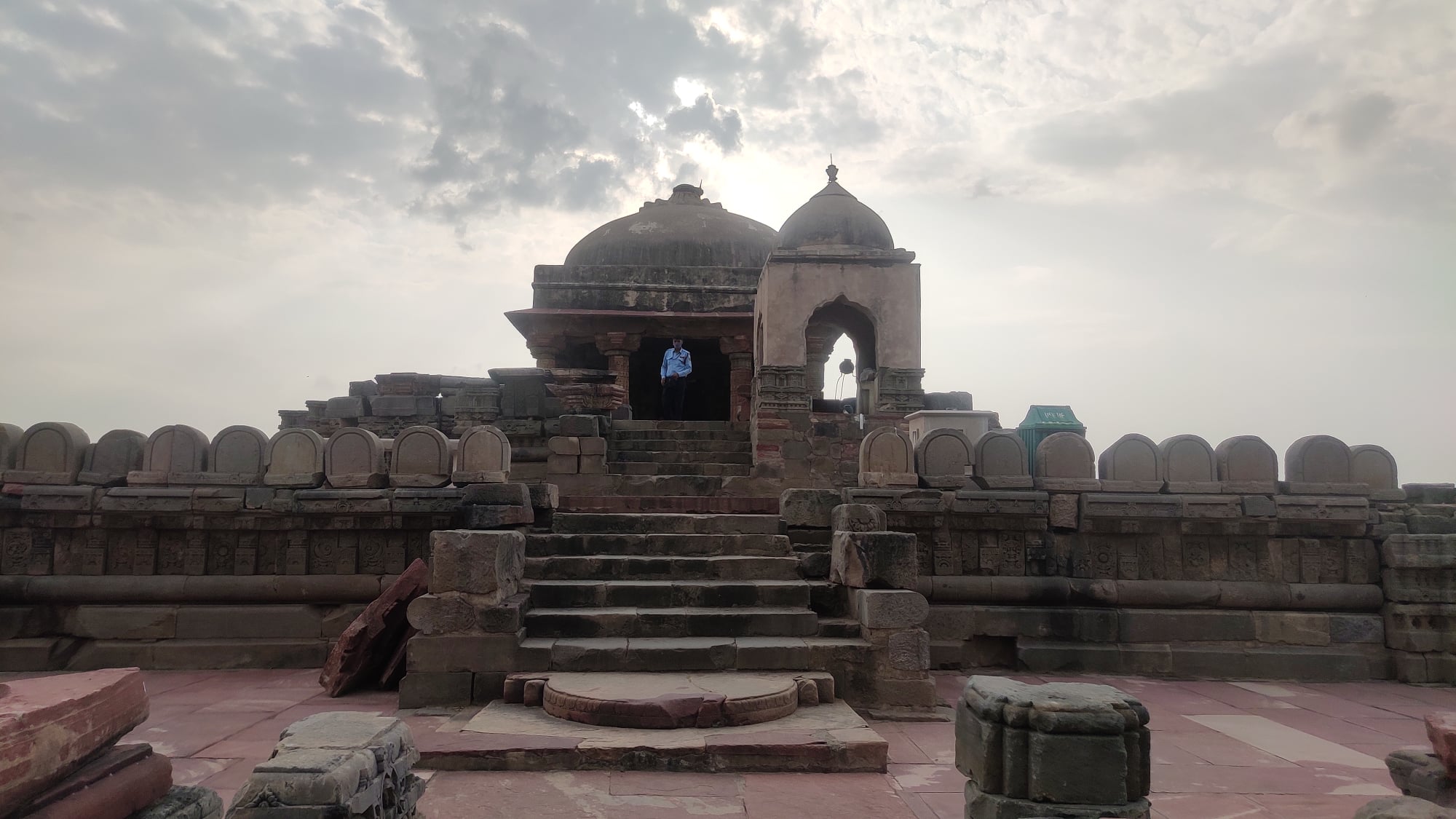
Beejak ki Pahadi, Bairat
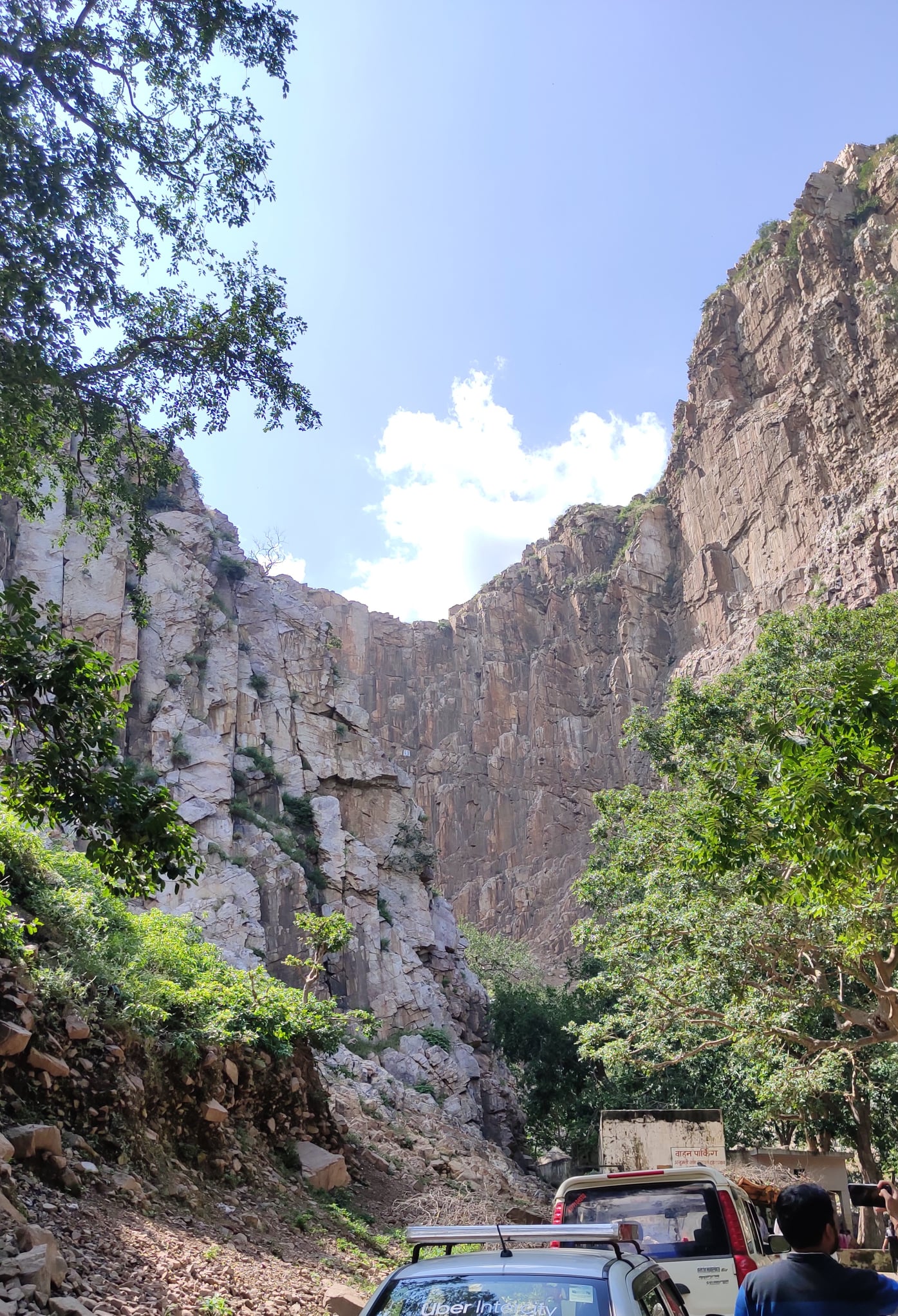
In a nook in the Aravallis, near a town called Bairat, are remains of a Buddhist Monastery of unknown antiquity, where Ashokan inscriptions from around 3rd century BC have been found. It can be reached by veering off the Delhi-Jaipur Expressway 70km before Jaipur on NH 248A, then taking a right turn onto a narrow road from Bairat town, and finally, taking a mix of long flight of steps and ramps to the top of a hill.
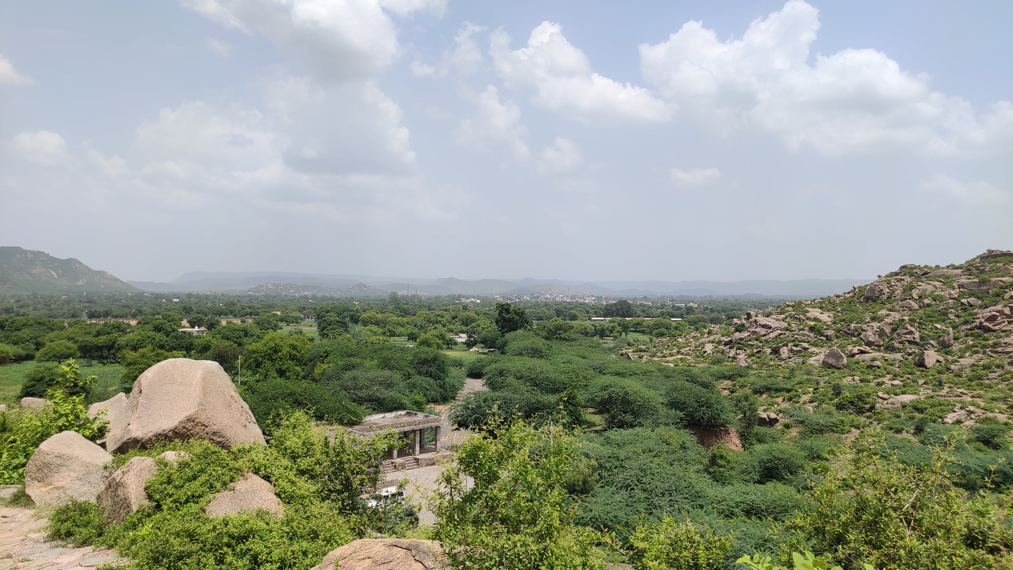
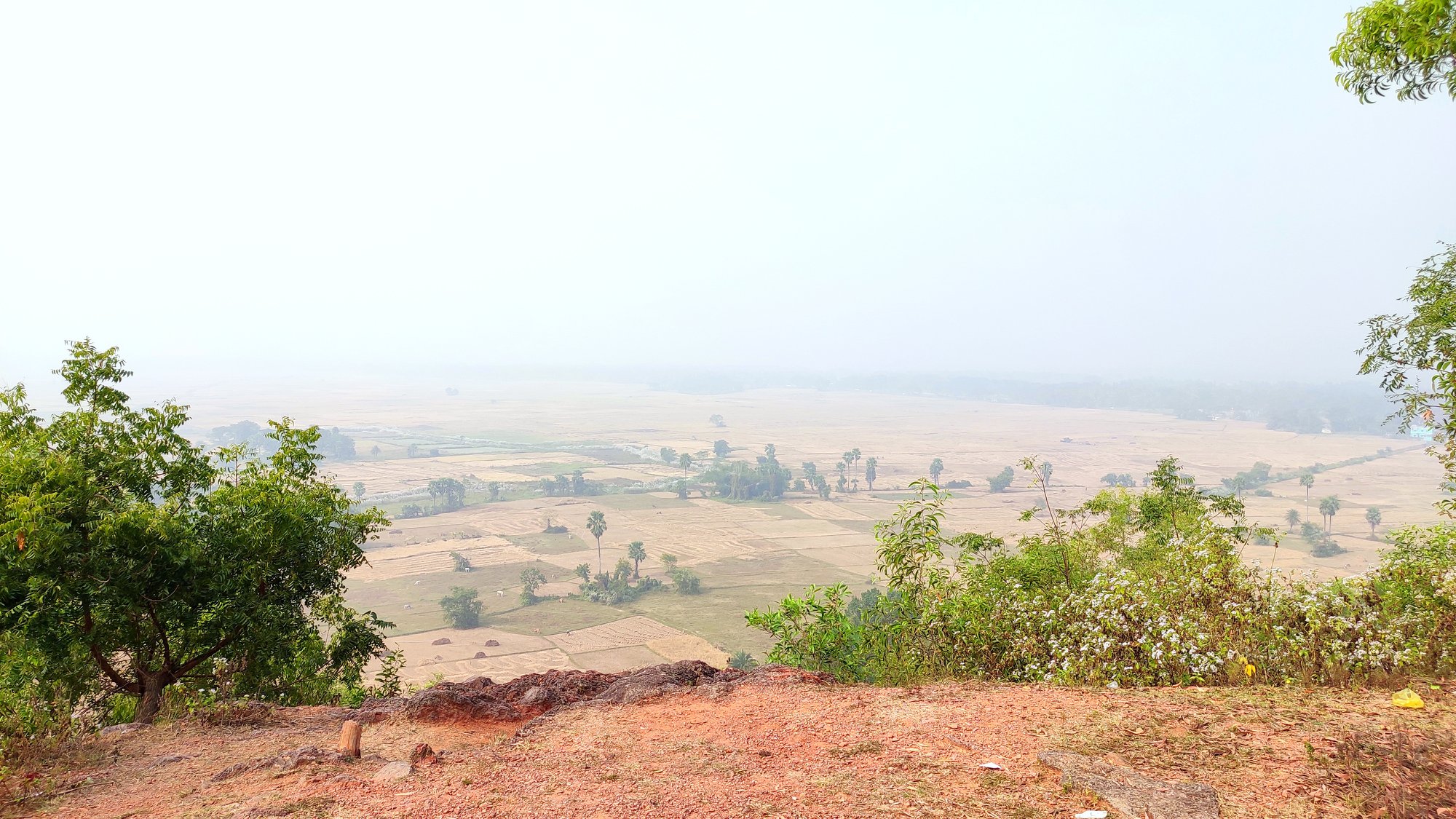
Bairat or erstwhile Viratnagar itself is said to have been founded by King Virata, in whose kingdom the five Pandavas (of Mahabharata) spent the thirteenth year of their exile in disguise. The site of the monastery affords a majestic view of the valley below and undulating hills on the horizon.
Steps leading to hilltopInformation plate for the site
View of the countryside from hilltop
Remains of the 3rd century BC Buddhist temple, one of the oldest recorded temples in India
P.S.: I came to know later that this is one of the oldest places of worship that we have recorded history of in India .
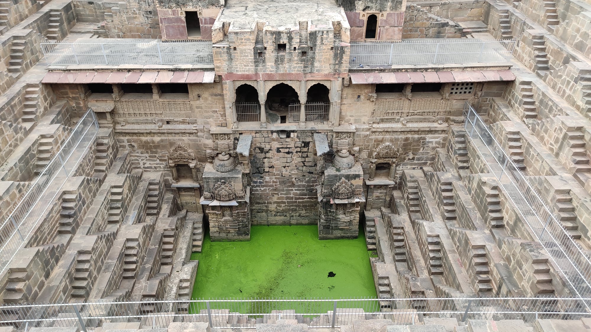
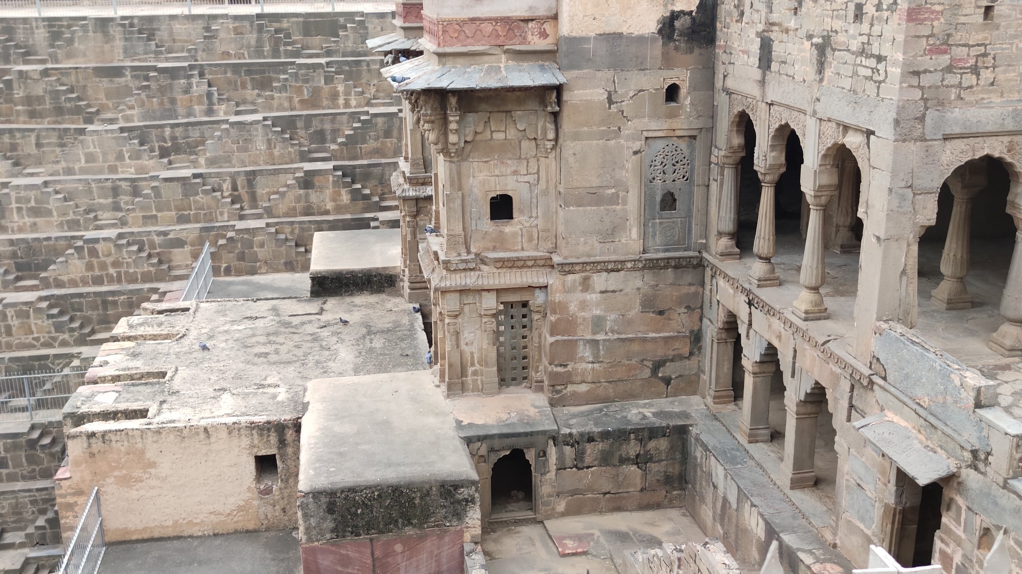
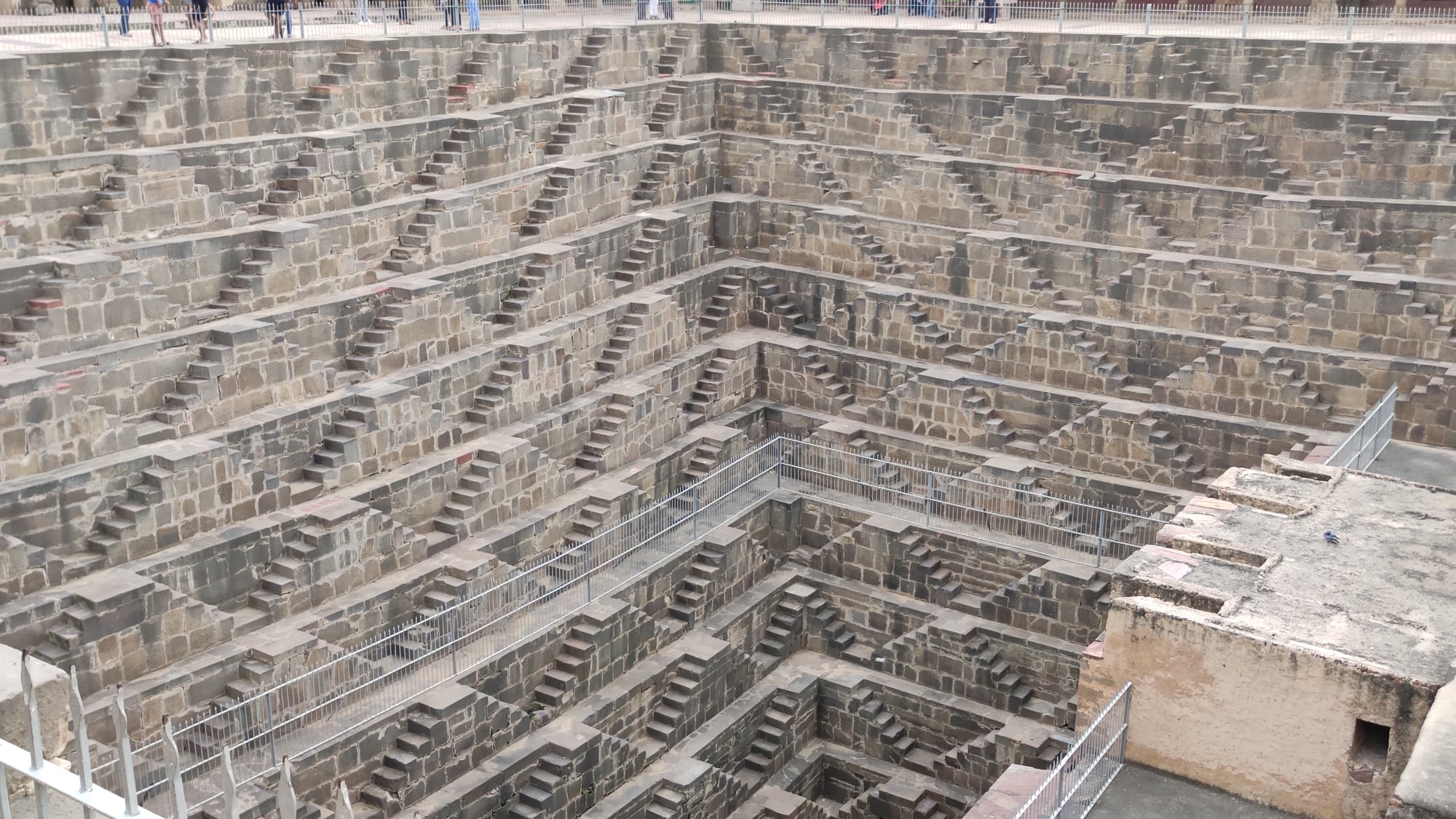
Abhaneri
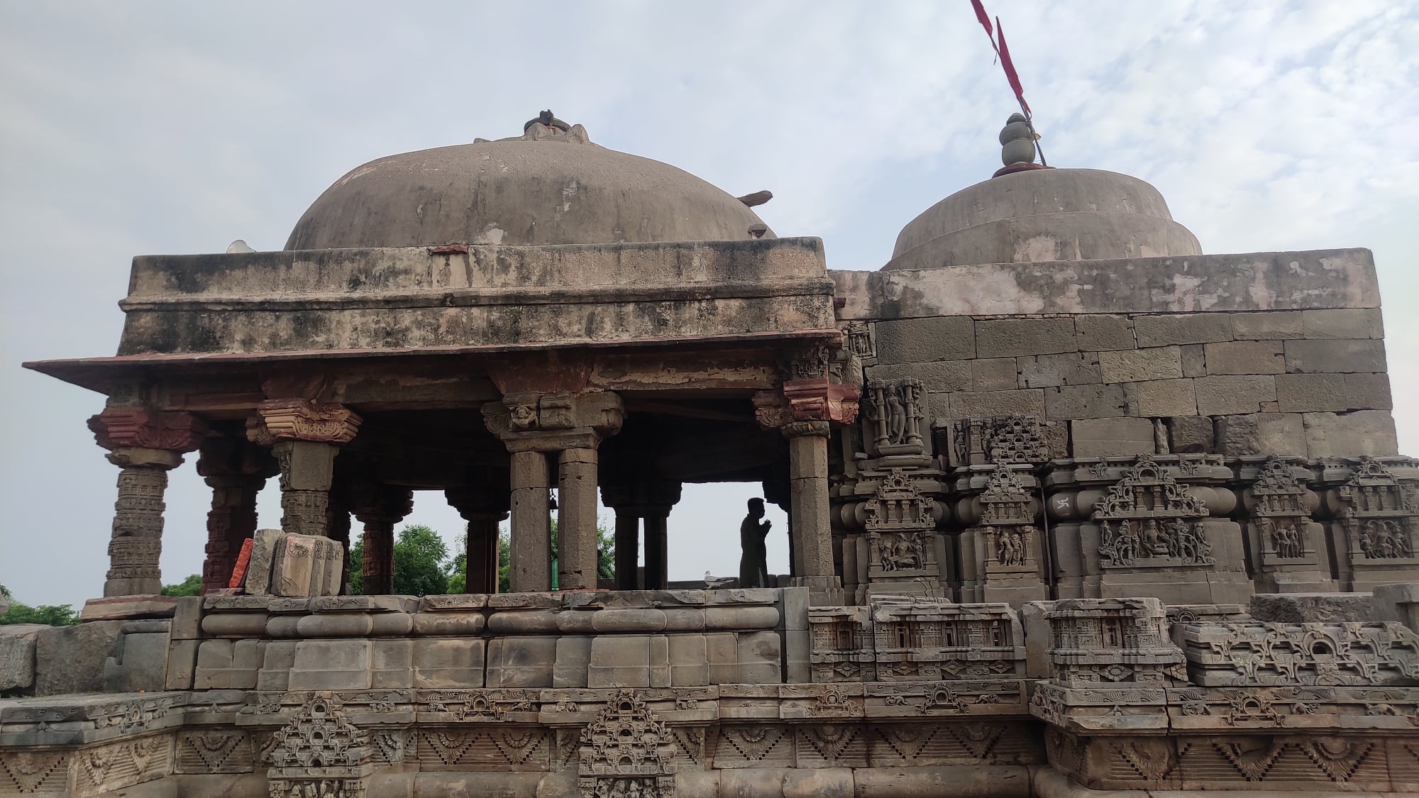
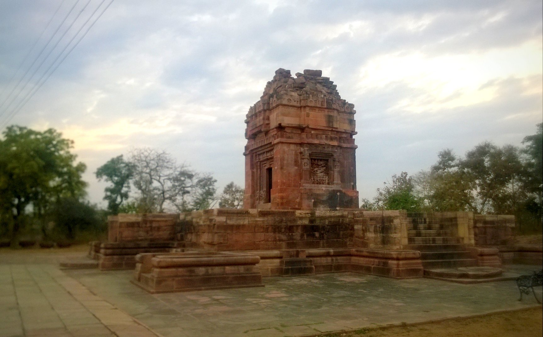
A quaint little village south of Alwar that is home to an exquisite stepwell, Chand Baori, an engineering marvel in its own right and a well regarded temple dedicated to Harshat Mata. Both of these monuments are said to be 1200 years old – the stepwell’s beauty is something that can only be grasped upon seeing for oneself.
The Chand Baori stepwell at AbhaneriThe Harshat Mata temple at Abhaneri
Sambhar Lake
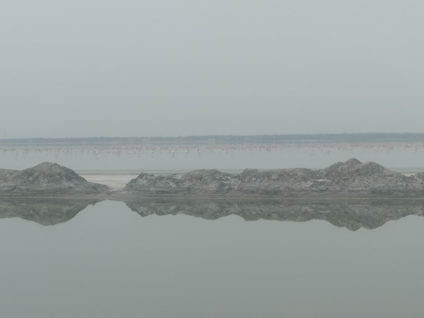
A place that had been on my wish list since I was a schoolboy – it contributes roughly 9% of India’s total salt production and plays host to migratory birds. With swathes of white stretching as far as the eye can see, one cannot be far off calling this a mini Rann-of-Kachh. I had heard that one could spot flamingos here, but nothing had prepared me for the sight of thousands and thousands of flamingos resembling a pink stripe stretching from one end to the other. Now, if only I had binoculars, or even a DSLR camera, at hand!
A view of the saltpans
A flamboyance of flamingoes in the distance
Pushkar
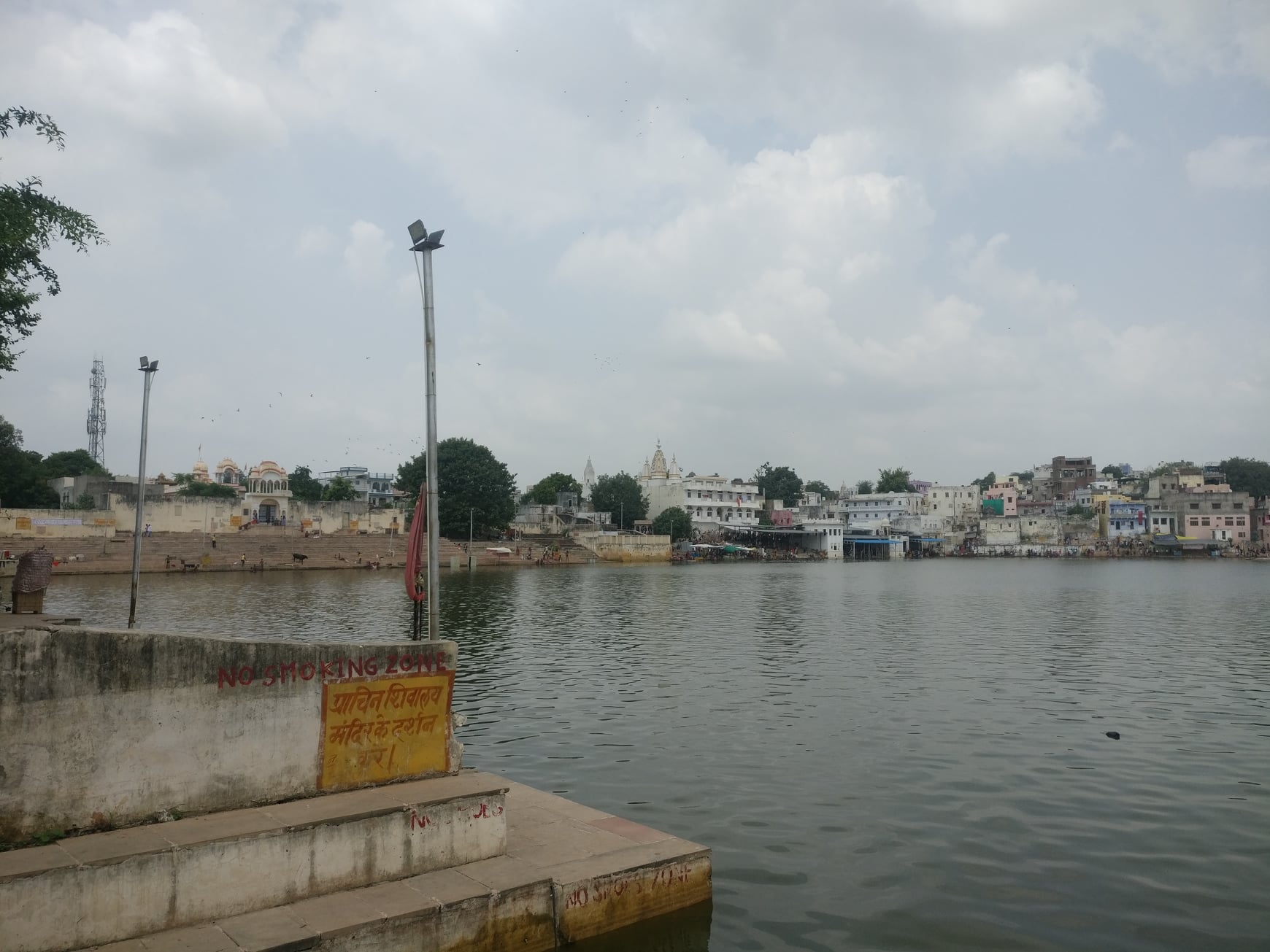
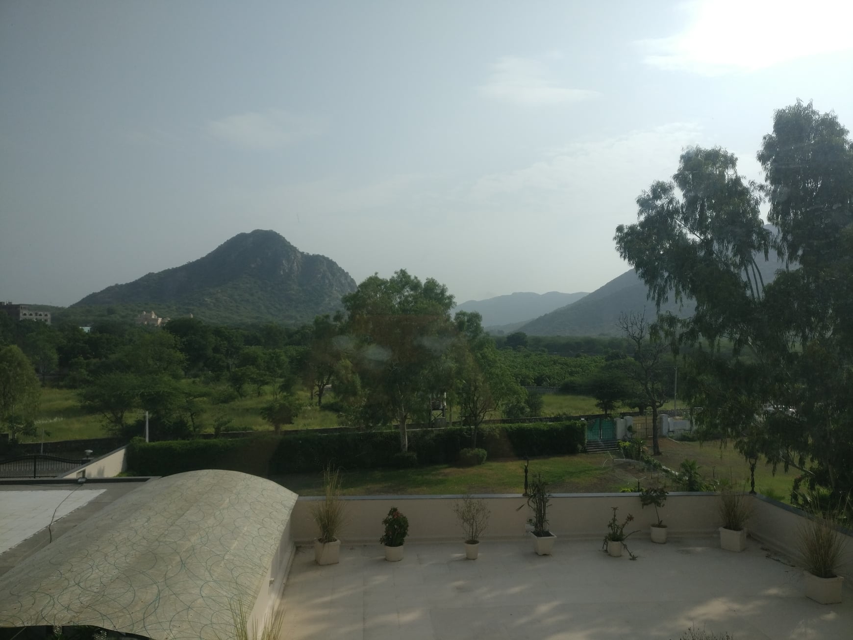
The holy city, according to legend, was the only place where Brahma would be worshipped as per Savitri’s curse (though a few more Brahma temples have cropped up elsewhere since). Also, as per legend, the Pushkar Lake was the source of the mythical Sarasvati river. Pushkar is nestled within the Aravallis, with amazing views of the hills against the clear skies. Another major attraction is the annual camel fair held here.
The holy Pushkar tankView of the Aravallis from the hotel
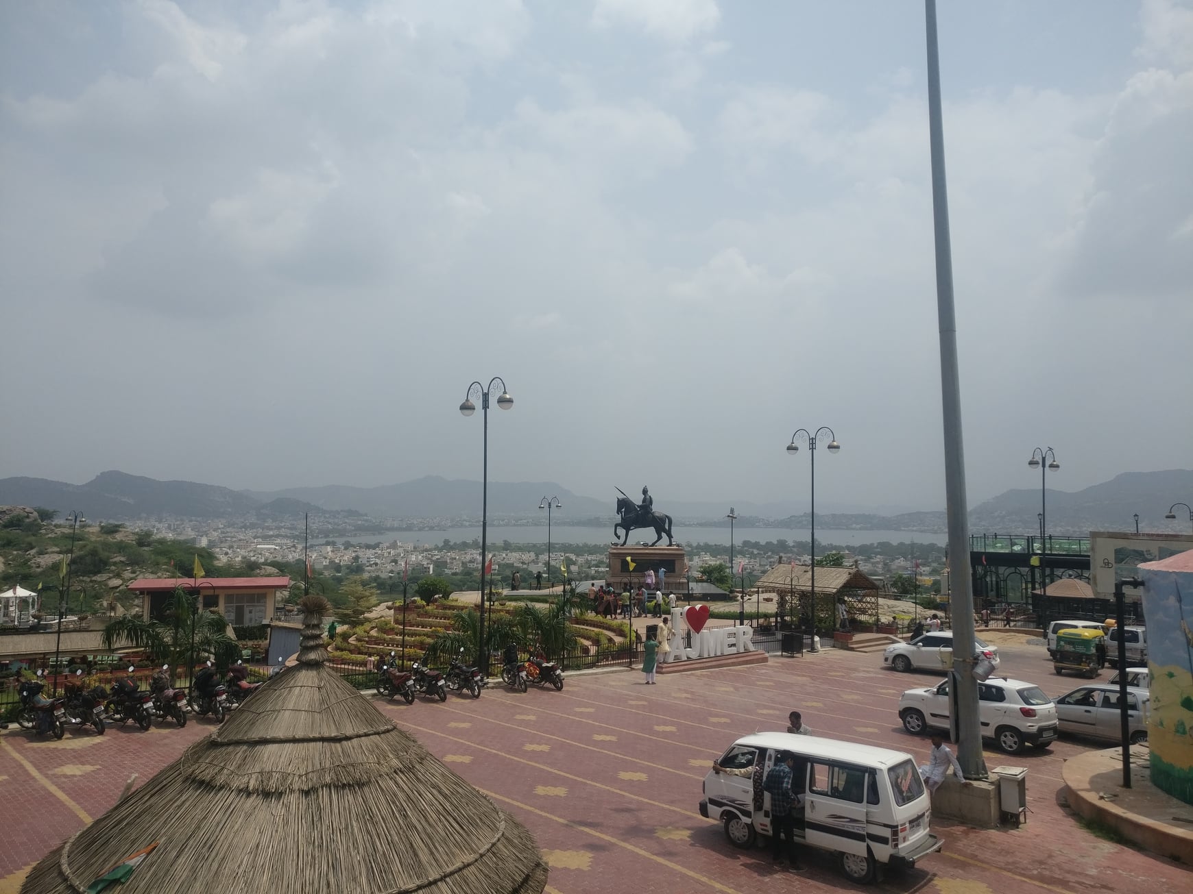
Ajmer
Separated from Pushkar by Aravallis and connected by a pass called the Pushkar Ghati, Ajmer is home to Dargah Ajmer Sharif and a gargantuan lake. Unfortunately, we could not visit any place in Ajmer.
View of the Anasagar lake and a portion of Ajmer city while coming down the Pushkar Ghati hill pass to Ajmer from Pushkar
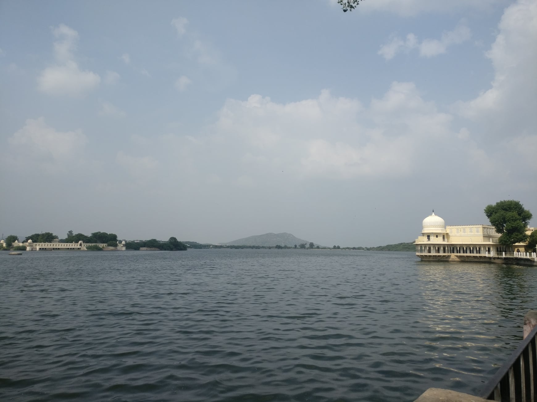
Kishangarh
The capital of a former princely state of the same name, home to an elegant looking fort, which unfortunately is not open to tourists, and the vast Gundolav lake reminiscent of the lakes of Udaipur. Just outside the city is a National Geological Monument dedicated to Nepheline Syenite, traces of which dating back to 1590 million years to 1910 million years can be found.
Entrance of the Kishangarh fortView of the Gundolav lake
Trip Summary
Day 1 Gurgaon to Beejak Ki Pahari – 165 km, 4 hours Beejak ki Pahari to Abhaneri – 120 km, 3 hours Abhaneri to Ajmer – 250 km, 4 hours
Day 2 Ajmer to Sambhar Lake – 100km, 2.5 hours Sambhar Lake to Pushkar – 105 km, 2.5 hours
Day 3 Pushkar to Kishangarh – 40km, 1 hour Kishangarh to Gurgaon – 360km, 8 hours
Total – 1140km
How to reach Beejak ki Pahadi No public transport available, so you will have to use your private transportation (personal vehicle or cab). It is a 5 hour drive from Delhi, 2 hour drive from Jaipur.
How to reach Sambhar Lake While there is a handful of trains from Jaipur to Sambhar Lake railway station, the timings may not be suitable for a day trip. Moreover, seeing around Sambhar Lake area after getting down from the Sambhar Lake station might be a hassle due to paucity of local transport options. In the absence of public transport, you would want to either use your personal vehicle or cab. It is a 1.5 hour drive from Jaipur.
Finding Forgotten Cities is an exhilarating account of how Harrapa and Mohenjo-Daro were discovered and findings were pieced together to advance the case for the Indus Civilization for the first time in 1924, with ample attention given to all the major characters that played an indispensable part in the story.
From this account, the Britishers that were at the forefront of the Archaeological Survey of India (ASI), especially John Marshall himself, the Director General of the ASI during the discovery and, in fact, for a good part of the first quarter of the 20th century, seem to emerge as unlikely heroes, but for whose love and passion for the antiquities of India, the beauty and significance of portals to India’s past may have been lost to the sands of time.
At times thrilling, and at times exuberant, the narrative unfolds like in a novel, with interesting detours into circumstances within which the ASI had to work. I just wished there were more details on some of the people besides Marshall and Rakhaldas Bannerji. Also, modern colour photographs would have helped paint a more vivid picture. Sometimes, the narrative while being pegged in a certain year went forwards and backwards too often, thereby causing me to lose the base year.
Nevertheless, being enamored with the Indus Civilization since my childhood, I finally had the opportunity to be transported back to a time where I could be a fly-on-the-wall even as the ancient cities I was fascinated with were getting uncovered.
Highly recommended for history lovers in general, and Indus Valley Civilization aficionados, in particular.
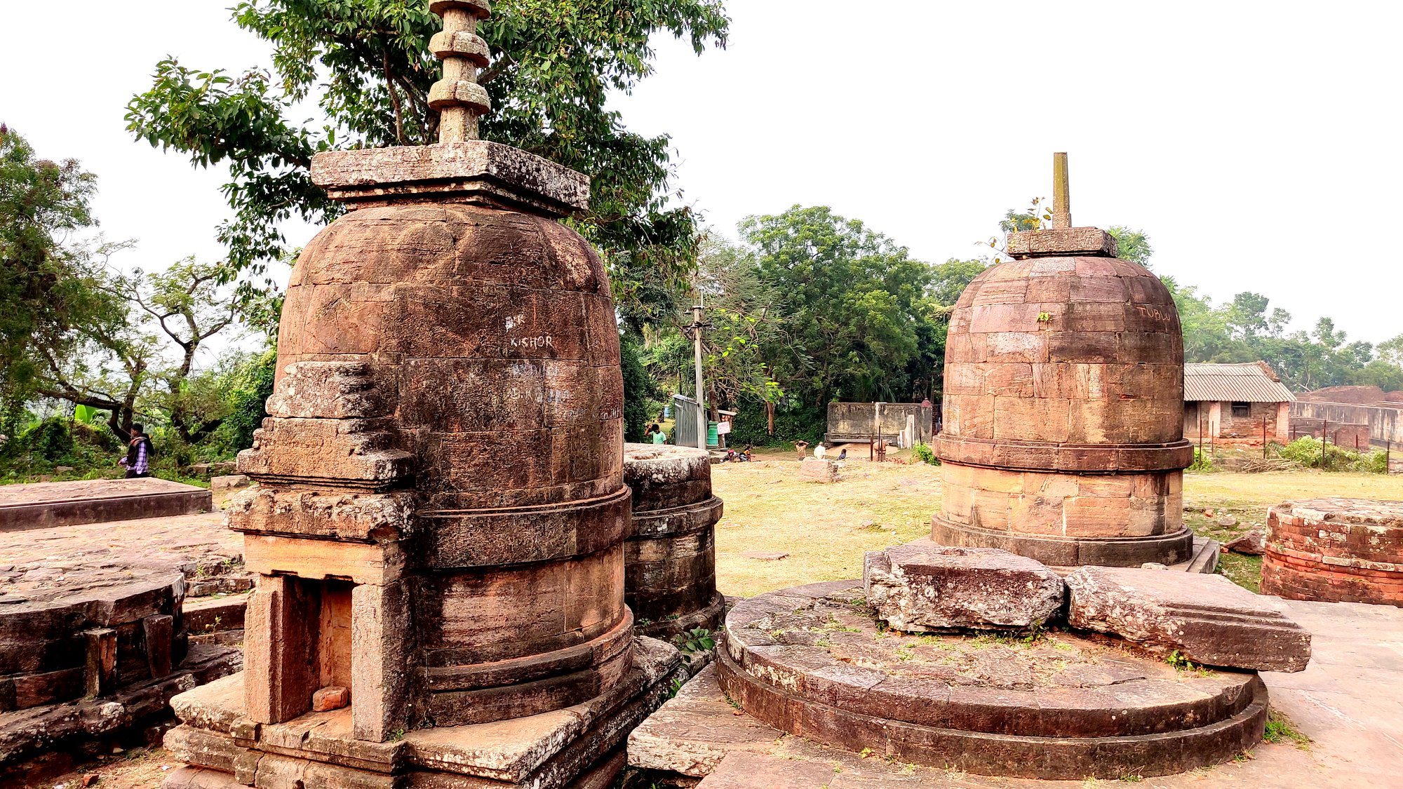
Just in time for Christmas, the family set off on another ‘hidden gem’ heritage trail inside Odisha. This time we explored the Diamond triangle comprising three hill-based Buddhist hot-spots which flourished between 7th and 13th Century AD, namely Lalitgiri, Ratnagiri and Udayagiri.
The three locations set in low but sparsely populated hillsides or hilltops prove without doubt to be the most idyllic backdrop for a life of material detachment and quiet contemplation for the Buddhist monks. Consistent with Kalinga’s nature of acceptance and tolerance of all religious and spiritual dispositions, these spots display the syncretism of both the Mahayana and Hinayana schools of Buddhism.
Lalitgiri
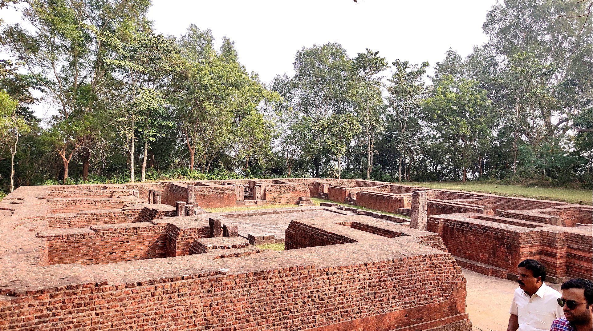
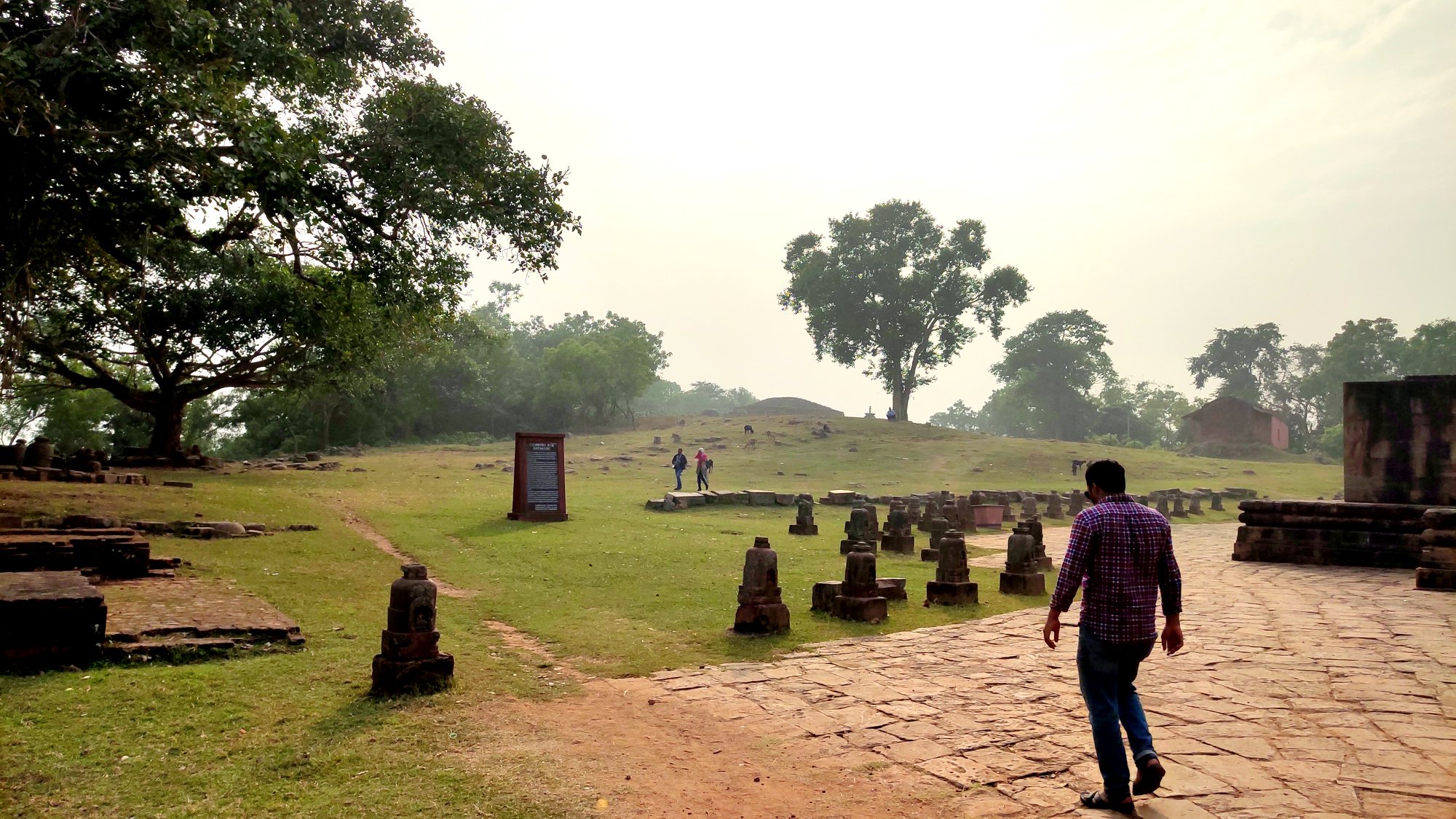
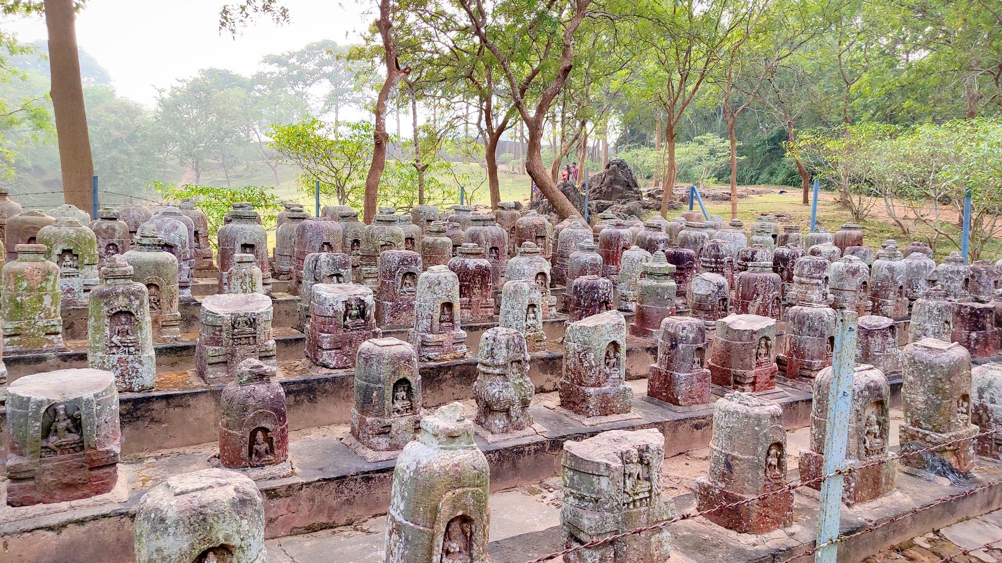
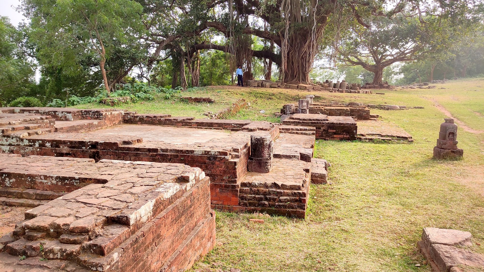
Starting off at around 9AM from Bhubaneswar, we first reached Lalitgiri around 11 AM via the Chandikhol-Paradeep road. After a walk up the hill on the wide metalled road, we first came upon the Archaeological museum which we deferred for seeing on our return from the trail. Walking further, we came upon multiple structures: Viharas (monasteries) in ruins – the monasteries dating from 9th to 11th century contained rooms, a chamber for holding a Buddha status – and a 6th-7th century Chaityagriha (prayer hall) with a stupa in the middle and several votive stupas strewn around.
Glimpses of the many monuments and surroundings at Lalitgiri
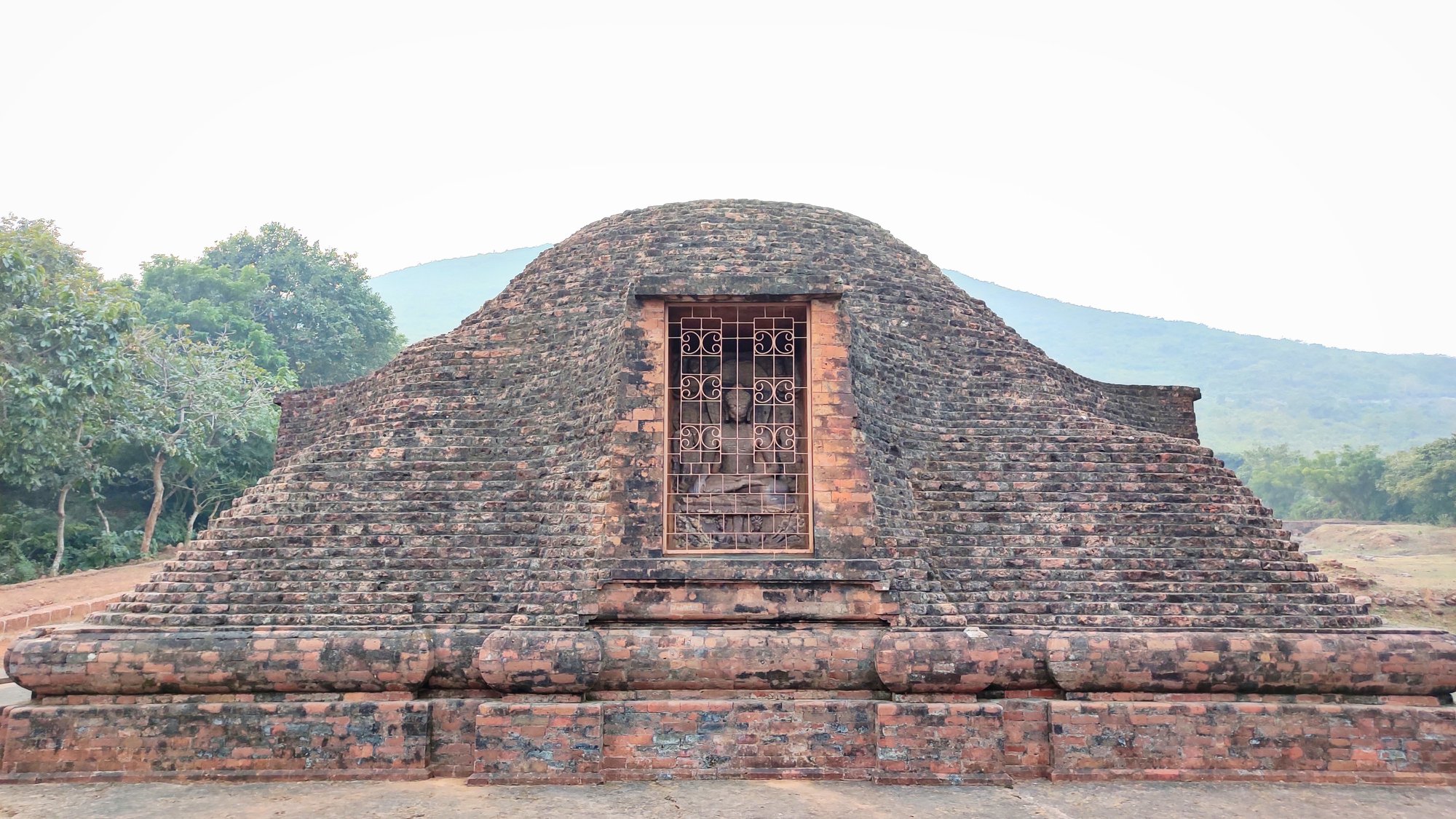
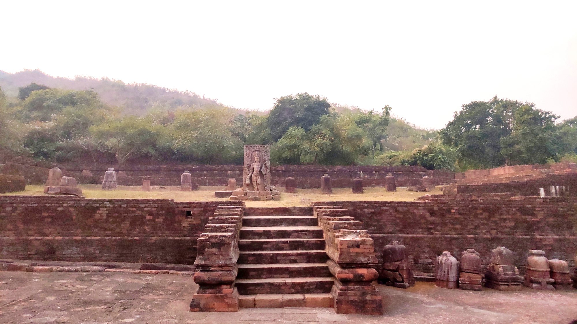
At the furthest end of the trail, atop another small hill, lay a lone relatively larger stupa, where two rare stone caskets containing relics of Buddha were found. The casket, made of khondalite, itself housed three smaller concentric caskets made of steatite, silver and gold respectively, with the innermost gold casket contain a piece of Buddha’s bone. These relics as well as well multiple sculptures, including those of the Buddha and Tara, are now displayed at the museum. All told, Buddhism is said to have prevailed at this site right from the post Mauryan period, i.e. 3nd century BC to 13th century AD.
Approach to main stupaView of countryside from beside stupa
The main stupa where Buddha’s relics were found
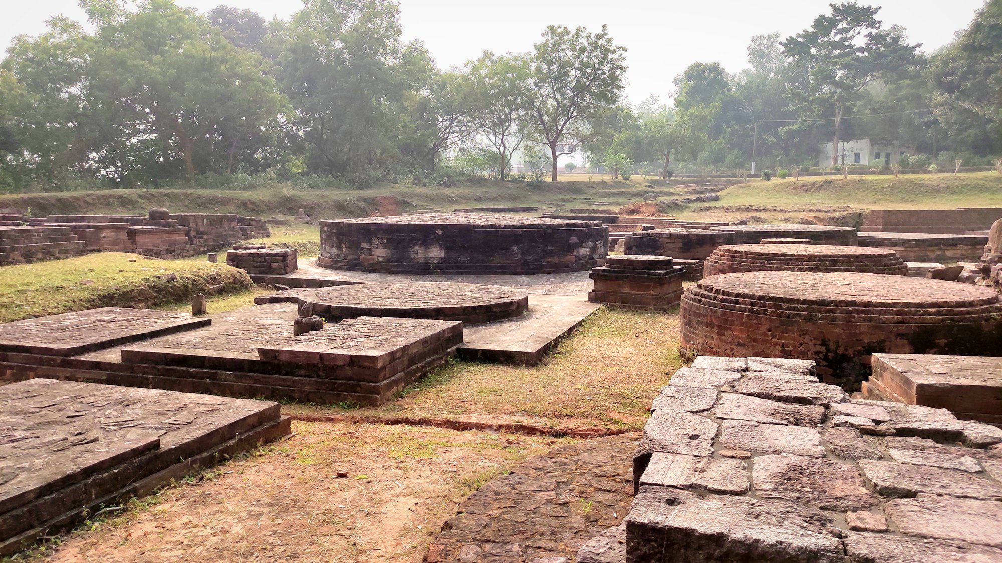
Ratnagiri
Leaving Lalitgiri around 12.30 PM, we crossed the Brahmani river and reached Ratnagiri around 1.30 PM. Ratnagiri looked unique due to fact that the road to the monasteries and stupa lay in a pass between two crests of the hill, flanked on both sides with neatly manicured lawns. Here, we decided to first see the museum, where many relics and artifacts found at the site are displayed. However, what interested me more was the additional information displayed in various sections about the history of the evolution and dissemination of Buddhism and of other Buddhist sites in India.
Approaching the Ratnagiri hill
The exquisite entrance of a monastery at Ratnagiri
Inside the monasteryInside the monsateryGlimpses of monuments and surroundings at Ratnagiri
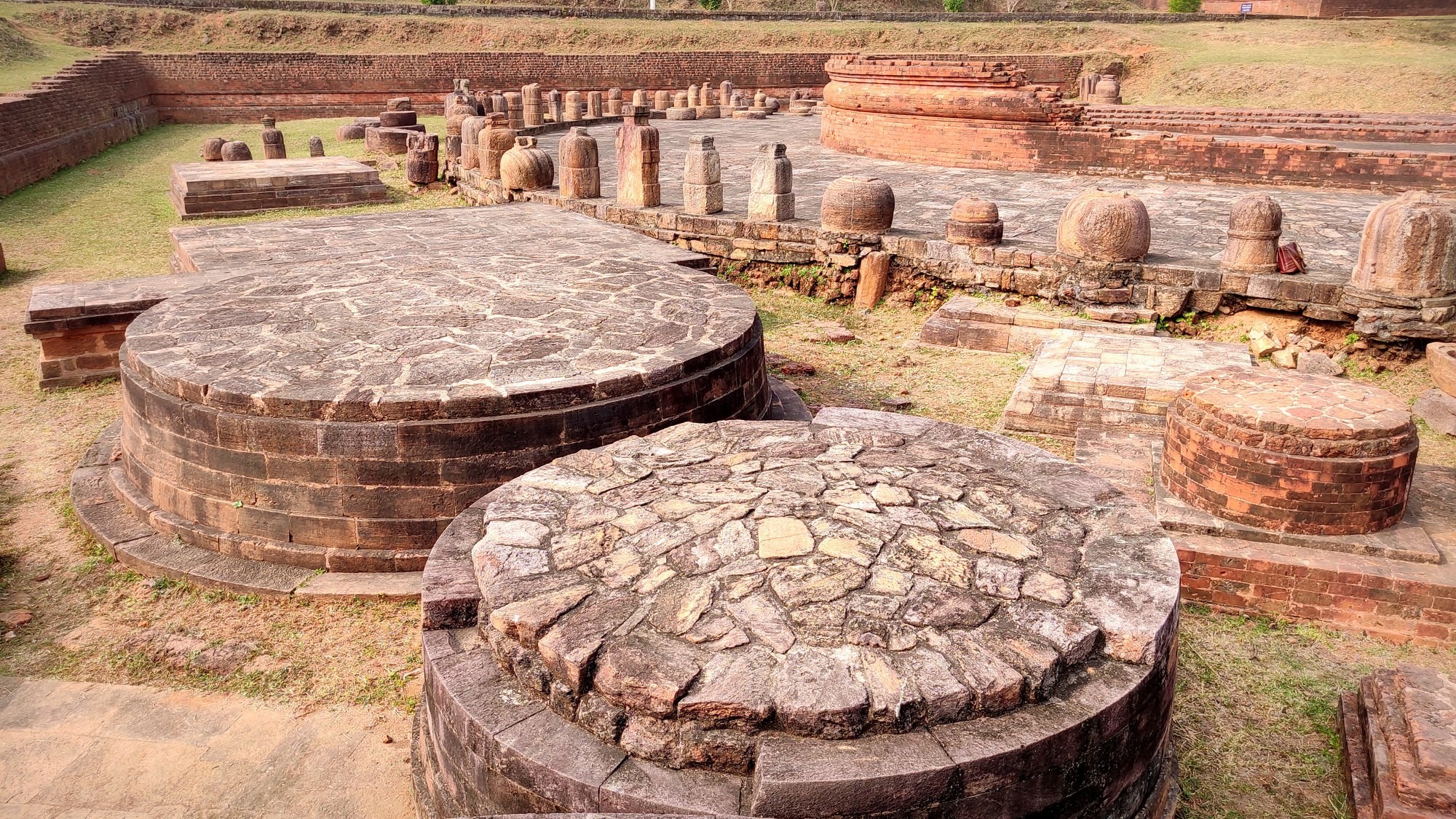
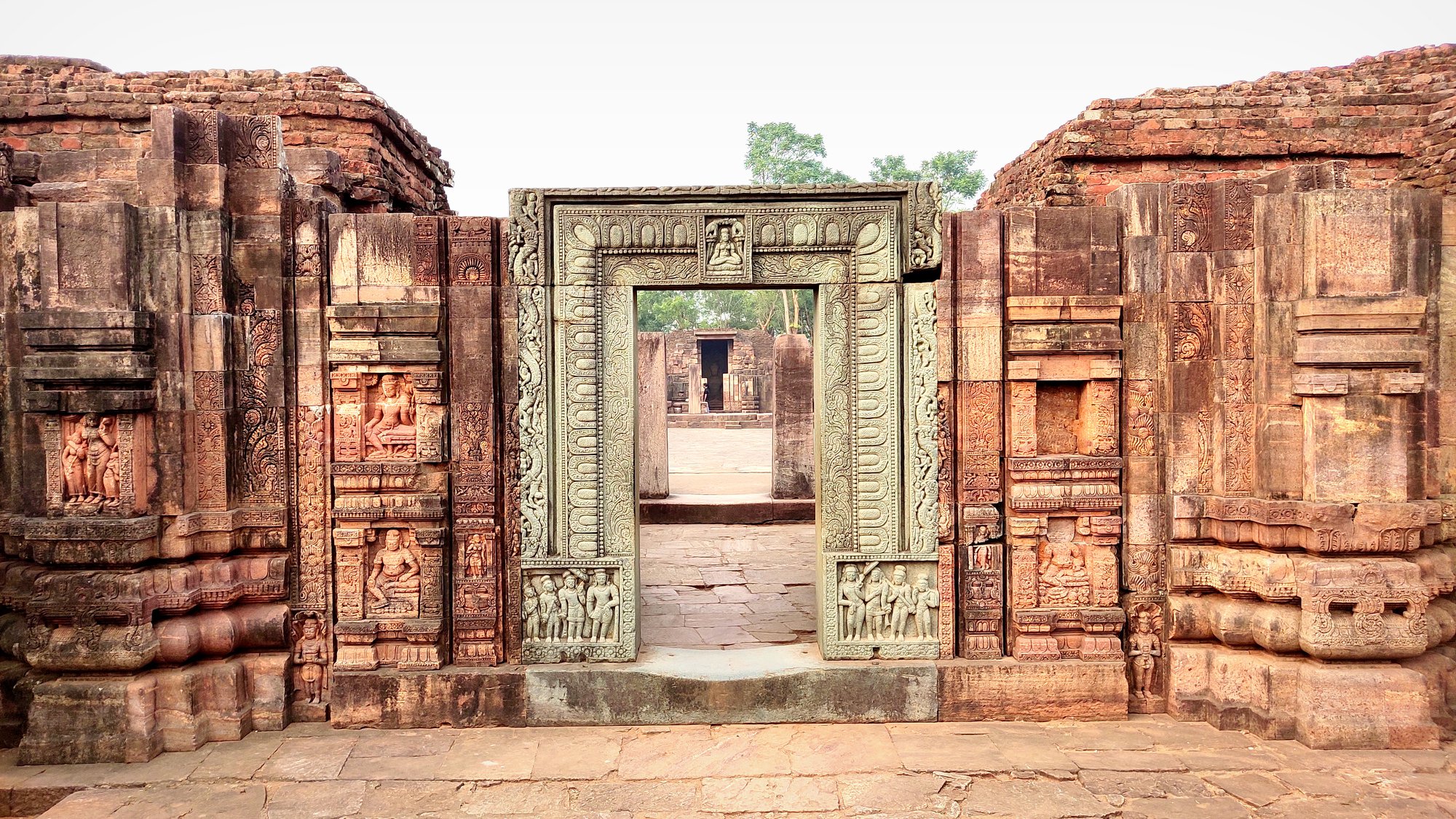
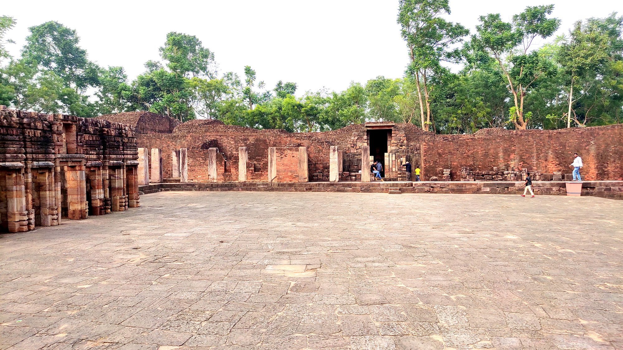
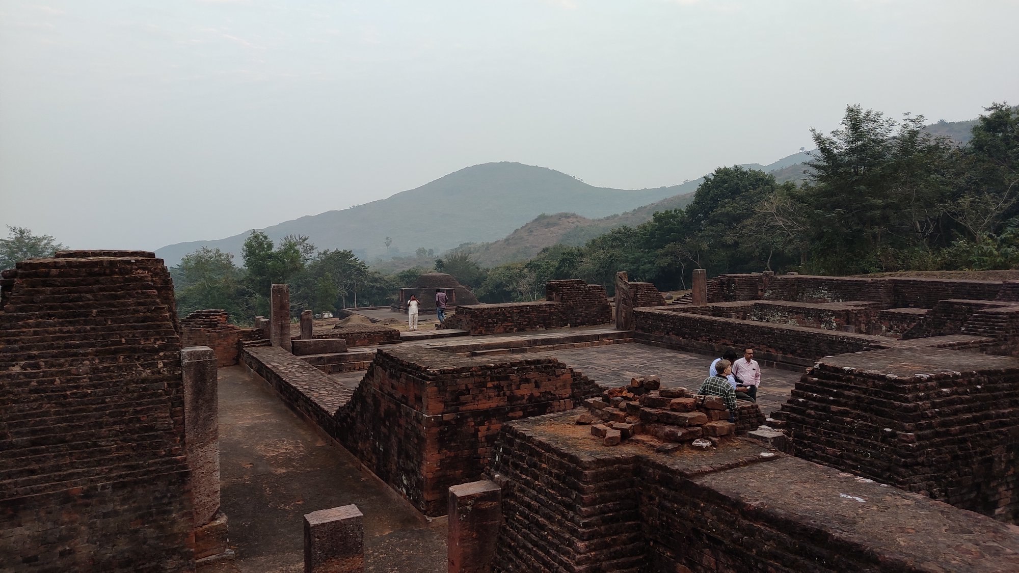
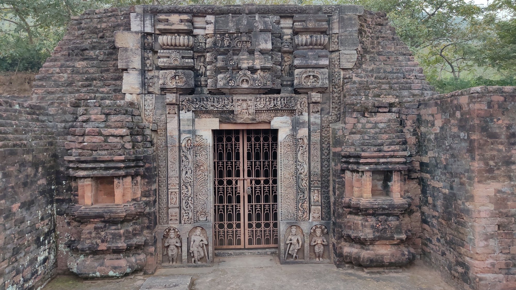
Walking up the hill, we were wowed by the iconic elaborately carved stone doorway at the entrance of the largest of the 3 monasteries, which could be dated to the 8th century. This monastery has a large courtyard with rooms surrounding the same, and a shrine for the statue of Buddha, at the wall farthest opposite from the main entrance. Besides this monastery, there are 2 smaller monasteries, and a 9th century stupa, surrounded by smaller votive stupas. Beyond all these structures, is the Mahakal Temple, built over an earlier stupa, and recently relocated to its current location by the ASI.
Udaygiri
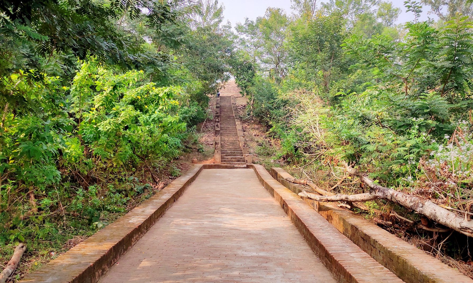
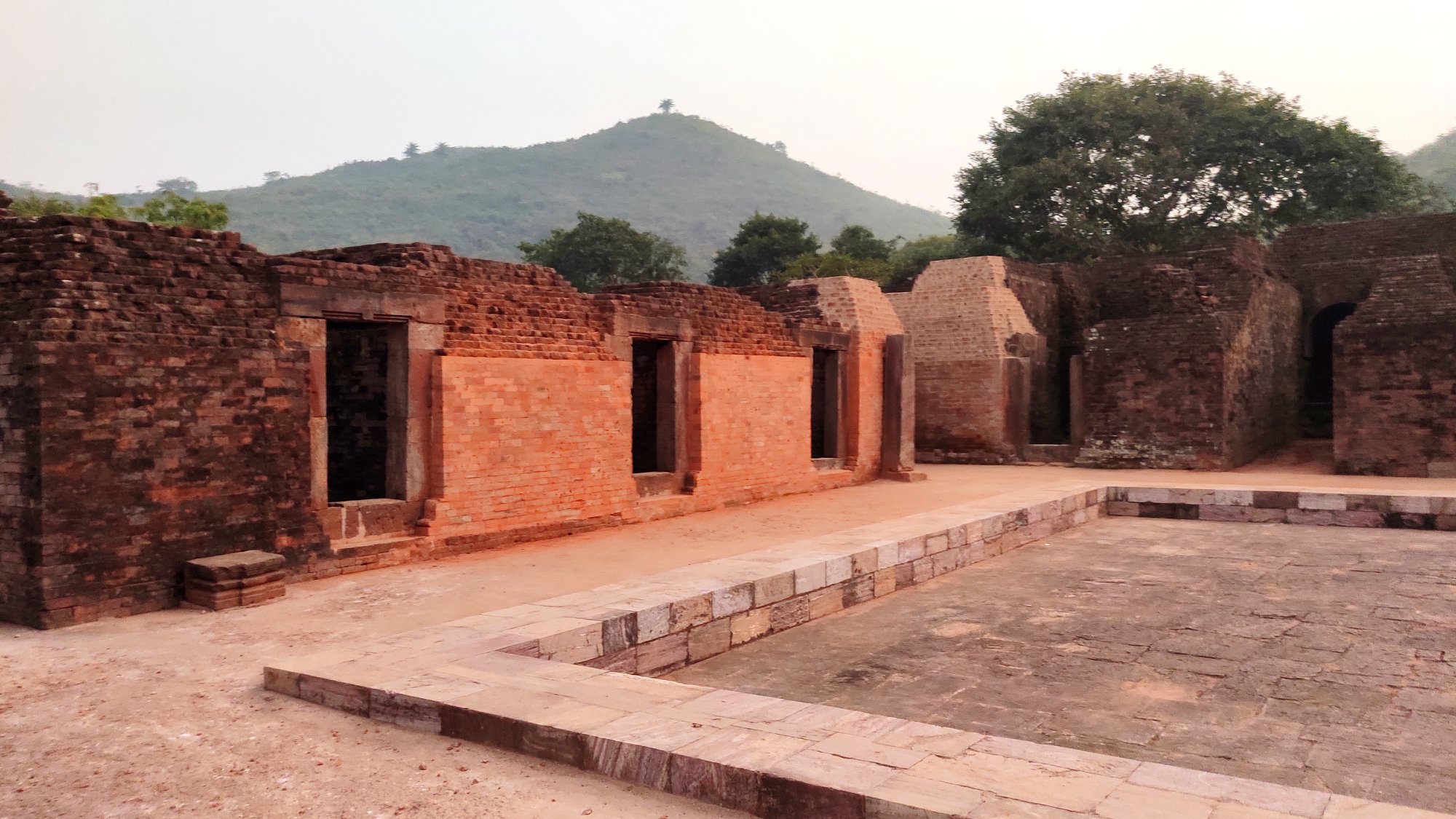
After a light meal in lieu of lunch, we crossed the Brahmani river yet again and reached Udaygiri around 4PM. Udaygiri seems, out of the three sites, to be the site with the least attention paid to maintenance. The two monasteries are far-flung not only from each other but also from the entry gate, and can be accessed after walking quite a bit through jungle. Here too the monasteries with statues of Buddha, lay in ruins.
Glimpses of the many monuments and surroundings at Udaygiri
Adjunct to one of the monasteries, lies a chaityagriha with the main stupa, with several smaller stupas surrounding it – the stupas are dated between 1st and 12th centuries. Several stupas, including votive ones stand beside the other monastery too. Of note is a stepped well near the second monastery, the depth of which we could not gauge because it was already dark.
Votive stupasA well
Walking back through the forest as darkness falls
By now, it was already 5 PM, and given that it was peak winter, we were faced with the prospect of walking back through the jungle in pitch dark. Nevertheless, what is a family that does not bravely maneuver difficult paths! So, using our mobile phones are torches, we navigated our way through the narrow path cutting through the forest, making the least of sounds lest we attract undue attention from the wildlife. By 5.3o PM, we were back at the entrance, and were soon headed back to Bhubaneswar, after successfully completing the day-long Diamond Triangle trip.
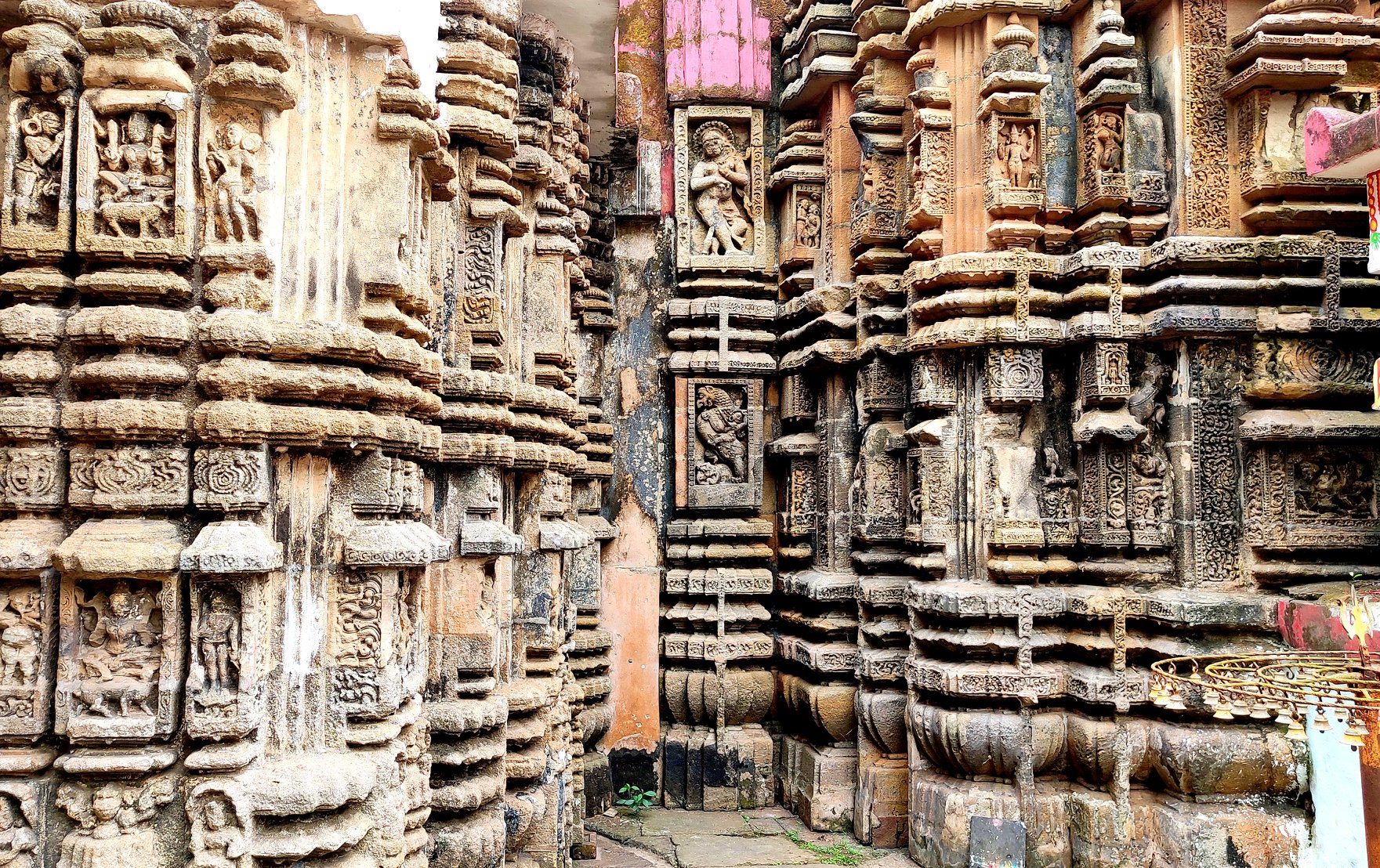
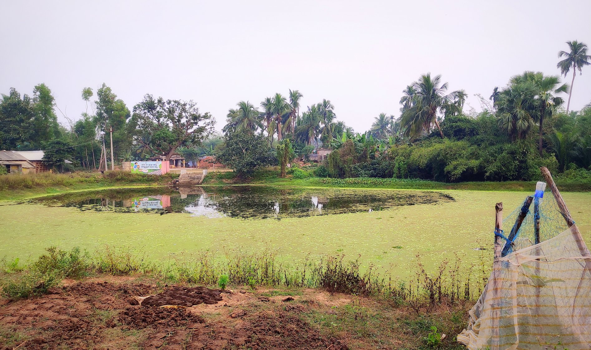
Despite spending the first half of my life in Odisha, it was only last weekend that I finally got the chance to trace the pearls of heritage hidden along an innocuous but highly-fabled river, reduced now to a rivulet, called Prachi.
Centuries ago, the Prachi river along with its valley, was host to a flourishing civilization that not only prospered on trade with Southeast Asia (Bali, Indonesia etc.) thanks to its ‘sadhaba’ (sailor) sons but also reveled in art & architecture of the highest order, being home to some of the most skilled artisans & sculptors. At the same time, the region was also a melting pot for the seamless chronological prevalence of Jainism, Buddhism, Shaivism, Shaktism & Vaishnavism leading to a syncretic religious fervour.
Some accounts date the region’s earliest artifacts to even before the Indus Valley Civilization. Yet the currently standing vestiges of the civilization dotted along the valley afford us a peek only into the period from 7th century AD to the 15th century AD. Nevertheless, these bear fine witness to the cultural richness of the erstwhile Kalinga, being some of the finest representatives of the distinctive Kalingan temple architectural style.
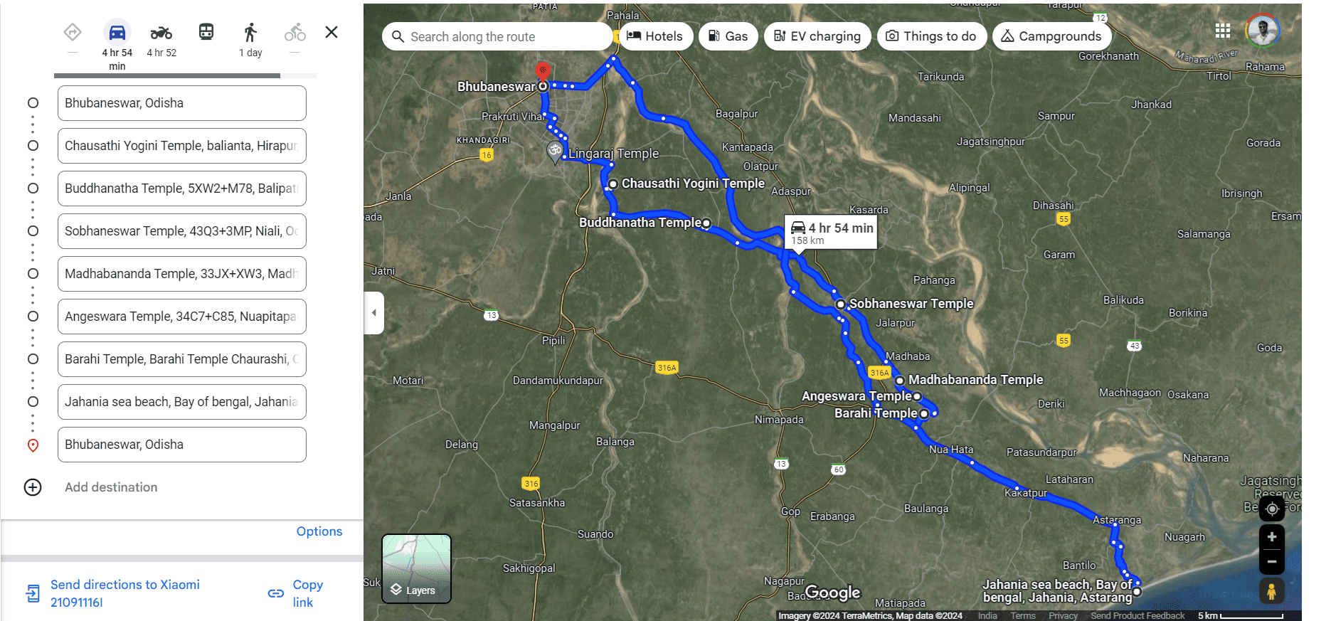
Trail on this trip covered the following places: Chausathi Yogini Temple (Hirapur, Bhubaneswar), Buddhanath Temple (Garedipanchan, Balipatna), Sobhaneswara Temple (Niali), Madhabananda Temple (Niali), Angeswara Temple (Pitapada), Varahi Devi Temple (Chaurashi), Mangala Temple (Kakatpur) and Jahania Beach (Astaranga).
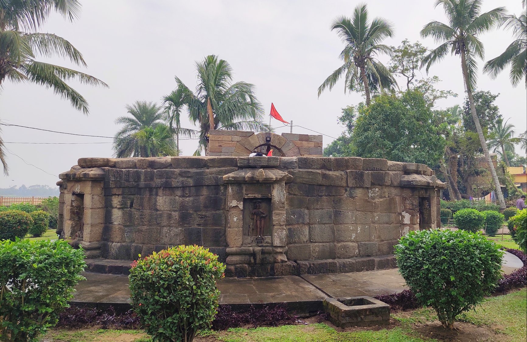
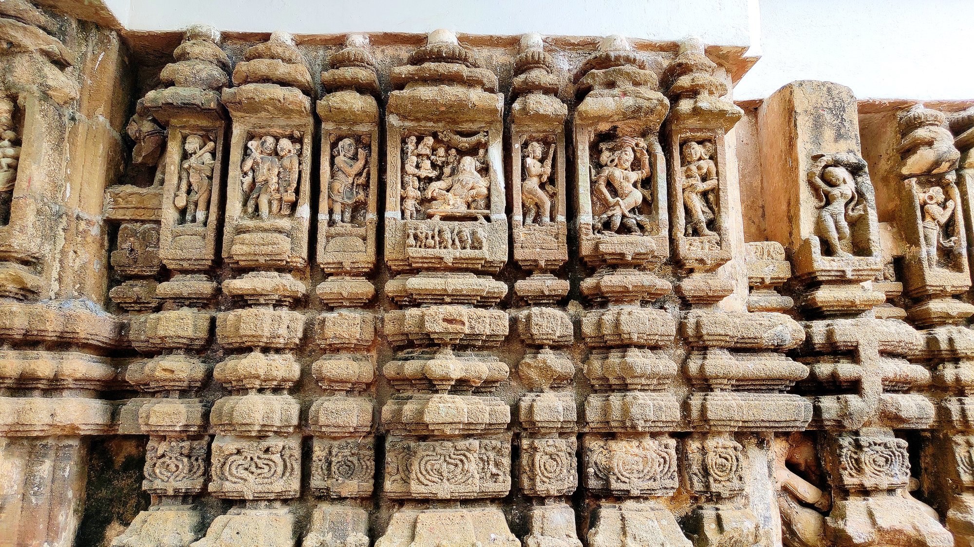
We first stopped at the 9th century AD Chausathi (64) Jogini Temple, the tantric temple built in circular fashion, at Hirapur just at the outskirts of Bhubaneswar. The legend behind the temple, according to priests, goes: Goddess Durga took the form of 64 demi-goddesses in order to defeat a demon. After the fight, the 64 goddesses (Joginis) asked Durga to commemorate them in the form of a temple structure. Accordingly, 56 idols line the inner walls of the structure with the remaining 8 carved on the 8 sides of a central square platform (altar).
(left) Chausathi (64) Jogini Temple. 9th Cent. AD. (right) Idols lining the inner side of the wall
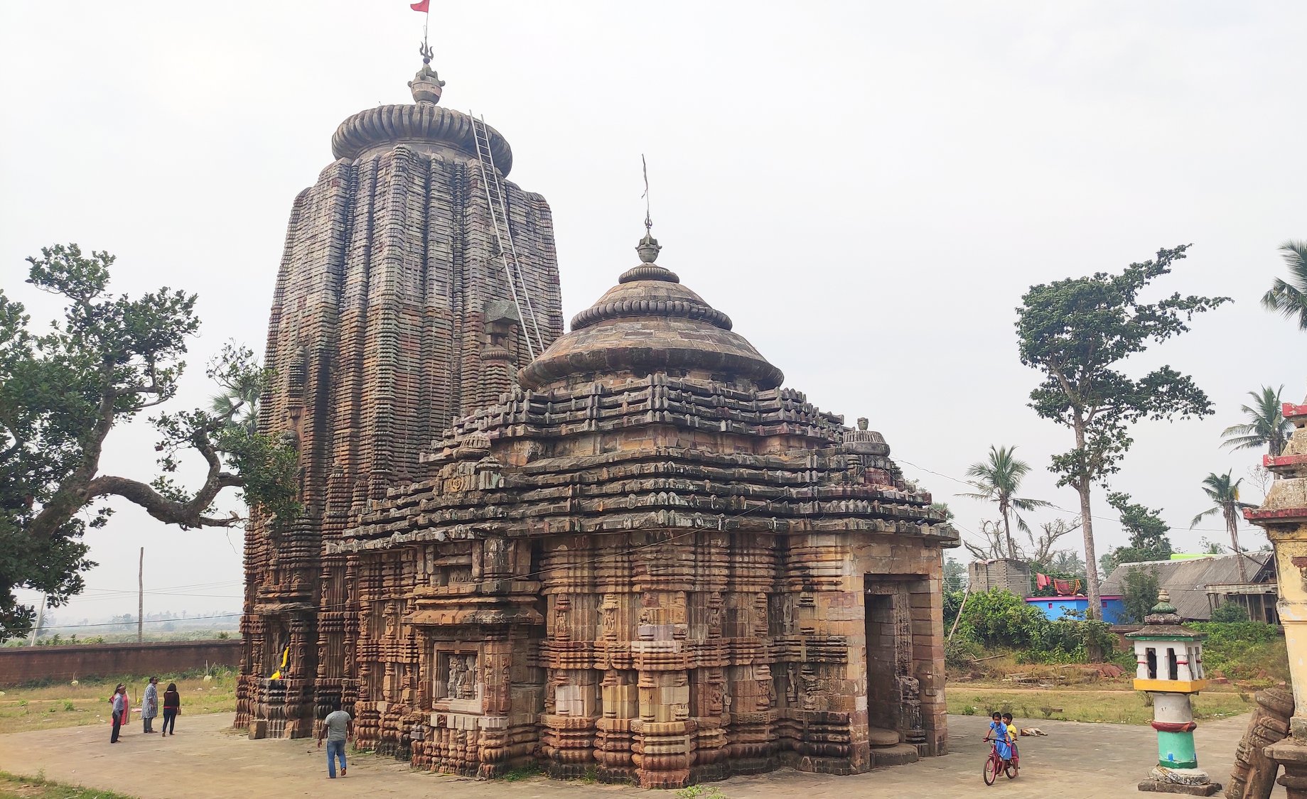
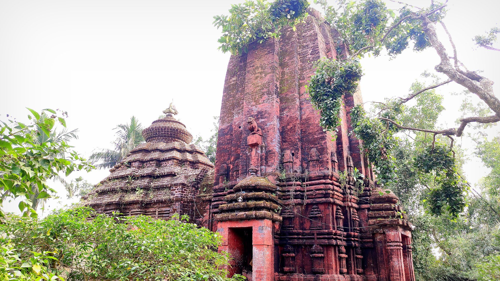
Next stop was Buddhanath Temple, an 12th Cent. AD. Shiva Temple, located in Garedi Panchana, 11km from Hirapur . The temple is said to be built on tantric principles, and was apparently also a Buddhist monastery at some point of time.
(left) The Buddhanath Temple (right) Example of Kalingan stone art on the walls of Buddhanath temple.
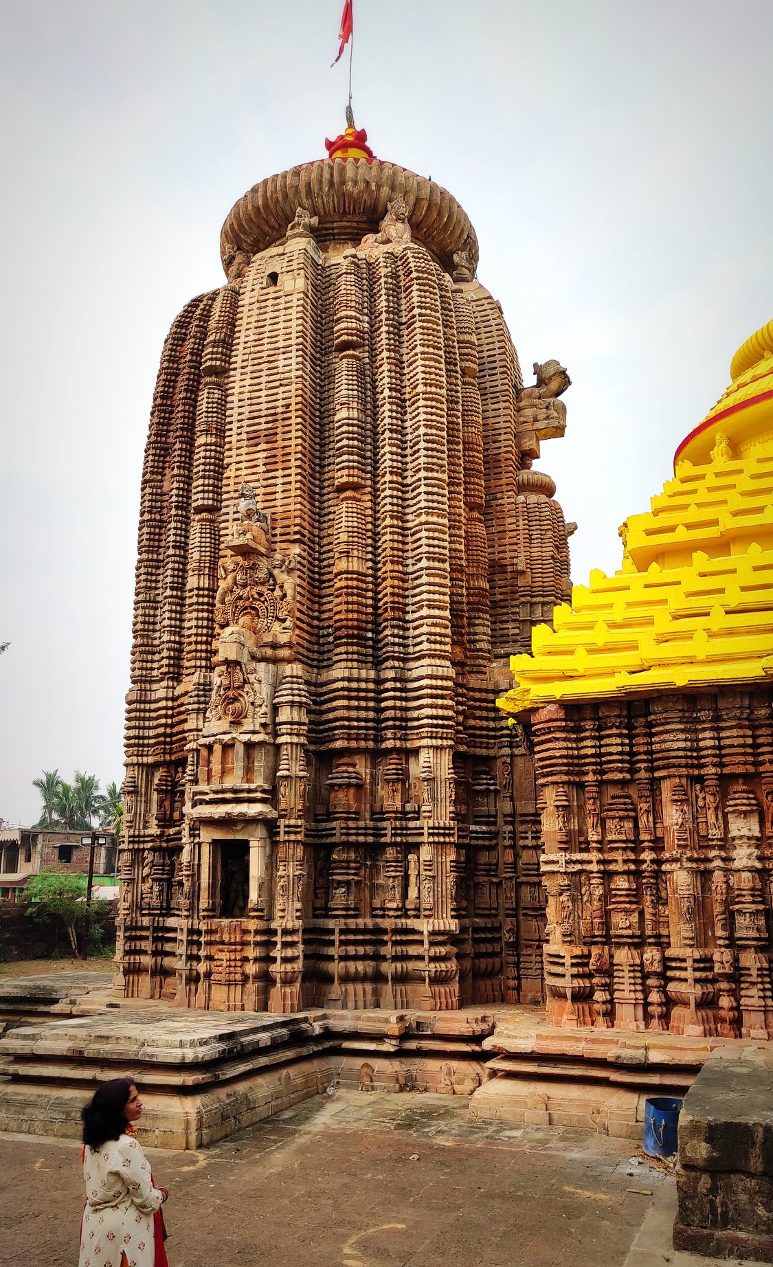
15km further away, lies the Sobhaneswara Temple, another 12th Cent. AD, temple at Niali, of which only the lower half survives from the original structure, with the upper half being restored by later kings. Consequently, the lower half provides another demonstration of the intricate stone art of Kalingan artisans.
Glimpses of the intricate stone art of Kalingan artisans on the Shobhaneswara temple walls.
Next stop was the Madhabanada Temple, built in the 13th Cent. AD, located at Madhaba. Said to commemorate Madhaba (Krishna) located near the site where Jayadeva, the author of the famed Geeta Gobinda, is purported to have worshipped Madhaba.
Madhabanada Temple. 13th Cent. AD. Said to commemorate Madhaba (Krishna) located near the site where Jayadeva, the author of the famed Geeta Gobinda, is said to have worshipped Madhaba.
Just a couple of km away, lies the Angeswara Temple, a 10th Cent. AD. Shiva temple, which is probably one of the few surviving brick structures from the era.
(left) Angeswara temple (right) A snapshot of the Prachi Valley countryside landscape outside the temple, not very far from the sea either.
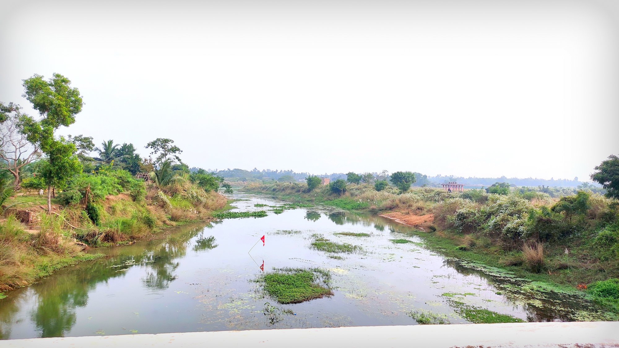
As we proceeded from Angeswara, we finally made rendezvous with the river whose valley we were exploring – the Prachi river today is a pale shadow of the splendour attributed to in historical records.
A glimpse of the sacred Prachi river, now almost reduced to a trickle.
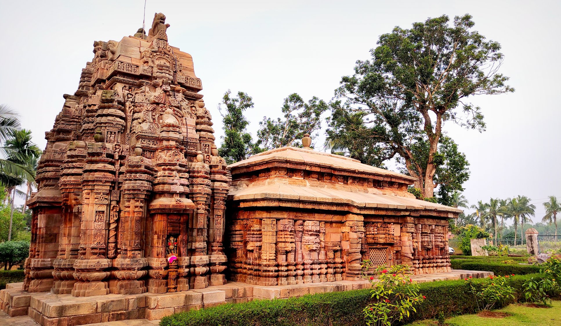
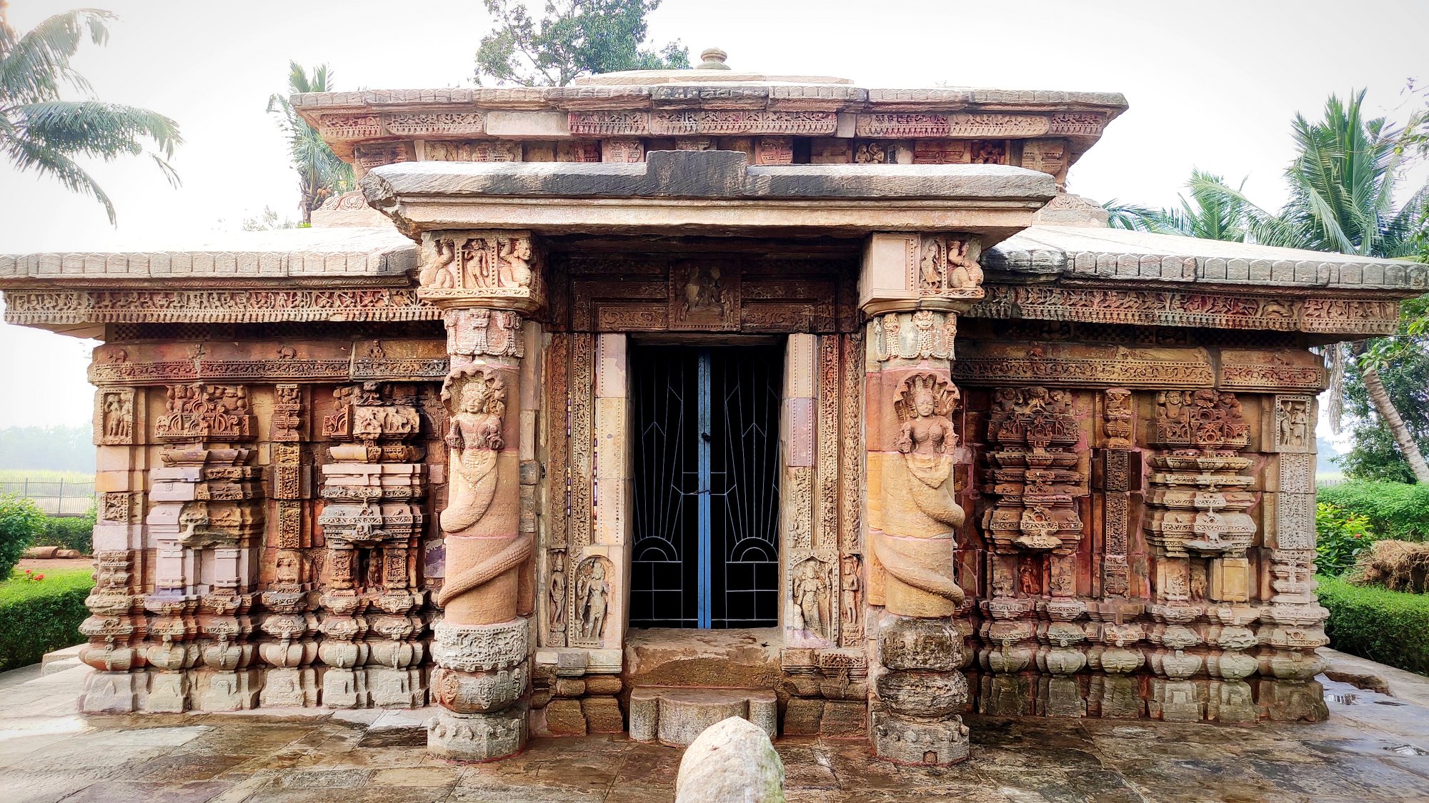
4 km further from the Angeswara temple, is the Barahi temple, a 10th Cent. AD temple dedicated to Maa Barahi, the shakti form of Baraha, the boar-form of Lord Vishnu’s incarnations. This temple incorporates Khakra style, a variation of of Kalingan temple architecture, reminiscent of Mahabalipuram temples.
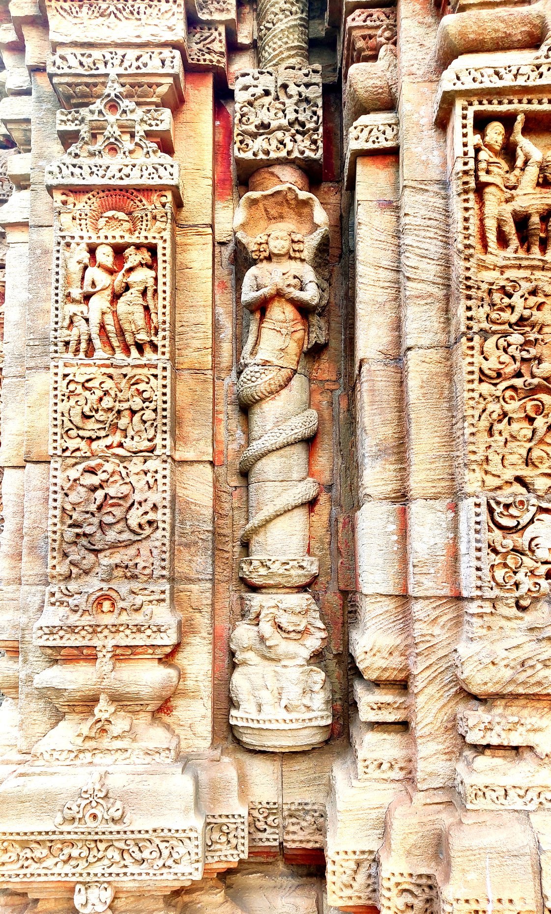
(left) Barahi Devi Temple (right) Front view of the Varahi Devi templeA motif on the Varahi Devi Temple wall representing ‘Adisesa’ – hooded serpent shielding upper body of human with folded hands and lower body of a serpent on the columns and pillars
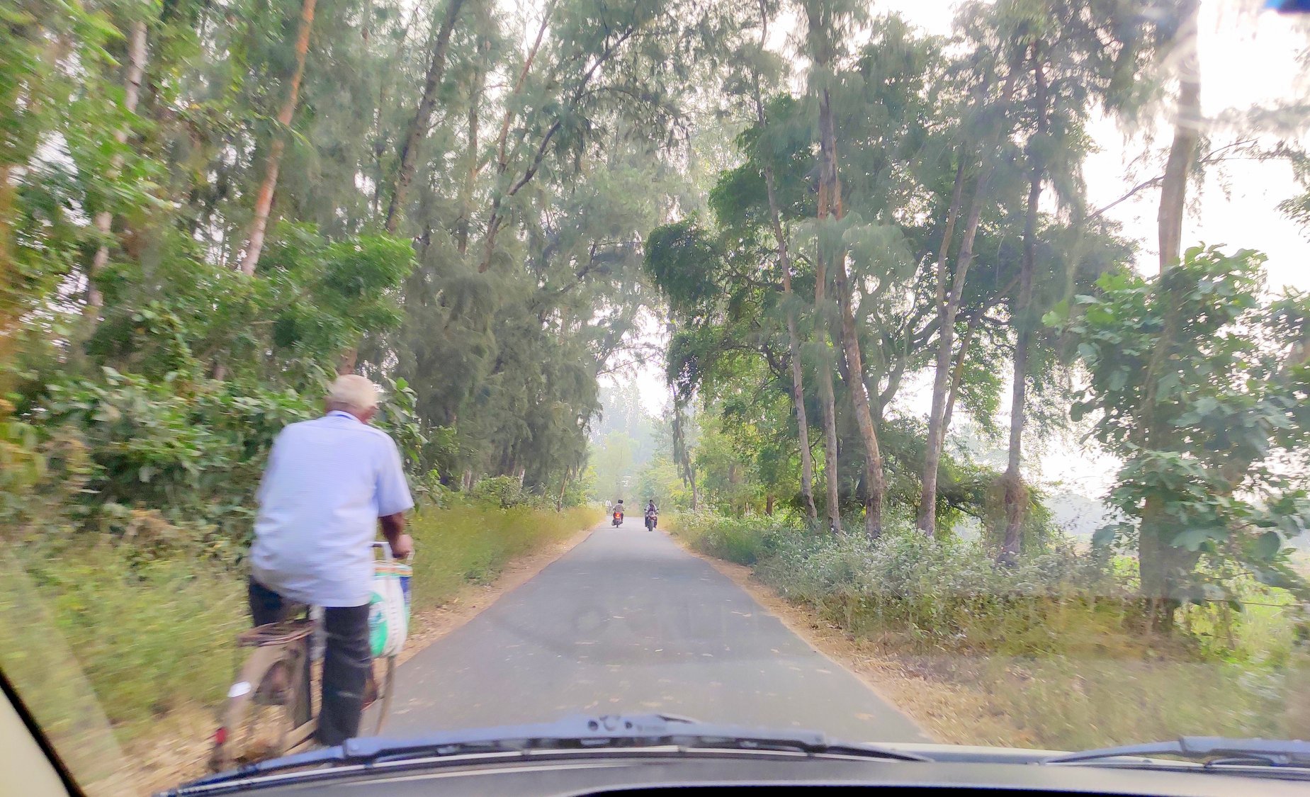
Moving on from Barahi, we reached a crossroads at Charichhak, and were faced with two choices – take a right turn and see a few more monuments from the Prachi Valley or take a left, to the sea. With the evening about to descend, we chose the road leading to Astaranga, which has an adjunct beach at Jahania. Astaranga, literally, of the seven colours, seemed to be a fitting finale for this trip, as it sat upon the mighty Kalinga Sea, which the Kalingan sons traversed to spread the Kalingan glory far and wide.
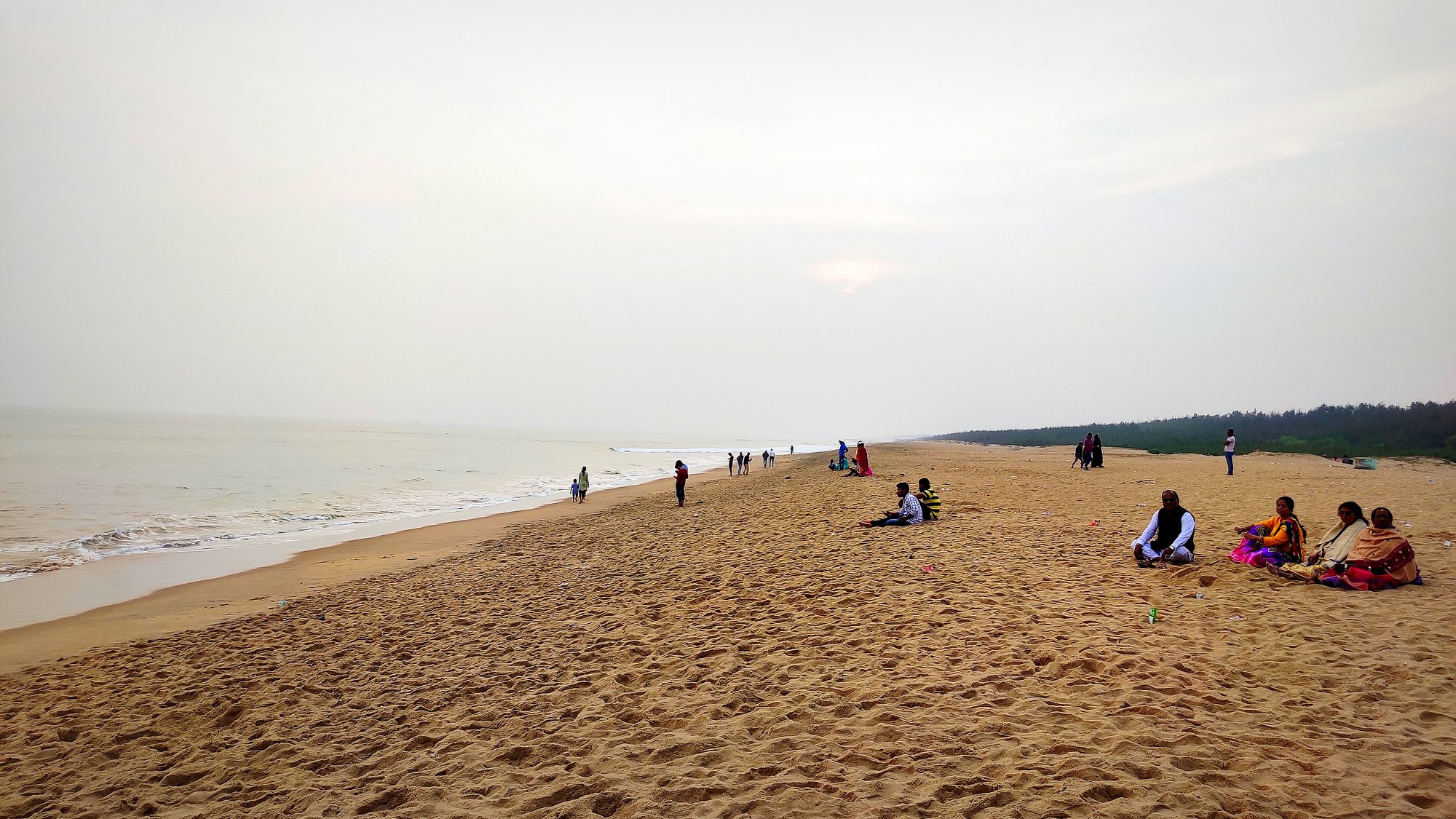
(left) Road leading to Jahania beach from Astaranga town. (right) Jahania beach
How to reach You have to invariably take private transport and follow Google maps, since many of these sites are not on a major road. Alternatively, you could join some of the day-long heritage walks organized from Bhubaneswar by a few heritage enthusiasts.
In February 2019, my friend Abhijit & I picked up our backpacks and forayed into the Betwa and Chambal Valleys in search of some less-heralded archaeological treasures. Planned to be a quick weekend trip, we took an overnight train from Delhi, got down at Lalitpur and checked in into a hotel early in the morning. After gorging on a breakfast of the famous local dish poha, we took off by public transport across the Betwa river to the quaint little town of Chanderi which is tucked behind a hill range.
Chanderi, famed today for its sarees, was under the control of Bundela Rajputs of Orchha from the 16th century before it passed to the Gwalior Scindias, and then into British hands in 1844. It is home to a fort and a few other monuments, including Jain caves & Tirthankara sculptures and a Scindia haveli. Chanderi was most recently featured in the Hindi horror-comedy movie, ‘Stree‘. In fact, a beautiful gated hill pass featured towards the movie’s end is what had fascinated me about Chanderi in the first place.
Entry to the Chanderi fortInteriors of the fortView of the Koshak MahalView of the fort from the Scindia HaveliAt the entry of the Badal MahalA Jain site inside Chanderi cityOne of the gates leading to Chanderi city. The last scene of the movie ‘Stree’ was shot here.
On our way back, with darkness fast approaching, we took a bold venture into the thick forests of Deogarh on the other side of Lalitpur, in pursuit of a 6th Century Vishnu Temple called Dashavatara (of the 10 incarnations of Vishnu) Temple. It was beyond sun-down, the closing time of most monuments, however, we still got to access the temple as the temple upkeep is not geared towards tourism – a truly unheralded site. As I perused the sculptures and the carvings on the Gupta period temple walls, I trembled with the knowledge that I stood in the vicinity of one of the oldest standing temples of India!
How the early 6th century Dashavatara temple at Deogarh, dedicated to Vishnu, looks like on an early February late eveningMotifs on the walls of the Dashavatara temple
As we pushed ahead towards a 8th century Jain Temple Complex in the pitch darkness, the auto-rickshaw we were riding on was hailed by a couple of burly men, who asked to hitchhike to the Jain Temple. They claimed to be policemen and the auto-rickshaw driver had to relent. With our hearts in our mouths, we rode up a hillside to finally reach a well-illuminated temple complex, which was already closed. Fortunately, the men turned out to be who they claimed they were, and let us inside the Temple complex, as the sole visitors at 7pm on a deserted hilltop!
The Shantinath Jain temple complex, Deogarh, at 7PM – we were the only visitors in the darkness
The next morning, we learnt that our early morning train for Morena was running late by 5 hours, forcing us to improvise. So we ditched the train and took two buses back North towards Gwalior via Jhansi, racing against time. Getting down at Gwalior bus station, we approached an autorickshaw driver to ply us around for the whole day. The autorickshaw driver knew nothing about the places we were interested in, but he agreed immediately to the assignment when we pitched to him that it would be we who would show him around for a change! Now, who gets paid for being shown around?
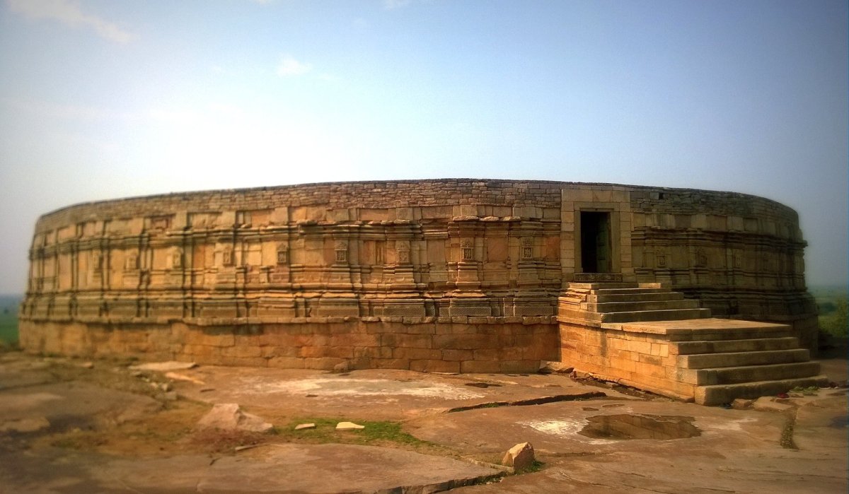
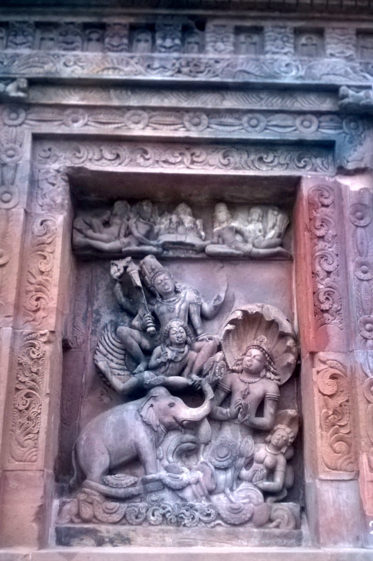
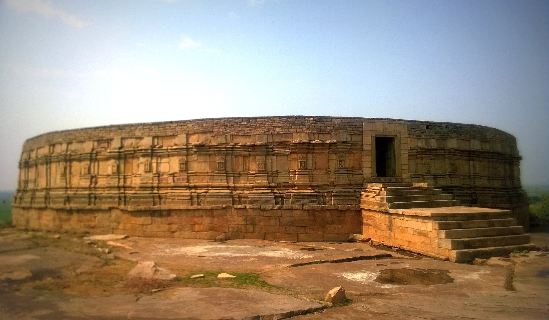
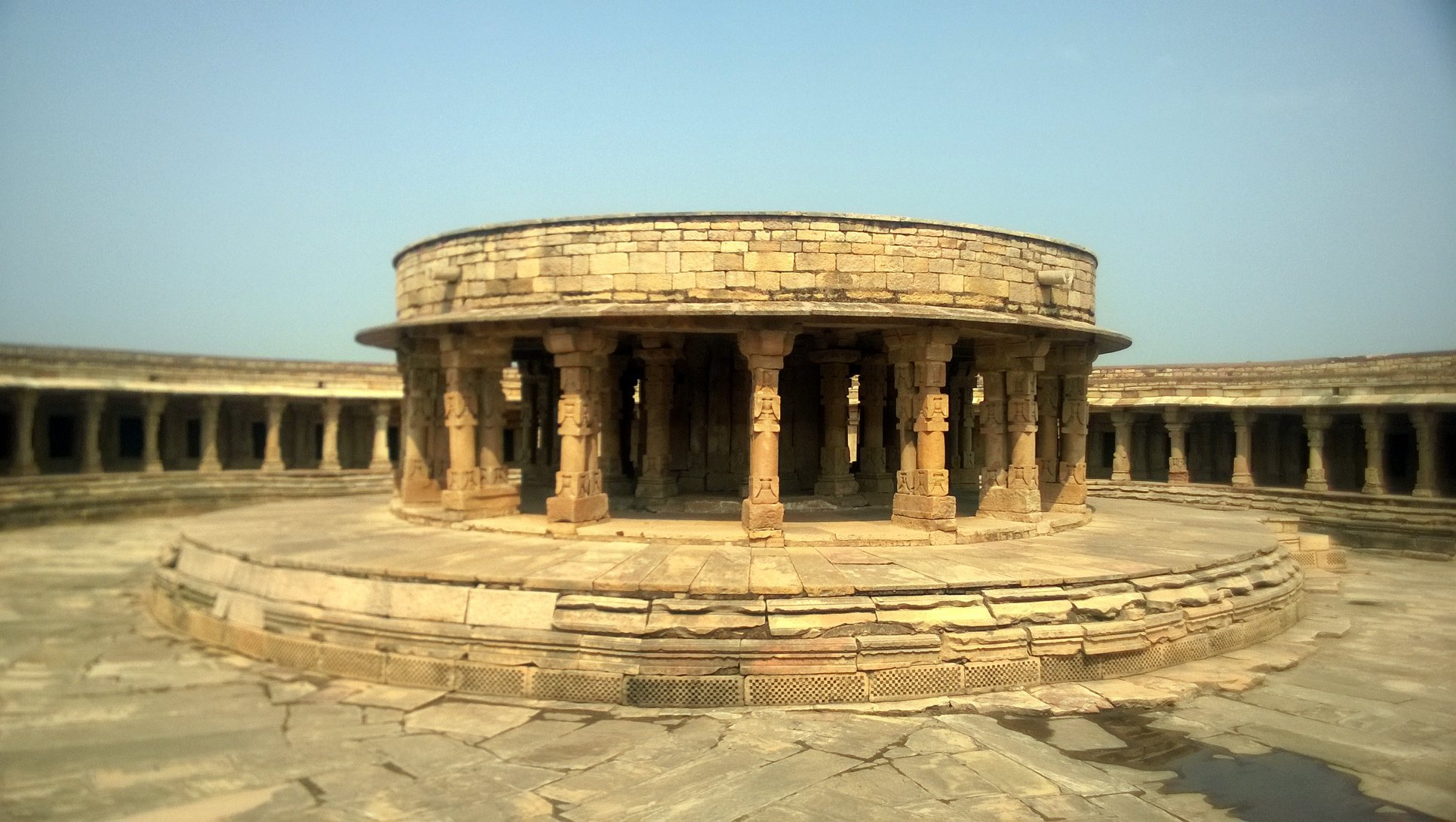
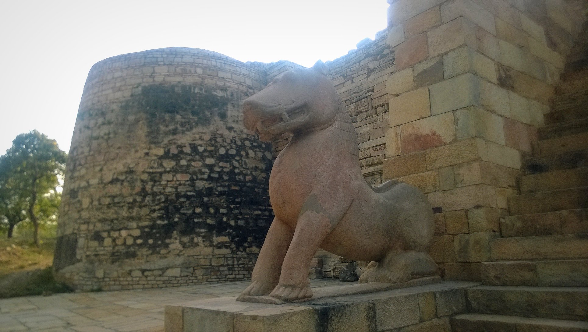
Soon, pulling away from the main road, we ventured into the Chambal Valley. Encountering the occasional shallow ravines and sparse vegetation. Our first stop was the mesmerizing circular Chausath (64) Yogini Temple atop a hill at Mitaoli, a 1 hour drive from Gwalior. 4 km away lies Garhi Padavali, a fort-like temple, our next stop. However, the most intriguing and spell-binding site lay another kilometre from there – the 8th to 10th century Bateshwar Temple Complex, which was only restored a few years ago, with the help of Chambal dacoits!
Glimpses of the 11th century Chausath Yogini Temple, Mitaoli, also known as Ekattarso Mahadeva Temple at Mitaoli, MorenaGlimpses of the Garhi Padavali temple at Padhavali, Morena
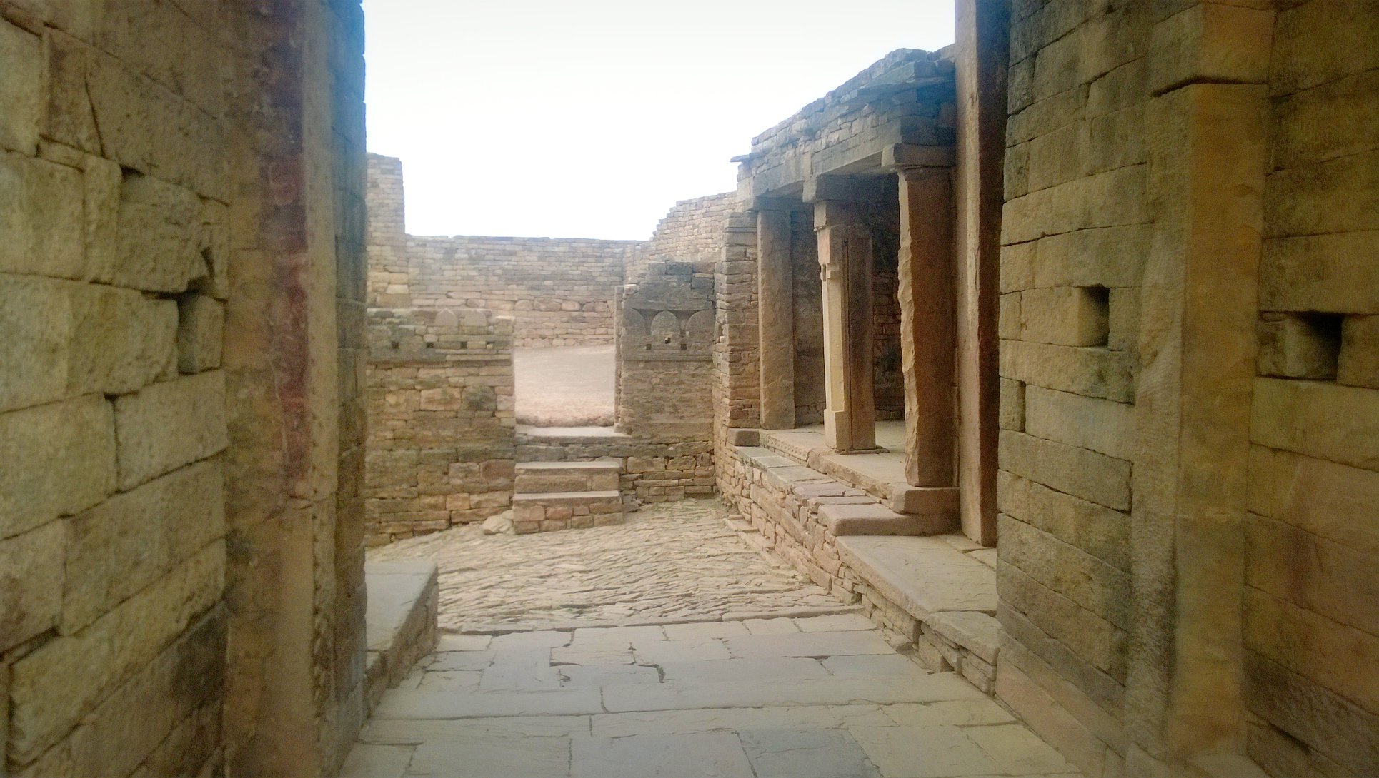
The Bateshwar temple complex lies protected in a cove in the hillside, and is accessed by turning around the hillside when coming from the Padavali site. The complex comprises more than a hundred small temples stacked in tiers, along with a couple of bigger temples and a water tank at the innermost end of the complex. Standing at the bottommost level of the complex, the tiered lines of temples is a sight to behold! The story of how the temples were restored is in itself a testament to the dedication to his craft, and perseverance of reputed archaeologist K.K.Mohammed, and to the magic of collaboration amidst disjointed forces in the face of forces of vested interests.
The road leading to the Bateshwar temple complex as seen from atop the fortress wall of the Garhi Padhavali templeView of the stacks of tiered temples inside the Bateshwar temple complex – the temples are mostly small and a testimony to syncretism of the three major traditions of the Shiva, Vishnu and Shakti within Hinduism.More glimpses of the Bateswhwar temple complex; the motif in the rightmost picture probably depicts Vishnu
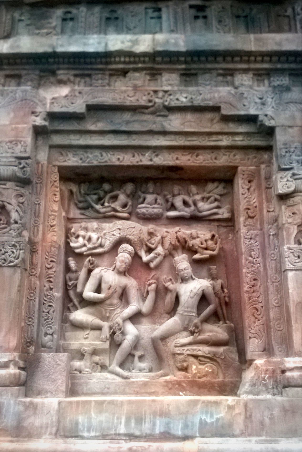
We rounded up the tour with the Kakanmath temple at Sihoniya, 20 km away from Padhavali. Built in the 11th century, the temple is decrepit, but the intricacy of the carvings on the walls are unmissable. After hovering around the site to our heart’s content, as we hurtled towards Gwalior in the autorickshaw through the Chambal ravines and ridges, with the billowing dust-clouds dispersed by the autorickshaw’s wheels bathing, and then clothing us with layers of dirt, I was reminded as to how easy it was for the sands of time to bury things into oblivion, and how, there is so much more from our past to uncover.
Glimpses of the 11th century Kakanmath temple at Sihoniya
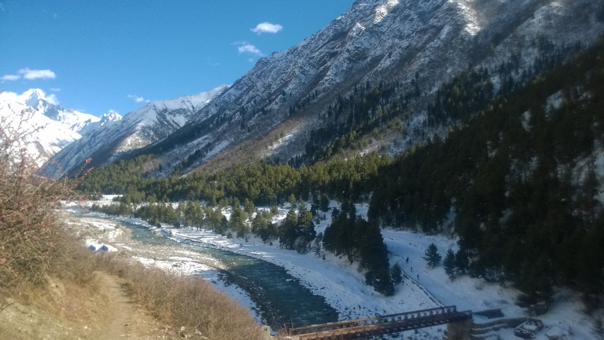
Diwali this year afforded us with a very long weekend, and off we (my friend Abhijit, his friend Amiya, and I) set for Kinnaur Valley. We had booked overnight bus tickets till Shimla, and as the bus ascended the sharp turns with each passing minute, it was overtaken by a contagious wave of nausea. Even those who held their fort tight till the very end, had to give in – spurred by bouts of throwing up all around – to throwing up themselves.
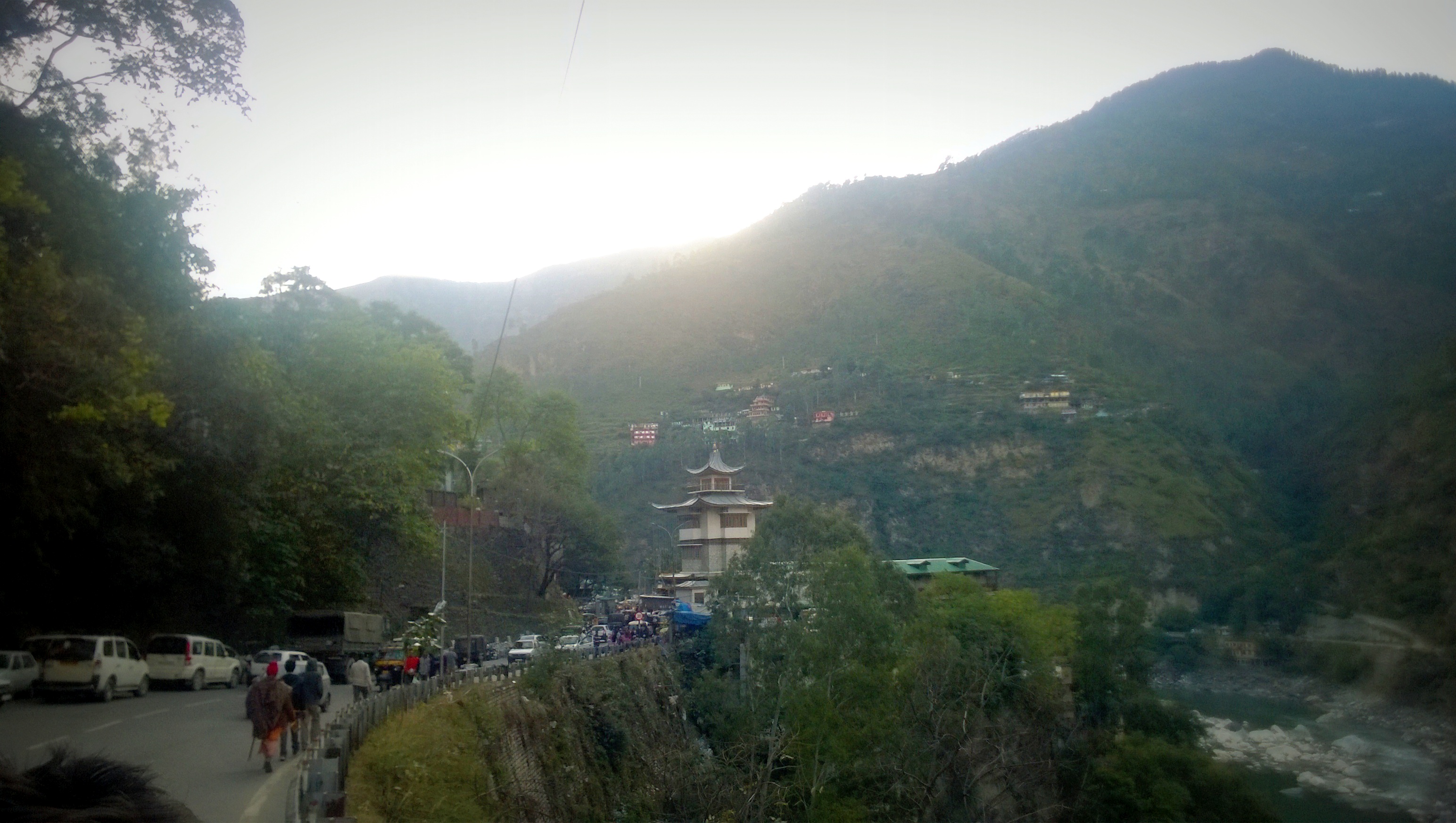
After a quick breakfast in Shimla, we hopped on to a state transport bus, even as a 12-hour journey remained before us. Accompanied by Pahadi Nati songs (of which the most memorable one was ‘Teri Paronthi Laga Radio‘), we finally reached Rampur-Busahr at 3PM, and soon got ourselves a room alongside the Satluj river. After a quick lunch, we stepped out to check out a Buddhist temple, the Rampur-Busahr bridge across the Satluj, and then, the King’s palace, where public access was allowed only till the lawns.
A monastery in Rampur-Bushahr, overlooking the SatlujThe royal palace of Rampur-Bushahr
It was Diwali after all, and so atop the hotel’s terrace, we looked in awe at the night sky, as the twinkling stars became indistinguishable from the showers emanating out of exploding fireworks. The mountain on the other side of the river looked as if it wore chains upon chains of sparkling diamonds. The temperature dropped to below 5 deg. C.
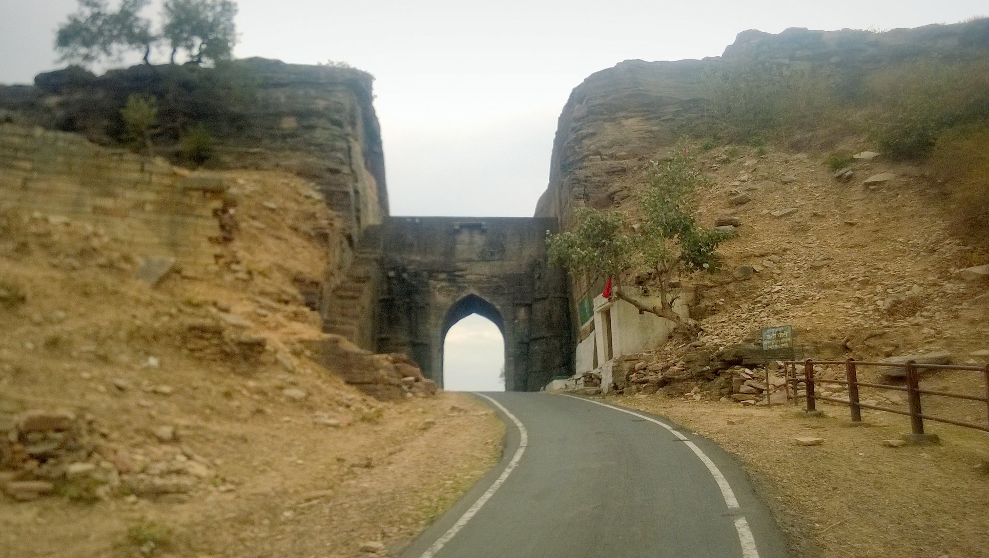
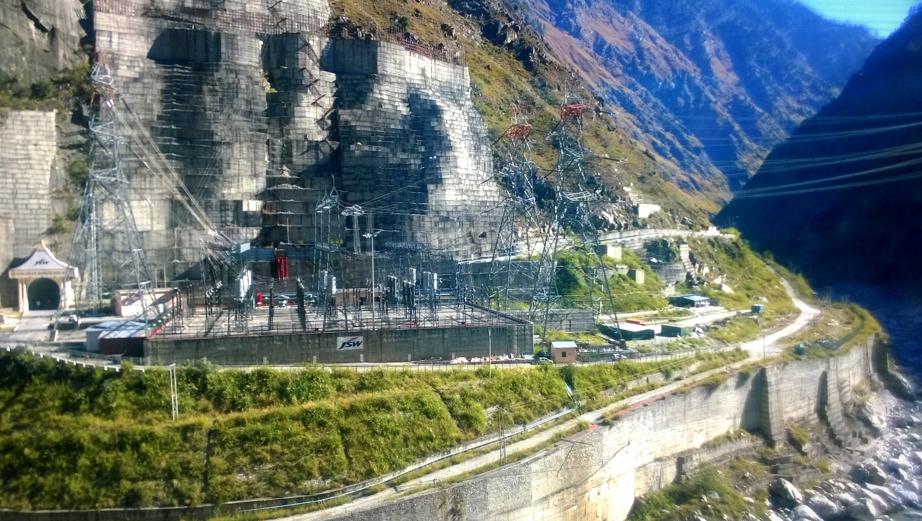
The next morning at 9am, we took a Himachal State Transport bus to Rekong Peo which was the gateway to the Kinnaur Valley. We hurtled alongside the Satluj for the longest time, with the mountains flanking us on both sides, treated to images of waterfalls streaking across the ridges on the opposite mountainside and the numerous hydro-projects. Before soon, we had passed through the famous hoop-like rock tunnel marking our entry to the Kinnaur Valley.
A hydel project on the Satluj
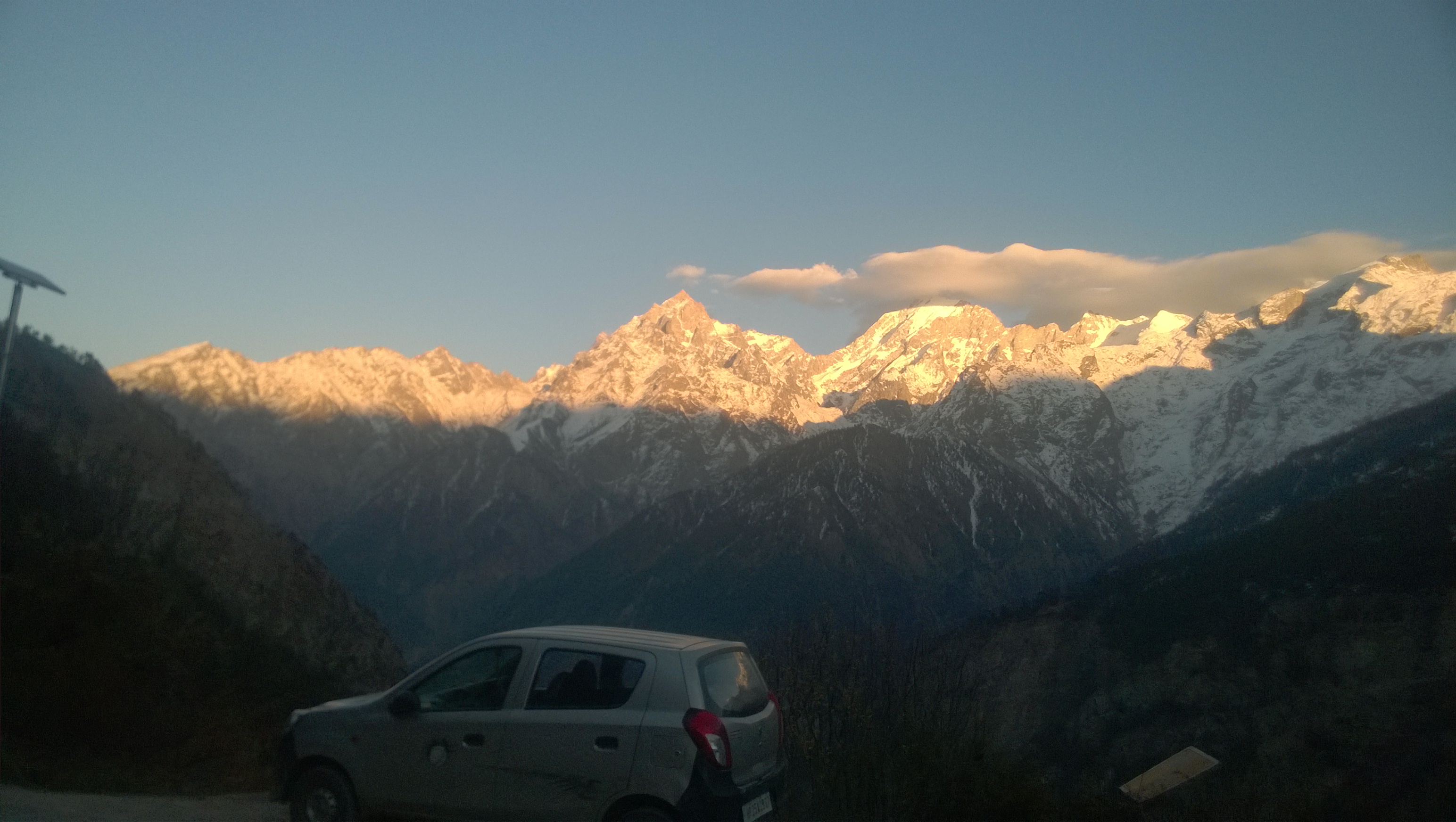
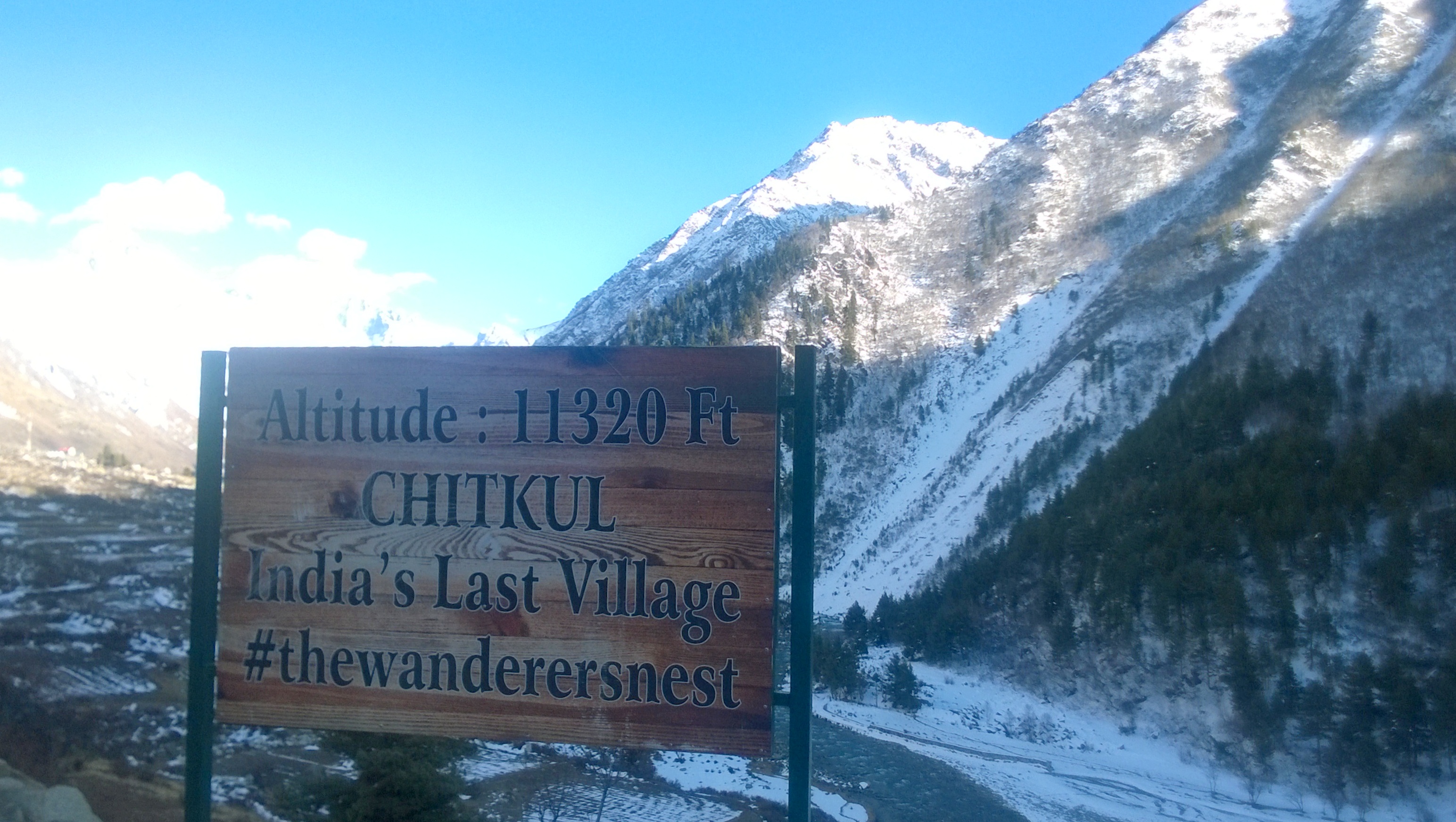
Shortly, we reached Karcham, the point where the Baspa river met the Satluj, and the road diverged, with one branch leading to Rekong Peo and further to Kaza, and the other leading to the Sangla Valley, where the well-regarded village of Chitkul, touted as the last Indian village, is situated. At this point, the snow-capped Kinnaur Kailash was already visible, standing there as if a stone’s throw away, but still unreachable even as we kept windingly moving in its direction.
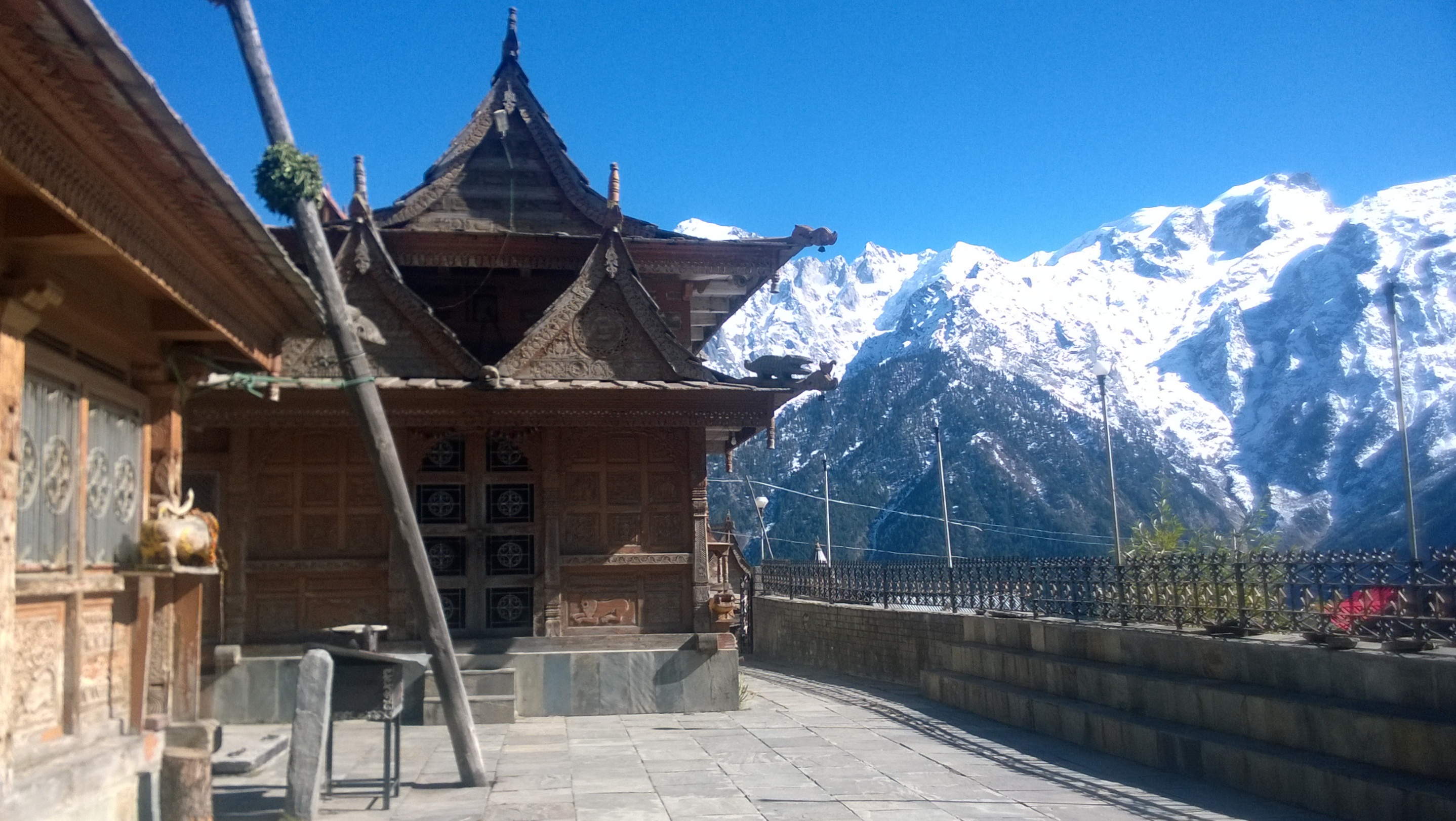
Reaching Rekong Peo around 2 PM, our first step was to hail a lift from a personal vehicle going towards Kalpa, which is accessible by a 7km drive diverging from the road to Kaza. Getting down at Kalpa, we were immediately struck by the shining peak of the Kinnaur Kailash, which now seemed like a touching distance away. It being the shoulder season, we checked in at a throwaway price into a fascinating hotel in the form of a standalone Himachal-style bungalow located in the village centre, and chose a room with a clear view of the Kinnaur Kailash.
After a quick meal of thukpa at a roadside diner, we walked down the slope to the Kalpa monastery and the Chandika Devi temple. Exiting from there, we stopped to have tea at a homestay run by a 70-year old lady, who offered to make us a hot mutton curry dinner that night for a price. With the cold setting in, the prospect of hot piping food was enticing enough that we paid up the advance, and left for some further sight-seeing… or to put more precisely, aimless wandering.
The Chandika Devi temple with the Kinnaur Kailash in the backdrop
That’s when a local villager offered us a ride to Roghi. Little did we know that we would be subjected to one of the most dangerous roads that I have come across in my whole life: in fact, the Kalpa-Roghi road is cited to be one of the most dangerous roads in all of Asia! The road was as narrow as they came – suitable for barely two small car to pass through – with a vertical wall on one side, and a 500-feet vertical drop on the other, supplemented by a general dose of blind curves.
On the dreaded Kalpa-Roghi road, looking at the Kinnaur Kailash
We stopped at the famous ‘suicide-point’ on a platform jutting outwards into the Valley. The view of the Satluj lying as a shining silver ribbon several feet below, and the road winding around the corners on two opposite ends, with the Kinnaur Kailash standing like an imposing guard overlooking the whole set-up, was breath-taking. The villager took us to Roghi, and dropped us back at Kalpa, after which we explored the Apple orchards on foot, to while away time till dinner was readied by the old lady. The dinner, as it turned out, was delicious.
Walk through the Apple orchards of Kalpa
Part 2: Sangla Valley
The following morning, we were were stuck by decision paralysis – Abhijit wanted to see Chitkul which was quite a detour, while Amiya was keen to just return to Delhi. The quibbling went past 9 AM, the scheduled time of the sole morning bus to Chitkul, and it was time for me to adjudicate. My verdict: we would see Chitkul and leave for Delhi the same day.
Abhijit and Amiya looked at me incredulously, given there would be no public transport to Chitkul until later that evening. I told them I didn’t know how we would would do it, but there would be only one way to find out: we would get down at the fork in Karcham, where the road to Sangla Valley emanated – the point the River Baspa met the Satluj – and try our luck.
So checking out at 10AM, we hitched, yet another ride, down to Rekong Peo, and caught a bus headed to Rampur-Bushahr; got down at the fork in Karcham, as planned; and waited for a lift. Amiya was still sceptical – he would rather he was headed to Delhi – and Abhijit just sat there in quiet anticipation. After a couple of vehicles ignored our hailing sign, we were pleasantly surprised to find a middle-aged couple stop to give us a lift in their Alto. Stashing our luggage in the boot, the three of us squeezed ourselves into the rear row, and soon found ourselves negotiating another death-defying road.
At 11.30, the couple dropped us at the Sangla bus depot, where, upon a quick inquiry, we learnt that there was a bus to Chandigarh at 3.30 PM. So, we had 3 hours in hand to make a trip to Chitkul and back if we wanted to be on our way to Delhi the same day. With no public transport in sight, and the reliance on hitchhiking seeming undependable given the time constraints, hiring a cab seemed to be the only resort. Thus, following yet another round of disagreement, this one involving the budget, we bit the bullet, and hired a cab for Rs. 2000.
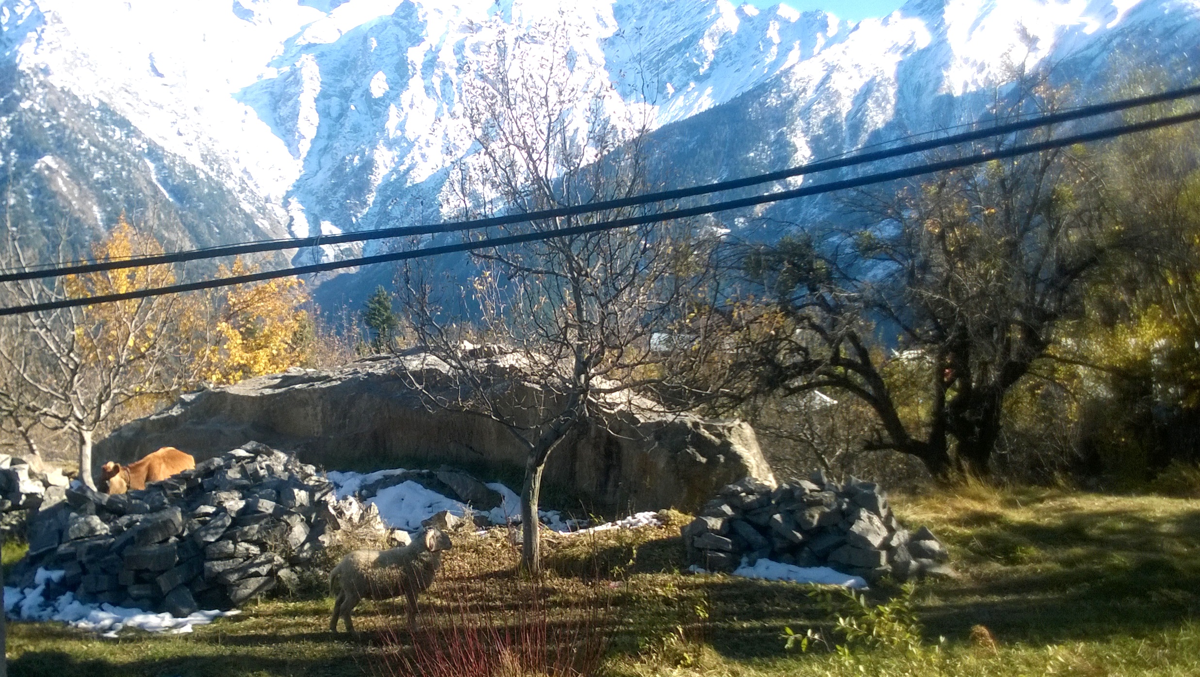
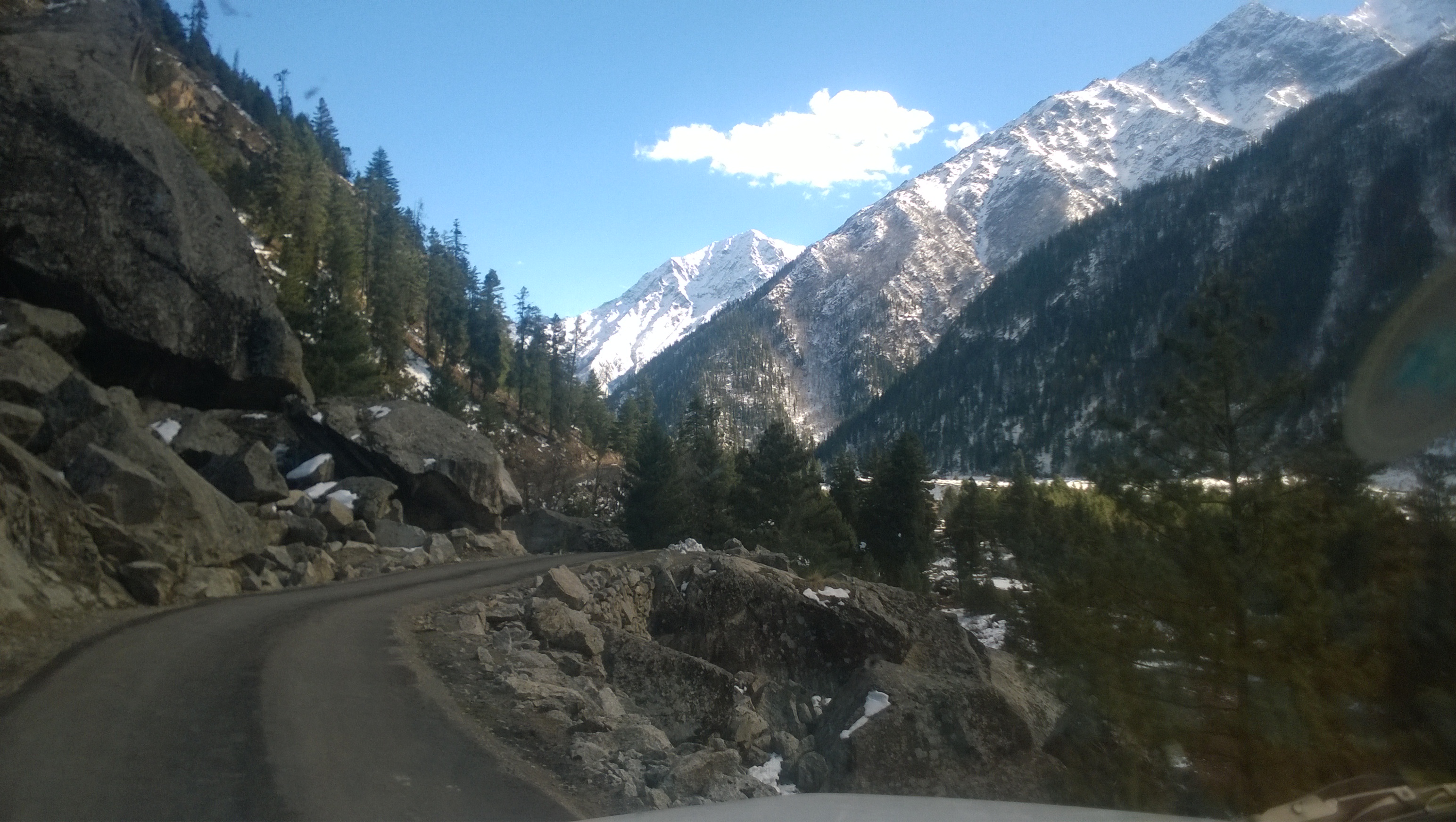
Soon, we were headed to Chitkul – with the road seeming less dangerous, since the Baspa Valley in this stretch is not very deep – marvelling at the sight of glaciers flowing down the mountainside into the River Baspa. We encountered a cute-looking waterfall on a stream with a bridge on which only 1 vehicle could pass at a time. The tarmac soon gave way to an unpaved road, even as the mountains on our side of the river soon turned brown with no vegetation, with their peaks topped with snow.
Sangla Valley enroute Chitkul
By 12.30, we were at Chitkul village, and we promptly trekked down to the bank of the Baspa, on the other side of which lay a cover of snow. Crossing the bridge over the Baspa, we were soon wading in the snow. There’s something about snow that awakens the child inside of man, and we were not immune to the same, evident from how we soon got down to making snow mortar and throwing them at each other. A pint-sized snowman followed soon after.
Signboard welcoming you to ChitkulAt Chitkul
But we had to be mindful of the time, so at around 1.30 PM, we clambered back on to the main road, had a quick lunch at a roadside eatery, and headed back to Sangla. At Sangla, we hopped onto the ordinary (non Air-conditioned) state transport bus as soon it arrived, and managed to get ourselves window seats, keeping in mind the long journey ahead. The joy of managing to get those seats, however, was tempered by the vomit stains on the window frame, and on the inner side of the bus’s wall, and on the floor…meaning, leaning against the bus’s wall was not an option.
Desertified mountain on one side of the valley
The bus started at its own sweet time, at around 5, and soon we were traversing the treacherous stretch of the road, with our seats located on the side of the bus facing the deep, deep valley below, and only a hair’s width separating us from the edge of the cliff. Luckily, as it was getting dark – and darkness falls rather quickly on the high mountains – we were spared the scary views of the bottom of the valley from our window seats.
After a dinner stop somewhere near Rampur-Bushahr, we fell asleep, waking up only once the higher temperatures of Punjab lashed at our faces. At Chandigarh the next morning, following a quick freshening up, we caught another state transport bus to Delhi. Amiya seemed exhausted by now, and could not wait to be back home, but Abhijit and I were not helping matters, as we ribbed him by humming the tune of ‘Teri Paronthi Laga Radio‘. Thankfully for Amiya, his misery ended at 2 PM when we finally reached Delhi.
4-day marathon trail of 5 places: Gwalior-Datia-Jhansi-Orchha-Bandhavgarh
Just 3 months into my new job, my colleague Abhijit, who I had recently befriended, and I, decided to make full use of the last weekend of September, and impulsively booked overnight bus tickets to Gwalior, with no itinerary in place. I did have Orchha in mind, which we decided we could do by taking public transport to Jhansi from Gwalior, since Orchha lay just 15km away from Jhansi. I also hoped to see the monuments strewn around in Morena, near Gwalior, on the trip, and be back in Delhi by Monday morning.
Day 1: Gwalior
Getting down early morning at Gwalior, our first task was to find some lodging to freshen up. Soon, we were down in Naya Bazar to try out for breakfast kachoris which are quite the rage in Gwalior. While munching on the kachoris, Abhijit wondered if we could also visit Bandhavgarh National Park. While I had heard about Bandhavgarh before, a quick Google search revealed Bandhavgarh was over 500 km from Gwalior, with iffy public transport communication. Abhijit said, ‘Never mind’, and got back to snacking. I reconciled to the same, however, as is my wont, I could not stop thinking if there was the slightest chance we could work something out regarding Bandhavgarh.
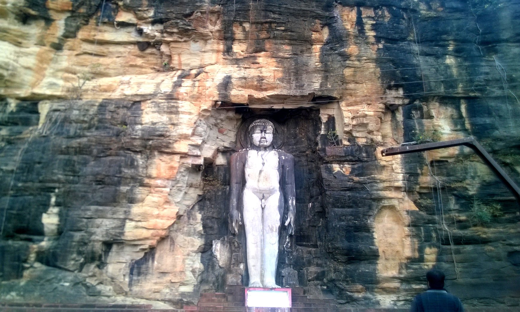
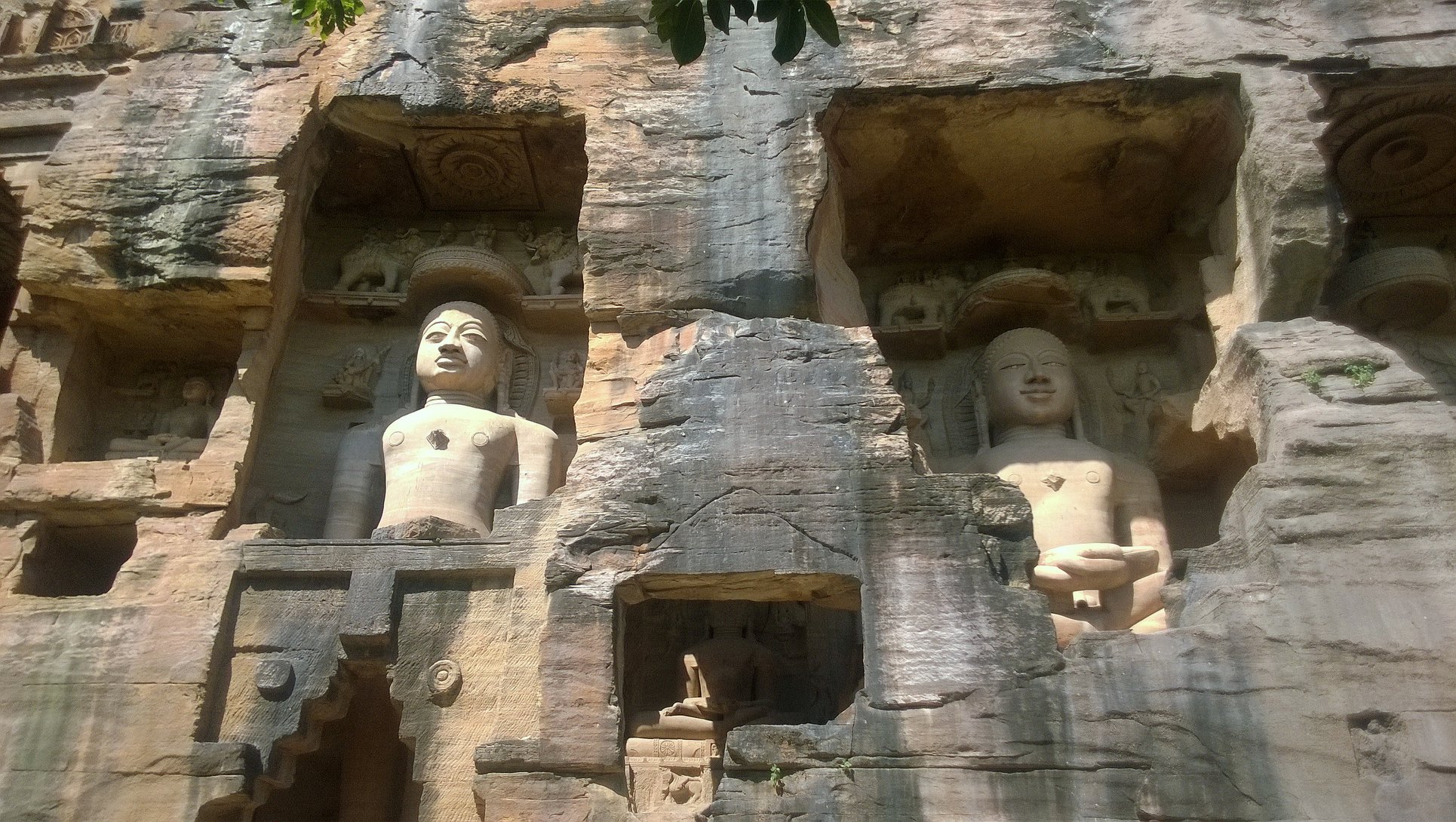
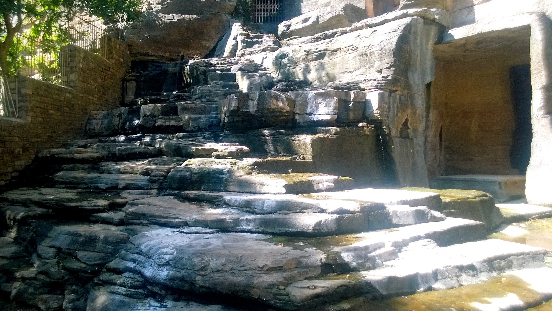
We then headed to Gopachal Parvat, where there exists groups of Jain sculptures depicting Tirthankaras in both standing as well as seating position, built in between 6th and 15th centuries. The caves themselves are accessed by walking along a stepped pathway cutting the lawns and garden maintained on the hillside. At the end of a series of statues, there is also a perennial spring emanating from the hillside. The foliage around makes it the ideal location for a peace-centred getaway from daily life.
A perennial spring at Gopachal Parvat
Glimpses of the Jain statues at Gopachal Parvat
Meanwhile, with my mind racing about Bandhavgarh, with the barest of discussions with Abhijit, I simply booked waitlisted tatkal tickets from Jhansi to Umaria, the nearest railway station to Bandhavgarh. And all this, while having no idea about what to do in Bandhavgarh regarding accommodation and the main attraction, the tiger safari, which I could see from the park’s website, was completely booked for the whole upcoming month! Anyway, this meant the end of my dream to see the monuments in Morena. Perhaps, I could compensate this by seeing the Sheshsaiya statue of Vishnu in Bandhavgarh?
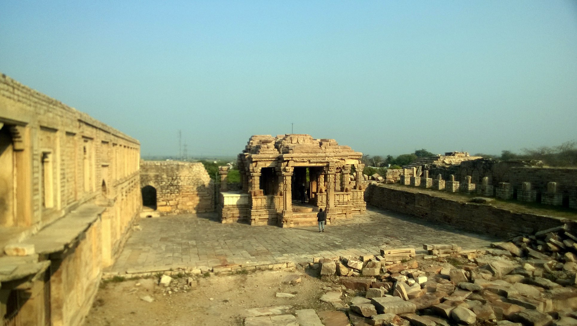
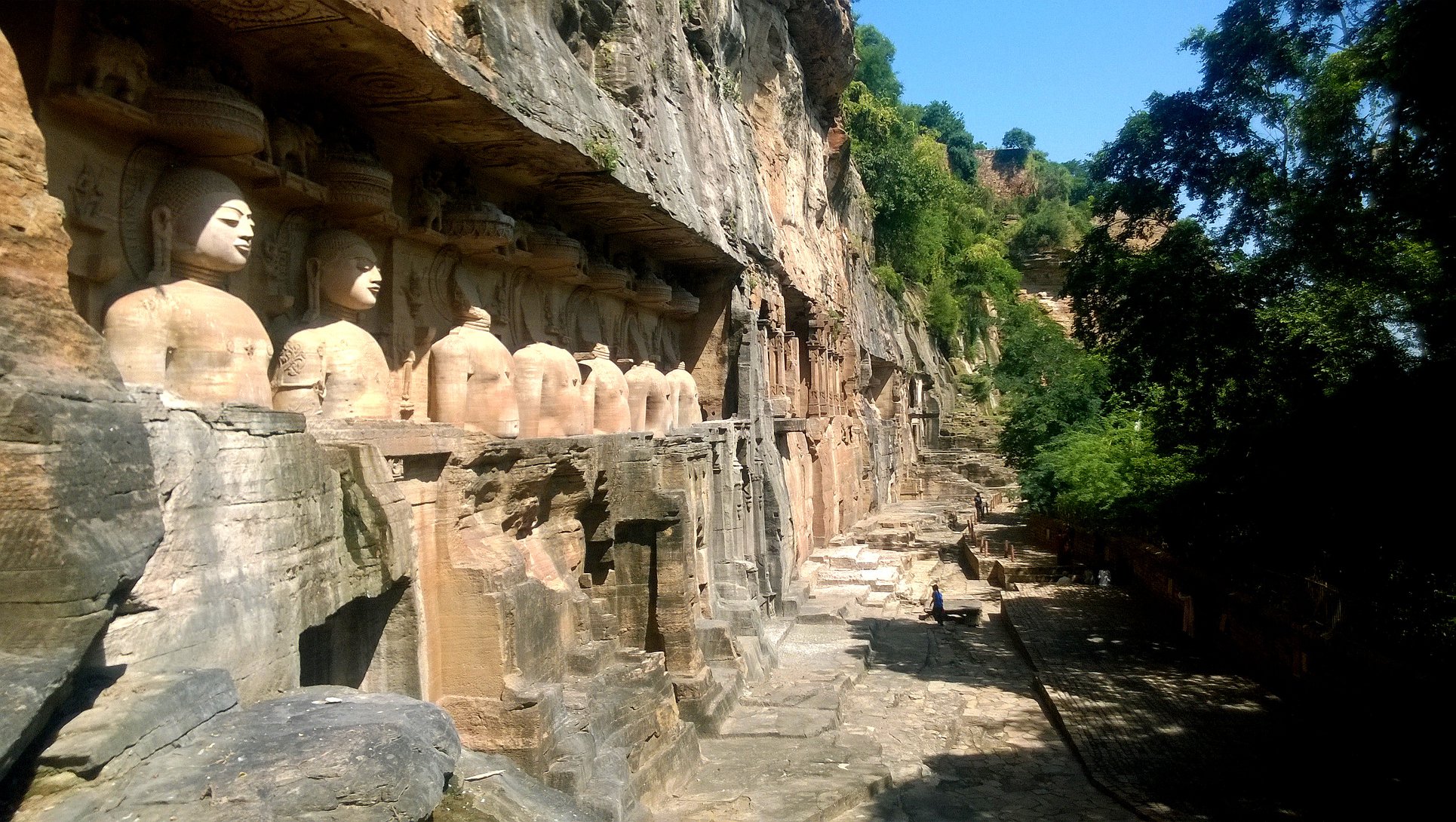
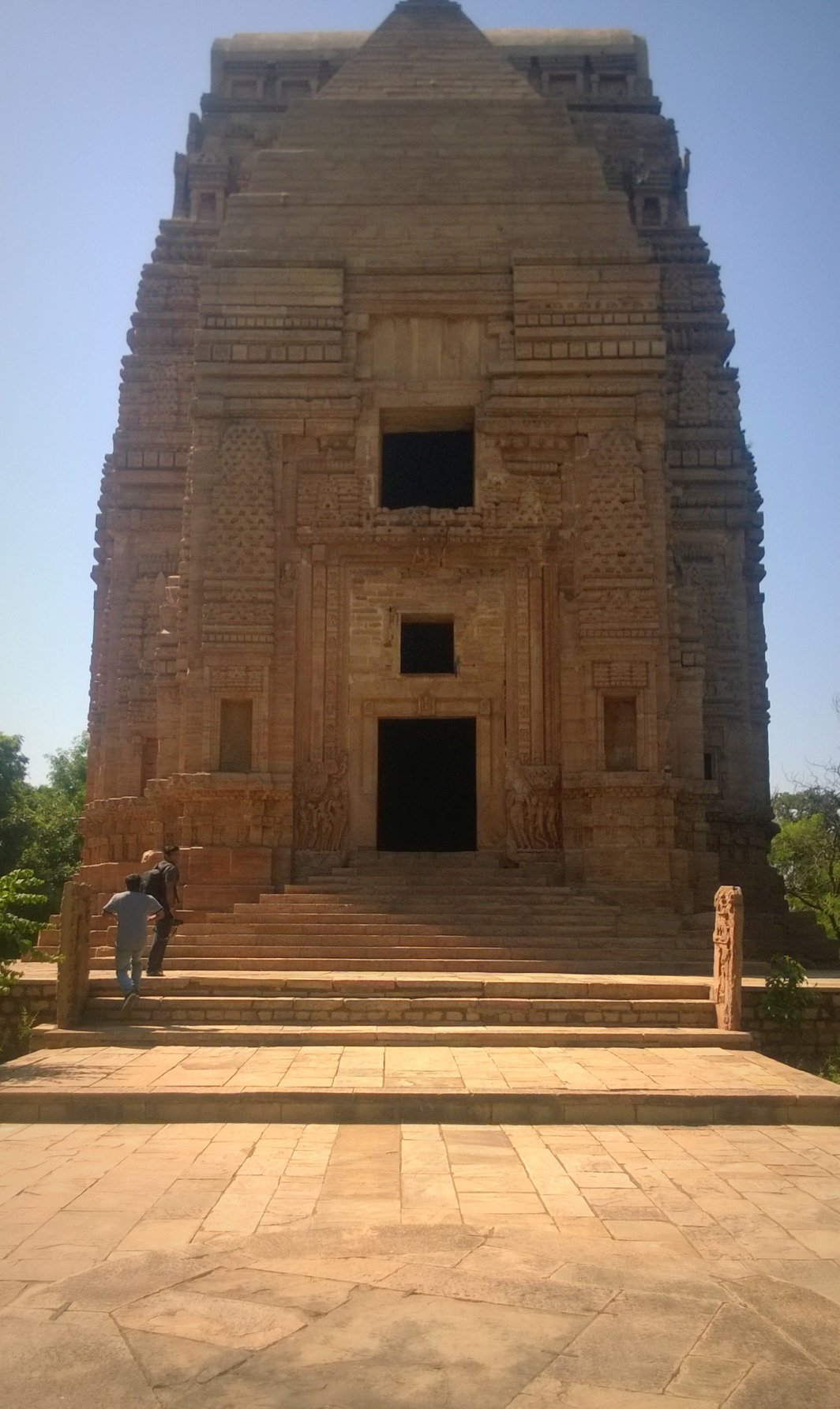
Our next stop was the Gwalior fort which sits upon a elongated flat-top hill, and accessed by two paths. The autorickshaw driver dropped us at the bottom of the Kila (Fort) Gate road that approaches in the southwest side, the other road leading to Urvai gate can be used if one wishes to take their vehicle inside the fort premises. We clambered up the steep Fort road by foot, encountering first Jain caves on the mountainside, and then, the famed Chaturbhuj temple -a 9th century Shiva temple carved out of rockface, that lies on a bend on the road – noted for bearing the earliest known epigraphical evidence of ‘zero’ inscribed as the ‘0’ symbol on stone.
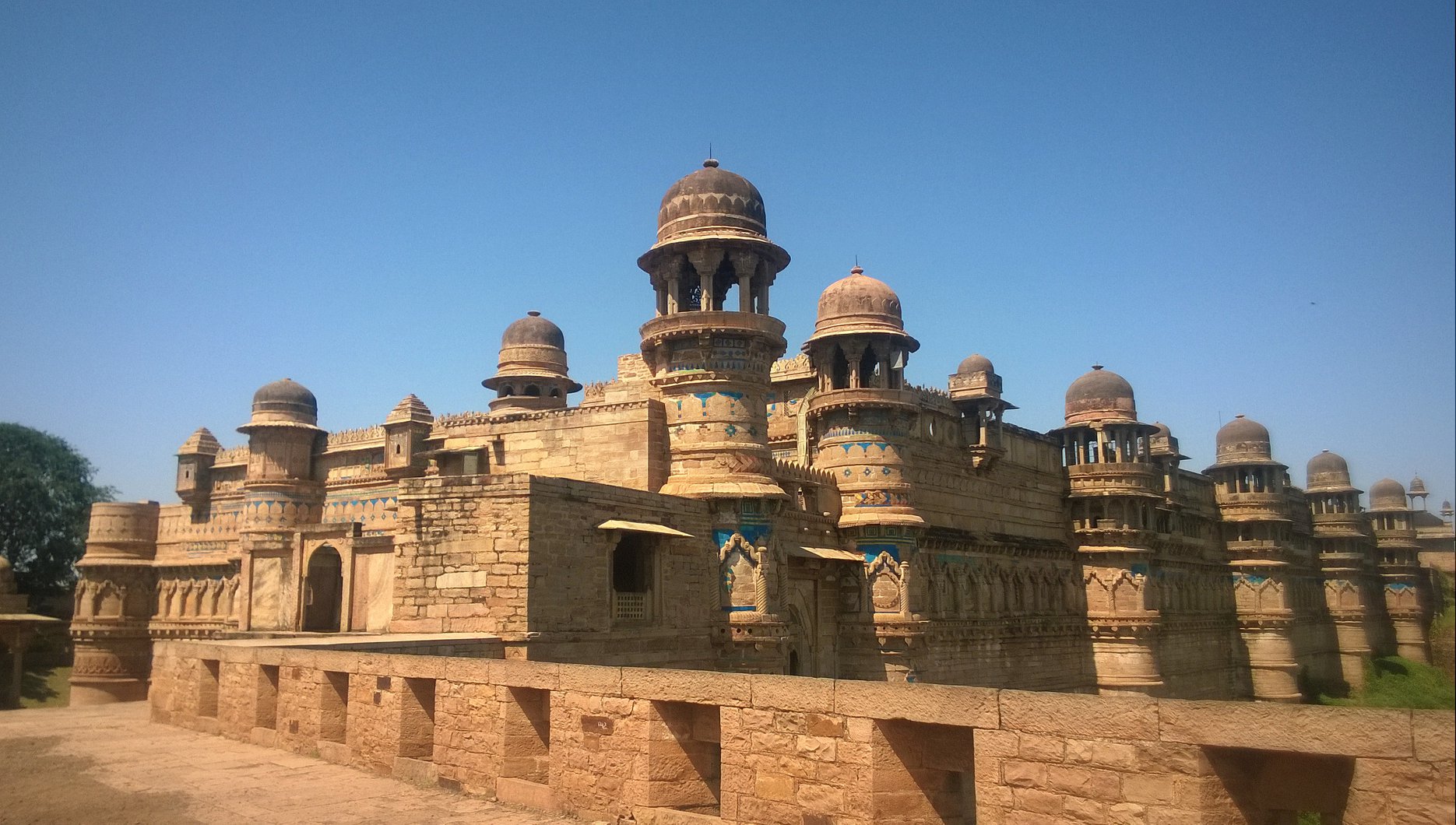
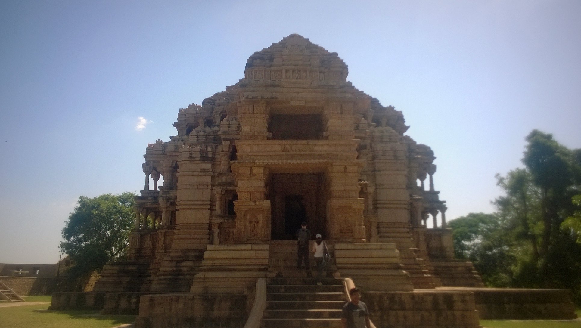
As we approached the gate leading to the main area enclosed by the massive walls, we finally got a glimpse of the iconic image of the blue coloured turreted wall extending into the distance. Once inside, we hired an electric rickshaw to take us around the major sightseeing points inside the fort. We first came upon the 11th century Sahastrabahu (also called the Saas-Bahu) temple, and then the 9th century Teli ka Mandir. Riding through the roads spread across the vast hilltop, criss-crossing each other many times, we got the feeling the fort premises themselves were akin to a fortified small town lying entirely on the hilltop.
Turrets in Gwalior fort
Chaturbhuj temple with one of the earliest mentions of ‘zero’Teli ka Mandir
Sahastrabahu (Saas-Bahu) temple
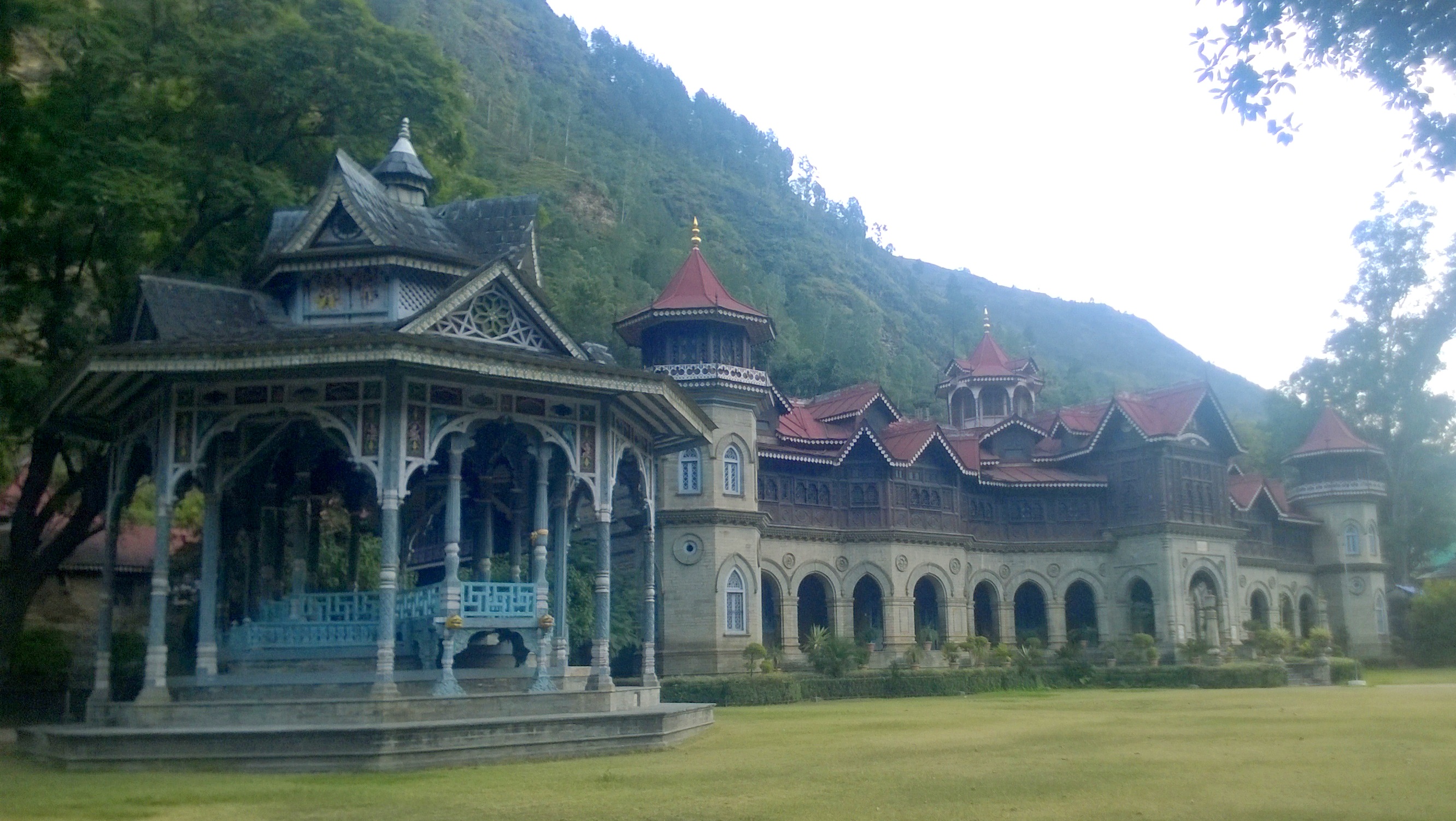
Back at the point where we had entered the main fort area, we hired a guide who walked us through the main palace called the Man (pronounced as Maan) Mandir Mahal, named after the reputed Tomar ruler Man Singh Tomar. We then walked further to the area behind the Man Mandir Palace, and saw the Jauhar tank, as well as the Jahangir Mahal. And then, on our way down from the fort along the Fort Road, we also took a peek into the Gurjari Mahal – that lies at the foot of the hill with the fort in the background – now turned into a museum containing many of the artifacts found inside the fort, and in and around Gwalior.
After a quick lunch, we then proceed by autorickshaw to the Tomb of Tansen – the favoured musician in Akbar’s court – which lies inside the compound enclosing the bigger Tomb of Muhammed Ghaus. This is where I made a point to call up my friend Priyam, who at that point happened to be living in Gwalior due to her civil servant husband’s posting. After a bit of admonishing from her for not having informed earlier, Abhijit and I were promptly invited over for dinner that night – it also happened to be her son’s birthday.
Tomb of Muhammed Ghouse
After resting for a while in the hotel, and then picking up a birthday gift, we were at Priyam’s place for some catching-up with both her and her husband Neeraj, accompanied by good food and beverages. This is where I mentioned in passing that we hoped to make it to Bandhavgarh: we had train tickets from Jhansi, but just didn’t know how we could get tiger safari bookings in such short notice. Priyam asked us not to worry, and following a few calls by Neeraj, assured us that our stay and safari for Bandhavgarh were sorted! They threw in an additional recommendation for good measure: a place called Datia, which lay midway between Gwalior and Jhansi, our stop for the next day.
Day 2: Datia, Jhansi and Orchha
We started out by road transport at 7am on the second day, and some distance before Datia, we saw a cluster of white spires on the top of a hill- this, I came to know later, is a site called Sonagiri, bearing a Jain temple cluster. Then, just around 9 am, while we were on the outskirts of Datia, as surely as Priyam and her husband had said, we saw the palace sitting proudly on top of a low hill, right from the main road that bypasses Datia town. We got down at the Datia bus-stand and walked down the to the palace.
Datia (Bir Singh) Palace seen from the main road
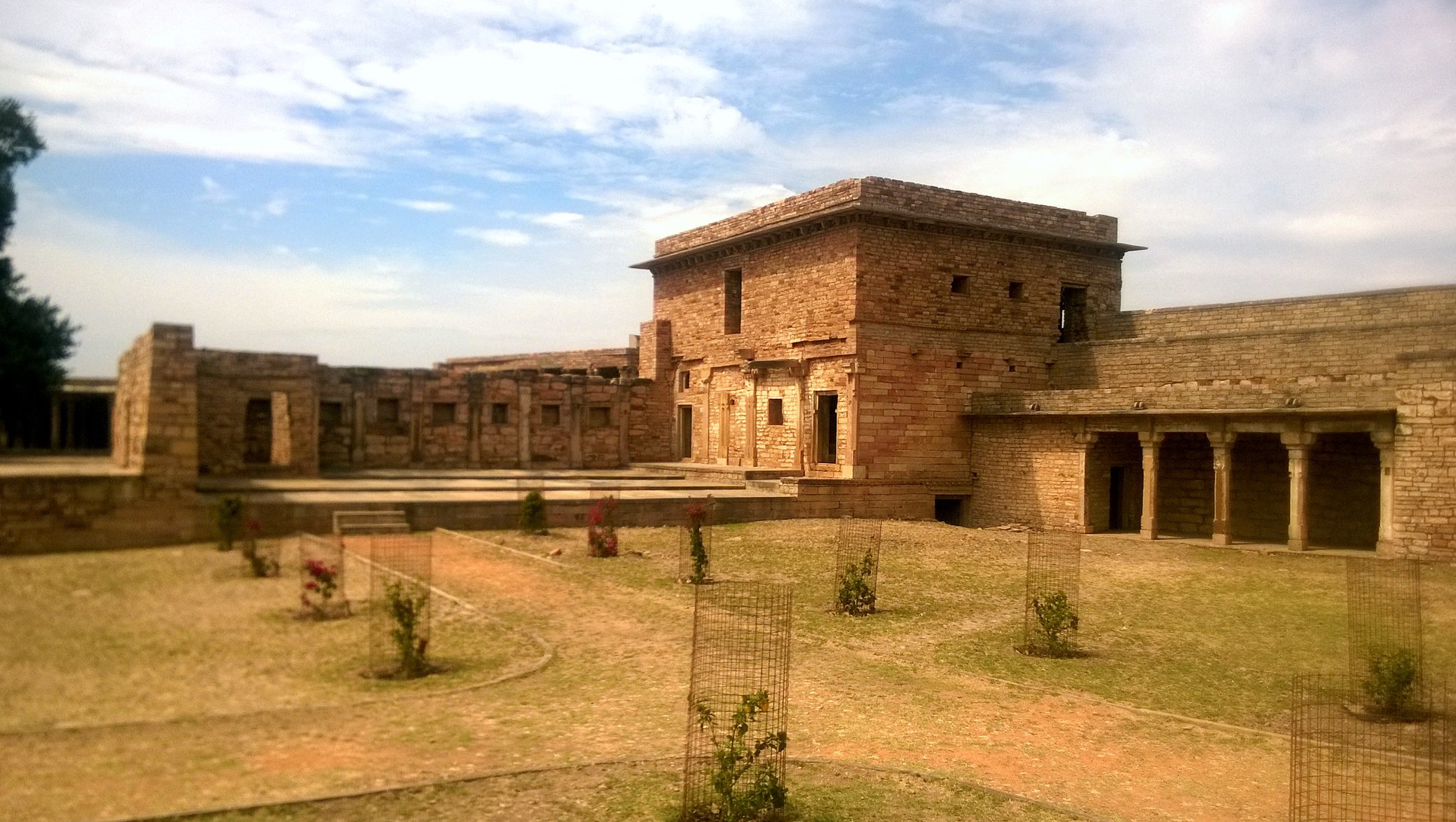
The 17th century palace, it turned out, is called the Bir Singh Palace, after its builder Bir Singh Deo, one of the most significant Bundela kings, who became a trusted acquaintance of Jahangir, and is also said to have built the Jhansi Fort. The 7-stroreyed palace itself is remarkably well constructed on a square plan, with symmetrically laid squared wings within the main square plan, each inner square having spacious rooms with overhanging balconies, interspersed with L-shaped large courtyards in the centre of the inner squares. It is easy to get lost inside the maze of stairs and pathways inside the palace.
Bir Singh PalaceA courtyard inside Bir Singh Palace
Heading back to the bus-stand, we took a bus to Jhansi, and soon found ourselves inside Jhansi fort by 11.30 AM. After seeing around the Jhansi fort, including the point where Rani Laxmi Bai along with her infant son is purported to have jumped off the fort on her horse to escape enemy forces, we hired an autorickshaw driver to take us to Orchha, which is 16km away. Soon, after a 40-minute ride through Jhansi’s streets, then through light jungle, then across a railway-line, and a tiny bridge, and a dusty track, we were in Orchha.
Glimpses of Jhansi Fort
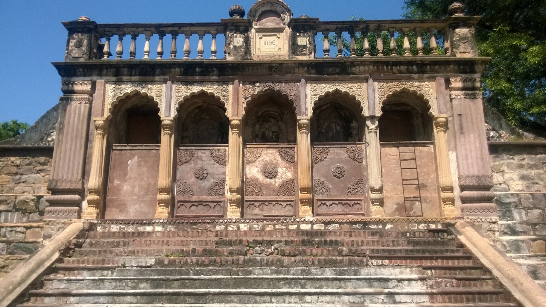
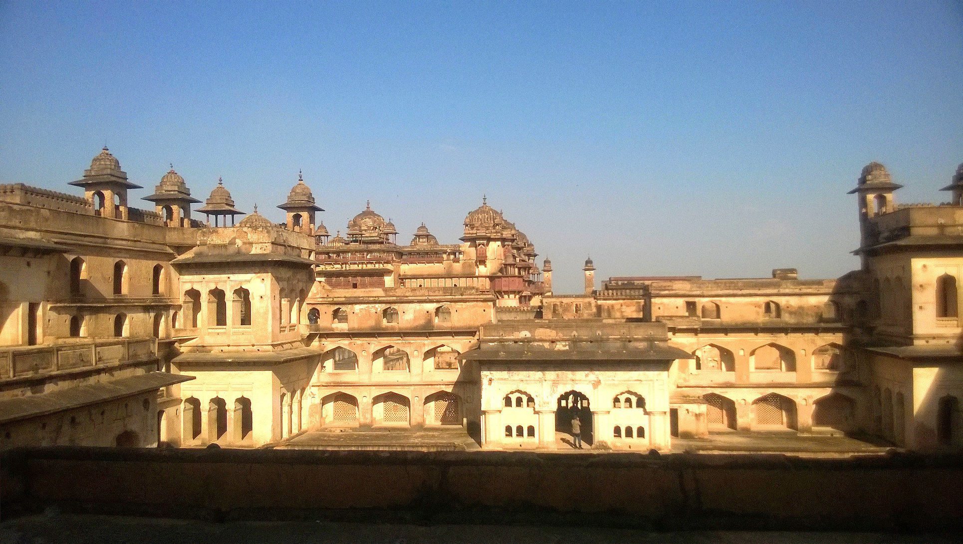
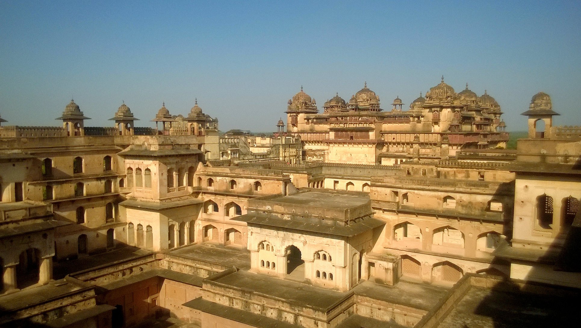
You could say the moment you stepped in Orchha that it was a special place! We were first enamoured by the sight of the Orchha Fort sitting at a height just across a channel of the Betwa river – in fact, the fort lies on the edge of a fairly large island on the Betwa river. Once inside the fort complex, we were further wowed by the near perfect 16th century palace Raja Mahal, built by Rudra Pratap Singh, the founder of Orchha. From an upper storey, we were treated to breathtaking sights of the town’s skyline as well as of the countryside. Just behind the Raja Mahal is the 17th century palace Jahangir Mahal, built by Bir Singh Deo to honour Mughal Emperor Jahangir’s first visit to Orchha.
Raja Mahal inside Orchha FortRaja Mahal inside Orchha Fort
View from a higher elevation inside Orchha fort
I must interject here to make a special mention of the place that we had lunch at before we went to the Orchha Fort. Open Sky Restaurant, run by a middle aged man and his son, is a quaint place with the eating space located on the first floor of a building standing right on the main road. It serves all sorts of items across multiple cuisines geared towards appealing to the western crowd, however, the dish that we ordered simply by chance and were completely blown away by is the Brinjal Tomato Mix Rice.
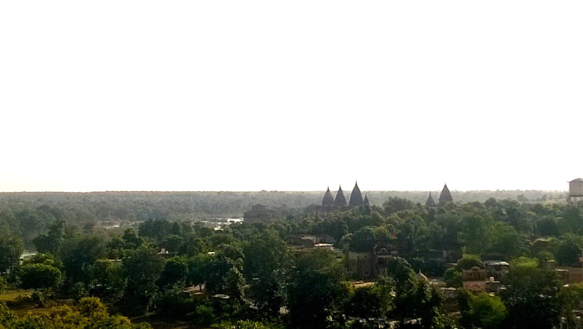
Our next stop was at the conspicuously imposing and utterly inviting 16th century Chaturbhuj temple, whose multiple spires are visible from all parts of the town. The temple sits on a very high platform and has multiple storeys above the level of the sanctum sanctorum dedicated to Lord Krishna and Radha. A man stood guard at the entrance of the staircase leading to the upper floors, charging us a 5o-rupee fee for entry to what was advertised as the Bhool-Bhulaiya (maze). The so-called ‘maze’ for all its worth did provide us with amazing views of the town and of the countryside.
View of Chaturbhuj temple from Orchha Fort
We then headed to the 17th century Laxmi Temple that sits a little farther from the town center on another low hill, and notable for the many frescoes on its inner walls and ceilings. With it now already being 5.30 PM, we headed down to the Royal Chhatris (cenotaphs) by the Betwa River. After spending some time by the riverside with the darkness already falling, and with the auto-rickshaw driver getting antsy about riding in the darkness, we headed back to Jhansi where after having a sumptuous dinner at the Jhansi Hotel, we reached the railway station to catch our 10.30 PM train to Umaria.
Royal Chhatris (cenotaphs) of Orchha
Day 3: Bandhavgarh
Getting down at 8AM in Umaria, our first task was to somehow reach Bandhavgarh by public transport before meeting up with Neeraj’s acquaintance, who then drove us in a Gypsy to a wonderful resort called Nature Heritage Resort. After checking in around 1o.30 AM, freshening up, and resting for a while, we made a tour of the beautiful resort. Then, following an early lunch, we headed out around 12.30 PM for the afternoon safari starting at 2 PM.
Thankfully, because of Neeraj’s prior calls, we were able to make a choice out of the 3 zones, namely Tala, Magdhi and Khitauli – Abhijit and I both chose Tala, for different reasons – for Abhijit, it was the relatively higher probability of tiger-sighting at Tala, and for me, the presence of the Seshsaiya statue! Luckily, we were able to share safari costs with another group – since, a gypsy could take up to 6 passengers in addition to the driver and the guide, and we were just two. And soon we were on the safari trail, where we first encountered the grasslands, then gradually making our way into denser foliage. In the distance stood the a long hill bearing the Bandhavgarh fort.
The Bandhavgarh fort stands on the flattop hill beyond the meadows
I kept reminding the guide about Seshsaiya to his bemusement, even as we stopped at points looking for traces left behind a tiger, sometimes leaving the main trail to go into nooks in search of the elusive tiger. One such narrow detour led us on an uphill path through the dense jungle, where first we encountered ancient structures with open rooms carved out of the hill-side. These supposedly served, in the distant past, as lodging for the visitors to Bandhavgarh. The guide looked at me with a smirk betraying the feeling that he was now going to grant my wish!
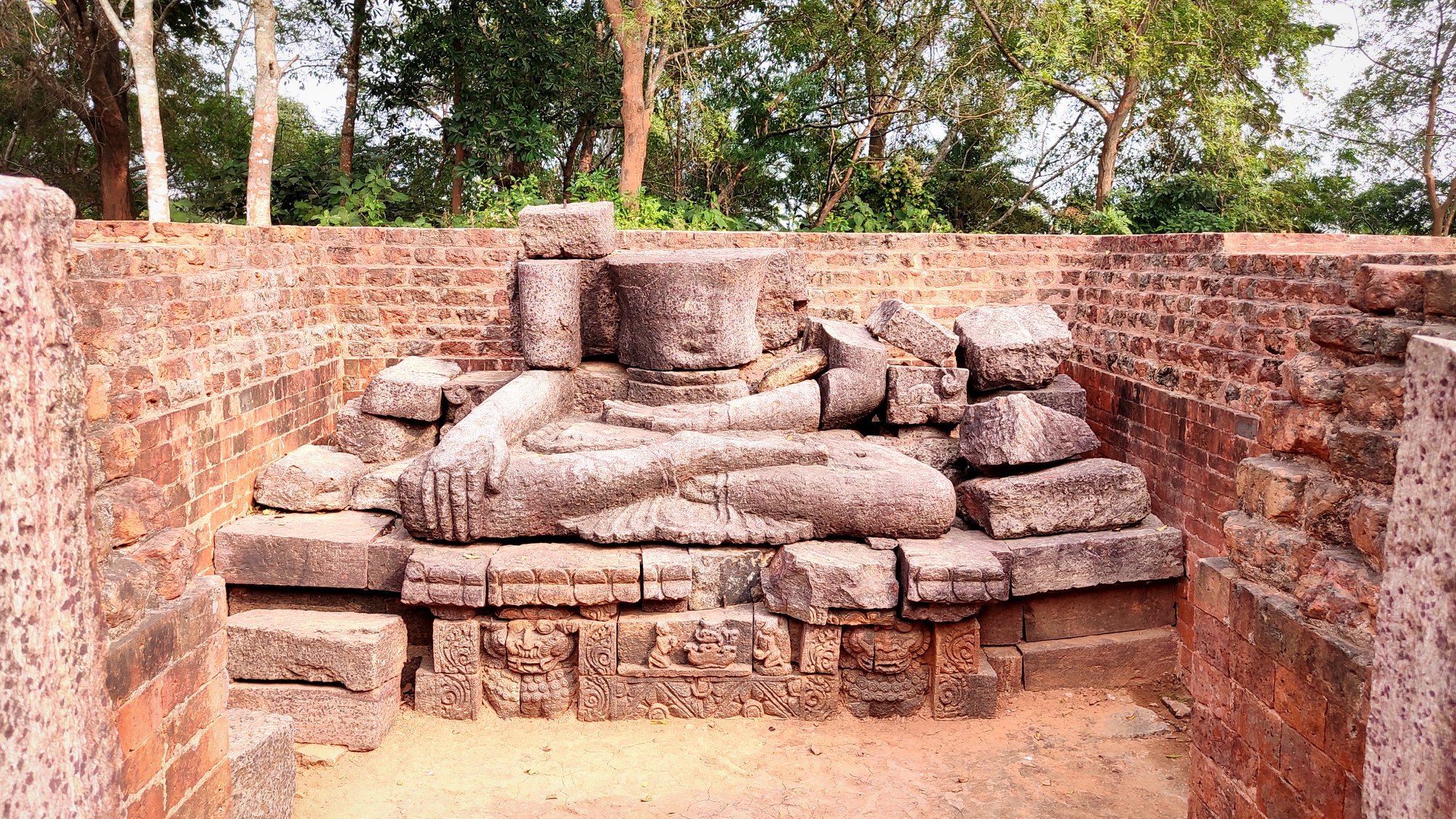
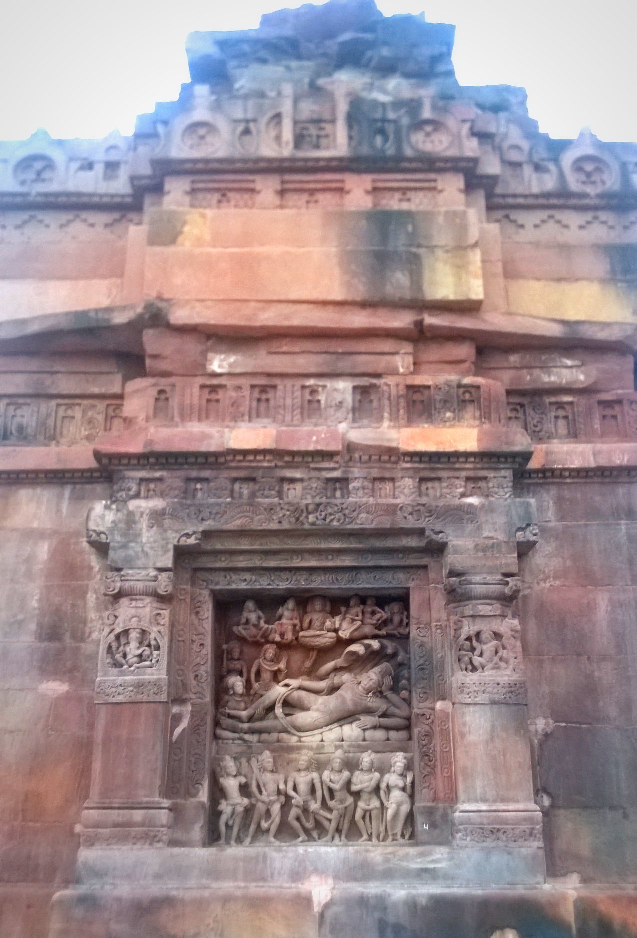
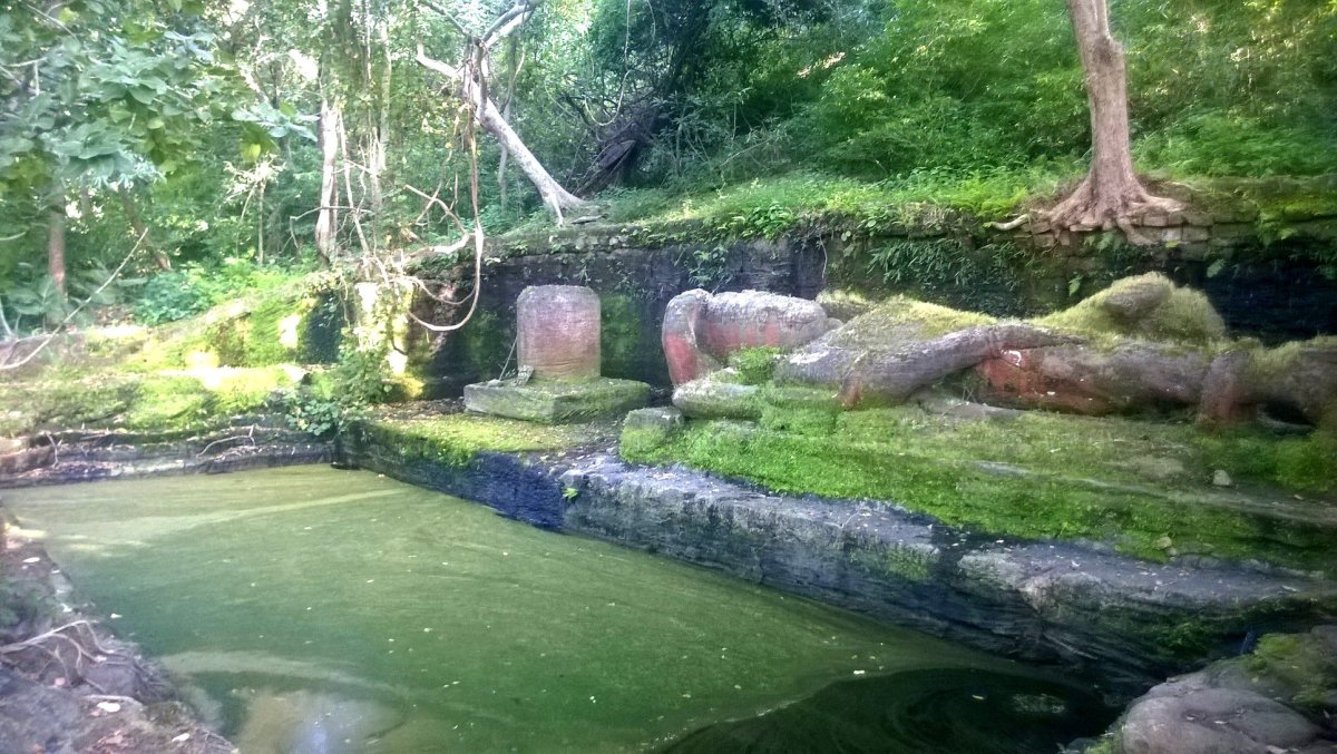
Soon, we came upon a fleet of stone steps leading to a ledge, where the guide beckoned us to get down and take a look. With anticipation writ large on my face, I climbed up the steps to the top, and there it was – the 10th century statue of Vishnu in sleeping position, dubbed the Seshsaiya! The moss-covered statue lay in its exquisite glory alongside the inner wall of a tank with the water level lying below the plinth on which the statue lay. Just above the head of Vishnu, lay Shiva in the form of a shivling, and beside the feet, at the corner of the tank, lay the statue of Brahma, now completely obscured by the thick roots of a banyan tree. Thus, the place was graced by all three forms of the divine trinity, the trimurti.
Seshsaiya (sleeping Vishnu) with Shiva
Representation of Brahma in the corner, with a spring flowing down
I was so enamoured of the place that I did not want to leave, imagining myself having many adventures around the place, perhaps discovering hidden treasures from inside the structures or protecting such treasures from evil treasure-hunters, à la Indian Jones . But we had to move on, as it was already 4 PM, and we had some ground to cover.
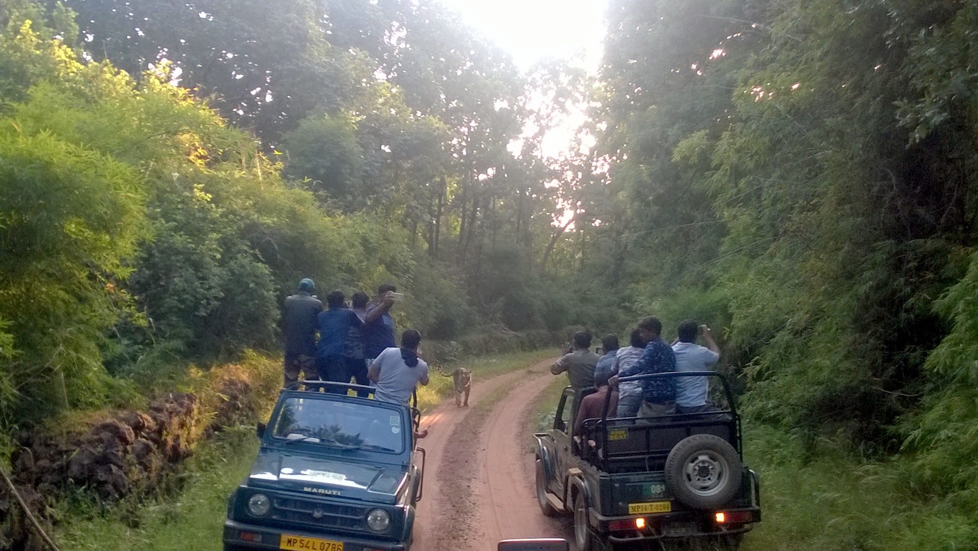
The tiger was elusive, even though we searched for it in the thickest parts of the jungle. Failing to spot one, we continued on the trail before we reached the buffer zone around 5 PM – where jungle and human habitation co-exist. Just as we were losing hope, we saw a group of Gypsies huddled in front of us. And there she was! A tigress burning bright in the rays of the sun setting just behind the tall trees, sauntering leisurely right in front of our very eyes! The excitement, not only in our Gypsy, but also in the other Gypsies was quite palpable.
Tiger, tiger burning bright!
Minor tragedy, major scare
With the tiger spotting behind us, it was now time to head back. And to make up time, the Gypsy driver drove like a maniac, racing against time, to make it outside the park by the scheduled closing time. As, we stepped out of the Gypsy, I was met with a shocking realization – my mobile phone was missing! It was not on the Gypsy either. I called my mobile phone using Abhijit’s phone, but expectedly, there was no response.
Frantically, I ran to other Gypsy drivers asking if they had found a phone matching my phone’s description, and then to the gatekeeper, asking for advice. The gatekeeper suggested we take another safari of the same trail the next day to check if my phone had fallen somewhere on the trail. Although, we had indeed planned another safari for the next morning, I would have rather we did a different zone, for novelty’s sake.
While I resigned to the fact that we would have to do the same trail next day, knowing quite well that looking for a mobile phone in a National Park would be akin to looking for a needle in a haystack, I attempted one last call to my mobile no. and – surprise, surprise ! – a man received the call. Apparently, the man had found it on the ground on the trail itself – he assured me that the phone was safe with him, and he could hand it over to me… in return for an inaam (reward). While I offered him Rs. 500, he quoted 1000 – grateful for the ‘miracle’ that had just happened, I agreed, and within half an hour, my phone was securely back in my hands. It would not be a lie if I said I had one of the most enjoyable meals that night.
Day 4: Bandhavgarh (continued)
Waking up at 5 AM for the morning safari, we picked up our packed breakfasts and were at the Park by 6 AM for the safari starting at 6.30 AM. With the mobile phone saga behind us, we had the luxury to choose a newer zone on this day – and we chose Khitauli.
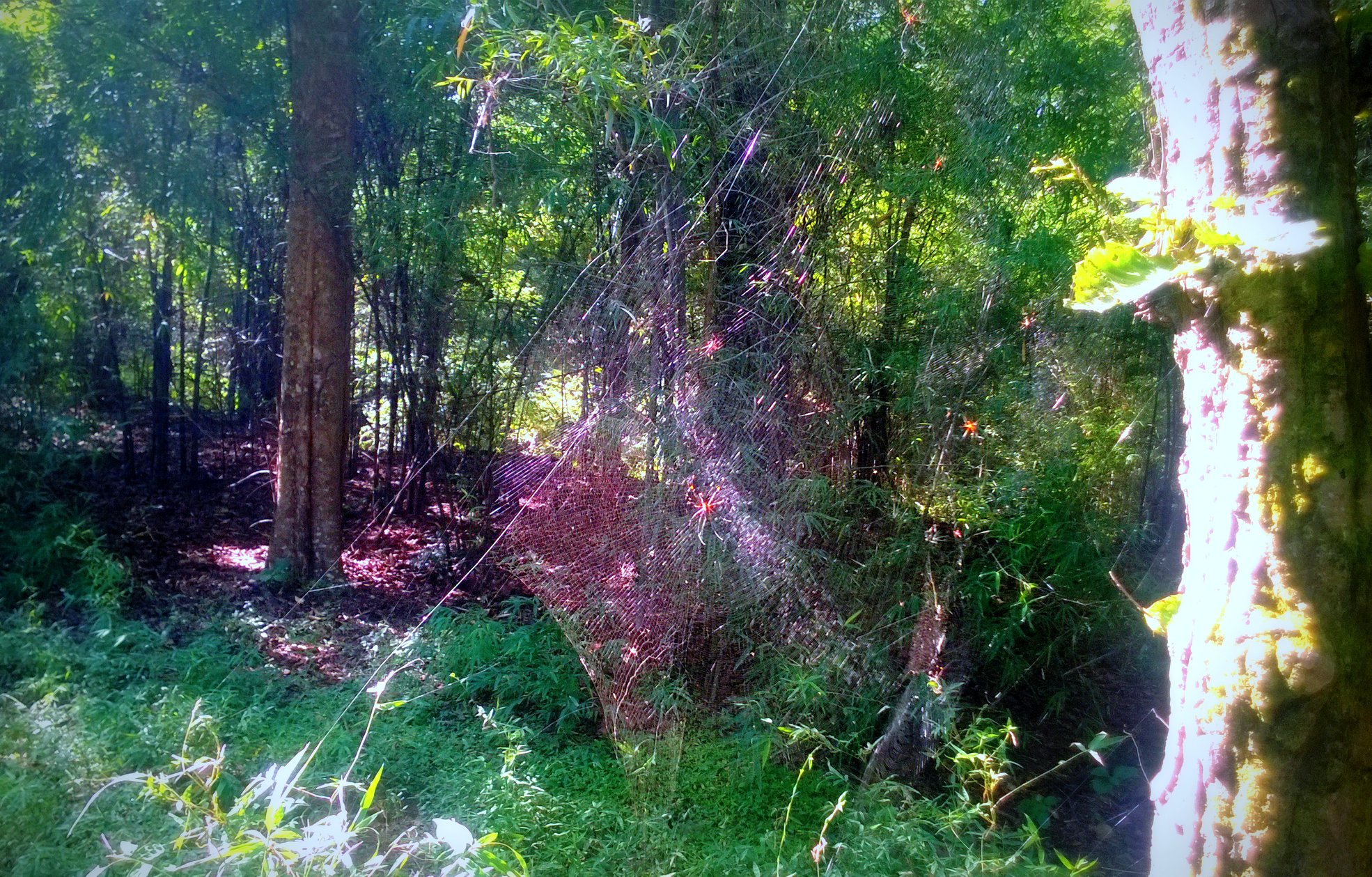
Soon, with the cool breeze blowing against our cheeks, and the mist caressing our hair, we perused the diverse fauna and flora inside the park. We came across giant spiders and their spider webs, myriads of birds, some deer… and leopard poo. Again, from across a patch of grassland, the flattop Bandhavgarh hill with the Bandhavgarh fort sitting atop it, stood there beckoning us, maybe not for this time, but for another time.
Humongous spider-web
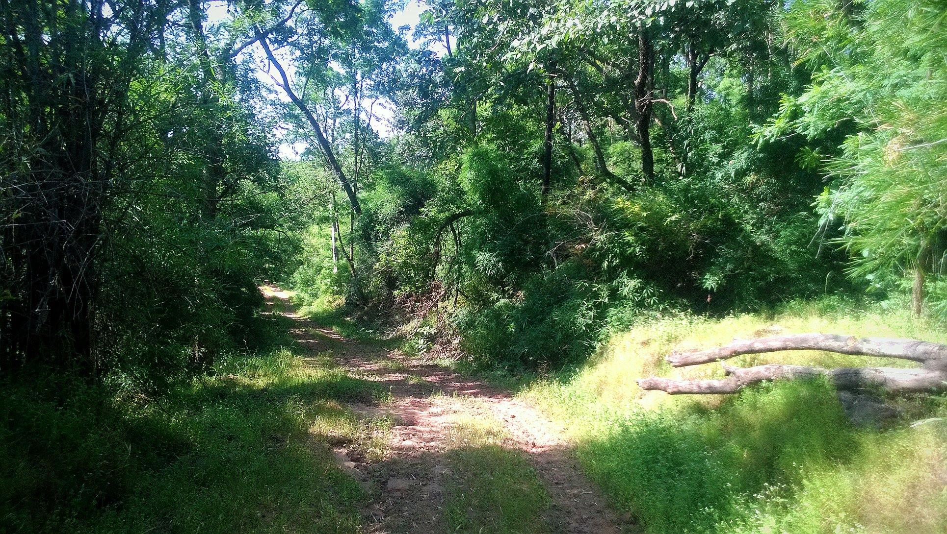
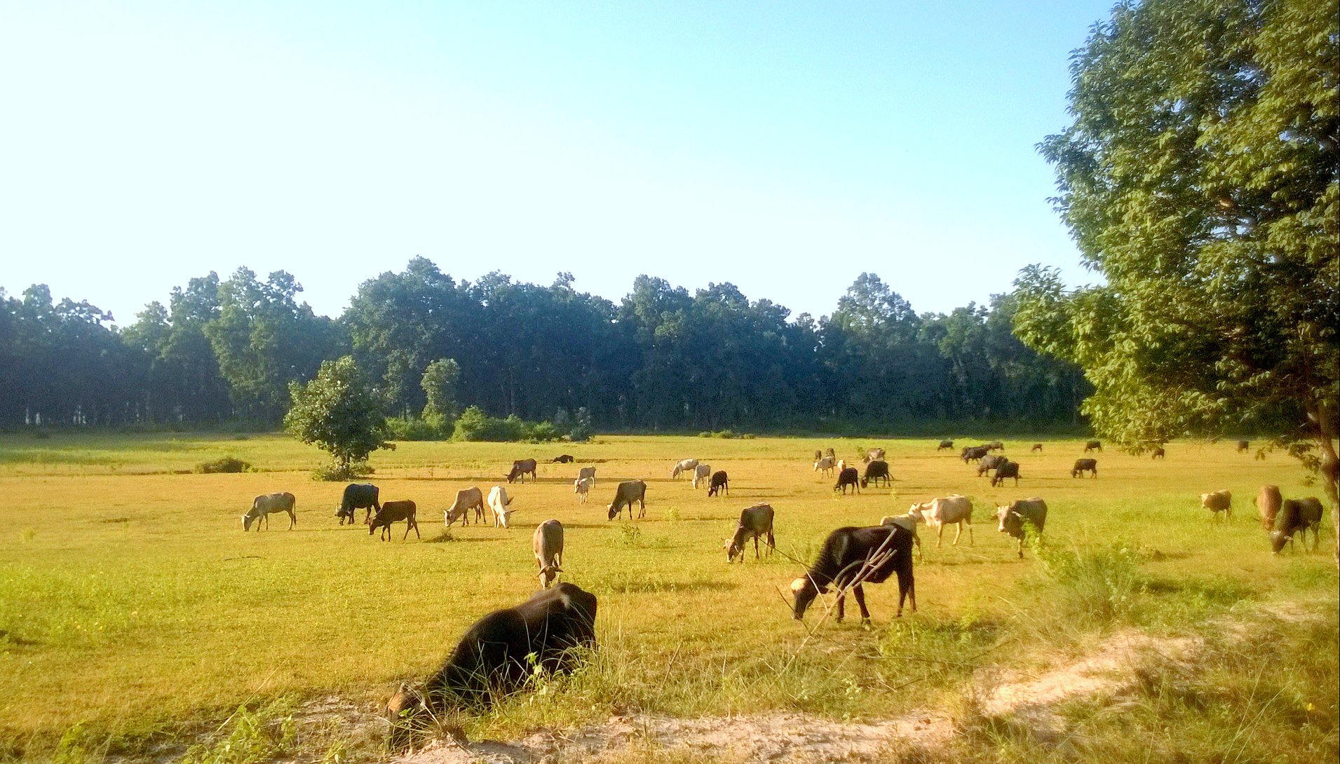
Forest trail in Khituali regionCows grazing in the buffer zone
However, neither a tiger nor a tigress was not to be found on this day. As the sun rose higher and temperatures increased, it was now time to retreat. Back in the resort, we had another laidback meal, and after resting for a while, were ready to check-out. The resort staff refused to accept fees for either the stay or the meals, due to which we decided to drop what we thought was the meal price in the tip-box. By 4.30 PM, we were back at Umaria railway station to catch our overnight train to Delhi. That night’s sleep was one of the most gratifying that I had ever had on a train.
With just three weeks remaining for my post-graduate course in Hyderabad to complete, I decided to head for a quick weekend trip to a place that had been on my bucket list for a long time – Hampi. So, I took an overnight bus from Hyderabad and was in Hampi by 8.30 AM. After checking in at Clark’s Inn, I went about hiking around Hampi – the capital of the legendary Vijayanagara empire – taking a walk through the annals of history.
Hampi is identified with Kiskindhya of the Ramayana, where Bali and Sugriva, the vanara brothers lived. Anjanadri Hill near Hampi is believed by locals to be the birthplace of Hanuman. Hampi is also called as Pampakshetra because of Pampa, an old name for the Tungabhadra River, which runs through the area. Hampi is also said to be the village of Pampa Devi, another name of goddess Parvati, Shiva’s wife. Another explanation is that Hampi became a place where five faces of Shiva (Paramesvarasya Panchamukhnam), namely, Virupaksha, Jambunatha, Somesvara, Vanibhadresvara and Kinnaresvara, began to be worshipped in the form of Panchalingas (five lingas).
Highlights of the trip are below:
Day 1
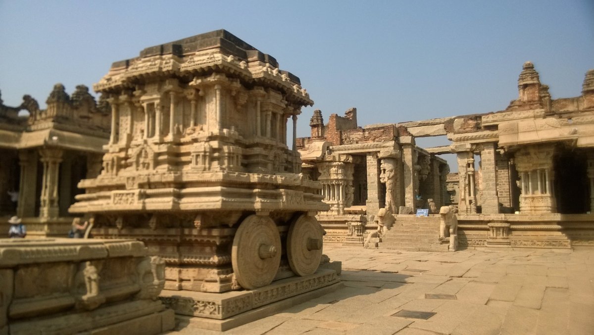
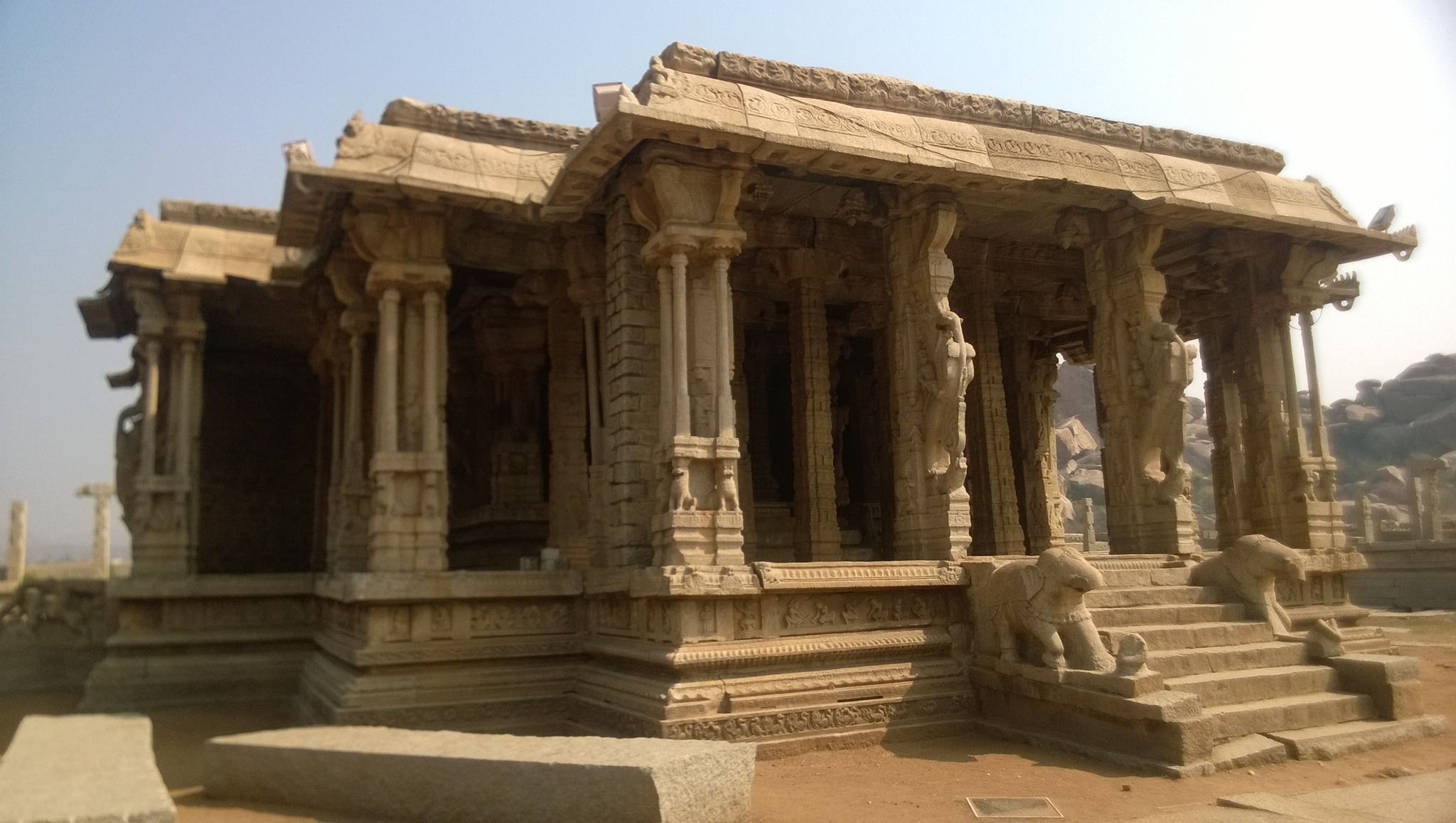
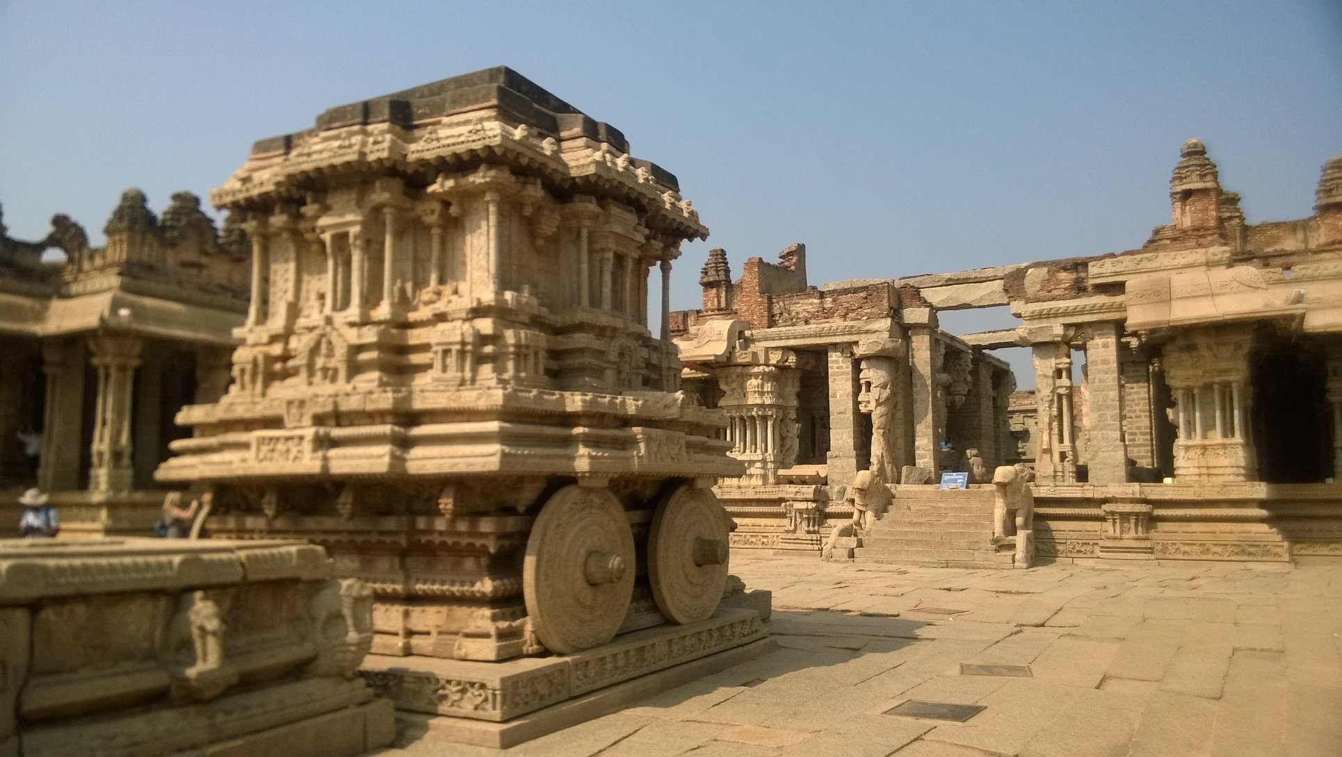
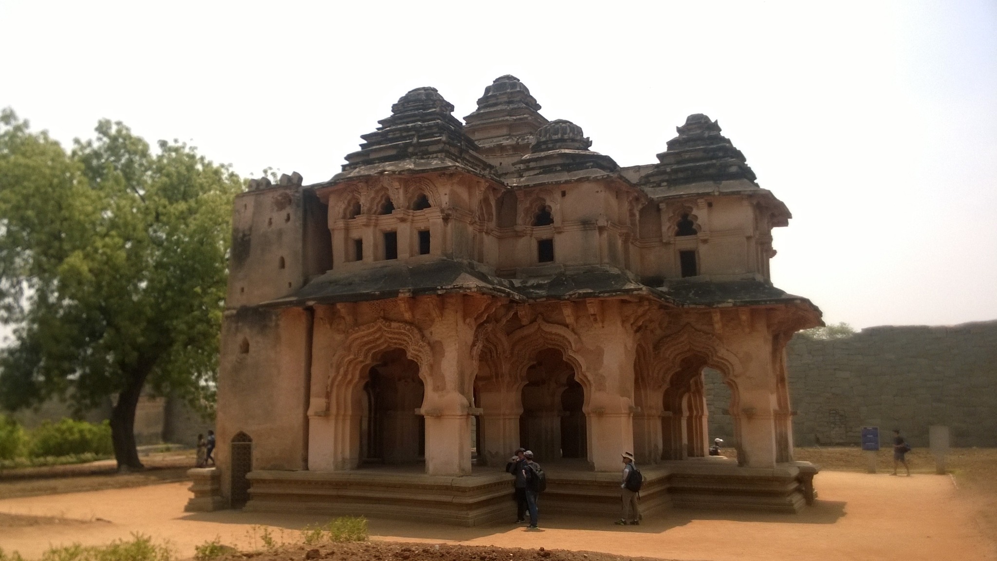
Vitthala Temple and Market complex
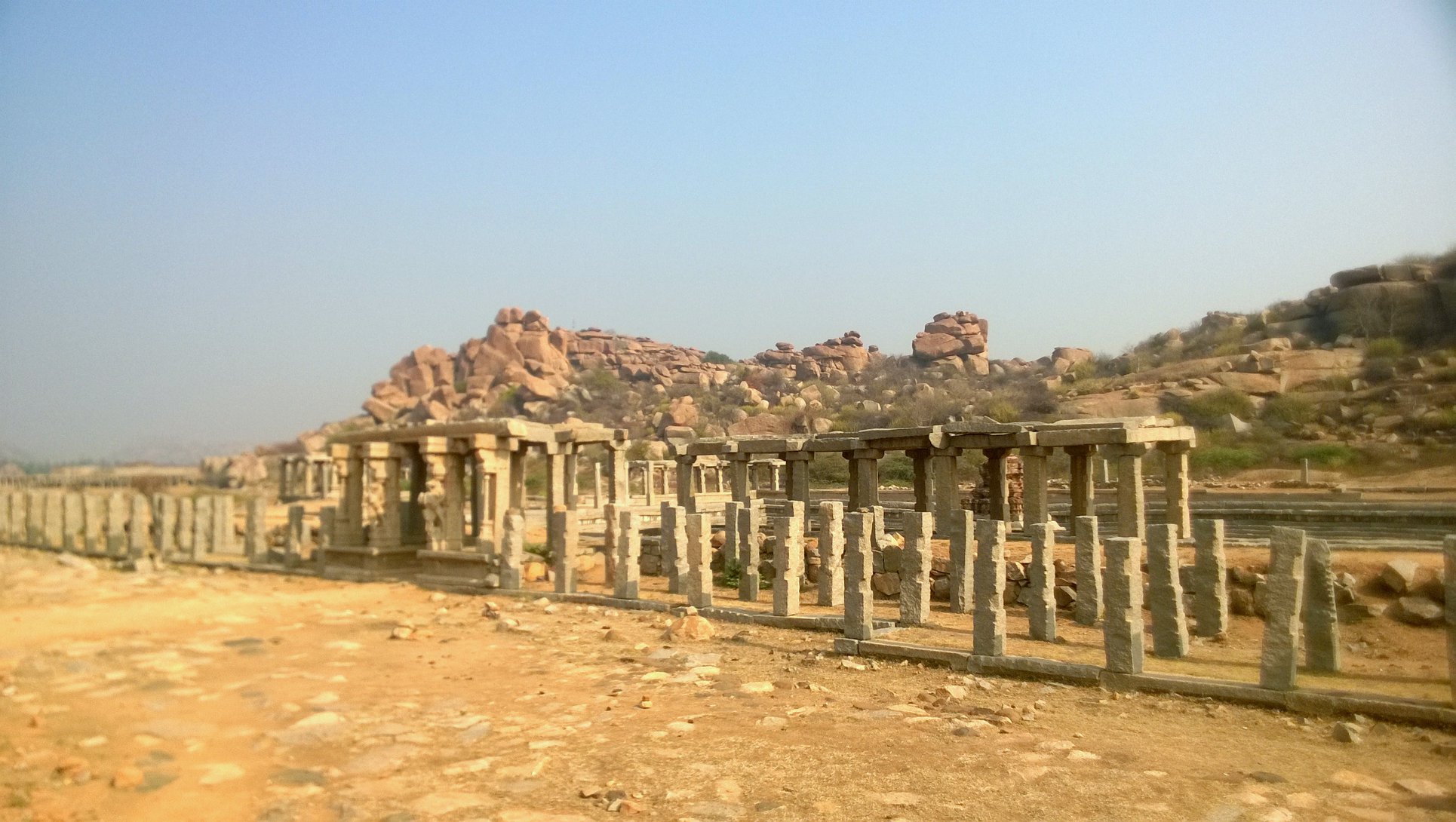
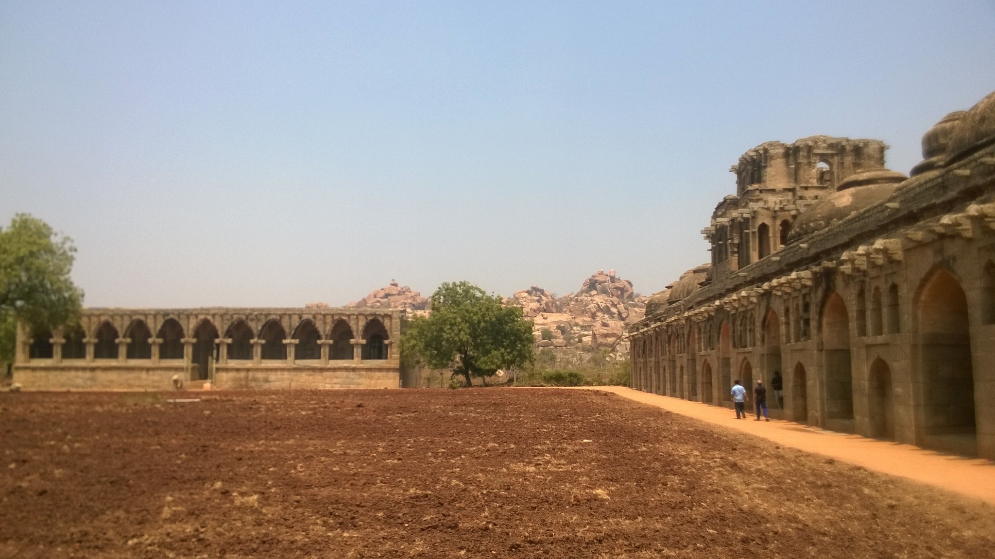
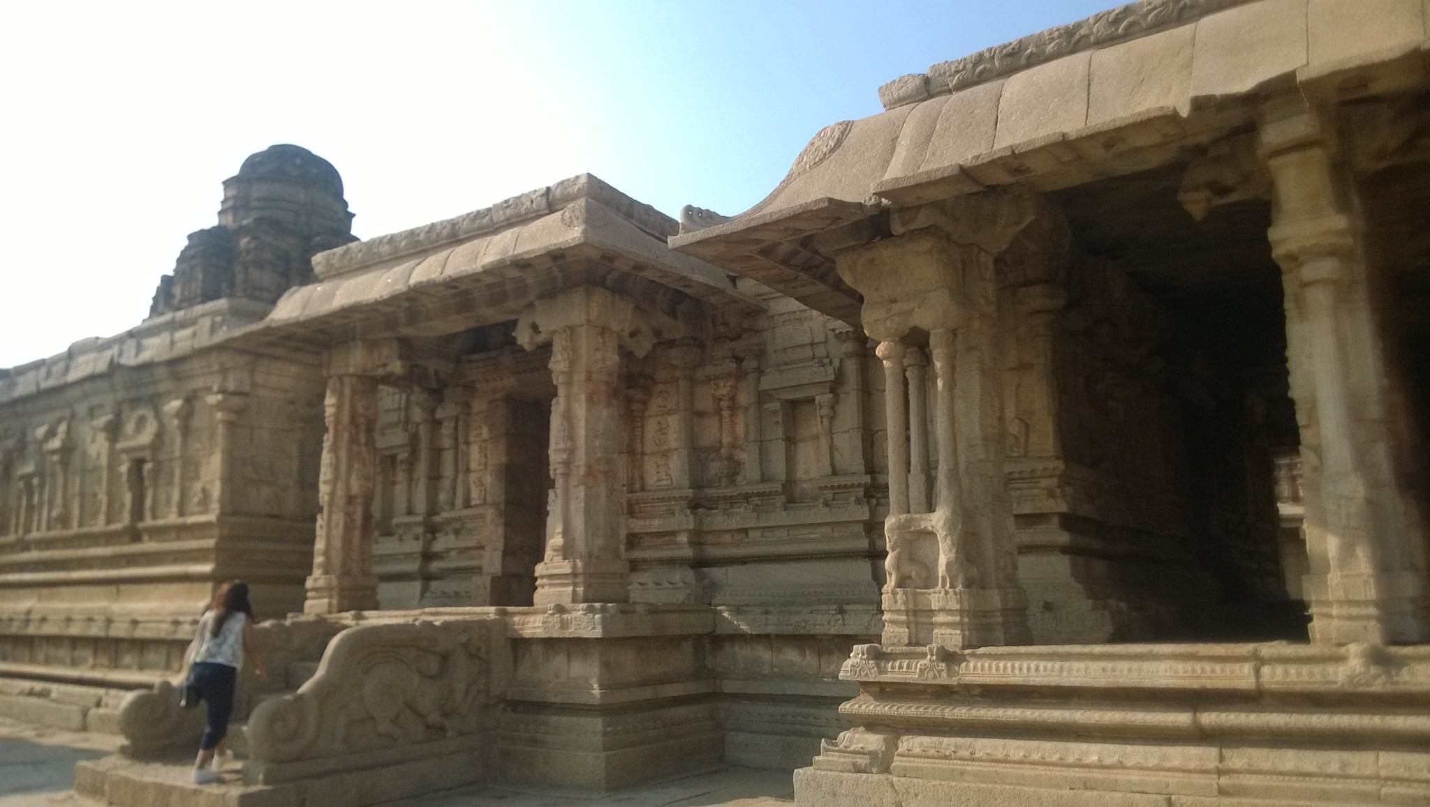
The 15th century temple, construction of which was started by Devaraya II and continued during the reign of Krishnadevaraya and later kings, is famous of the musical pillars and the stone chariot placed in front of the main temple structure. The carvings and sculptures on the temple and all structures around it, is a testament to the high workmanship achieved by the artists of Hampi.The long straight boulevard leading to the temple complex is flanked on both sides by long continuous lintels supported by a series of pillars – these structures once contained shops. Behind one of the shopping arcade is a pond.
The boulevard cutting through the Market complex enroute Vitthala temple
Utsava mandap in Vitthala templeGlimpse of musical pillars
The iconic stone chariot inside the Vitthala temple premises
The Royal Enclosure
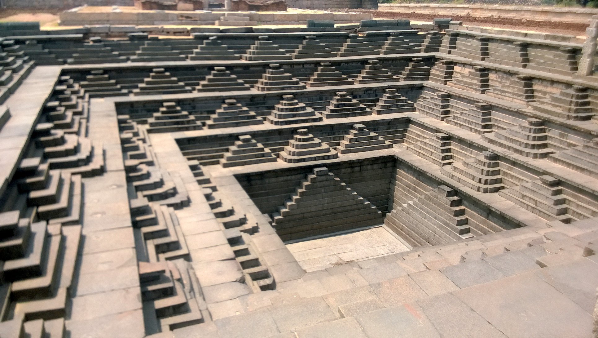
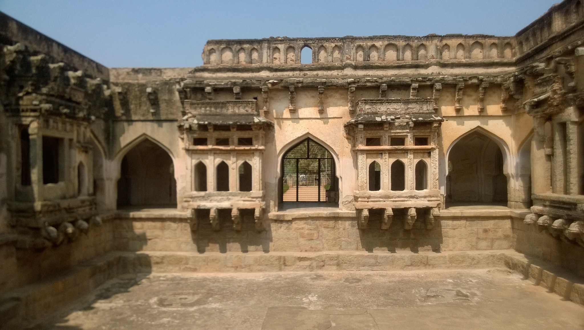
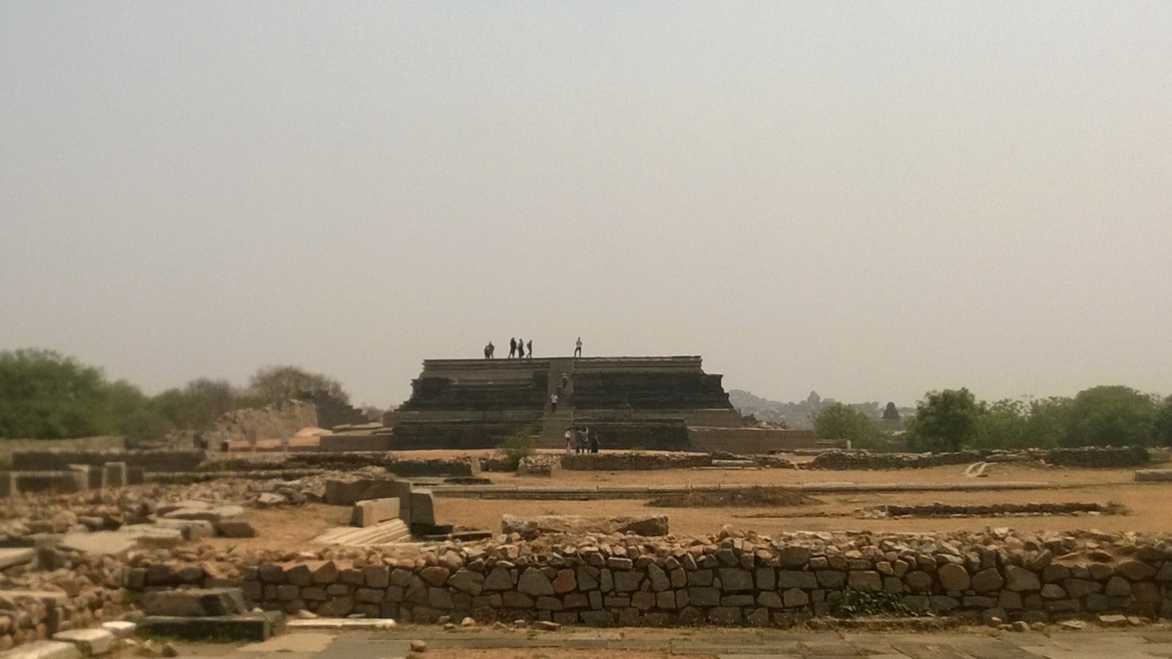
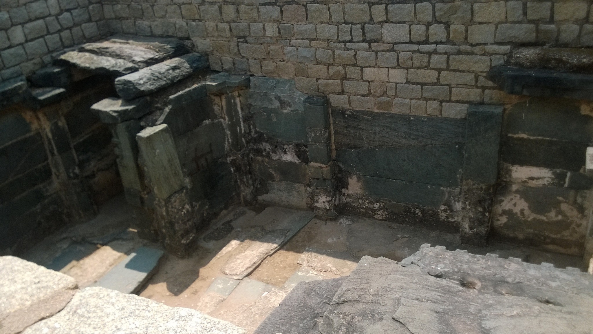
The Royal Enclosure is the area where the royal family lived and administerefdfrom. The major highlights of the area include a stepped tank called the Pushakarini Kola, a platform for conducting ceremonies called the Mahanavami Dibba, an ornate bath complex called the Queen’s bath, a hall purported to be for the King’s public audience, and a labyrinthine building with secret underground chambers. A little farther from the above mentioned structures are a structure of unknown antiquity and purpose called the Lotus Mahal that employs an Indo-Islamic style of architecture, and the elephant stables.
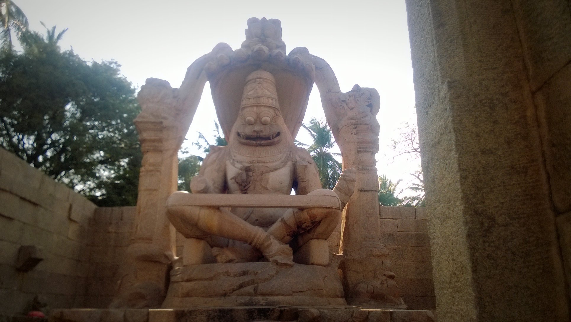
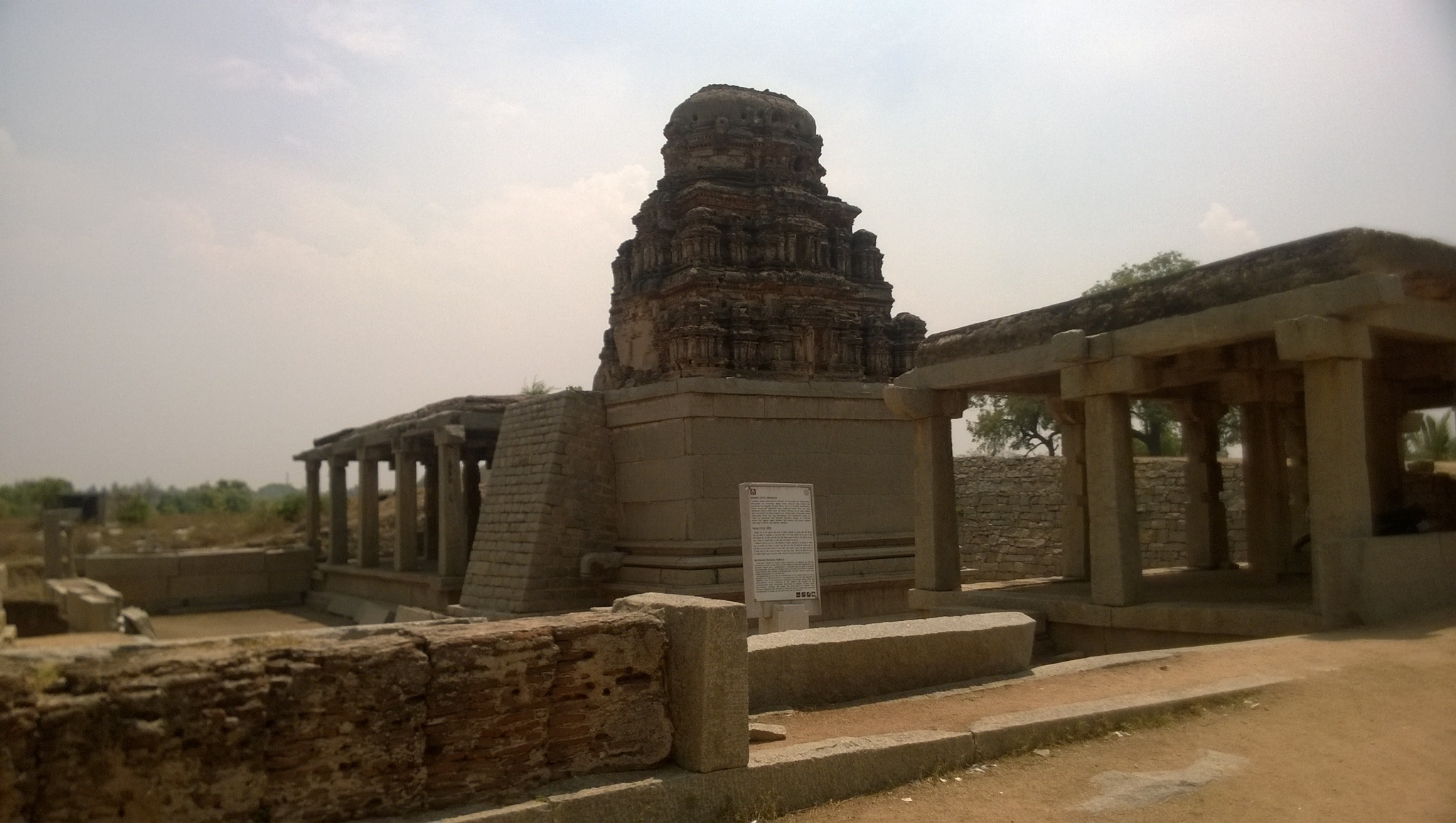
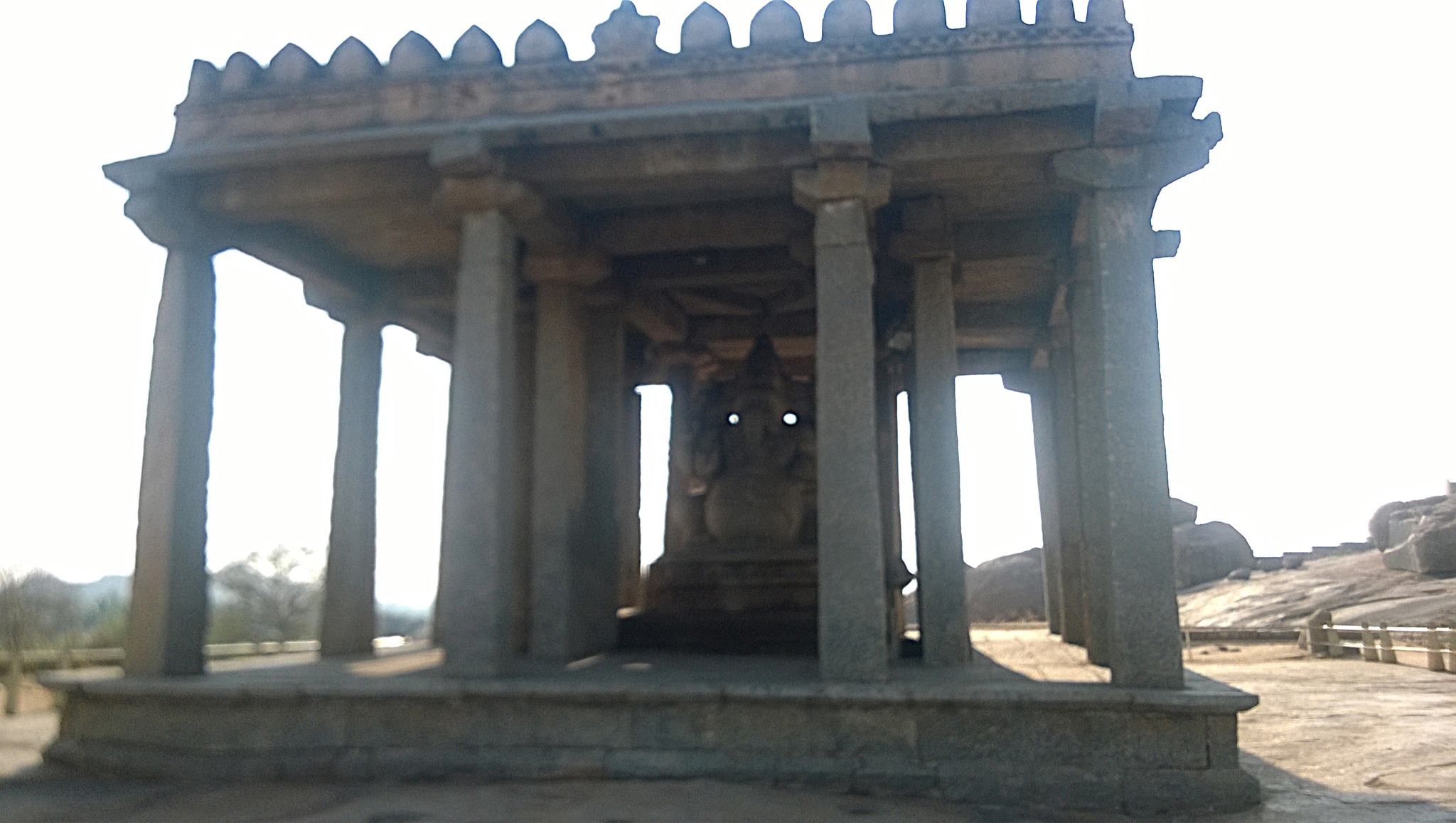
Further on the trail, were a series of temples and shrines, namely, Madhaba (Ranga) temple, temple built in 1545 AD exclusively for holding concerts of dance, vocal and instrumental music; Shri Lakshmi Narsimha temple, built in 1528 AD, houses a fearsome monolithic 6.7 meter statue of Lord Narasimha; Shree Badavilinga Gudi – a near-3 meter high shivlinga, whose lower part remains in water drawn from the Tungabhadra river, throughout the year; Krishnawamy temple, an ornate temple built by Krishnadevaraya in 1513 AD, with a Balakrishna image sourced from Odisha; Saasivekaalu Ganesha a 2.4 meter 16th century monolithic four-armed idol of Lord Ganesha
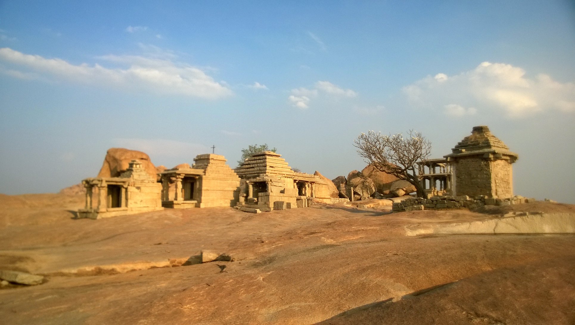
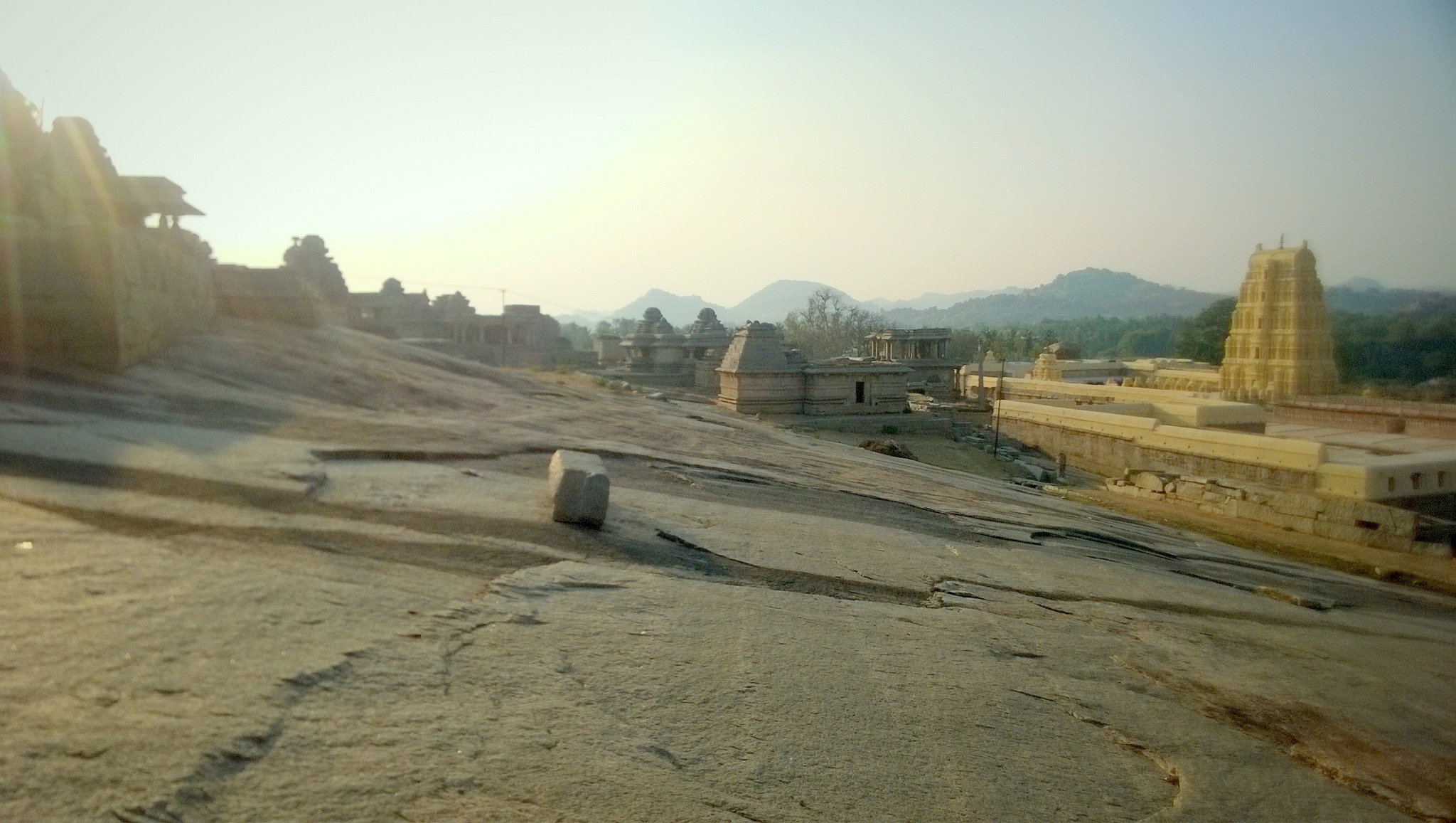
Walking a little further up the Ganesha idol, there is a bald hillock, upon which stands a cluster of temples – about 30 in number – of varying shapes and sizes, and datable between 9th and 16th century AD. Legend says Shiva was meditating on the Hemakuta hillock at the time the gods wanted Parvati to marry Shiva, and sent Manmatha, the god of love, to distract him. Infuriated, Shiva opened his third eye, thereby burning down Manmatha, and also melting down stones and boulders causing them to collected as pool called the Manmatha Honda at the foothills. Hemakuta hill affords a nice view of the sunset as well as of the Virupaksha temple and the Tungabhadra river.
A few monuments on the Hemakuta hill
Virupaksha temple from Hemakuta hillManmatha Honda
Virupaksha templecomplex
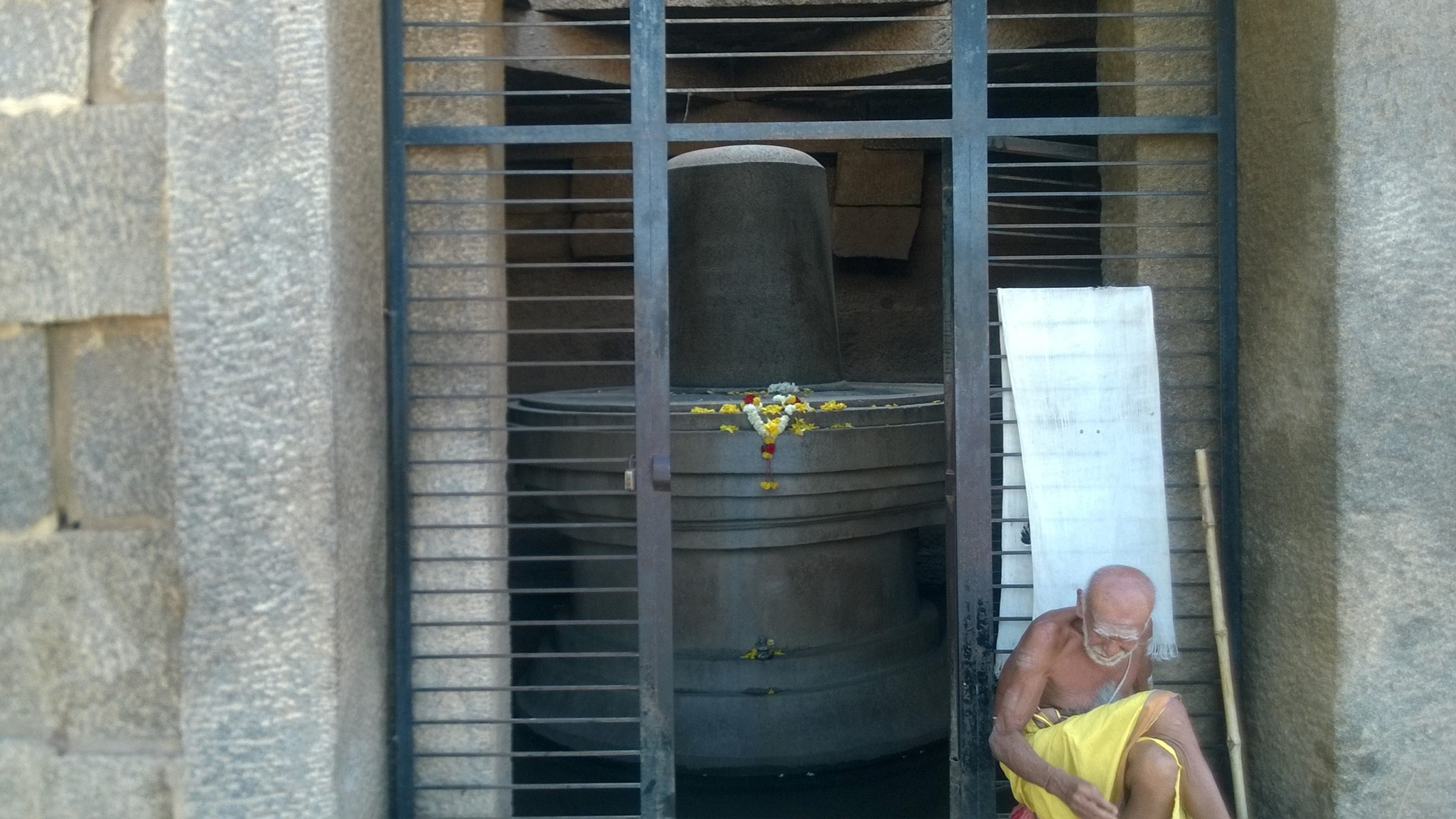
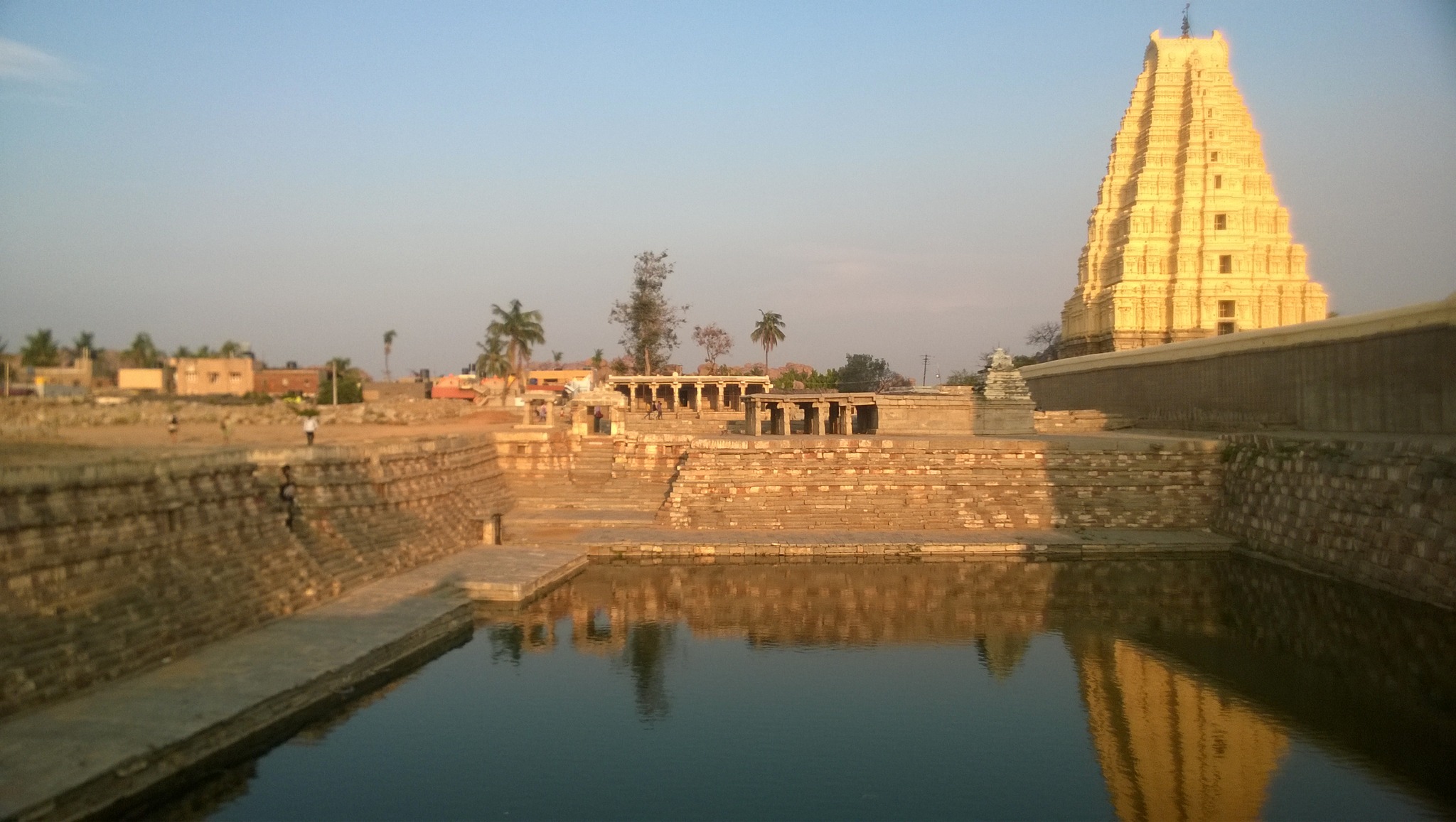
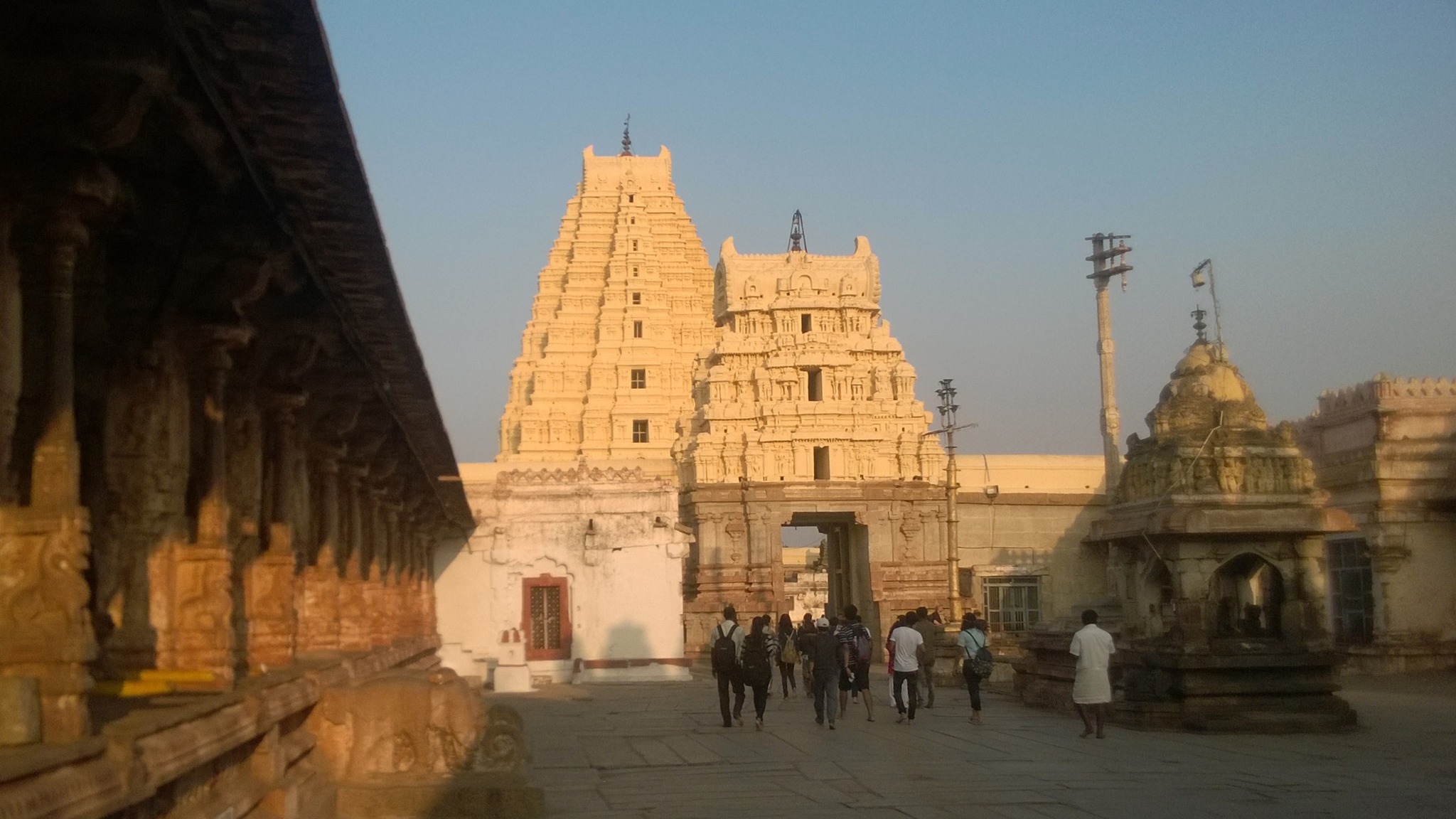
Descending the hillock from the other side, one reaches the Virupaksha temple that was expanded into its current imposing form in the first half of the 16th century. Standing on the bank of the Tungabhadra river, the temple complex has two large courtyards with numerous subsidiary shrines. The humongous main sanctum houses Virupaksha, a benign form of Shiva shorn of anger, the tutelary deity of the Vijanagara kings. The temple is most sacred of all sites in Hampi, and puja rituals are unfailingly performed in accordance with norms laid down by sage Sri Vidyaranya, beginning with drawing water from the Tungabhdara, considered equivalent to the holy Ganga.
Entrance of the Virupaksha temple
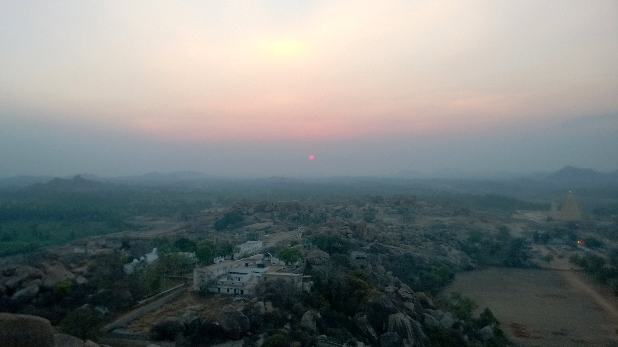
Matanga Hill
Finally, to close off the day, I hiked up the Matanga Hill, stopping many times to catch my breath before being treated from the hilltop to a breath-taking view of the sun setting with the crimson sky in the backdrop.
View of Sunset from Matanga Hill
Day 2
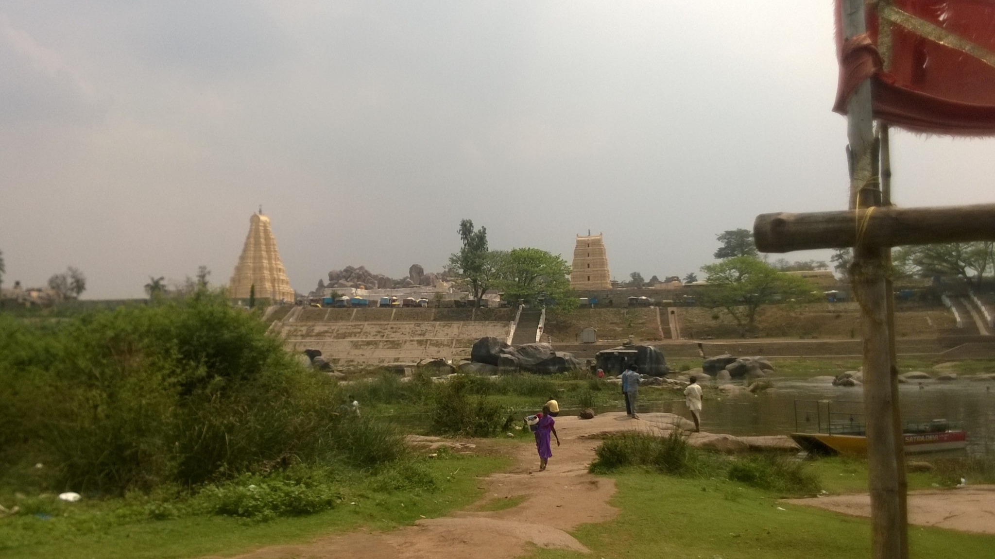
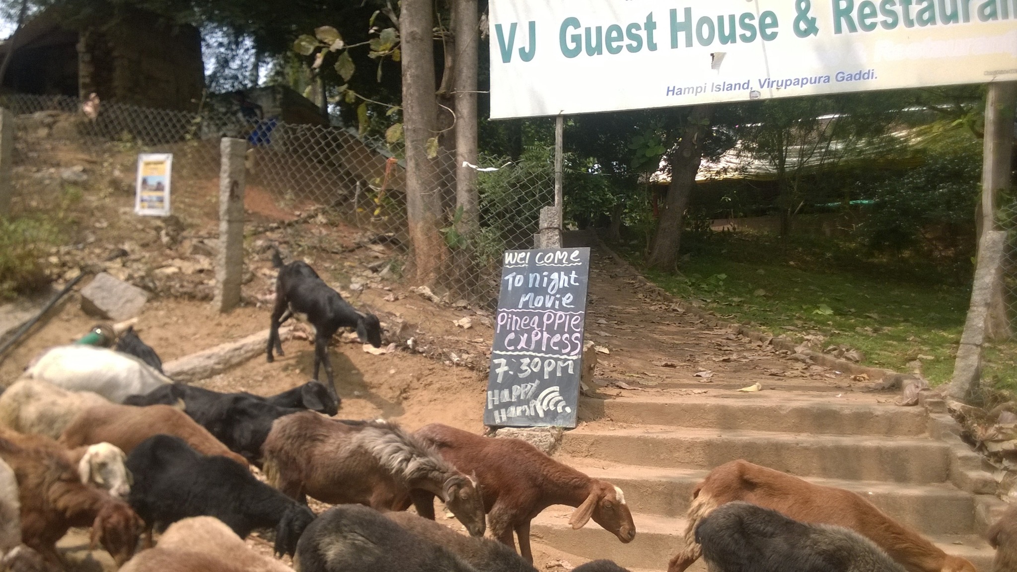
Virupapuragade or Hippie Island
The next morning, I went back near the Virupaksha temple complex, since adjacent to the temple complex lay the Ferry Point, that facilitates transport to Virupapuragade, a granite outcrop in on the Tungabhadra river. It acquired the nickname Hippie Island on account of providing an atmosphere for relaxation by virtue of the many shacks and cafes serving all sorts of cuisine accompanied by music, both live and recorded, and also abounds in shops selling souvenirs. This is also where one could rent scooters and bikes, which is what I did.
Virupaksha seen from Hippie IslandA cafe on Hippie Island
Thankfully, the channel separating the island from the other bank of the Tungabhadra, is shallow or virtually, non-existent, and the low connecting road runs parallel to an ancient aqueduct that now lies in ruins.
Ancient aqueduct on the other side of Hippie Island
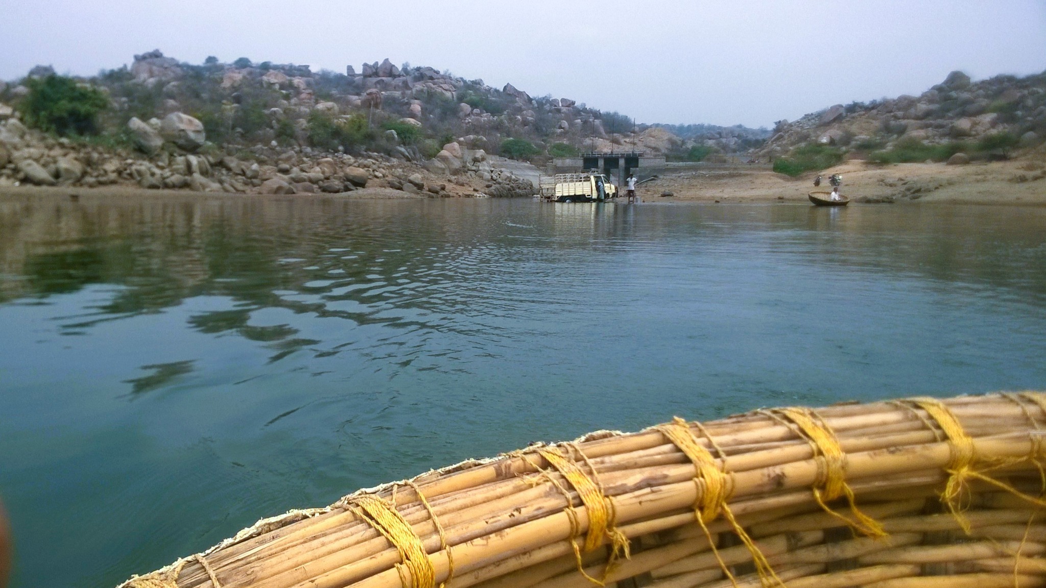
Sanapur Lake
On the rented scooter, I proceeded to Sanapur Lake, about 5 km north-east of Hippie Island, on a road winding through paddy fields and barren hills, until I reached a bend that curved around a boulder hill and took me across a dam to a coracle point.
Coracle ride on Sanapur Lake
After a peaceful coracle ride, as I was setting off for my next stop, the scooter refused to budge. Despite the spotty mobile network, I somehow managed to call the rent-a-bike shop-owner, and thankfully, got a replacement scooter, delivered to me within 30 minutes.
Anegundi
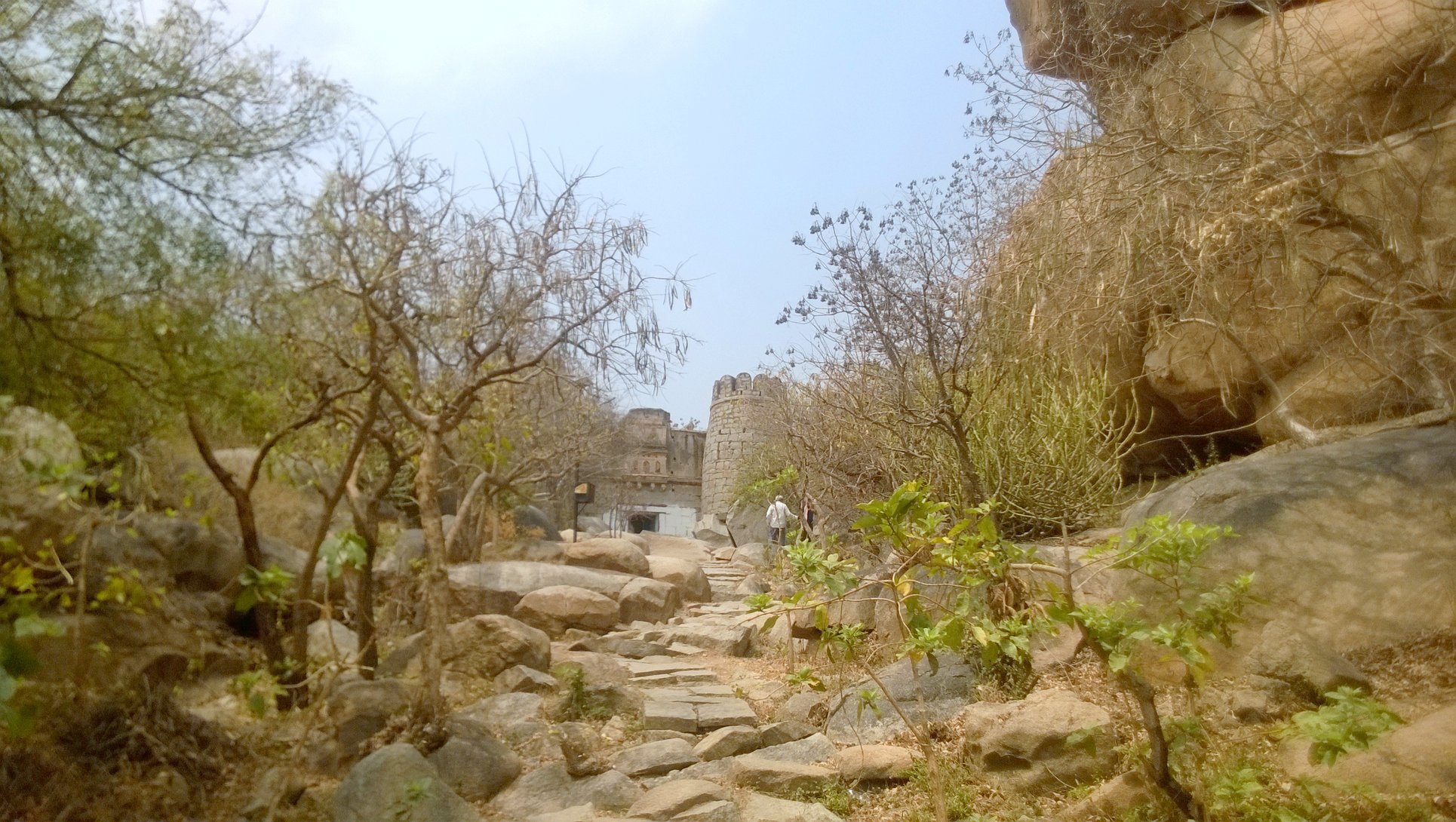
Racing against time, I rode, again flanked by barren boulder hills, paddy fields and water bodies, 8 km alongside the Tungabhadra river to Anegundi, where a hike up the hill leads to the Anegundi fort. Entering the fort premises, after a short hike, is a cave that legend identifies as the place where the vanara king Bali lived. Further hiking up, I reached the top of the fort, wherefrom I got a panoramic view of the countryside replete with boulder-hills, paddy fields, and the boulder-strewn Tungabhadra.
Approach to the Entrance of Anegundi fort
Bali’s Cave
View of the countryside from atop Anegundi hill
By 2 PM, back on Hippie Island, I returned the scooter, and following a lunch, I boarded a 4PM bus for Hyderabad, with the hope that I would return to Hampi someday.
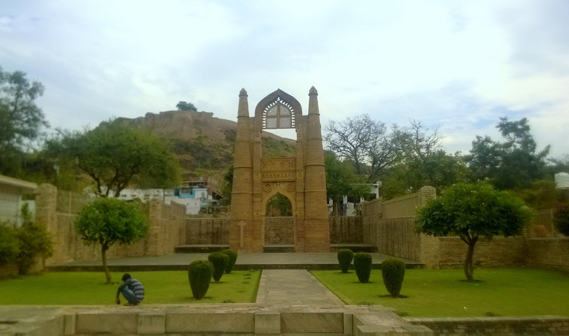
For many years I had seen the name ‘Alwar’ – on other buses while I waited for the bus to Jaipur or on road signage on my many forays to Jaipur. I had even passed through Alwar on one occasion on a bus, and had memories of a city glaring under the sun against the backdrop of yellowish, intermittently green hills. Alwar, despite being three hours away from Delhi, gets overshadowed by the names of bigger places, but now in October 2016, since I had ticked the big names off my list, I turned my attention to Alwar. And am I glad that I did!
Part 1: Alwar Calling
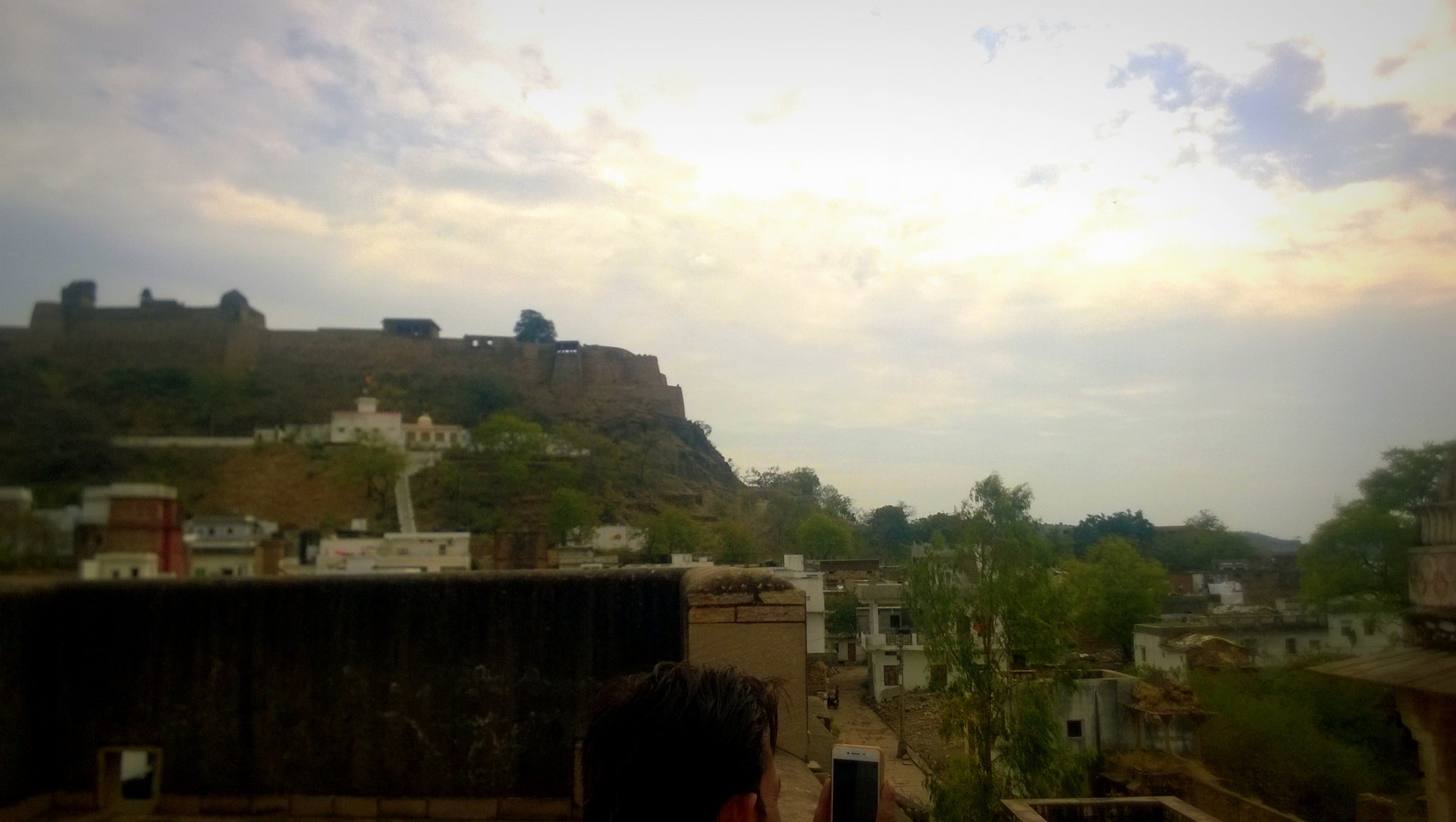
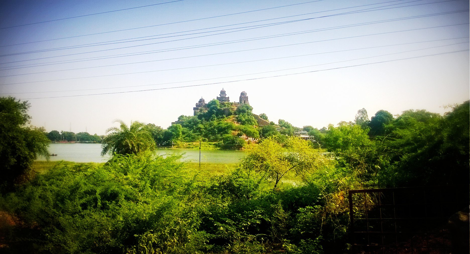
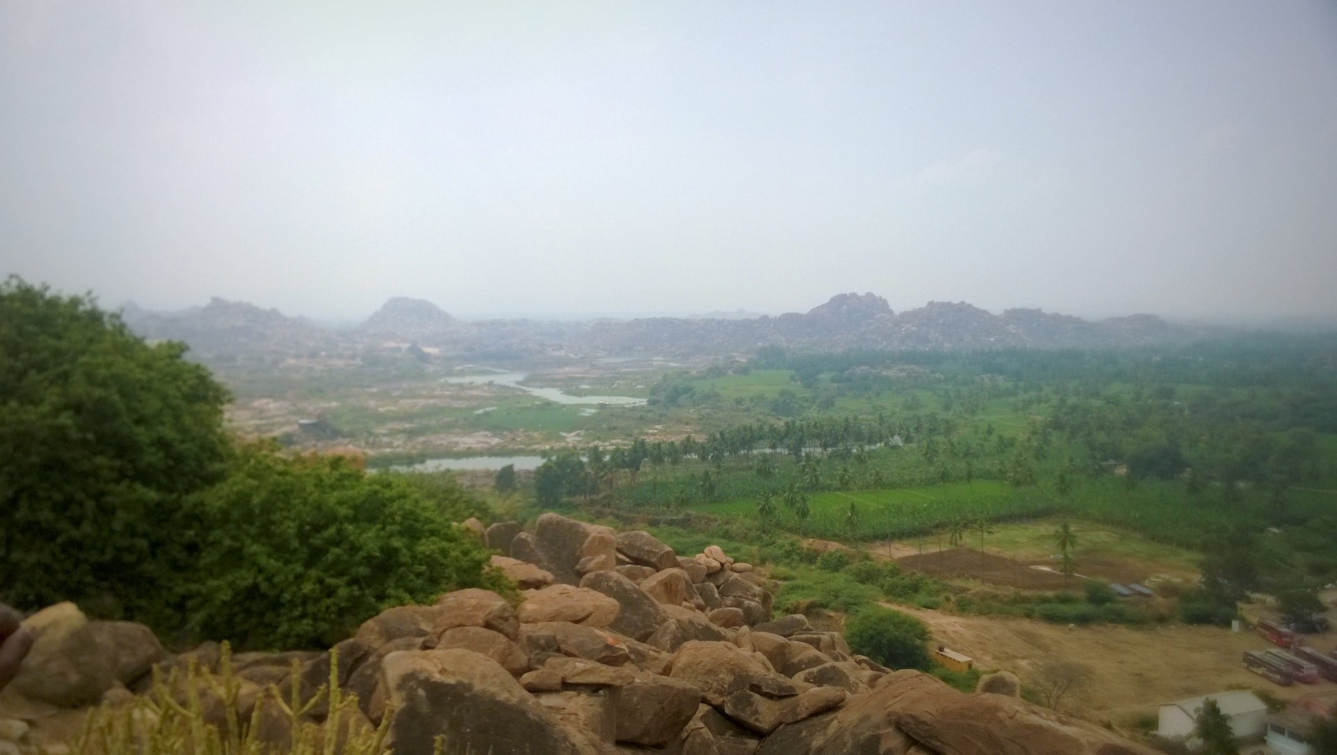
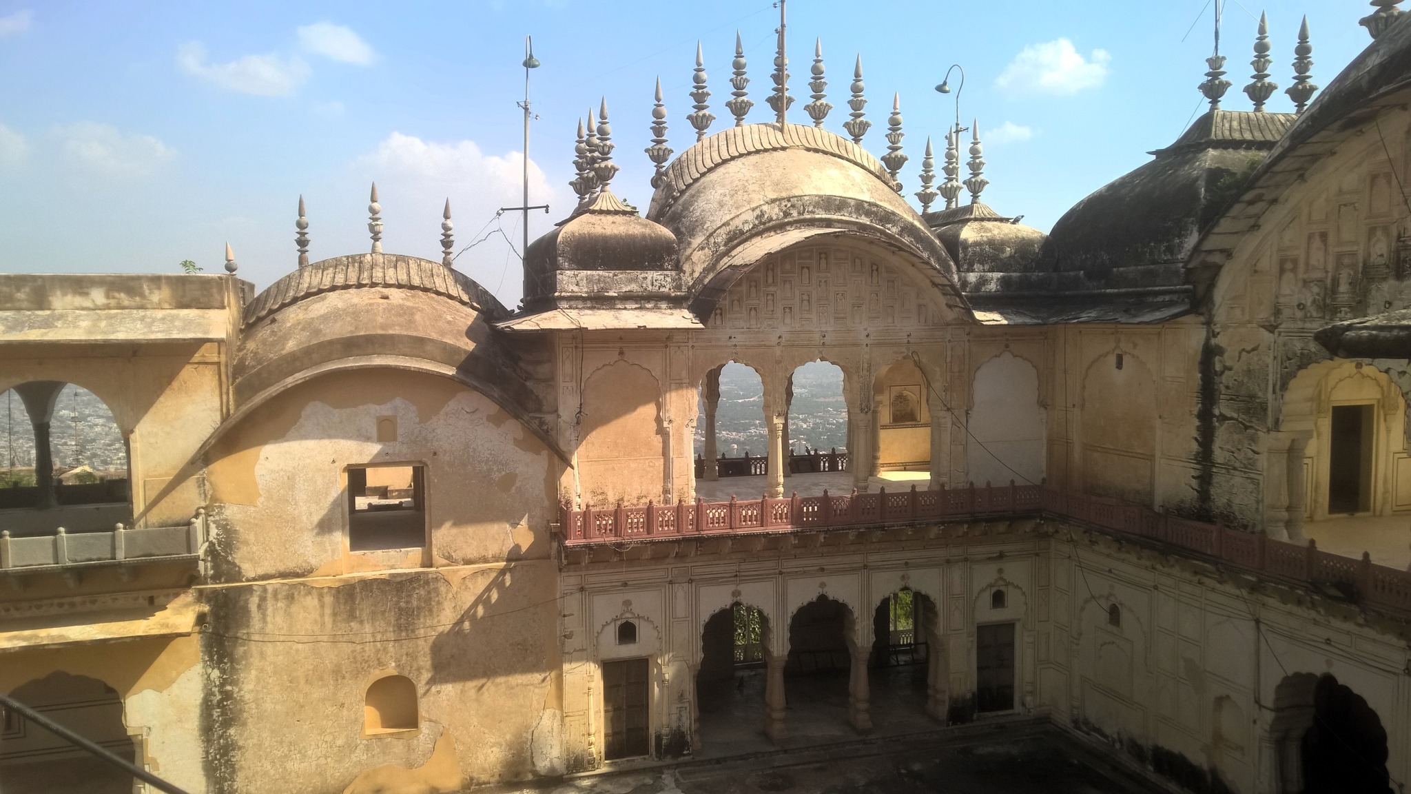
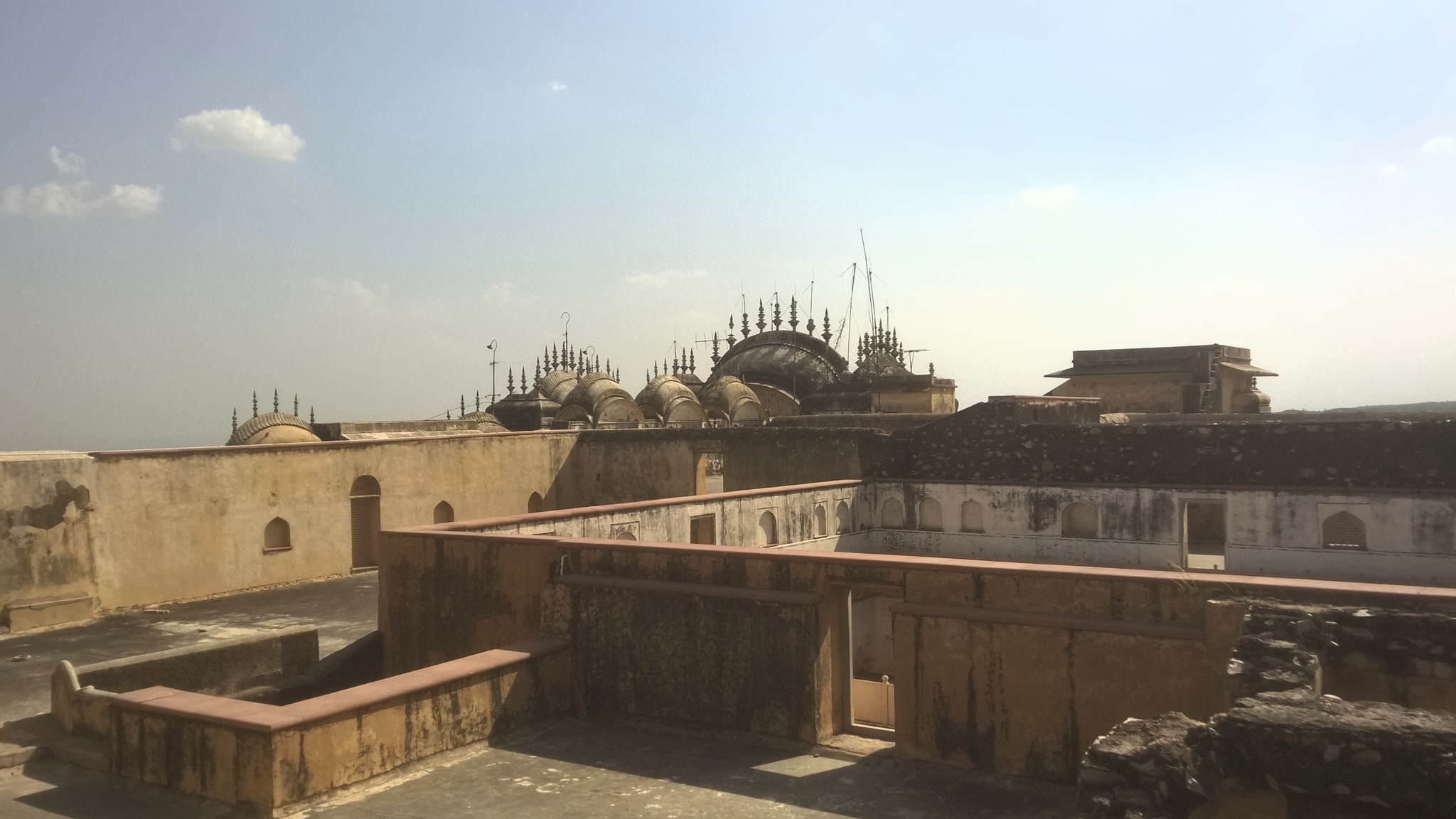
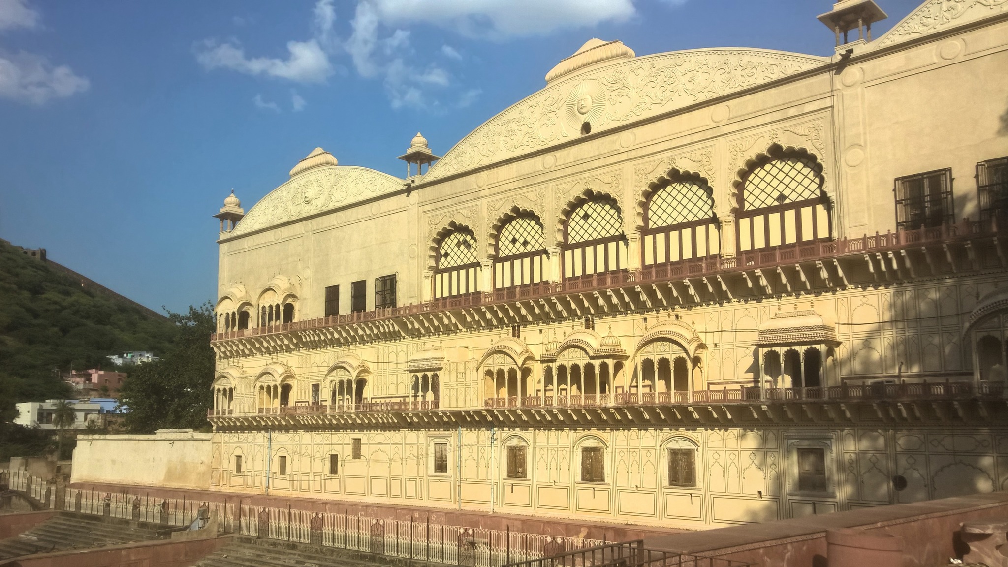
My friend and I caught the bus at 8 AM from Dhaula Kuan, from where I had boarded the Rajasthan or Haryana Roadways buses headed to Jaipur on all of my previous Rajasthan solo trips. By noon, we were in Alwar, where we had lunch near the bus-stop, and gathered information about places and access modes in Alwar. The Bala Qila (Alwar fort), perched on the hill overlooking the city and clearly visible from where we stood, beckoned to us – it was a no-brainer as to where we should start our Alwar sight-seeing with.
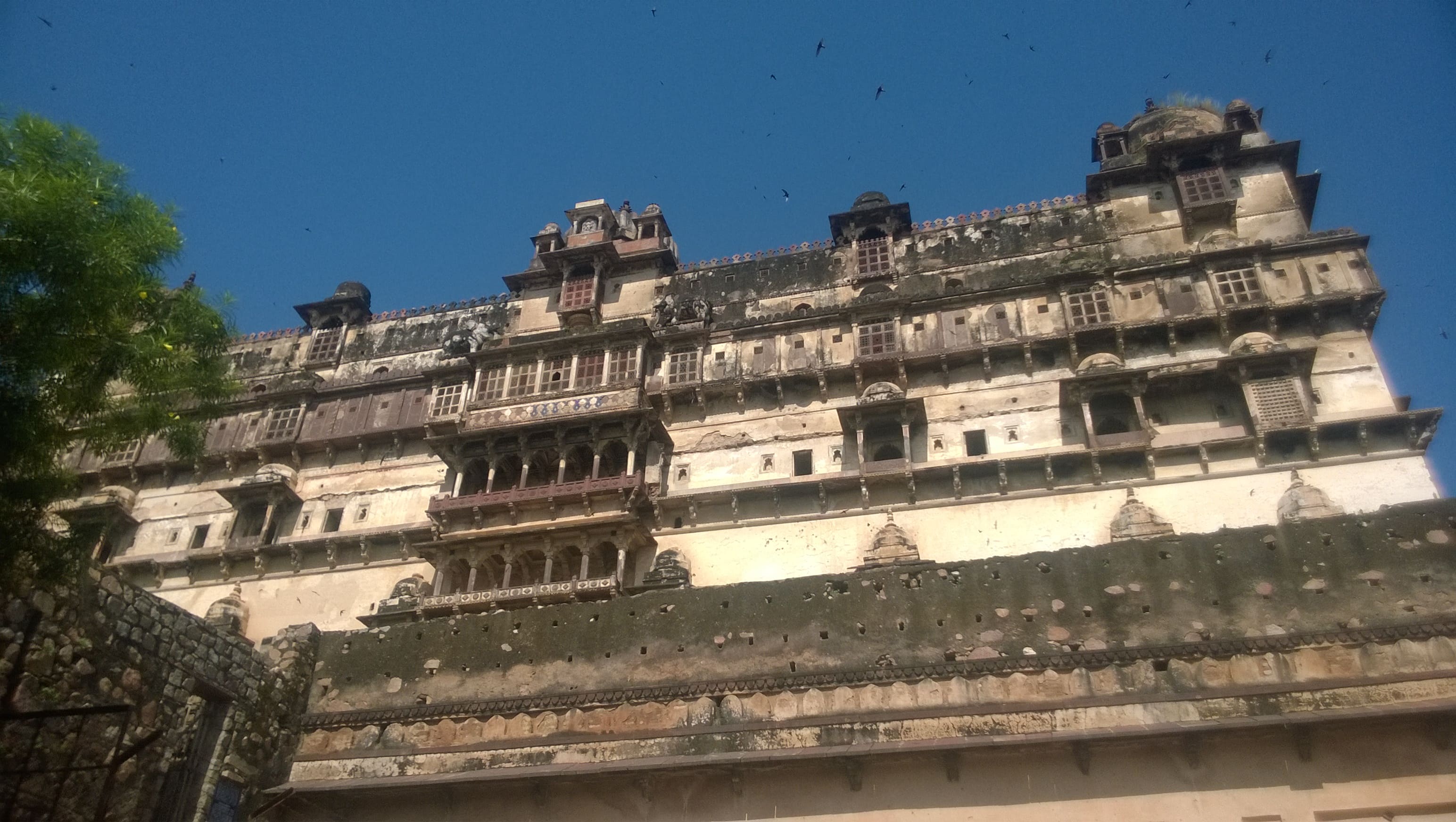
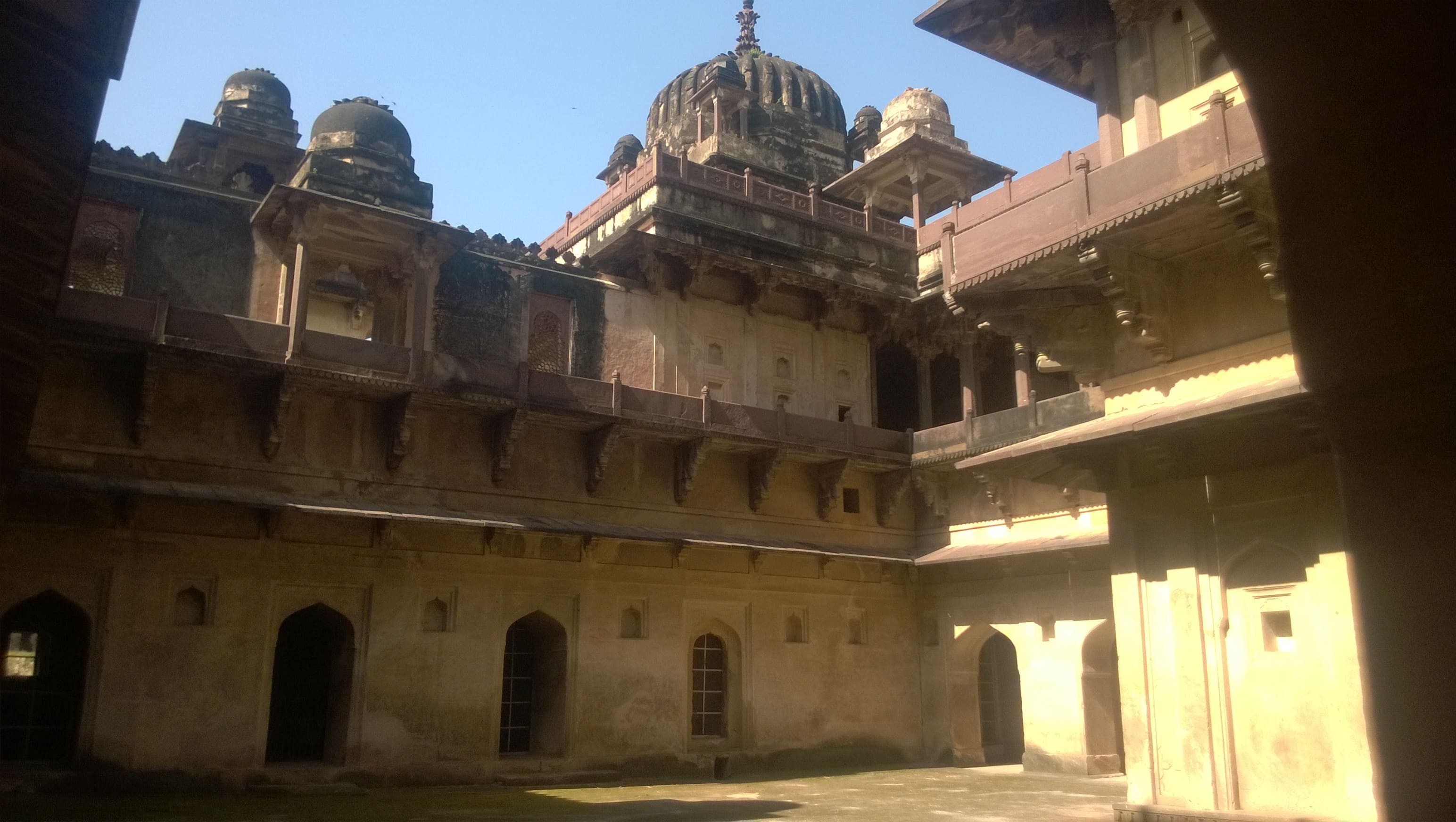
Hiring an auto-rickshaw, we headed off to Bala Qila, for which we took the fort road that winded around the side of the hill, passing through jungle, accompanied by a sharp drop into the valley on one side. We were pleasantly surprised by the size and condition of the main palace which was largely intact – the palace may not be the size of the palaces in the forts of Jaipur or Jodhpur, but the fort in itself was self-contained and seemed to possess every characteristic typical of a Rajasthani fort.
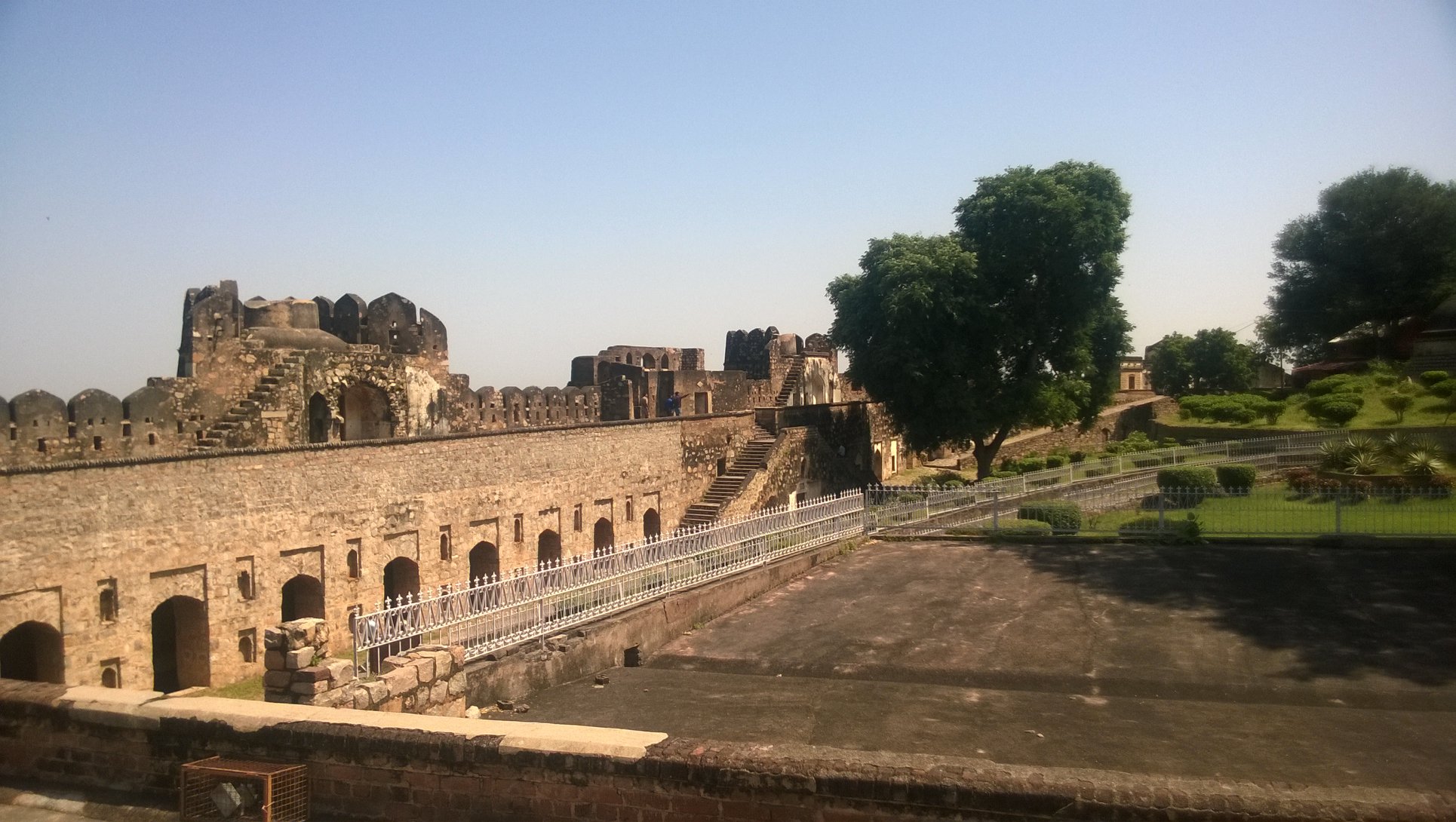
The origins of the fort date back to 928 AD, when it was built by Parmar Rajputs, however, it was resconstructed in 1521 AD by the Khanzada rulers who had wrested the fort from the Nikumbh Rajputs in 1492 AD. We explored the many floors of the palace and were smitten by the verdant vistas of the Aravallis from the arched windows of the palace. Later we walked on the fort wall towards a watching platform that provided a clear view of the city below.
View of Bala Qila from the fort wall leading to a watching platform on the south side
Inside Bala QilaOn the terrace of the palace in Bala Qila
View of Aravallis from a balcony in Bala Qila
Descending back to city at the foothills, we checked out the City Palace or Vinay Vilas Mahal, built in 1793 AD, with a part now converted to Museum and the other part housing government offices. The beautiful Moosi Maharani ki Chhatri, a cenotaph for Raja Bakhtawar Singh and his queen Moosi Rani, built in 1815 AD with marble roof and red sandstone pillars, stands adjacent to the City Palace, on the bank of water tank called Sagar Jalashay, which is fed by water flowing down the Aravallis at the foothills of which the tank lies.
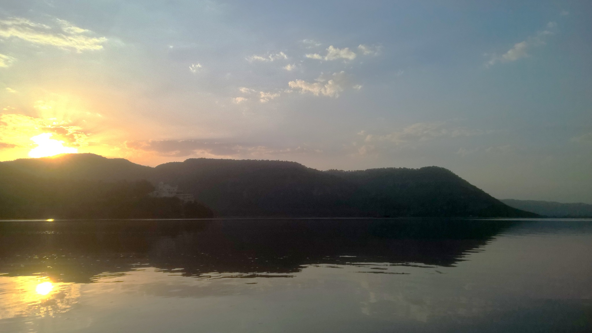
Our next stop was the Siliserh lake, an artificial lake built in 1845 by Maharaja Vinay, nestled in the Aravallis, a little outside the city, providing a picturesque view of the rounded tops of the Arvallis kissing the sky. Enjoying the gentle breeze along with the views, we took a boat ride exploring the length and breadth of the lake. Thereon, we headed to the Jaisamand Lake, another artificial lake not very far from the Siliserh Lake but a little closer to the city, notable for a series of chhatris (cenotaphs).
Moosi Maharani ki Chhatri, AlwarCity Palace, Alwar
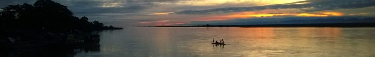
Sunset at Siliserh Lake, Alwar
Part 2: An Unplanned Extension
Our plan for the second day was to take a morning safari of the Sariska National Park that lies about 33 km from where we stayed. Waking up quite early in the morning, and starting around 5.30 AM, we walked about a kilometre to the main road leading to Sariska, hoping to get some sort of conveyance to Sariska. After about fifteen minutes of waiting, as the chances began to seem slim of us making it to Sariska in time for the safari, an autorickshaw driven by a Sardarji (a turbaned sikh man) drew alongside us . We negotiated a price for the half-day trip to Sariska and were soon headed to Sariska with renewed hope for the safari.
Passing through the road sliding up and down, curving ever so slightly to the right and the left, along the foothills the Aravallis, with the cool breeze hitting our faces, we soon encountered a narrow valley in the Aravallis which we crossed alongside a narrow river. In this stretch lies a place called Natni ka Bara, where a bridge stands connecting the main road to a white-coloured temple with a narrow tall spire on the other side of the river. In the early morning mist, the sight of the bridge and the temple standing in the middle of the valley was etched in my mind.
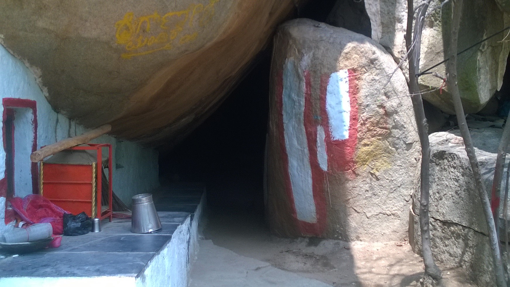
By 6.50 AM we were at the Safari Booking Office at entry gate of the Sariska National Park, where we were promptly denied entry because entry for the morning safari had already closed. We should have been there before 6.30 AM, they said, not relenting despite multiple requests, suggesting that we come back by or wait till 2.30 PM for the afternoon safari. As we were staring at a long wait, a safari guide who was hanging around suggested we do some more sightseeing instead of waiting, Bhangarh fort being his topmost recommendation.
Now, I had already been to Bhangarh fort – touted as a haunted place – and retained very fond memories of the same, but my friend had not, and I would not mind visiting Bhangarh again just to relive the aura of eeriness I had felt on my earlier visit. We calculated that we should be back to the park gate well in time for the afternoon safari, as we had five hours in hand. However, our autorickshaw driver did not seem keen at all, because it would be a 100 km round trip for him. Nevertheless, the safari guide, on account of being a local convinced him to take the ride, sweetening the deal with extra money, of course.
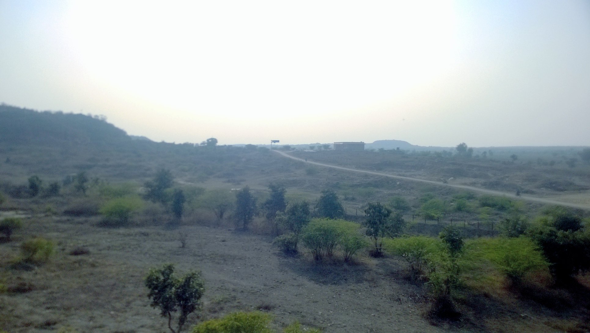
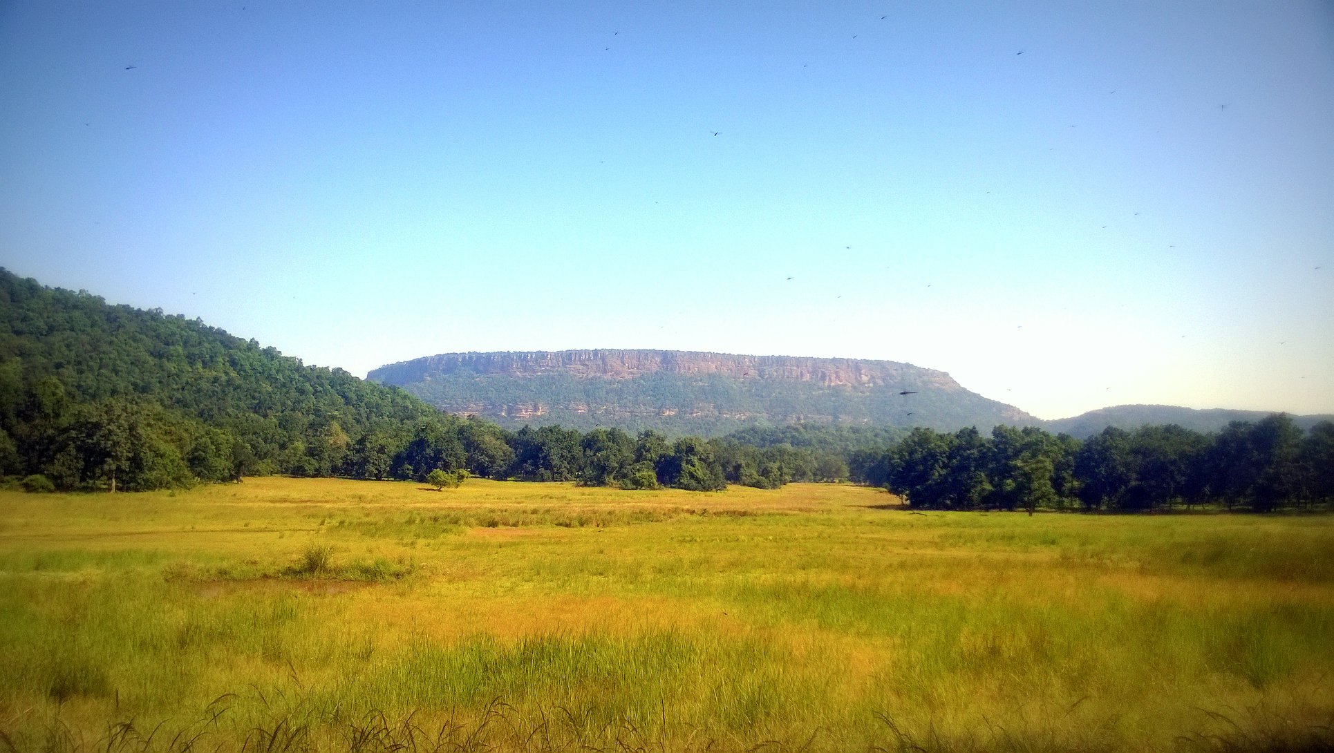
By 7.30 AM, we were on our way to Bhangarh, in an autorickshaw, of all things! From there on, we never lost sight of the Aravallis, which alternated between running alongside us and sliding away only to return. We hoped to reach by 9 AM, if not for the second half of the route where the road was under construction sending billows of dust in all directions including inside the auto-rickshaw as the vehicle plodded through. Soon we passed through Ajabgarh, where abandoned houses flank the road at one end of the village. Just outside the village, a compact fort sits atop a hillock against the backdrop of taller hills, while the road winds around a lake, called Jai Sagar, filled with a cover of lotus and lilies. At long last, by 9.45 AM, we were inBhangarh.
Part 3: All is Well That…
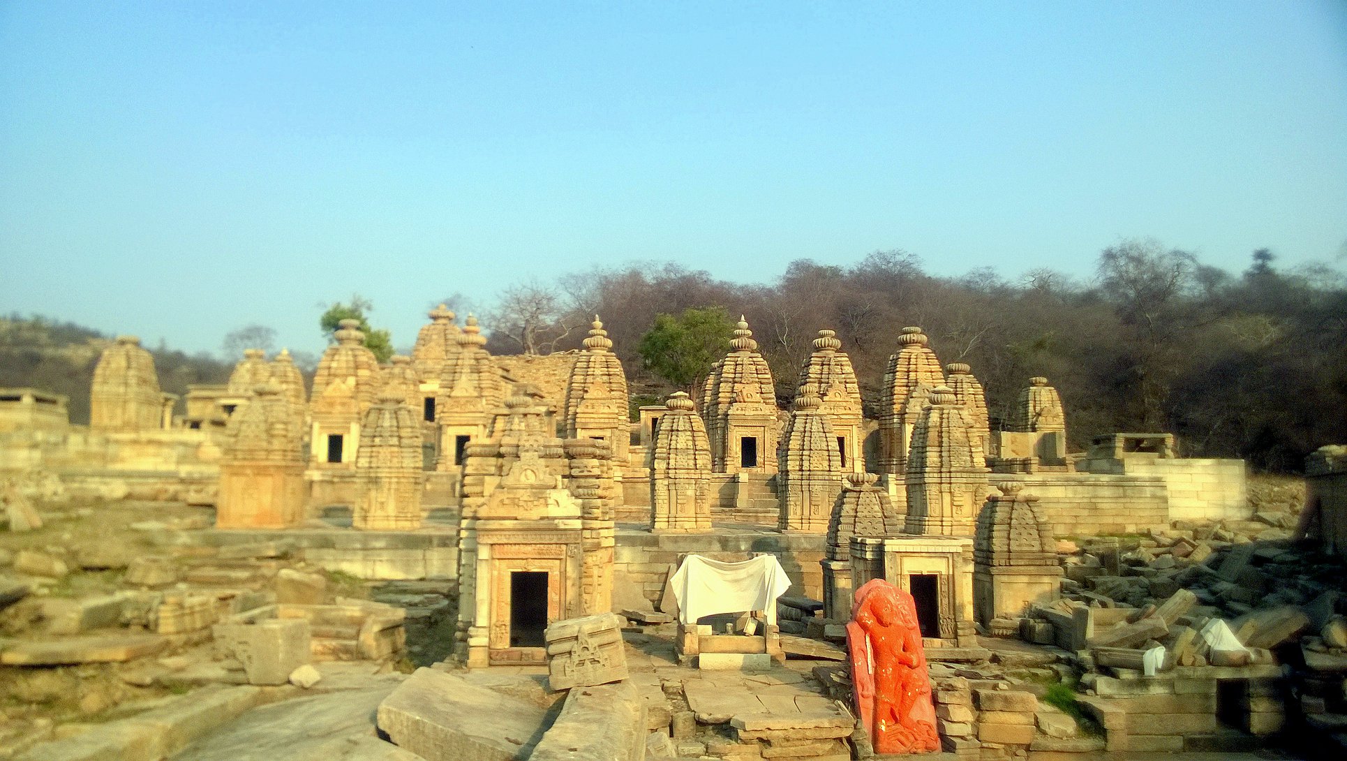
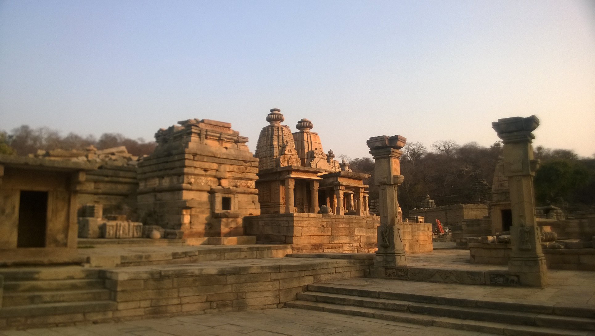
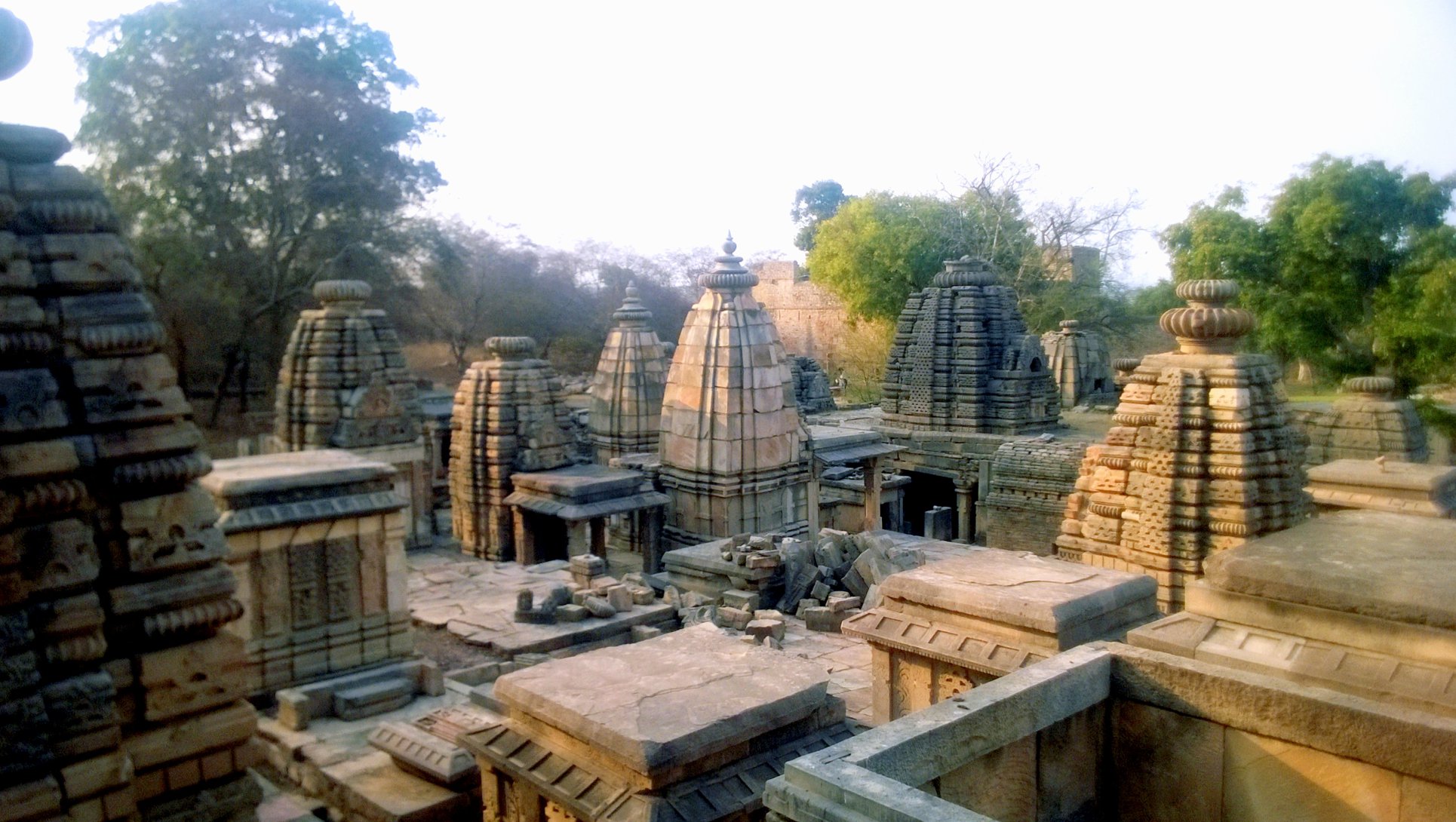
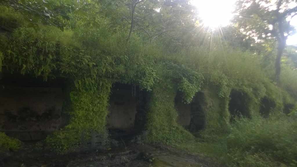
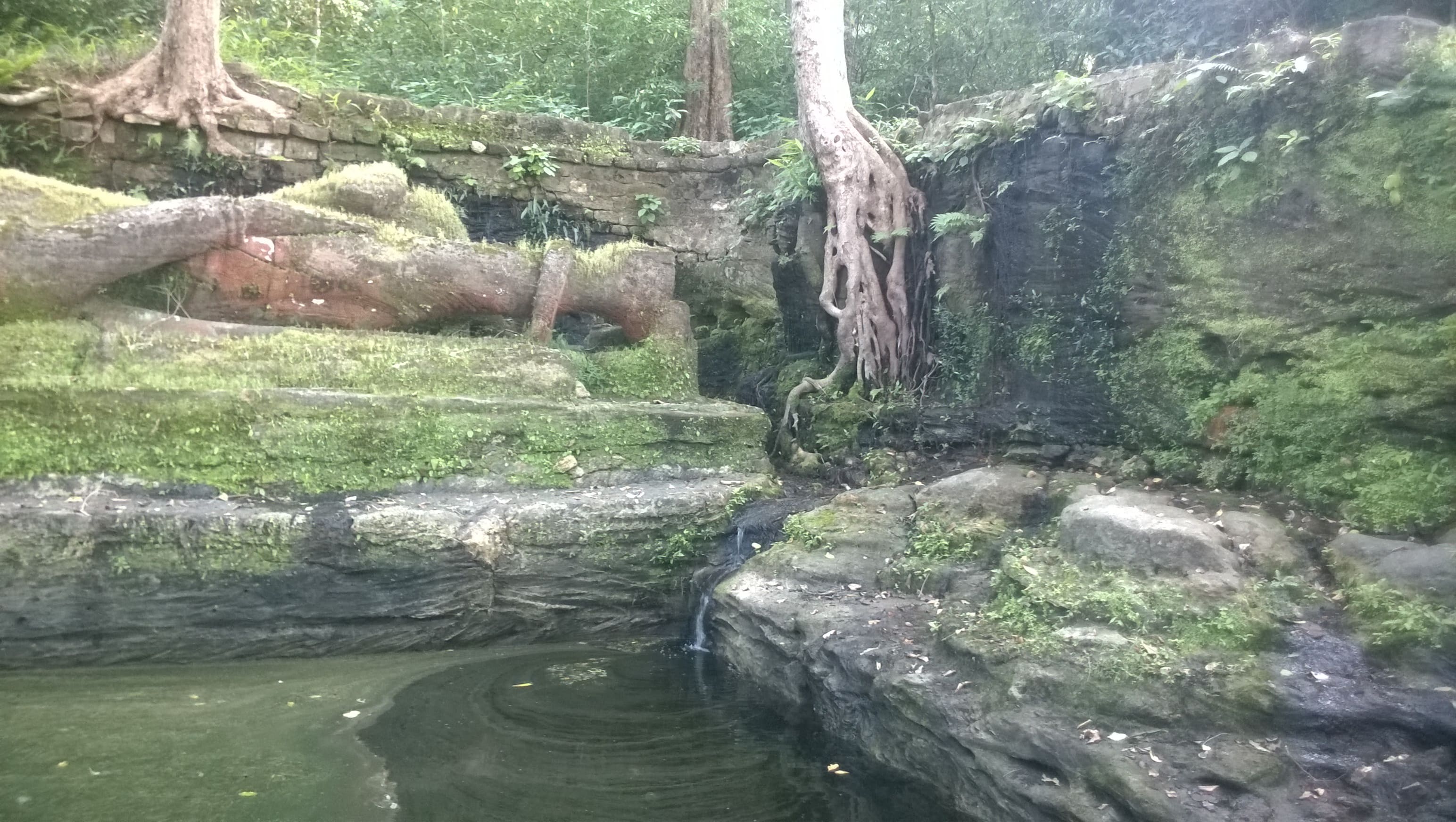
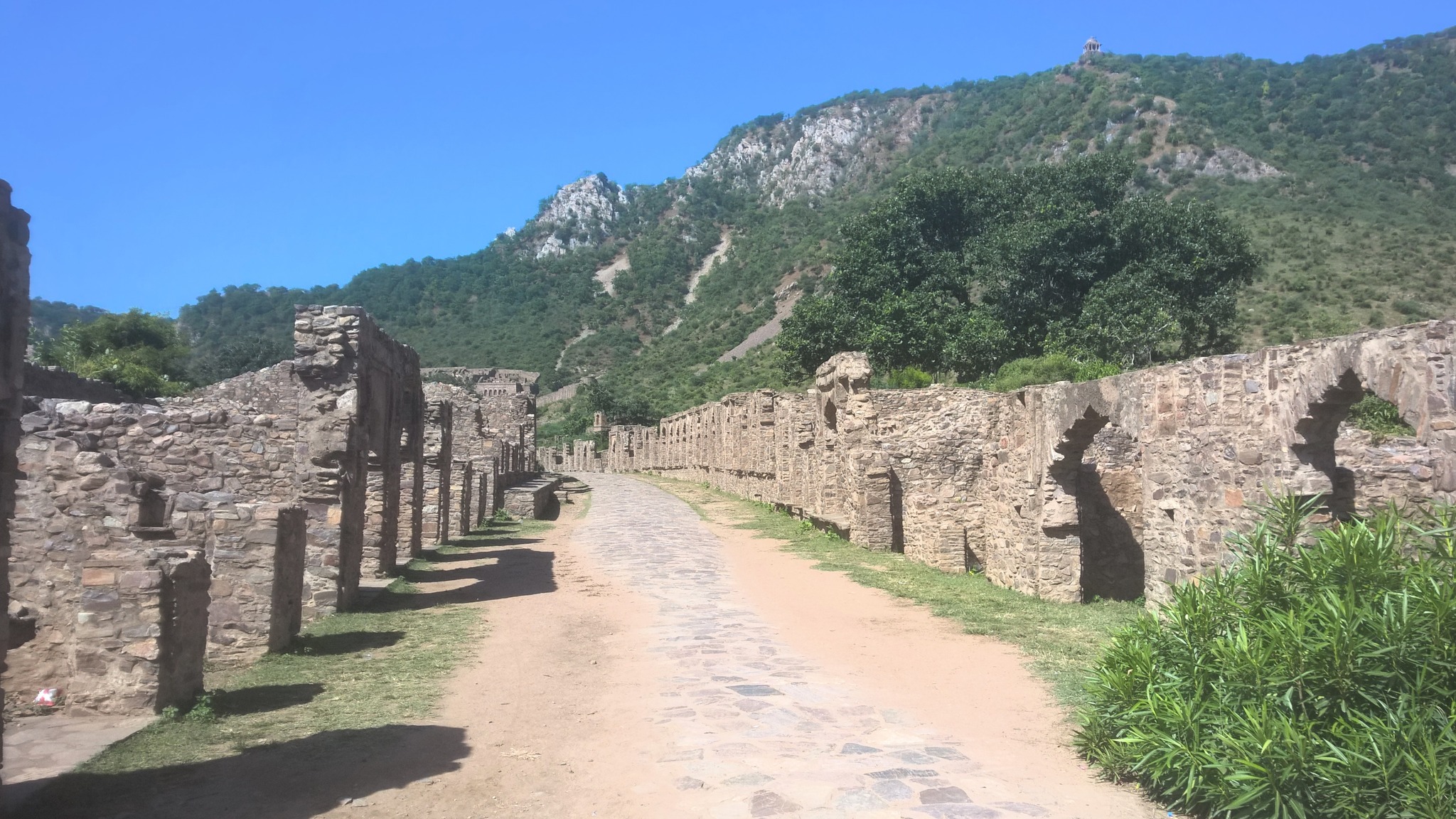
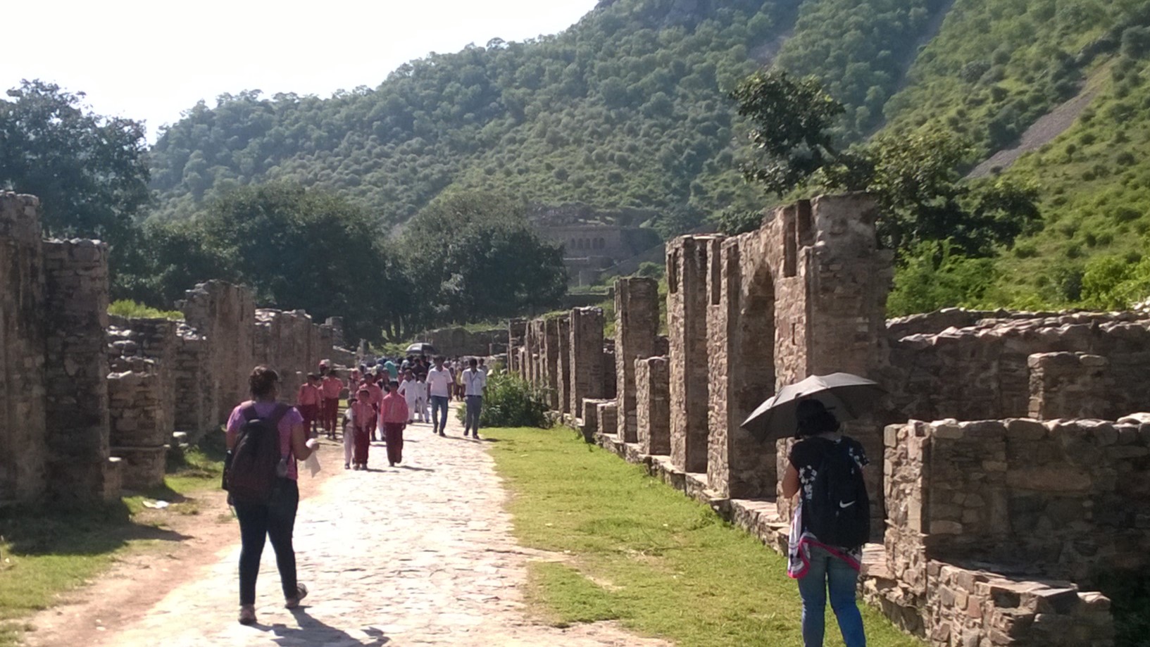
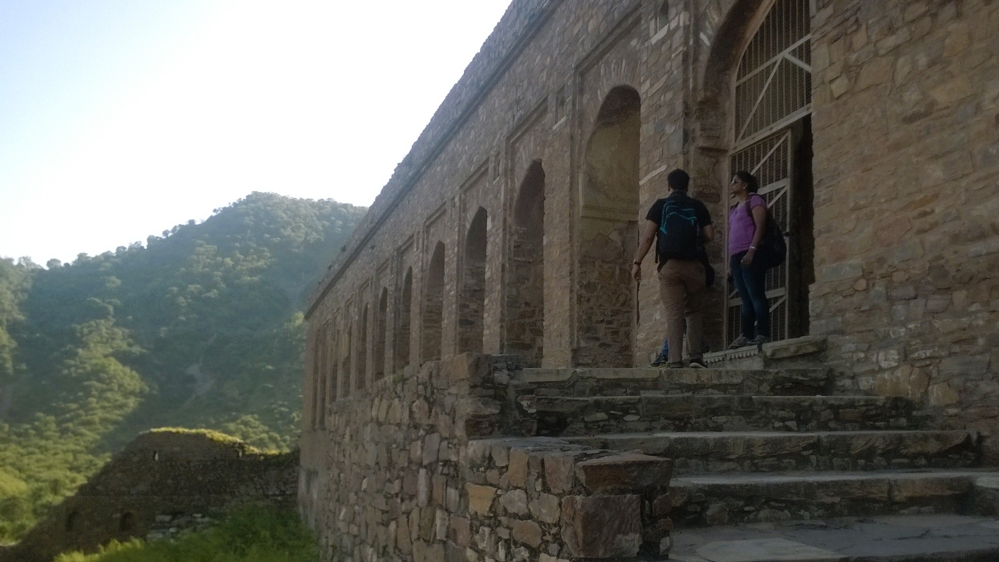
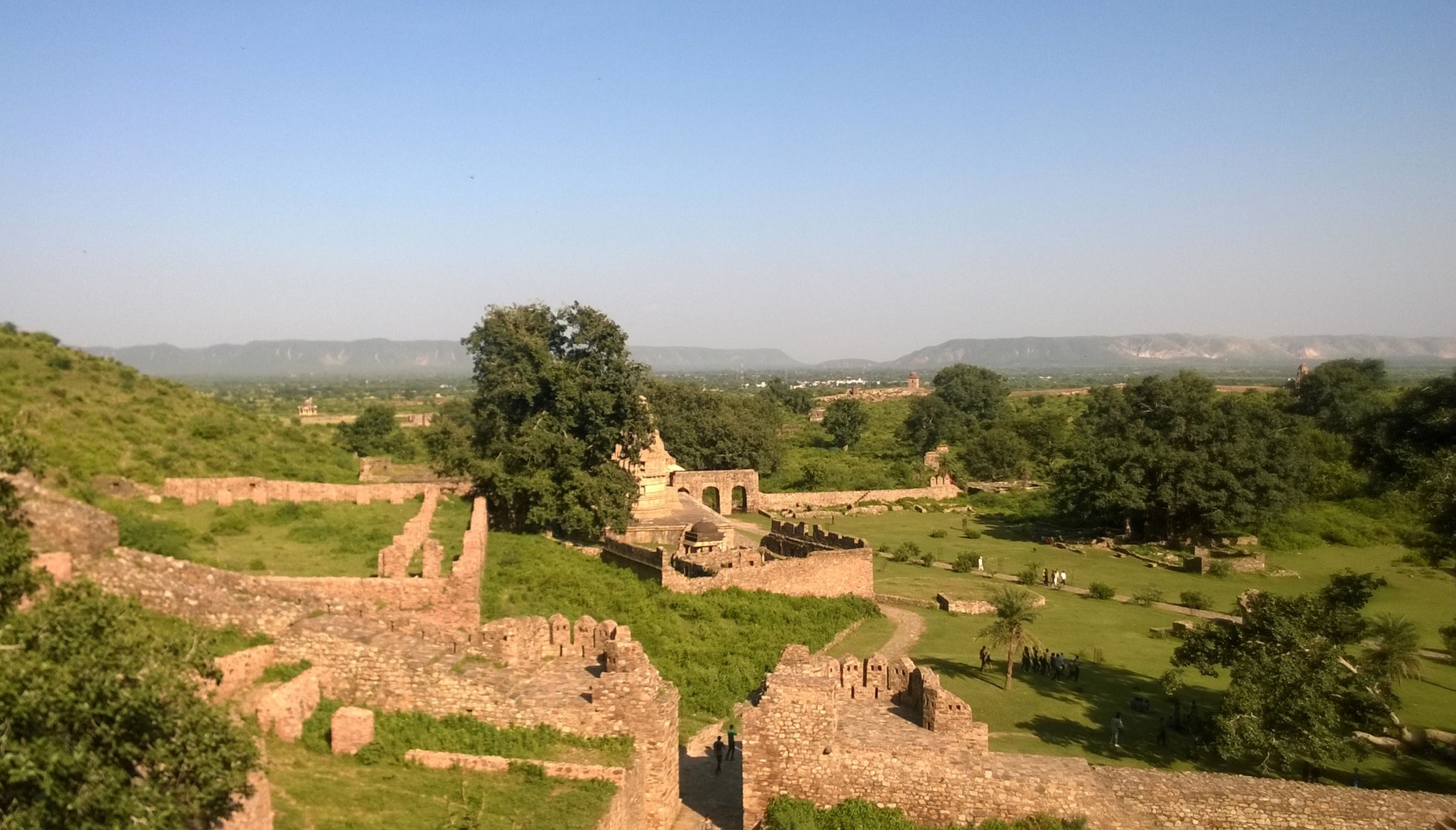
At Bhangarh, we began by exploring the ruined marketplace and residential area near the main entrance. Then walking further flanked by a series of ruined shops on both sides, through the stretch called the Jauhari Bazaar, and crossing a stream, we entered the fort enclosure where sprawling lawns, numerous temples and the main palace welcomed us. Walking through main palace gate, we approached the first layer of buildings having two wings in the form of long pillared hallways on either side of the passage. Both wings had indications of occult practices being conducted, further bolstering the sense of haunting around the place.
After enjoying the views of the Alwar district countryside accentuated by the Aravallis standing like long flattop platforms from the top of the existing structure of Bhangarh, we walked back to the parking lot, where the auto-rickshaw driver was waiting. After another two hours of riding through the dust clouds over the under-repair road, we were back at the Sariska National Park gate by 1.15 PM, where we were faced by the next challenge – finding 4 more co-passengers for the jeep safari, else we would be paying the fees for 6 passengers for the jeep. Luckily, we ran into a family of 3, consisting of another (!) Sardarji and his wife and kid – who readily agreed to share the ride with us.
Walking through Jauhari Bazaar, Bhangarh
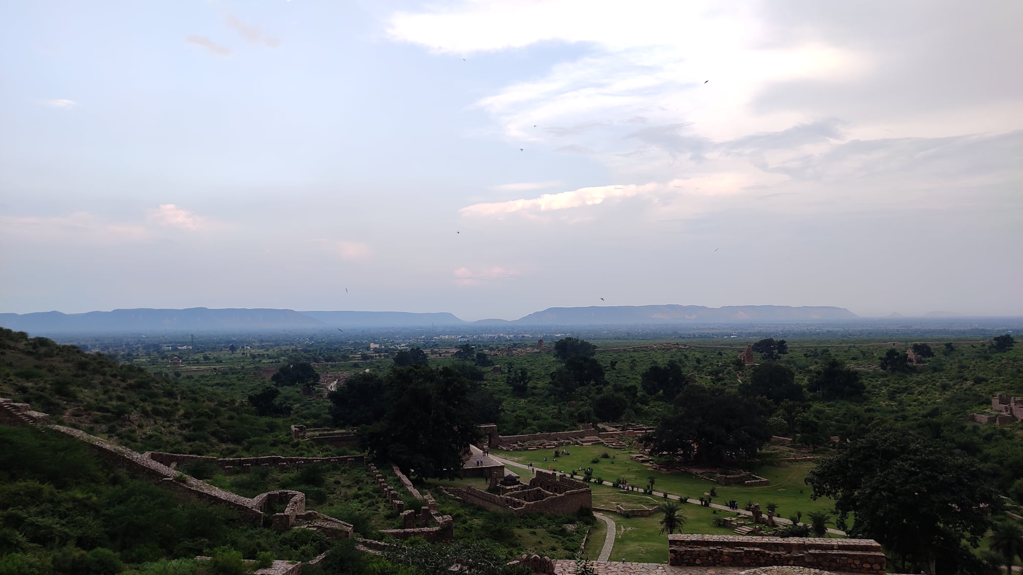
Inside the fort enclosure and approaching the fort, Bhangarh
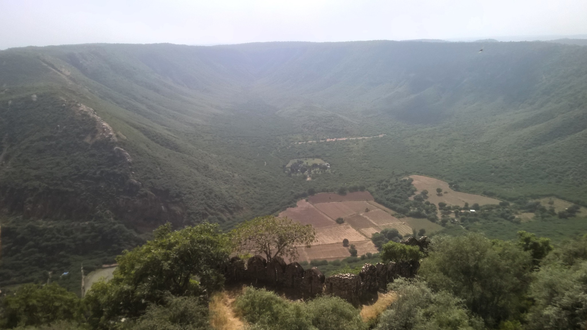
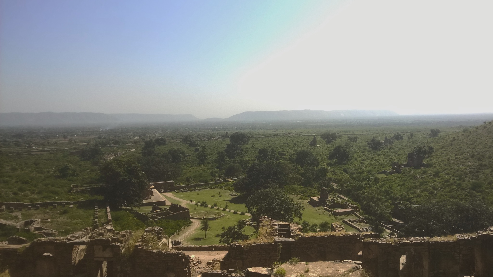
View of the countryside from atop Bhangarh fort
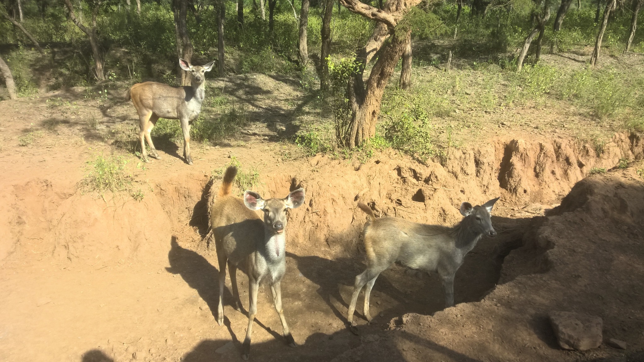
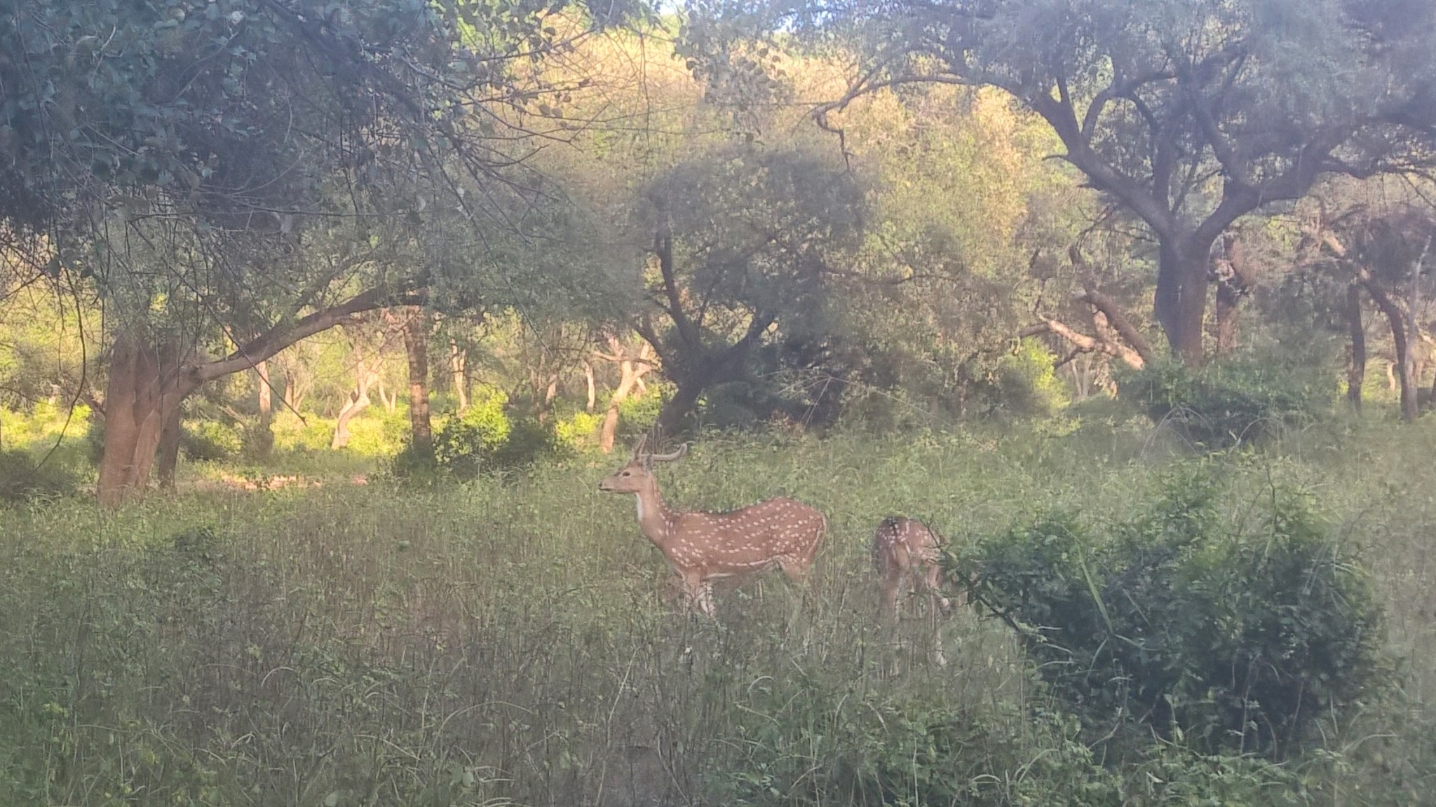
After a quick, light lunch at the canteen near the safari booking counter, we set out on the jeep safari on a trail that took us deep into the Sariska forest. We sighted sambhar, deer, peacocks and countless birds, complemented by thrilling sights of watering holes, and streams cutting through the jungle. Though we did not see a tiger, I would still count this as a very memorable safari in terms of the density of wildlife seen.
Sambhar laze around in a stream, Sariska National Park
Sambhar lounge about, Sariska National ParkA watering hole, Sariska National Park
Deer in Sariska National Park
By 5 PM, we were back on our way to Alwar, with a thick layer of dust having settled on our bodies. When the sardarji finally dropped us off at the place where he had picked-up, he wore a long face, as he grappled with the sight of the coating of dust shrouding his auto-rickshaw – surely, he regretted having picked us up in the morning, and more so, for having agreed to the impromptu extension of the ride to Bhangarh. As if on cue, I handed him a couple hundred more rupees, hopping to alleviate his dejection.
Now, as we wandered around looking for conveyance to the bus station, we were approached by a couple who looked like students on separate two-wheelers. Lo and behold, it was another Sardarji (!), who along with his apparent girlfriend, offered us both a ride on their motorcycle and scooter respectively. By 8 PM, as we boarded the bus headed back to Delhi, it struck us that we had encountered the grace of good Samaritan Sardarjis every time we faced a difficult situation the whole day!
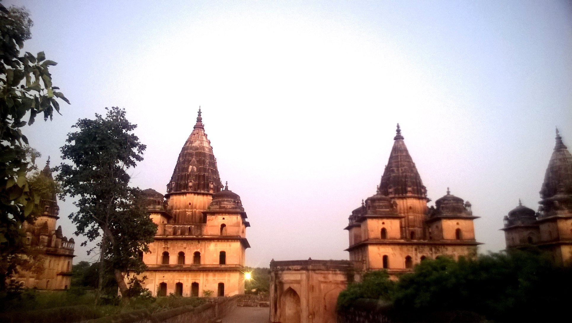
Post-script: My first trip to Bhangarh, September 2014
My first trip to Bhangarh happened by virtue of a day-long trip with a travel group called ROOTS. We had started around 6 AM from Delhi, passed through Sohna and then Alwar, and reached Bhangarh by 1 PM – a journey of almost 7 hours, a testament to the condition of roads that prevailed two years ago.
In any case, I had been awestruck by the atmosphere and ambience of the place, with the setting of the lawns and the fort etched at some height in the hillside seeming like a leaf out of a fairytale. When the tour of fort had ended, I found myself yearning more.
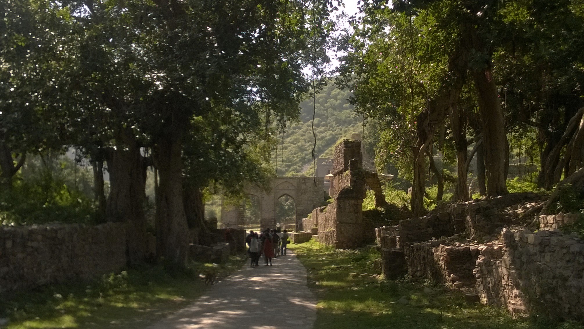
Walking through Jauhari Bazaar, BhangarhApproaching the gate of the Fort enclosure
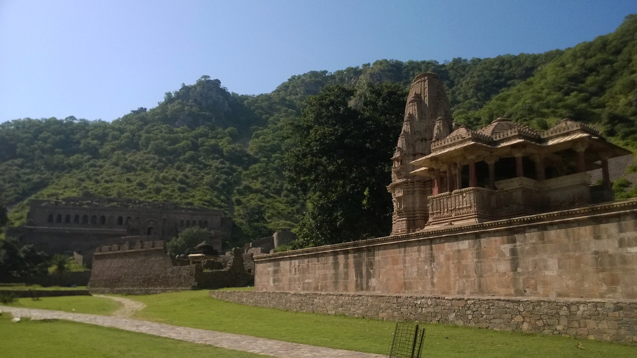
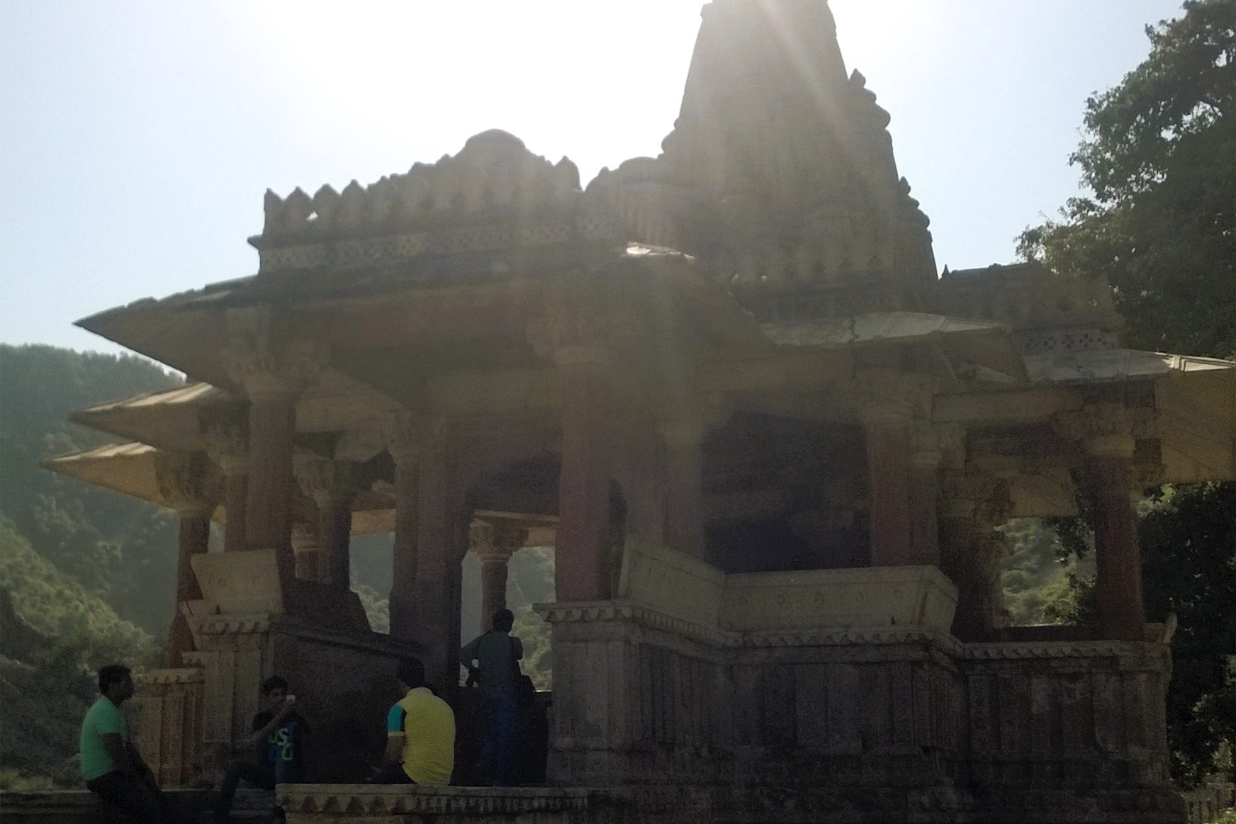
View of the Gopinath temple, with the fort in the background,Bhangarh
Gopinath temple at the entrance of fort enclosureSomeshvar temple near the fort gate
A section of the fort wall, Bhangarh
Entrance to the palace, Bhangarh fortView from palace gate, Bhangarh fort
Leaving Bhangarh, we had then stopped by Ajabgarh, where we were intrigued by the sight of the abandoned houses lining up both the sides of the road for quite a stretch as we entered Ajabgarh village. Later, we had hiked up the hill to explore the compact fort even as darkness was falling. The hilltop also afforded a view of the expansive lake, called Jai Sagar, abounding in lotus and lilies, below by the roadside.
One of the many abandoned houses at one end of the village
Ajabgarh fort beckons from atop a hillock
View of a turret from outside the Ajabgarh fort
A courtyard inside Ajabgarh fortA room in Ajabgarh fort
View of the Jai Sagar lake from Ajabgarh fort
By then, it had already been 6.30 PM, with the twilight looming over the village, imparting it with an even eerier character. In the darkness, we had passed through the Aravallis with the moon smiling from behind the clouds, and the silhouettes of the hills accompanying us till we had crossed Sariska.
By 1 AM, we were back in Delhi, the journey turning out to be way longer than originally scheduled, but at the same time ending up being more memorable than I had ever expected.