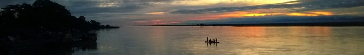
Right on the heels of the Aurangabad affair, we took an overnight bus that rocked and rollicked its way to Indore, where we learnt that the self-drive car that we had booked much in advance was no longer available. Fortunately, a cab through the hotel concierge became available on short notice. It was now time to explore a couple of prominent places of Malwa, a historical region in Central India, that flourished under the Mauryas, Guptas, Paramaras, and later the Malwa Sultanate. So off we set for Mandu, a UNESCO World Heritage Site candidate, 100 km away from Indore, via Dhar.
Our relief was short-lived, as the driver, a sexagenarian, instead of taking us through the spanking new highway, chose older run-down roads, probably to save on toll charges. What ensued was a race against time, given the fact that winter had commenced, and the monuments would close early. As we headed towards Dhar, I kept ruing the fact that I had not tried harder for an alternative self-drive option. Nevertheless, we finally entered Dhar after a 2-hour drive, something that should have taken only an hour via the highway.
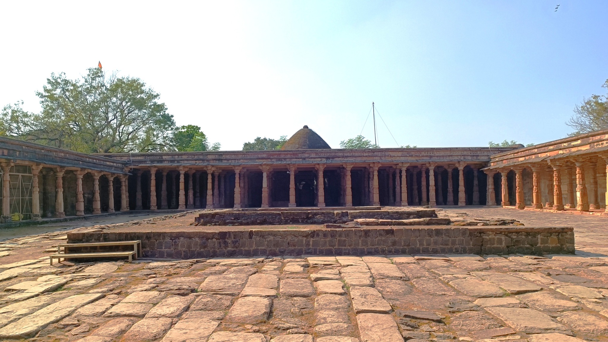
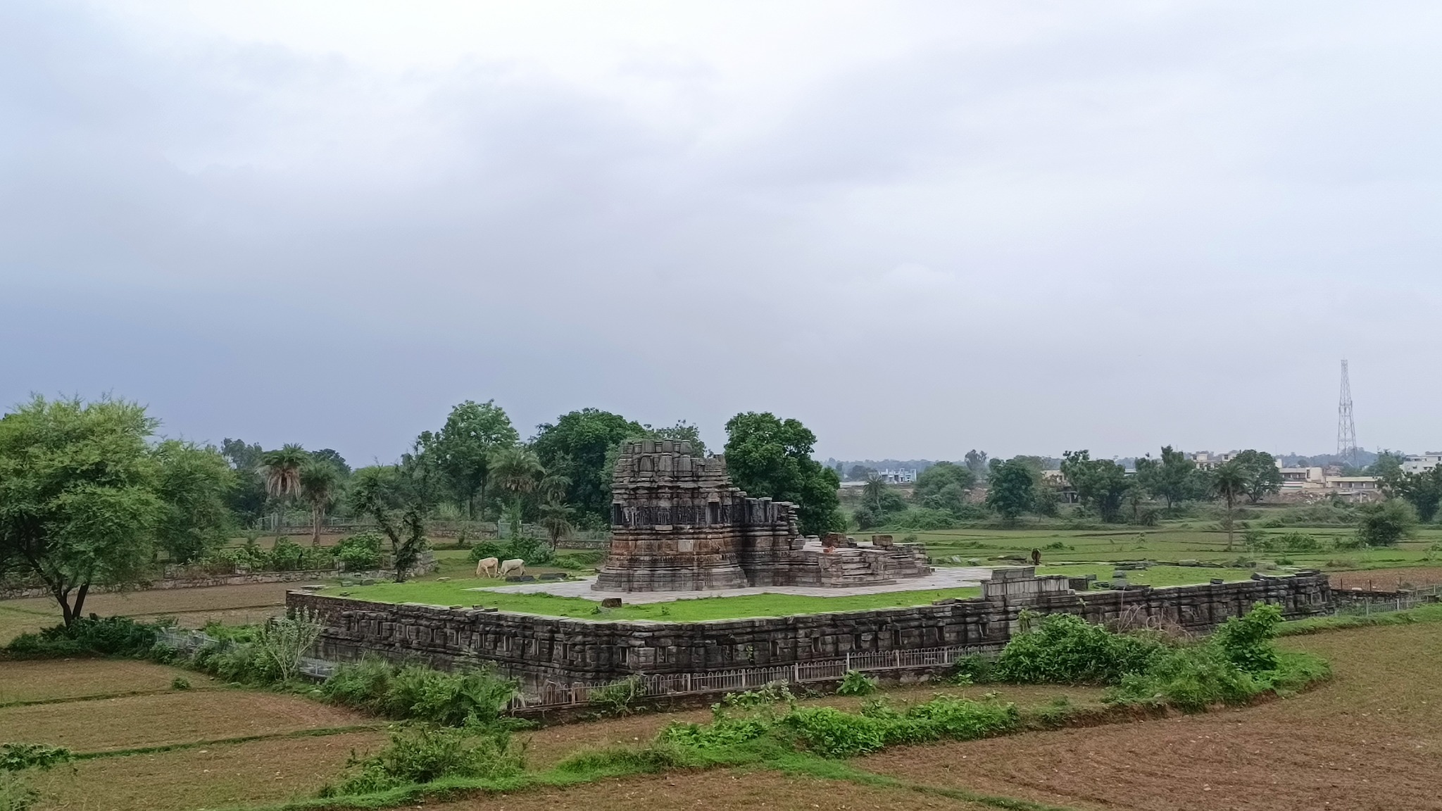
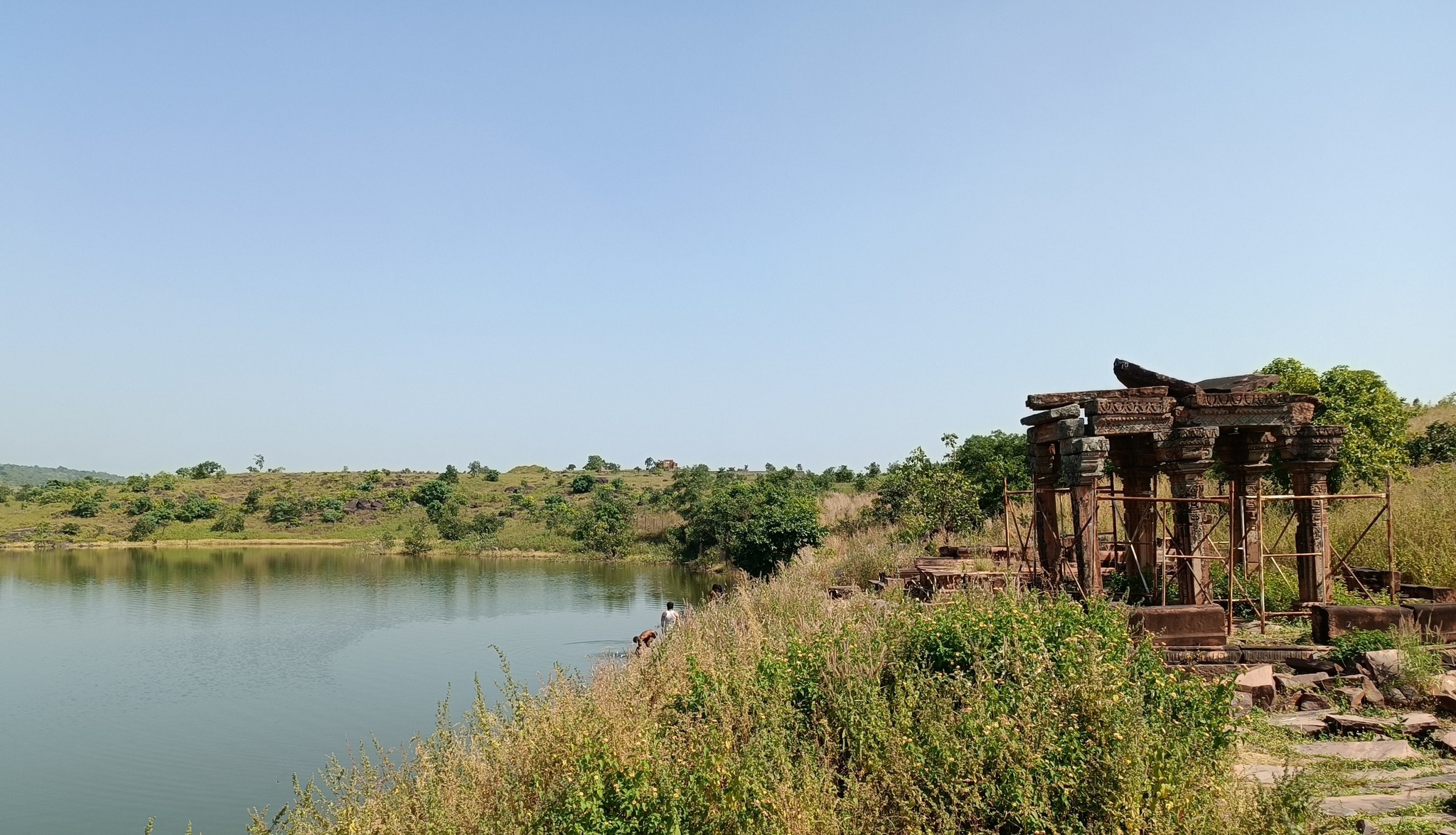
Dhar is a historic town, a prominent center of power and culture, founded in the 9th century by the Paramaras. It flourished under King Bhoja, renowned for his patronage of learning and arts, and a legendary figure who is the subject in the frame story of the Singhasana Battissi (the 32 tales of Vikramditya’s Throne). Dhar later became part of the Delhi Sultanate, the Malwa Sultanate, and the Maratha Empire. Its architectural heritage includes the Dhar fort and the Bhoj Shala, an ancient Sanskrit learning center, purported to be patronized by Bhoja himself. Dhar’s rich history reflects a blend of Hindu and Islamic influences.
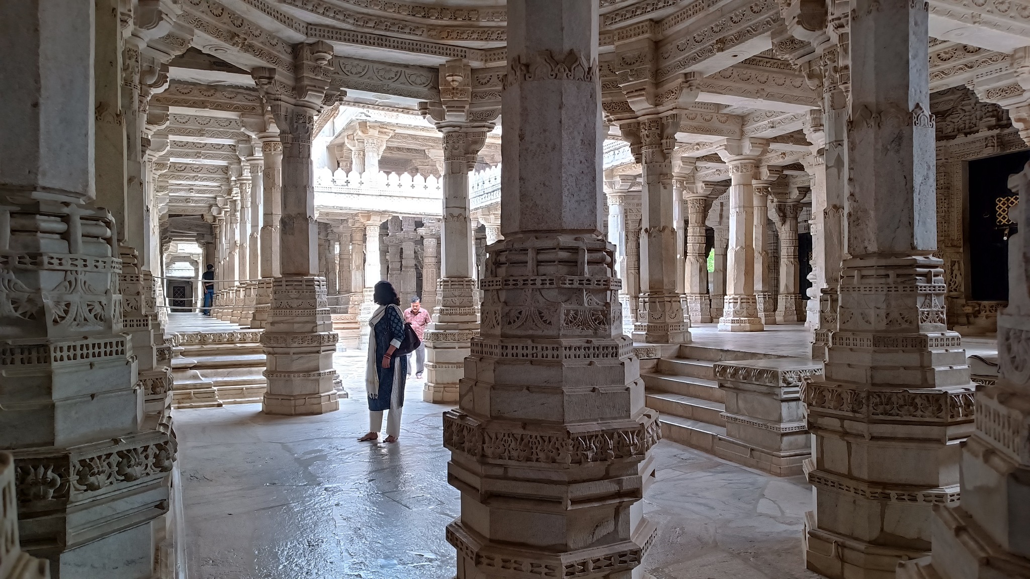
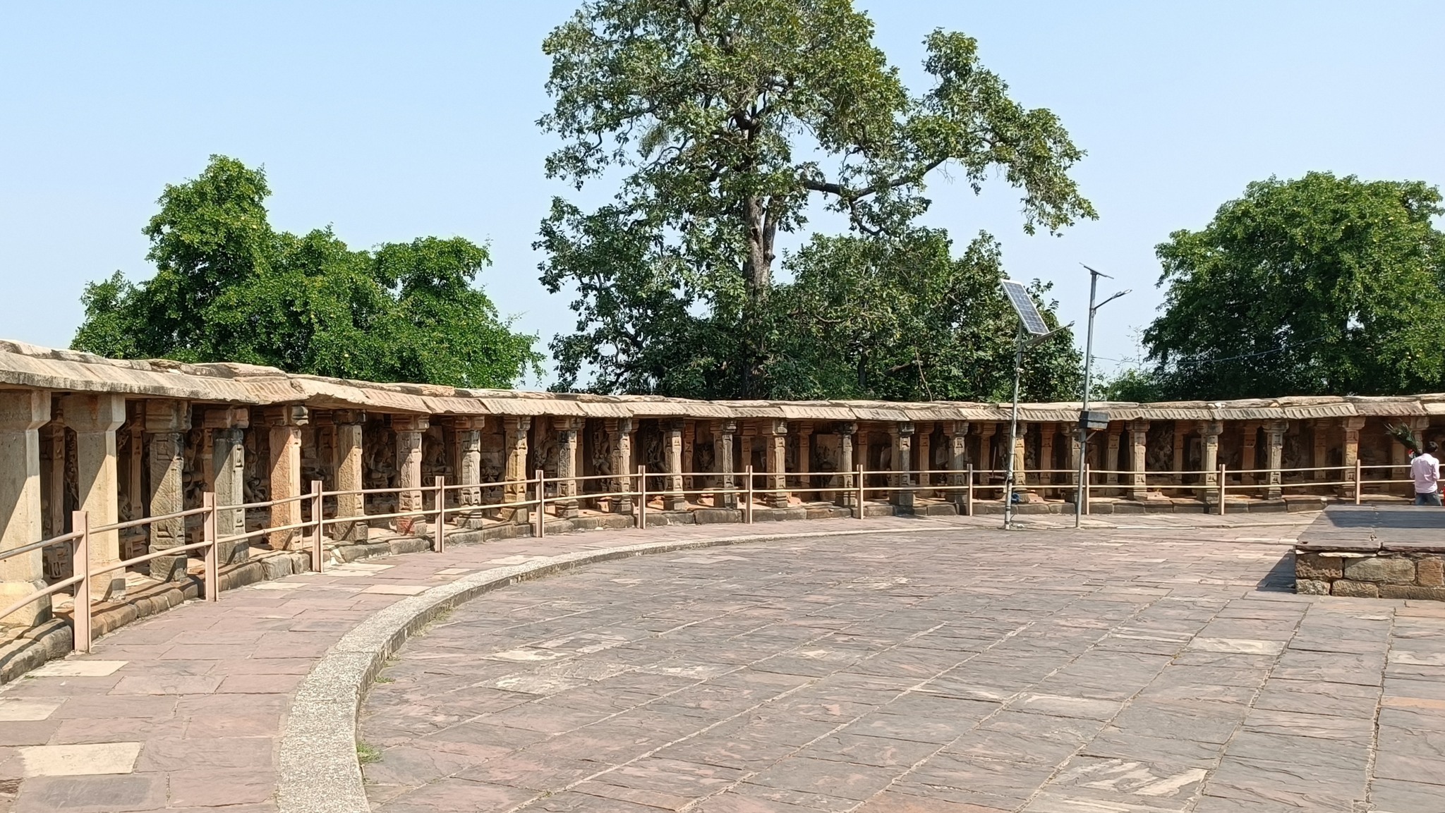
The Bhoj Shala, Dhar12th century pillars inside the Bhoj Shala
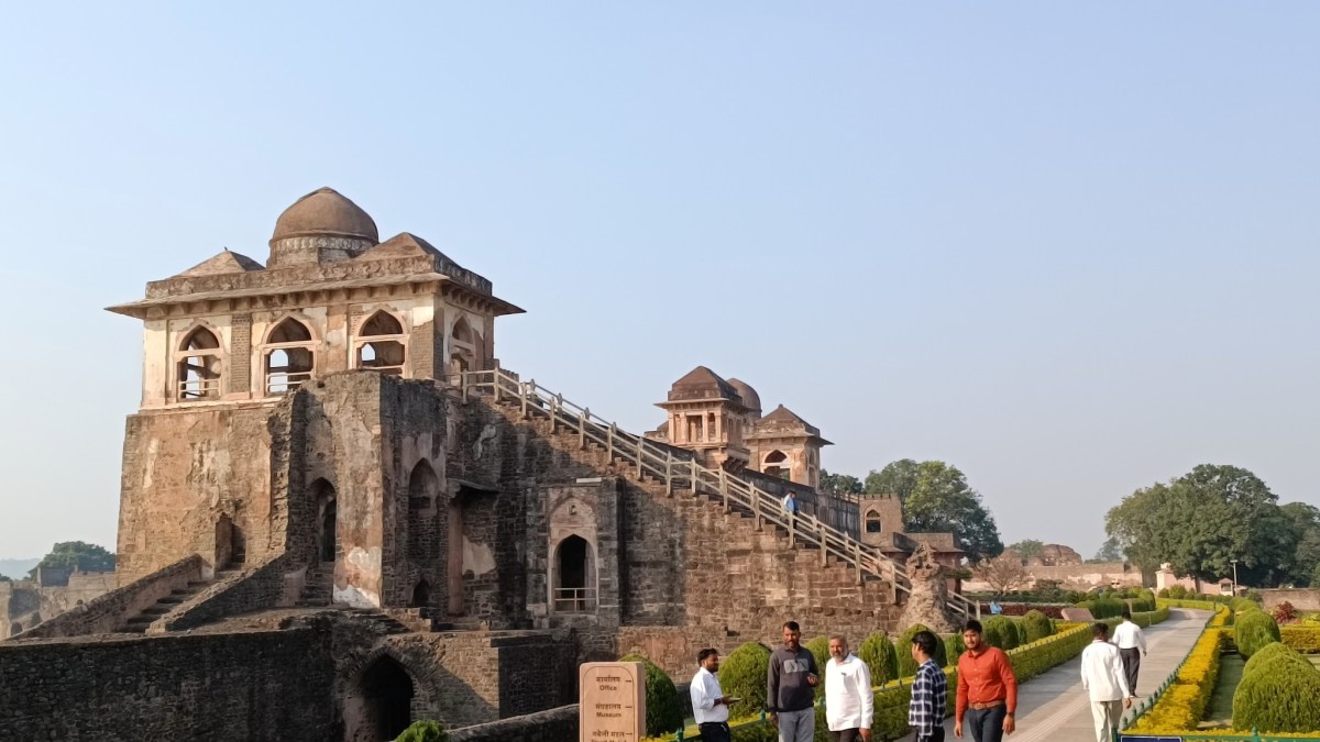
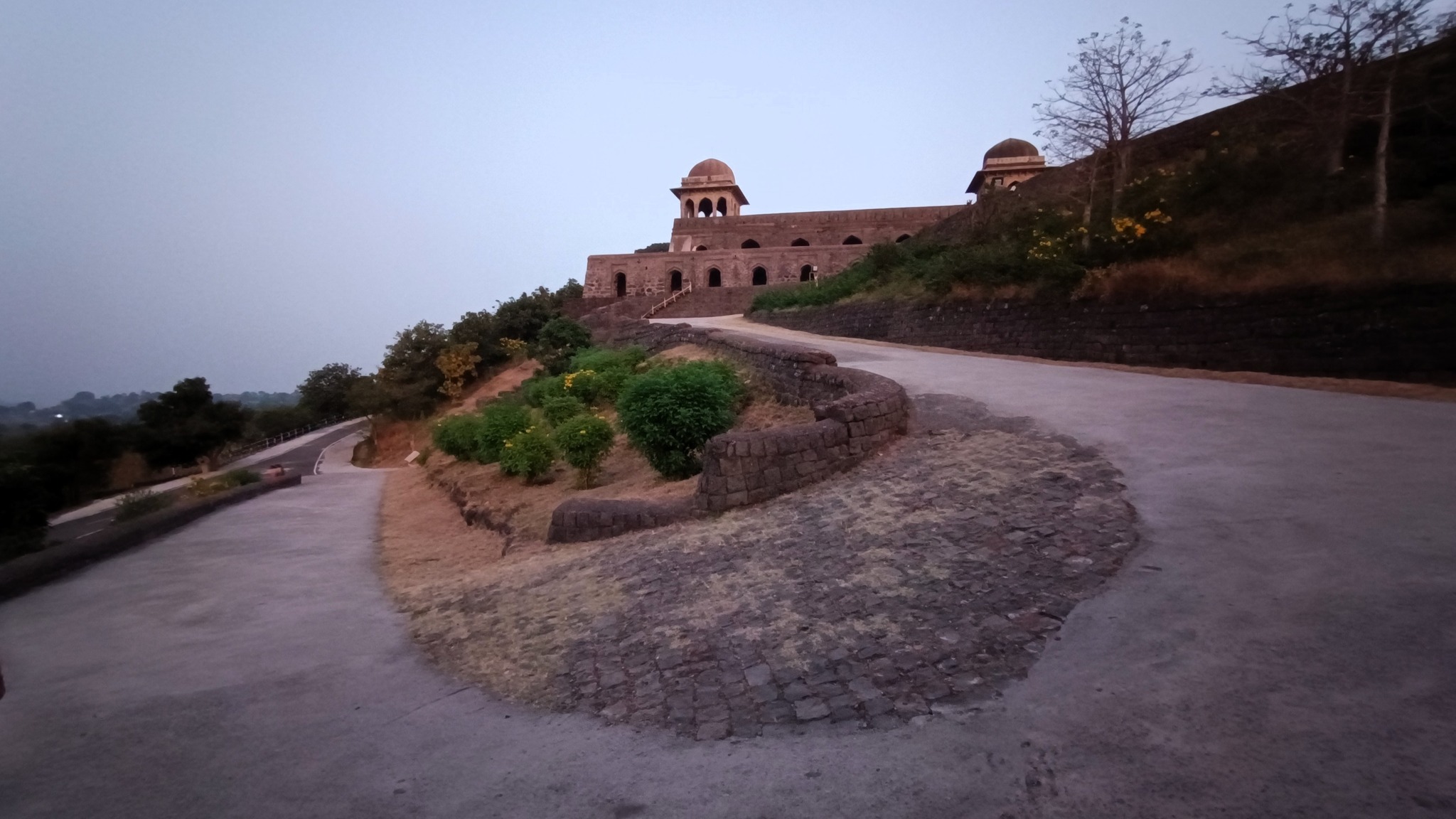
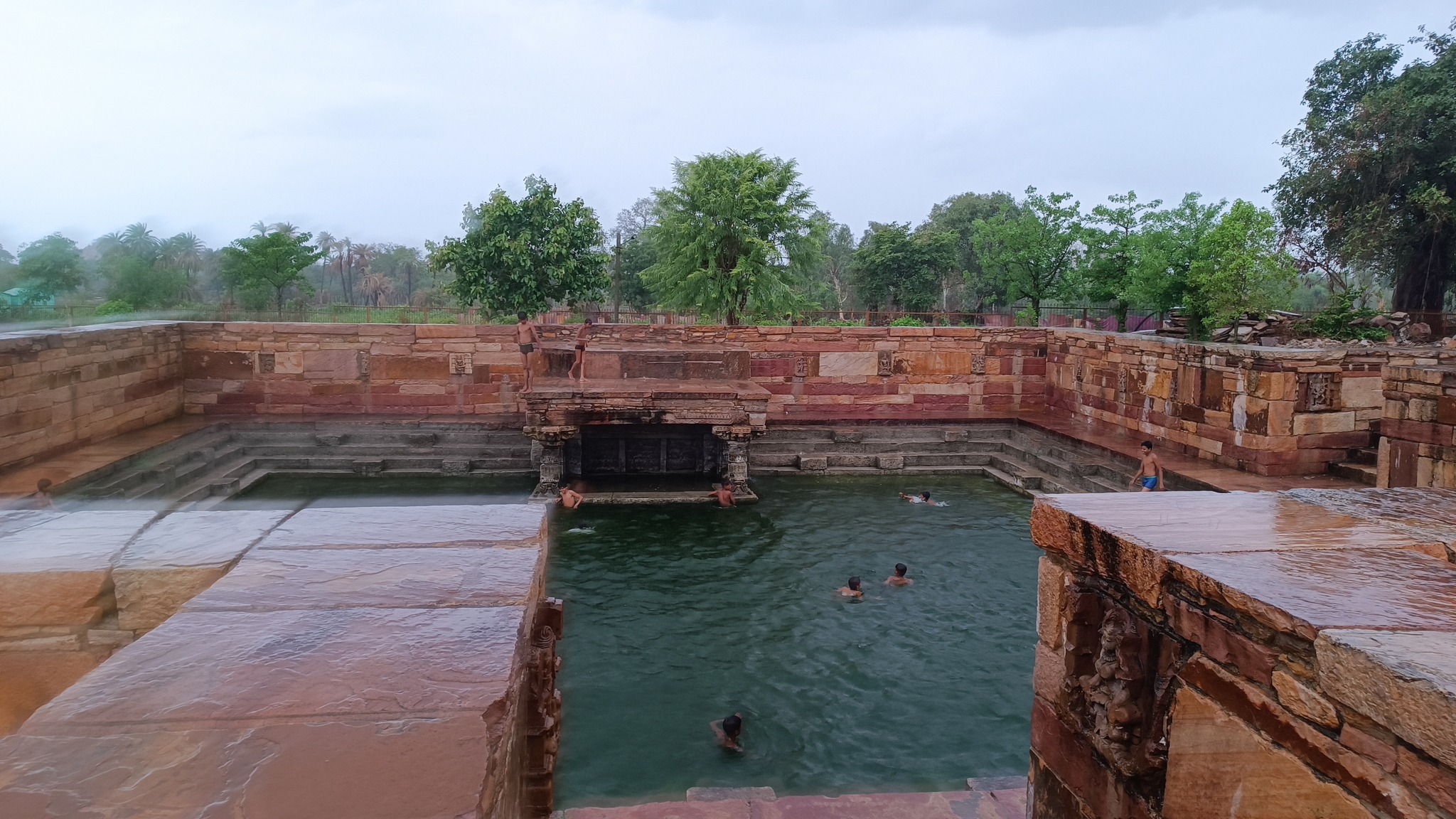
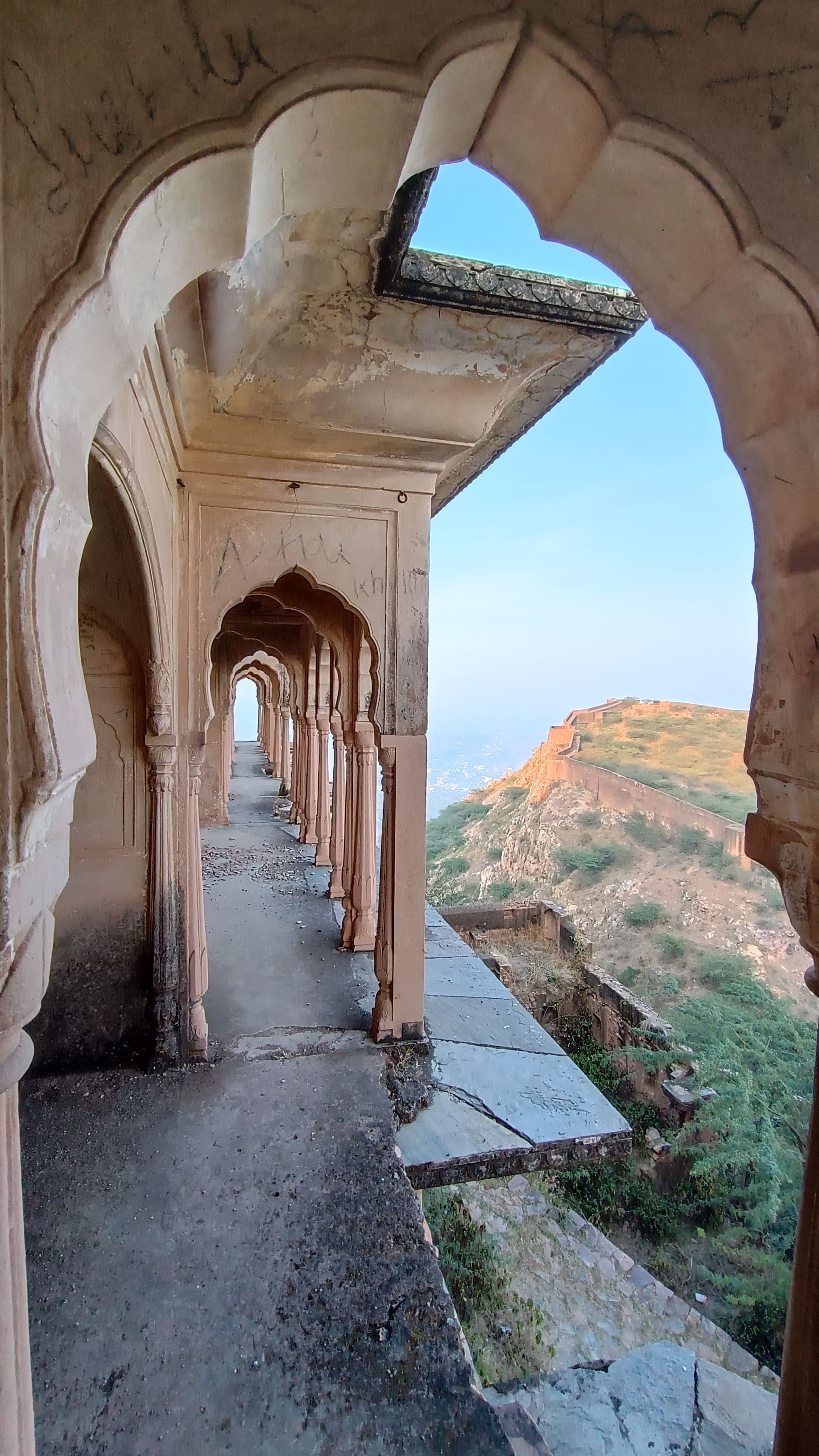
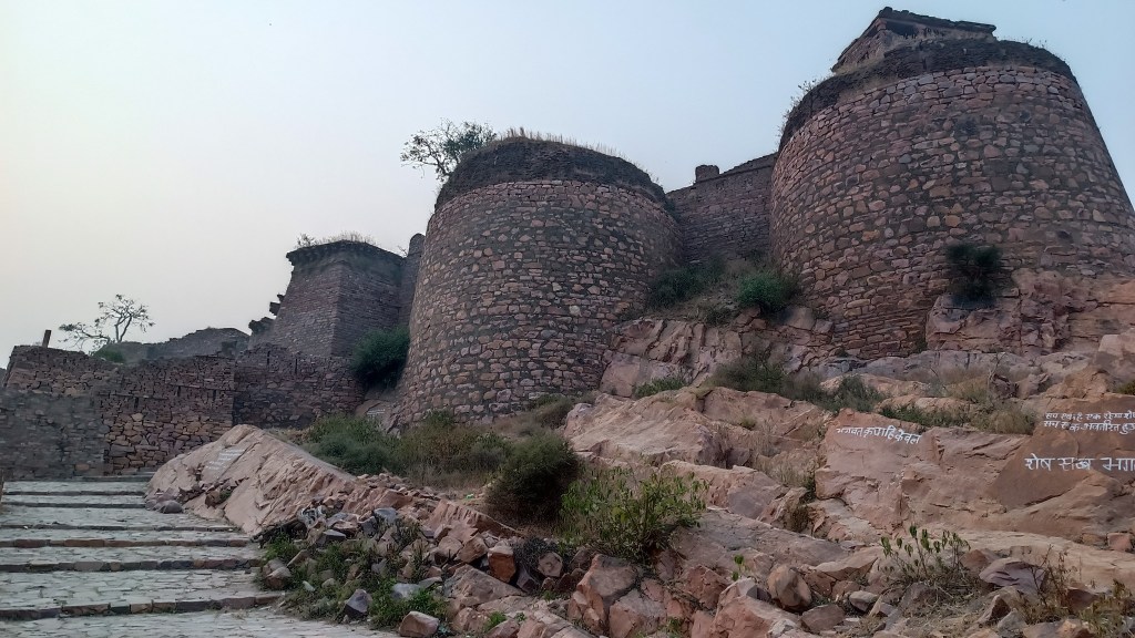
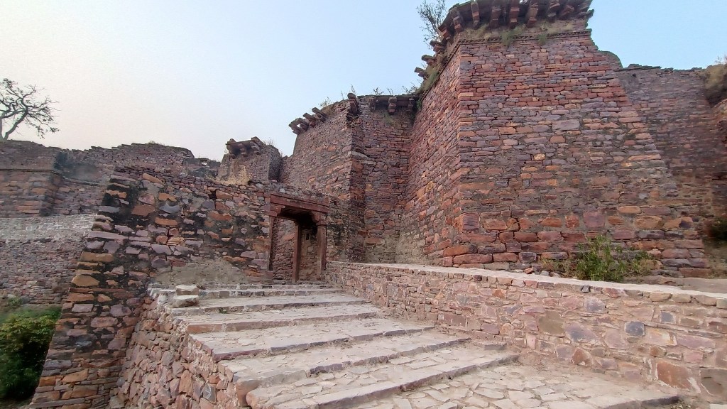
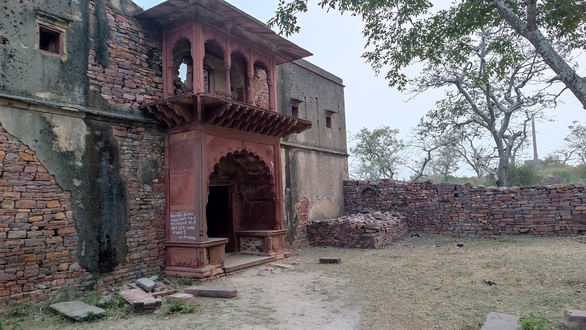
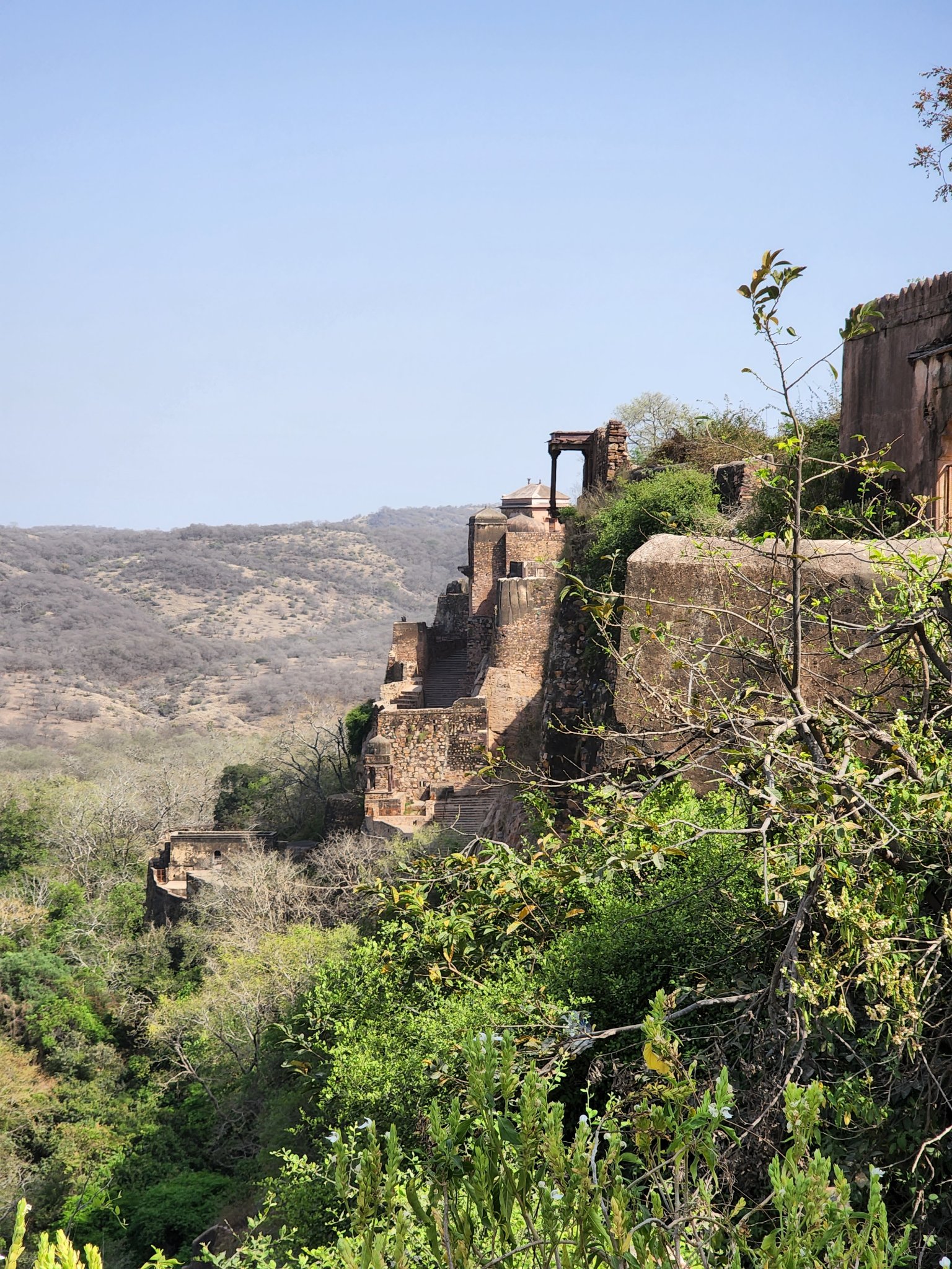
Moving on, we snaked up a gentle slope to reach the top of a vast flat top hill in the Vindhya range, welcomed by a gate in a thick stone wall that once fortified Mandu. Mandu, erstwhile ‘Mandapa Durga’, flourished under the Paramaras in the 10th century, but reached its zenith after being made the capital of the Malwa Sultanate by Hoshang Shah of the Ghuri dynasty, followed by the rule of the Khalji dynasty. The legacy of the Malwa Sultanate lives on in structures such as Hoshang Shah’s Tomb, India’s first marble mausoleum, and Jahaz Mahal, an engineering marvel. Mandu’s romance is immortalized in tales of Baz Bahadur and Rani Roopmati.
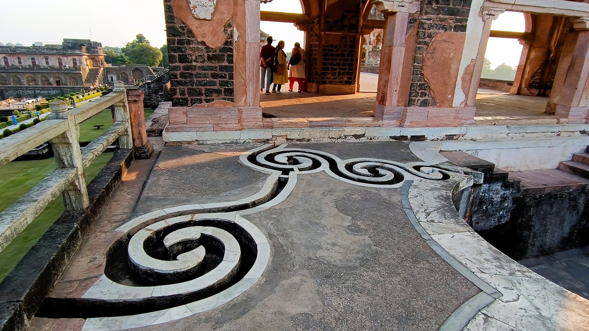
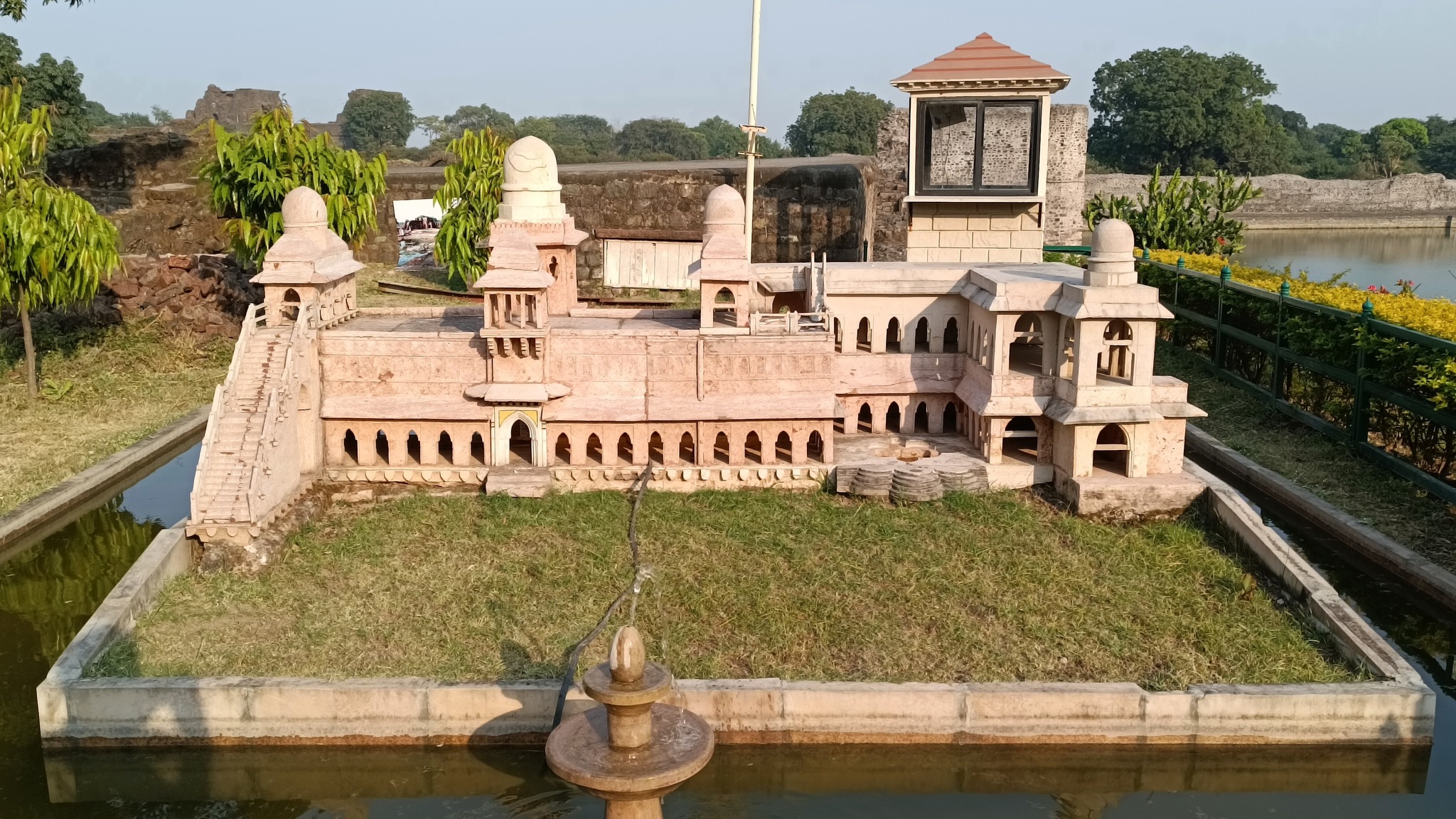
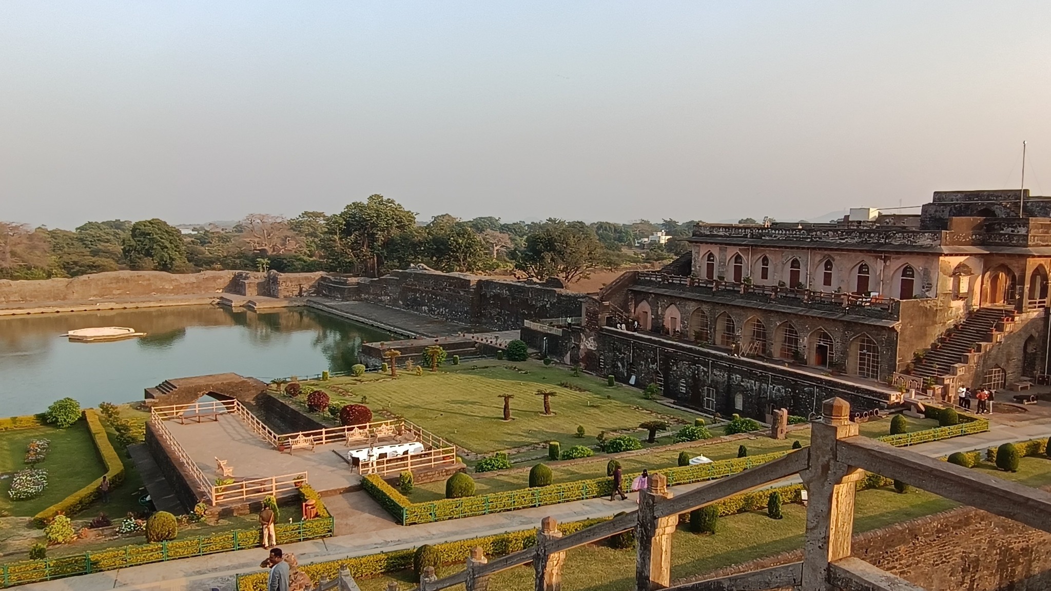
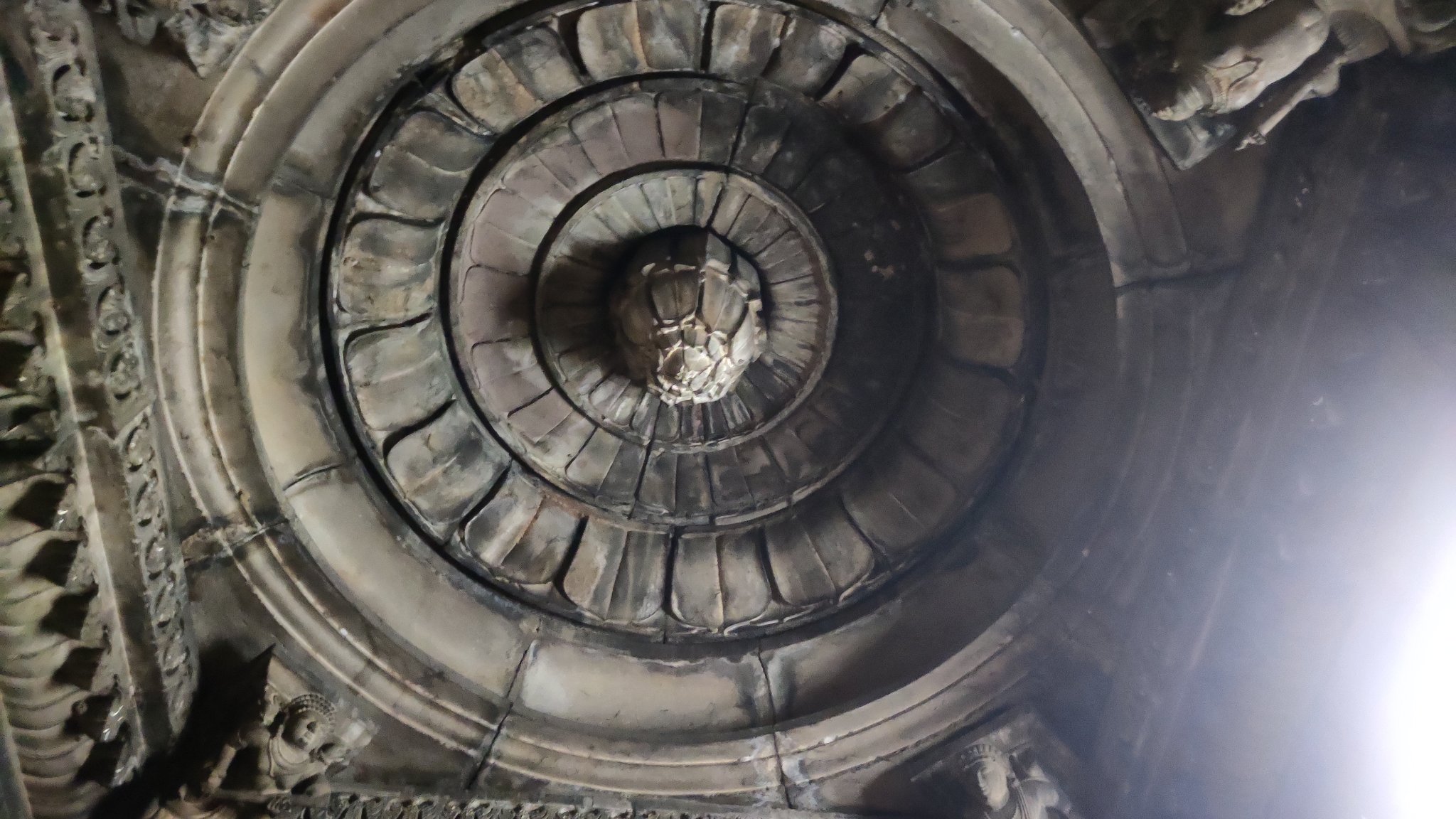
By 3 PM, we were finally inside Mandu’s fort walls, woefully late, only to learn that access or at least the visiting hours would be limited due to a G20 event involving foreign dignitaries! At break-neck speed, we made a tour of the Jahaz Mahal, where we were told we had only about an hour, before access was stopped to the public to cater to the dignitaries. Jahaz Mahal was built as a harem by Ghiyas-ud-din Khalji, a patron of the arts, to resemble a ship afloat the artificial water bodies surrounding it. A two-storeyed structure, it also features a small pool with flower-shaped outline on each storey.
The Jahaz Mahal, the Ship Palace, at Mandu, built by Ghiyas-ud-din Khalji between 1469 and 1500 AD.
Munj Talao just behind Jahaz Mahal, Mandu
A flower-shaped pool in Jahaz MahalDecorative drains in Jahaz Mahal
A scale model of the Jahaz Mahal showing its full splendour
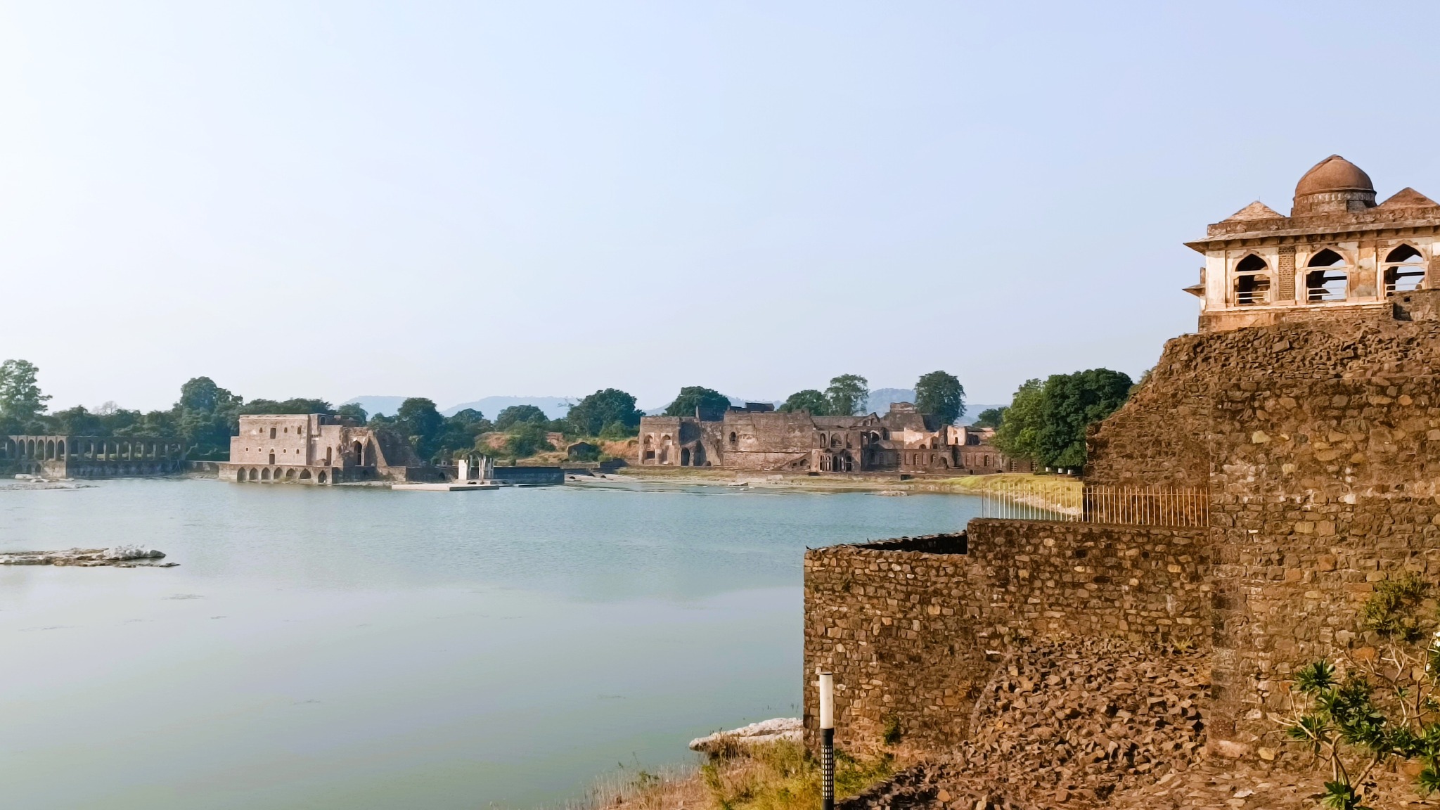
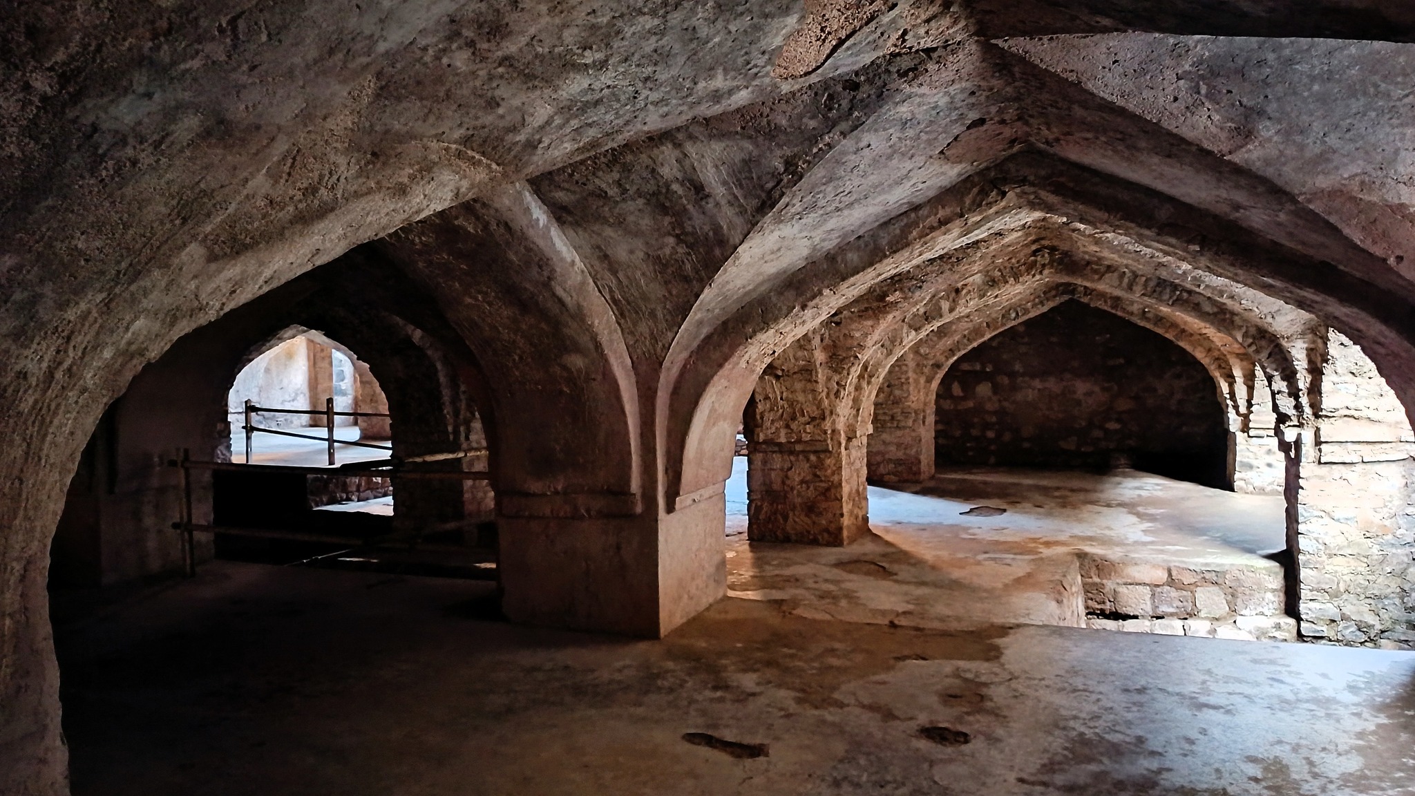
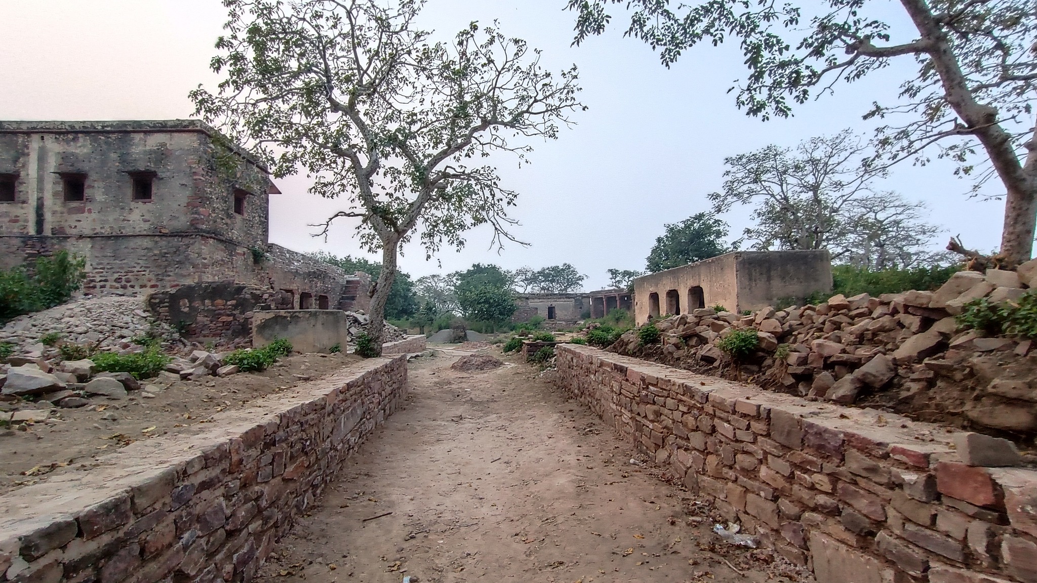
In the vicinity is the Hindola Mahal, a meeting hall structure resembling a swing, due to its sloping sides. Alongside it are other structures, forming part of the royal complex, such as the Champa Baodi, a well that once held water smelling of champak flowers, sitting beneath and accessed through a mesh of subterranean passages, and the Hammam, the Turkish-style royal bath, adjacent to the well. Gardens, and other structures such as the Jal Mahal on the Munja Talao behind Jahaz Mahal, and the Taveli Mahal on the Kapur Talao in front of Jahaz Mahal, complement the splendour of the royal complex.
The Hindola Mahal, Swing Palace, a meeting hall
Subterranean passages above Champa BaodiKapoor Talao in front of the Jahaz Mahal
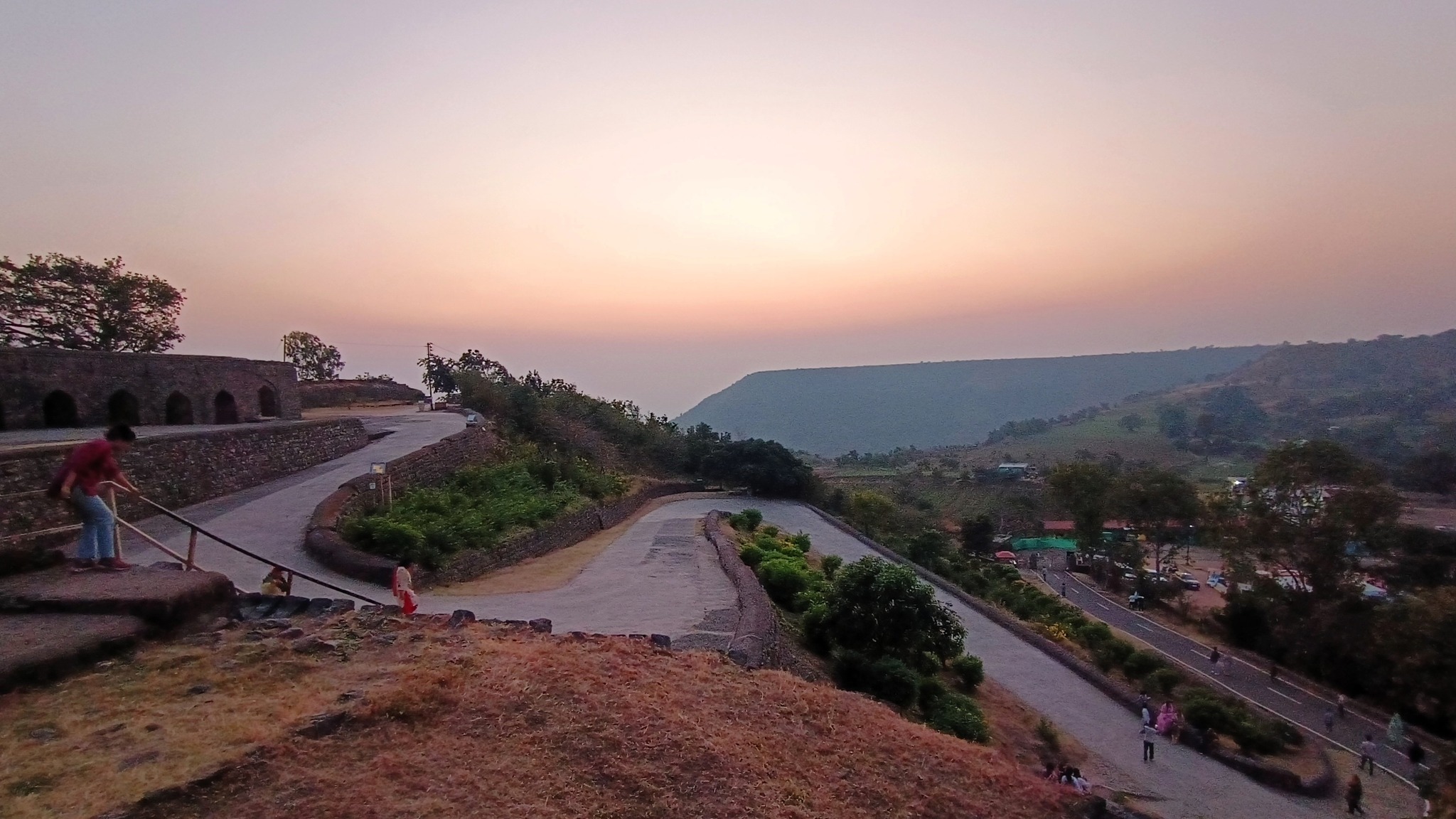
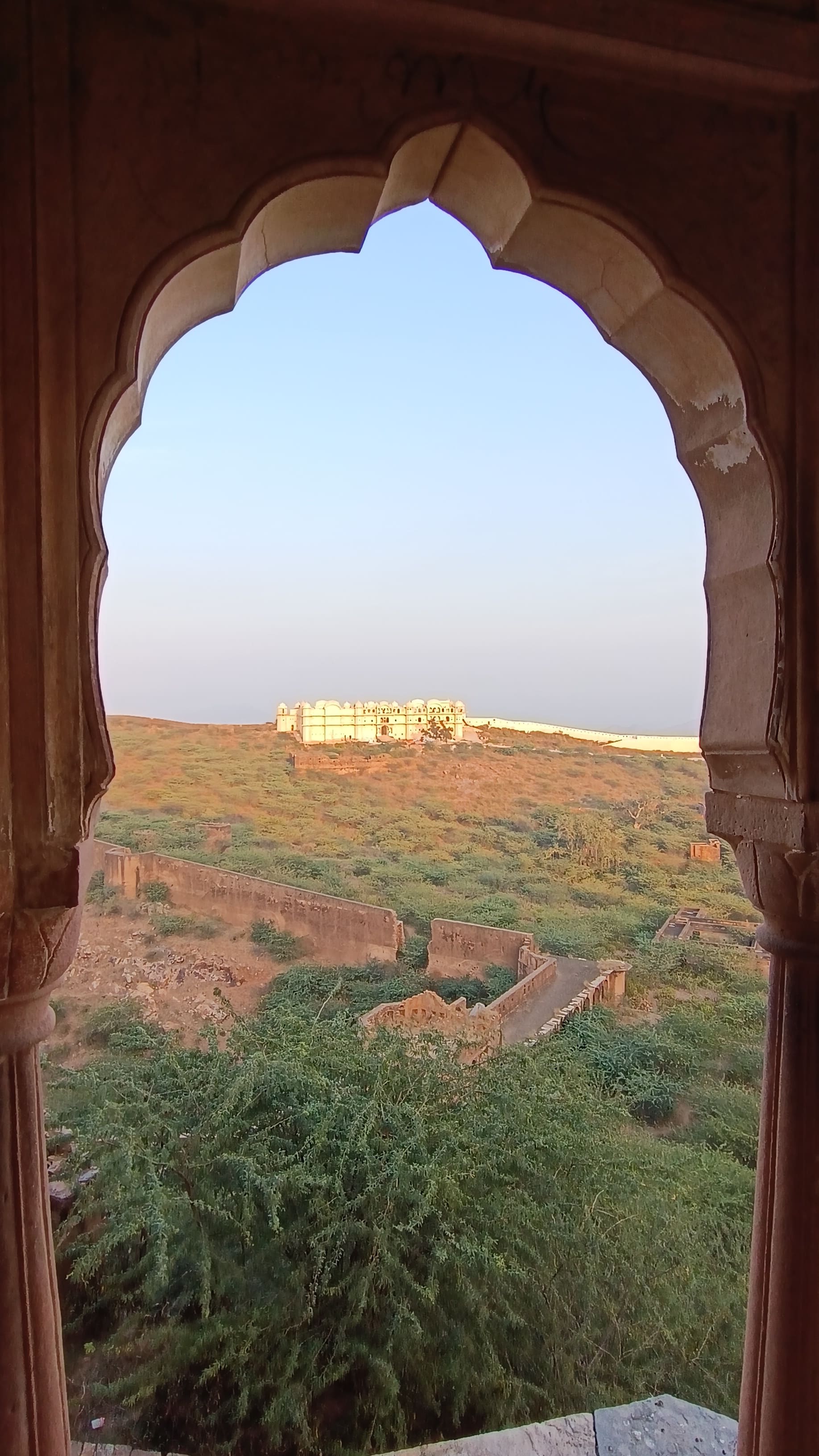
Driving further south, we passed by Hoshang Shah’s tomb, the Jami Masjid and the Sagar Talao to reach the southern edge of the hill, about 4 km from the Jahaz Mahal complex. This region houses the Baz Bahadur Palace. The last ruler of the Malwa Sultanate, Baz Bahadur’s liaison with the musically-inclined shepherdess, later queen, Roopmati became the stuff of Malwa legends. He built the adjacent Rewa Kund, a lake connected to the Narmada river, revered by Roopmati as a mother. When Baz Bahadur fled facing a debilitating defeat at the hands of the Mughals, Roopmati committed suicide believing her beloved to be dead.
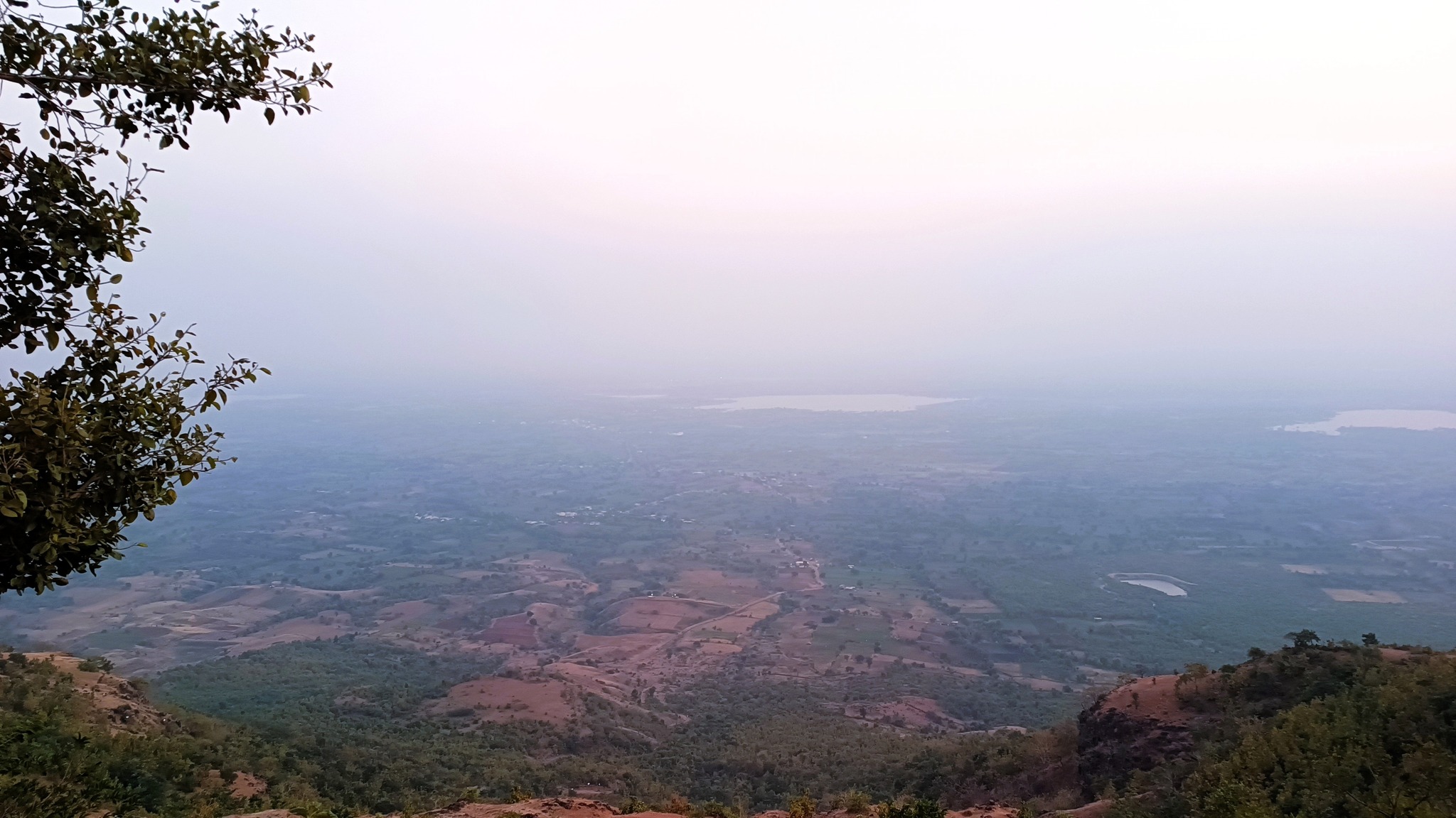
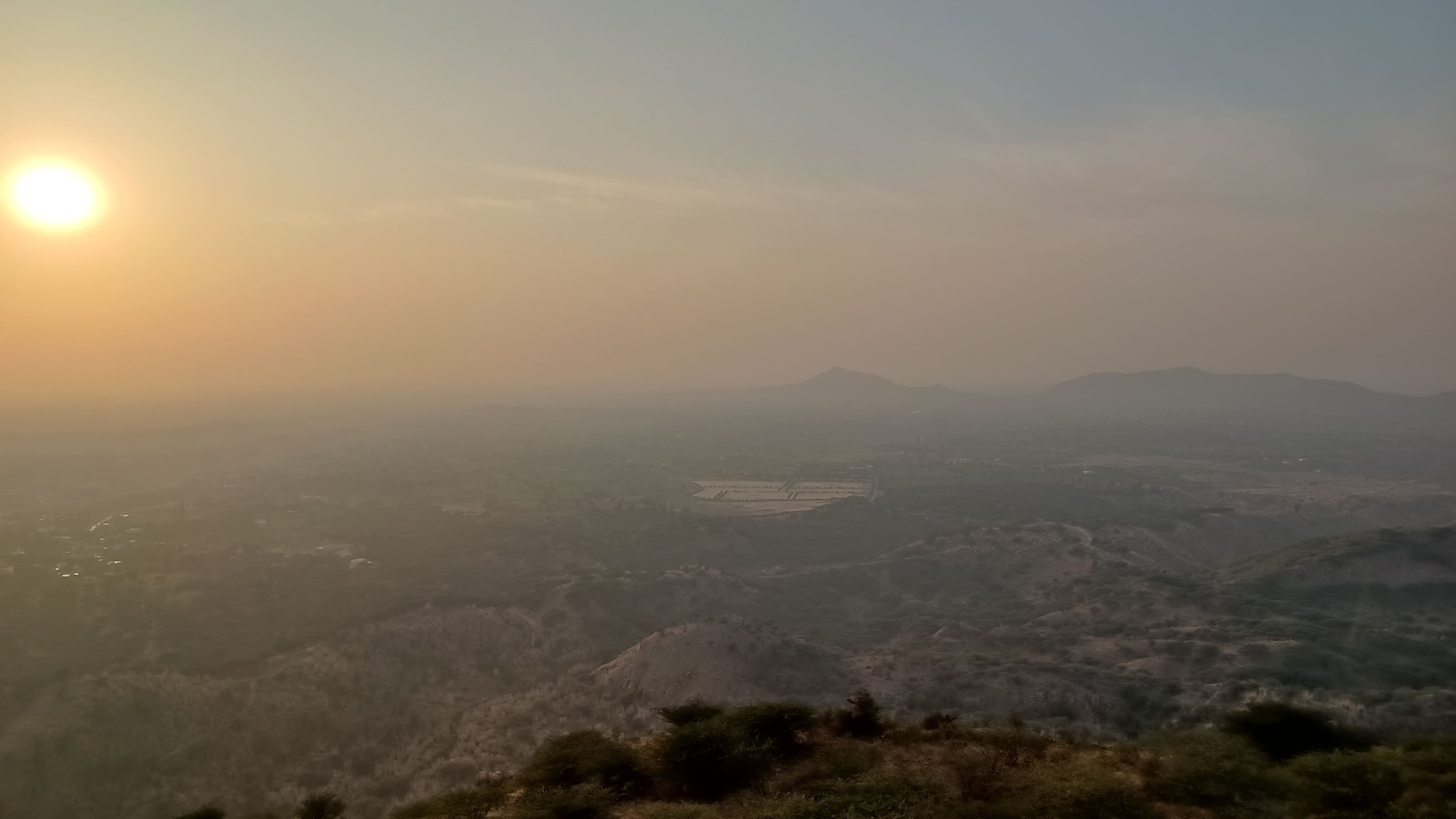
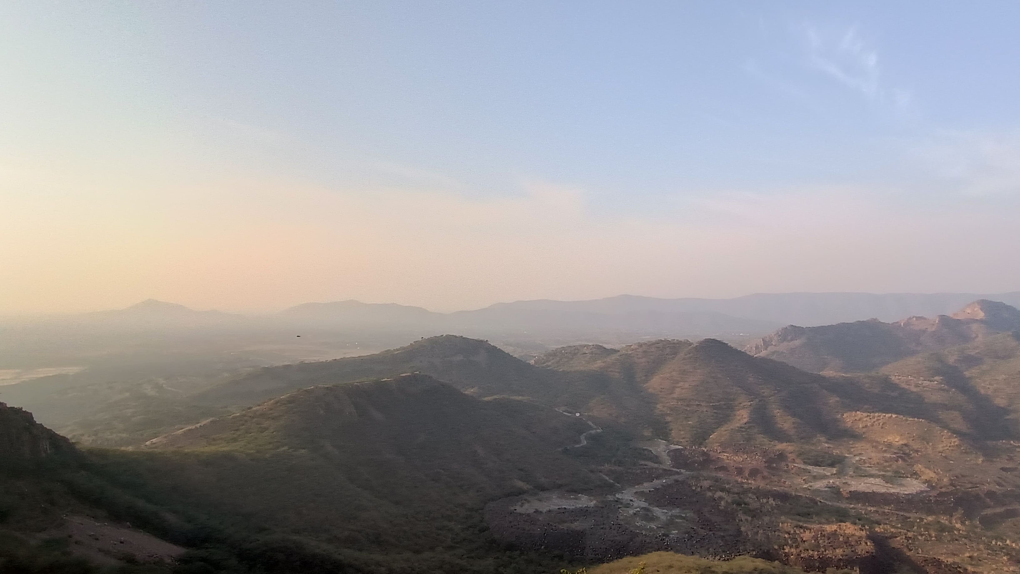
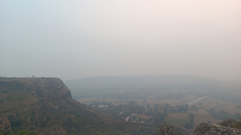
It was well past 5.30 pm, when we reached Roopmati’s Pavilion, the final destination of the tour. Sitting at the absolute edge of the hill, the simple structure attributed to Roopmati, served as a viewing post in times of invasion, providing views of the Narmada Valley in the erstwhile Nimar region. The sight of the Malwa landscape replete with its plains punctuated with little water bodies and the top of the flat hills awash in the twilight, provided a fitting end to a whirlwind tour of a shining gem of India’s heritage with its blend of Afghan, Hindu, and Mughal architectural influences.
Roopmati’s Pavilion at the fort’s southern edgeTwilight as seen from Roopmati’s Pavilion
View of the Malwa landscape leading up to the Narmada Valley, standing at the southern edge of fort, in Roopmati’s Pavilion
How to visit Mandu and Dhar
Dhar and Mandu can be reached only by road from Indore or from Ratlam. Indore is connected by flight, train and road, whereas Ratlam, which lies on the Delhi-Mumbai railway line, is connected by rail and road.
Mandu is 2 hours from Indore, whether you go via Dhar or not – the route via Dhar is longer in distance but takes the same time as the non-Dhar route.
Mandu is so vast that you could easily spend two days with an intervening night at any of the hotels and resorts. You can squeeze in Dhar either on the onward or return leg, if you are interested.
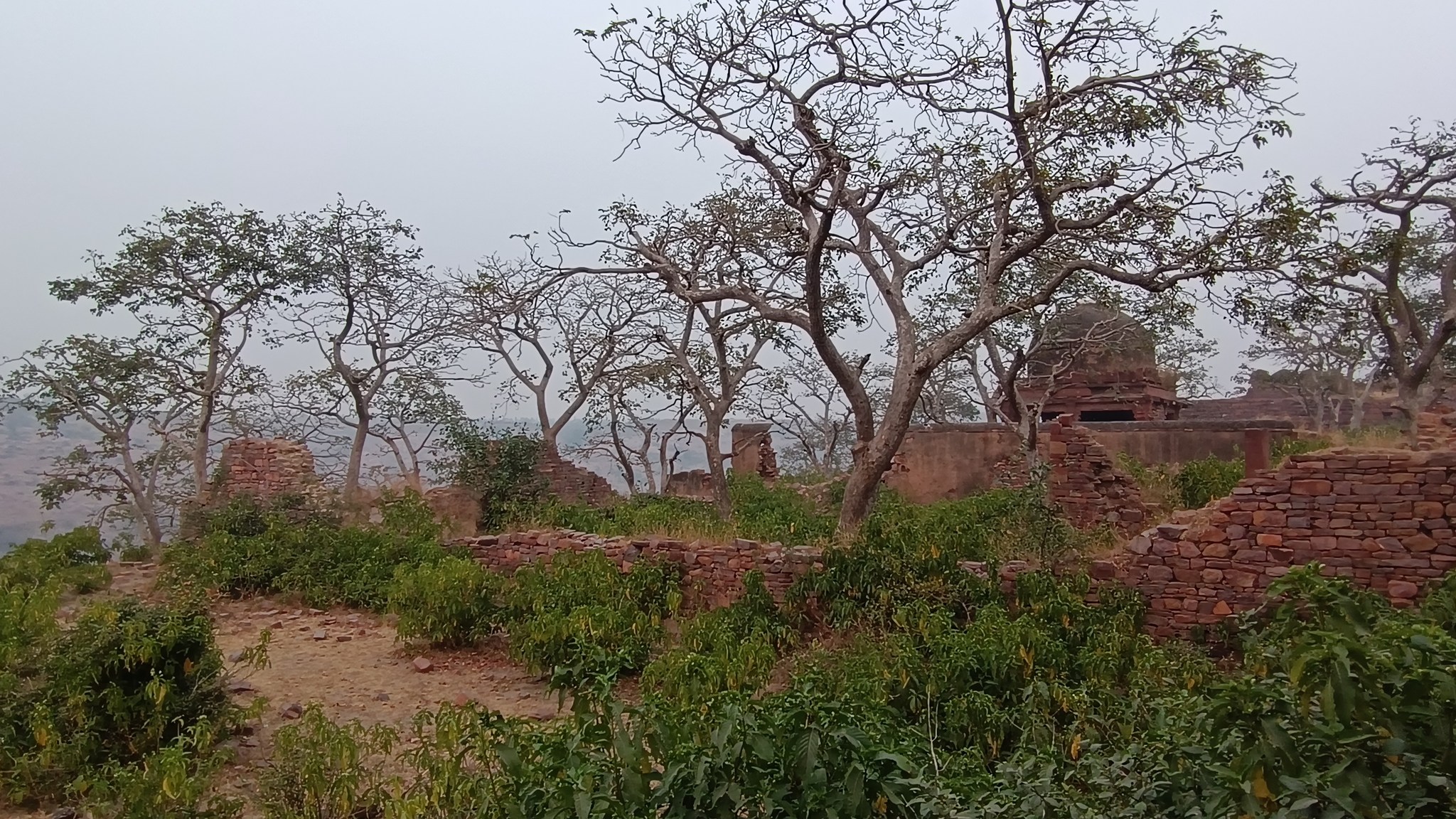
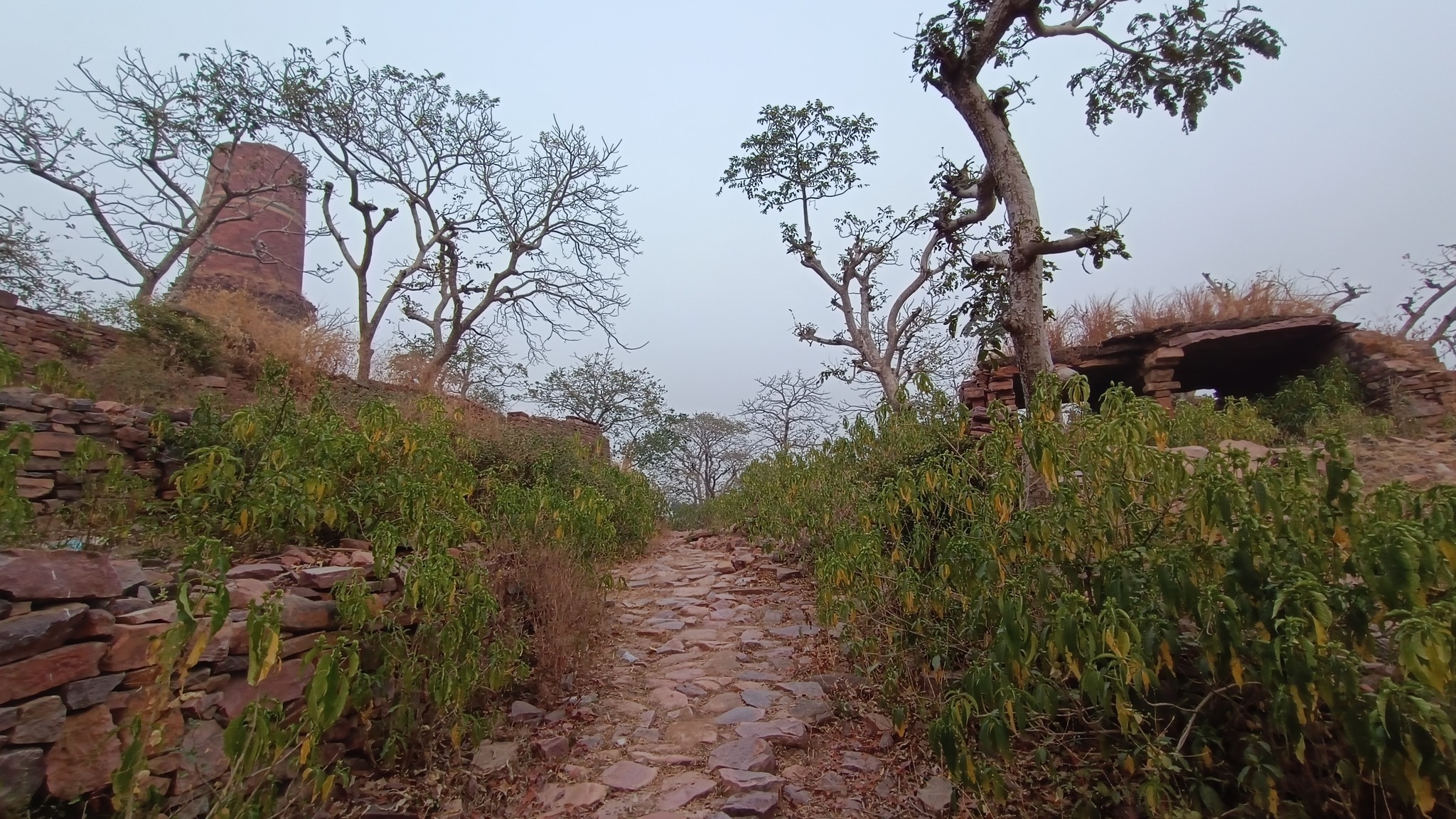
Think of Mandu as a place to see things in three clusters: 1. The Royal Complex comprising Jahaz Mahal, Hindola Mahal, etc., in the north 2. The Village area with monuments such as Hoshang Shah’s Tomb, the Jami Masjid, and Ashrafi Mahal, in between the north and the centre of the fort area 3. Rewa Kund Group with Baz Bahadur Palace, Rewa Kund and Rani Roopmati Pavilion at the extreme south of the fort area
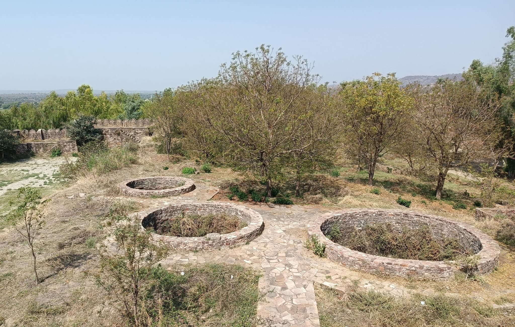
Apart from the above, you also can see the Sagar Talao at the centre of the fort, the Darwazas (gates) on the fort wall, 6th century Jain caves, multiple minor structures, little forts, and an echo point, where you can hear your own echo if you shout with an appropriate intensity.
Guide fee at the Royal Complex: Rs. 450 for a group of 4-5 people, as of November 2024.
Better to complete your visits of the monuments by 5 PM, although you do have access to the Jahaz Mahal at 7 PM for the Light and Sound show.
In October, during a brief illness, I got hooked on a book I had picked up in Udaipur in 2019 – Rajasthan: An Oral History, written by Rustom Bharucha, based on his conversations with the late Komal Kothari. Komal Kothari, who spent most of his prime documenting the folk music instruments, oral traditions and puppetry of Rajasthan, was instrumental in popularizing Managaniyar and Langa musicianship globally.
Komal Kothari’s insights into the relationship of the Rajasthani populace with their geography, natural elements, especially the arid stretches, their folk deities and folk traditions, as well as the intriguing interrelations amongst the various Rajasthani communities, left me in a trance. It was as if dormant connections to a distant past of mine were suddenly awakened. Besides, Komal Kothari lived in Jodhpur.
Now, since my 2019 outing to the Thar, Jodhpur had remained crouching in a corner of my mind. Mentions of Jodhpur anywhere, be it on social media, or television, or cinema, or by a friend, would stir long-repressed longings to go back to the city cradled in swathes of red-coloured escarpments. In two previous outings, everything that had to be seen in Jodhpur was already done and dusted with. Or, was it?
Nevertheless, in mid-November, my parents and I set off on our first-ever self-drive trip to Jodhpur via Salasar and Nagaur. What would follow was a spree of educational experiences: two involving things I had discovered about Jodhpur since our last outing, spurred somewhat by my reading during the intervening pandemic. And, a third we would just stumble into, and be pleasantly surprised by, despite my initial reluctance to indulge it.
A Living Museum
In an abandoned rock mine, on the low hill ranges encircling the western outskirts of Jodhpur, now covered with a blanket of grass and shrub, punctuated with the inimitable trio of ker, sangri and kumat trees, is located a unique interpretation of a museum. Arna Jharna Desert Musuem, literally meaning ‘forest and spring’, was the brainchild of Komal Kothari, who envisaged it as a showcase for the daily life of the regular desert folk.
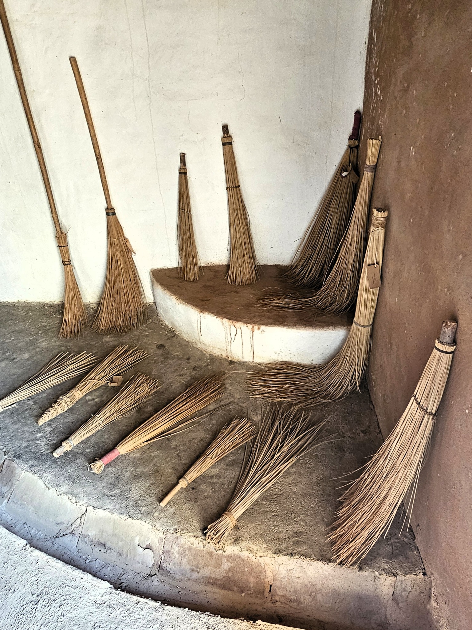
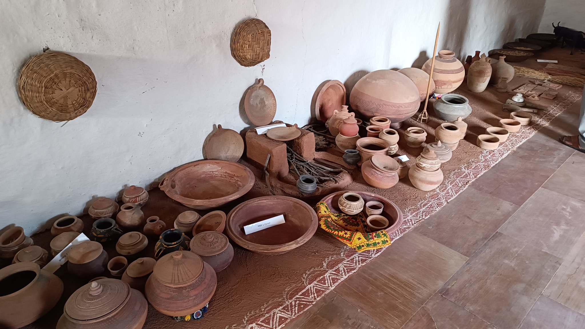
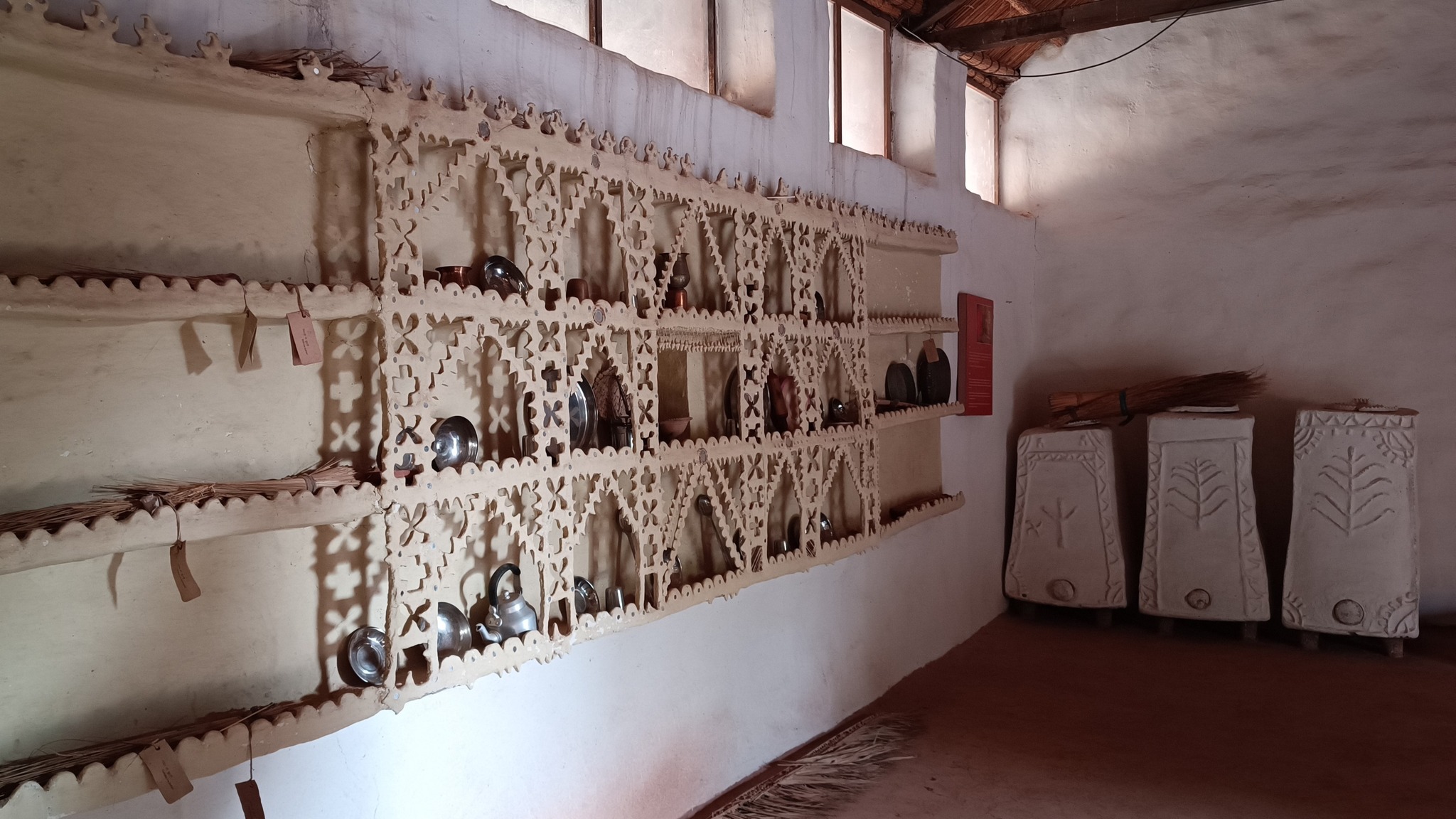
The museum began with a single concept of displaying an object that is inseparable from daily life across all communities – the broom. On display in a cluster of huts are many more elements of daily life – pottery, utensils, storage spaces, cooking apparatus. Also on display are aspects of folk culture and indigenous knowledge systems. For instance, a humongous collection of musical instruments used across Rajasthan curated by Komal Kothari himself through his lifetime.
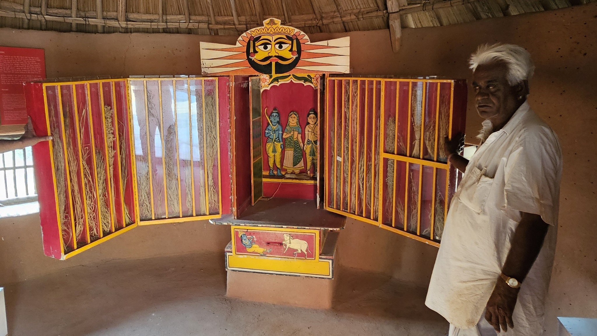
The most intriguing exhibit is a contraption serving as a portable shrine, called the kavad. A cupboard-like structure with multiple folds that can be progressively unfurled to reveal layers of shelves, it houses deities and pictorial depictions of religious stories and epics. The shrine moves from one place to another, accompanied by the storyteller, invariably from the bhat community, where he would narrate stories of the gods, folk-gods or epics to the patrons. Oftentimes, in the past, the patron would have a hereditary relationship with the bhat.
Walk towards the rear of the cluster of huts through the tall grass, and you reach the edge of a ravine with a stream that turns into a waterfall when it rains. The set-up of the huts in a cluster in a vastly open space reflects the general pattern of how habitation exists in and around the desert. The museum is highly recommended if one is keen for a glimpse into daily life in the desert, and into how daily life practices and processes have evolved within the ecological constraints of the desert.
A snapshot of the cluster of huts in the Arna Jharna Musuem
The Arna Jharna Musuem started with a single concept – showcase the broom, an integral part of life in the desert
Earthernware from the TharStorage places used in daily life in the Thar desert
The kavad is a portable shrine, a cupboard with multiple folds housing deities and pictorial narratives
The edge of a ravine in the Arna Jharna MusuemAnother glimpse of the Arna Jharna Musuem
A Nature Park
During the pandemic, I came across an interesting essay titled ‘Dying to Live’ in an anthology called Journeys through Rajasthan. Penned by the filmmaker-turned-naturalist, Pradip Krishen, it chronicles how a rocky desert landscape overrun by an invasive species mesquite (Prosopis Juliflora), colloquially called ‘bawlia’, was painstakingly transformed into a desert rock park through rewilding with desert-native plant species.
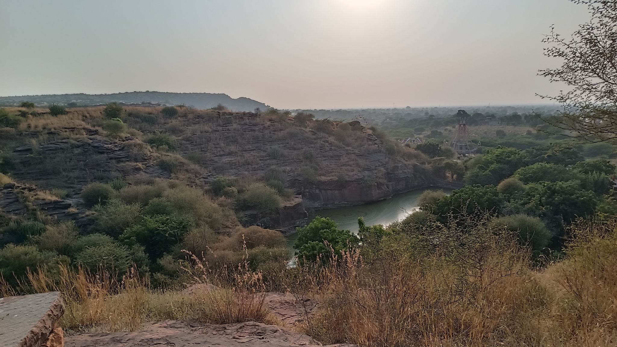
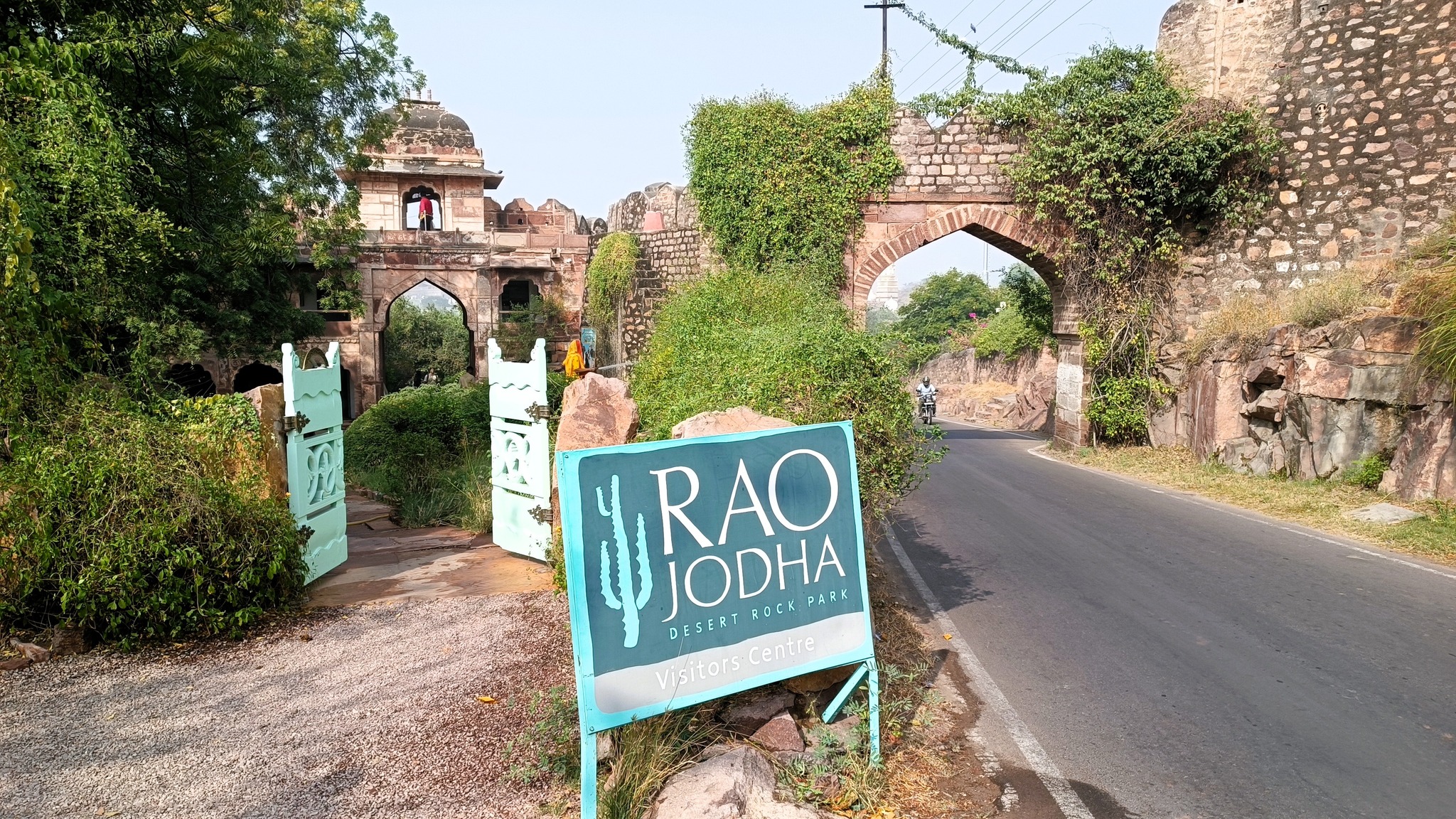
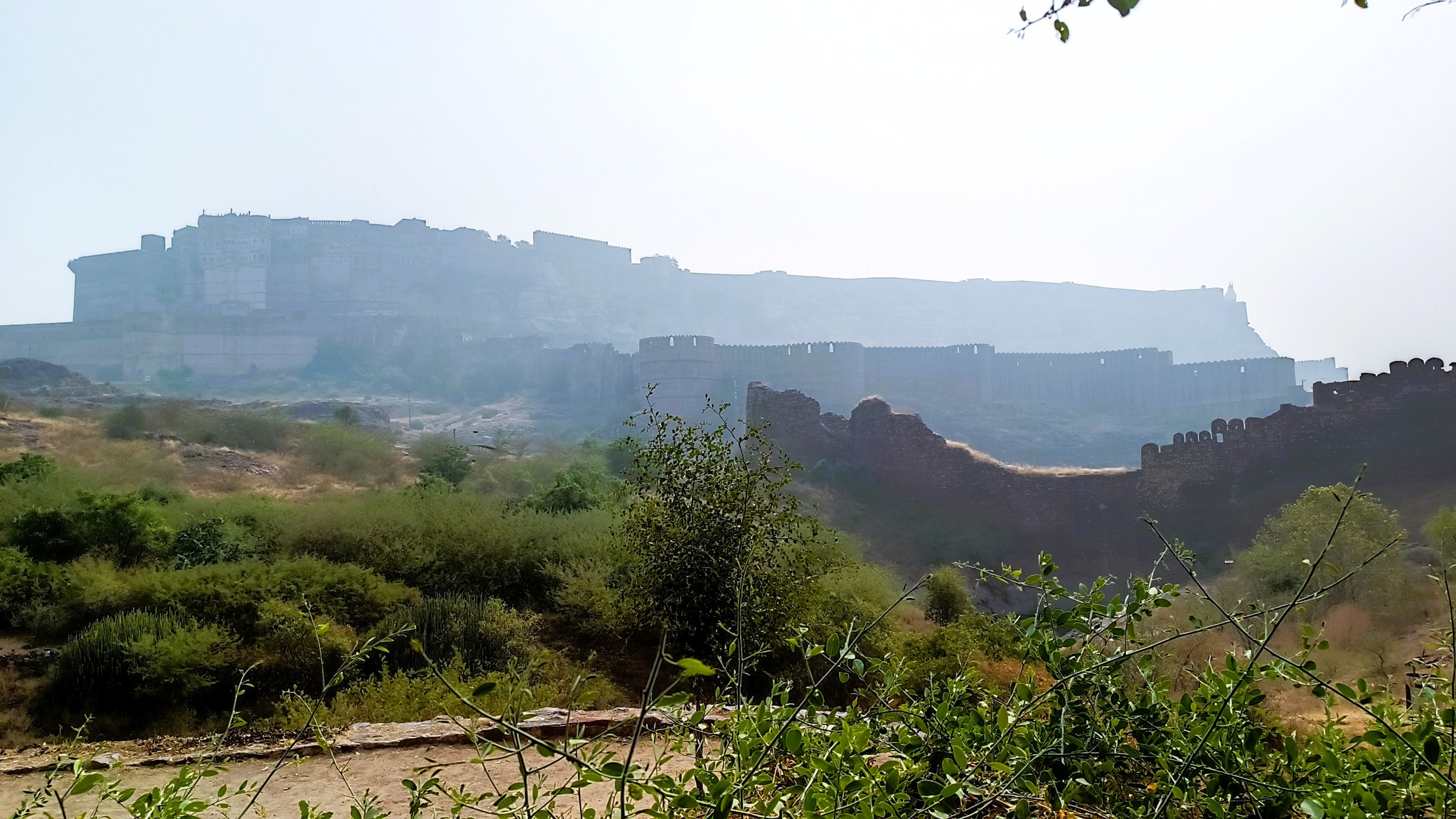
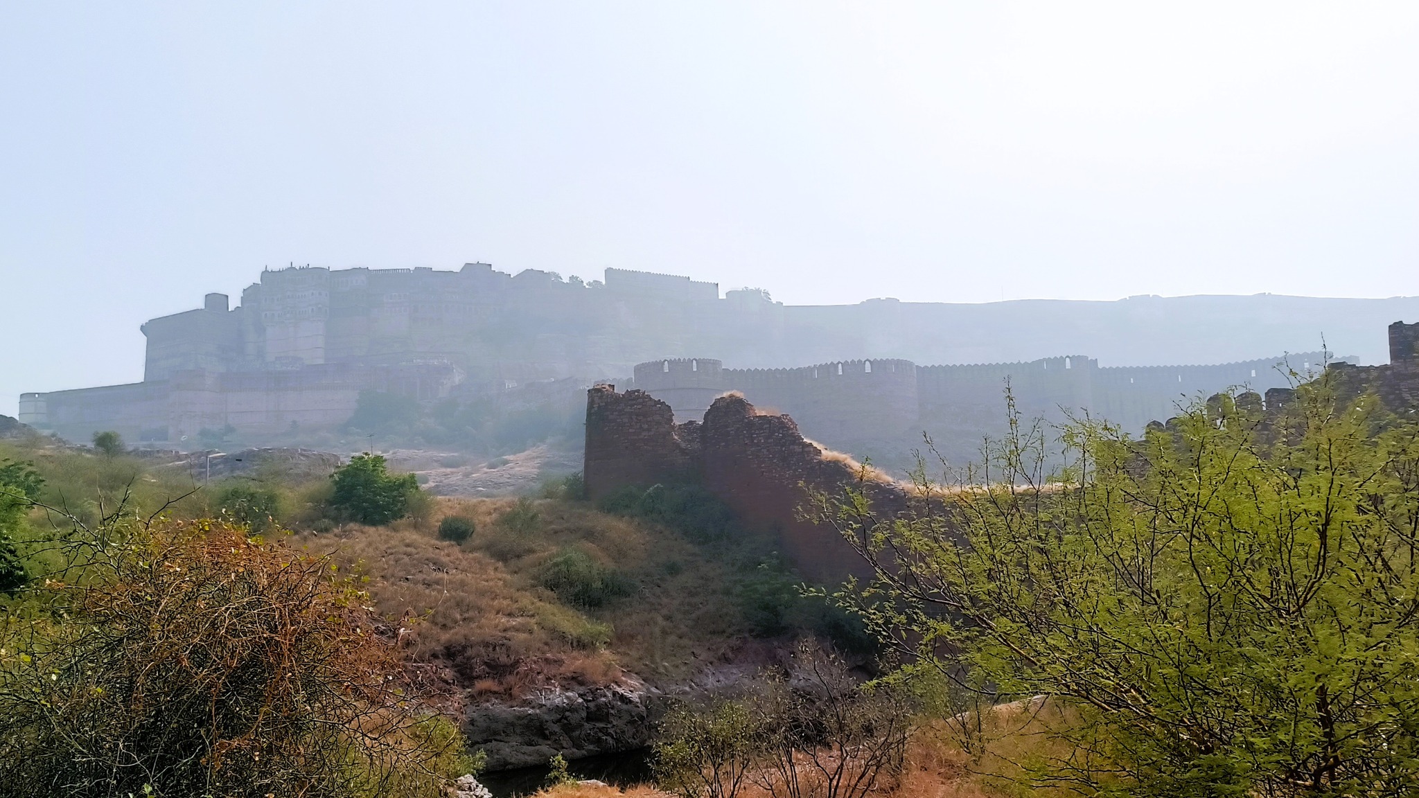
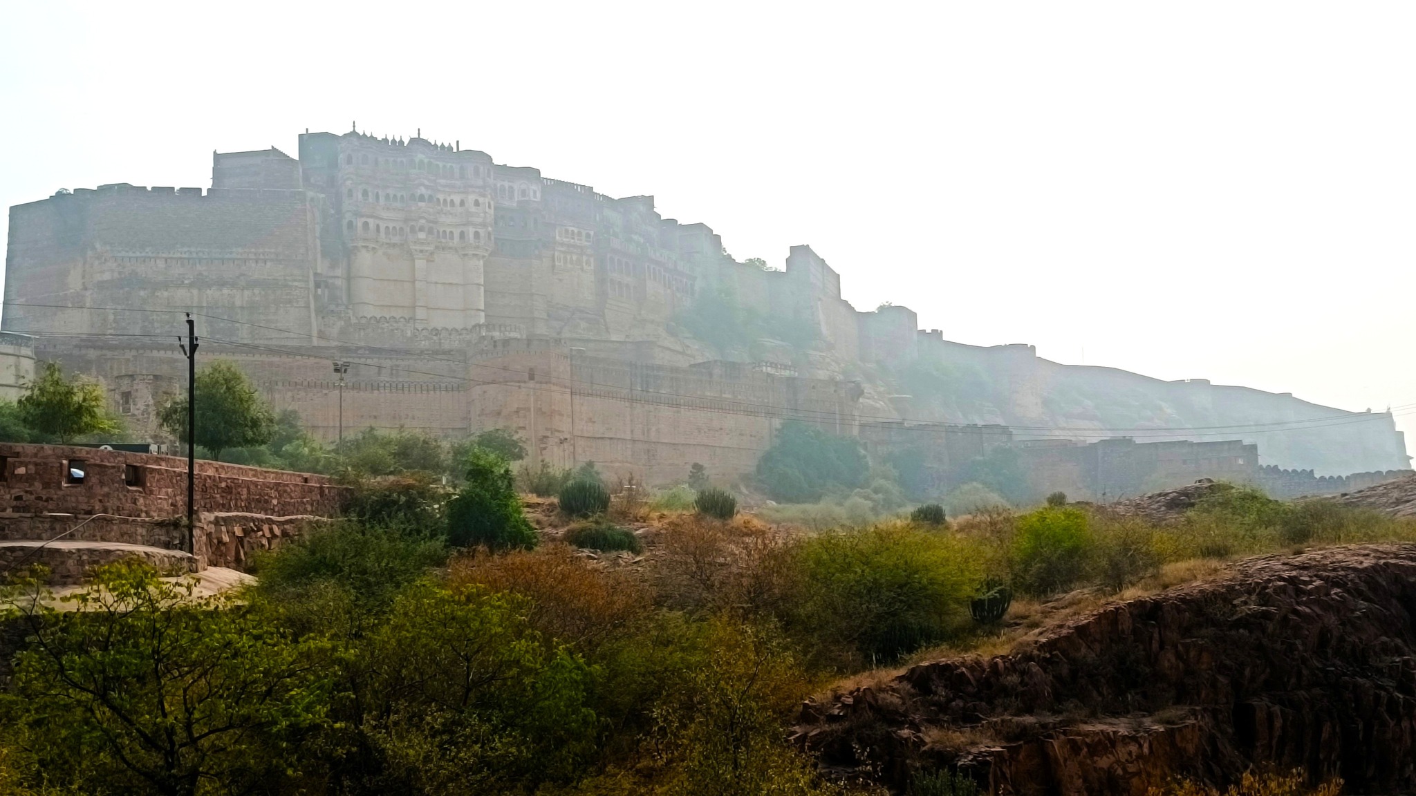
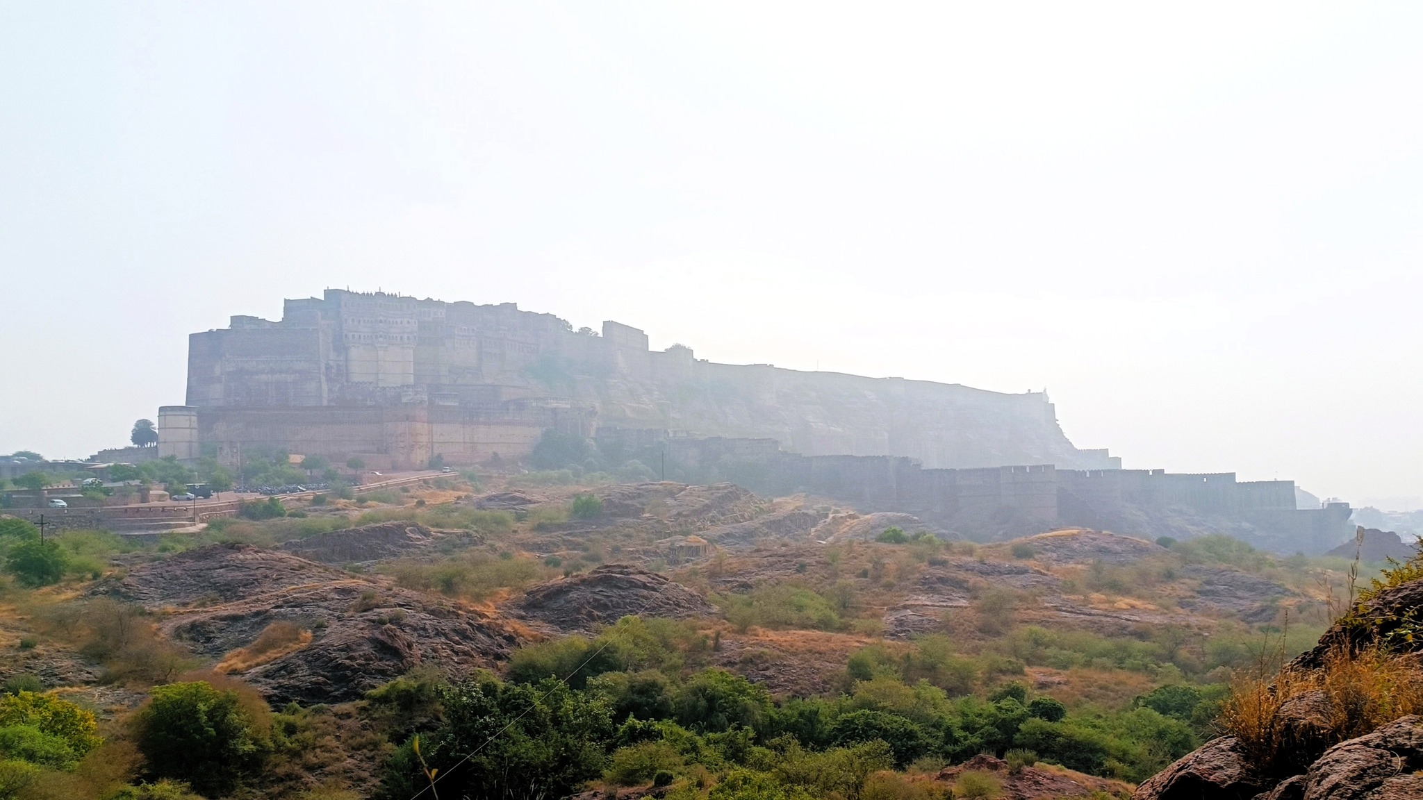
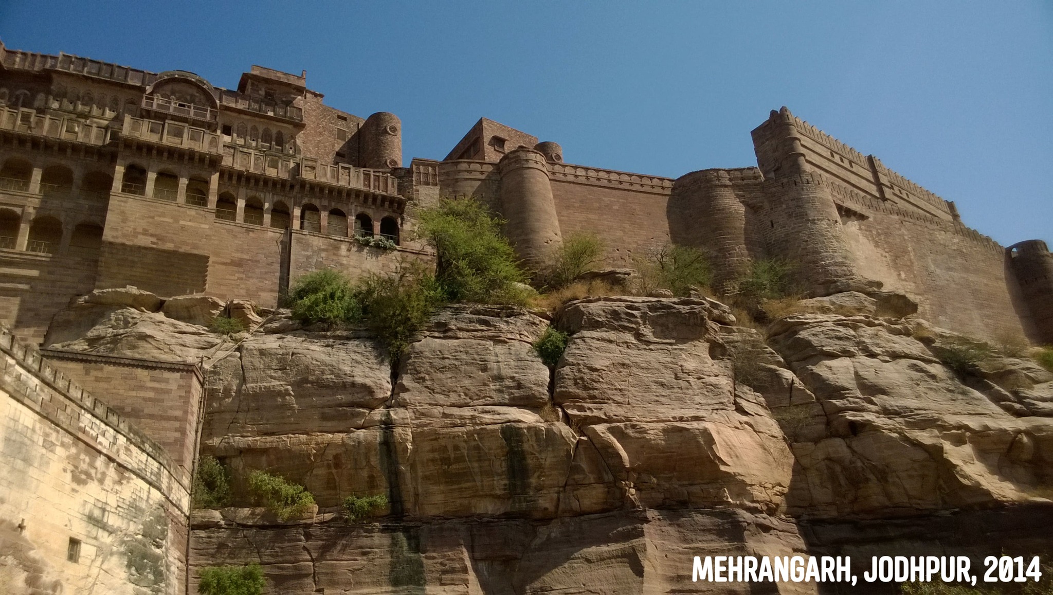
In fact, I had often wondered what lay behind the rocky outcrop holding up the Mehrangarh fort, and it turned out, it was this very park, the Rao Jodha Desert Rock Park. On our 2019 Jodhpur trip, we had even driven past the park on our way to Jaisalmer, but I had little idea back then that it was anything remarkable. Not until I learnt that the area in and around Mehrangarh fort was the site of not one, but two Geological Monuments of India – Jodhpur Group–Malani Igneous Suite Contact and Welded Tuff.
The Malani Igneous Suite consists of a variety of rock formations which resulted from a volcanic event occurring 750 million years ago. However, one variety of orange-pink coloured flat-faced columnar rock formations called rhyolite, is remarkable in that the Mehrangarh fort sits atop one such formation. And so does the park, sprawling across eroded hills and valleys of rhyolite, sprinkled with bits of welded tuff, another rock formed during the Malani event.
The park welcomes you with an assortment of rock sample exhibits, sourced from the western part of the subcontinent stretching from the Indus basin through the Thar desert to the Kachchh, with most from rock systems formed tens of millions years ago to more than a billion years ago. The most fascinating exhibit is a 635 million year old sample from the ‘Sonia Sandstone Formation’ near Jodhpur, containing ‘trace fossils’, which are traces of movements and burrows in the mud left behind by some of the earliest organisms which had no hard parts that could fossilize.
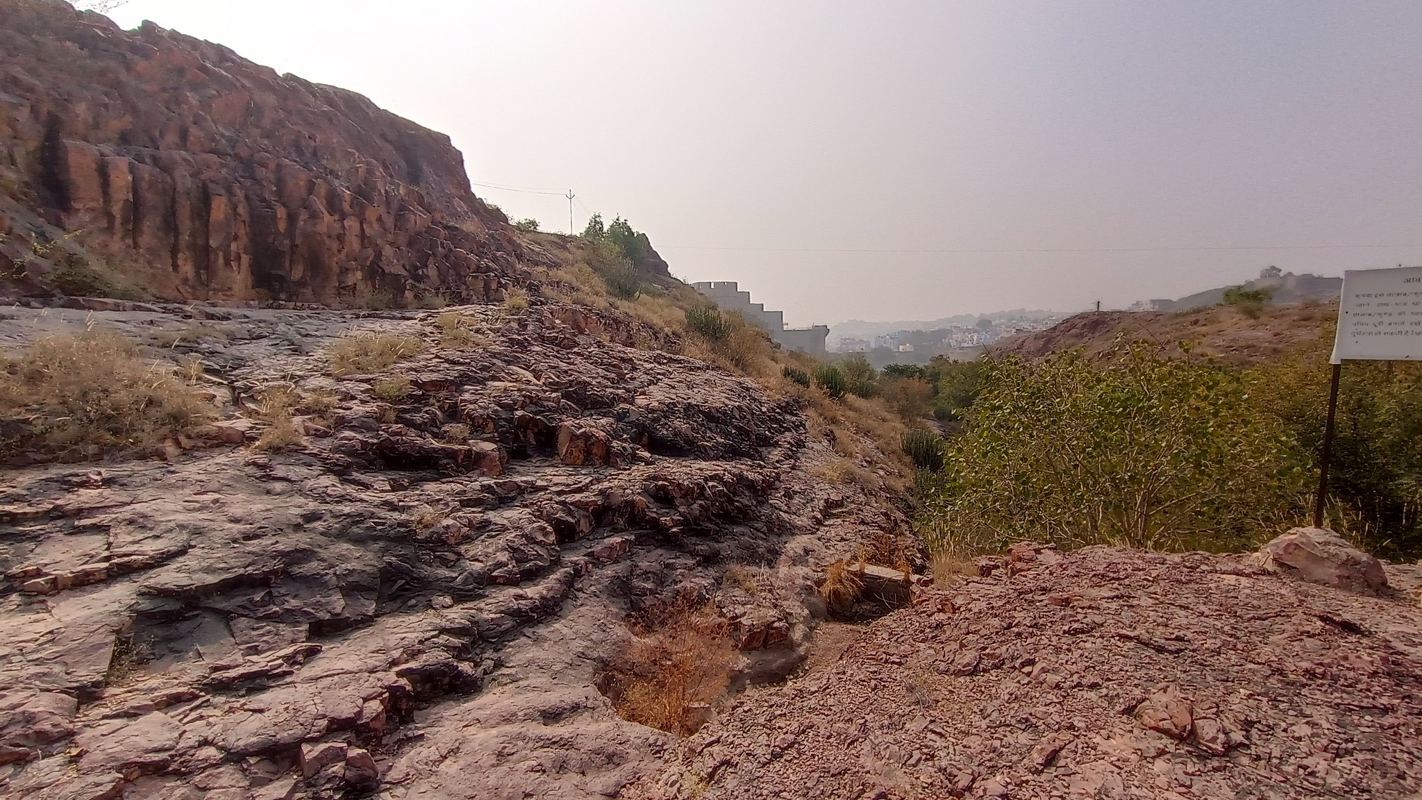
Just entering the arched stone gate where the ticket counter is located, one comes across an array of desert microhabitats that acts as a nursery for desert native plants. From that point on, a flight of stairs leads down to a 500 year old rainwater canal that channels water to the Ranisar and Padamsar lakes, some of Jodhpur’s oldest water reservoirs, located at the opposite end of the park. The canal, called the Hathi Nahar (elephant canal), which serves as one of the four trails earmarked in the park, cuts through a welded tuff formation, and soon meets a path that leads to the aforementioned lakes.
Another trail runs along the ancient city wall that also serves as a boundary wall for the park, and yet another trail meanders through the rewilded forest comprising more than 250 plant species. From most points of the park, one is treated to exhilarating views of the profile of the fort from various angles. My favorite location was from the edge of the Padamsar lake. Or was it from just below the foothills of the rhyolite hill on which the fort is located? I am confused.
Entrance of the Rao Jodha Desert Rock Park
A sample of Trace Fossil from the 635-million year old Sonia Sandstone formationThe Hathi Nahar rainwater canal at the start of the trail through Rao Jodha Desert Rock Park
View of Mehrangarh fort from the Rao Jodha Desert Rock Park
Yet another view of Mehrangarh fort from the Rao Jodha Desert Rock ParkA closer view of Mehrangarh fort from the Rao Jodha Desert Rock Park
Welded Tuff in the Rao Jodha Desert Rock Park
A glimpse of the Rao Jodha Desert Rock Park
Cannot get enough of the view of the Mehrangarh fort
The Thorr is the quintessential nurseplant of the Thar Desert, it is not a cactus, and serves as a habitat for 24 other species of plants
Devkund Lake near Jaswant Thada, also a part of the Rao Jodha Desert Rock Park
An Unusual Safari
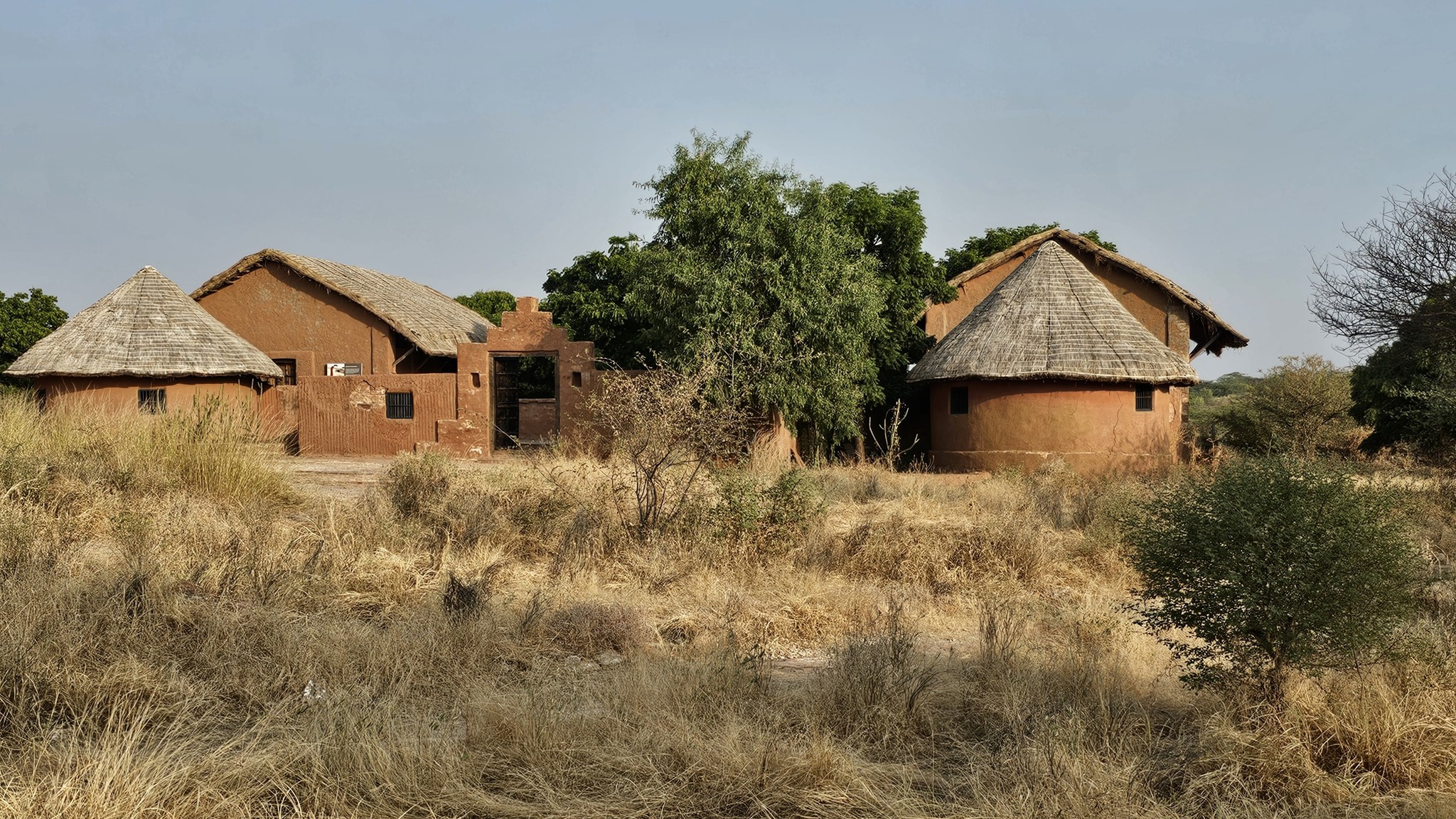
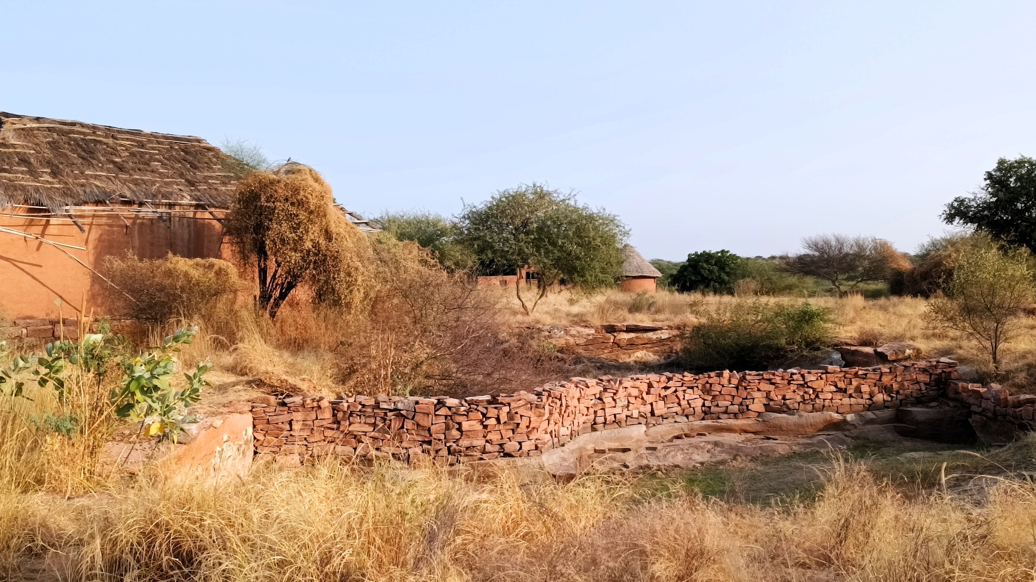
All this while, I had been debating with myself and my parents whether we should venture into a heritage or village style accommodation for the remaining night. Searching online, I had zeroed in on one candidate, Bishnoi Village Camp and Resort, located 30 km to the south of Jodhpur, somewhere in between Mogra Kalan and Kankani. Circumspect for the better part of the two preceding days, yet encouraged by many stellar recommendations of foreign tourists, we headed off to the resort.
And boy, were we bowled over by the host, who showered special attention on us, given that we were the only guests for that particular night. Following a late evening safari through the nearby villages, where we visited the workshops of craftsmen showcasing pottery, bedsheets and durries, we were treated to a most satiating and authentic Rajasthani meal, which included, among many things, bajra (millet) roti, kadhi, and the delectable Ker Sangri fortified with kumat.
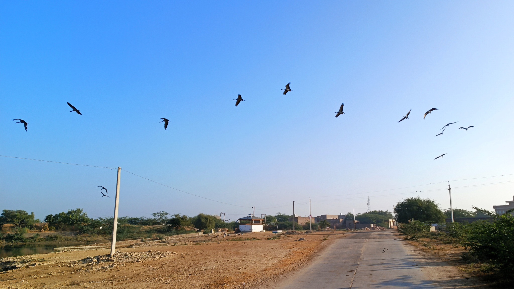
The next morning was a revelation of sorts, when we set out for a 7AM early winter safari to see the elusive blackbuck and the migratory demoiselle crane, colloquially called kurja. Imagine the surprise when we learned that we had been staying in the same area where the infamous 1998 blackbuck hunting which had offended the Bishnois, had occurred .
The Bishnoi community, in deference to rules set down by their founding guru Jambheswar, protects wildlife and vegetation, sometimes, with their lives. Testament to this is the 1730 AD incident from nearby Khejarli village, where a Bishnoi woman, Amrita Devi along with her three daughters, gave up their lives protecting khejri trees from the felling attempts of the king’s soldiers, triggering a wave of such sacrifices in 82 other Bishnoi villages where tree-felling had commenced. With the final tally reportedly reaching 383, the king, eventually, had to ask for forgiveness and abort the tree-felling activity.
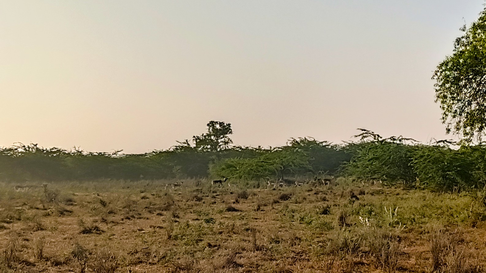
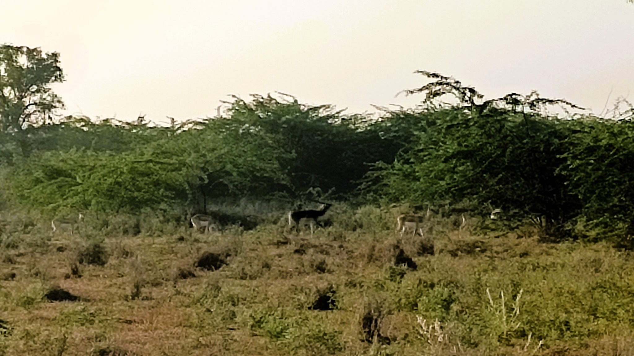
The blackbuck is even more sacred to the Bishnoi community, as Guru Jambheswar is purported to be reborn as a blackbuck. No wonder then that our safari included a stop at a memorial built by the Bishnois for the slain blackbuck. Then crossing the saline Luni river, the largest river of the Thar, and the only one that originates at Pushkar and ends in the Rann of Kachchh, we ventured into blackbuck territory. And lo and behold, in open spaces hidden behind curtains of bushes, we sighted a group of nearly 50.
However, as I learned, sighting blackbucks is not the challenge – it is just that the male blackbuck, which the layman has an image of in the form of a black upper body and white underbody, with long antlers, is rarer than the female blackbucks which have a brown upper body. Male blackbucks engage in lekking, whereby a single male takes control of a territory comprising multiple females and juveniles, driving away other males through aggressive means. It was interesting, however, to see two to three groups of blackbucks, led by their respective leading male blackbuck, mingling, while two male blackbucks at separate locations trudged through the forest, alone, in the distance.
With rapid urbanization, the wilderness available to species such as the blackbuck has rapidly shrunk. The forested area where we spotted the blackbucks, have, in fact, already been earmarked for future industrial development. It will not be long before the blackbuck population will be further impacted. Sadly, the convictions of the Bishnoi community can only do so much against this new advancing frontier.
A glimpse of the Bishnoi Village and Camp Resort
A memorial for the blackbuck slain in 1998A glimpse of the seasonal Luni river, largest in the Thar Desert
A herd of blackbucks in the distance
An attempted closer view with the puny phone camera, of a male blackbuck
A flock of demoiselle crane
Details for Visitors/Guests
Arna Jharna Museum
Entry fee: Rs. 100 per person Visiting hours: 8:00 AM – 6:00 PM
The museum also conducts cultural folk programmes on occassion.
Drive from Jodhpur to the museum is remarkable.
Rao Jodha Desert Park
Entry fee: Rs. 100 per person Visiting hours: March to September: 6:30 am to 7 pm October to February: 7:30 am to 6 pm
There are four trails, out of which three are in the area below the fort, i.e. the area which has been vigorously rewilded, and a fourth is around the Devkund lake, which lies adjacent to the Jaswant Thada, a short walk/drive away.
If time was a constraint, I would do the Yellow trail, to get a more involving flavour of the rewilding done in the park.
In warmer months, the trails are best done in the morning or evening.
Unsurprisingly, the park is at its beautiful best during the monsoons.
Keep an eye on their Instagram page to keep track of guided tours and other organized events.
Bishnoi Village and Camp Resort
Blackbuck and Village safari: Rs. 3000 for a group of 4-5 persons
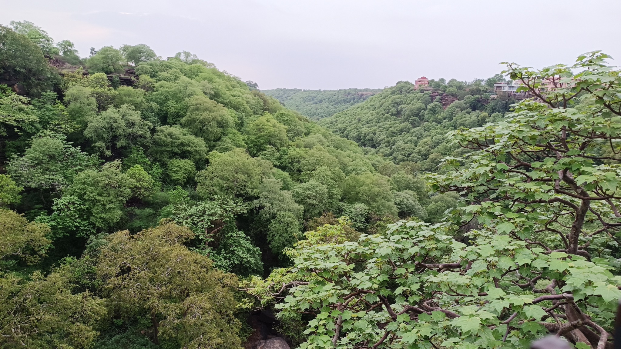
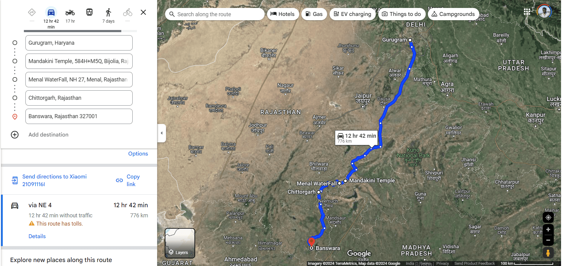
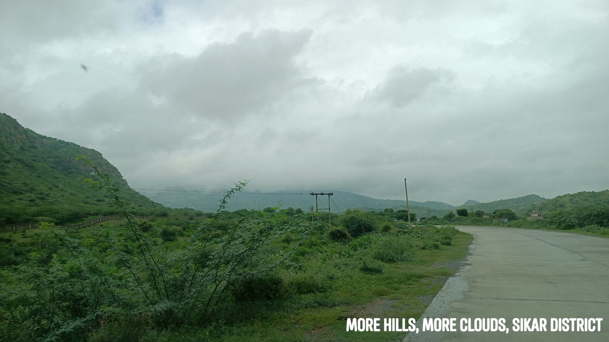
Continuing the tradition of the annual self-drive family trip, this year we decided to explore the lesser-known side of Rajasthan. Of course, this trip came about after having exhausted the roster of all the well-known Rajasthani cities, except Barmer, but it was really hastened by the incidence of the monsoons. It was now time to experience something different than the arid landscapes, desert expanses, and mountainous folds of the Aravallis. What better region than the south-western part of Rajasthan to soak in the splendour of the rain-sprinkled countryside?
The place in focus on this trip was Banswara, touted as the ‘city of 100 islands’—a place many travel bloggers exhorted to visit, specifically in the monsoons. However, Banswara, being a good 800 km from Gurgaon, necessitated stops, and the stops were better worth it. Those stops turned out to be Chittorgarh on the outward leg and Udaipur on the return, thus helping me fulfil my mother’s long-cherished wish of seeing Nathdwara and Ranakpur, and my own wish of showing my brother Kumbhalgarh. In fact, we did the latter three stops on the same day, surprising even ourselves!
As usual, we did not book accommodations beforehand, and simply let serendipity be our guide. That’s how I found myself at Chittorgarh Fort, at the same place, the same day I was 10 years ago. That’s how we beheld the beauty of a temple complex getting showered in a cloudburst. That’s how we chanced upon a temple complex with a waterfall, straight from the imagery of an Indiana Jones movie. That’s how we found ourselves meandering upon the low rolling hills leading to and adorning the course of the mighty river Mahi, with intermittent spells of monsoon rains for company.
Highlights of the road-trip
Mandakini Temple, Bijolia
This temple complex comprises three Shiva temples – the oldest being from the 11th century called Mahakal – and a water tank, and lay just beside our route to Chittorgarh. Just as we stepped out of the car, there was a cloudburst, forcing us to run inside the temple complex and take shelter under the roof of one the temples.
Main temple inside Mandakini temple complex, Bijolia
Water tank inside Mandakini temple complex, Bijolia
Temple showering in rainAftermath of rain
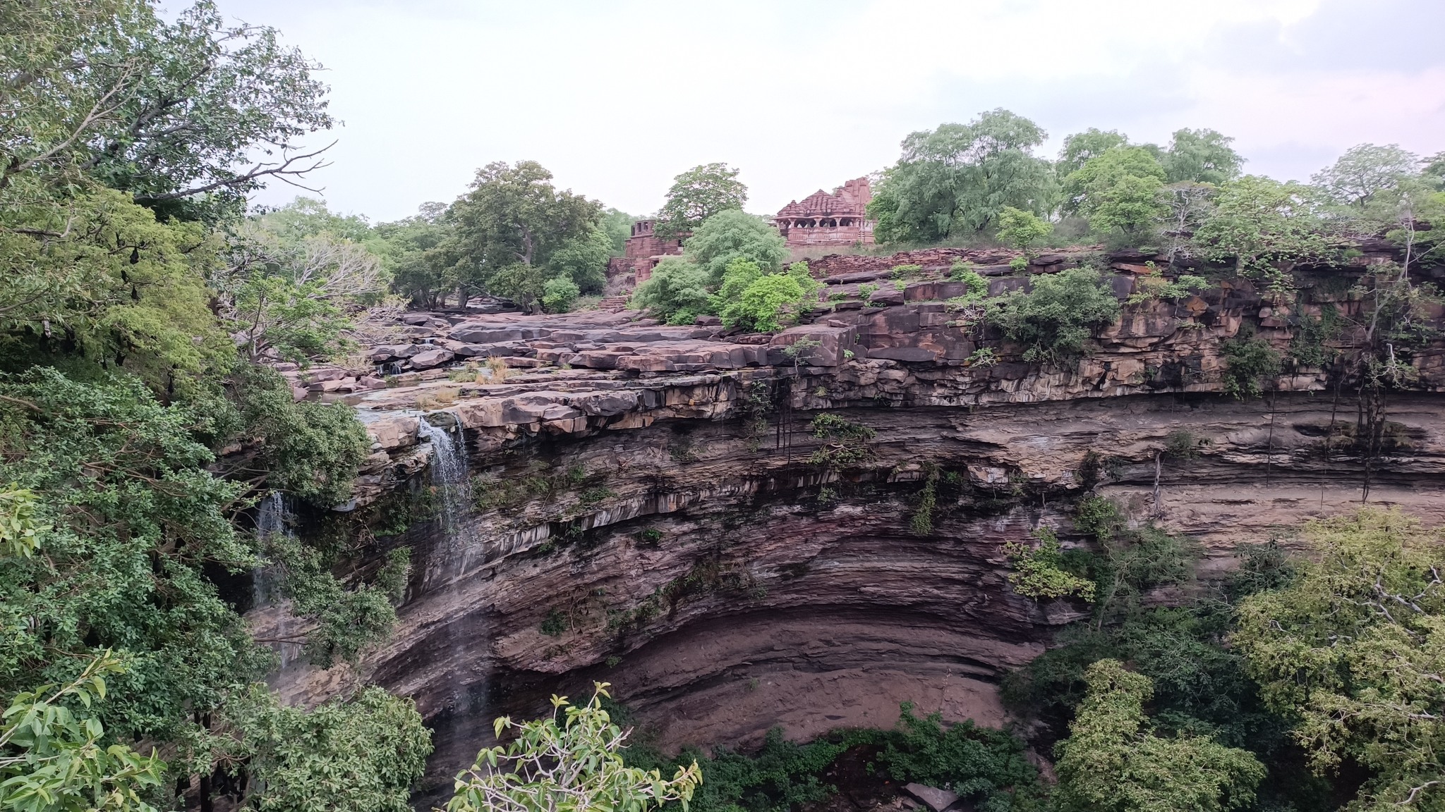
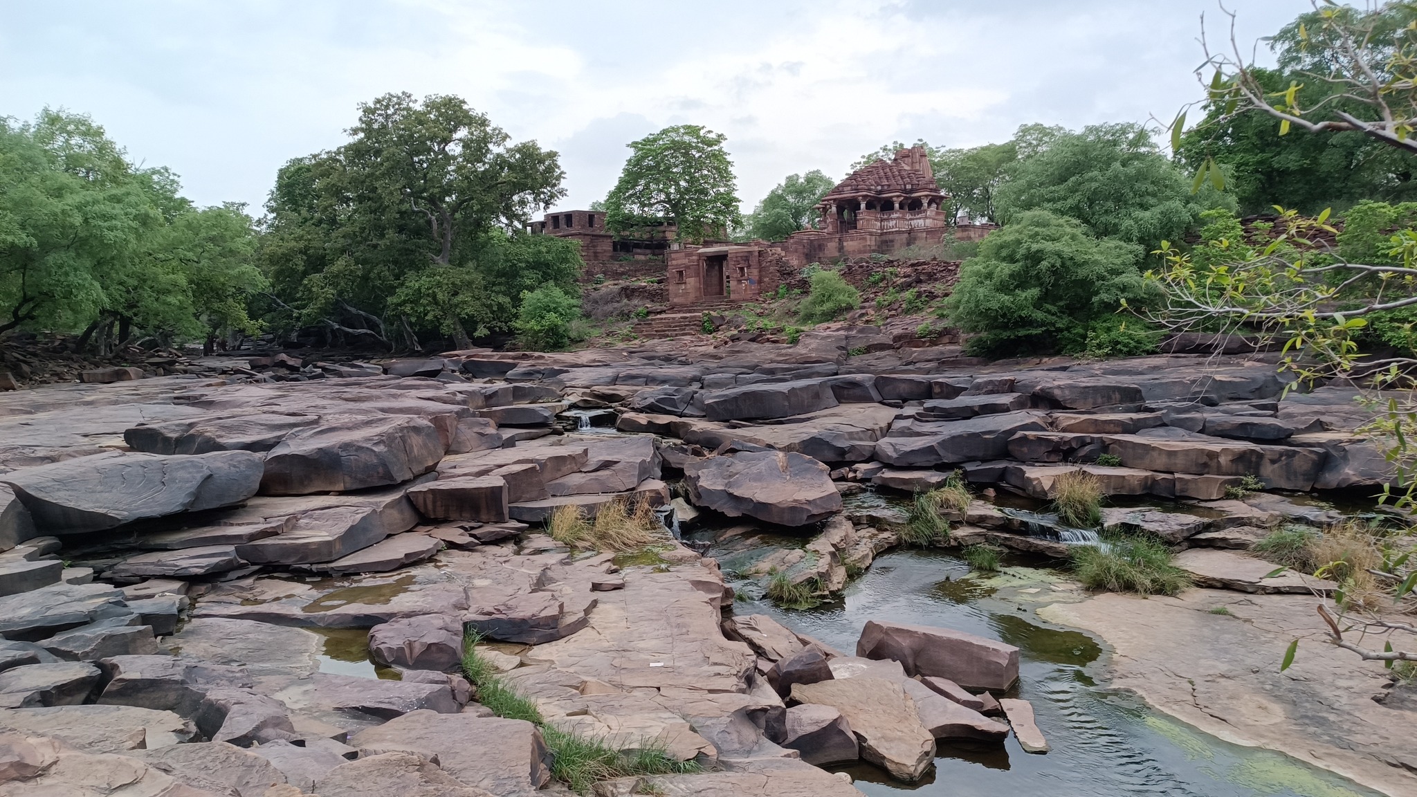
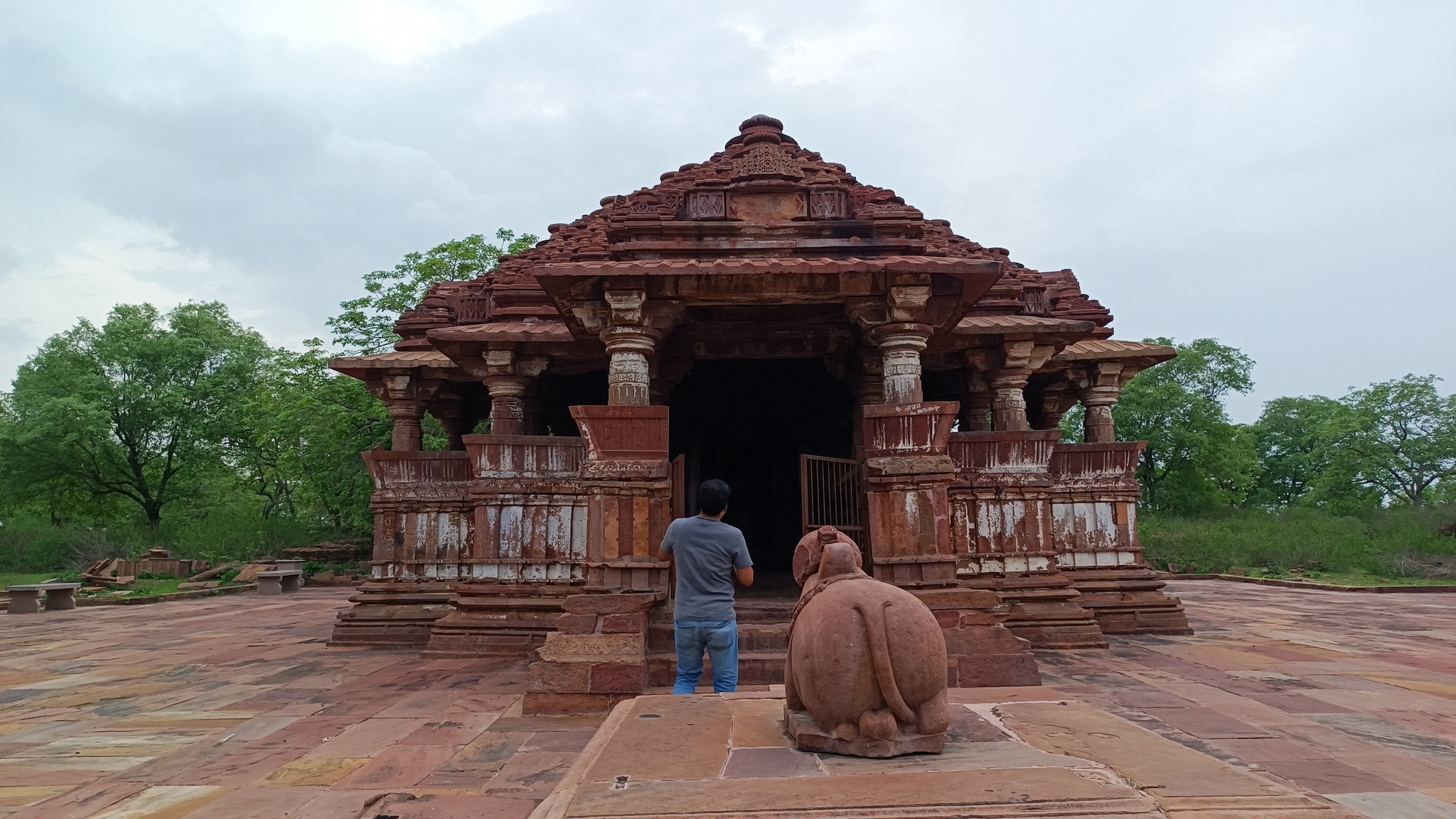
Menal and Mahanal temples, Menal
This was just an unexpected, happy accident that happened because my brother was simply scanning Google Maps on our way to Chittorgarh. The 11th century Shiva temple complex lies just beside the highway, nestled in a forest, straddling a stream with a waterfall dropping into a gorge. Across the steep waterfall is one of the temples, with an adjoining monastery in ruins, which one can access by simply crossing the stream before it drops into the gorge. Now, that’s truly a set-up venturing into Indiana Jones territory.
Menal waterfall with temple across the gorge
Crossing the creekTempleMonastery
Canyon lush in midst of monsoons
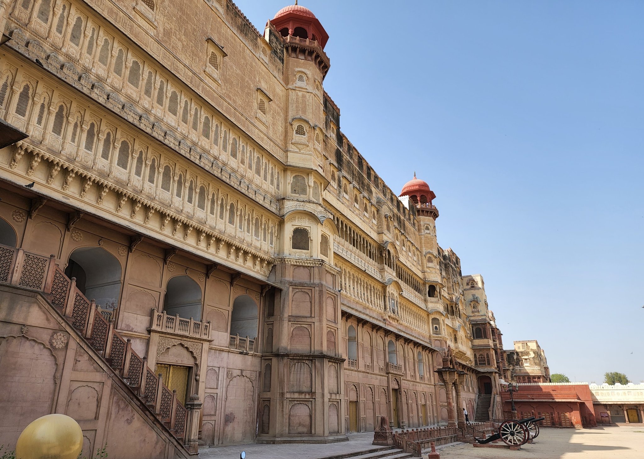
Chittorgarh
What can be said in a line or two about Chittor fort that would capture what it is, what it stands for, what legacy it bears, what history it has seen!
But what struck me most upon first visiting the place, and has remained with me since, is how it is a self-contained city spread upon a vast flat-topped hill, like on a plateau. The palaces and structures are far-flung, interspersed with water tanks and jungle. This is a place that is removed from the rest of the world that lies beneath, one that transports you to another era as a time machine.
Samadhiswara temple in Chittorgarh fort premises
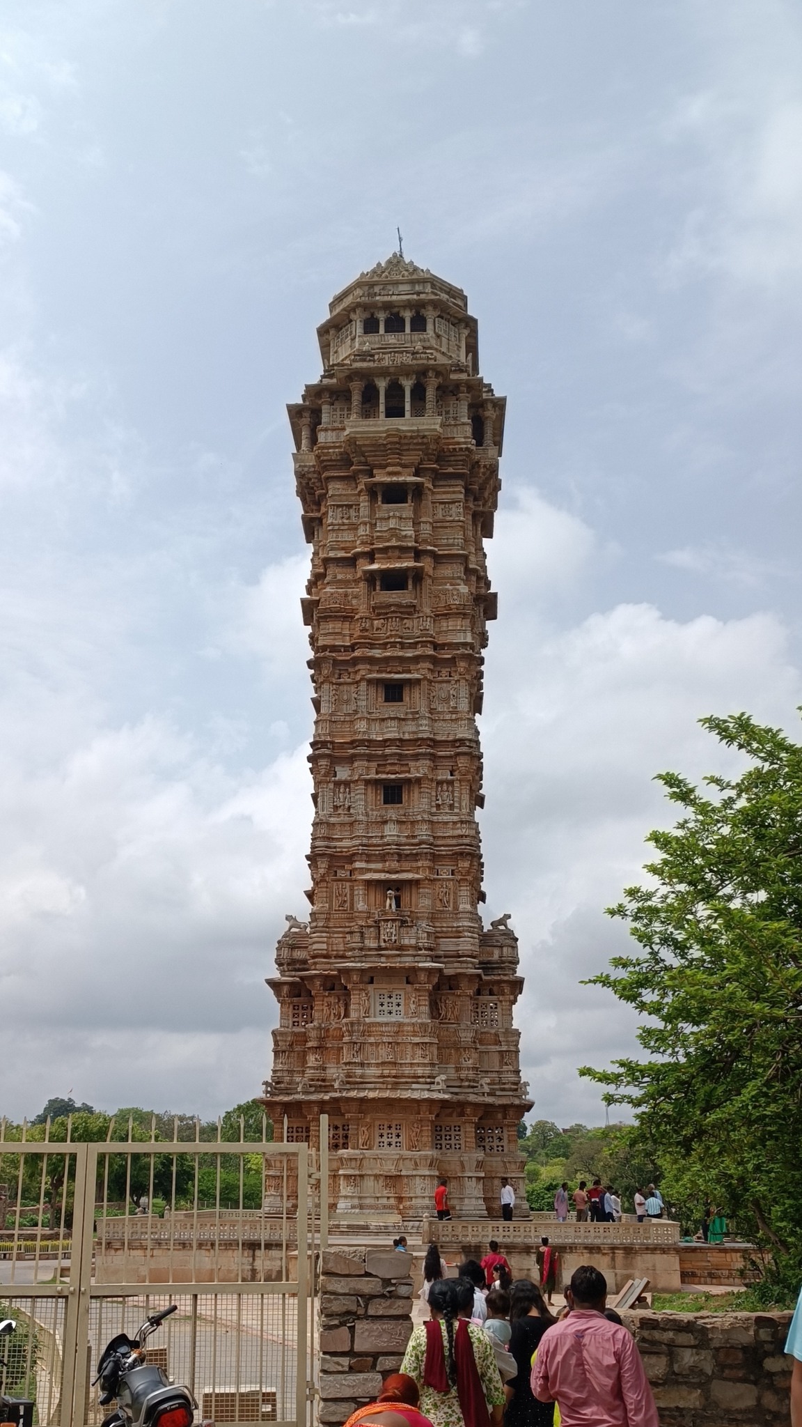
Vijaya Stambh, ChittorgarhThree faced-Shiva in Samadhiswara temple
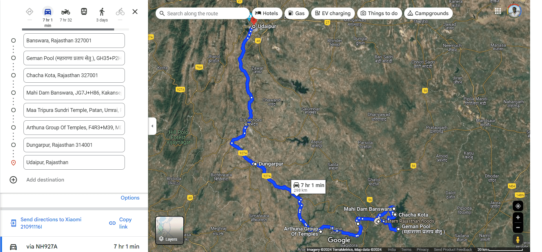
Banswara
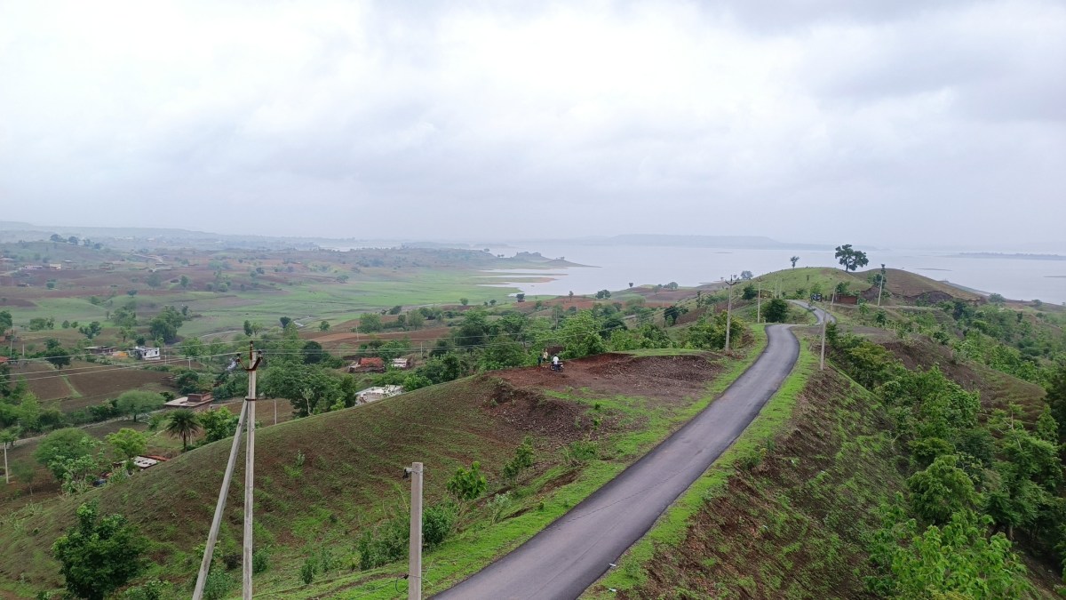
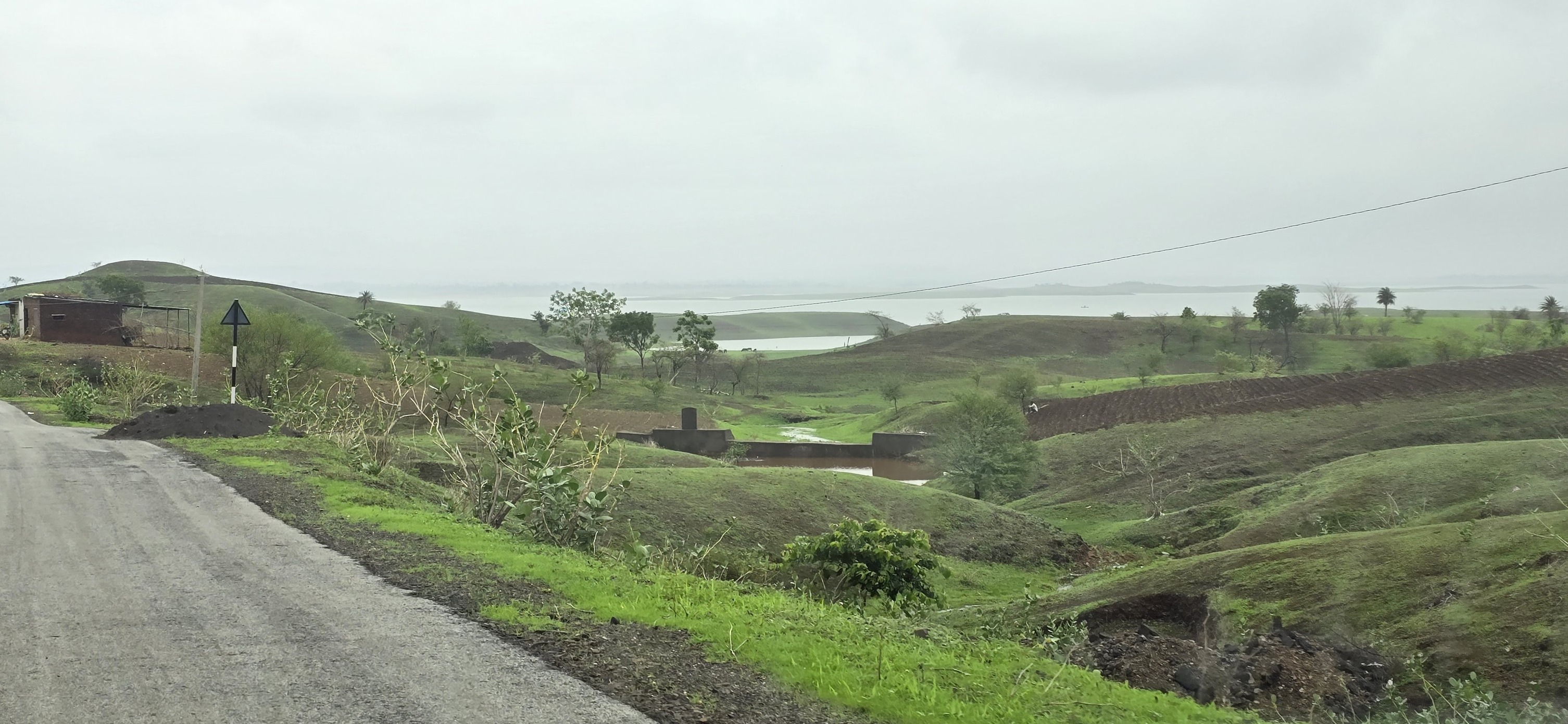
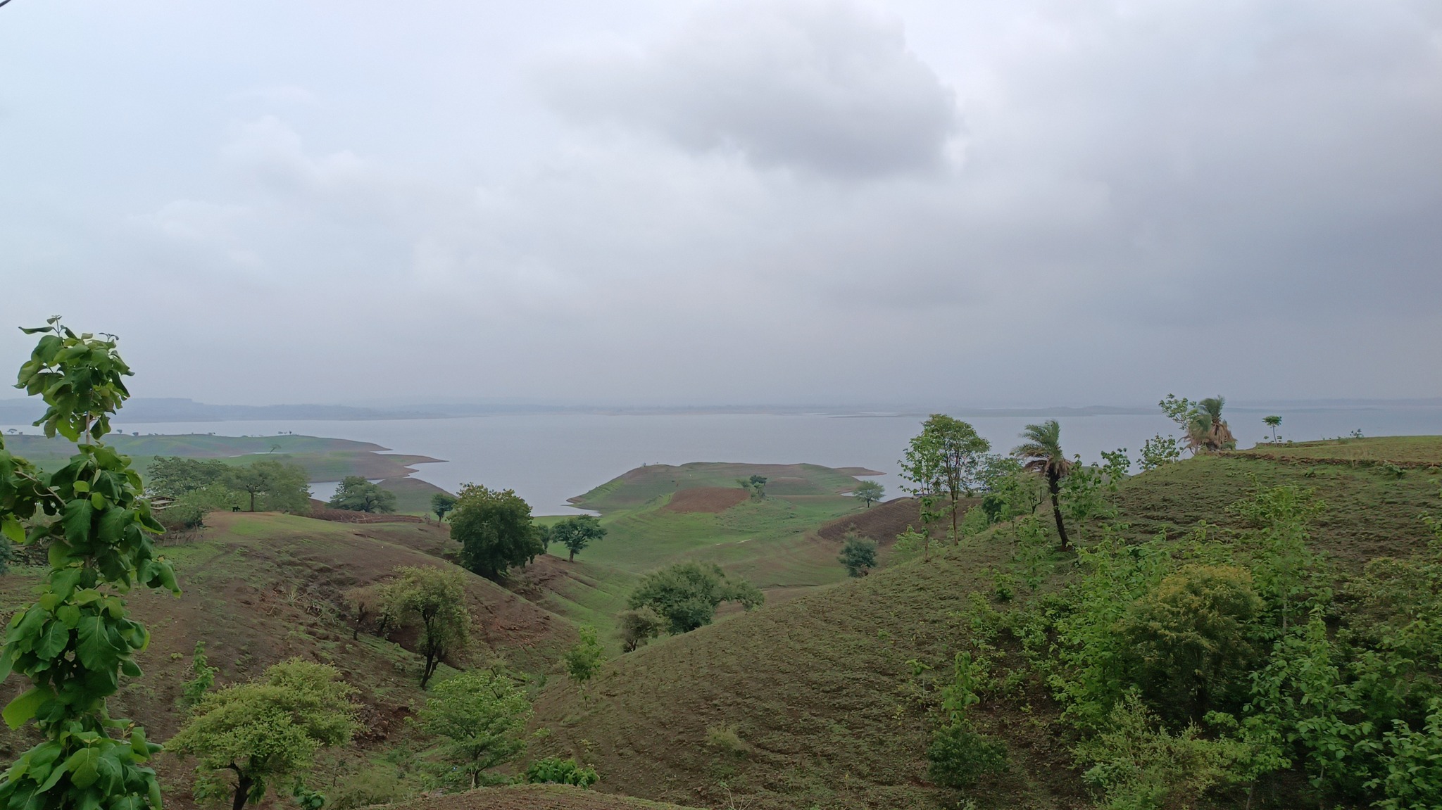
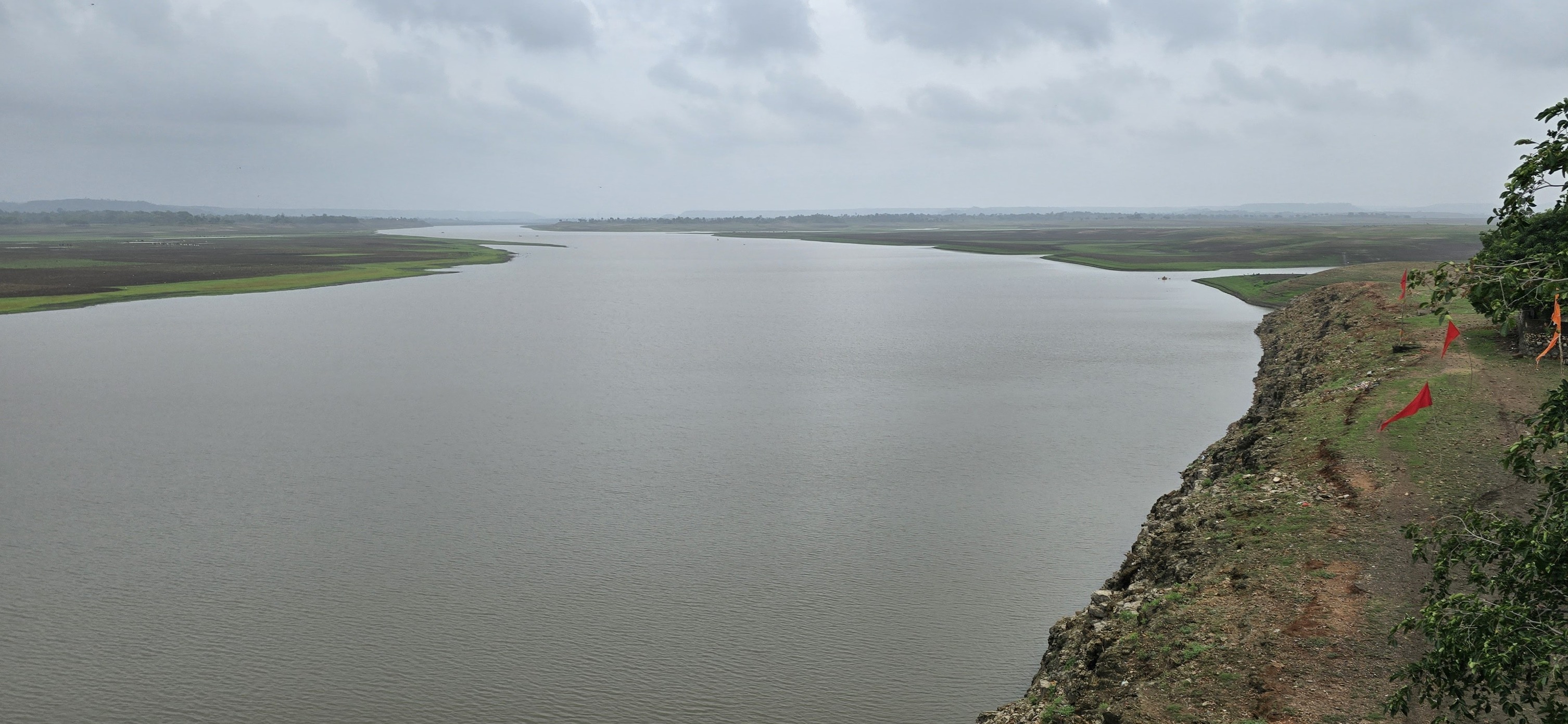
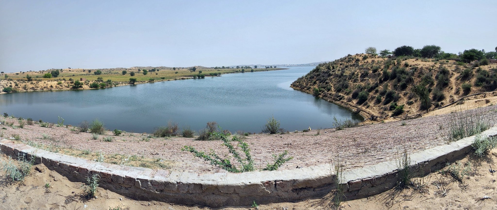
Banswara region lies in the Mahi catchment area in south-west Rajasthan, and is home to the massive Mahi Dam. The region is typified by low rolling hills undulating for miles, whose tops turn into meadows in the monsoons, evoking scenes from a Kashmiri landscape. This topographical feature has also led to formation of islands in the reservoir created by the Mahi Dam.
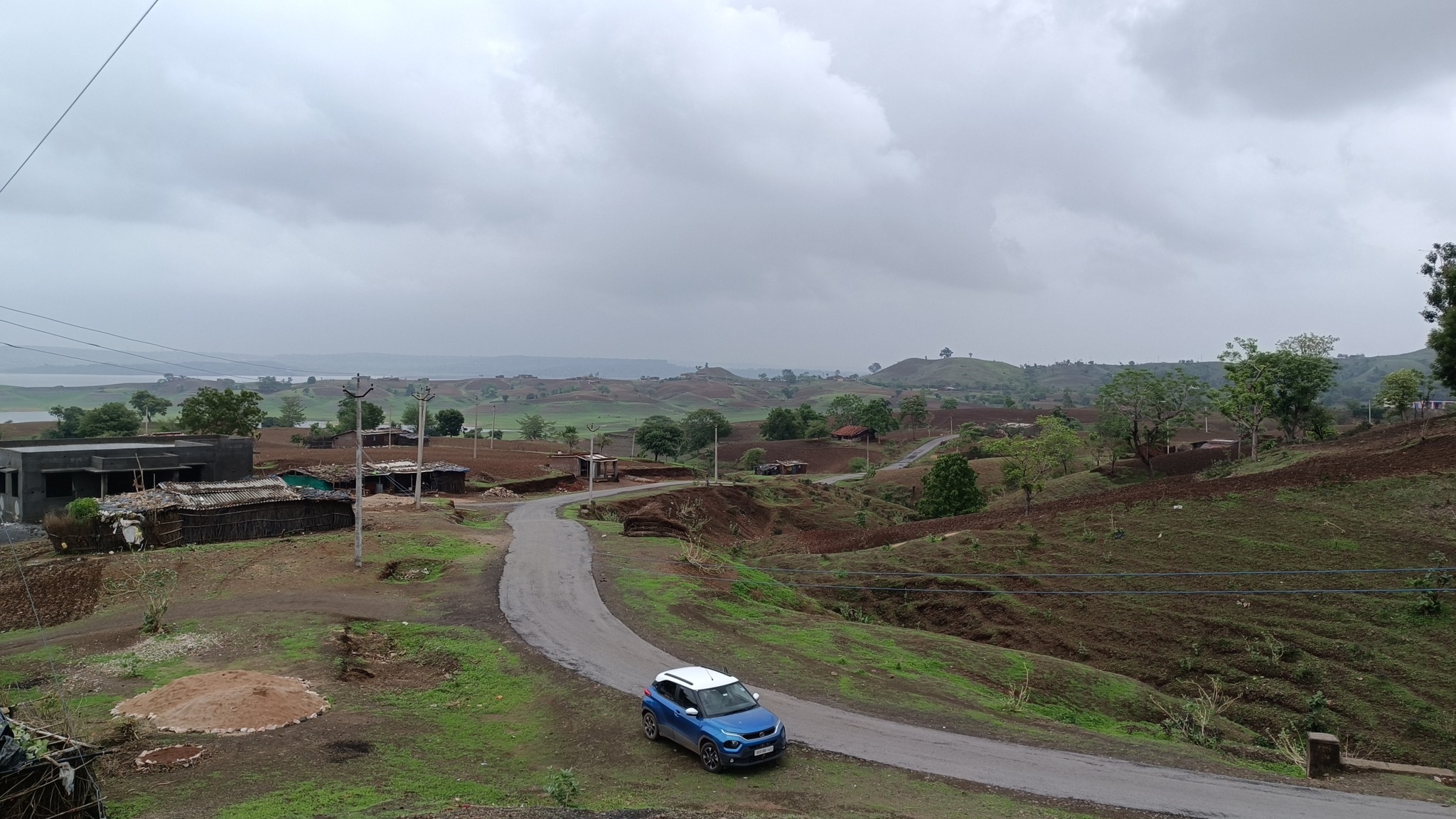
Enroute BanswaraMeadows with windmills enroute Banswara
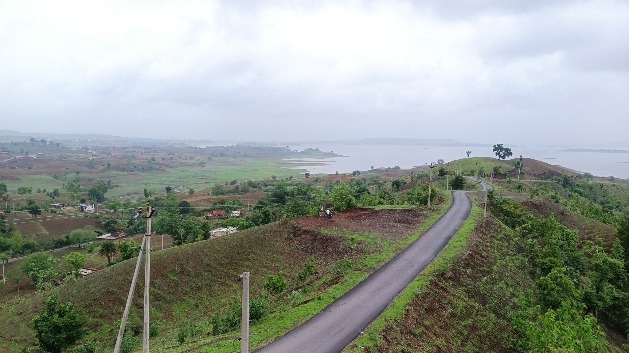
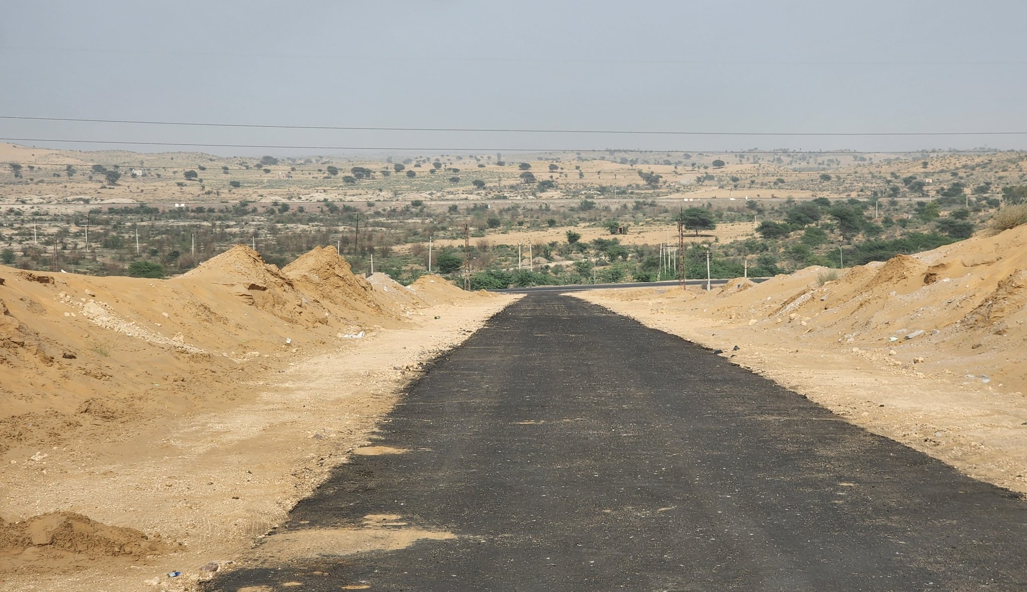
The road, winding across the ridges, leading to a village called Chacha Kota, affords a roller-coaster like ride with breathtaking views of the low rolling hills stretching to the horizon, as well as the islands in the reservoir. With overcast skies, you might even feel you’re gliding through the clouds.
Chacha Kota
Glimpses of the landscape on the road between Banswara and Mahi River Dam via Chacha Kota
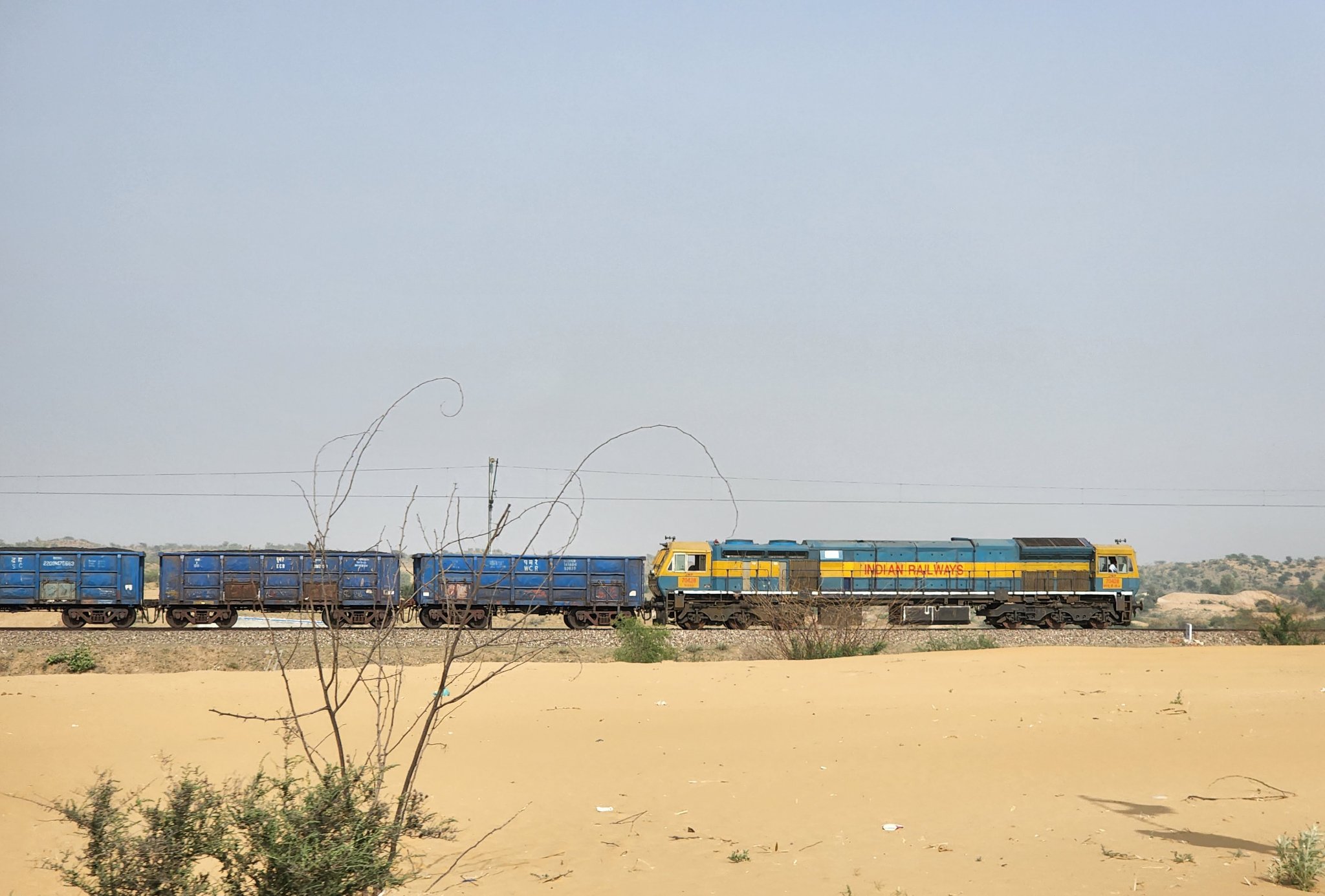
Another point of significance is the long Maharana Pratap Setu (Bridge) over the Mahi River on the road to Ratlam, where the Tropic of Cancer also passes through.
Maharana Pratap Setu (Bridge) over Mahi RiverTropic of Cancer at the Maharana Pratap Bridge
Arthuna
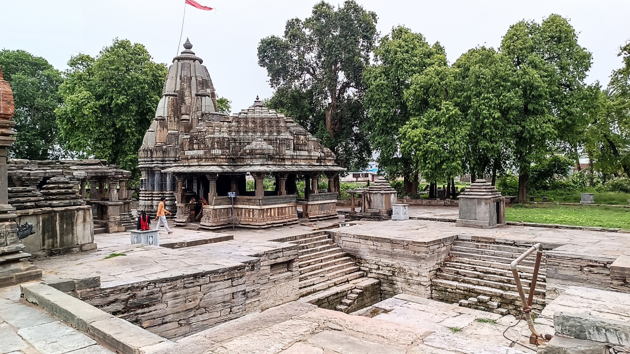
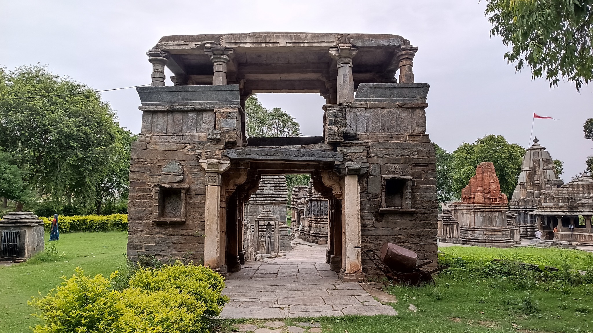
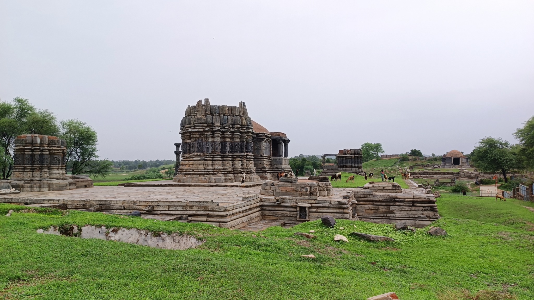
Arthuna, also called Utthunaka, the capital of the Paramaras of Vagad in the 11th-12 century AD, was an important commercial centre at the time. Home to a complex containing multiple temples, from the same period, dedicated to Shiva, and a stepped tank. What is interesting is that outside this complex, there are ruins of even larger temples, and several mounds probably concealing even more structures.
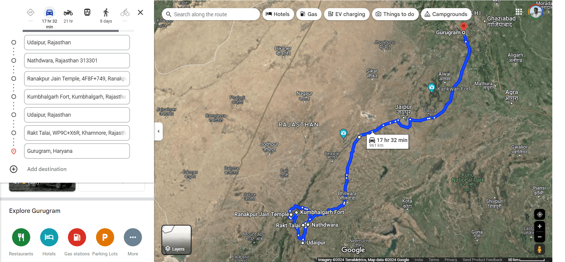
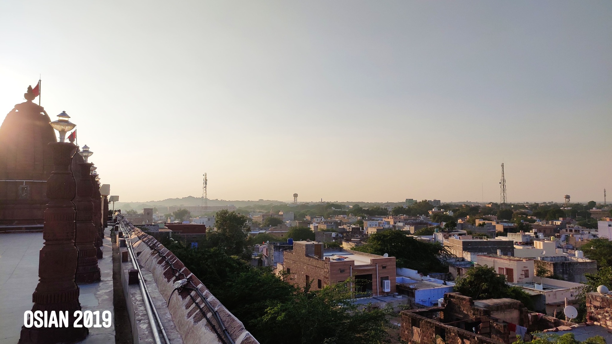
Nathdwara
Home to the temple of Shrinathji, an infant form of Krishna.
Ranakpur
A 15th century Jain temple built entirely in marble sits majestically in the jungle at the Aravalli foothills. I would put this temple alongside the Taj Mahal as a mediaeval wonder of India.
The magnificent Ranakpur Jain temple
Interiors of the Ranakpur Jain temple
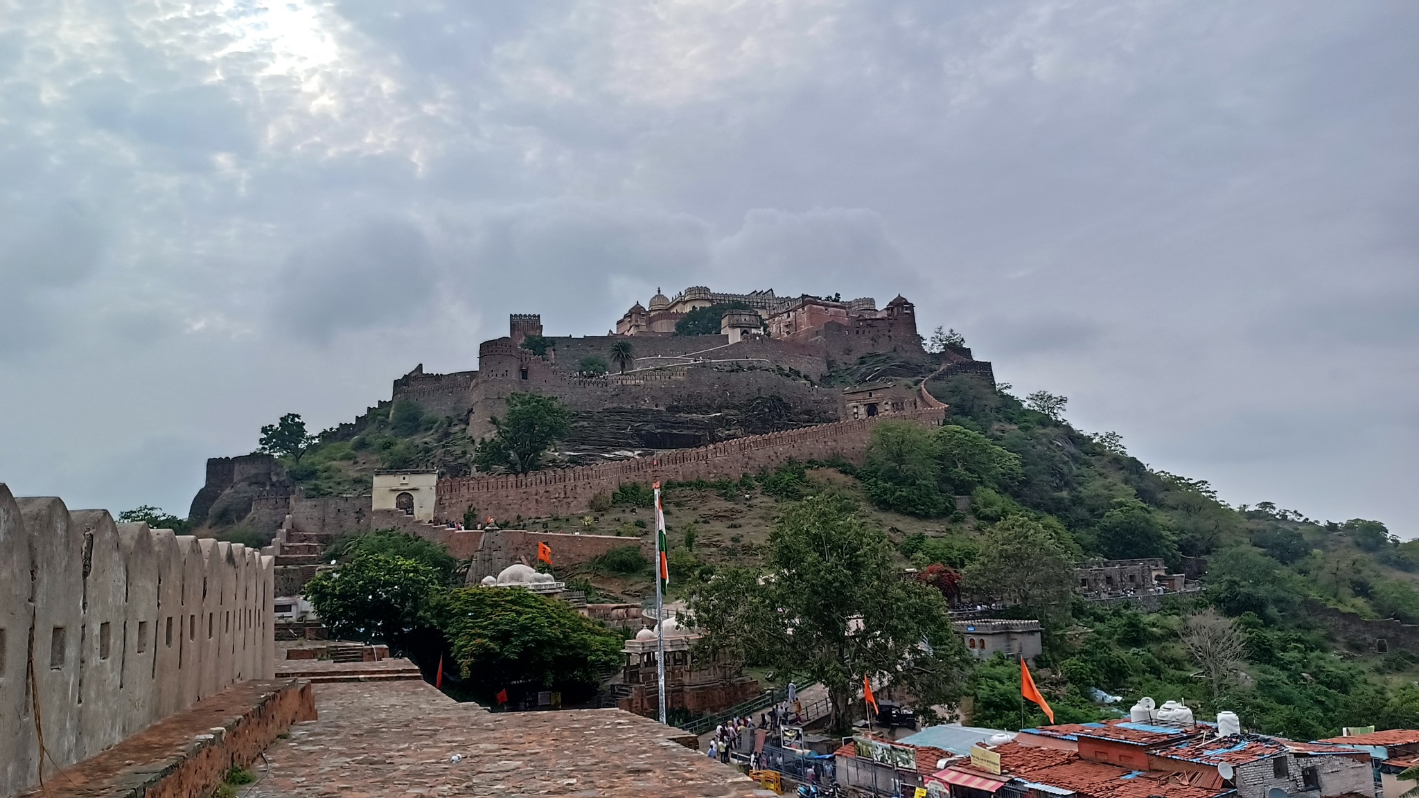
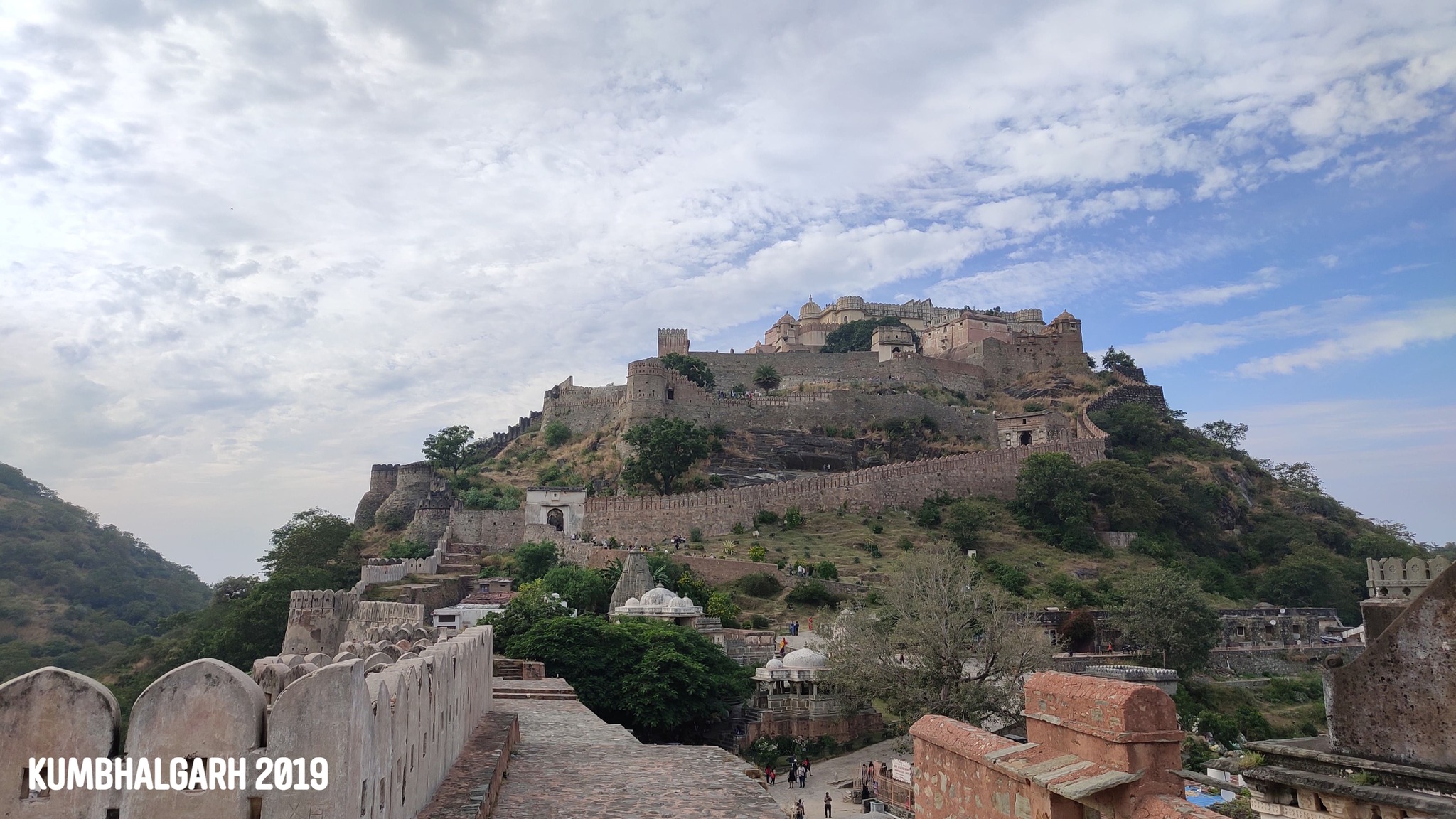
Kumbhalgarh
Another historic fort, the birthplace of the legendary Maharana Pratap, and hailed as the fort with the longest fortification wall in India (2nd in the world) at 36 km. From the top of the main palace, aptly named Badal Mahal (or Palace of the Clouds), it is said, one can see the Marwar on one side, and Mewar on the other.
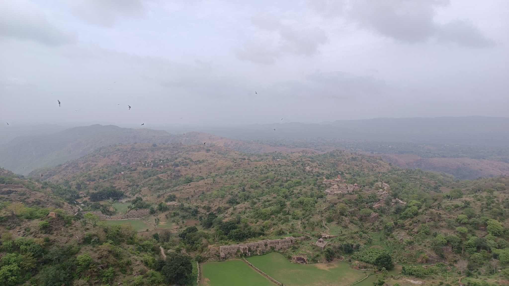
At Kumbhalgarh
Mewar landscape from atop KumbhalgarhGlimpses of Kumbhalgarh
Rakt Talai (Pool of Blood)
As one crosses Haldighati pass, the region around which served as the battleground between the armies of Maharana Pratap and Akbar, and reaches Khamnore, there comes a depressed patch of land where a pond is said to have existed. The pond is said to have turned red with rainwater that trickled down into it, after mixing with the blood of those fallen in the battle of Haldighati on 18 June 1576.
Rakt Talai
Trip Summary
Day 1: Gurugram to Chittorgarh via Bijolia and Menal
Day 2: Chittaurgarh fort, and then on to Banswara
Day 3: Banswara and thereabouts including Mahi River Bridge, Chacha Kota and Mahi Dam. On to Udaipur via Arthuna and Dungarpur
Day 4: Udaipur to Nathdwara, then on to Ranakpur and Kumbhalgarh, and back to Udaipur
Day 5: Udaipur to Gurugram via Haldighati and Bhilwara
In my search for places that could be visited on a single day trip from Gurugram, Khetri seemed to pop up on a few occasions. I did try to plan a Khetri trip a few times over the last three years, even attempting to rope in my colleagues once, but it was not to be, especially since it would need a detour from all the major roads. I also abolished thoughts of doing a solo drive to Khetri because I was uncertain about the condition of roads and the remoteness I would encounter.
That was until the time my parents were here in Gurugram, and we really had to find something for a day trip before they returned to Odisha. While mother is always excited for any arbitrary new place, father only agreed once I brought to the fore the connection of Khetri with Swami Vivekananda. So, off we started on a mid-December morning around 10 AM in the quest to uncover Khetri.
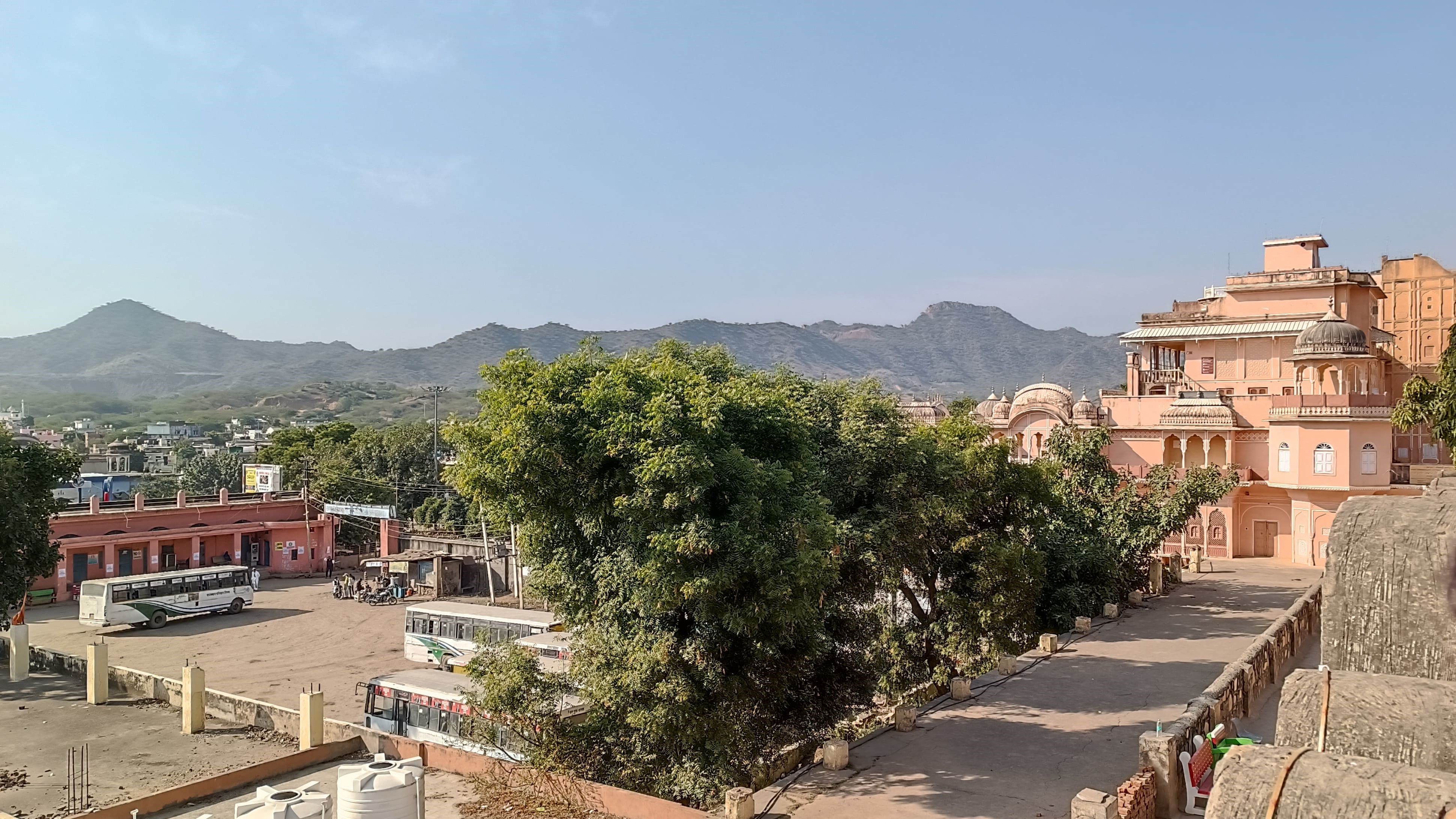
We first drove towards and bypassed Rewari, then took NH 11 – that runs westwards to Jaisalmer through Jhunjunu – till Singhana, and then turned to the left, passing first by a low stretch of the Aravalli, and then approaching a pass in a cluster of the low Aravalli hills. Soon we were flanked by the Aravallis on both the sides, as we drove up the road winding through the pass, and finally reached a wide patch of undulating land surrounded by the Aravallis, with low houses and buildings sprawling across the dry valley, and swarming with people betraying a certain laid-backness in their demeanour.
On the way to Khetri, taking a turn from Singhana
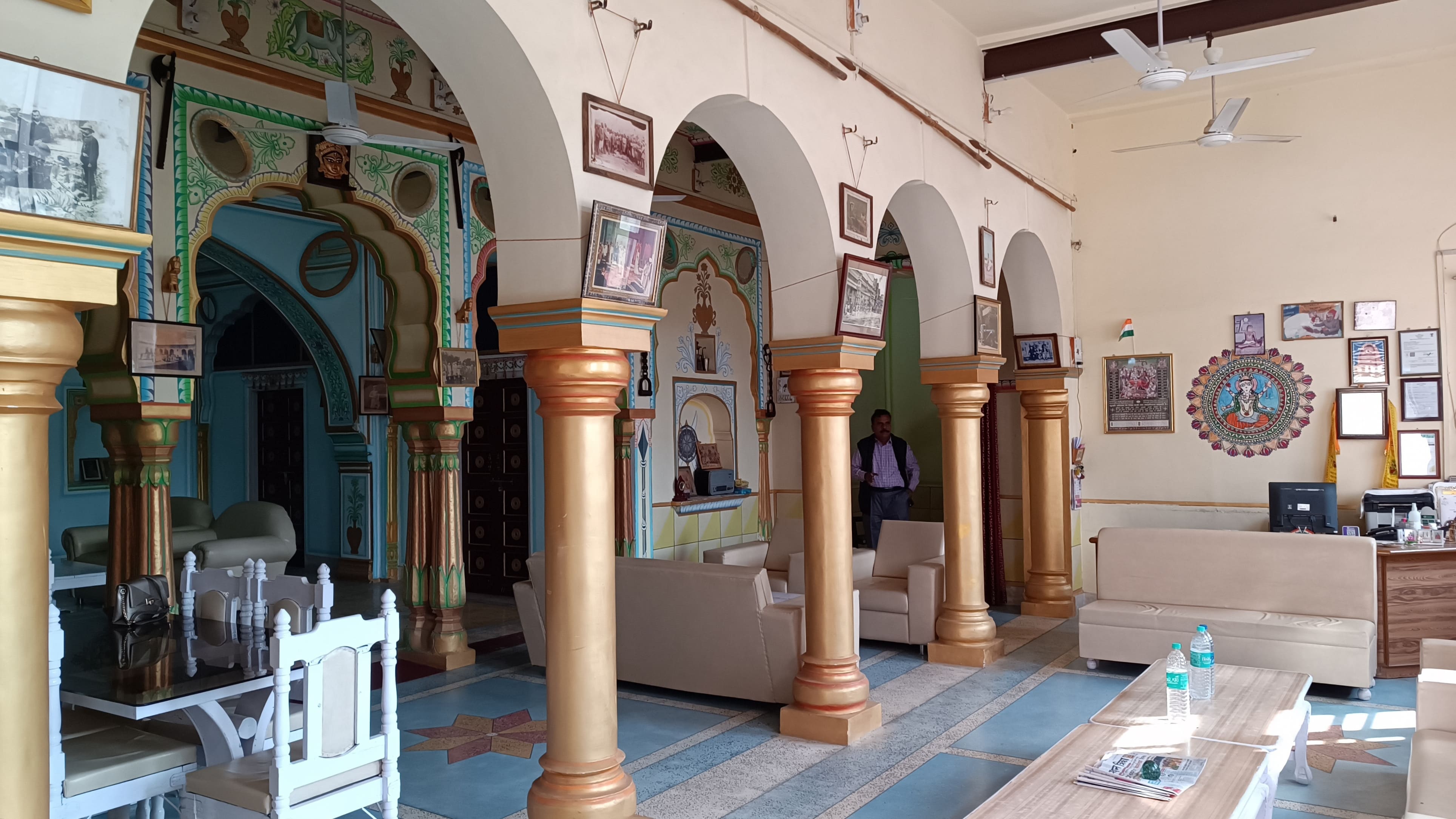
It already being 1.30 PM, we asked around for a good place to have lunch, and took a hairpin upturned bend from the main road, reaching a haveli that once belonged to the royal dynasty. Now turned into Hotel Haridiya Heritage, the haveli is located higher than most of the town, affording a view of the erstwhile king’s palace which lies almost adjacent to it, and a view of the Aravallis running on the other side of the town. Photographs and souvenirs from the past adorn the walls of the main hall transporting one to a more circumspect time, convincing us that the haveli would be a good retreat for someone looking to spend time in Khetri.
Main hall of the Haridiya Heritage Hotel
View of the town, hills and palace from outside the Haridiya Heritage Hotel
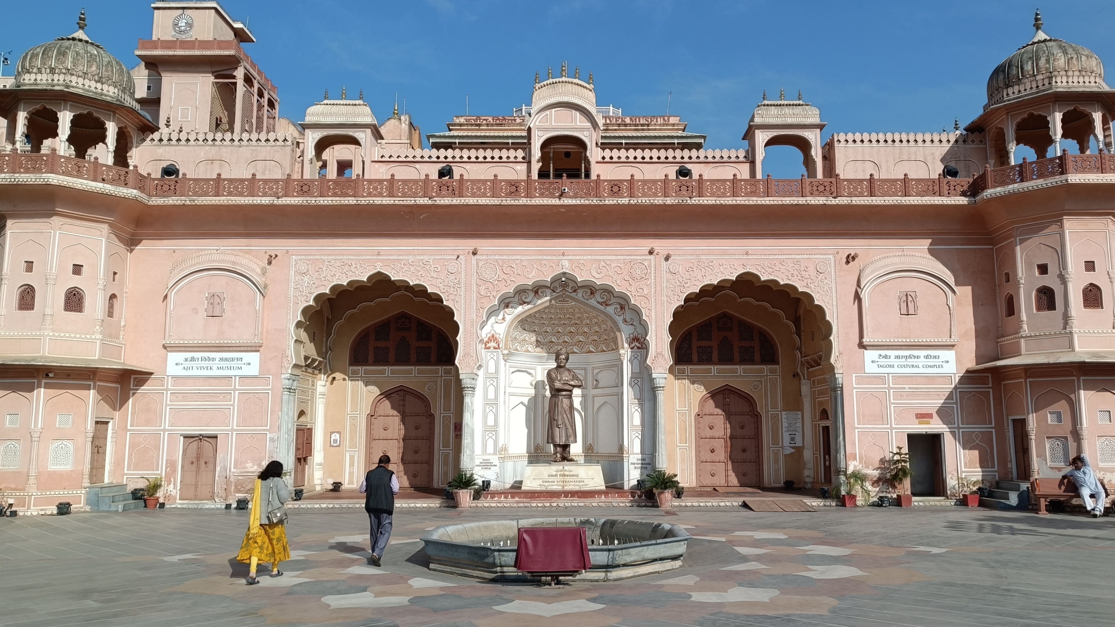
Our next stop following lunch was the royal palace which has since been given over to the Ramakrishna Mission who now run the mission in part of the palace. The remaining part has been turned into the Ajit-Vivek museum dedicated to displaying the life and teachings of Swami Vivekananda. But why is this quaint little town nestled in the Aravallis being spoken of in the same breath as a monk from Bengal, a land in the east of India? Well, this seems like a good point to take a detour and learn about the connection between Khetri and Swami Vivekananda.
Khetri and Swami Vivekananda
After starting his life as a wandering monk in 1888, Swami Vivekanand first set foot in Khetri in June 1891, meeting Ajit Singh, the ruler of the Shekhawat estate (thikana) of Khetri. Following a discussion on a wide range of subjects, Ajit Singh invited Vivekananda for dinner. Vivekananda ended up staying in Khetri from 4 June 1891 to 27 October 1891, during which period Ajit Singh taught Vivekananda to wear a turban in the Rajasthani style to protect him from the hot wind blowing in the area. With variations added of his own, Vivekananda made the turban a staple of his life, as evident from most of the well-known pictures of the monk. A teacher-disciple relationship and a life-long friendship had begun.
Vivekananda visited and stayed in Khetri a second time from 21 April 1893 to 10 May 1893. Learning of his wish to participate in the Parliament of World’s Religions as a speaker, Ajit Singh readily provided him with financial aid, and the tickets for the voyage, even escorting him till Jaipur, from whereon Ajit Singh’s Munshi escorted Vivekananda till Bombay. Purportedly upon Ajit Singh’s request, the monk also assumed the monastic name Vivekananda replacing his then-assumed name Vividishananda. The two remained in correspondence during Vivekananda’s stay in the west, with Ajit Singh providing him financial support whenever required.
Vivekananda visited Khetri a third and final time in 1897, upon Ajit Singh’s invitation, where he gave a lecture attended by Ajit Singh and many Eurpoean guests. During this visit, Vivekananda openly expressed his gratitude to Ajit Singh for his support. In 1898, Vivekananda requested that a monthly stipend given by Ajit Singh to his mother, be made permanent even after Vivekananda’s death. Ajit Singh honoured this arrangement, without publicising this, till his death in 1901 due to a collapse of a tower he was standing on, at the age of 39. Incidentally, Swami Vivekananda also died at the age of 39, the following year.
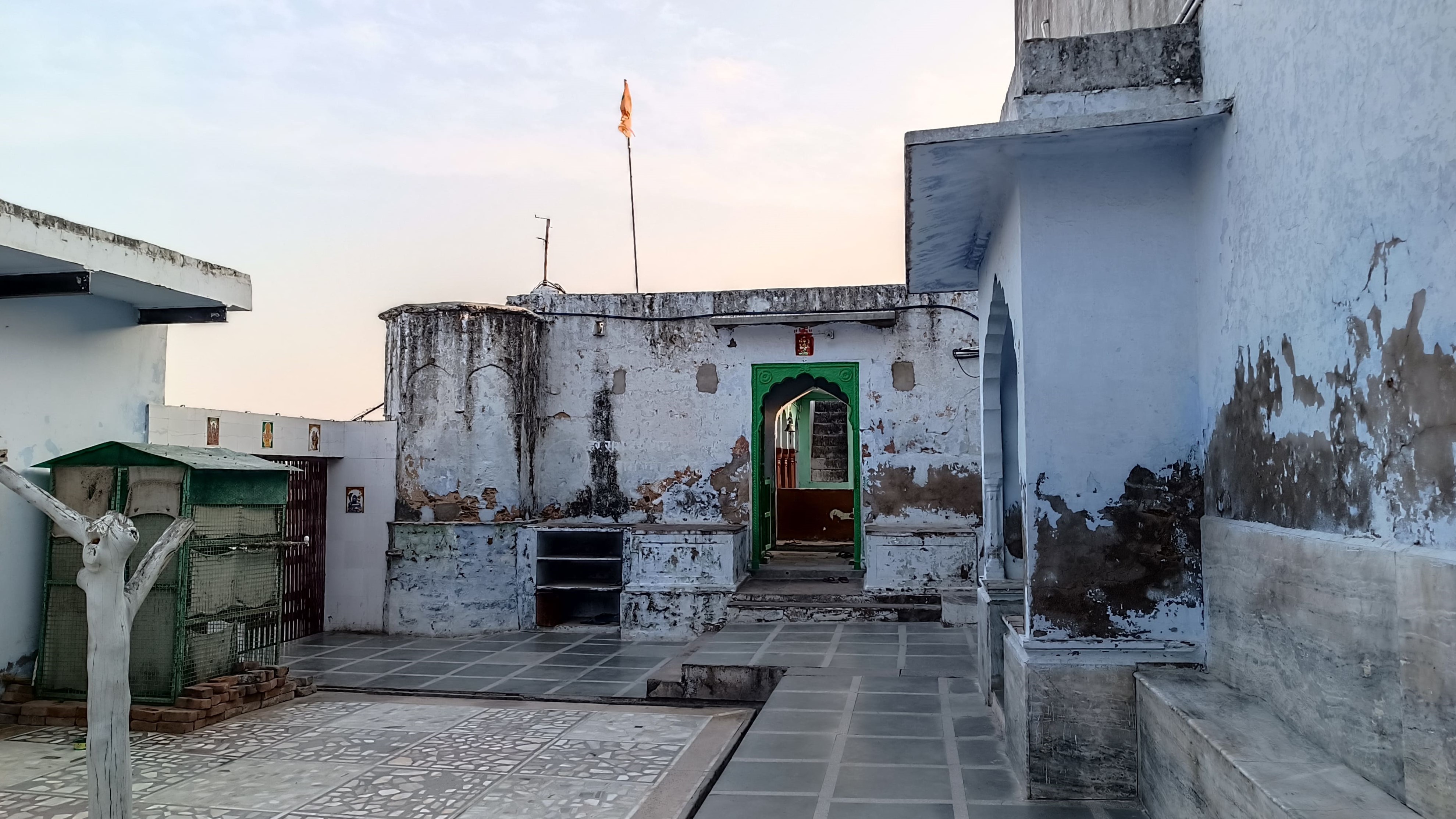
In 1958, Ajit Singh’s grandson, Bahadur Sardar Singh donated the then abandoned and dilapidated Palace of Khetri to the Ramakrishna Mission, who cleared and restored one part of the palace to establish a mission. Later, another part of the building, Fateh Vilas, was turned into a museum showing Vivekanda’s life and teachings, while also honouring Ajit Singh. The room overlooking the town and the Aravallis, where Vivekananda lived during his stays in Khetri has now been turned into a prayer room. Some letters of correspondence between Vivekananda and Ajit Singh are also on display.
Front courtyard and entrance of the Ajit-Vivek Museum
*************
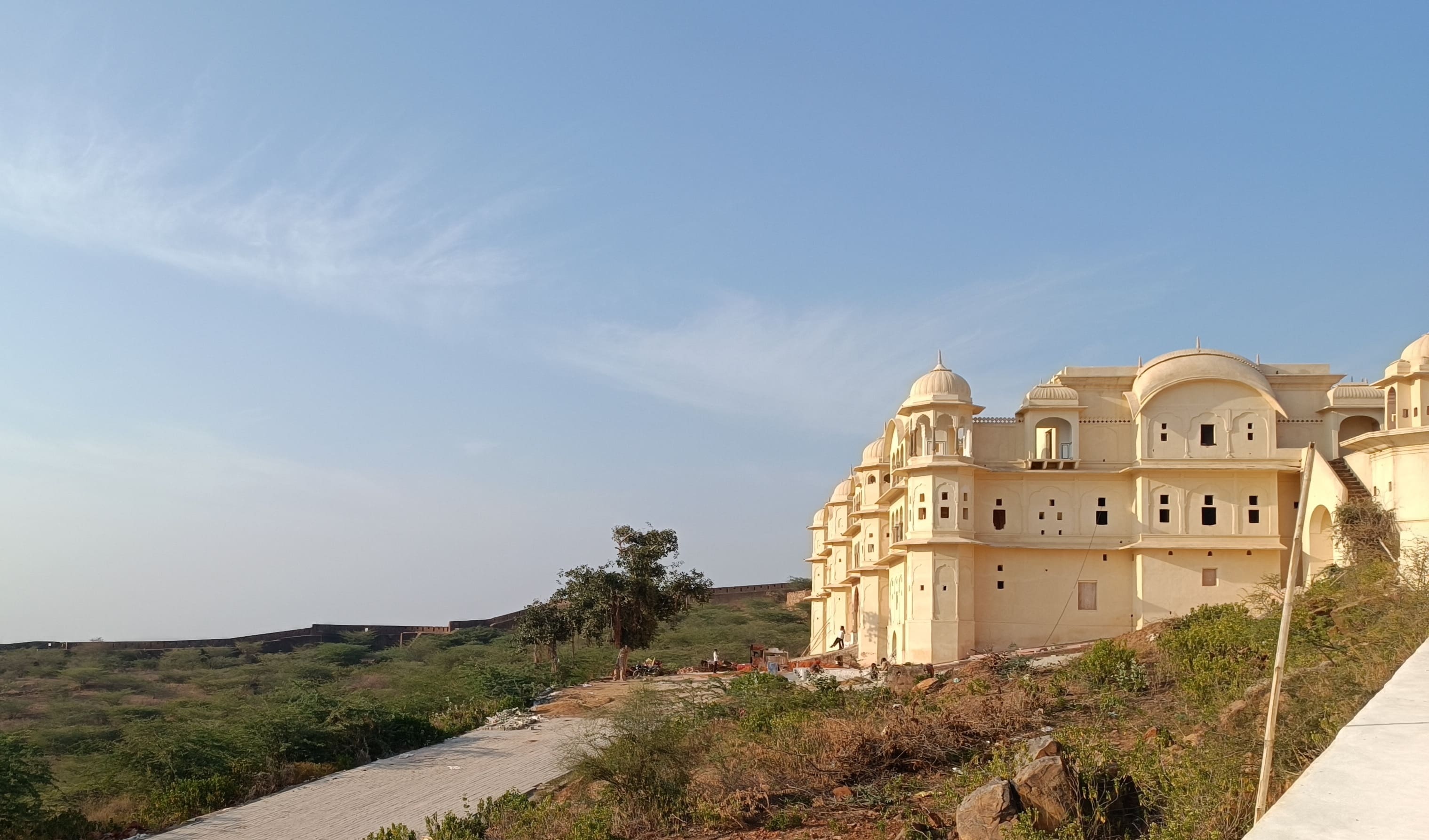
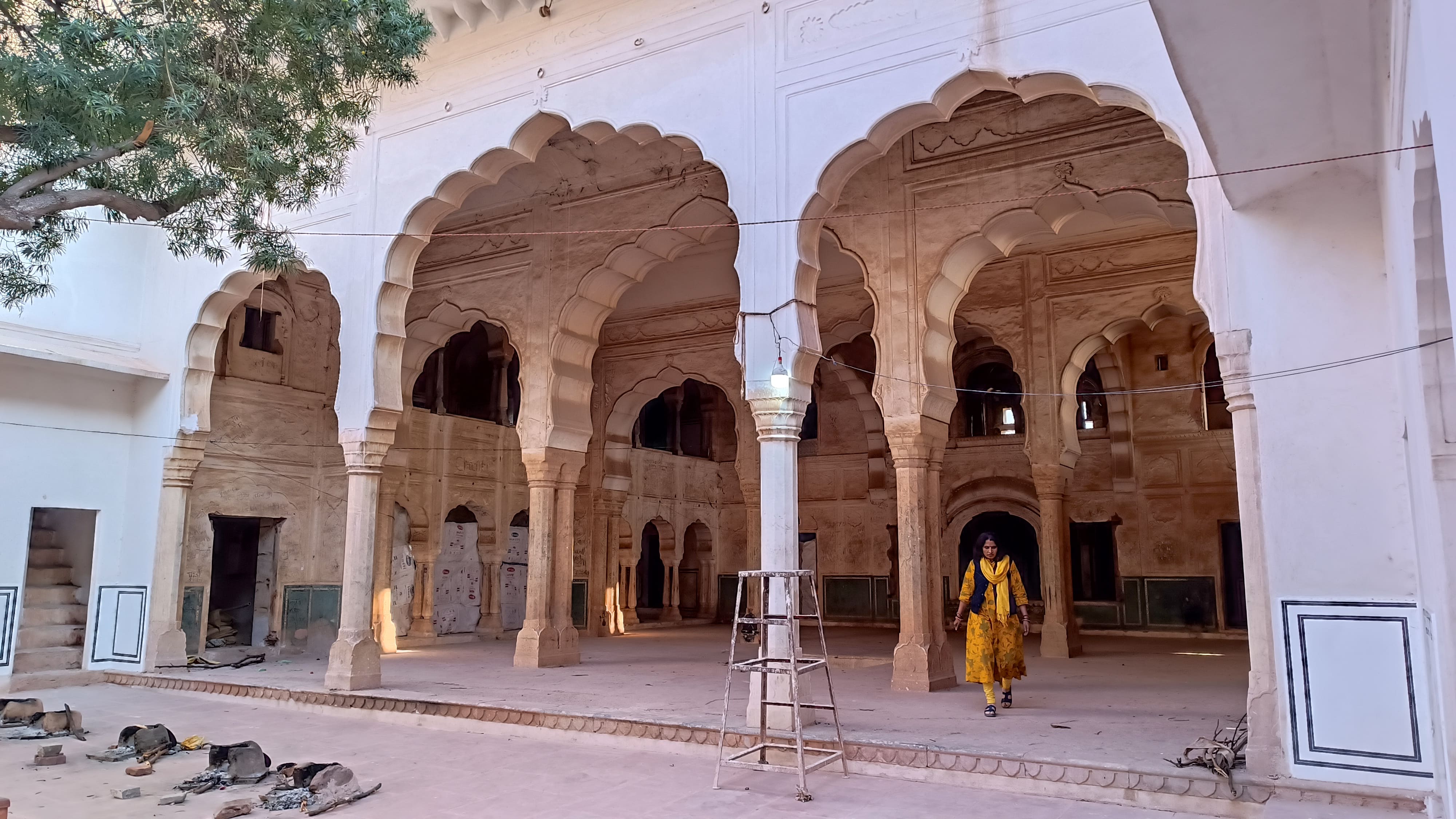
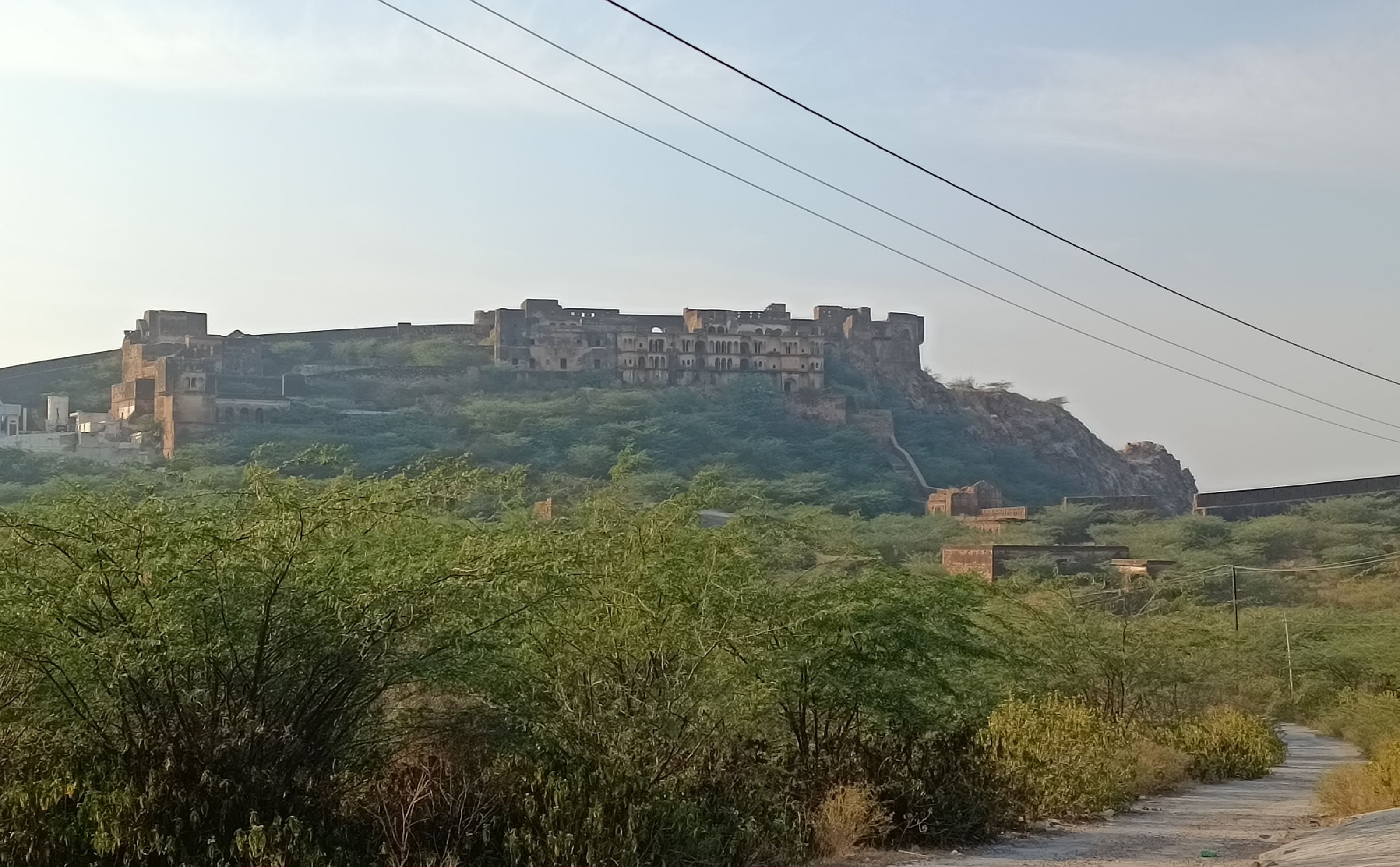
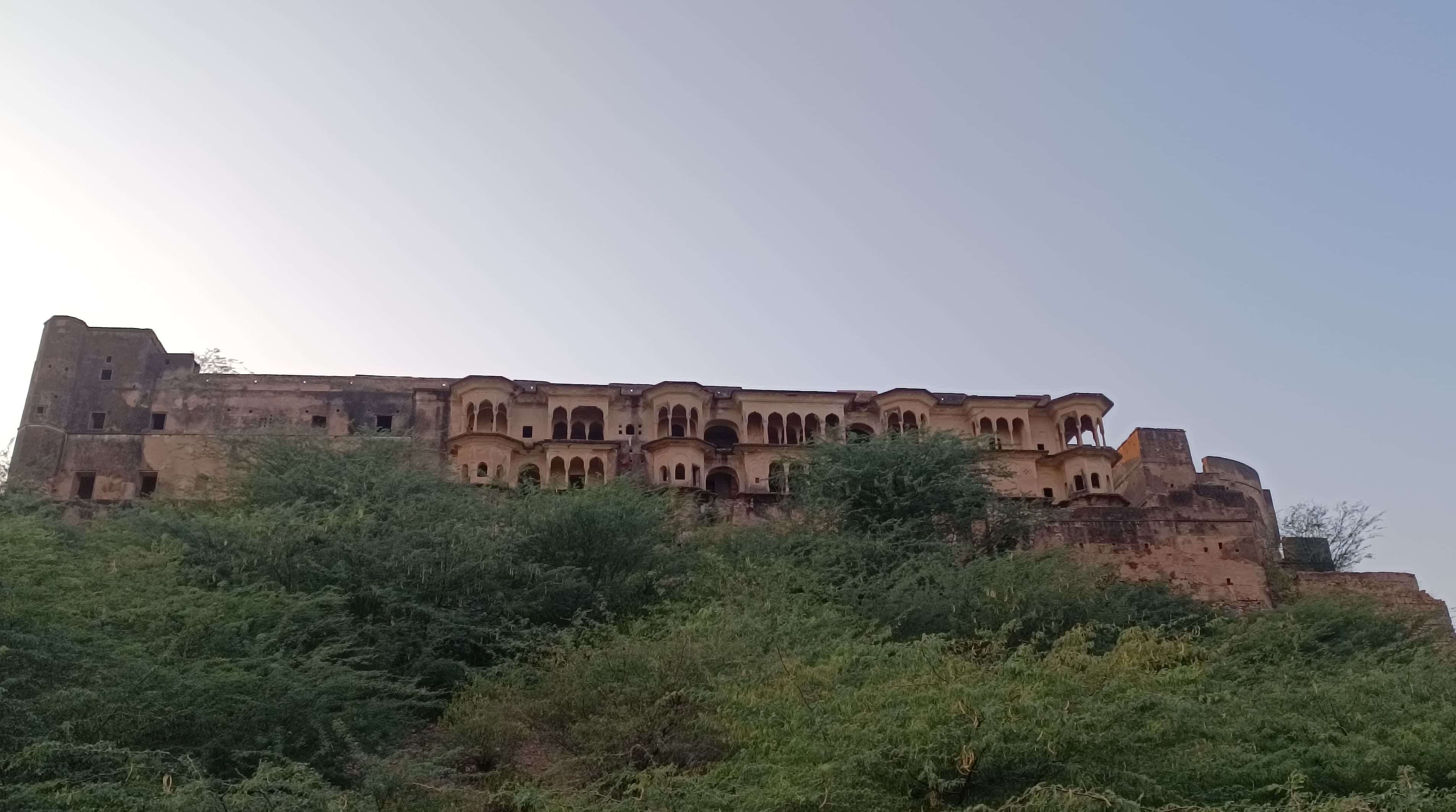
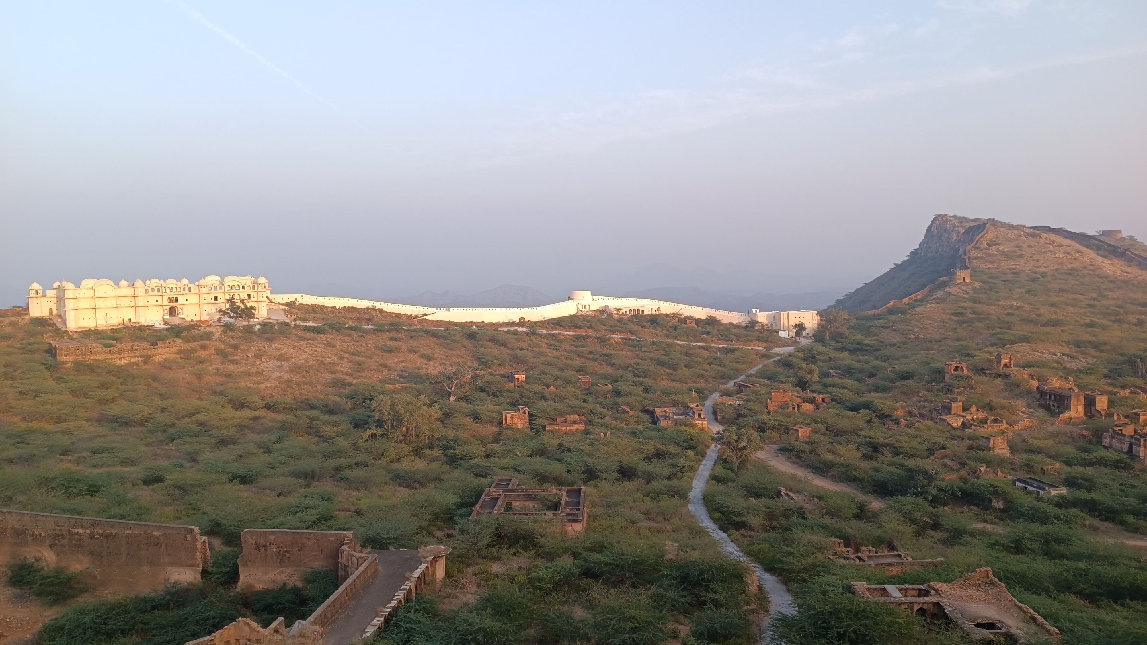
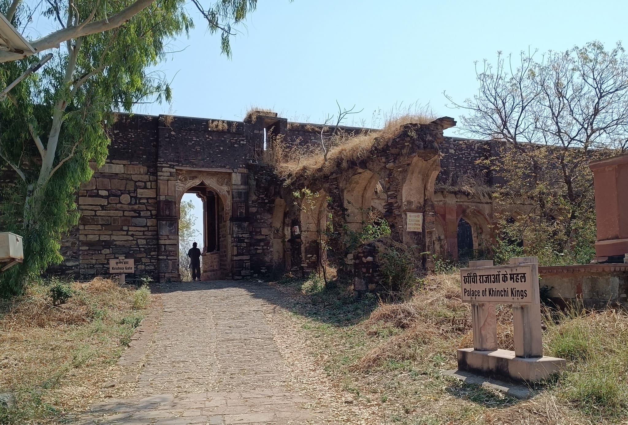
Offering our prayers in the prayer room, we then proceeded to the 270 year-old Bhopalgarh fort that beckoned us from the hilltop in the distance. Taking a steep two-kilometre winding road we were at the fort’s gate around 3.30 PM, with the Khetri town visible down below. Entering the fort premises, we immediately got a bearing of the area – the fort wall encloses an area shaped like a trapezoid, with most of the inner part depressed, resembling a wide crater.
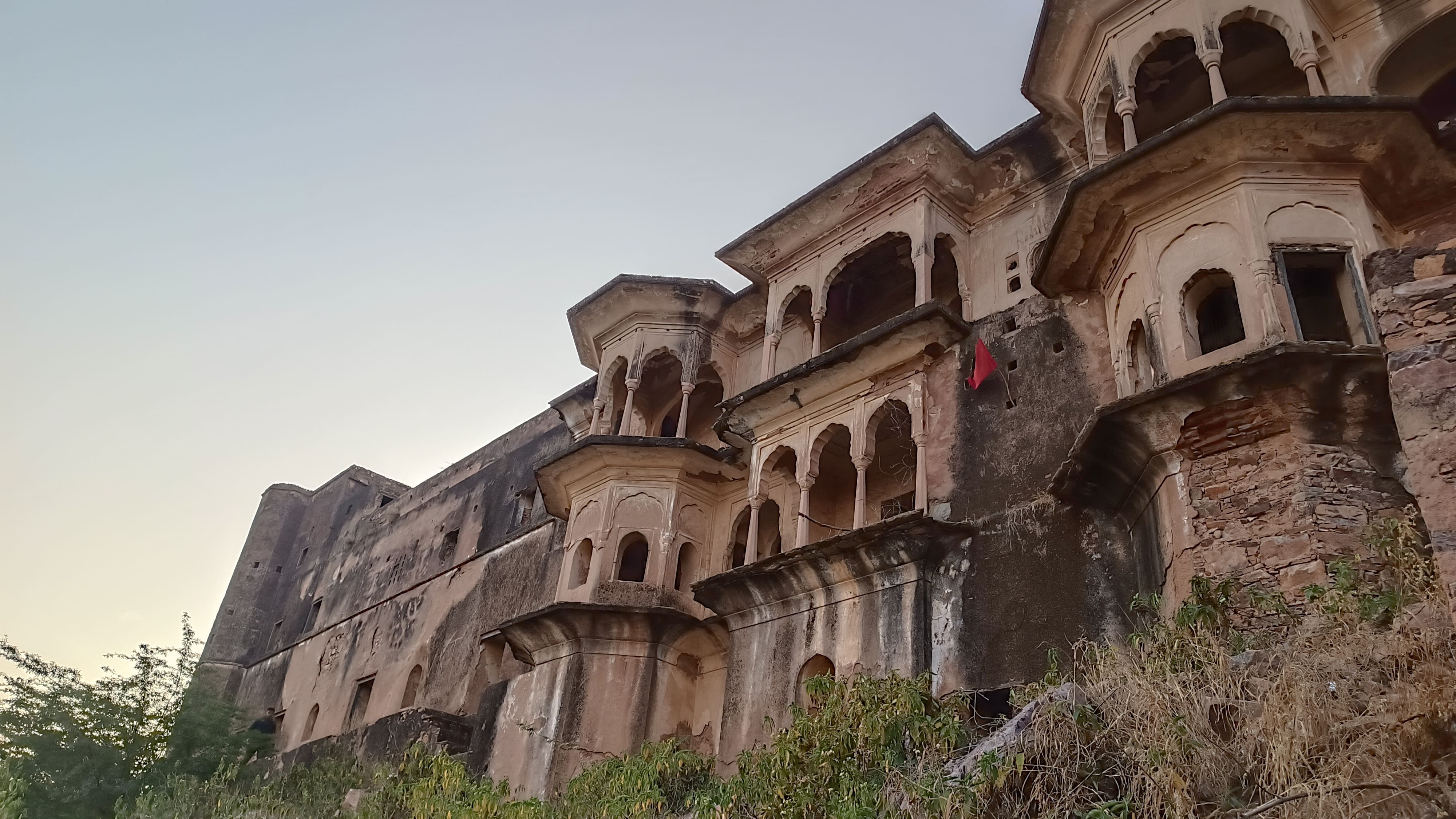
Half a kilometre to the right of the entrance, bang on the fort wall is a palace sporting multiple windows and balconies, called the Sheesh Mahal, which is currently closed for renovation. Peeking in from the corridor at the main gateway, one could see a large courtyard and multiple storied halls and rooms surrounding the hall. Walking beyond the palace on the fort wall, one gets a clearer view of the Khetri town and the surroundings, including some now-defunct copper mines, nestled in the Aravallis.
Sheesh Mahal which lies adjunct to the fort wall on the right side of fort entrance
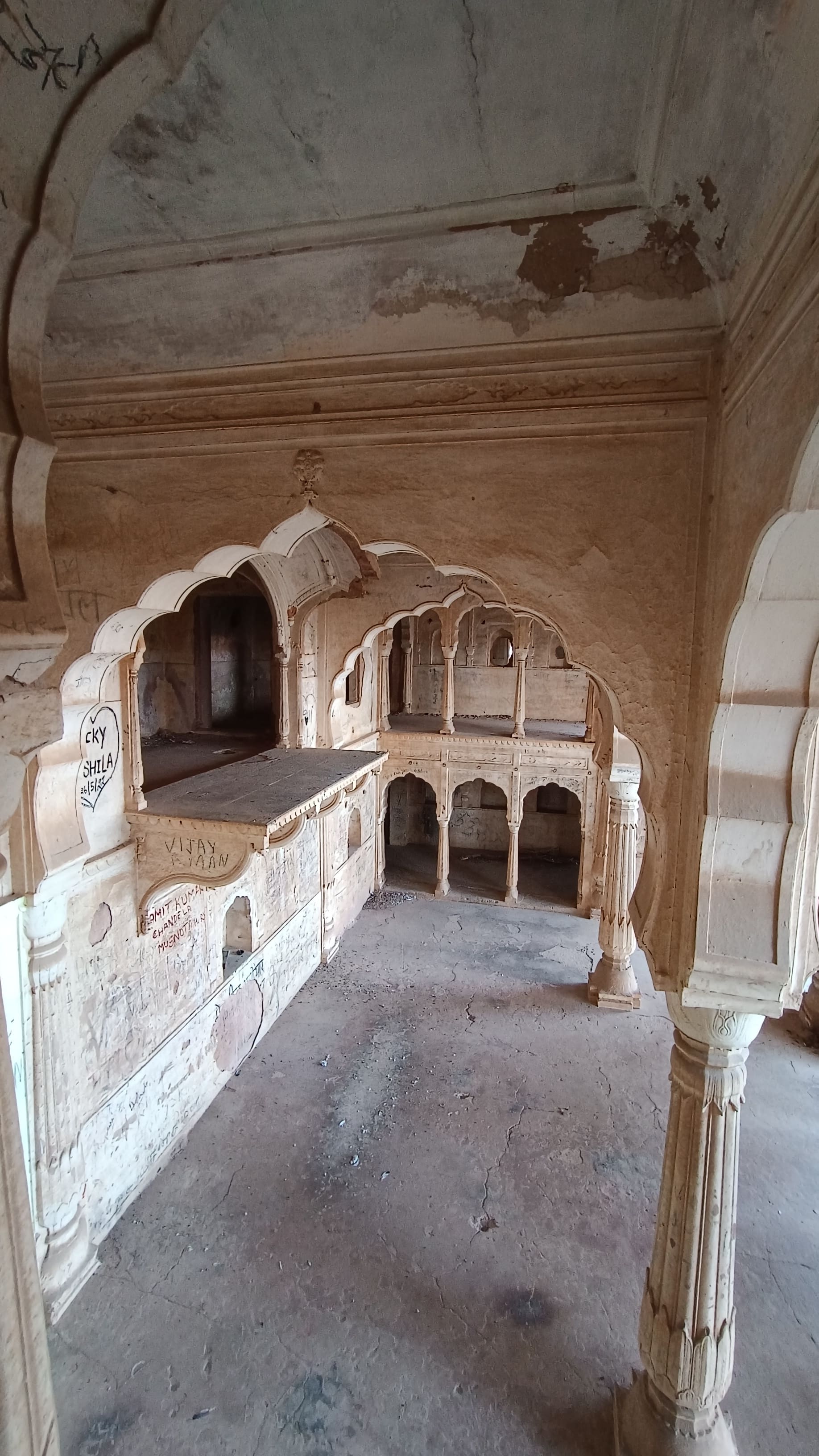
Courtyard and hall inside the Sheesh Mahal
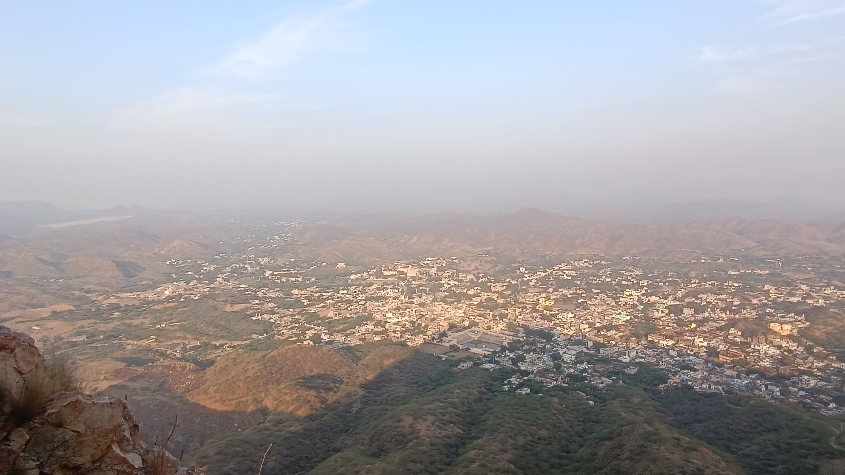
View of Khetri town from the fort wall, beyond the Sheesh Mahal
View of a portion of the fort from the fort wall
From the side of the entrance and the walls stretching on both sides of the entrance, one can clearly see the Moti Mahal, an elongated palace, located at the far opposite side of the fort. In between, in the depressed portion, lay swathes of low jungle with vestiges of more stone structures. I traversed through the jungle by foot, and found the Moti Mahal in a desolate condition with the front of the palace overgrown with thorny bush and jungle, making it look like a prohibited place. However, adjoining the Moti Mahal, is located the Gopinath temple, dedicated to Krishna, with an attached dharamsala, teeming with some people, which made the adjunct palace look less hostile.
The Moti Mahal beckons from beyond the depressed portion of the fort enclosure
Moti Mahal protected by jungleCloser view of Moti Mahal
Inside the adjacent Gopinath temple which mitigates the desolation of the Moti Mahal
All this while, with my mind constantly racing about whether or not to enter the Moti Mahal, I kept lingering on the outside of the palace. It already being 4.30PM, with the prospect of darkness descending soon, I decided to take the plunge. With my heart in my mouth, wading through the thorny bush and jungle, I somehow managed to gain access into the palace, and was at first greeted by what looked like the king’s throne where he gave audience to the court. Walking through labyrinthine corridors and staircases, I managed to get access to the roof of the palace, from where I was treated to breathtaking views of the Shekhawat countryside chequered with low hills, and arid plains.
View of the throne balconyViews from Moti MahalSheesh Mahal as seen from Moti Mahal
View from the rooftop of Moti Mahal
View from the rooftop of Moti Mahal
Around 5 PM, I descended from the roof of the Moti Mahal, intending to head back, and promptly lost my way through the labyrinthine corridors! After fumbling about in the low light, forced to use my mobile phone as a torch, for about 5 minutes, I was finally relieved to see that the exit had been present right before my very eyes – in my nervousness, I had simply not seen it! Exiting, I walked as fast as I could through the jungle to reach the fort’s entrance where my parents were waiting.
Wider view of the fort enclosure from Moti Mahal – the Sheesh Mahal and ruined structures strewn around are seen
As we drove back through Khetri town, we looked with fondness at the agglomeration of houses straddling the valley in the Aravallis. Here was a town that retained the charm and compactness of a British-era princely state, and yet was no stranger to modern flourishes. It was easy to see why the monk Vivekananda would have appreciated the coziness of this town ensconced in the Aravallis, spending here 3 months at a stretch. Surely we could come back to spend 3 weeks at the least, we concurred amongst ourselves.
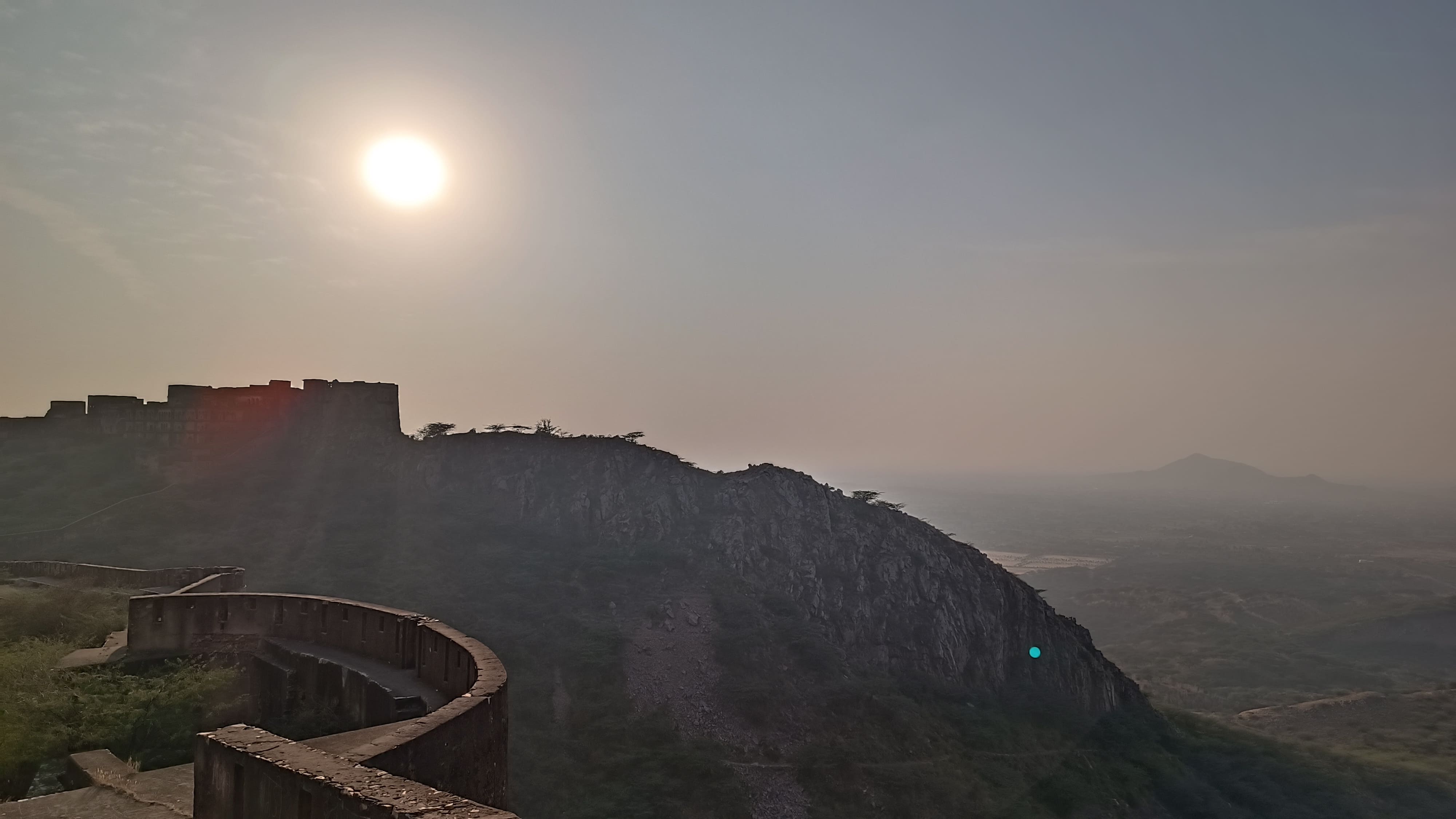
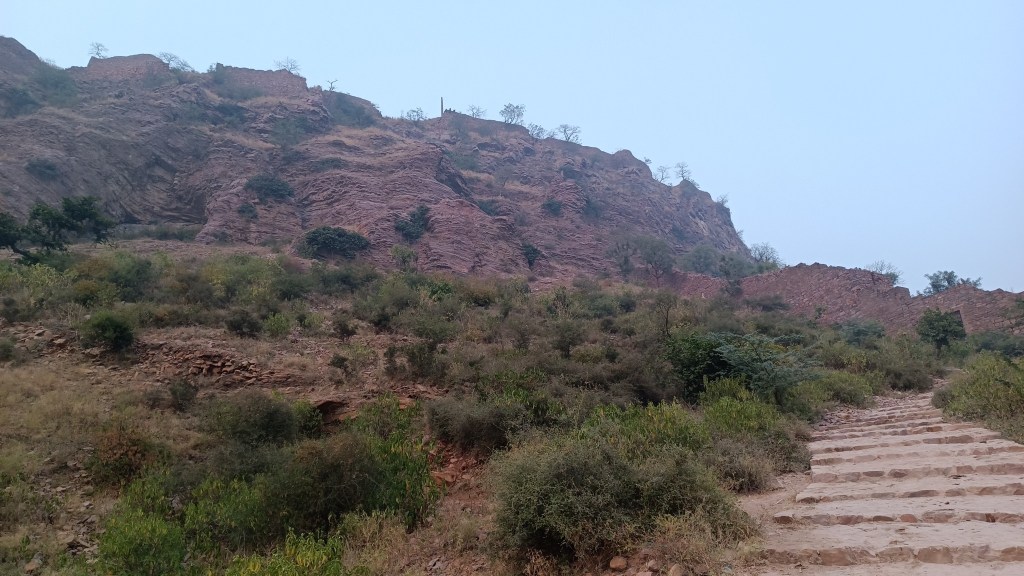
Somehow, circumstances lead me into situations where I land up in remote places on the verge of sundown. This time, it was at the base of a high cliff atop which sat the Bayana fort, with fortification walls stretching for miles and miles. I learned about Bayana Fort only a few months ago from a book called ‘Forts of Rajasthan’, and had been itching to set foot on it since. It was quarter to five on this mid-November evening when I finally arrived at my destination, having driven for an eternity, having been slowed down by narrow winding roads, interrupted by a political rally, and rocked by an undulating last-mile dirt road.
A fort beckons
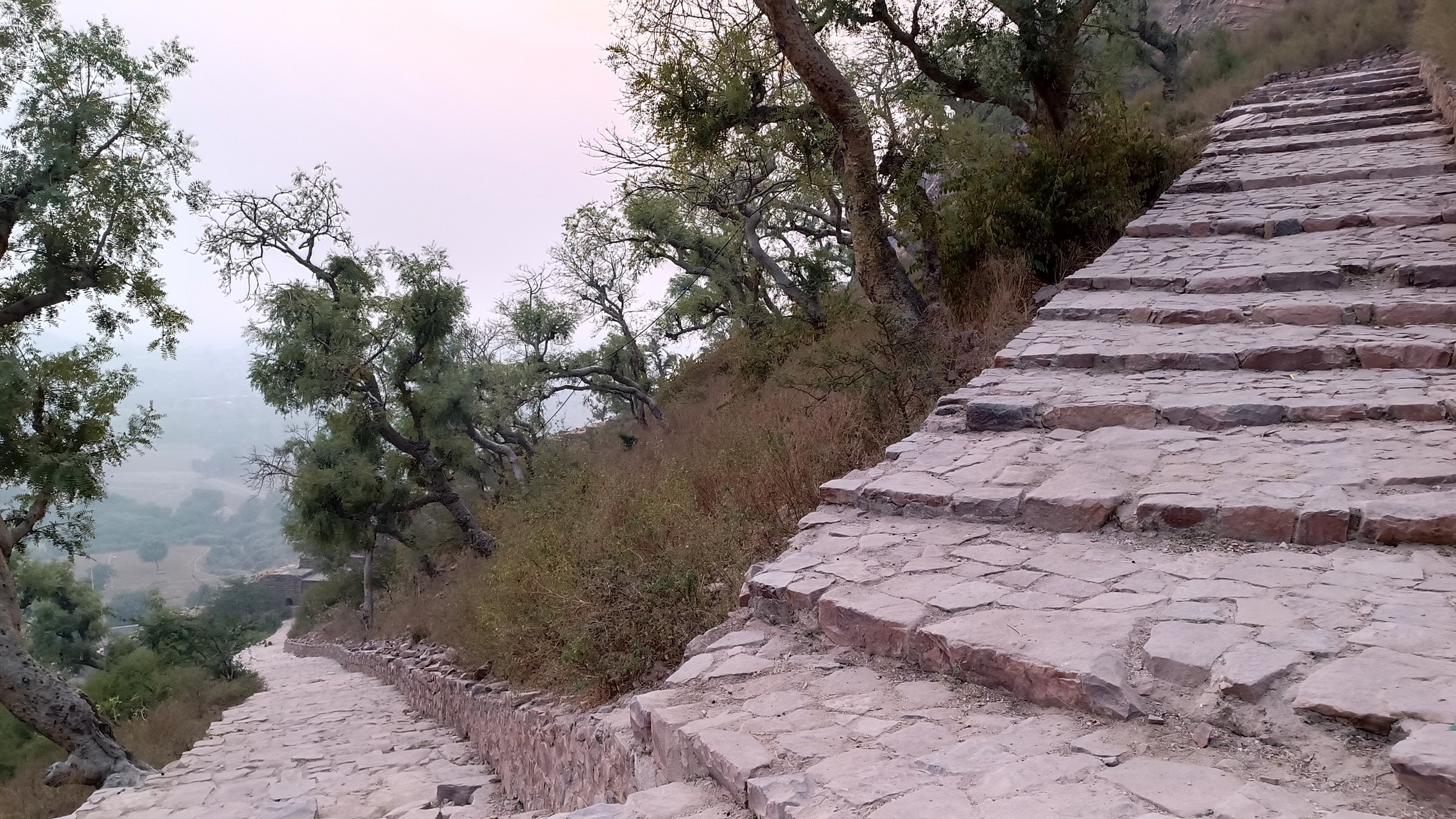
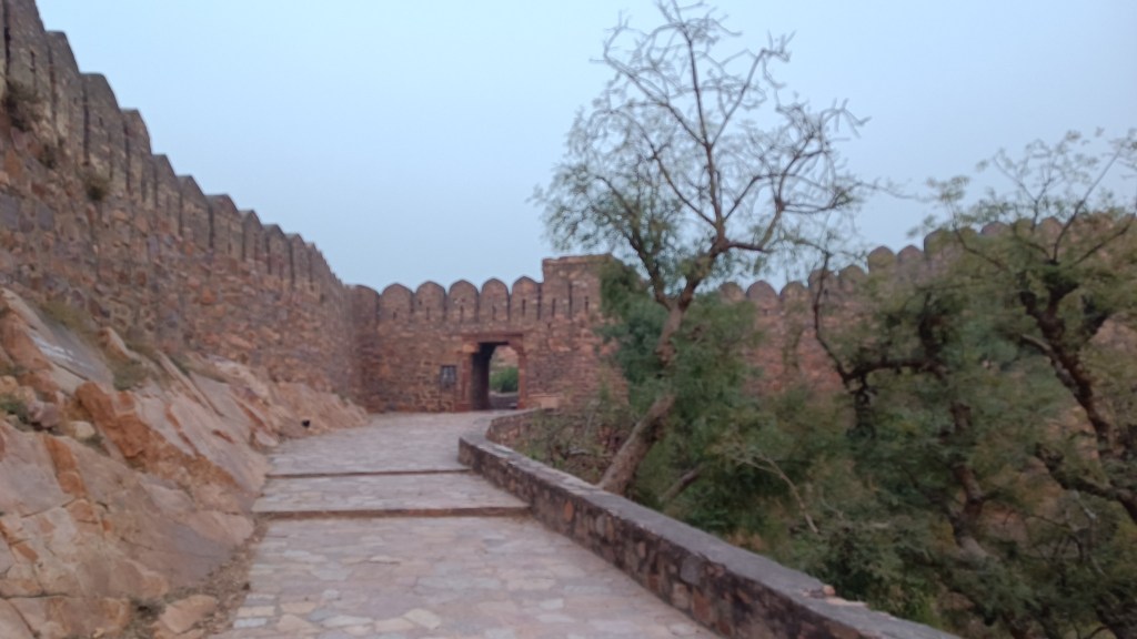
As I stood at the bottom of the long flight of stony steps, with the last group of people having already descended, I mulled over whether it would be a prudent idea to climb uphill at this hour. Figuring I did have a small window of sunlight, I virtually ran up the tall, sloping steps, stopping mostly to catch my breath at each hairpin bend and sometimes to steer clear of the langurs. In 10 minutes, I was within the fort precincts, passing through multiple arched gates after almost a kilometre-long climb. The panoramic view of the countryside was breathtaking from that height.
Taking the steep and long climb into the fort head-on
Views of the countryside from the fort steps (left) and top of fort (right)
On the flat hilltop, flanked by jungle, stood several buildings in various stages of decay and a half-finished minar dedicated to Ibrahim Lodi. To say that I was scared out of my wits, owing to the lack of human presence, would be an understatement. Add to that the fear of wild animals and reptiles that could be lurking just around the corner. Could there also be a supernatural presence? As I waded through the jungle, I saw a figure emanating from behind a bush. I was almost happy, hoping for it to be human, but was startled to come face-to-face with a cow! I jumped aside, but the cow following the first one simply darted off, as if it had seen a ghost! Perhaps, nay, definitely, it was time to turn back now.
With darkness fast approaching, as I was descending down the stairs, I came face-to-face again with a long line of cows and buffaloes, making their way up, who simply refused to budge and let me pass. The stand-off continued for 10 minutes with me perched atop a ledge…till a calf, of all the bovines out there, decided to take the bull by its horns (pun intended) and took a few steps forward; the adults followed. I heaved a sigh of relief as the last one passed me by. With the sun already down, I hiked back, admiring the loftiness of the fort walls and the lushness of the landscape awash in the waning twilight while peacocks went about their evening walks.
Bovine encounters on the way back
******
Bayana is associated in the lore of Krishna with Banasur, and the precursor to the Bayana fort itself can be traced to 4th century AD at least, from some inscriptions found on the hill. However, the fortification was reinforced and the fort repaired by king Vijayapal in the 12th century AD who named it Vijaymandir. It subsequently fell to the Sultanate, then passed through the hands of the Lodis, and then the Mughals. The battle between Babur and Rana Sanga at nearby Khanwa proved to be a landmark event in the Mughal conquest of Northern India.
How to reach While Bayana town itself is reachable from Delhi by public transport or by a 5 hour drive from Delhi, the fort, 8km away from the town, needs private transport to reach. Alternatively, one can also reach Bayana town and the fort from Agra by a 2.5 hour drive.
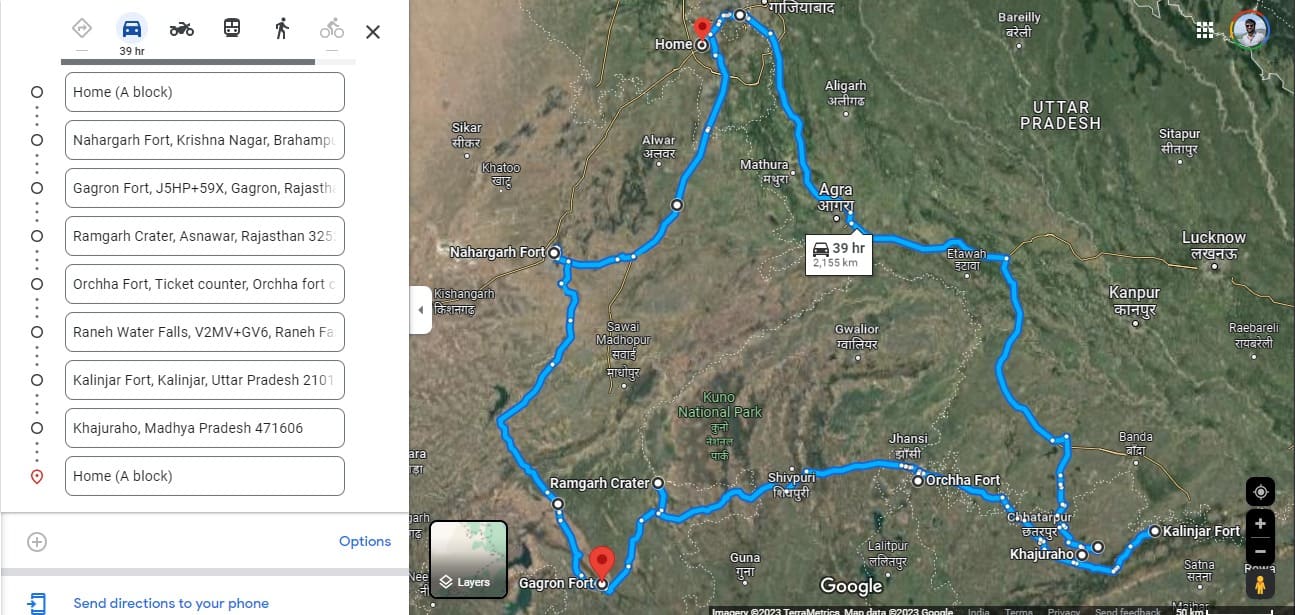
The little one touched down in late February on his annual visit to the homeland, and as has been the family’s wont, we set out on another self-driven road trip. This time I wanted to introduce my little brother to the pink-splashed, fort-dotted landscape of Jaipur. But that was not all of the plan – the plan also included exploring the antiquities lying in the upper Vindhya hill ranges.
One of those long-distance trips that uncharacteristically start at noon, it was the perfect opportunity to check out the Delhi-Mumbai Expressway (DME) which had just opened for the public. And soon we would be in Jaipur and climbing the hairpin bends up the Aravallis to reach Nahargarh fort in pitch darkness.
Following a quick family sight-seeing session in Jaipur, we crossed the Chambal river & Kota city onto the tiger-rich Mukundra Hills in pursuit of a hill-cum-water fort which had eluded me in my last two attempts – once due to floods and the other time, due to paucity of time. We then proceeded to a geological marvel in the form of a Meteorite Impact Crater (MIC) in the middle of nowhere, which also is home to a mysterious ancient Shiva temple.
Then we skirted around the Kuno National Park to push into Bundelkhand, touching some places that formed the backdrop at crucial junctures in the history of Bundelkhand, as well as of British India. We then advanced to that land of exotic temples – Khajuraho, which would then lead us to an intriguing fort straight out of the scenes of an Indiana Jones movie.
Highlights of the trip
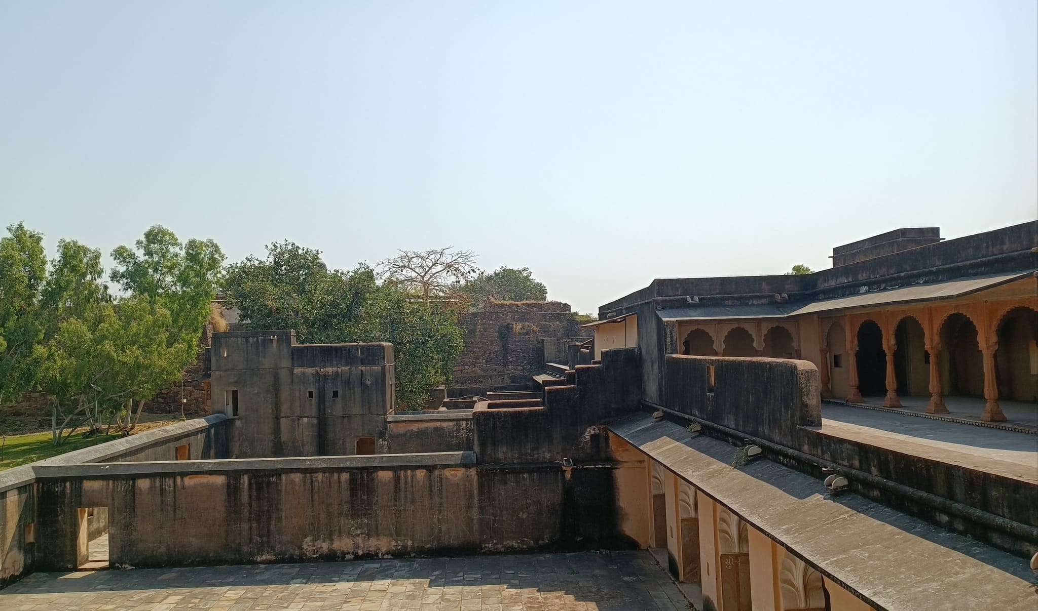
Gagron Fort
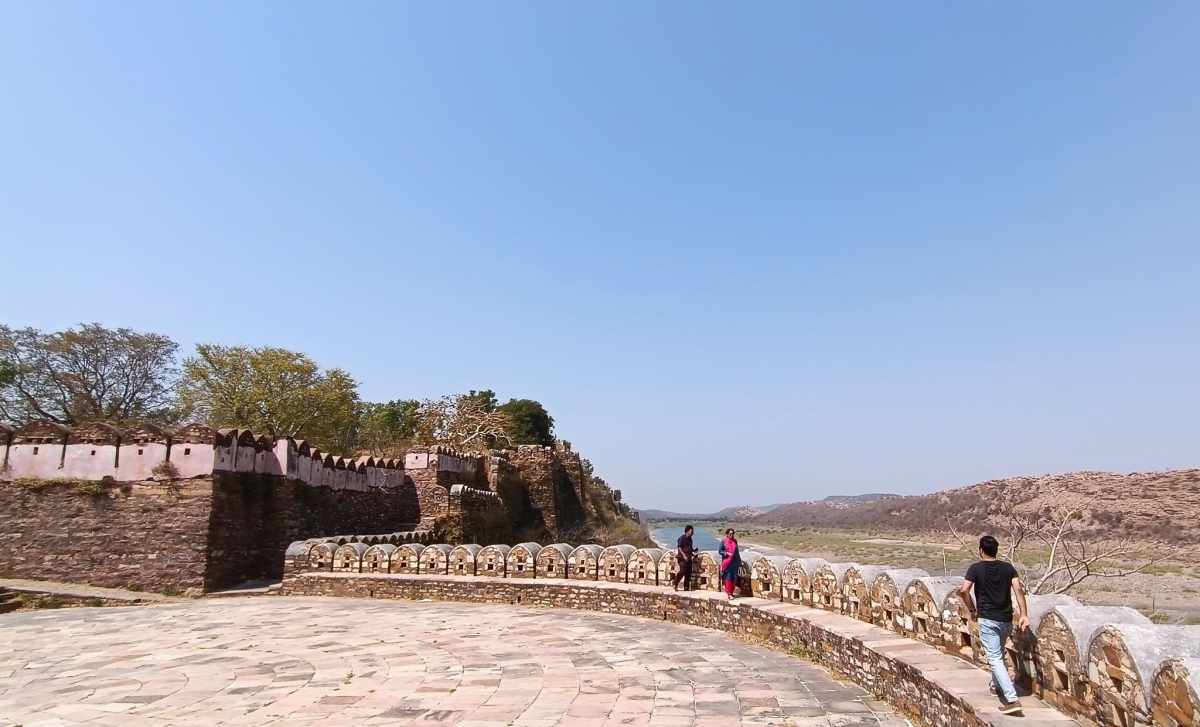
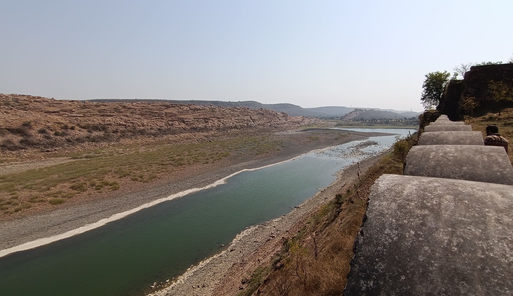
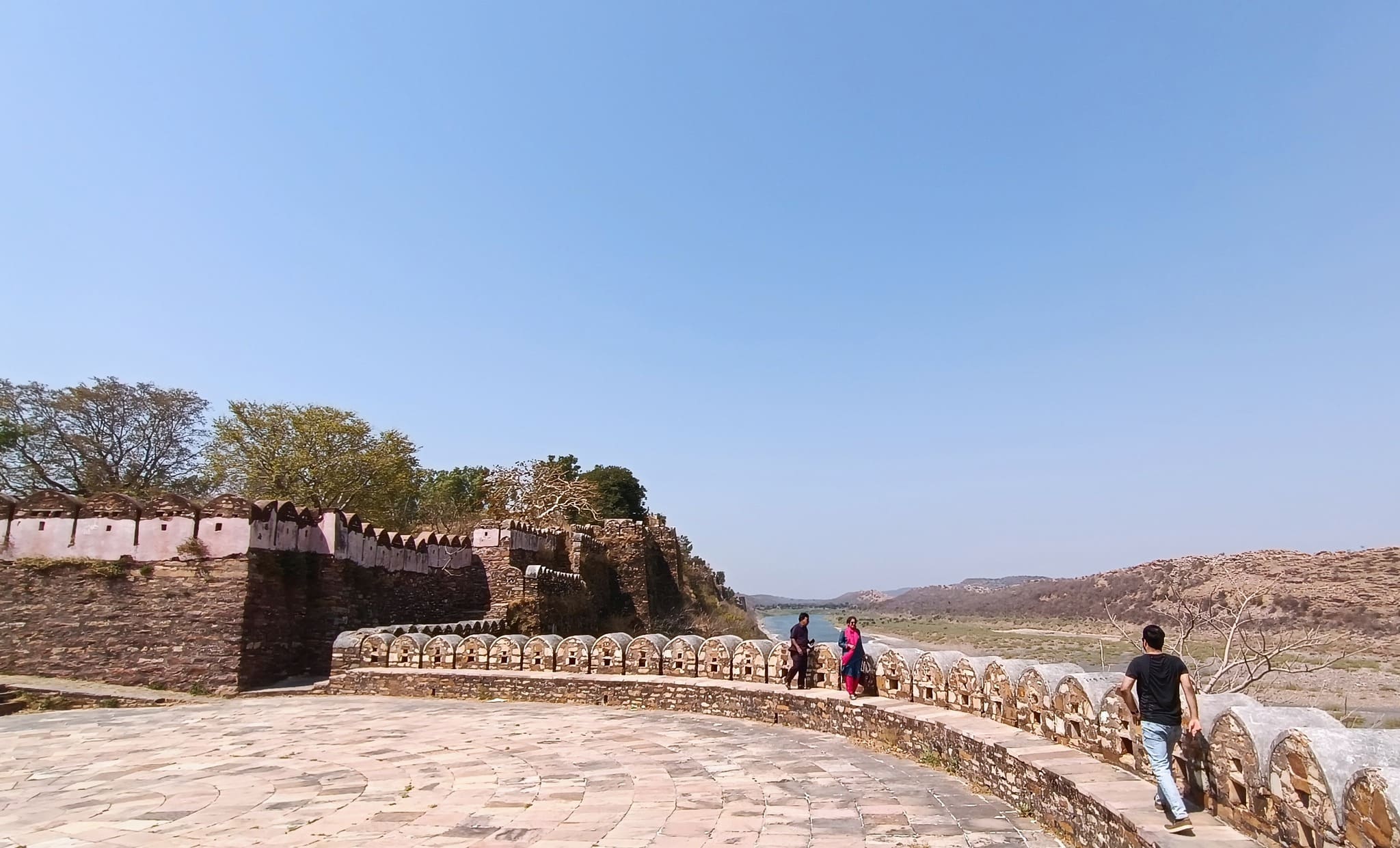
A 12th century hill fort that also doubles up as a water fort, by virtue of lying on the confluence of 2 rivers, with one river winding around the hill supporting the fort, giving protection by water on 3 sides. The fort itself is akin to a ship with the watchtower called Ram Burj situated at the fort’s edge where standing feels as if standing on a ship’s bow. The fort ramparts afford views of the sparsely vegetated rocky surface of the hill with the aquamarine Kali Sindh flowing along the hill base on one side and of the Ahu river on the other side. This fort rounds up for me, the six hill forts of Rajasthan that constitute a UNESCO World Heritage Site series.
Bada MahalWells or granaries?Entering another section
If one imagined the Gagron fort as having two decks, then we would be walking on the lower deck when taking this trail.
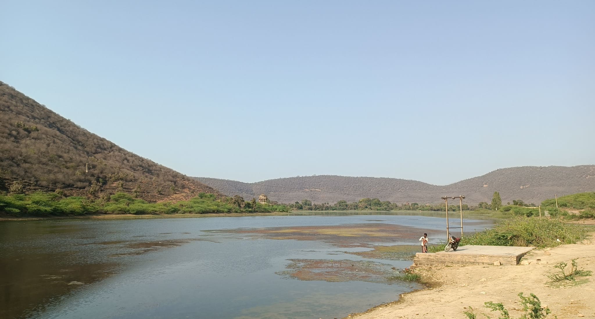
The Kali Sindh river separating the Gagron fort and Mukundra Hills.
The confluence of the Kali Sindh & Ahu rivers. The Kali Sindh winds around the fort and joins the Ahu river that flows along the other side of the fort.
Ram Burj – a large watch tower bearing similarity to the bridge on a ship
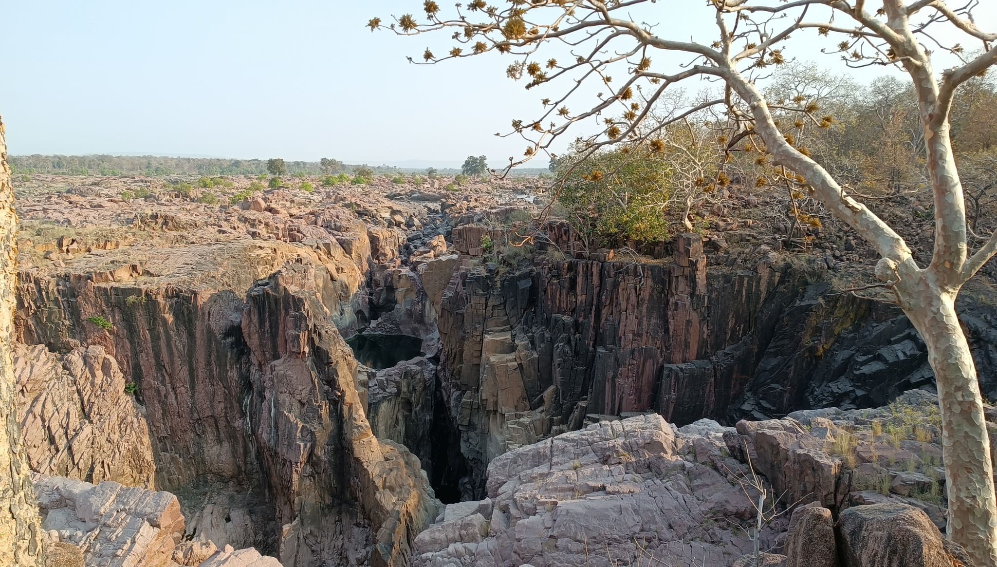
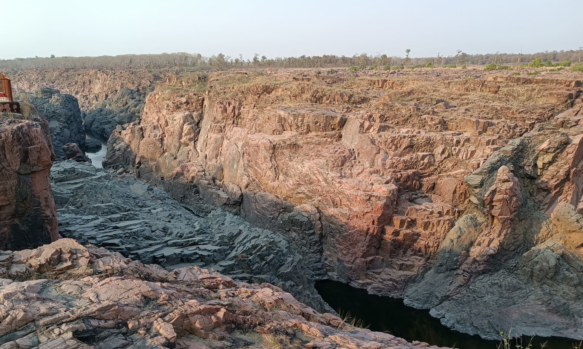
Ramgarh Crater
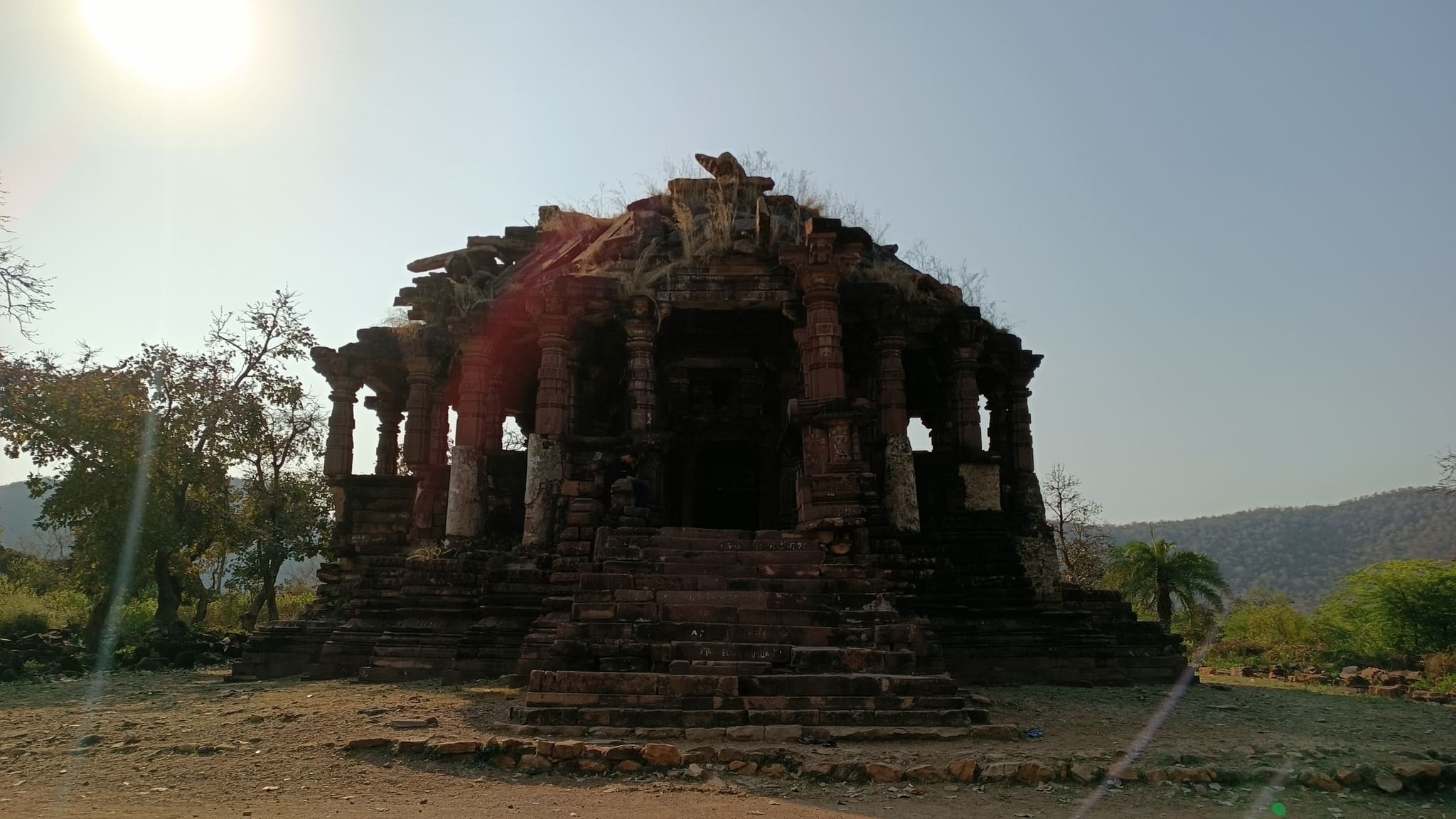
A Meteorite Impact Crater (MIC) formed more than 600 million years ago. The site is characterized by a rim of hills in the shape of a circle with only a narrow pass providing access to the inner area. At the centre of the crater are the Bhand Devra Temple, a 10th century Shiva temple, and a pond abounding in water lilies and lotus. Once formally recognized by the Earth Impact Database, this would be the second largest MIC in India.
A perennial pond ensconced in the craterA ruined temple at the centre of the crater
The Bhand Devra temple, lying exactly at the centre of the crater
Interiors of the Bhand Devra templeA stepwell with the Ramgarh fort above – this lies at the entry into the crater
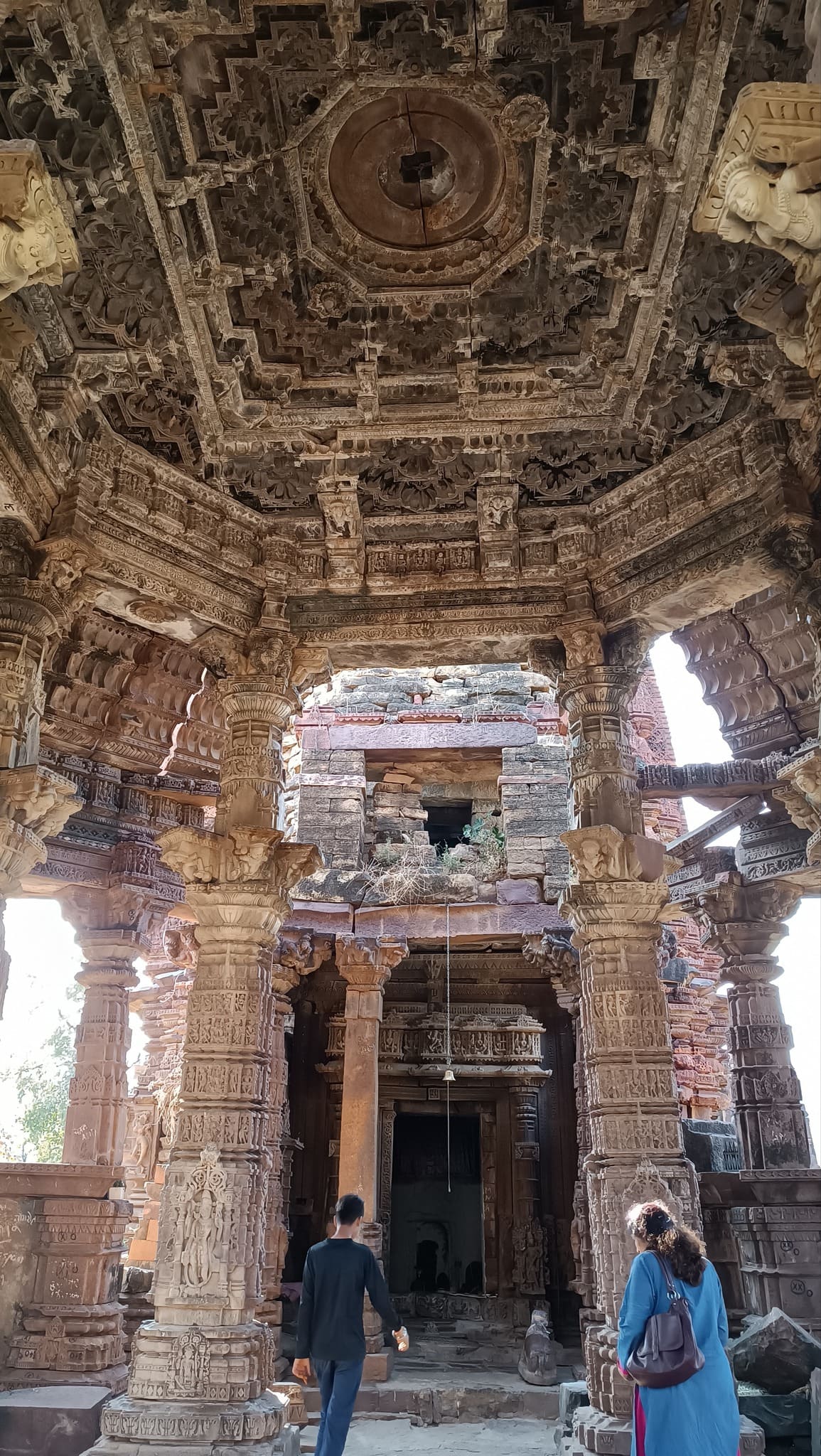
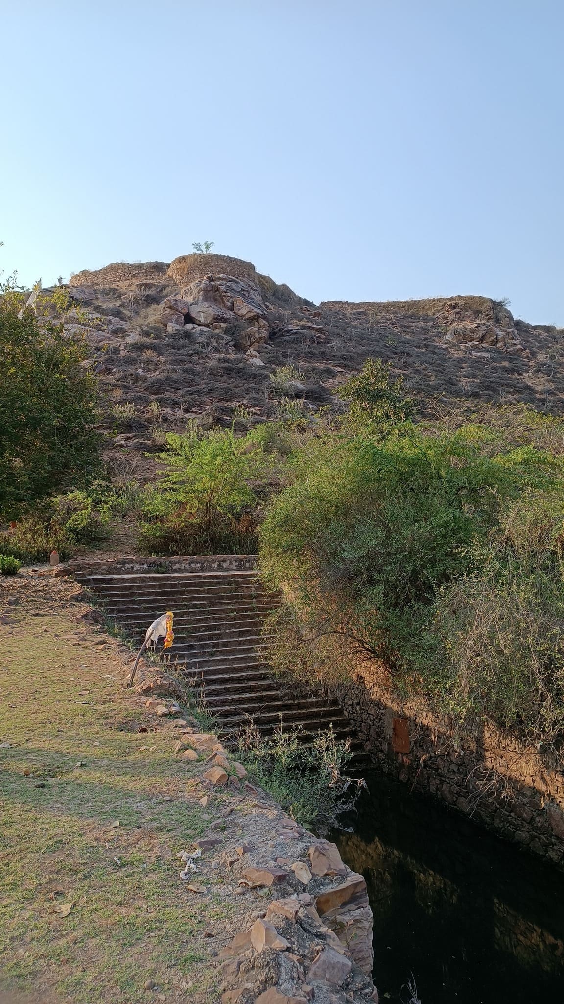
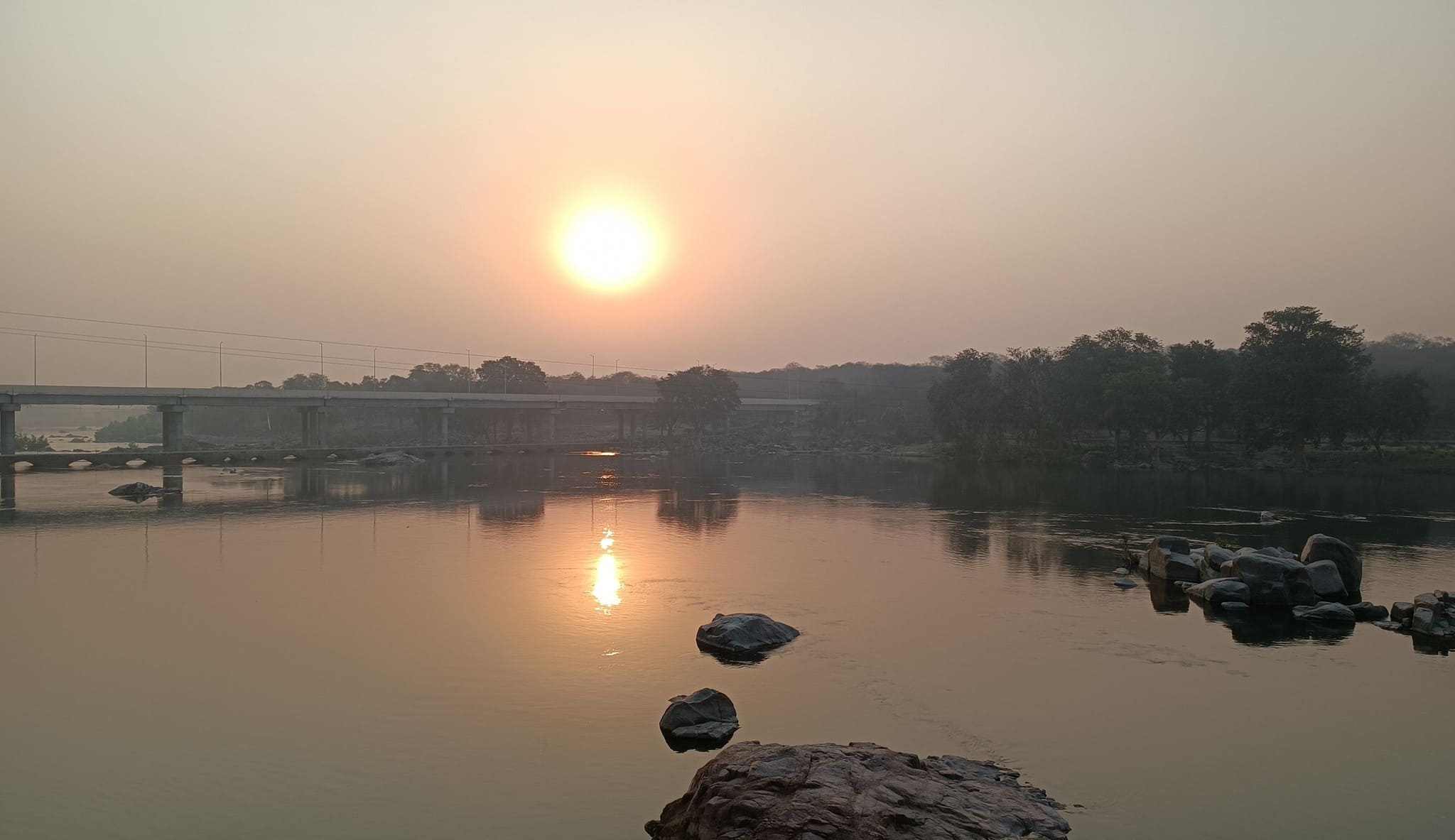
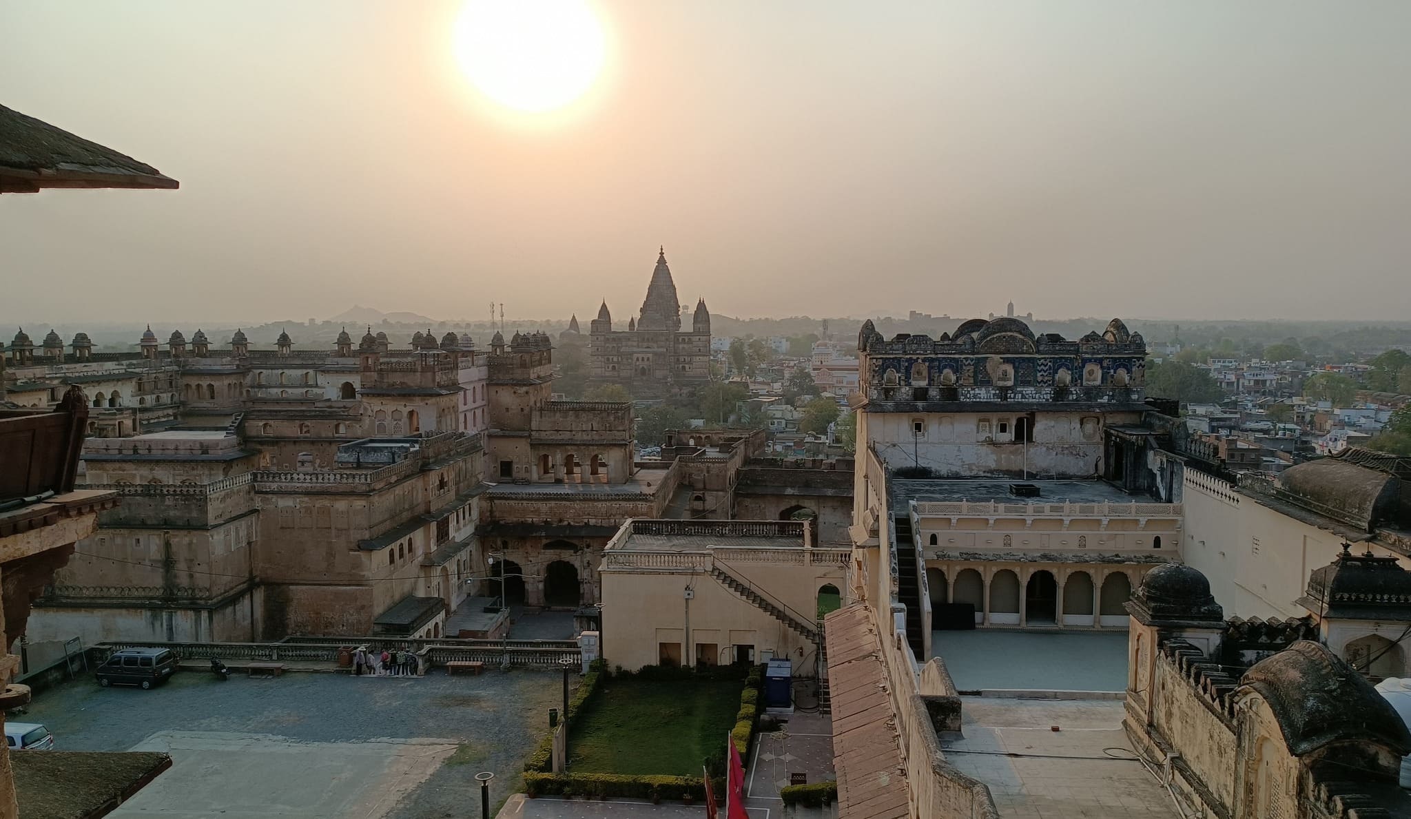
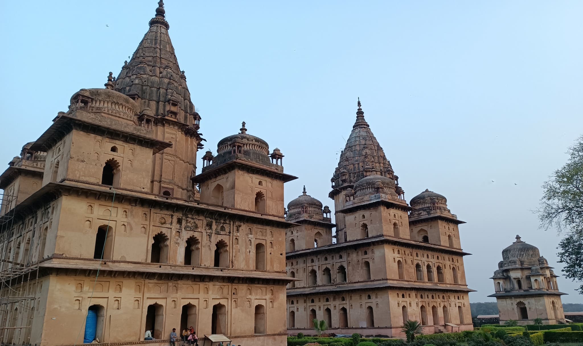
Orchha
A sleepy yet historically ornate riverside town of Orchha, hidden away from the hustle & bustle of the main roads. The palace complex housing two large palaces, the Chaturbhuj temple and the chhatris (memorials) on the Betwa river evoke a sense of nostalgia for a time gone by. It was established by Bundelas in the 16th century AD and named so because it was apparently “hidden” inside forests.
Sunrise on the Betwa river
View of the Orchha town from Jahangir Mahal
Royal chhatris (cenotaphs)Royal Chhatri on the Betwa river bank
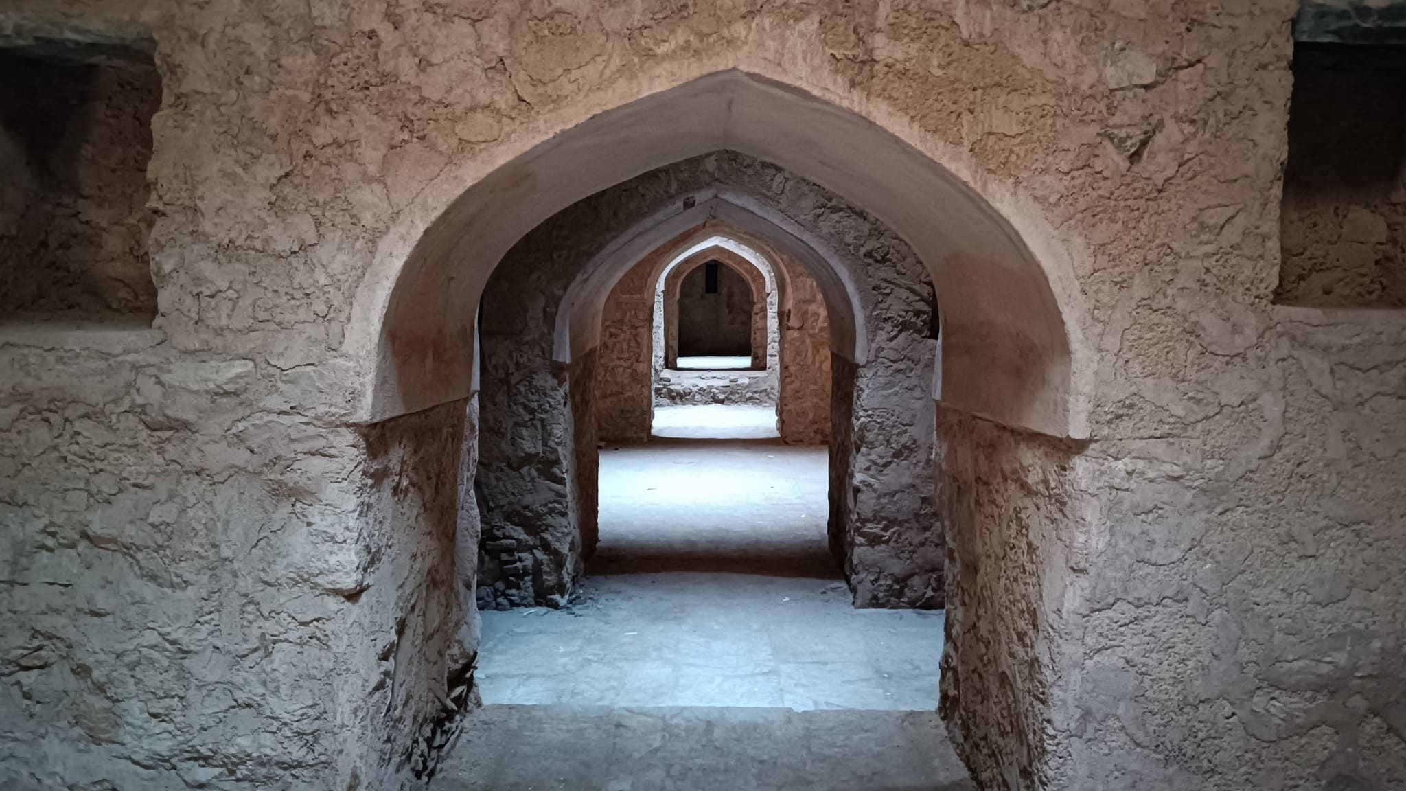
Garh Kundar
An enigmatic palace perched atop a rocky outcrop in the Bundelkhand region that is accessed after driving for a long time in the wilderness. It served as the residence of the Bundelas before Orchha was founded. There also exists a legend of betrayal and beguiling intrigue between two warring clans, leading to the murder of a groom’s procession in the underground caverns of the fort.
Approaching the imposing palace inside the Garh Kundar fort
Entrance to the underground stories
Glimpse of the underground chambersView of courtyard from an upper storey
Raneh Falls
A series of waterfalls in the canyon formed by the Ken river. One can see granite in varying shades of colours ranging from pink, red to grey.
Raneh Falls on Ken river inside the Ken Gharial sanctuary
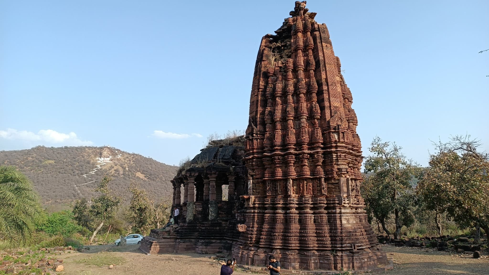
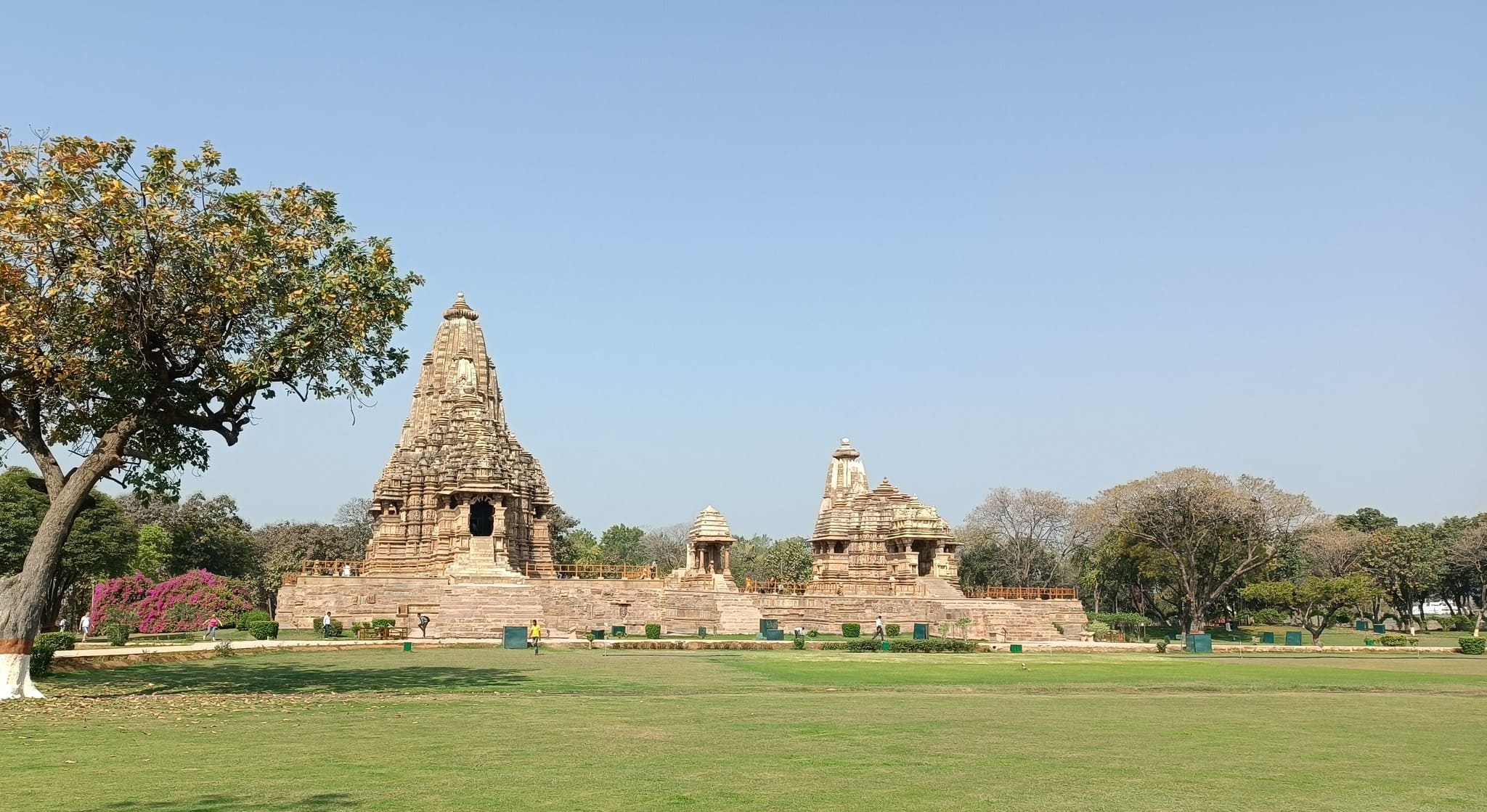
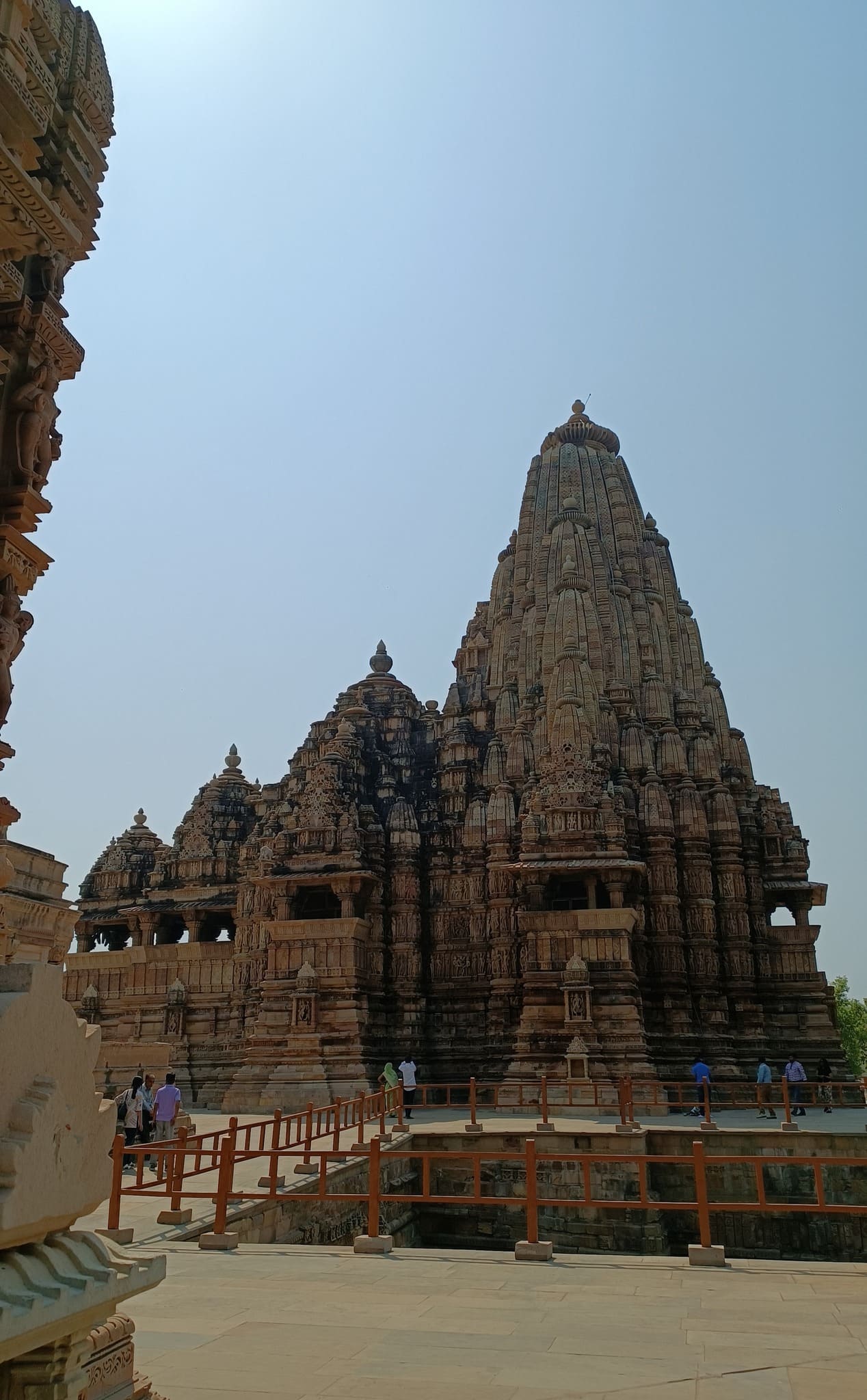
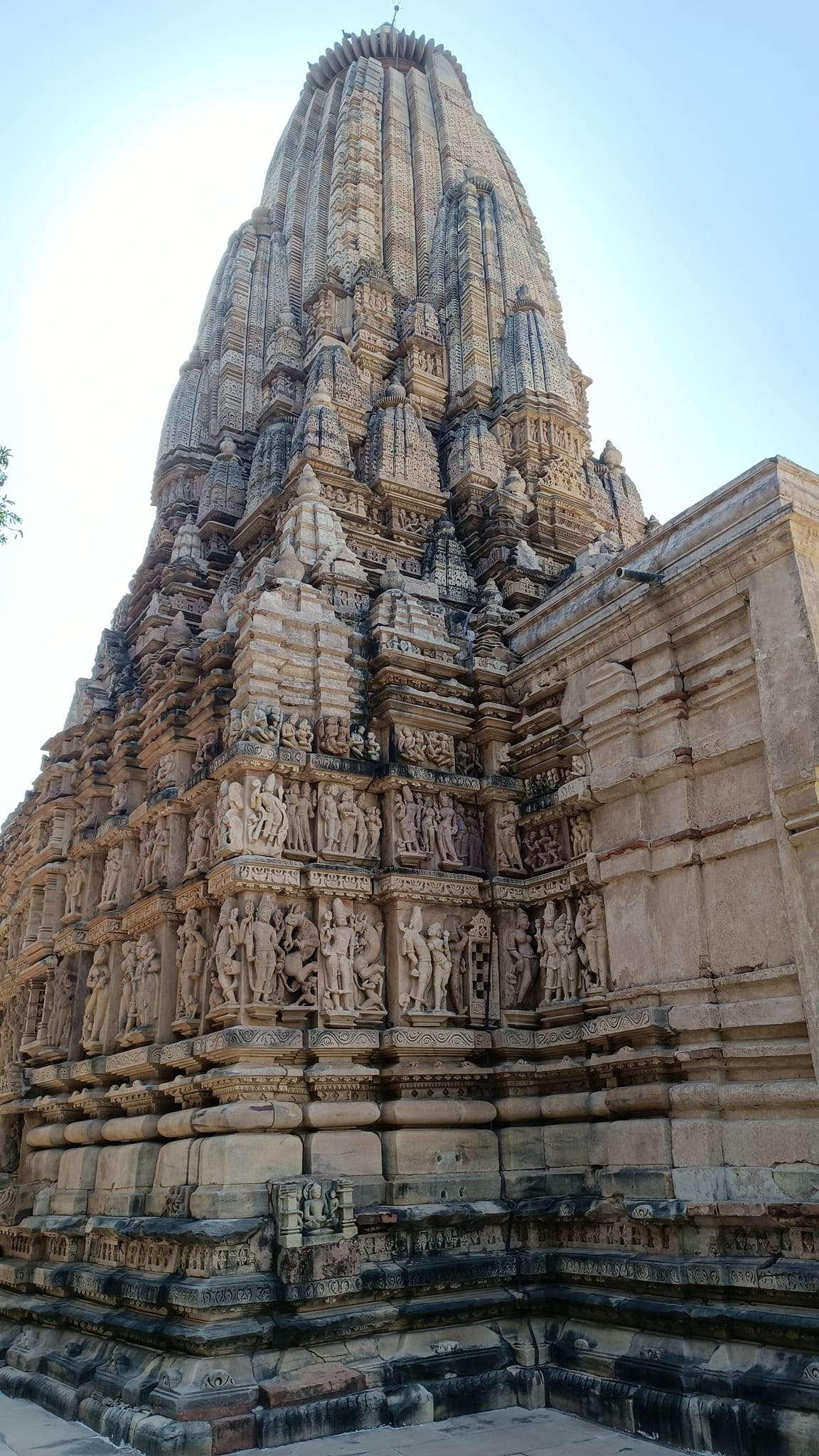
Khajuraho
Perhaps, one of the best known places of India, home to picture-perfect temples with exquisite workmanship in the carvings and sculptures dotting the structures.
View of the Kandariya Mahadev Temple, Western Group of Monuments, Khajuraho
Another perspectiveThe Varaha temple
The Chausath Yogini temple at Khajuraho, in an uncharacteristic rentangular shape, probably from before the circular shape became the norm
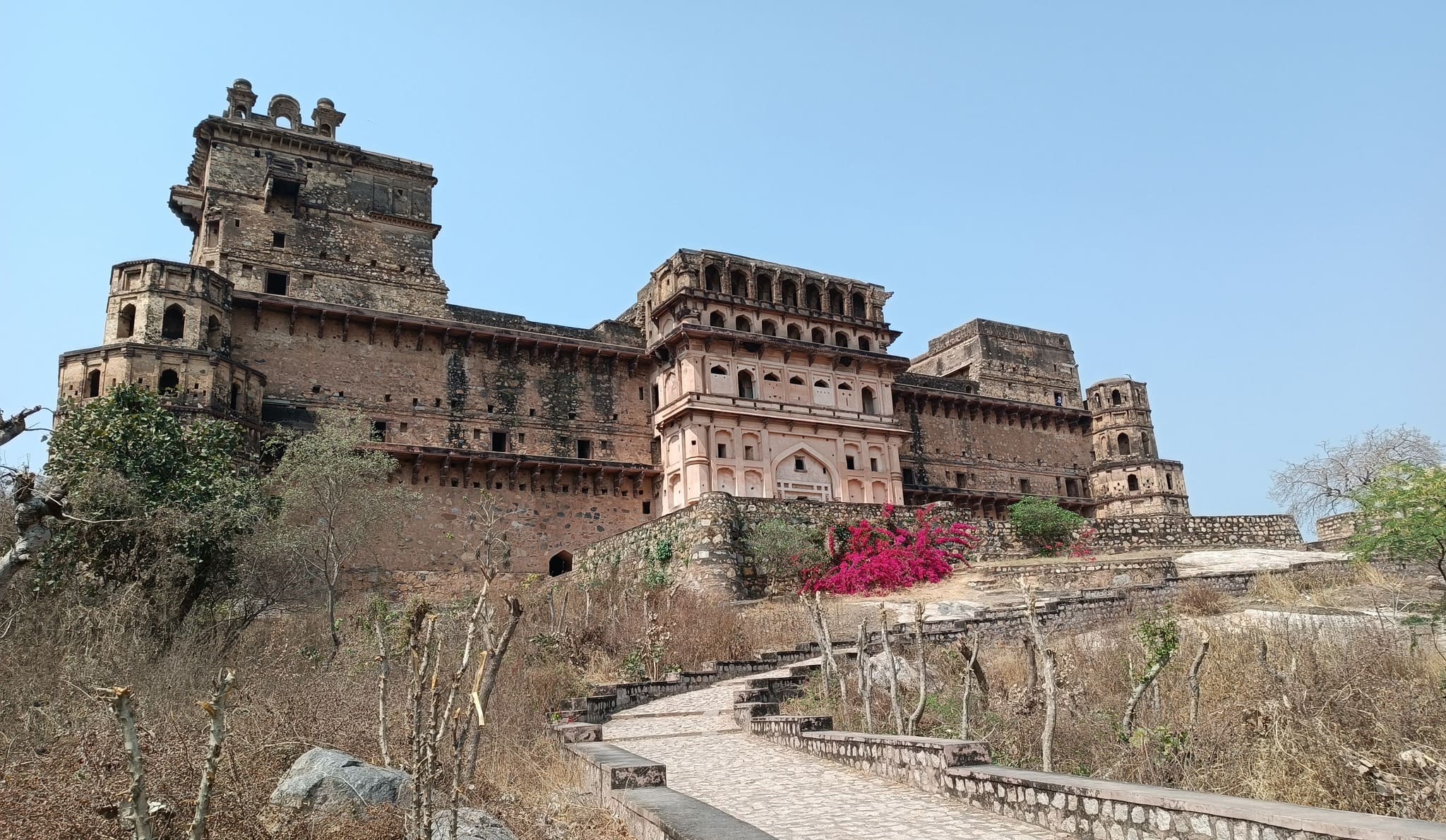
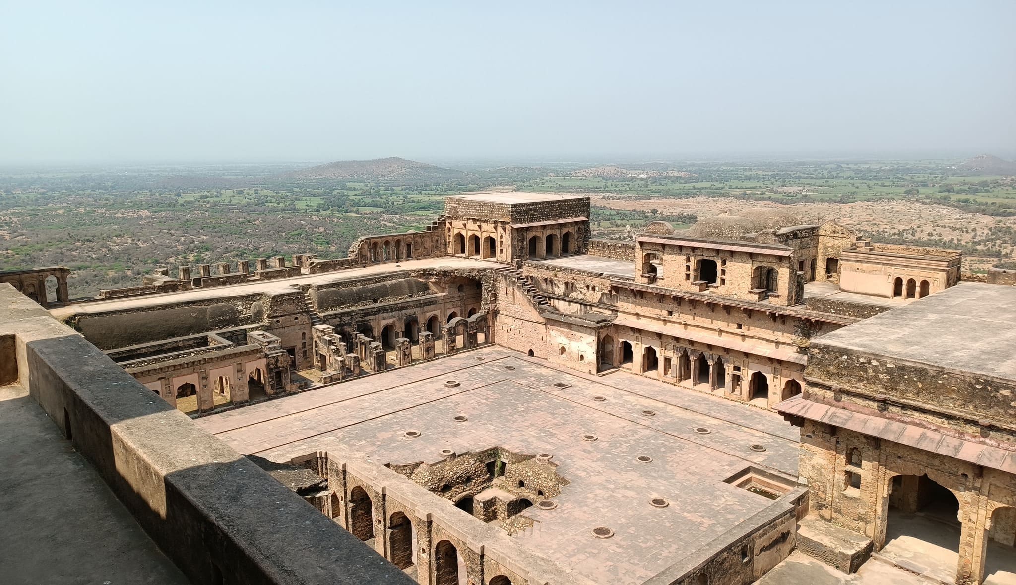
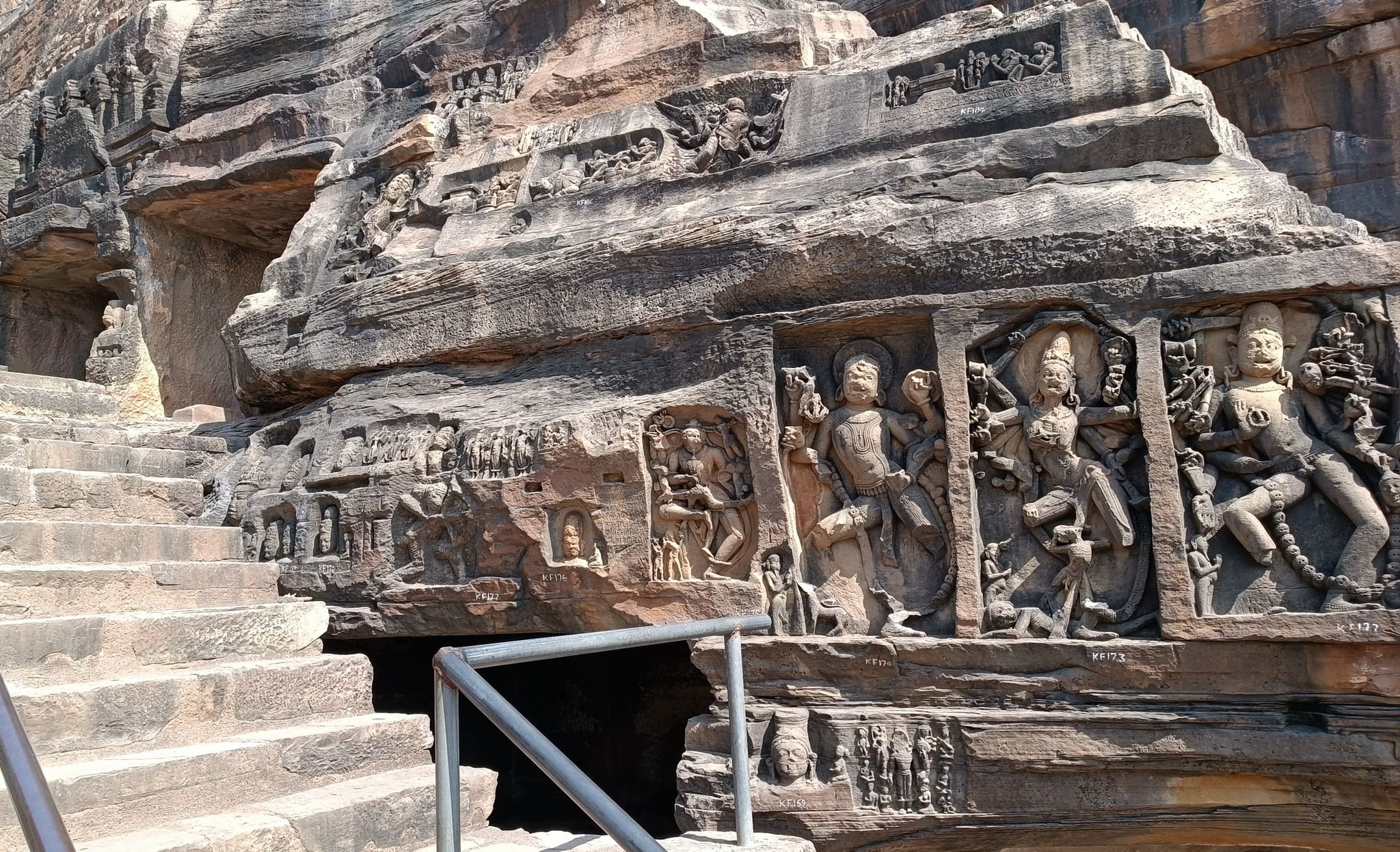
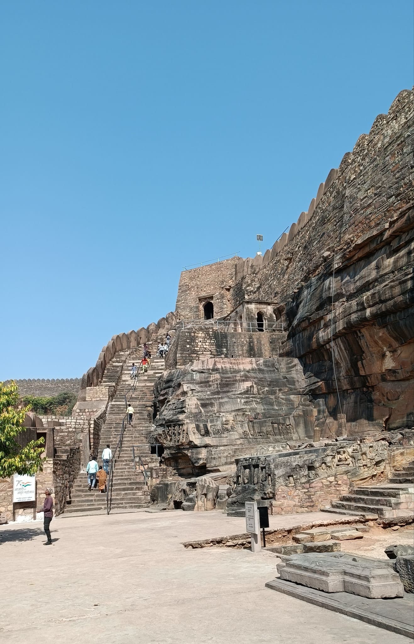
Kalinjar Fort
A place so ancient that it finds mention in mythological texts, with the fort being so important that it became the scene of many a battle and many an invasion, leading to its control passing through many dynasties from the Guptas, the Chedis during the times of Buddha to Mauryas to Chandelas to Mughals and finally to British hands.
On the way to KalinjarThe fort sits atop this hill
Inside the premises of the Kalinjar fort
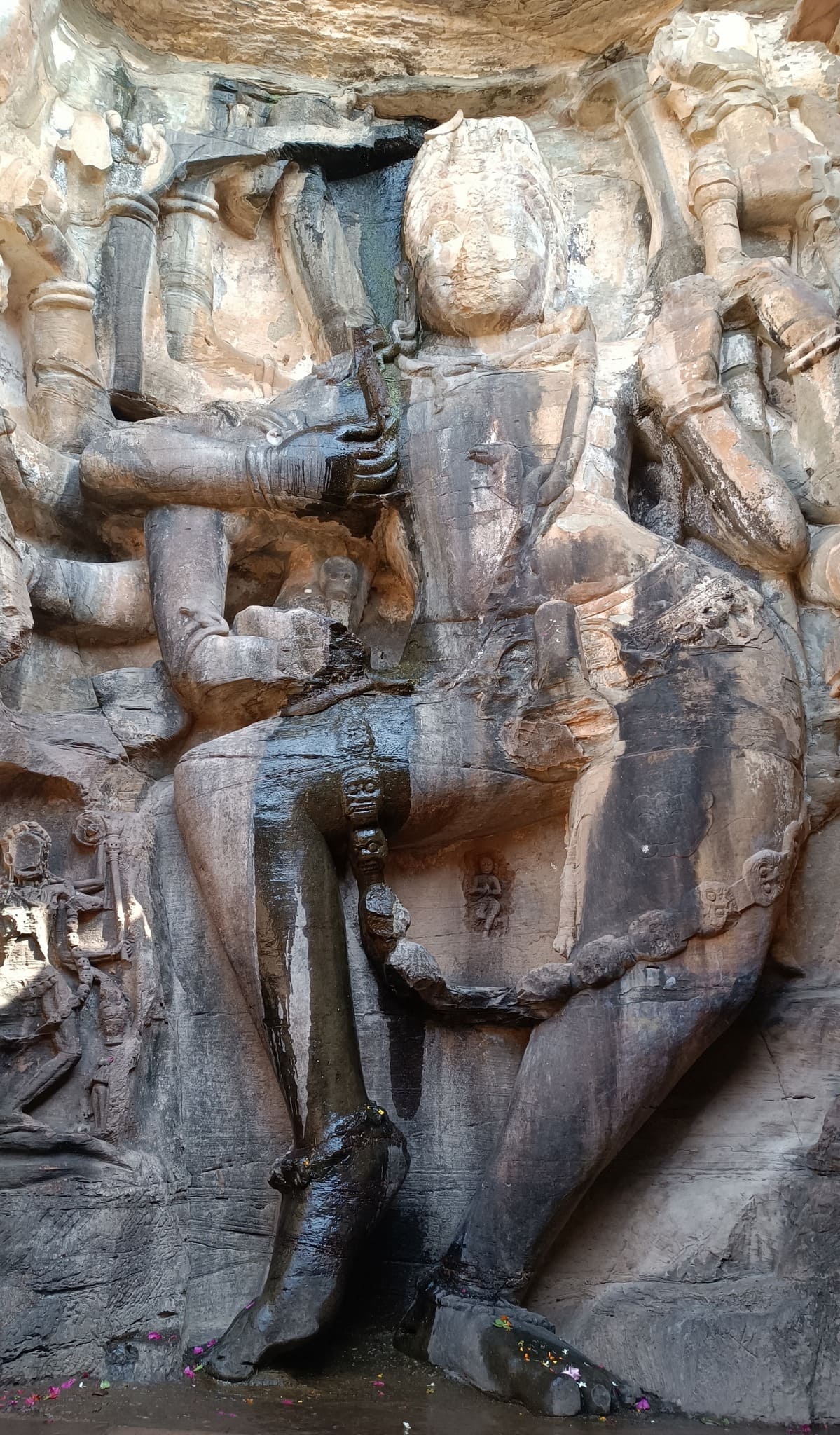
The fort sits on a flat-top hill, sprawling across a vast area replete with forest, ponds, and palaces. However, the most remarkable of the monuments is a temple formed out of a cave in the hillside, with the entrance embellished with a ruined pillared stone structure. The stone steps leading down to the temple are adorned with figures and caves carved into the rocky hillside that immediately transport one into the realm of perilous treasure hunts portrayed in an Indiana Jones adventure.
The Neelkanth temple sits on the hillside, accessed by climbing down a flight of stairs
Sculptures and carvings on the hillside by the steps
The steps connecting the fort premise with the Neelkanth templeMahasadashiva, a form of Shiva
2022 turned out to be the year where I did things that I had only ever dreamt of doing – a self-driven cross-country trip!
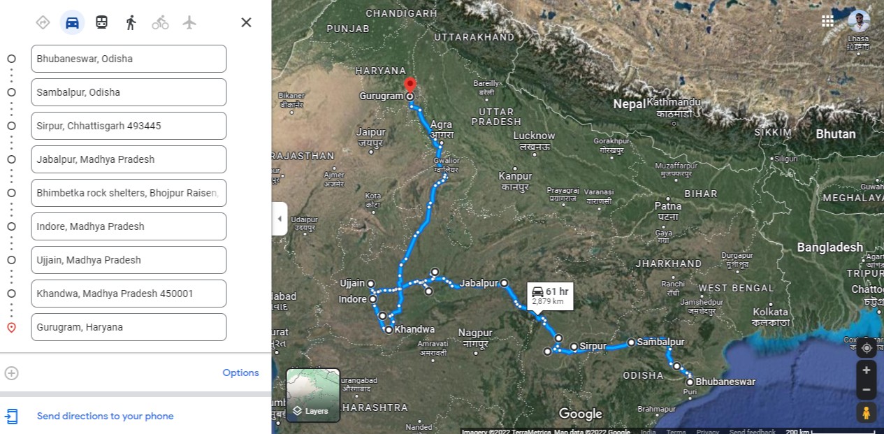
In late October, around Diwali, I drove my parents through a 3250+ km trip from Bhubaneswar to Gurgaon via Chhattisgarh and Madhya Pradesh.
Throughout 2021, while the pandemic was still raging, and concern for my parents back in Odisha constantly kept me on the edge, I mulled the idea many times of driving down to Bhubaneswar from Gurgaon. Little did I know that when the occasion to make the cross-country road trip eventually came, it would be in the reverse direction!
With our new car gathering dust in Odisha, and the family travelling suppressed for more than 2 years, what better way than a cross country road trip to accumulate some miles on the Blue Buck?
As usual, we had only an idea of the stops we would be taking and the route in general, and no advance reservations. The early winter weather was great, we discovered places to see as we advanced.
This is how we stumbled upon the quaint, ancient town of Sirpur on the banks of the Mahanadi, abounding in Shiva temples and Buddhist monasteries. We then took a detour to the Bhoramdeo temple, equalling Khajuraho in artistry, tucked away in a forest by a foothill. And of course, we veered off course for a pilgrimage to the birthplace of Kishore Kumar, who my Dad and I both idolize.
Unfortunately, Google Maps only allows 10 locations, and the route charted does not account for an additional 400km that we gathered exploring local places, over 10 days.
Each major location deserves an individual post to present the place in its fullest glory. In fact, neither a single post, nor the pictures do justice to the beauty, the mystique and the serenity we experienced as we drove through these places.
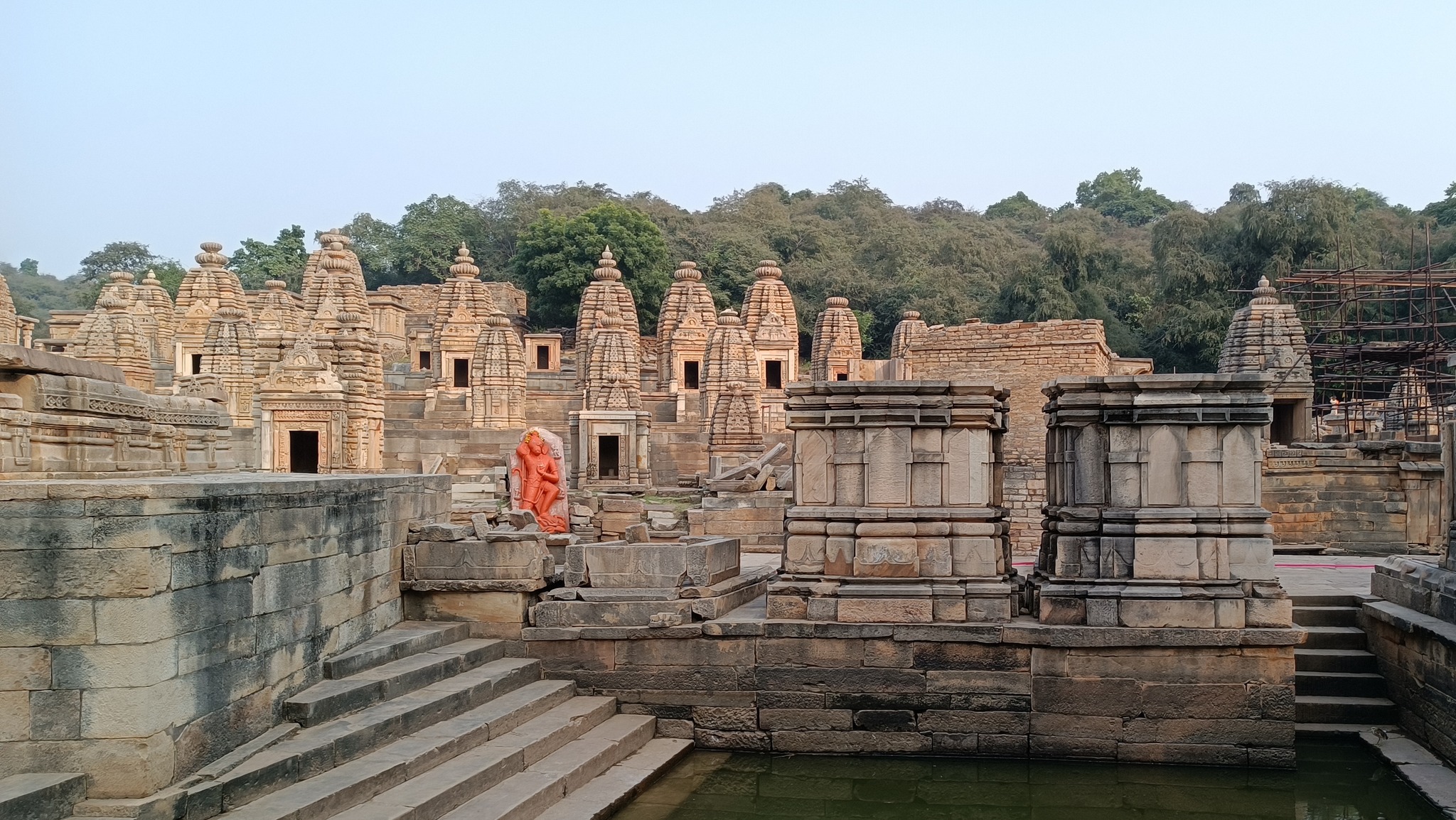
Sirpur
an ancient town, an important settlement of the South Kosala kingdom located on the Mahanadi river, the capital of the Panduvanshi dynasty, a major town of South Kosala kingdom. It saw its glory days from the 5th to the 12th century AD and is home to numerous Shiva,Vishnu and Shakti temples, Buddhist and Jain monasteries.
Surang Tila, multiple temples sit on the high platform accessed by steep steps
The Laxman temple at Sirpur, a 7th century AD brick temple
Ananda Prabhu Vihara
Bhoramdeo temple
11th century AD Shiva temple, built in the style of the Khajuraho and Konark temples, also nicknamed ‘Khajuraho of Chhattisgarh. It lies at the edge of the forest at the foothills of a hill range that is traversed through the Chilpi ghat.
Bhoramdeo temple
The drive through Chilpi Ghat makes you cut across this dense jungle abounding in natural beauty & wildlife.
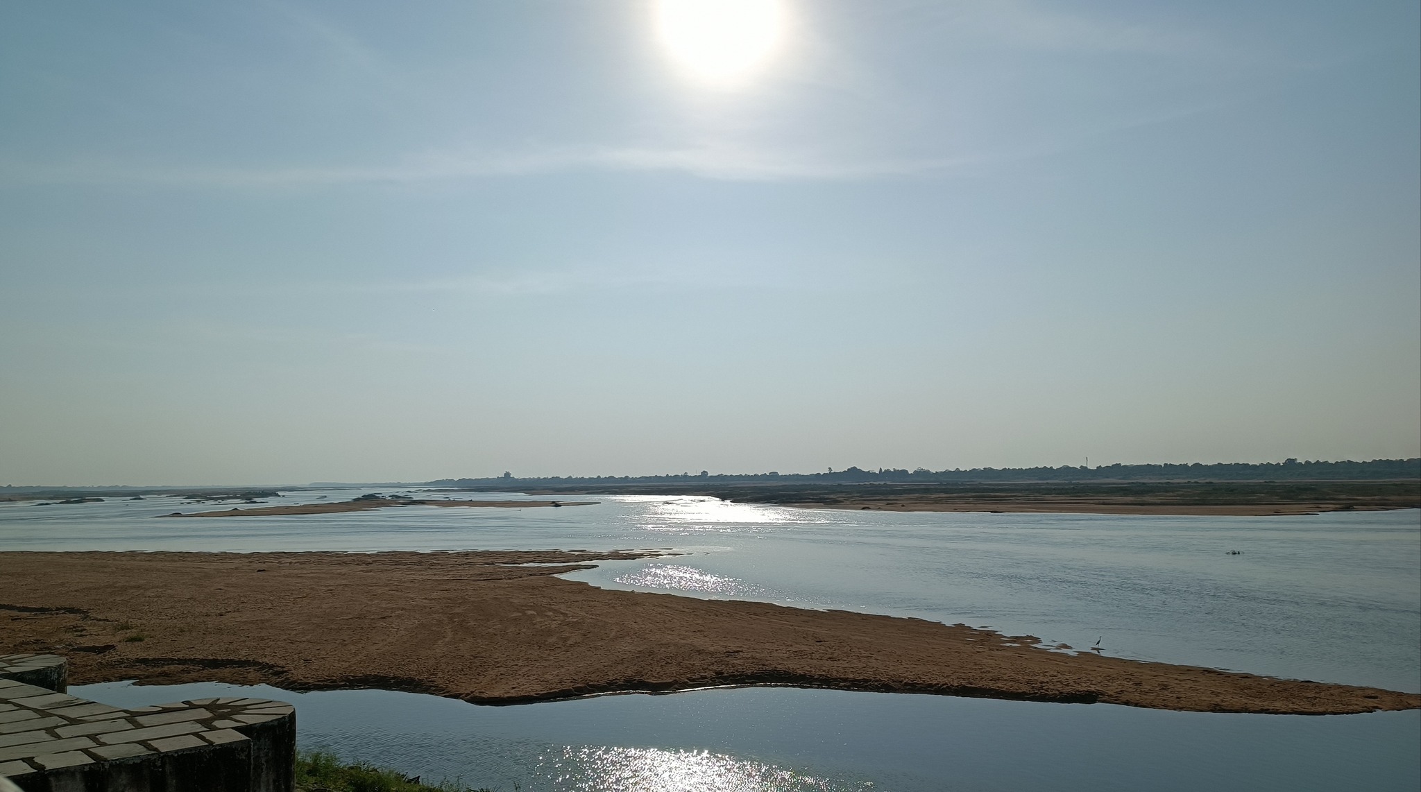
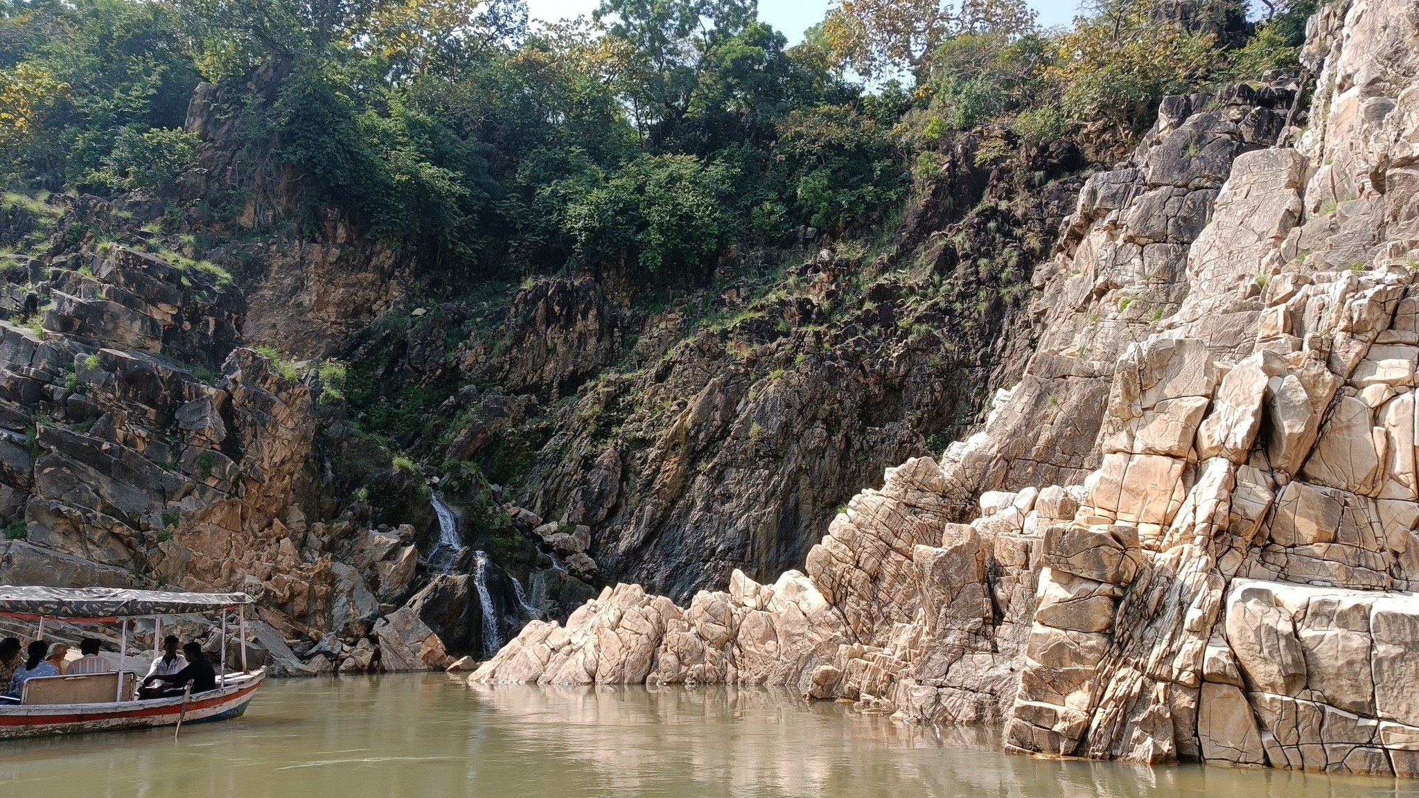
Jabalpur
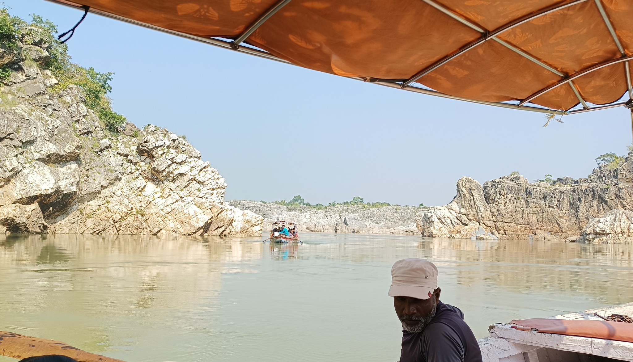
Marble Rocks in the Narmada river at Bedaghat, in a ravine formed in the hills replete with marble stone
Bhedaghat marble rocksA tiny waterfall at Bhedaghat
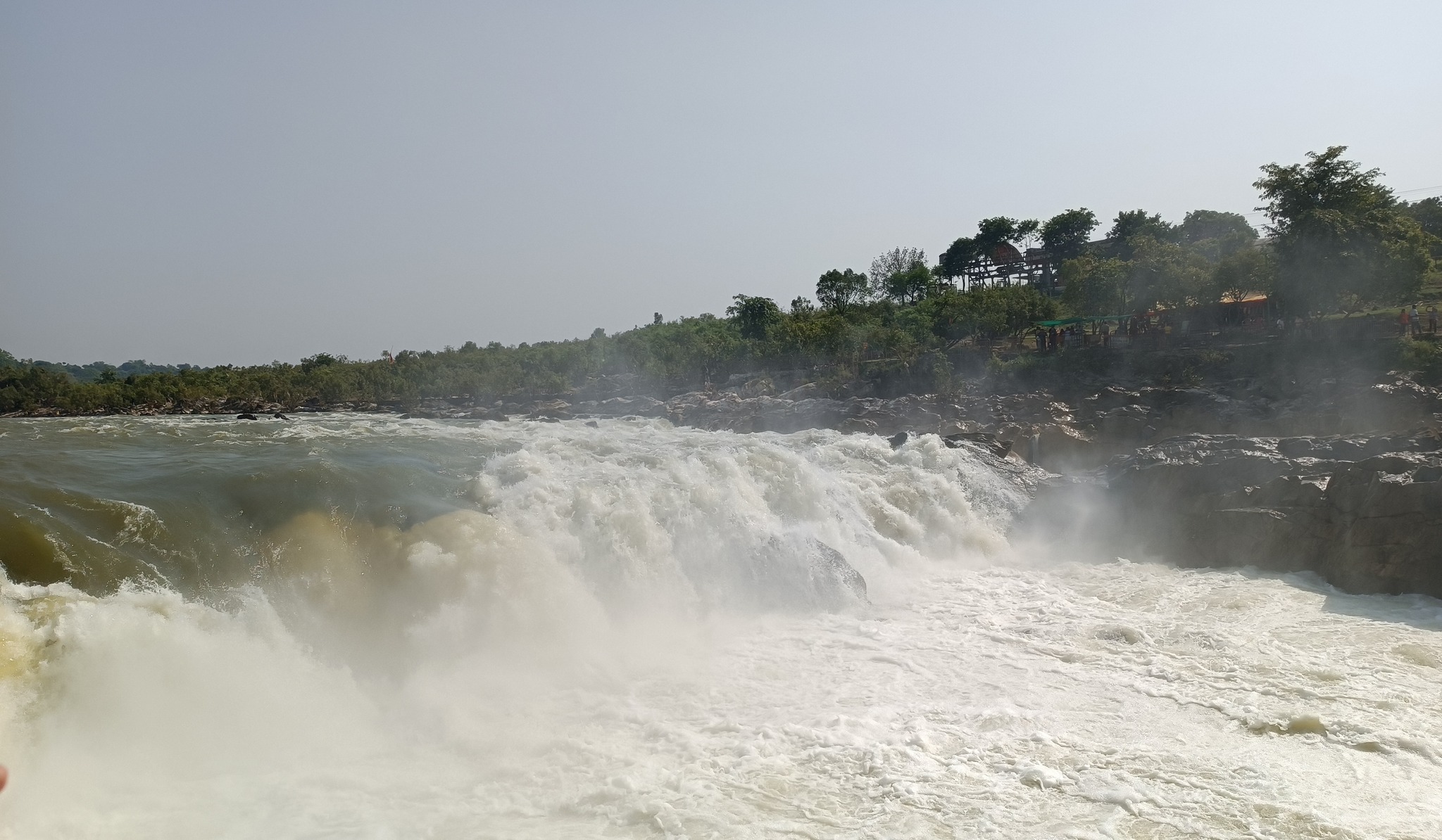
Dhuandhar waterfall on the Narmada river, Jabalpur
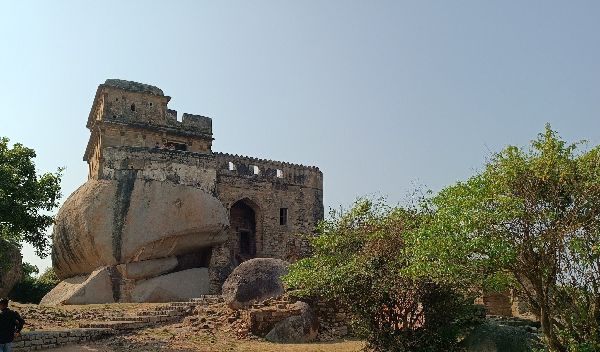
Madan Mahal fort (12th century AD), Chausath Yogini temple (11th century AD), Dhuandhar waterfalls
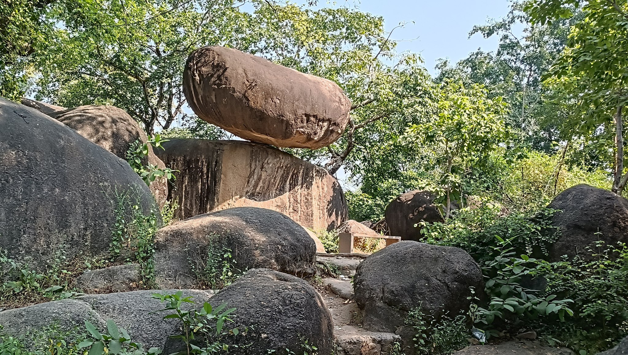
Madan Mohan palaceBalancing rocks
Chausath Yogini temple, Bhedaghat, Jabalpur
We happened to witness the Solar Eclipse on our way to Vidisha from Jabalpur.
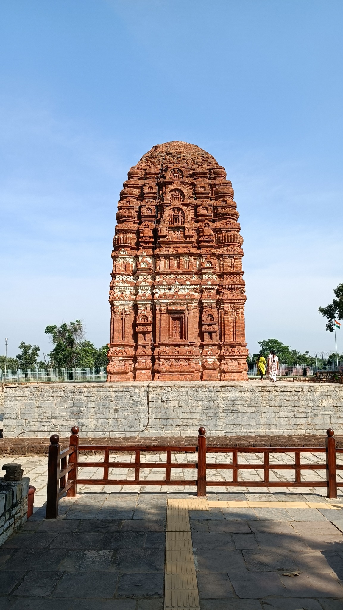
Vidisha
Udaygiri caves, 4th-5th century AD cave complex containing caves with Hindu sculptures (Hindu gods, especially, avatars of Vishnu) as well as Jain sculptures, located on a small hill
Varaha avatar of Vishnu, Cave no. 5 at Udaygiri, Vidisha
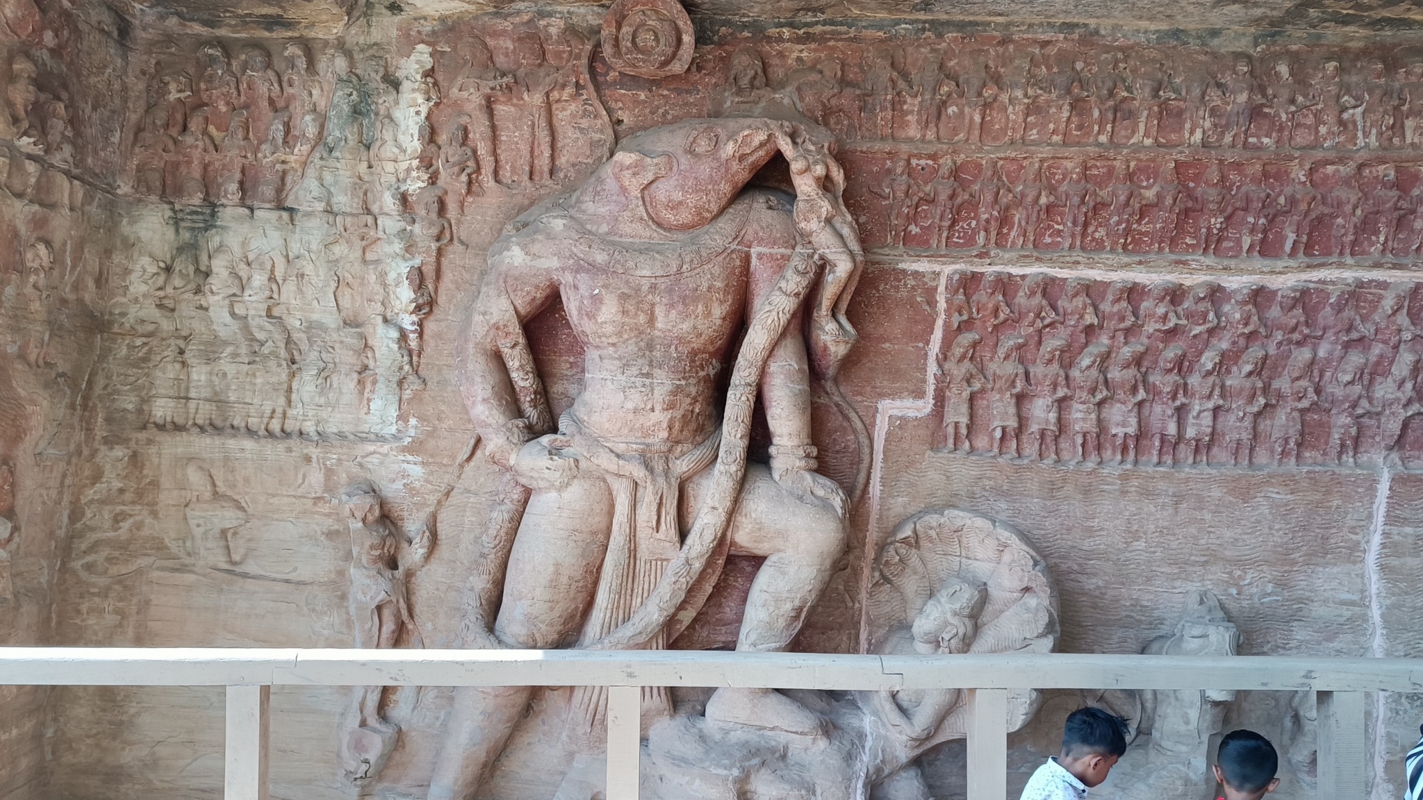
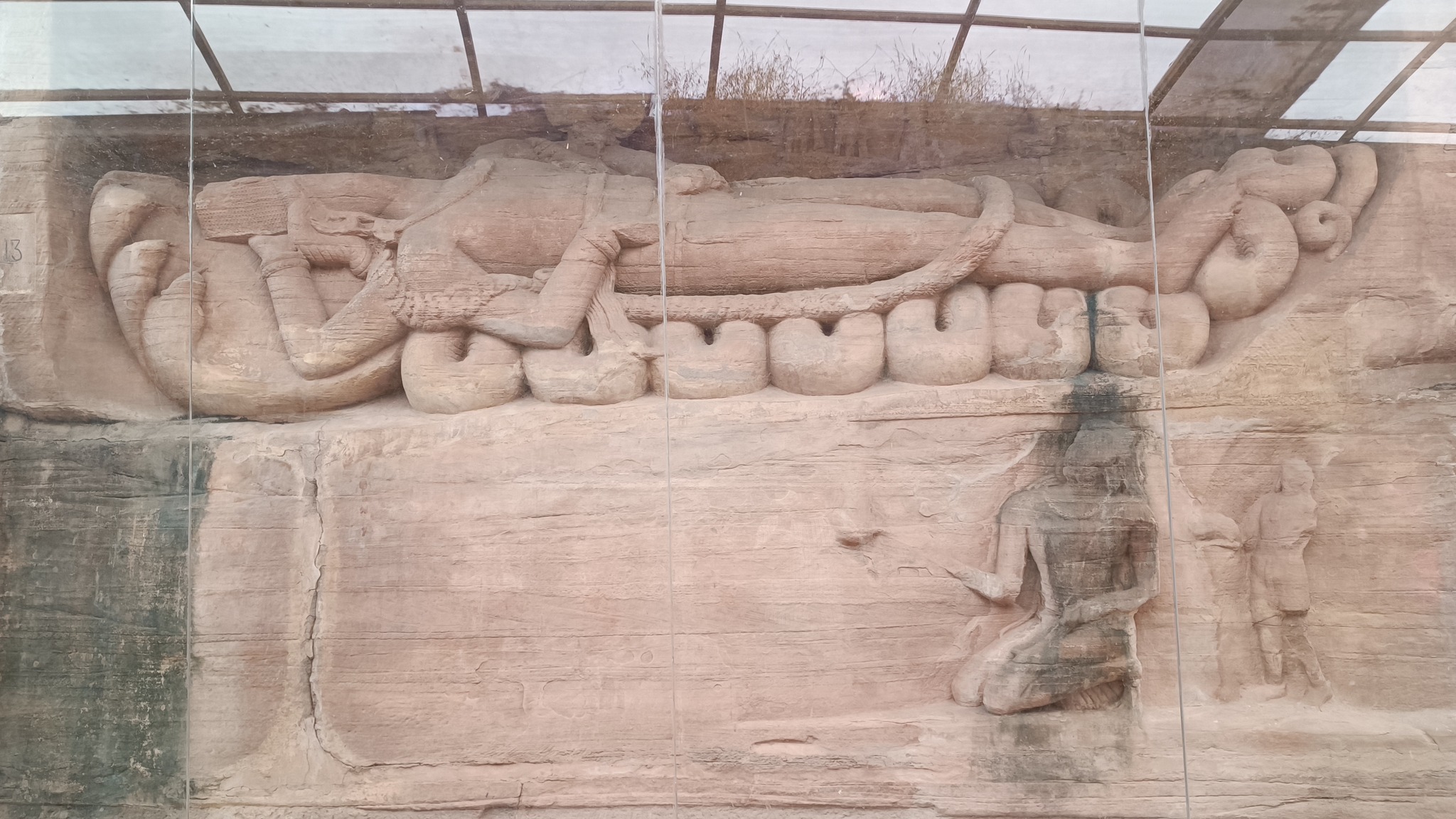
Anantasayanan (the Eternal Sleep) of Vishnu, Cave no. 13, Udaygiri, VidishaBija Mandal, Vidisha
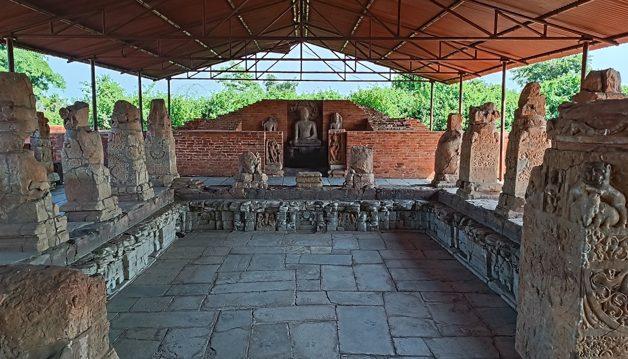
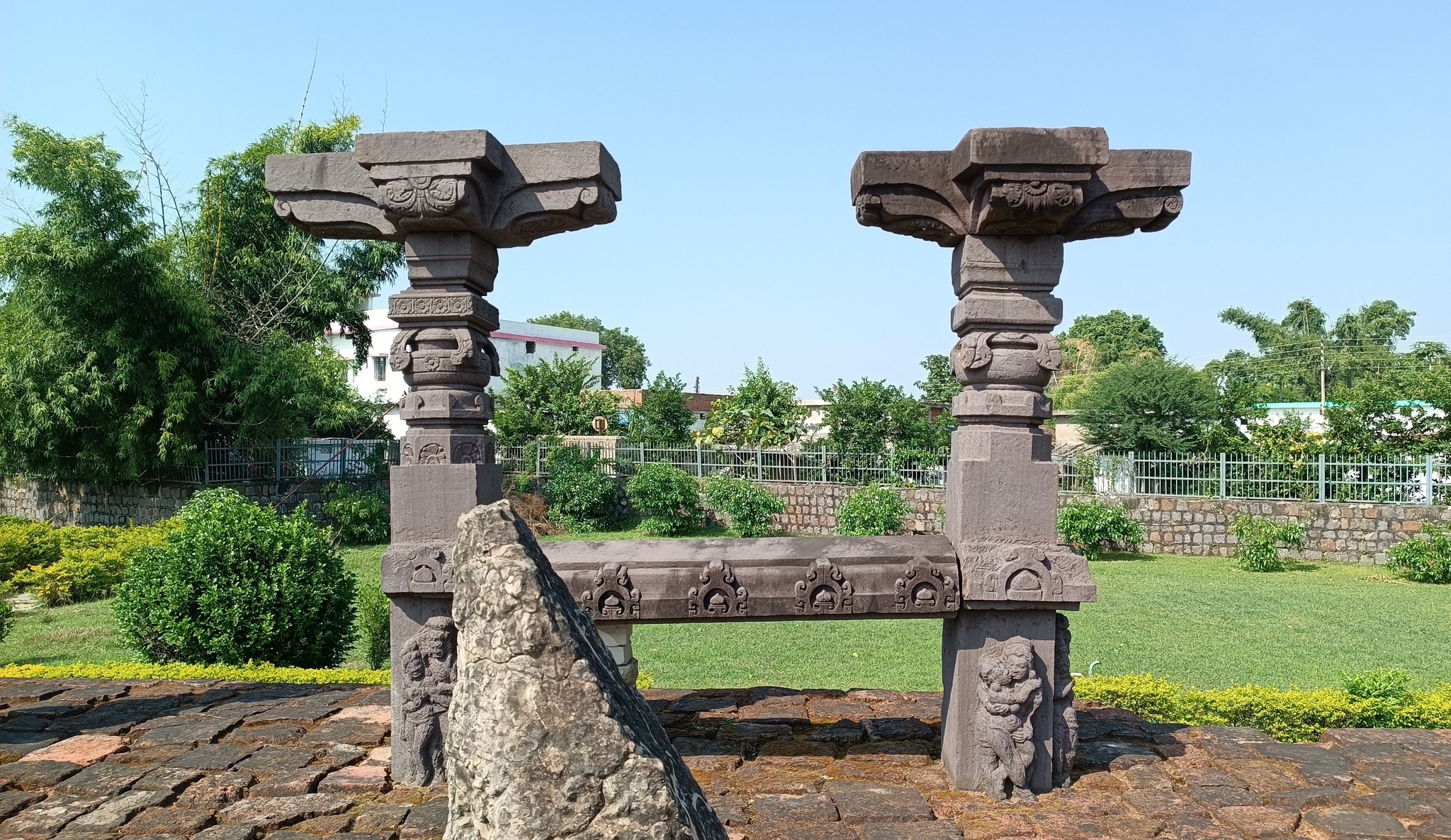
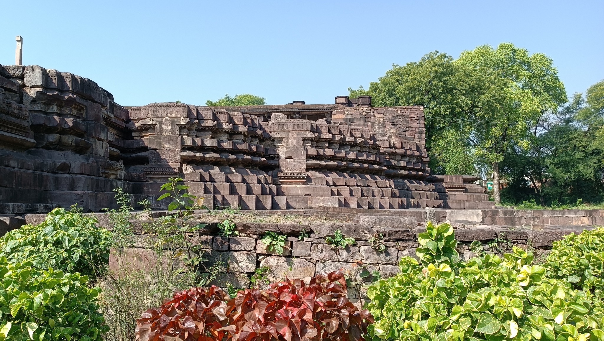
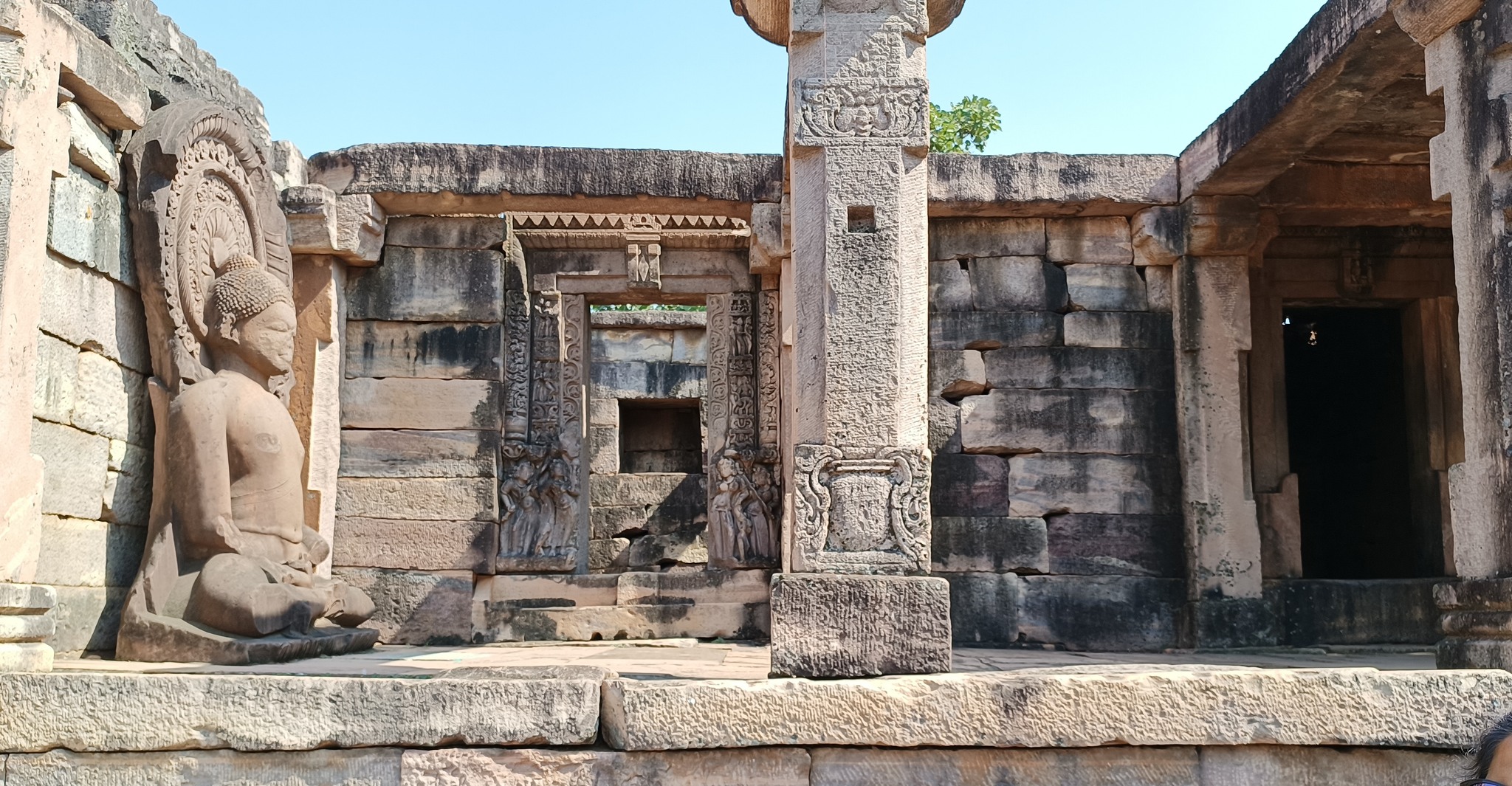
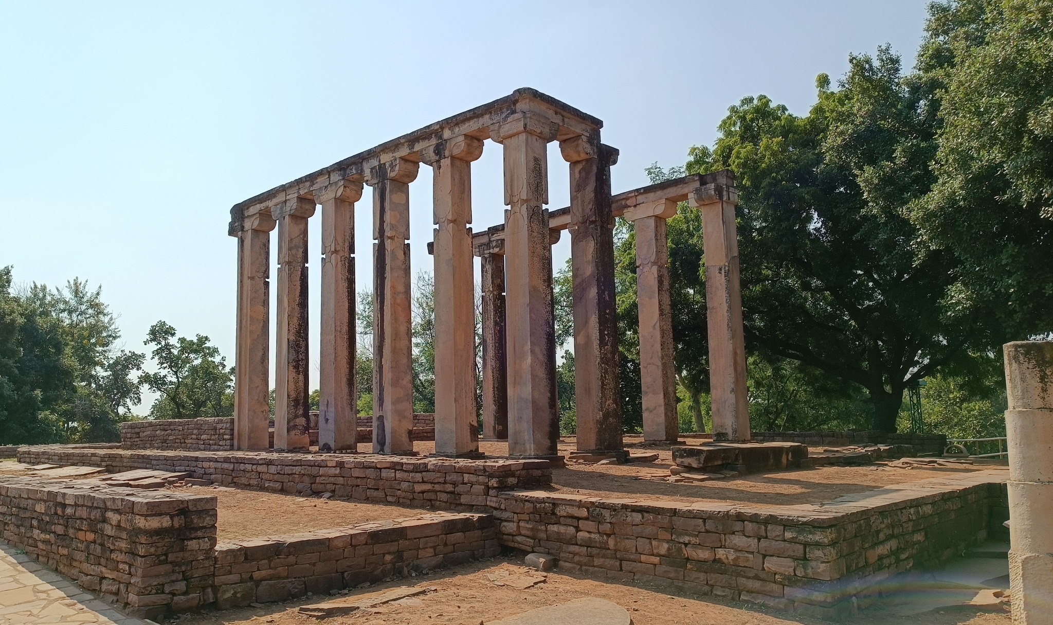
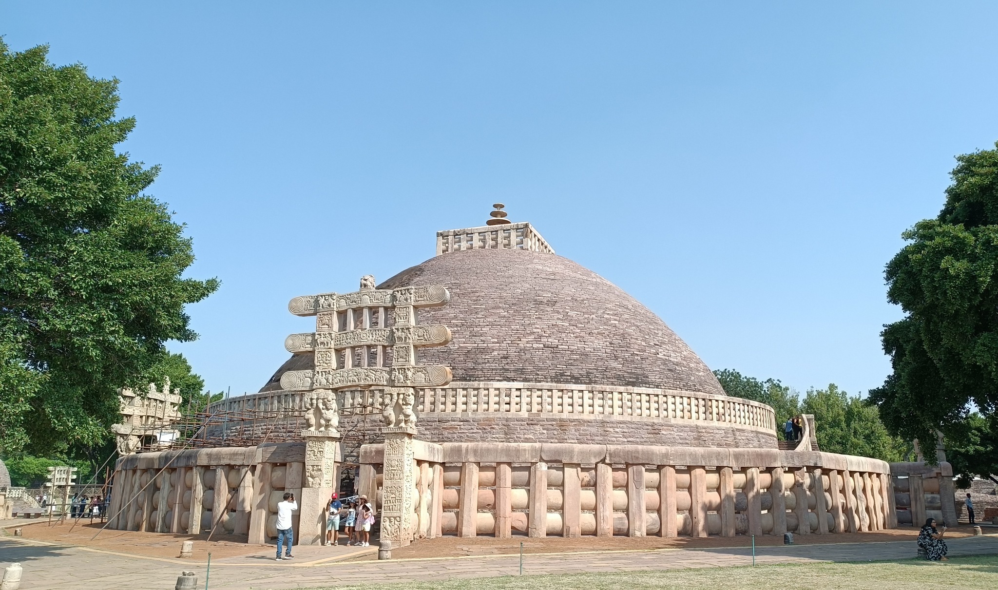
Sanchi
A World Heritage site, with Multiple large stupas dating back to Ashoka’s time (3rd century BC), and Buddhist monasteries dating from
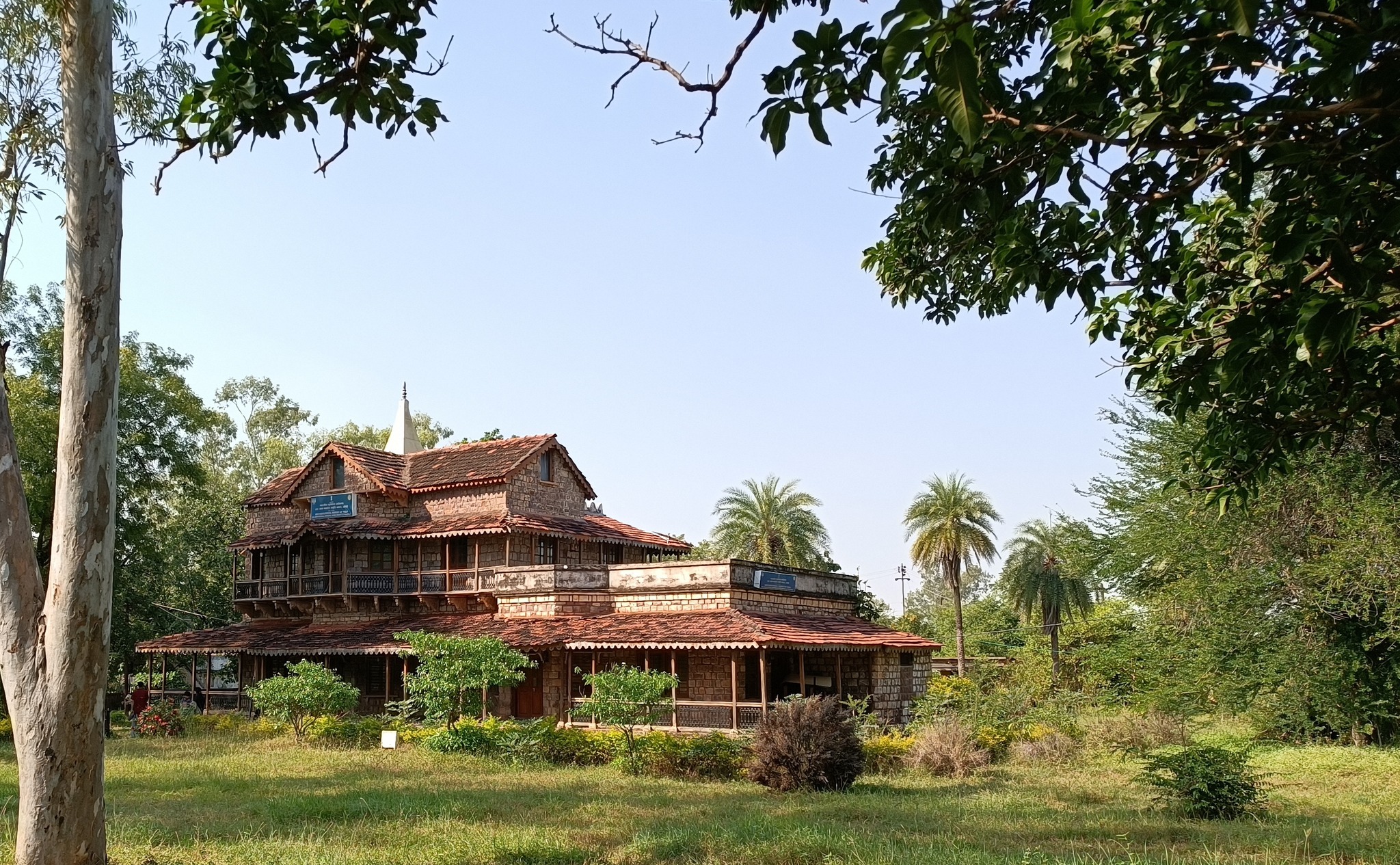
The Bungalow at which John Marshall, Director-General of the Archaeological Survey of India, stayed during the restoration of the Sanchi Stupa
The Great Stupa at Sanchi, oldest & largest at Sanchi, started in Mauryan times
Raisen (near Bhopal)
Raisen fort, an imposing 11th century fort
Glimpses of Raisen fort
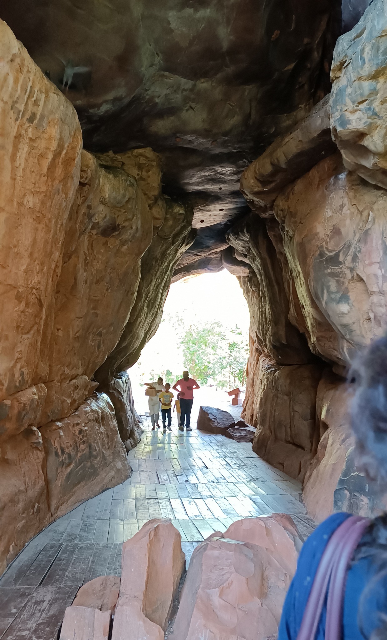
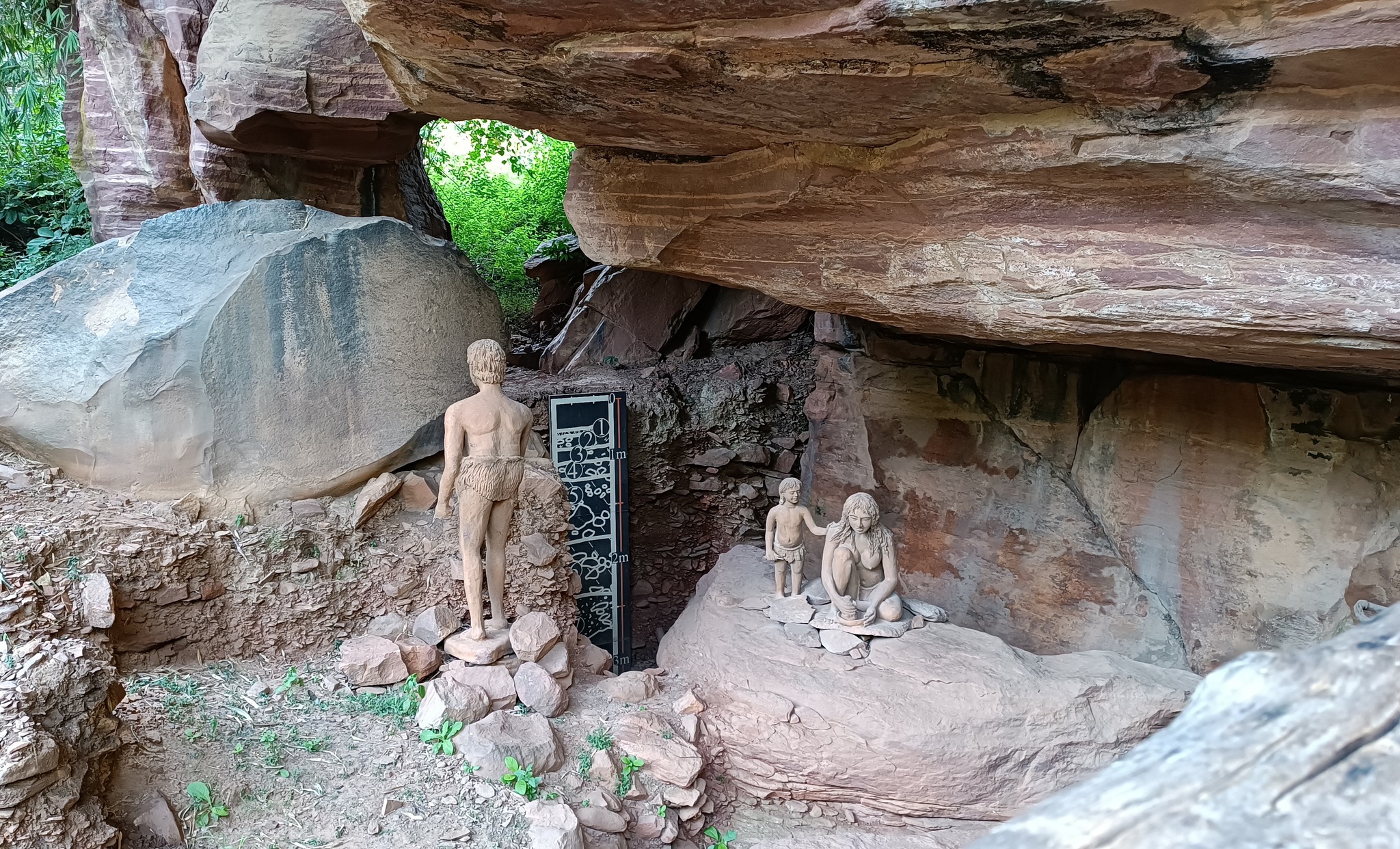
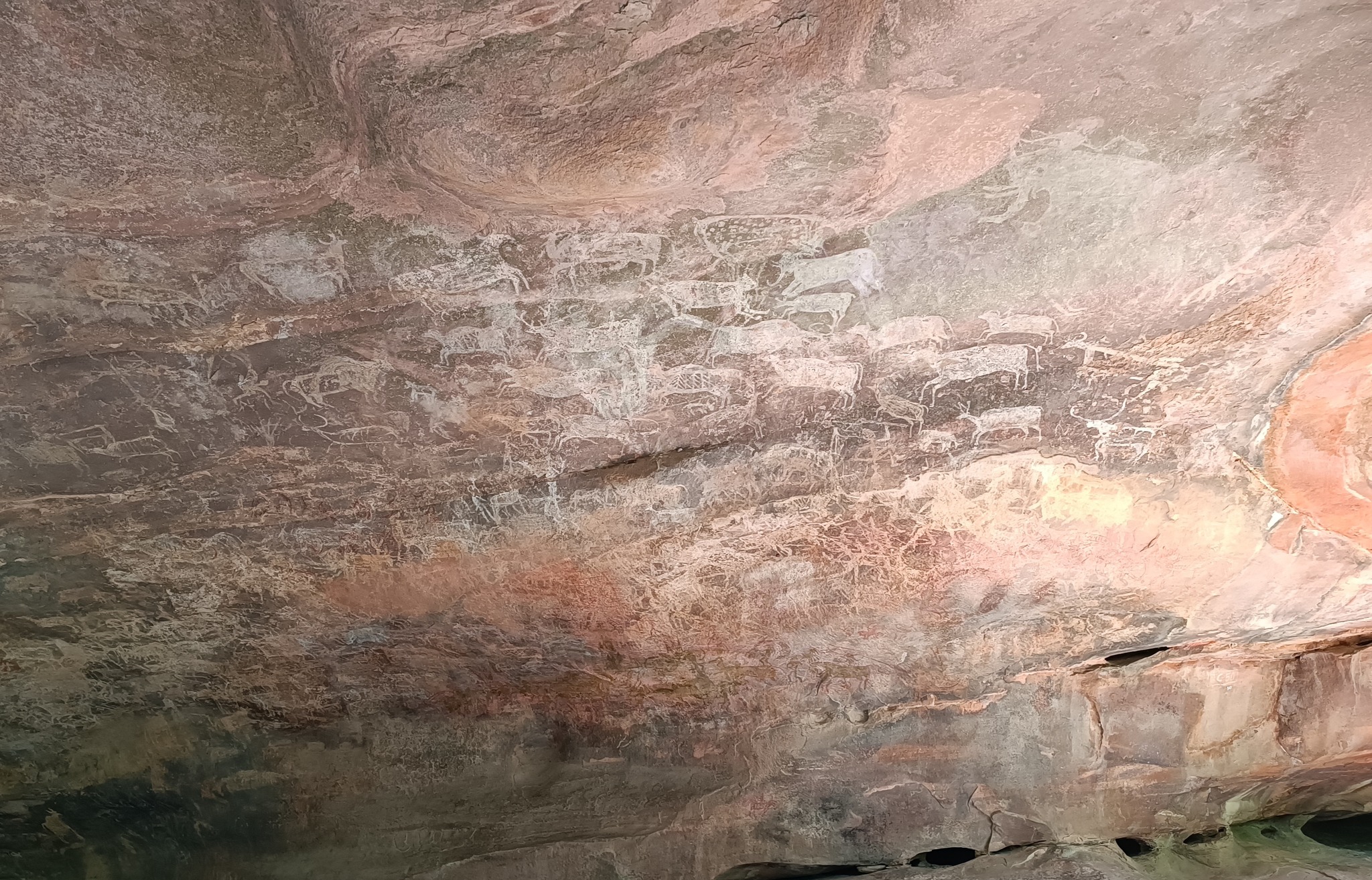
Bhimbetka rock shelters
A complex of rock shelters on a hill near Bhopal, which contain paintings made by humans from both the prehistoric as well as historic ages
Glimpses of Bhimbetka rock shelters, along with rock paintings
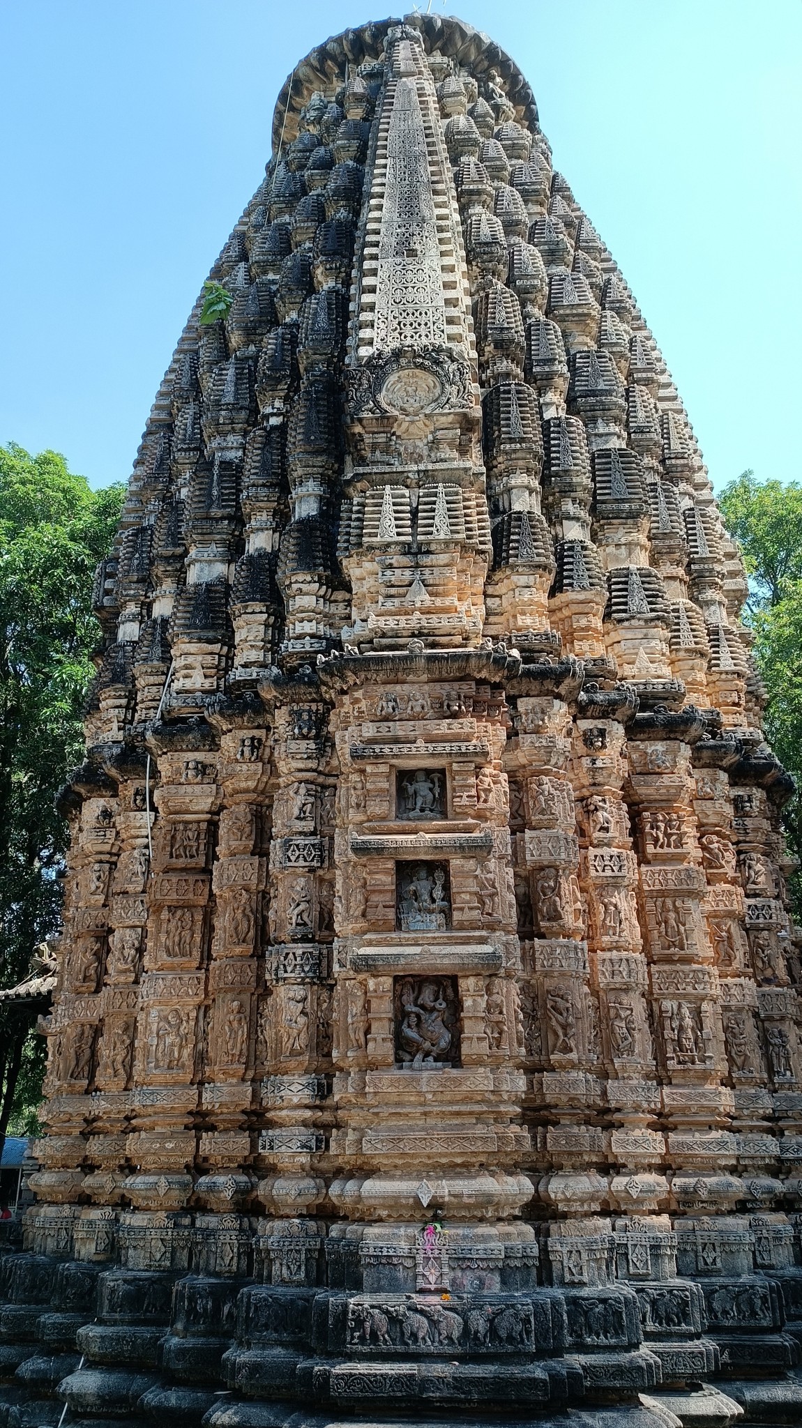
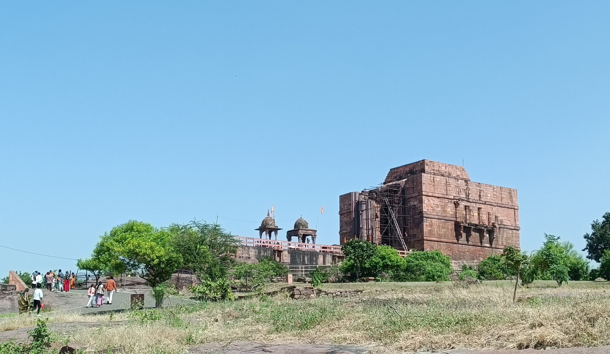
Bhojeswar temple
A 11th century Shiva temple,housing one of the largest Shiva lingas, commissioned by the legendary Raja Bhoja
Bhojeswar temple
Ashapuri group of temples
A group of 26 temples, currently in ruins, not very far away from the Bhojeswar temple. They were probably built under the patronage of the Pratiharas and the Parmaras. Their location on the shore of a lake points towards a luxurious setting during its prime, although the site itself would have been of ritualistic purpose.
A ruined temple lying on the lakeside at Ashapuri
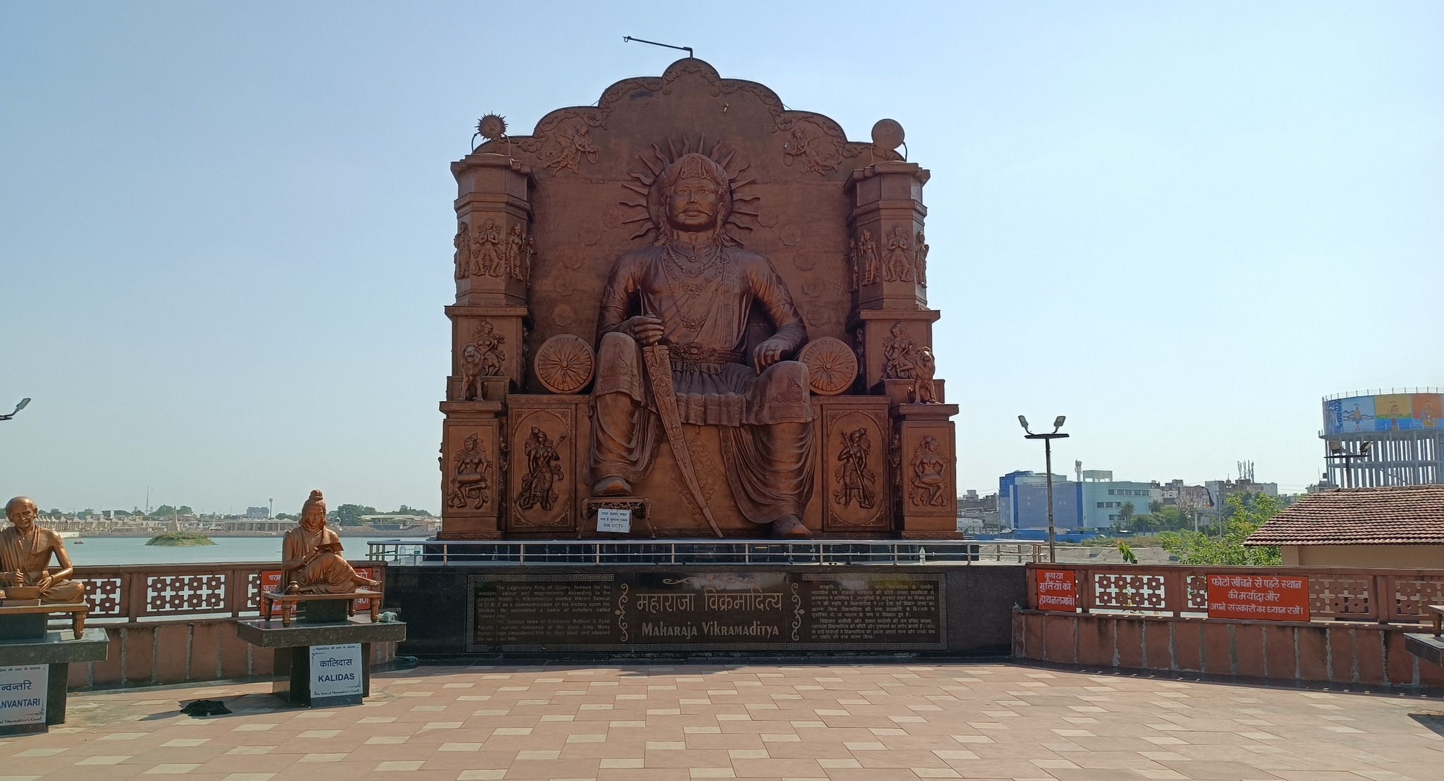
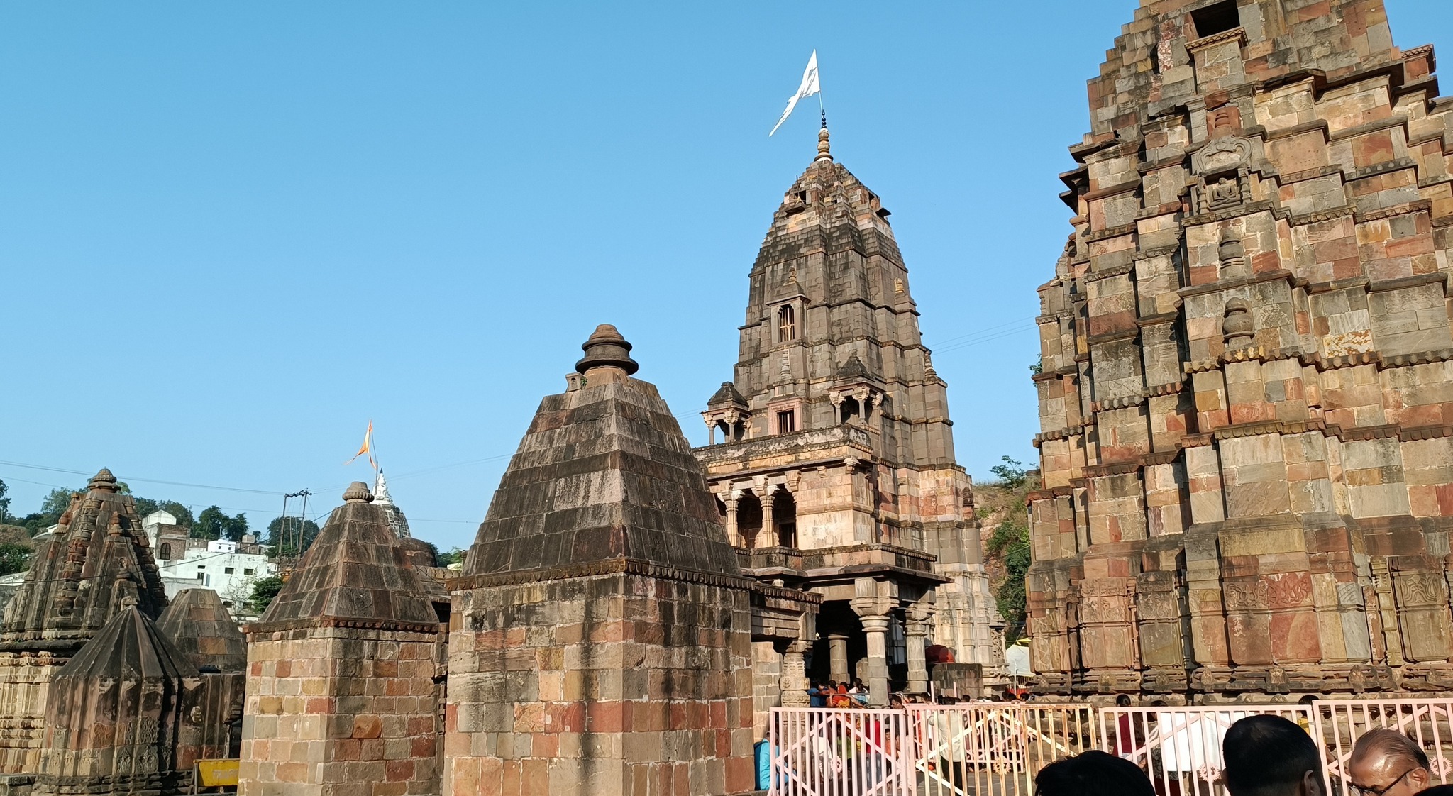
Ujjain
Home to the Mahakaleswar jyotilinga (one of the 12 jyotirlingas), a city of antiquity, capital of the Avanti kingdom, one of the Great Realms of ancient India. Also associated with the mythical King Vikramaditya, of Vikram & Betaal fame.
A statue depicting the mythical king Vikramaditya
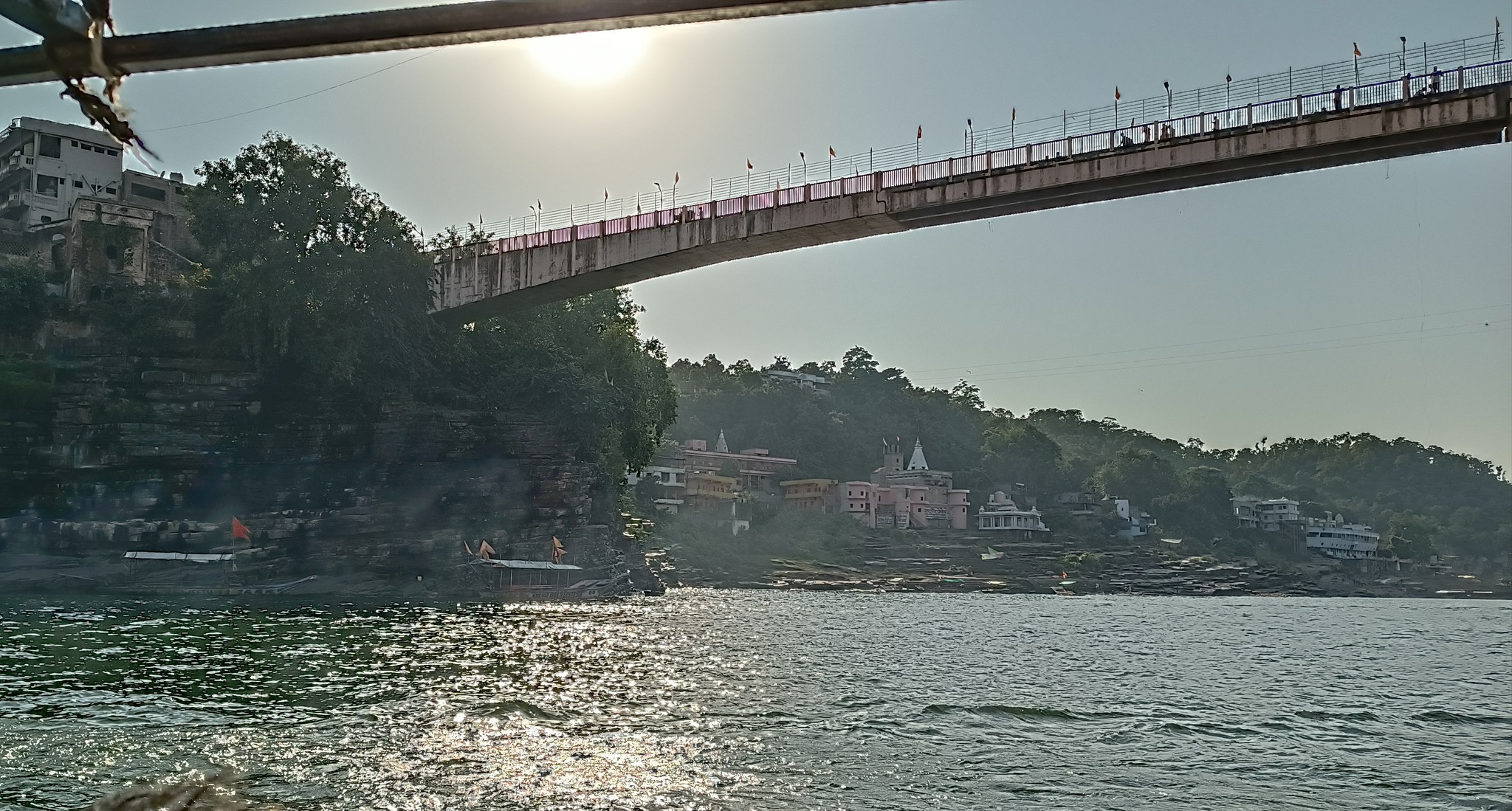
Omkareswar
The site of the other jyotirlnga in Madhya Pradesh, Home to the Omkareswar and Mamaleswar temples dedicated to Shiva, located on the Narmada river
Views at Omkareshwar
Khandwa
A small town in Madhya Pradesh, birthplace of the legendary Kishore Kumar
Gwalior
Bateswar group of temples, a complex containing more than 200 small and large Shiva temples, stacked in tiers., built between 8th to 12th century AD. The complex lies in the cove of a hill, with very little habitation around. The temple complex was restored by the ASI with the help of dacoits.
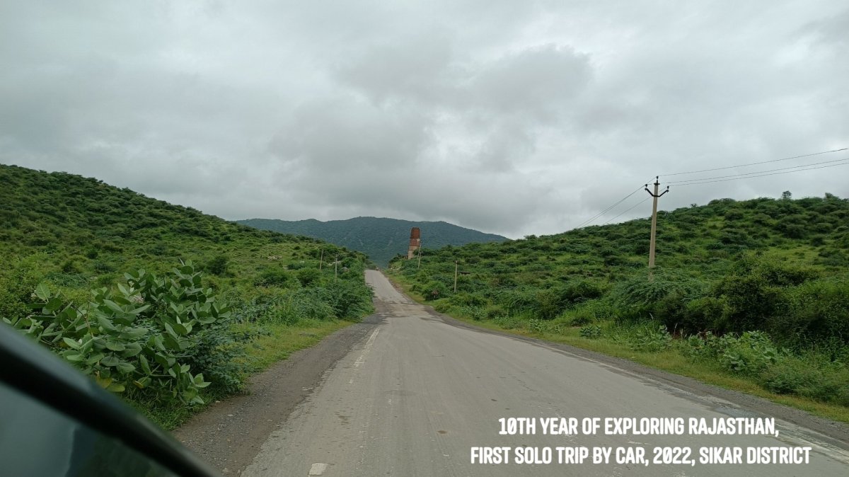
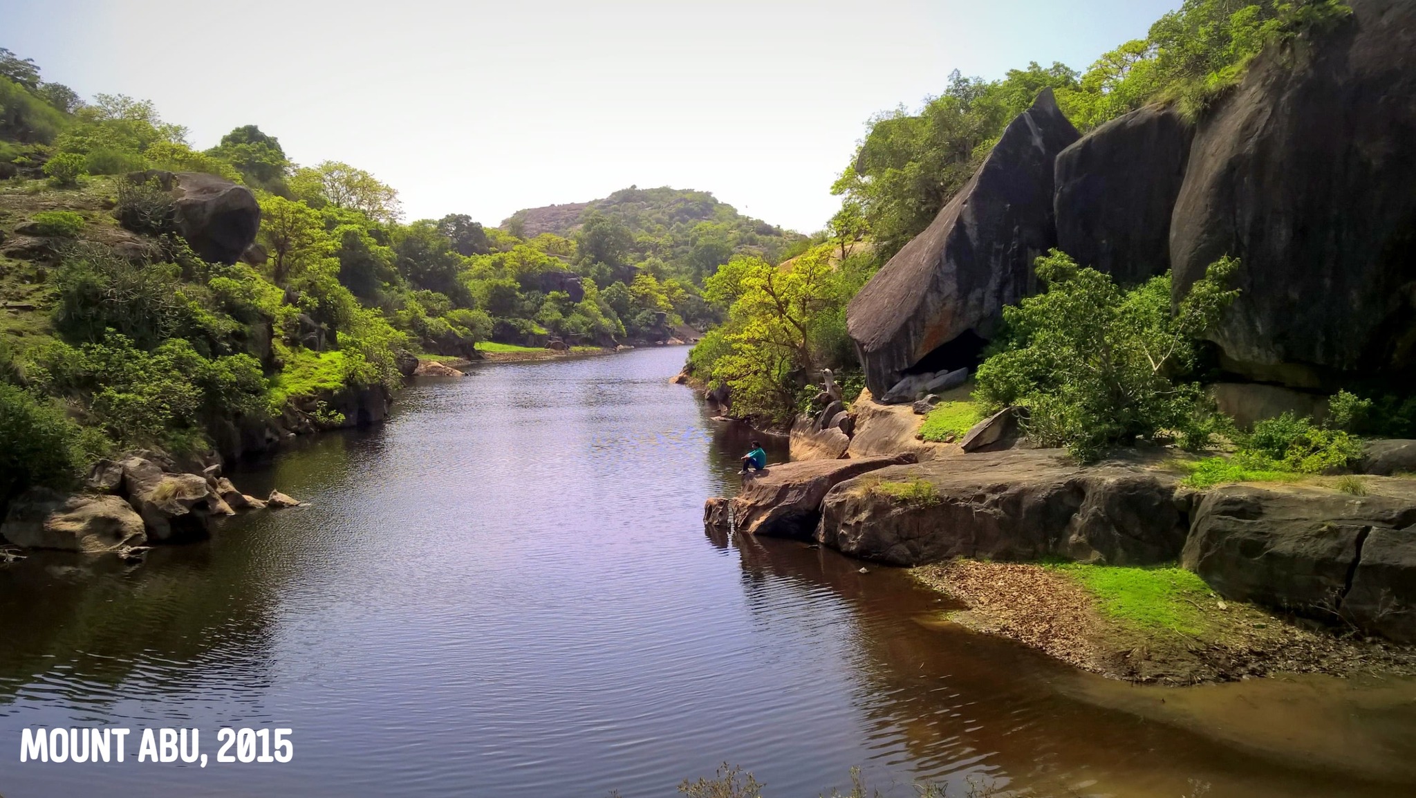
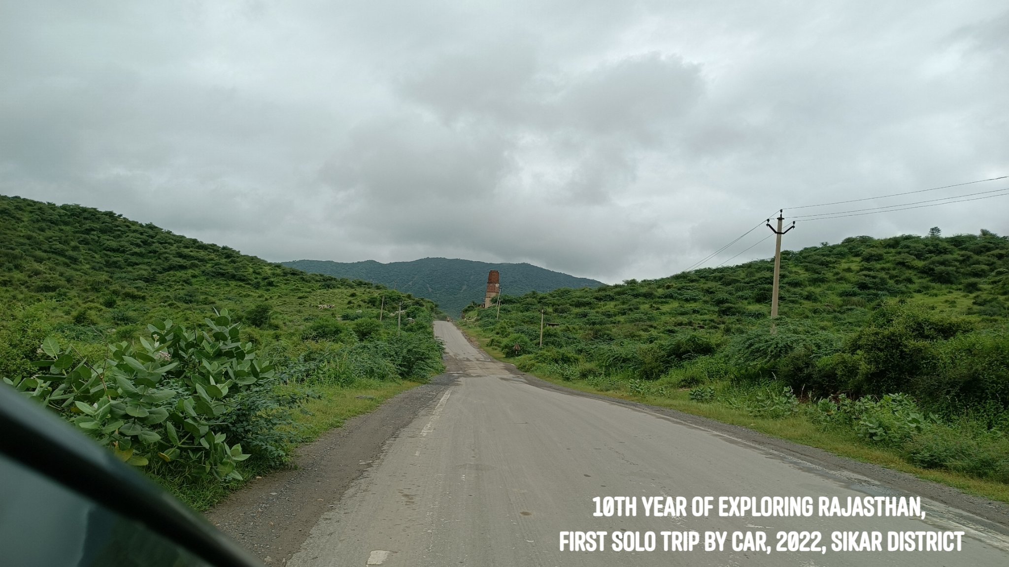
In April 2012, my first ever trip to Rajasthan was solo – by public transport, with the destination being Jaipur. In August 2022, I rounded off a decade of exploring Rajasthan by reprising the solo trip to Jaipur – only this time it was by driving on my own. A 700km self-driven solo adventure!
As always, it is rarely about the destination – and so off I went wandering through roads I had not trodden before, exploring a bit of the Aravallis in the Shekhawati region, while the sun and rain played hide and seek, and folds of hills lay in the distance in front and around me, their peaks crowned with fluffs of cloud.
I plead guilty to the charge of scooting off to Rajasthan every chance I get, even at the risk of inviting ridicule. ‘Why don’t you try out some other place this time – why not Himachal, Uttarakhand, UP?’, I have been asked. I say, some people love the mountains, some the beaches – as for me, I yearn most for the desert, the Aravallis, the forts…
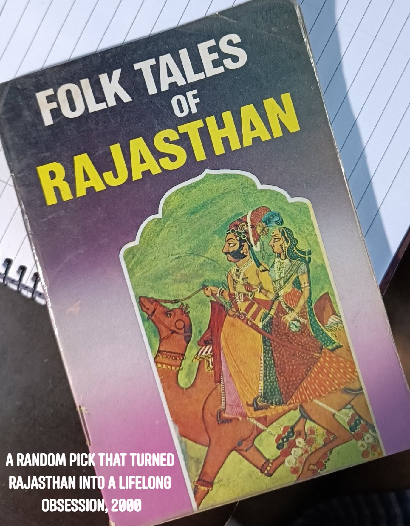
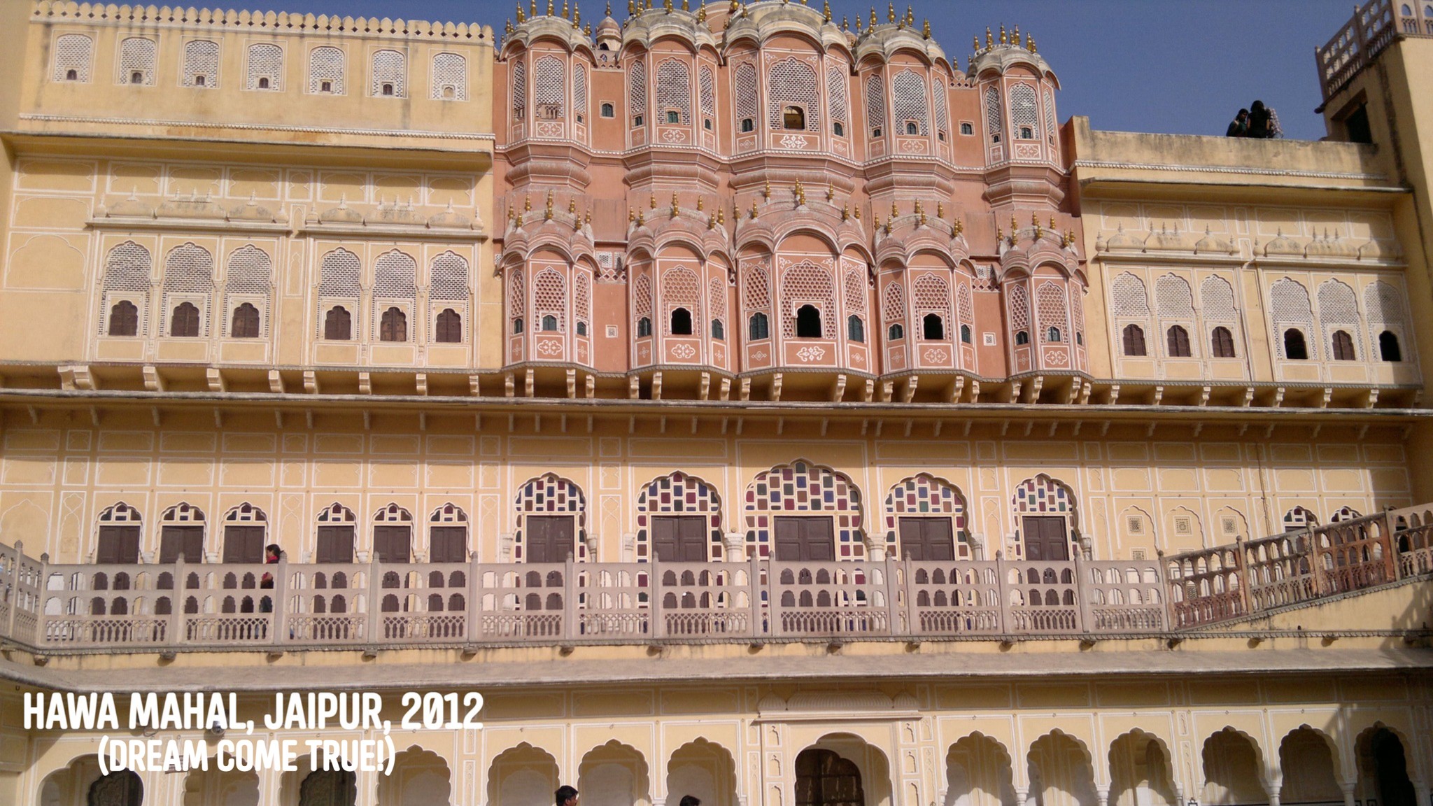
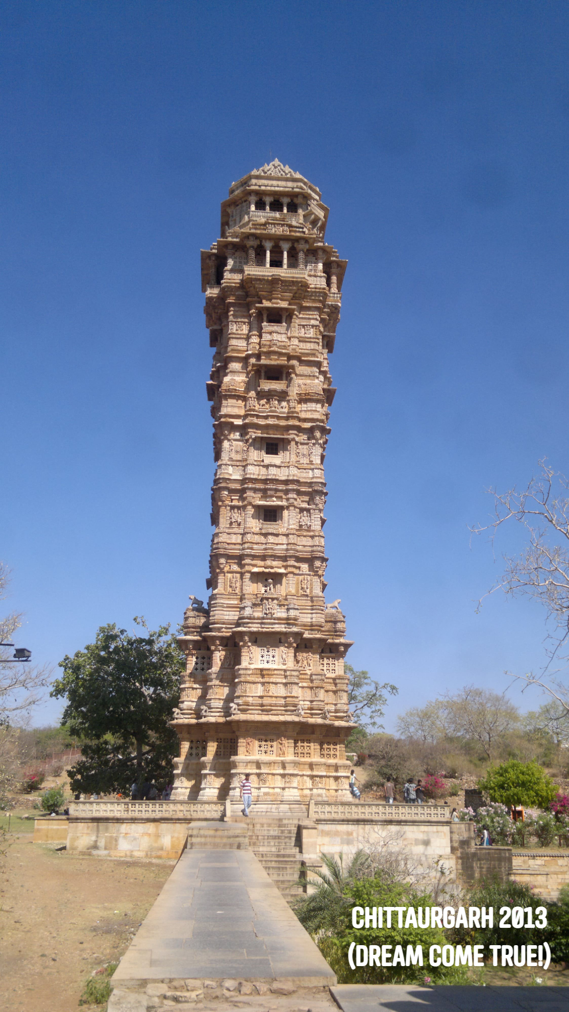
Growing up in Odisha, I had had a fascination with Rajasthan long since I could remember. In Grade 4 – the black-&-white picture of the Hawa Mahal in a textbook, and the mention of the Thar around Bikaner and Jaisalmer, images of the Vijay Stambh at Chittorgarh and the Dilwara temples at Mount Abu were imprinted in my head. A General Knowledge book addressed Jaipur as the Pink City, and Jodhpur as the Blue City. I always wondered looking at those black-and-white pictures how the cities might look like in real life in their famed hues.
Some years later as we were embarking on a train journey, Dad let me pick up a thin paperback from the book stall on the railway station- it was called ‘Folk Tales of Rajasthan’. While on that train, in my mind, Rajasthan turned into a place of magic, of kings, bards & princesses, of Pabuji, star-crossed lovers & clever thieves, of camels & shifting sands…I was enamoured.
Rajasthan was always just too far away though, and little did I know I would later land up at the gateway to it – Delhi. Little did I know as time progressed, I would reside at a place, on the outskirts of Gurgaon, where I could simply lug a backpack on my back and in half an hour, be inside Rajasthan. Little did I know I would once also drive solo to Rajasthan…
***
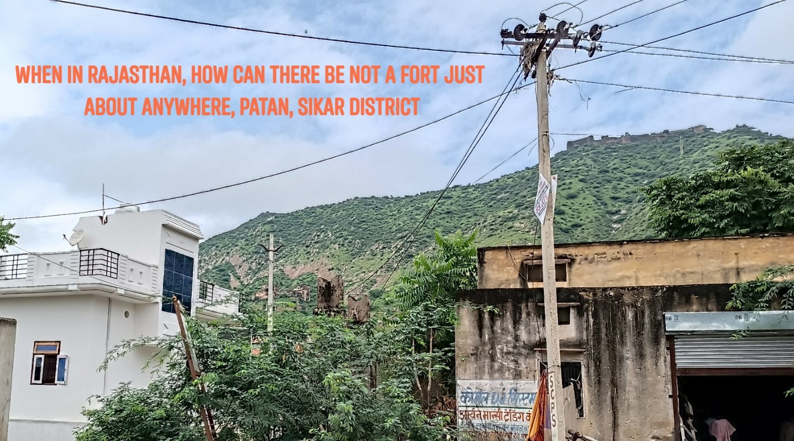
On this trip, instead of driving directly to Jaipur from Gurgaon, I took a detour midway, towards the north and drove through some of the most exotic sounding places – Kotputli, Neem ka Thana, Udaipurwati.
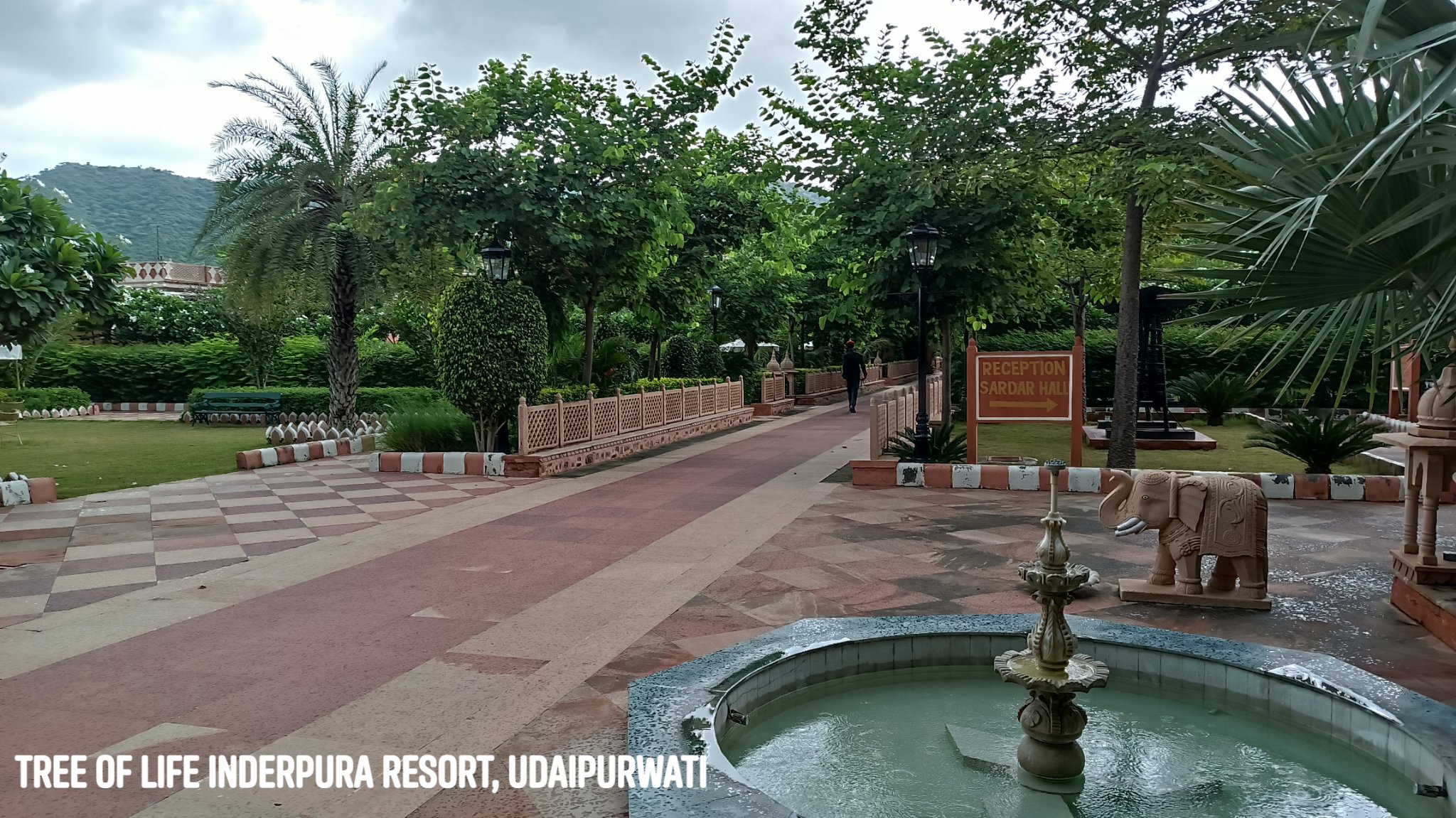
Udaipurwati
A quaint little town nestled within a gap in the Aravallis, is home to an excellent resort called The Tree of Life Inderpura.
Lohargal
Near Udaipurwati, within a crevice in the hills is a holy spot with a natural spring feeding a bathing tank and ancient Sun Temple. According to myth, weapons and armour of a Pandava army that camped here after their victory, dissolved in the water, giving the place its name: Loha (Iron)+Gal (To melt).
From thereon in Jaipur, I visited a couple of places that I had not seen before, both nestled in the Aravallis.
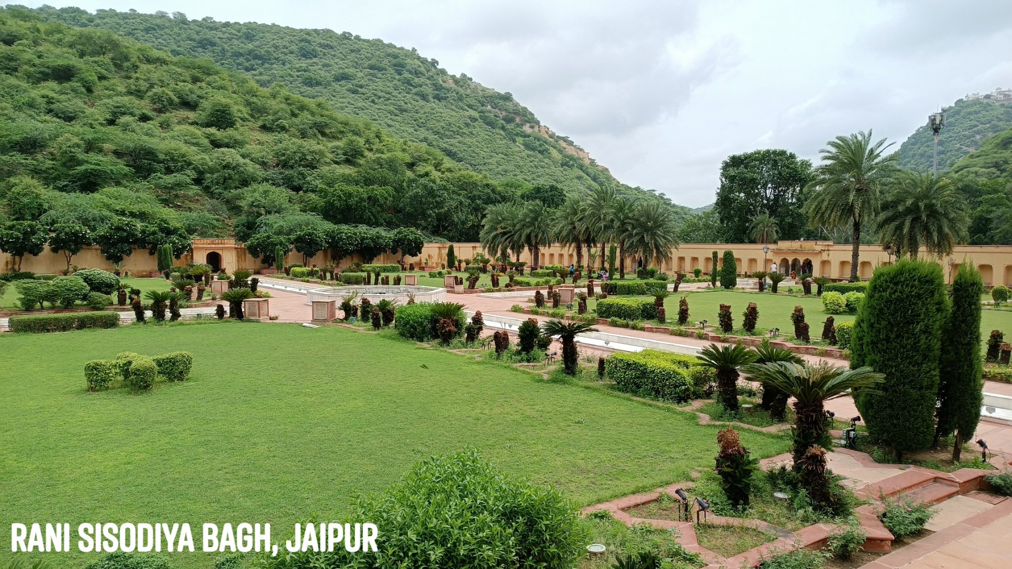
Rani Sisodiya Bagh
A hidden gem of a garden built by Sawai Jai Singh II for a princess of Udaipur, who agreed to marry him only on the condition that she be made the main queen of Jaipur.
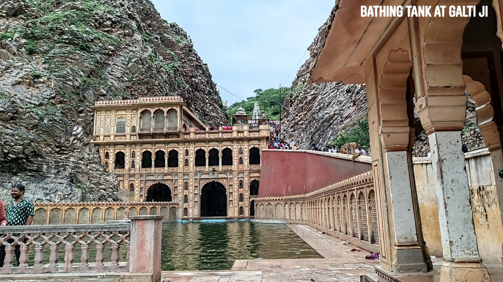
Galta Ji
Home to a bathing tank fed by a perennial spring and a temple dedicated to a hermit named Galta ji, along with temples dedicated to Krishna and Ram. At the peak of the hill is a 350 year old Sun temple, reached after a hike of about 1.5km. The first rays of the Sun reaching Jaipur apparently fall on the idol in the temple. Views from the hill are outstanding.
Trip Summary Day 1: Gurgaon to Udaipurwati via Neem-ka-Thana & Patan -250 km, 6 hours Udaipurwati to Lohargal – 15km, 30 min Lohargal to Jaipur via Udaipurwati & Reengus – 160km, 3 hours
Day 2: Jaipur sightseeing of Rani Sisodiya Bagh and Galtaji – 25km, 2 hours Jaipur to Gurgaon – 230km, 4 hours
My little brother paid the motherland a visit after 2 years, and before the Indian summer set in with its full glory, the family decided to make it the first ever self-driven road trip for the family. So, off we set in late March, on a 6-day road trip with an itinerary so fluid that we only knew the first 3 places we planned to visit. Deciding to let the vagaries of chance sprinkle our journey with generous doses of surprise, we did not also book a hotel prior.
And boy, was it rewarding! With a mix of the famous and the little known (or even barely-frequented), this time we forayed through the desert to brush with history stretching back to 5000 years ago, in search of a lost river and a lost civilization, chanced upon desert lakes and desert wildlife, hobnobbed with human-like rats, and delved deep into a jungle on a temple chase while the sun was going down.
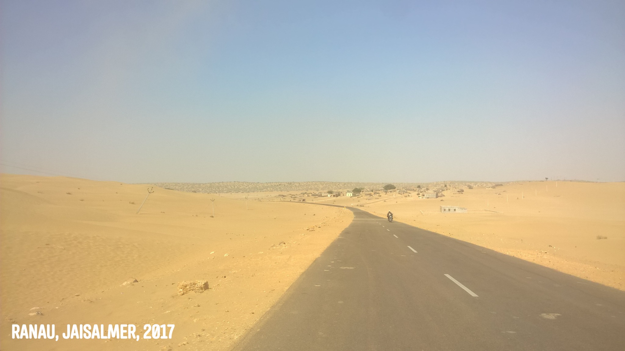
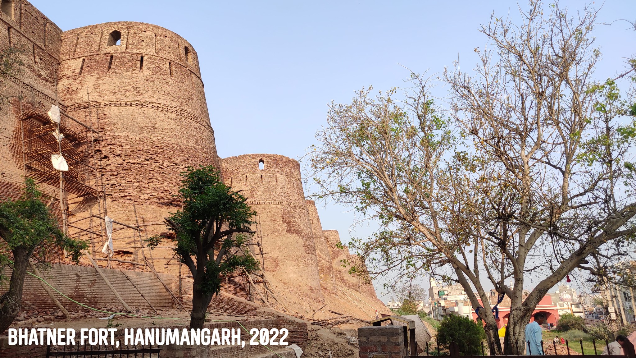
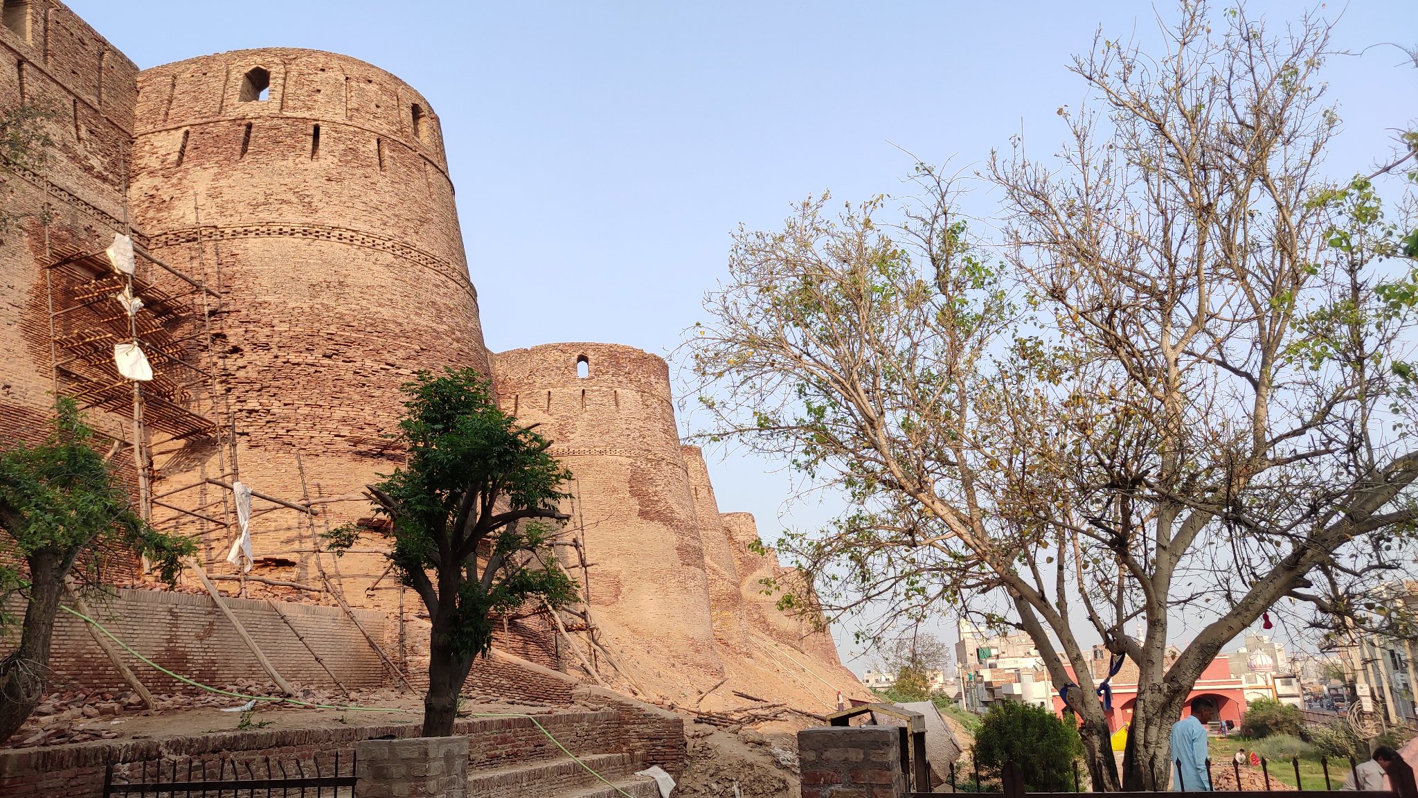
Hanumangarh
Our search of the mythical River Saraswati led us to the desert town of Hanumangarh, where we came upon the Bhatner fort, which dates its origin to the 2nd century AD. The old structures are now buried in mud, and the fort is being renovated.
Walls of Bhatner fortMounds over structures, Bhatner fort
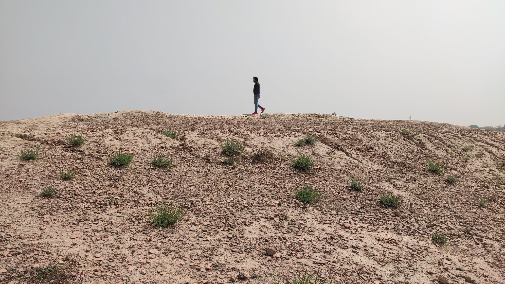
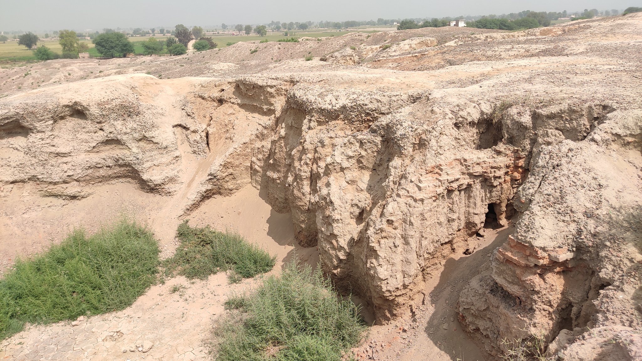
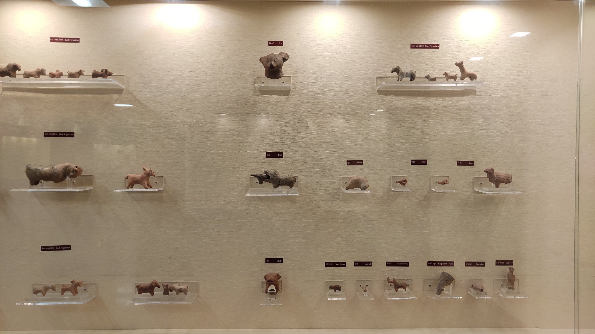
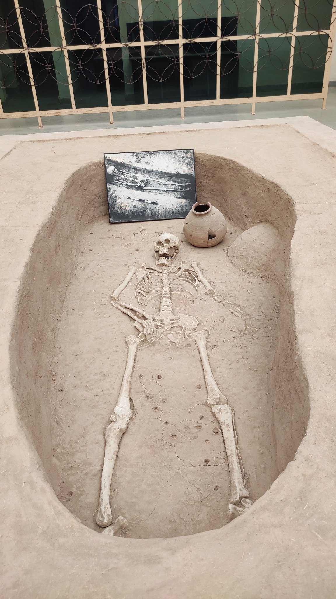
Kalibangan
One of the earliest discovered and excavated Harappan sites, Kalibangan gave us a sneak peek into 5 millennia earlier. Sadly, the ruins are buried in mud, even the excavations have been covered up by the Archaeology Survey of India (ASI) to prevent further deterioration.
Walking on 5000 years of history, a civilization now lies buried under mounds
Harappan structures lay below the mudArtifacts from the past
A Harappan
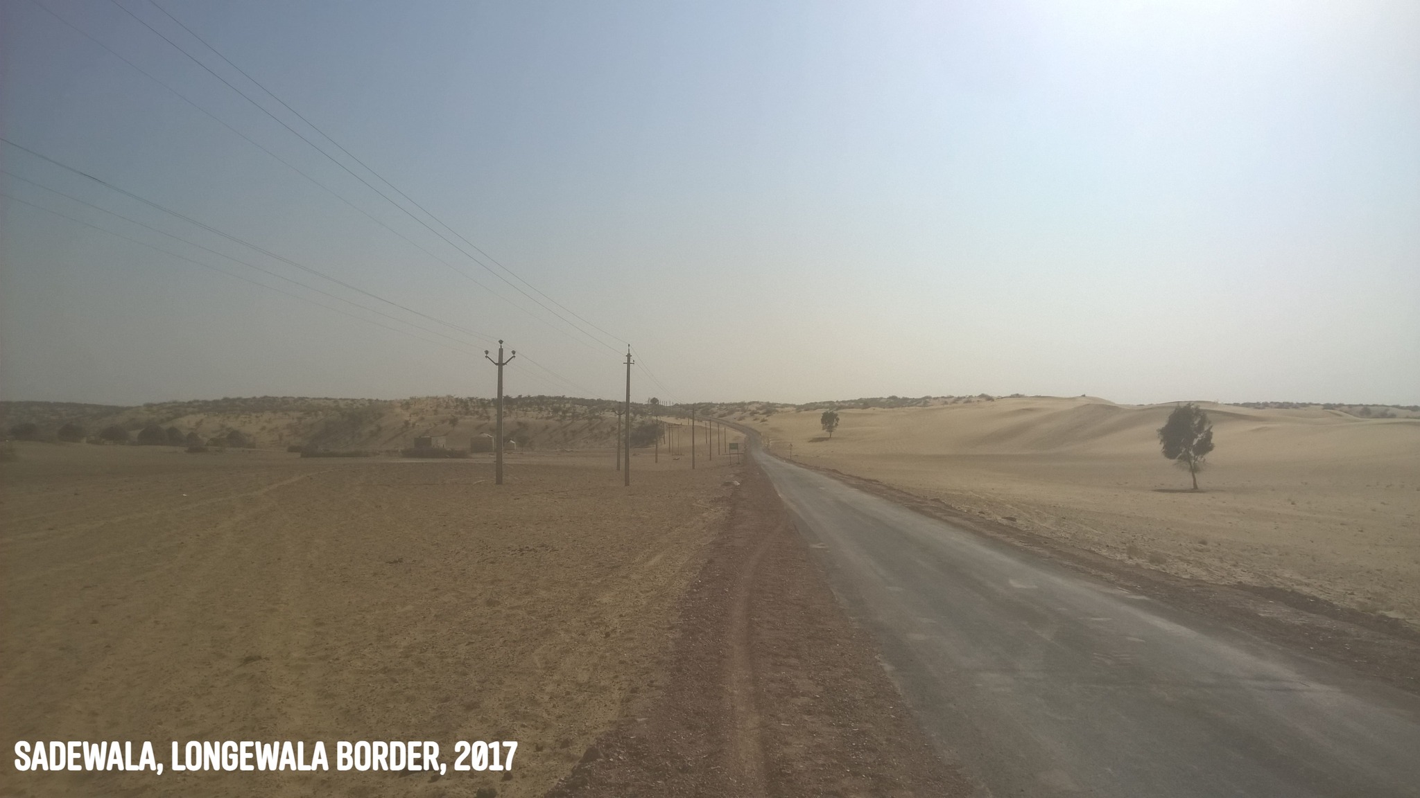
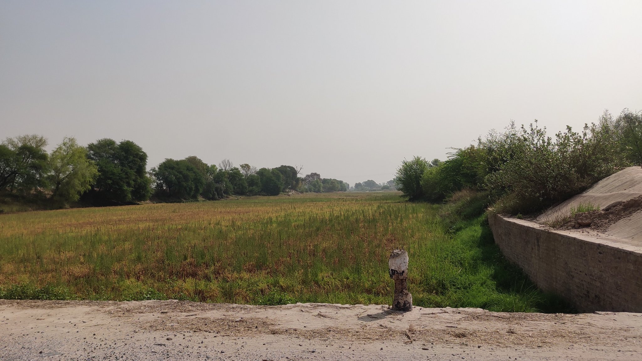
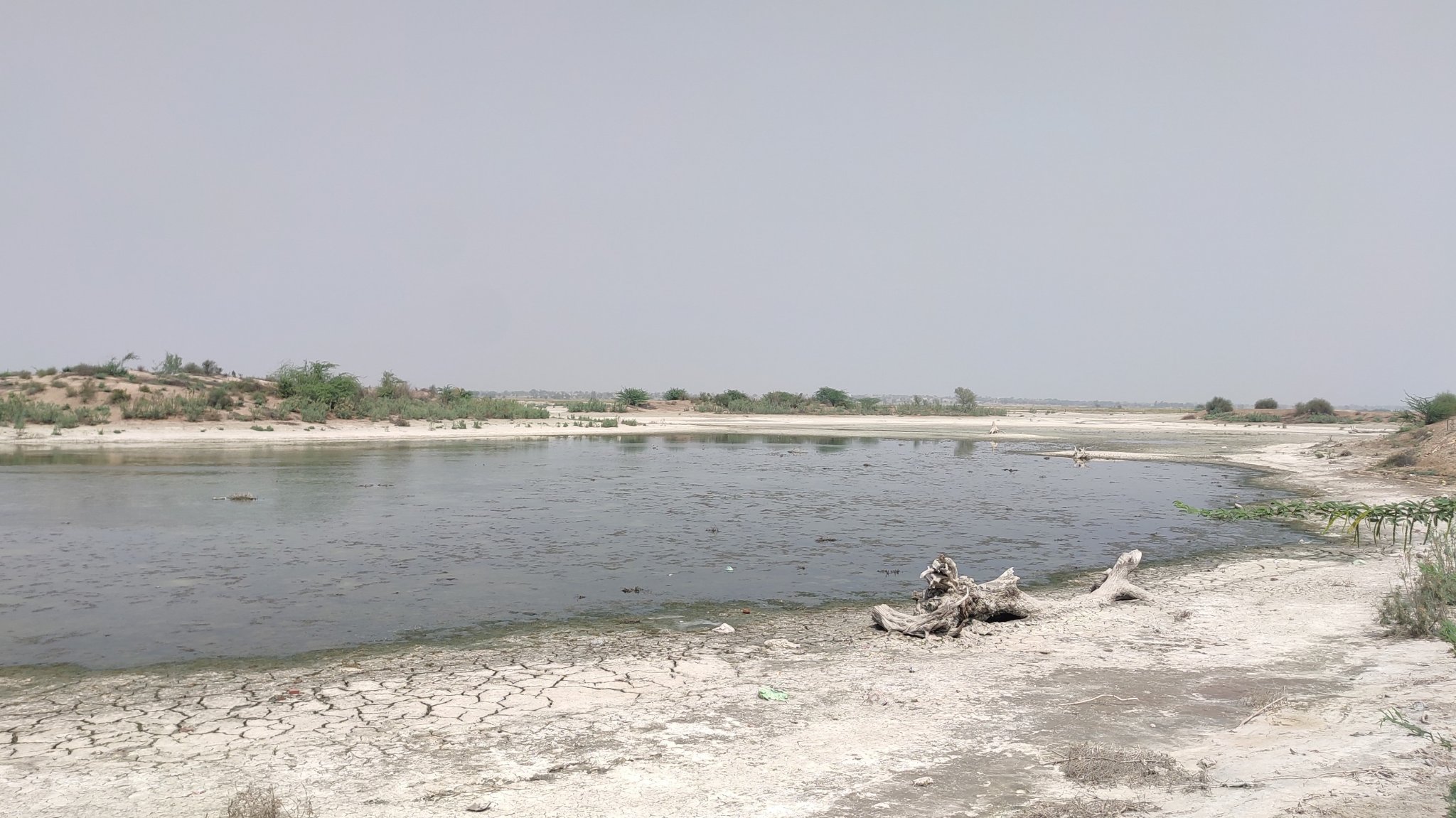
In the vicinity, we finally met the Ghaggar River, which is purported to be the Vedic Saraswati River – nothing more than a dried-up intermittent, almost obscure rivulet right now.
The dried bed of the Ghaggar river – purported to be the mythical Saraswati river
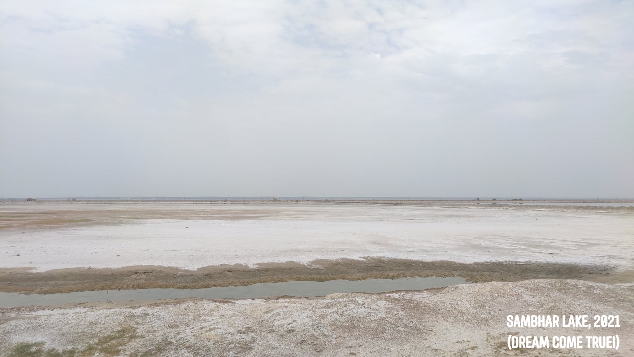
Badopal Lake
We took a slight detour through the desert hinterland to take a peek at the Badopal lake, a salt lake located beside the Badopal, an ancient mound, and part of the Rang Mahal culture.
Badopal Lake
Suratgarh
Another desert town midway between Hanumangarh and Bikaner, noted for its Thermal Power station and the air force base.
Dam on the outskirts of Suratgarh approaching from Badopal
Dunes outside Suratgarh enroute Bikaner
Keeping pace with a train, SuratgarhA view of the landscape, Suratgarh
Lunkaransar
A fairly expansive salt-lake that is home to migratory birds, midway between Suratgarh and Bikaner
Salt lake at Lunkaransar
Bikaner
One of the major cities of Rajasthan, founded by Rao Bika, famous for Junagadh Fort and savory sweets and snacks
Bikaner fort
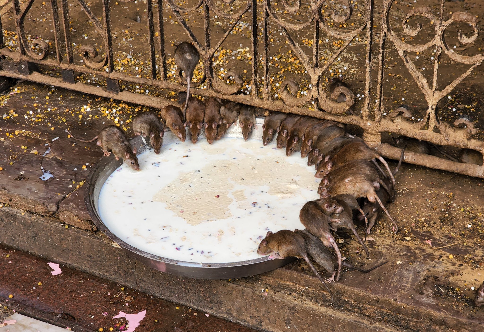
Deshnoke
Home to the Karni Mata Temple, where rats, who are considered children of the Goddess, behave just as humans! Eating nibbled on by the rats is considered auspicious. Accidentally or deliberately killing a rat requires replacing it with one made of gold or silver as atonement.
Rats feeding on offerings at Karni Mata temple
Kolayat
The place where the Vedic Sage Kapil (Kapil Muni) is said to have shed his body. Home to a lake and temples on its bank.
Lake at Kolayat
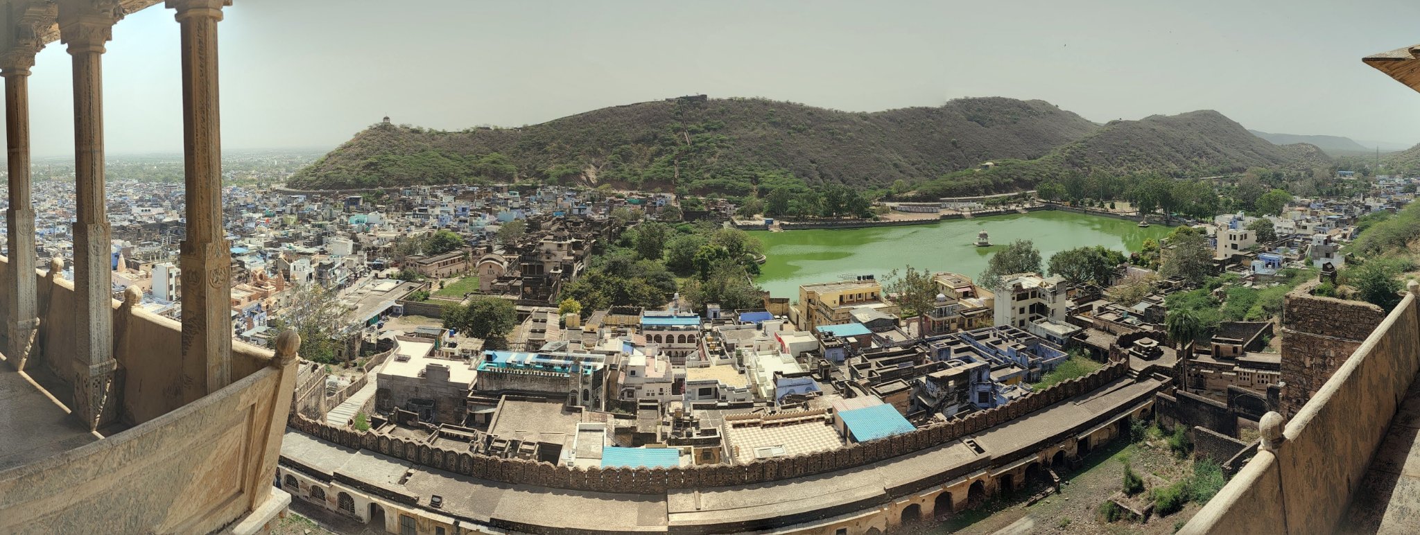
Bundi
A quaint town nestled in the Aravallis, with an imposing hill-side palace overlooking a lake.
View of the Garh Palace from the main road, Bundi
View of the surroundings from a balcony in the Garh Palace, Bundi
Badoli Temple Complex
A 10th-11th century temple complex which crept into our plan by serendipity as we were short on time to visit the Gagron fort. The temples, dedicated to Shiva, Vishnu, Ganesha etc., were built by the Gurjara-Pratihara dynasty, and are described as one of the best representations of the temple. Situated on the banks of the Chambal just outside the village of Rawatbhata, it can be reached from Kota through winding roads cutting across hills and forest. As the sun was beginning to set, the ride through the forest was a race against time, and quite the adventure!
Glimpses of the Badoli Temple complex
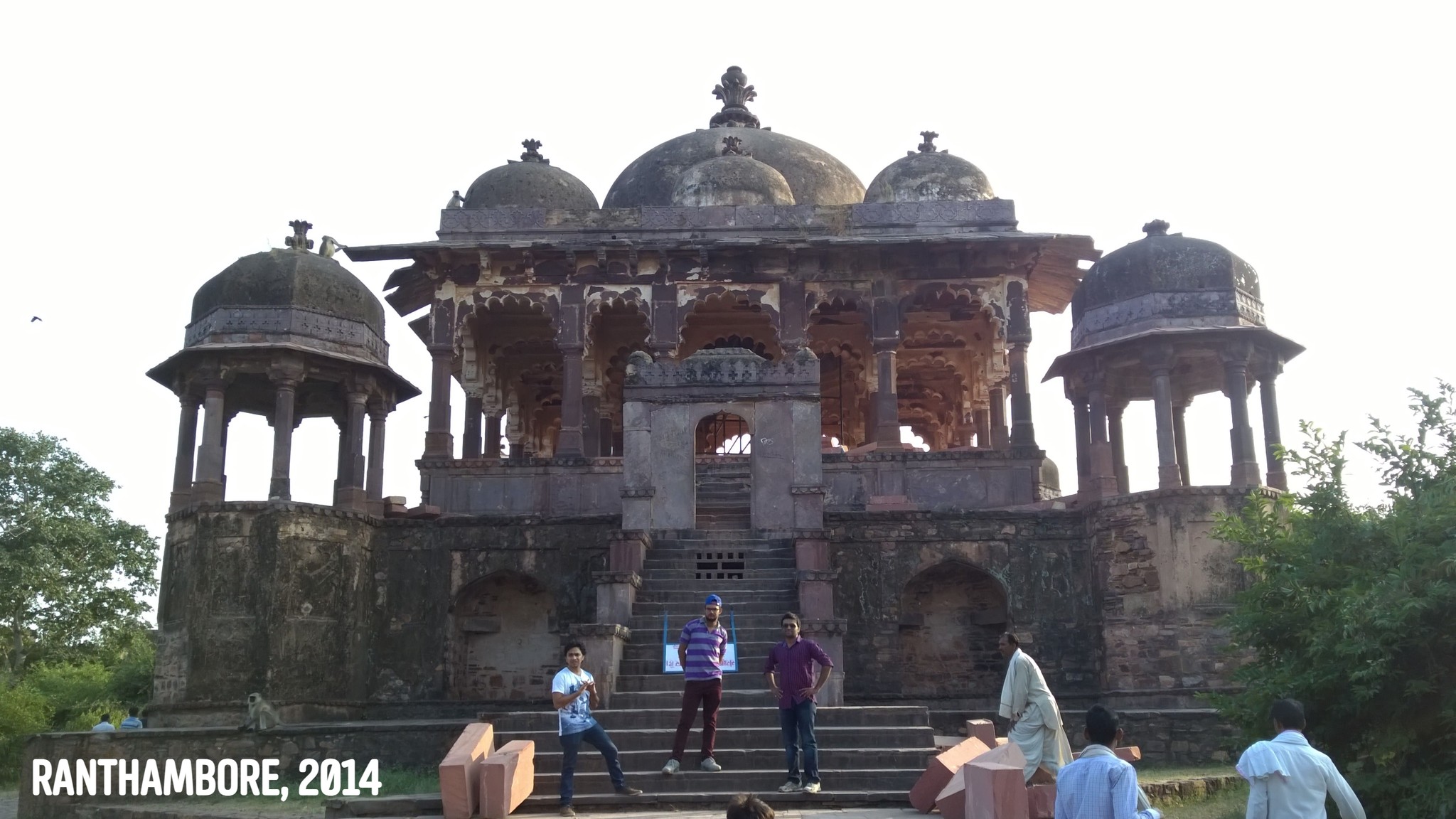
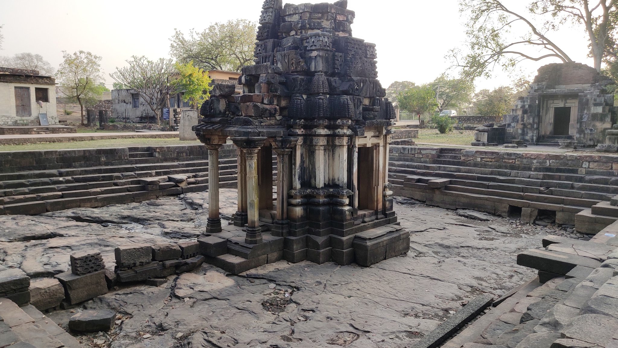
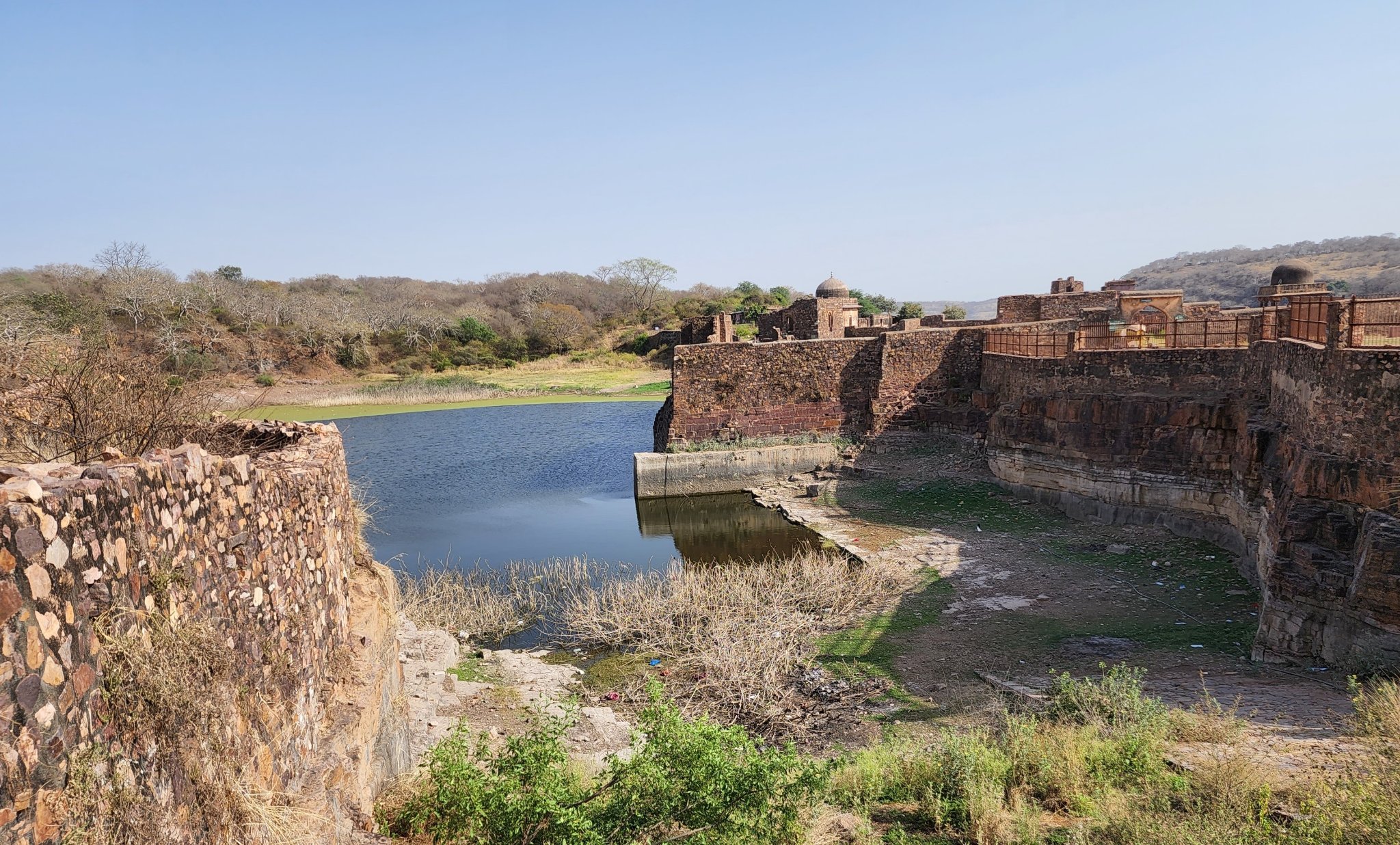
Ranthambore Fort
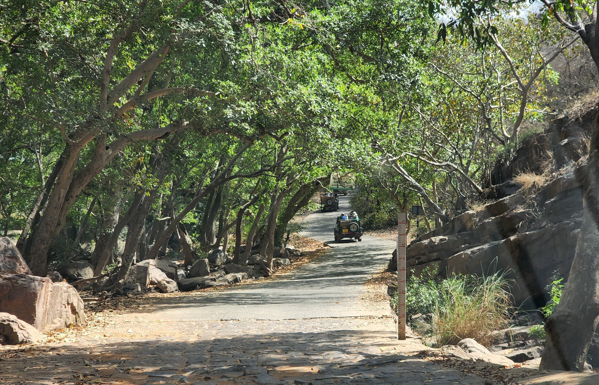
Rounding off the trip was the magnificent and legendary Ranthambore fort, situated on top of a hill right in the middle of the Ranthambore Tiger Sanctuary. The ride through the forest is memorable and so are the sights from atop the fort.
Approach road leading to the Ranthambore fort through the Ranthambore sanctuary
Water tank inside Ranthambore temple
The entrance road to Ranthambore fort as seen from a ledge inside the fort
Trip Summary Day 1: Gurgaon to Hanumangarh via Sirsa (lunch break in Sirsa) Saw Bhatner fort at Hanumangarh (overnight stay in Hanumangarh)
Day 2:
Hanumangarh to Kalibangan Kalibangan to Suratgarh via Badopal (lunch break in Suratgarh) Suratgarh to Bikaner via Lunkaransar (overnight stay in Bikaner)
Day 3: Bikaner fort early morning (lunch at Bikaner after seeing the fort) Bikaner to Deshnoke to Kolayat, and back to Bikaner (overnight stay in Baikaner)
Day 4: Bikaner to Jaipur via Sikar (overnight stay in Jaipur)
Day 5: Jaipur to Bundi Bundi to Badoli Temple complex (Rawatbhatta) Badoli to Kota (overnight stay in Kota)
Day 6: Kota to Ranthambore Ranthambore to Gurgaon via Dausa and Manoharpura
On 24th December 2021, we took the delivery of our car – the first in the family, in fact – in Bhubaneswar, and after offering our prayers, took off on our first ever road-trip in our own car, to the Chilika Lake, which is the largest brackish lagoon in the world. Chilika lake, in a distant past, was an important centre for trade and commerce and served as a shelter for ships sailing to South-East Asia.
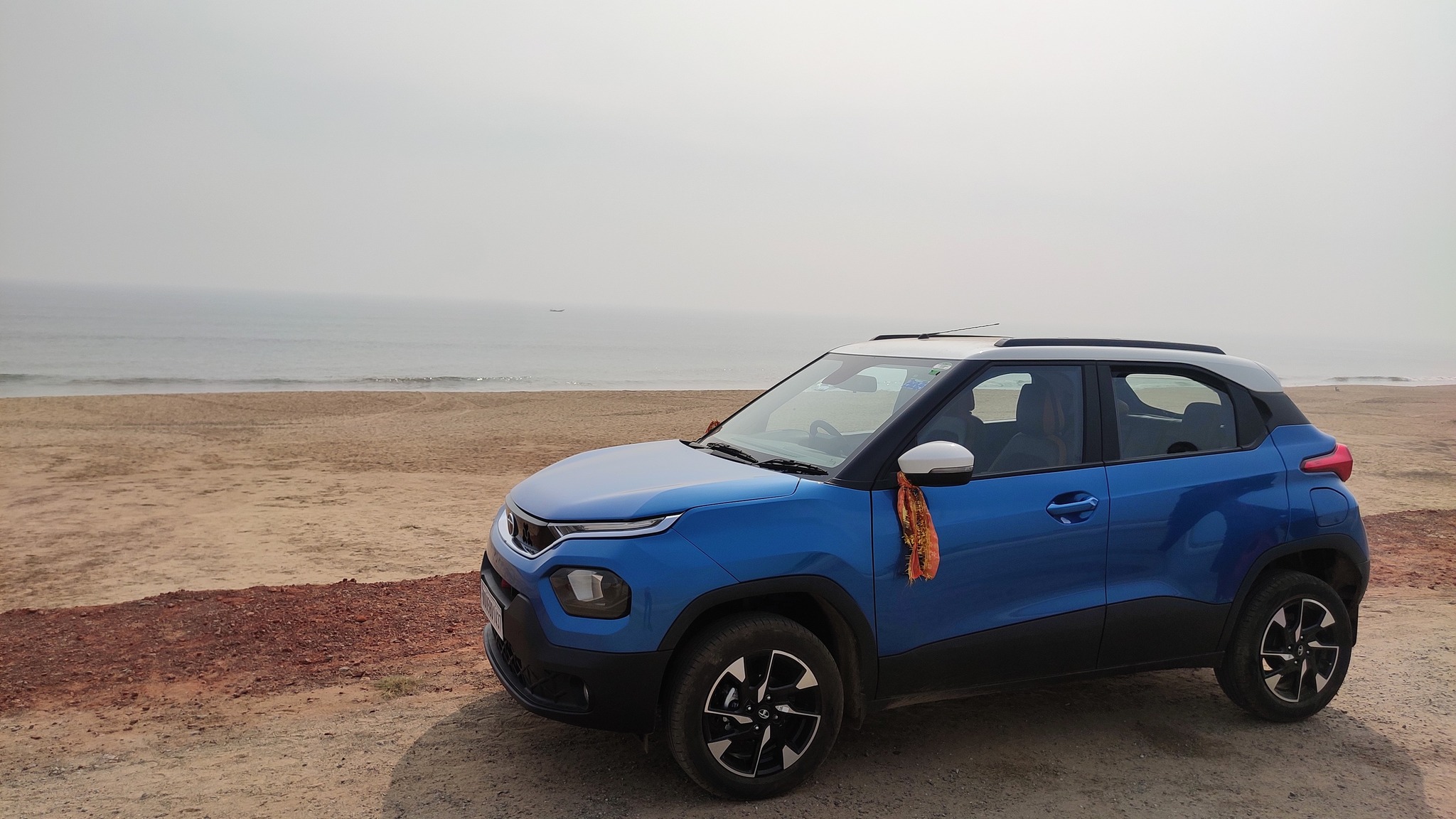
The new car posing at Puri beach
Today, the islands on the lake with their temples and natural beauty attract visitors, as also does its status as a ‘wetland of international status’ under the Ramsar convention. The lake serves as the largest wintering ground for migratory birds on the Indian sub-continent, with it hosting over 160 species of birds in the peak migratory season. At least two areas have been declared as bird sanctuaries – the Nalaban islands and the wetlands near Magalajodi village.
To celebrate the arrival of the new car in the family, we went to two different places in the Chilika lake area on consecutive days – Mangalajodi Bird Sanctuary and Satapada.
25th December 2021: Managalajodi
Tired from the car delivery process from the previous day, we started rather late, around 11 AM, and following lunch near Jatani, proceeded by the NH 16 till Tangi where we took a left turn, and pushed towards the coast. Crossing Mangalajodi village, as we entered the wetlands, we had to drive carefully on a meandering paved road built on an embankment that protruded into the wetlands on the periphery of the lake. Reaching the end of the road, we took a boat ride on the wetlands along with a guide who showed us numerous bird species, including, various types of egrets, ducks, cormorants, jacanas, swamphens and kingfishers.
Glimpses of Managalajodi Bird Sanctuary
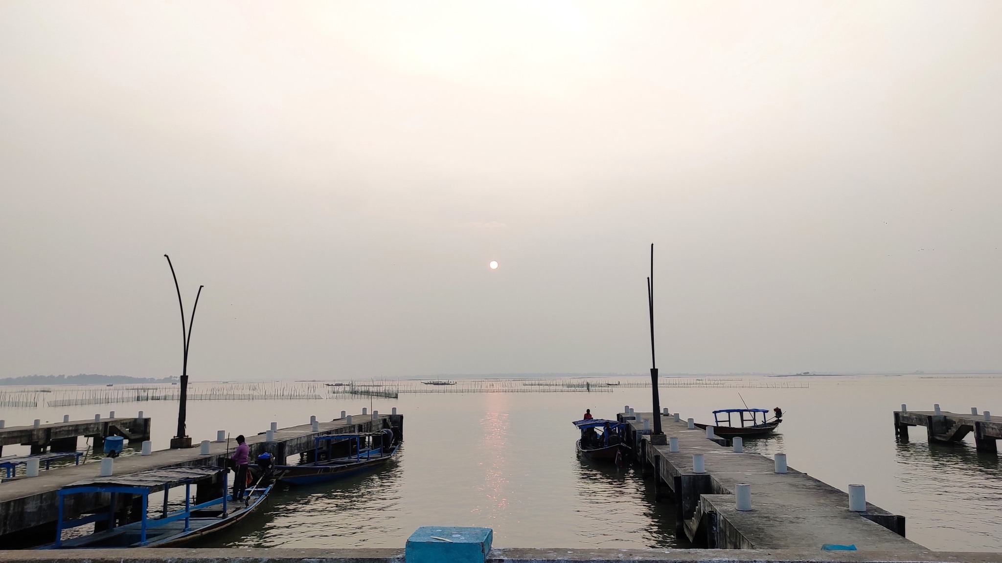
26th December 2021: Satapada
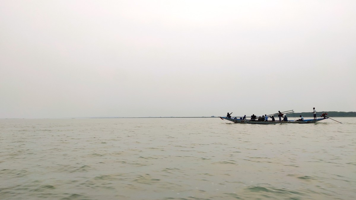
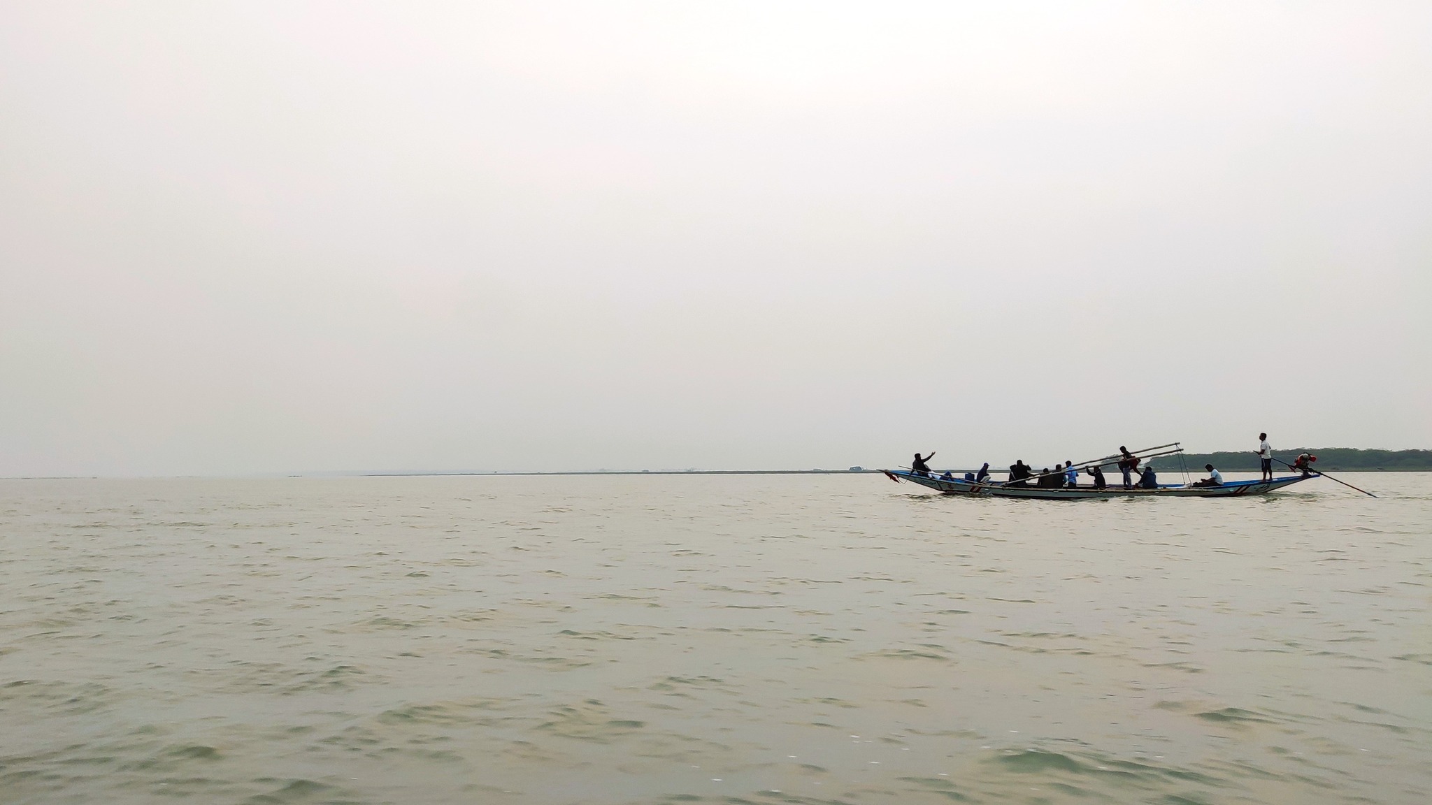
The next day, we started again from Bhubaneswar towards Satapada via Puri. Since we again started late, we were able to reach Satapada only around 4 PM. Satapada, name derived from a group of seven (sata) villages (pada), lies at the south-east cape of the Chilika Lake, very close to the place where the lake meets the Bay of Bengal, 50 km away from Puri. At Satapada, we took a boat ride of the lake proper, and managed to spot the Irrawady dolphins which abound in Chilika lake. The sunset was something to behold as well. Satapada also is heaven for pescetarians, especially for those interested in eating crabs.
Glimpses from boat ride on the Chilika Lake near Satapada