Meandering in the Monsoons: Bijolia, Banswara, Arthuna and Udaipur

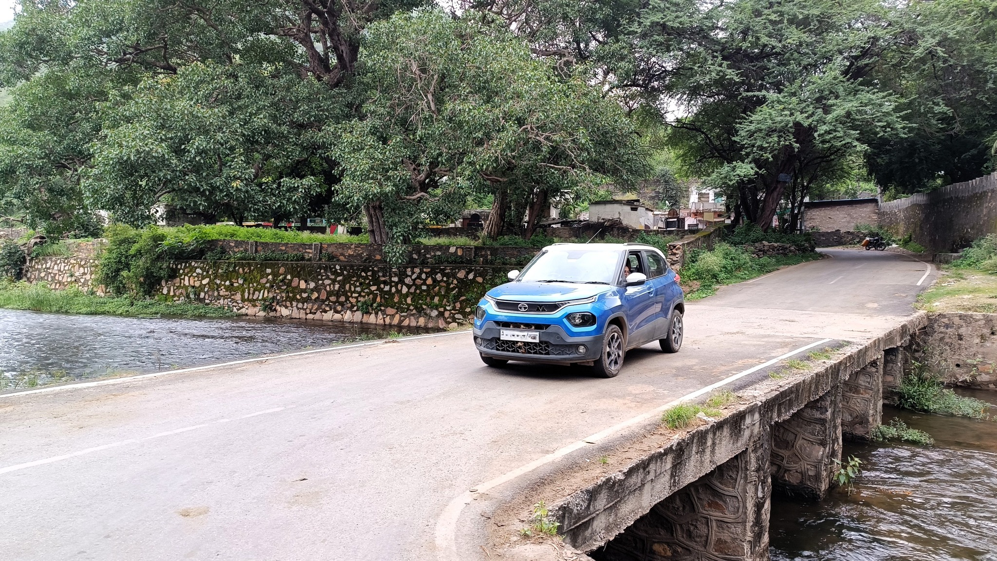
Continuing the tradition of the annual self-drive family trip, this year we decided to explore the lesser-known side of Rajasthan. Of course, this trip came about after having exhausted the roster of all the well-known Rajasthani cities, except Barmer, but it was really hastened by the incidence of the monsoons. It was now time to experience something different than the arid landscapes, desert expanses, and mountainous folds of the Aravallis. What better region than the south-western part of Rajasthan to soak in the splendour of the rain-sprinkled countryside?

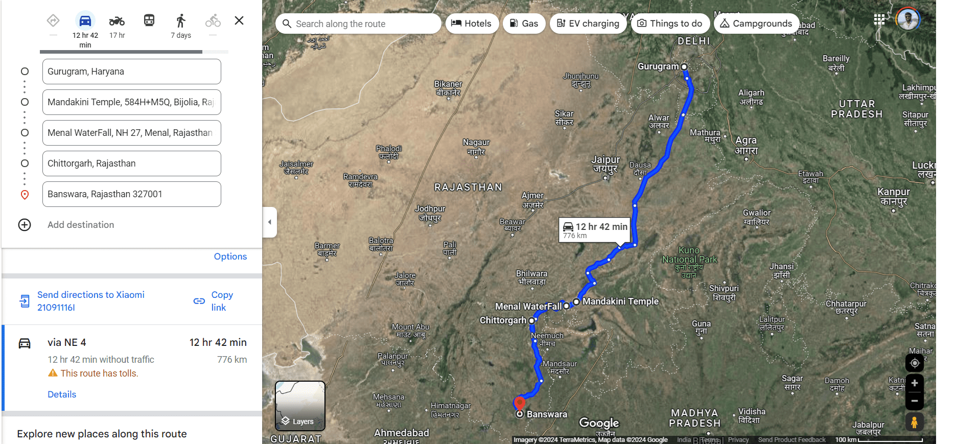
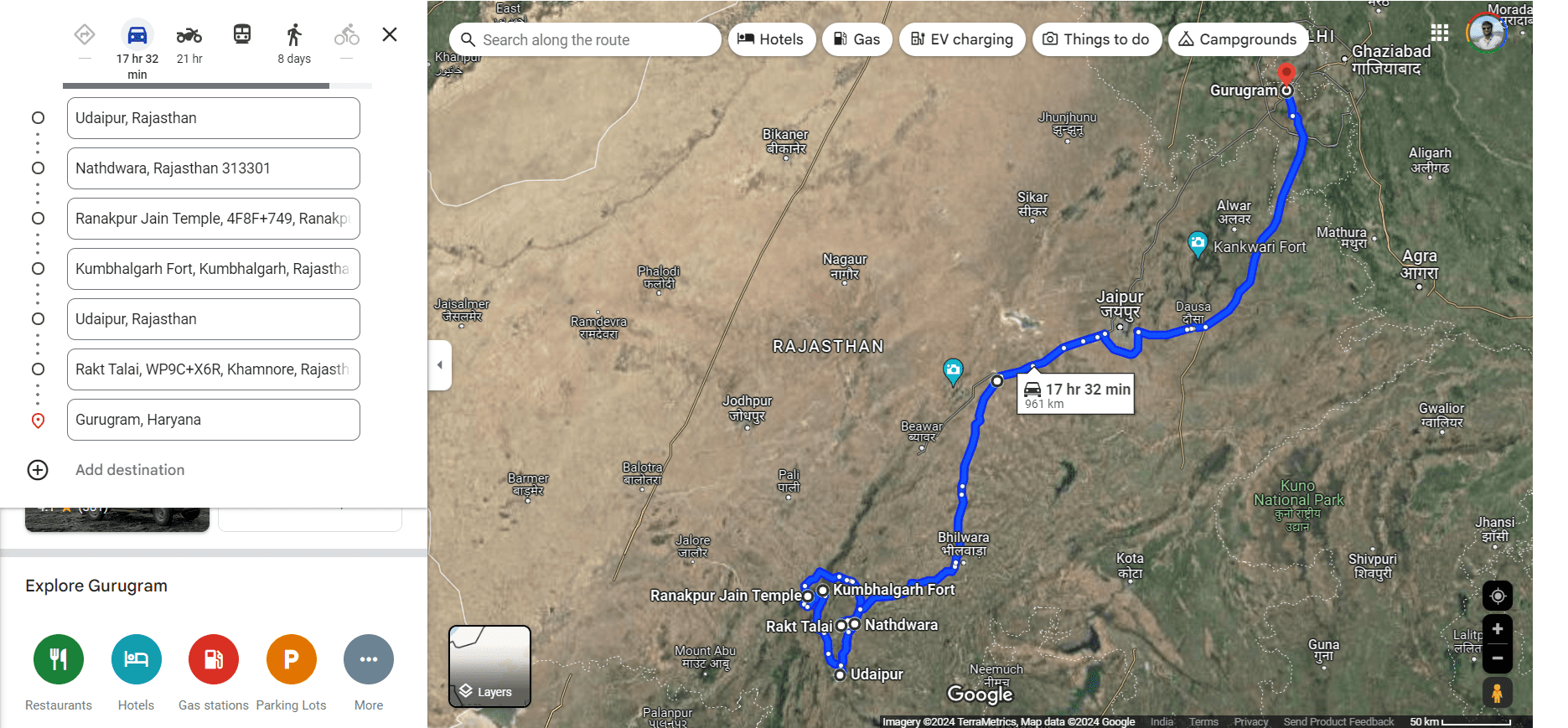
The place in focus on this trip was Banswara, touted as the ‘city of 100 islands’—a place many travel bloggers exhorted to visit, specifically in the monsoons. However, Banswara, being a good 800 km from Gurgaon, necessitated stops, and the stops were better worth it. Those stops turned out to be Chittorgarh on the outward leg and Udaipur on the return, thus helping me fulfil my mother’s long-cherished wish of seeing Nathdwara and Ranakpur, and my own wish of showing my brother Kumbhalgarh. In fact, we did the latter three stops on the same day, surprising even ourselves!

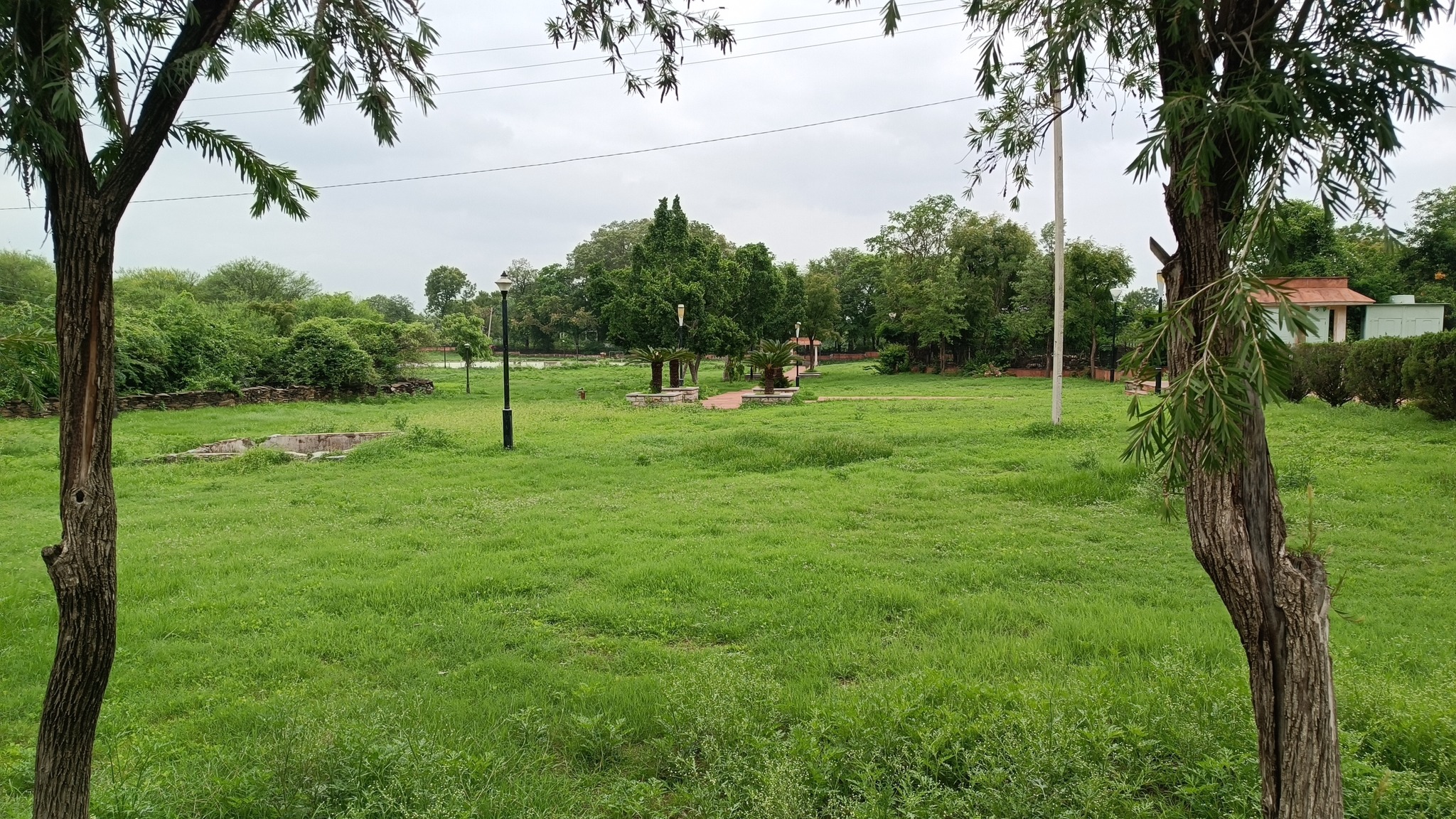
As usual, we did not book accommodations beforehand, and simply let serendipity be our guide. That’s how I found myself at Chittorgarh Fort, at the same place, the same day I was 10 years ago. That’s how we beheld the beauty of a temple complex getting showered in a cloudburst. That’s how we chanced upon a temple complex with a waterfall, straight from the imagery of an Indiana Jones movie. That’s how we found ourselves meandering upon the low rolling hills leading to and adorning the course of the mighty river Mahi, with intermittent spells of monsoon rains for company.

Highlights of the road-trip

Mandakini Temple, Bijolia

This temple complex comprises three Shiva temples – the oldest being from the 11th century called Mahakal – and a water tank, and lay just beside our route to Chittorgarh. Just as we stepped out of the car, there was a cloudburst, forcing us to run inside the temple complex and take shelter under the roof of one the temples.

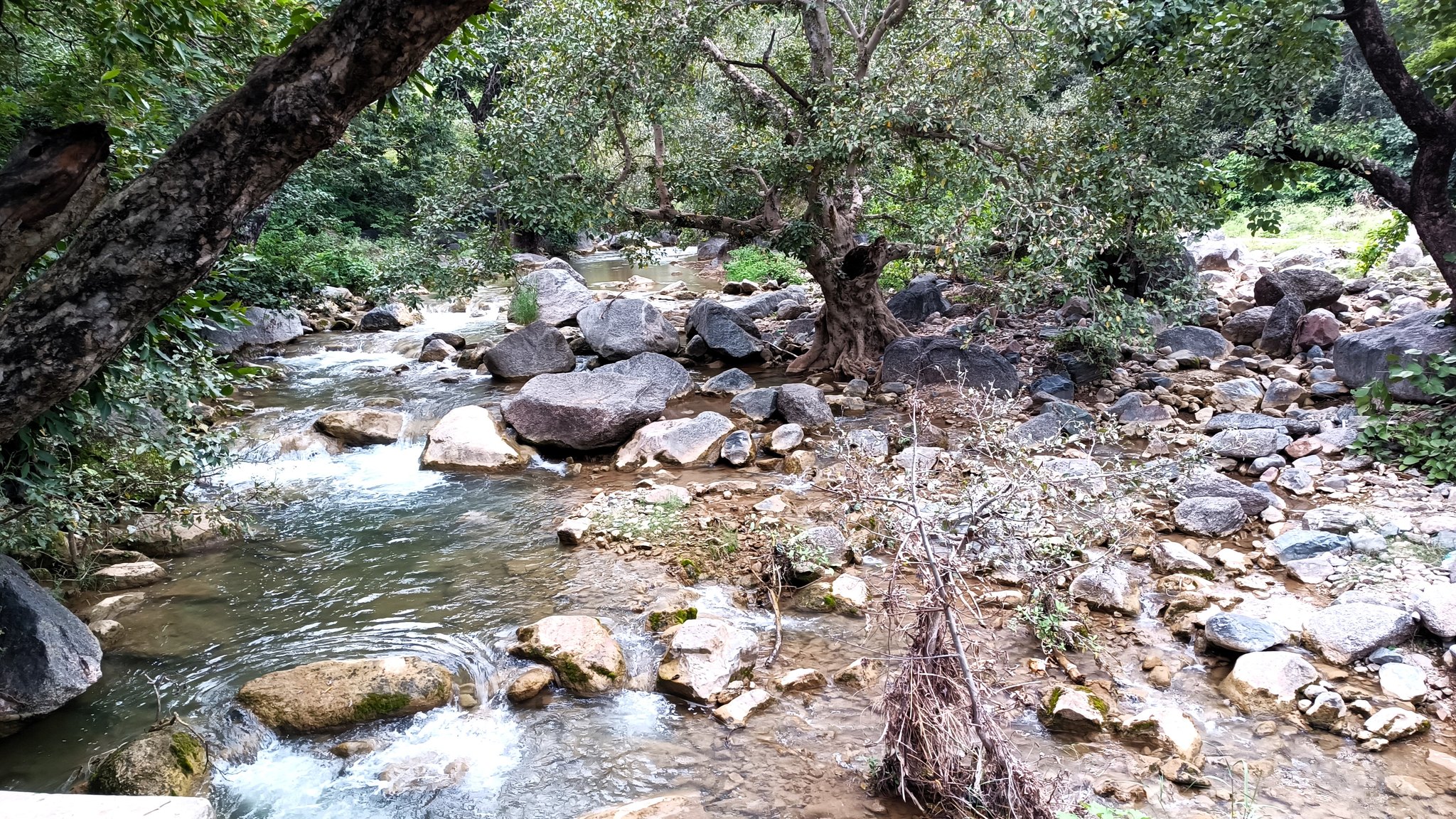
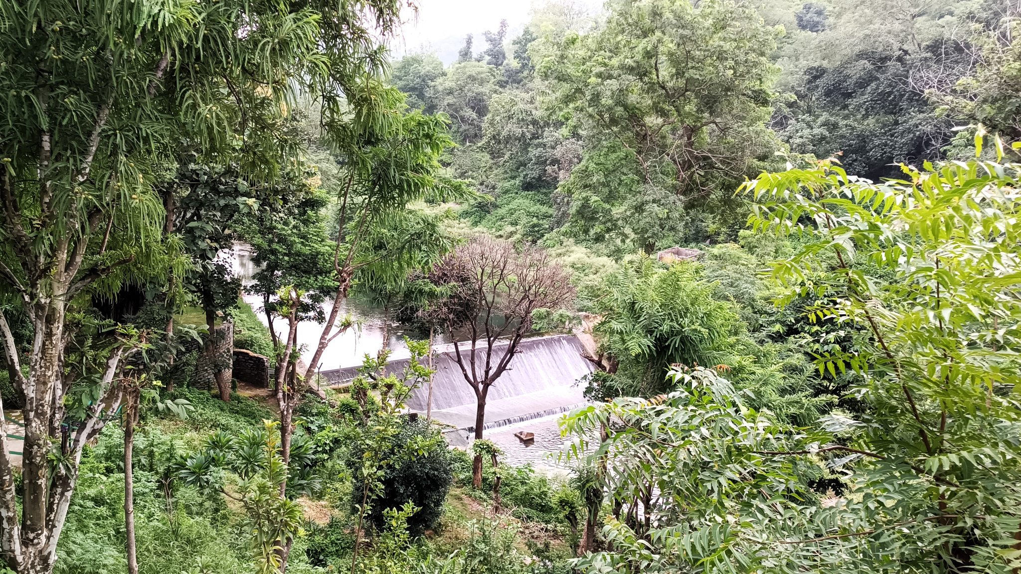
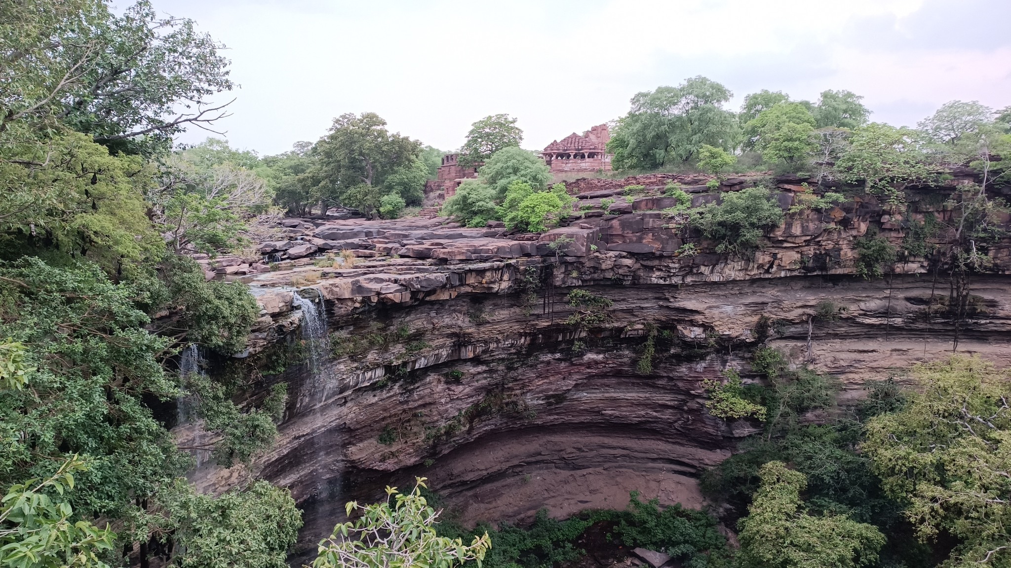
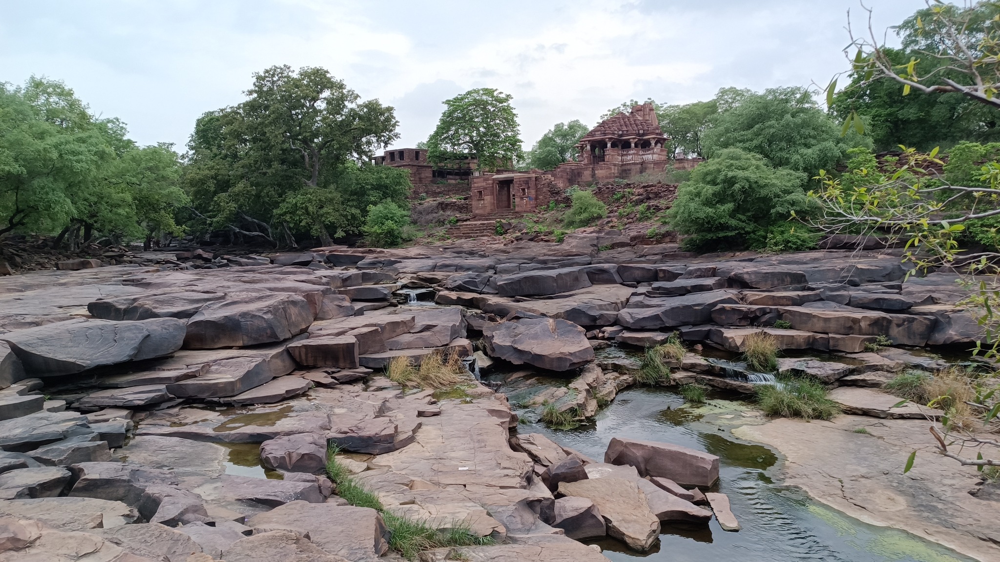
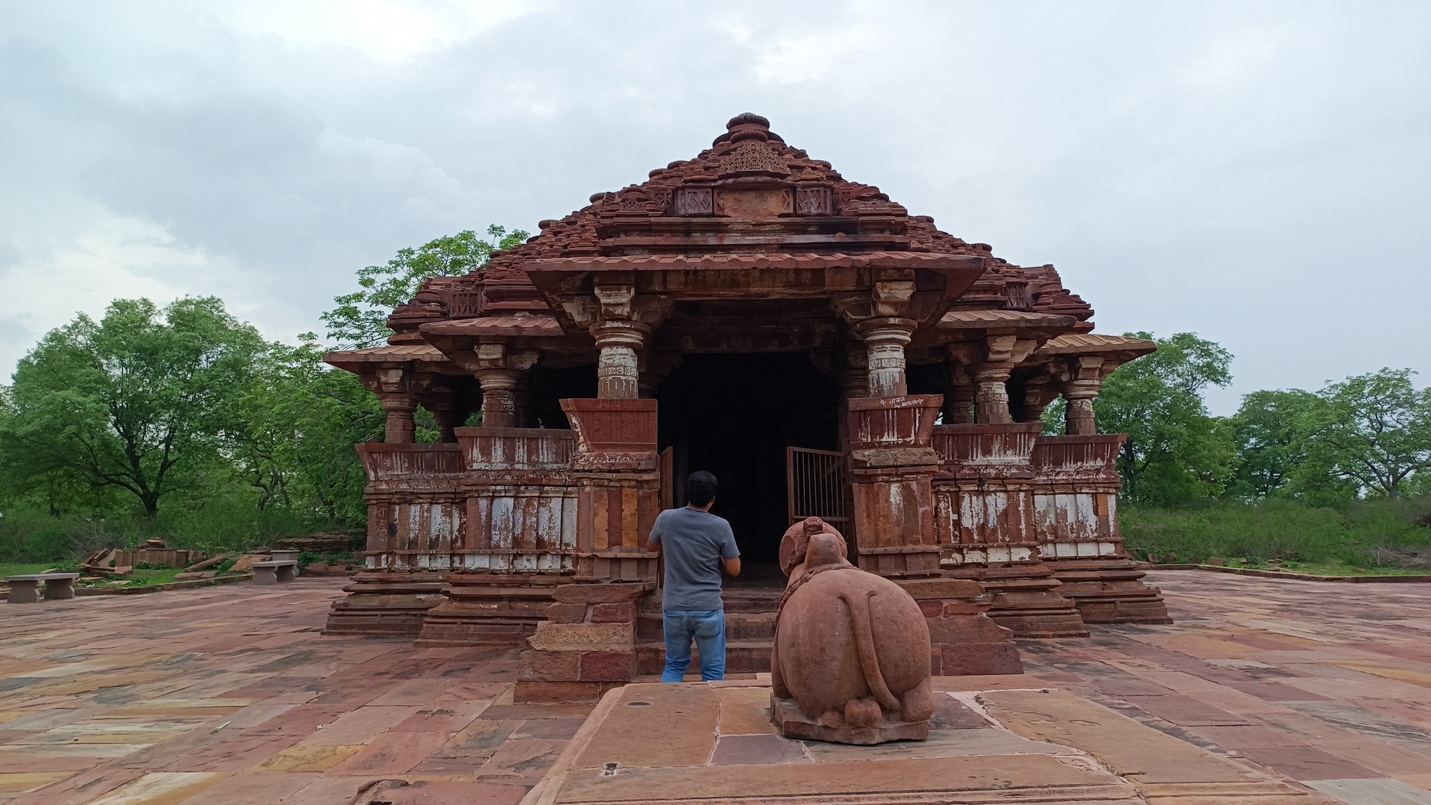
Menal and Mahanal temples, Menal

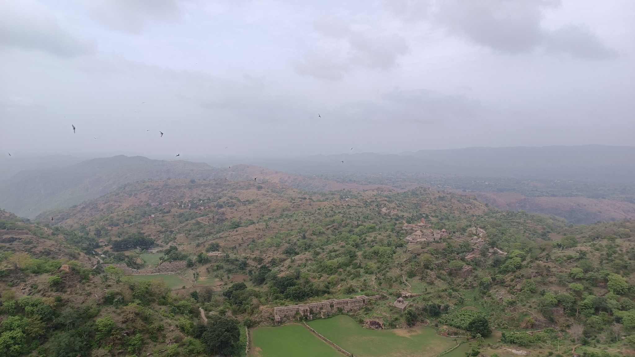
This was just an unexpected, happy accident that happened because my brother was simply scanning Google Maps on our way to Chittorgarh. The 11th century Shiva temple complex lies just beside the highway, nestled in a forest, straddling a stream with a waterfall dropping into a gorge. Across the steep waterfall is one of the temples, with an adjoining monastery in ruins, which one can access by simply crossing the stream before it drops into the gorge. Now, that’s truly a set-up venturing into Indiana Jones territory.
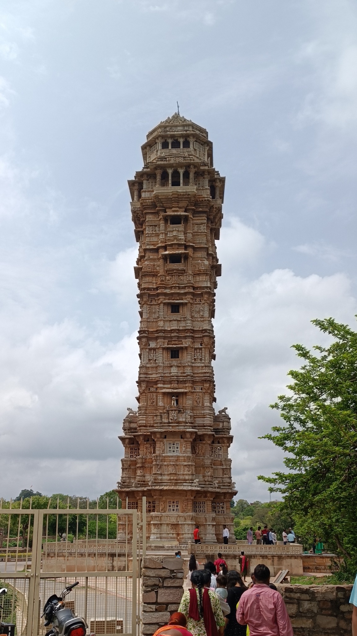
Chittorgarh

What can be said in a line or two about Chittor fort that would capture what it is, what it stands for, what legacy it bears, what history it has seen!

But what struck me most upon first visiting the place, and has remained with me since, is how it is a self-contained city spread upon a vast flat-topped hill, like on a plateau. The palaces and structures are far-flung, interspersed with water tanks and jungle. This is a place that is removed from the rest of the world that lies beneath, one that transports you to another era as a time machine.
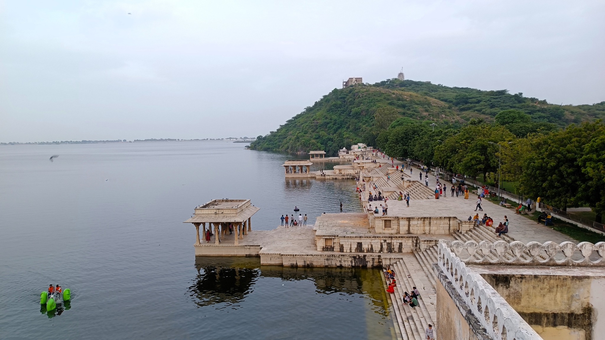
Banswara

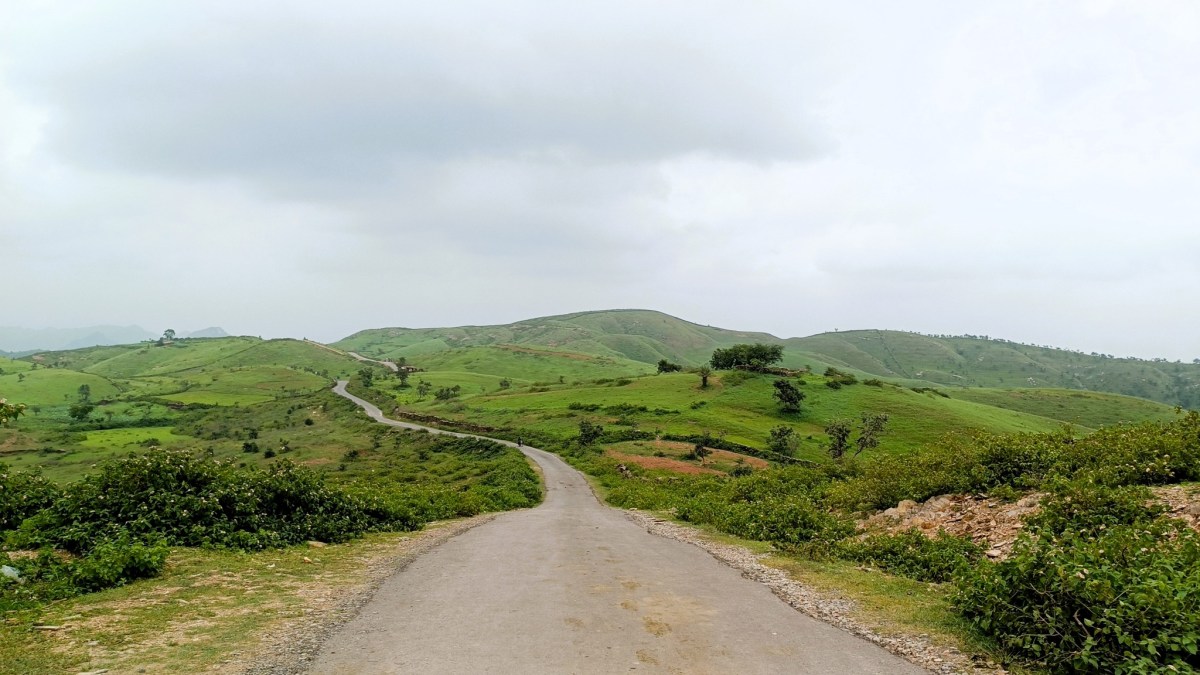
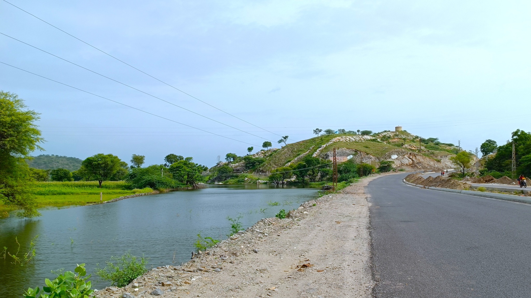
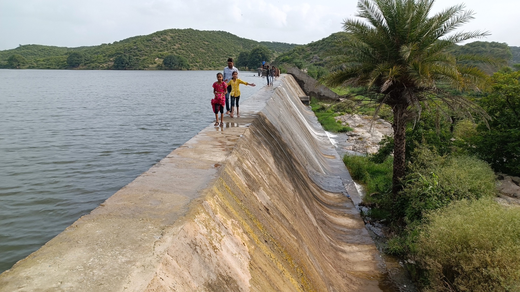
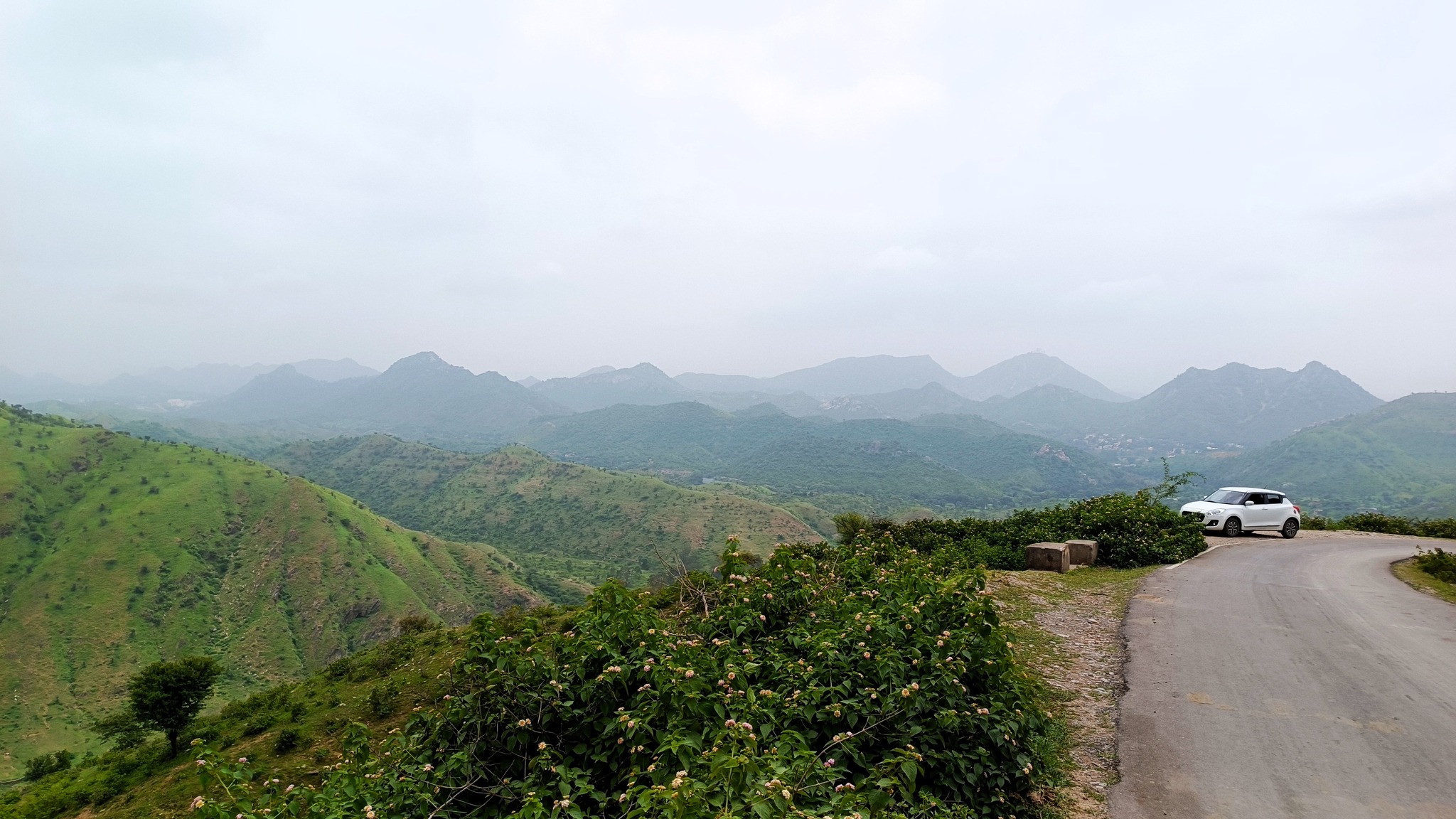
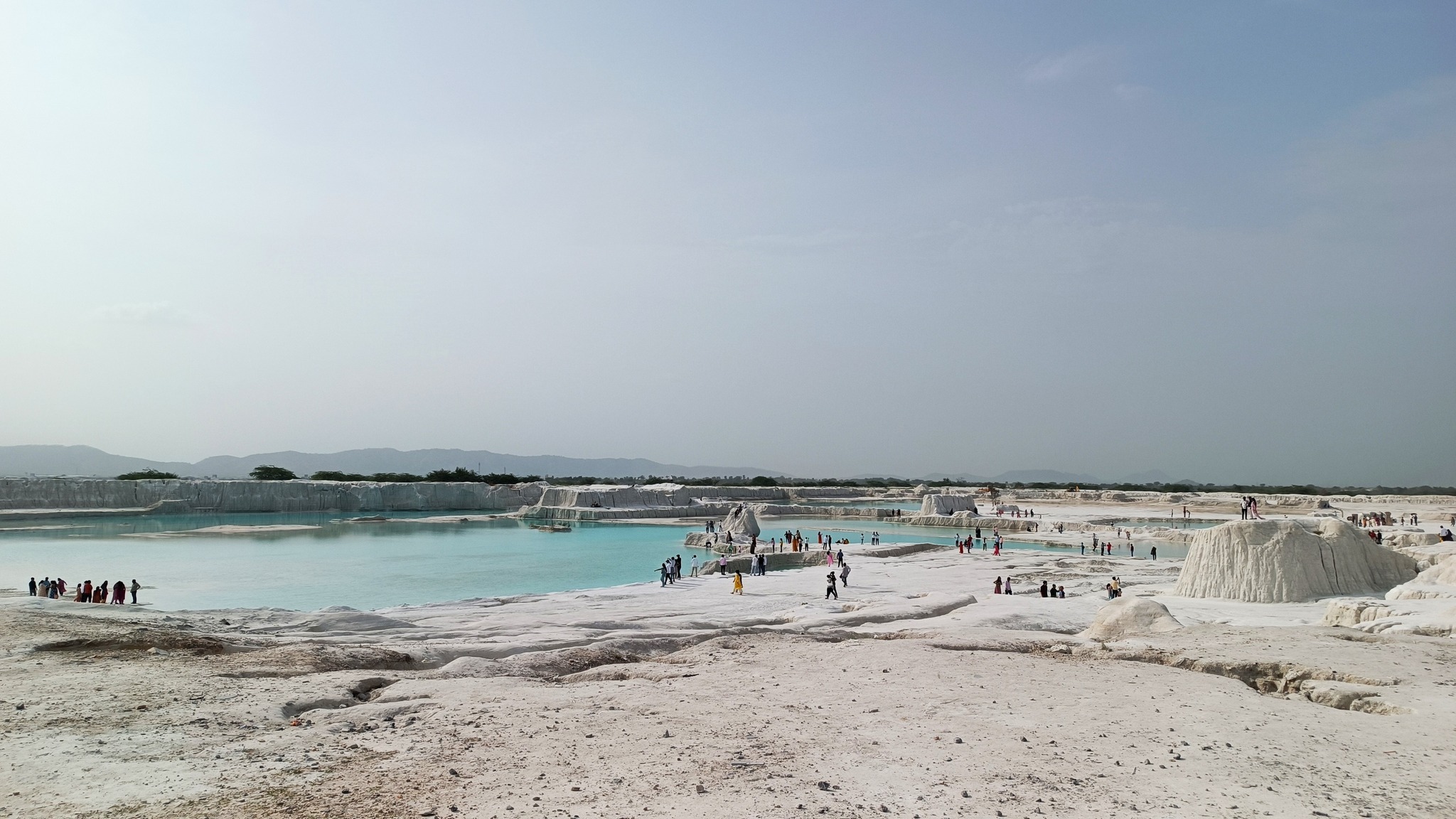
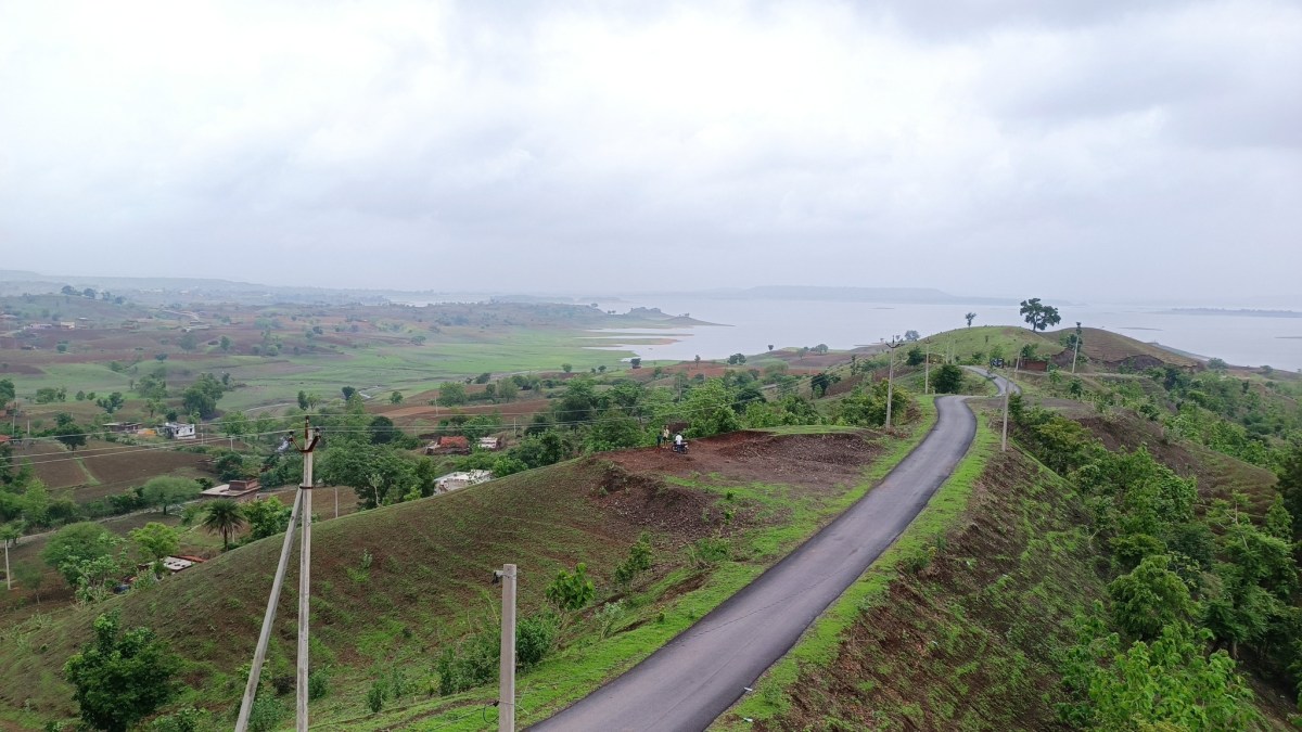
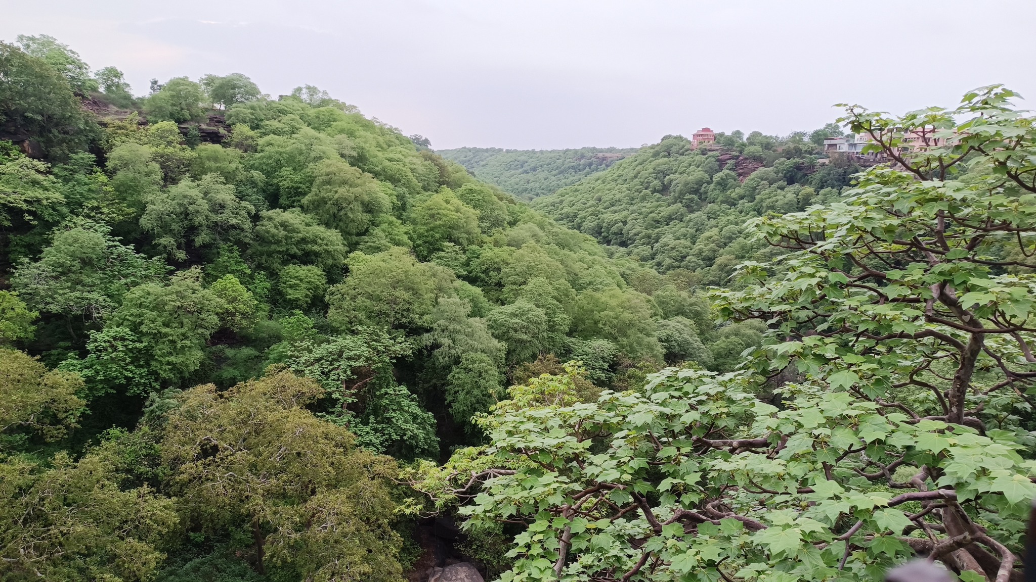
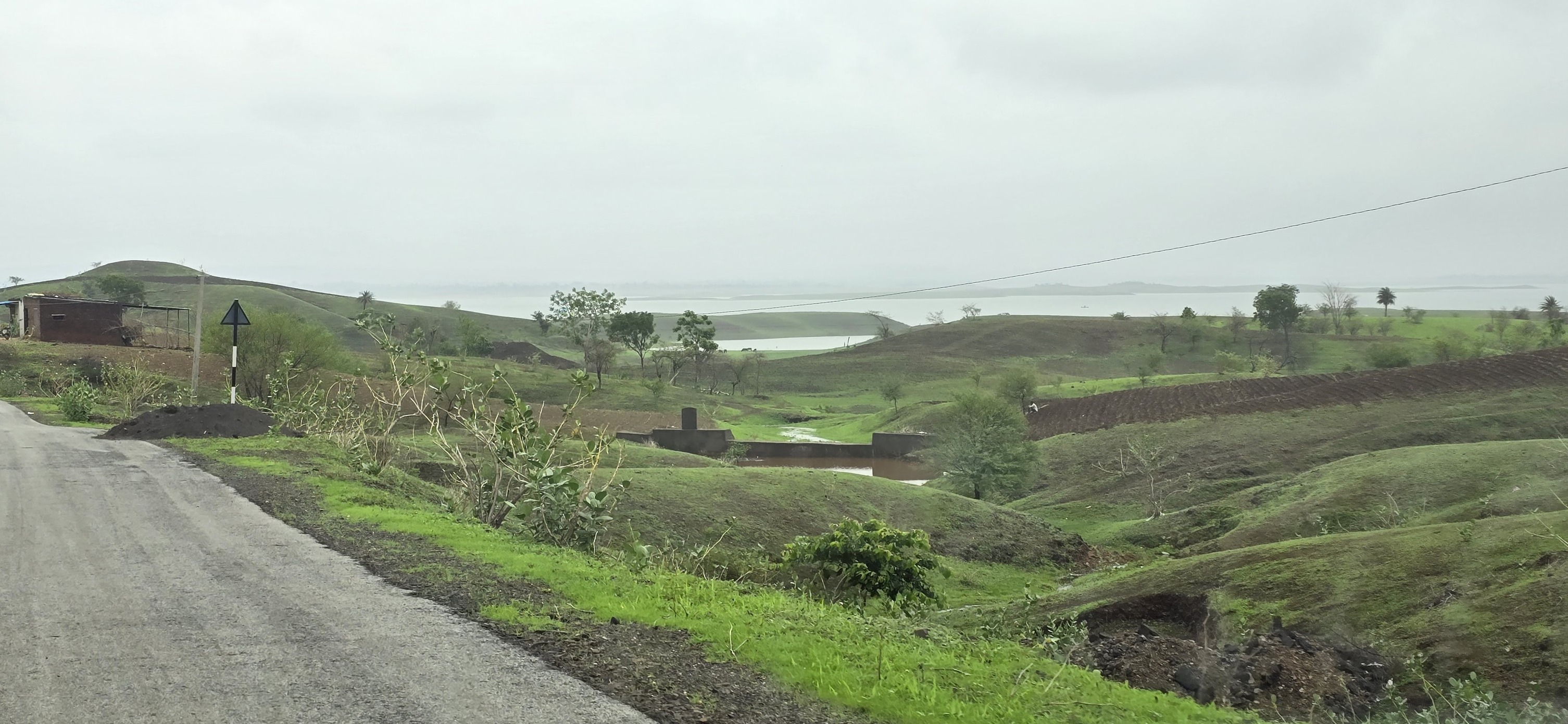
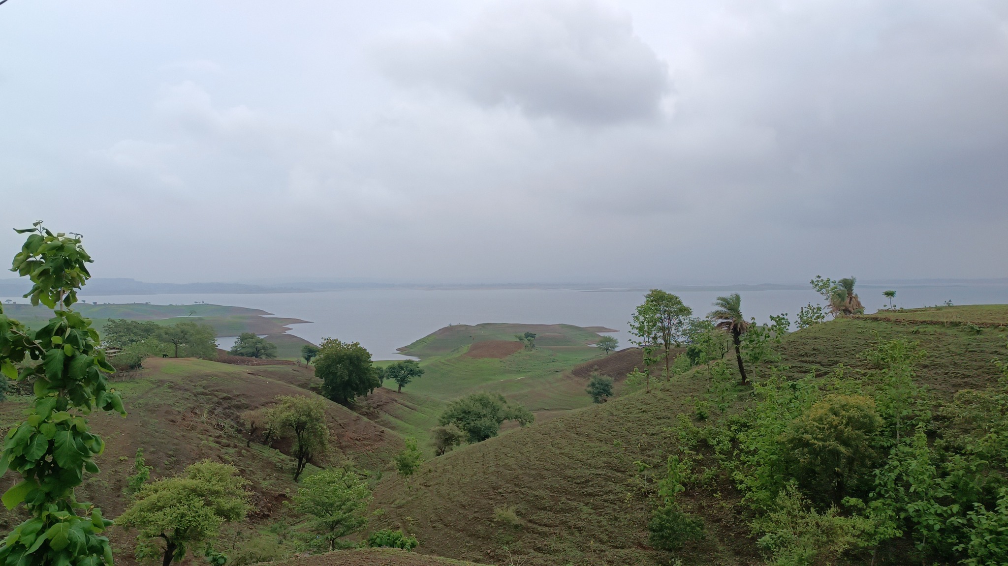
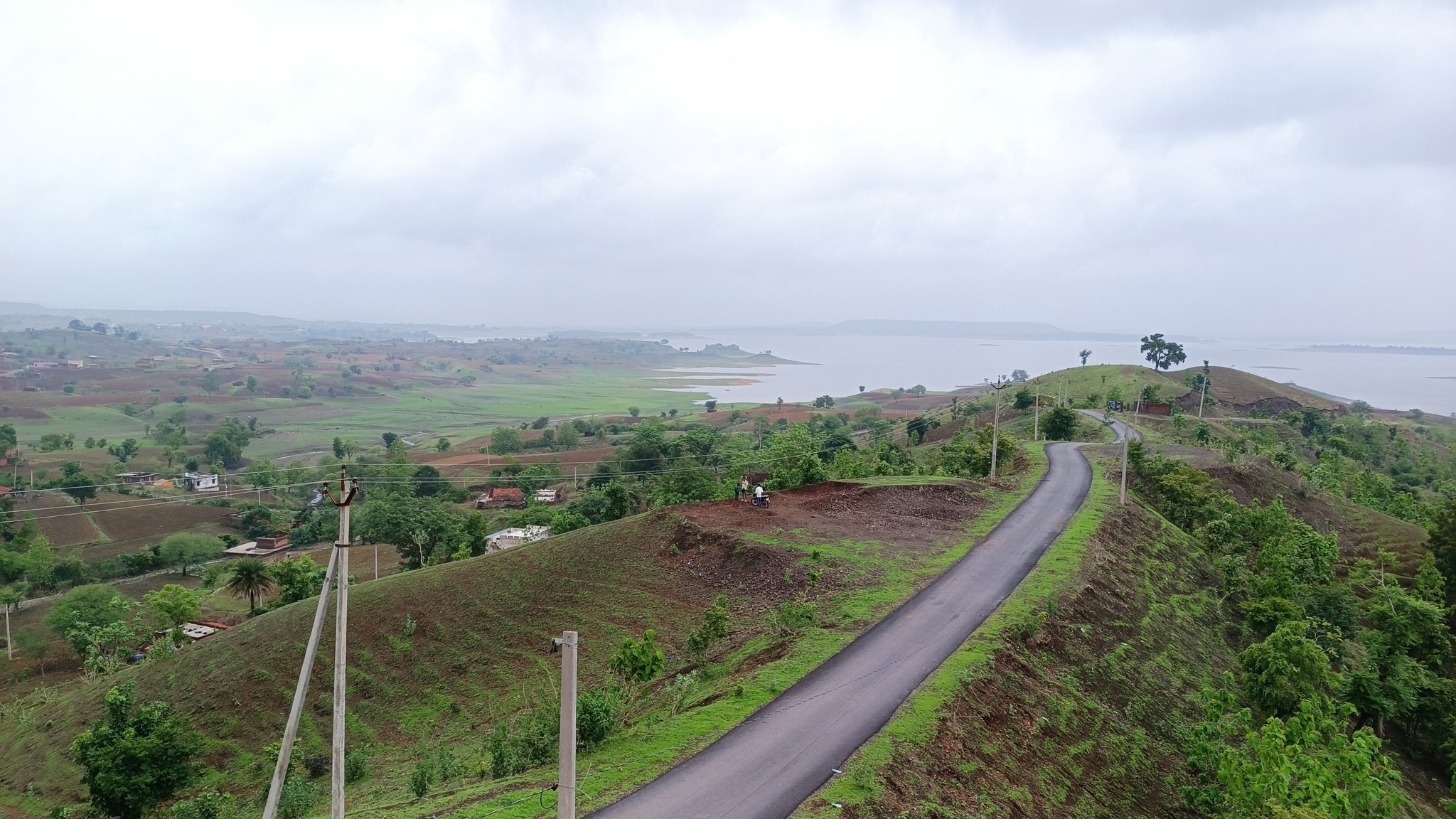
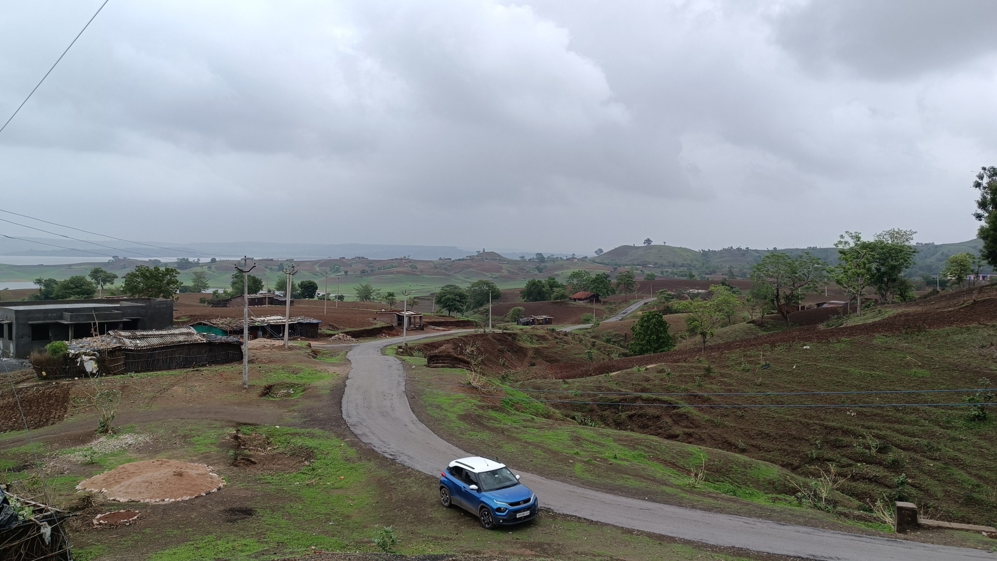
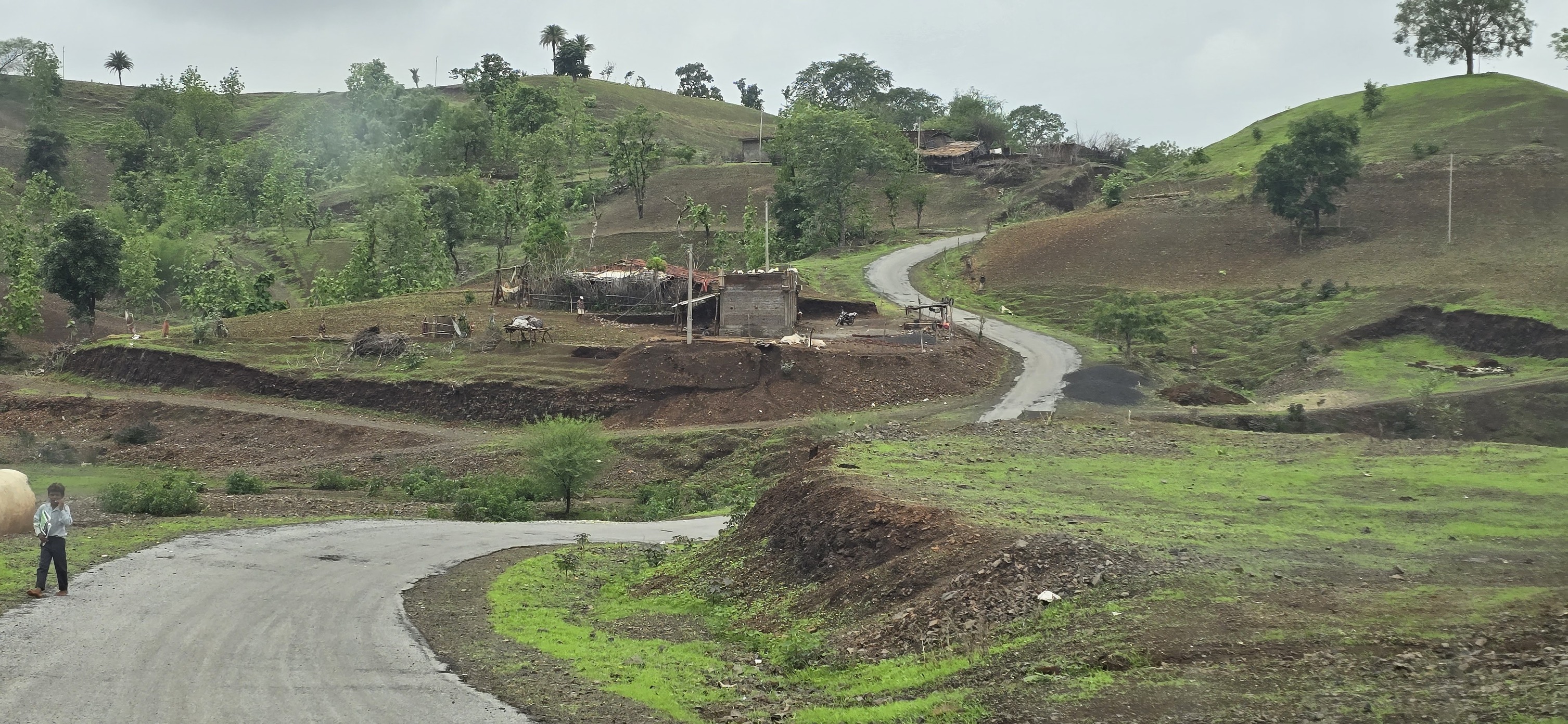
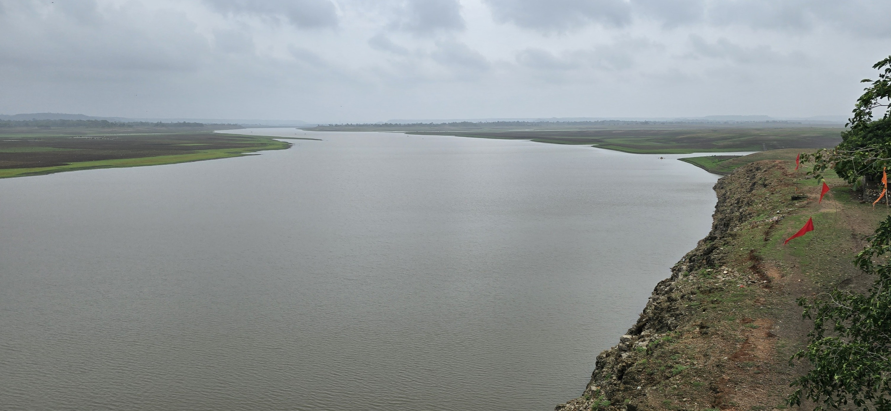
Banswara region lies in the Mahi catchment area in south-west Rajasthan, and is home to the massive Mahi Dam. The region is typified by low rolling hills undulating for miles, whose tops turn into meadows in the monsoons, evoking scenes from a Kashmiri landscape. This topographical feature has also led to formation of islands in the reservoir created by the Mahi Dam.

The road, winding across the ridges, leading to a village called Chacha Kota, affords a roller-coaster like ride with breathtaking views of the low rolling hills stretching to the horizon, as well as the islands in the reservoir. With overcast skies, you might even feel you’re gliding through the clouds.

Another point of significance is the long Maharana Pratap Setu (Bridge) over the Mahi River on the road to Ratlam, where the Tropic of Cancer also passes through.
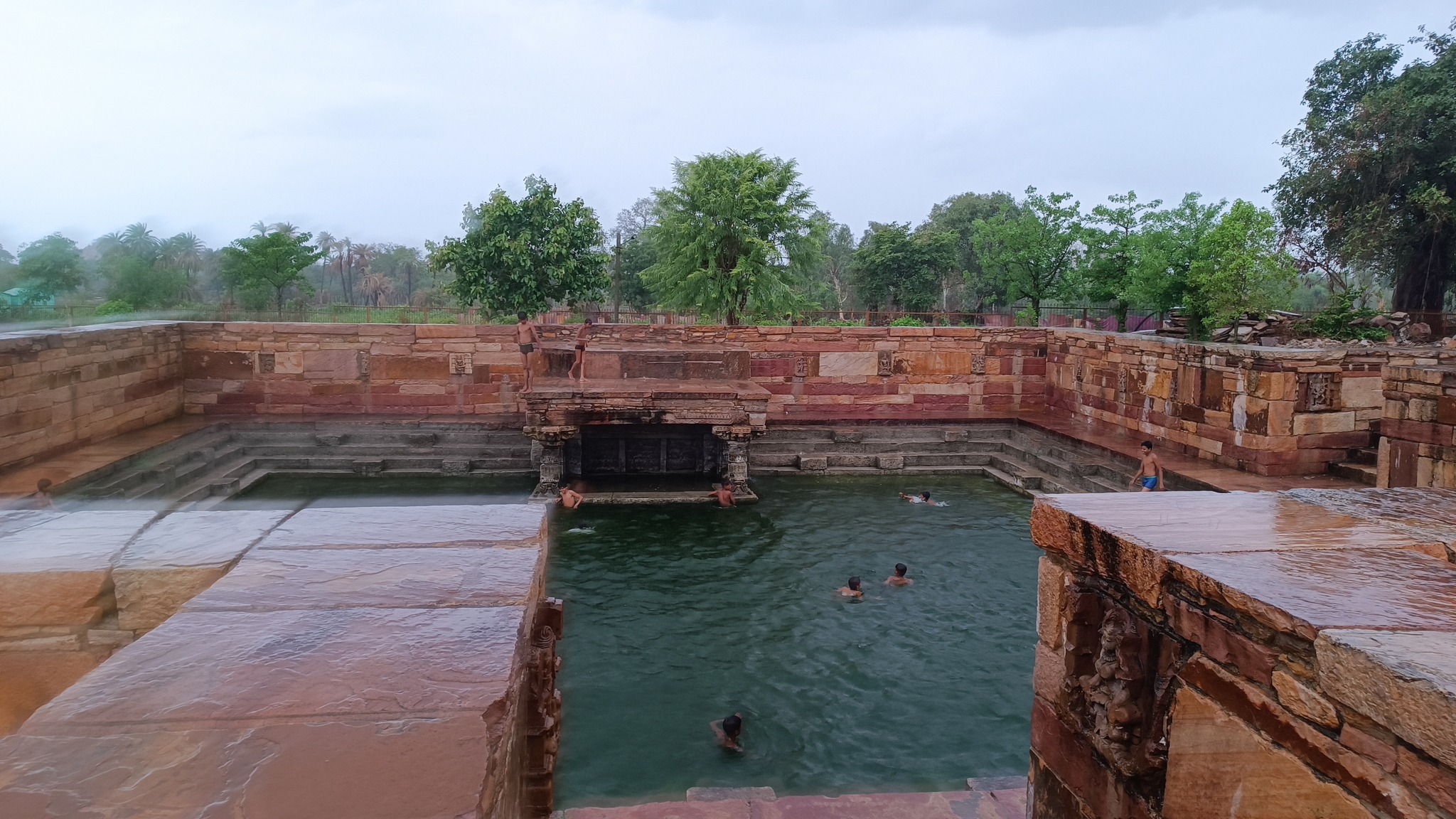
Arthuna

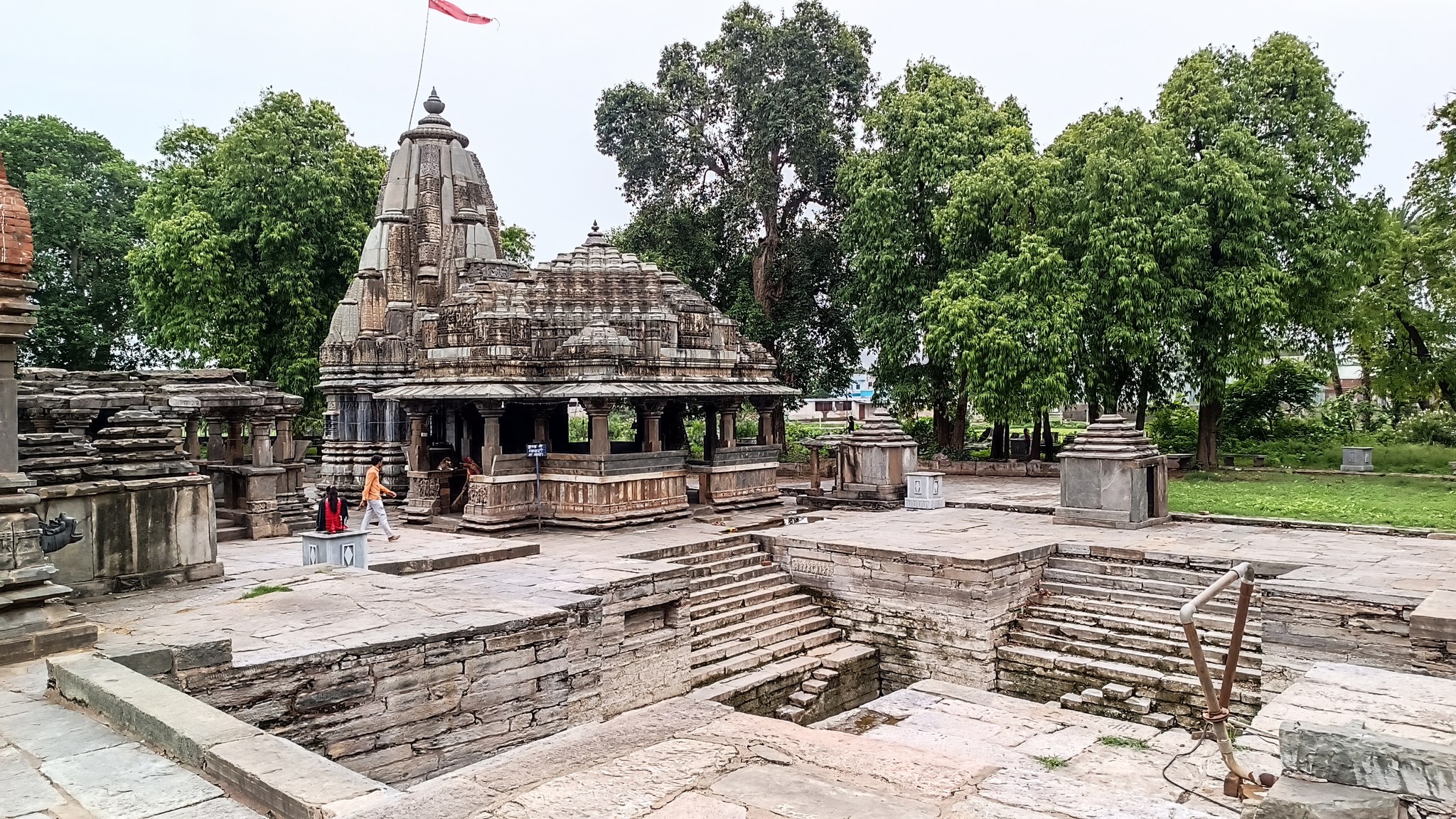
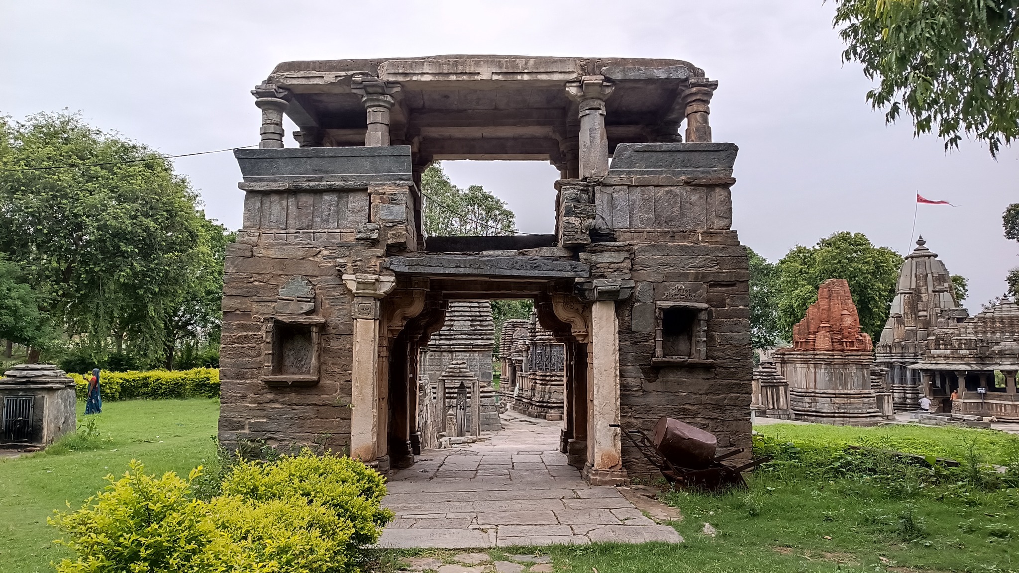
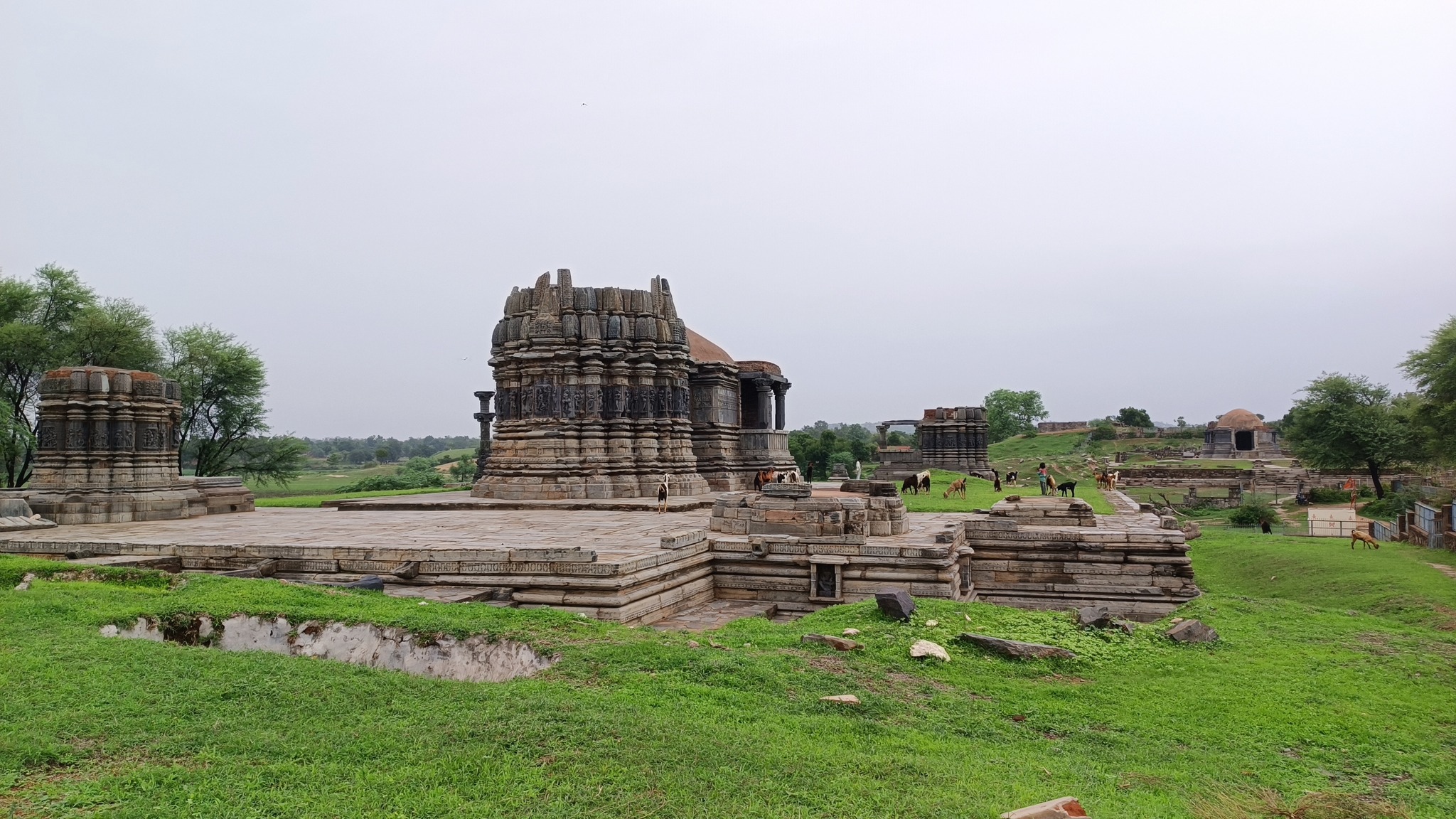
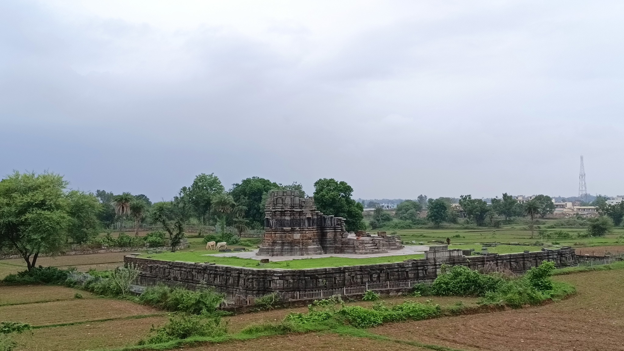
Arthuna, also called Utthunaka, the capital of the Paramaras of Vagad in the 11th-12 century AD, was an important commercial centre at the time. Home to a complex containing multiple temples, from the same period, dedicated to Shiva, and a stepped tank. What is interesting is that outside this complex, there are ruins of even larger temples, and several mounds probably concealing even more structures.

Nathdwara

Home to the temple of Shrinathji, an infant form of Krishna.
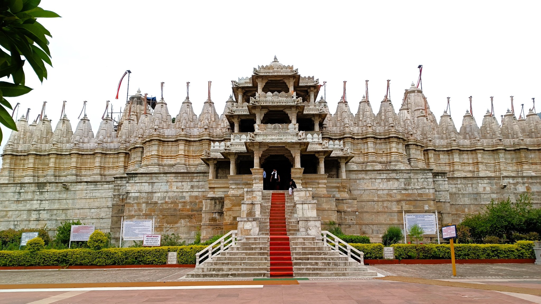
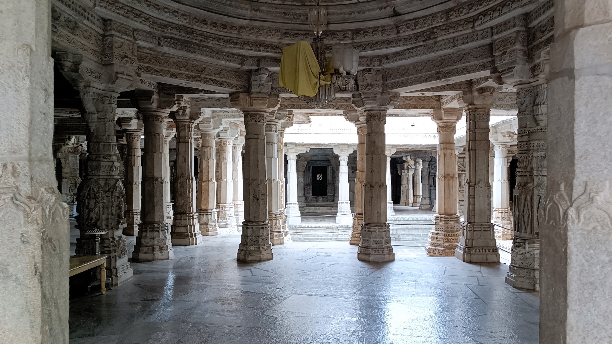
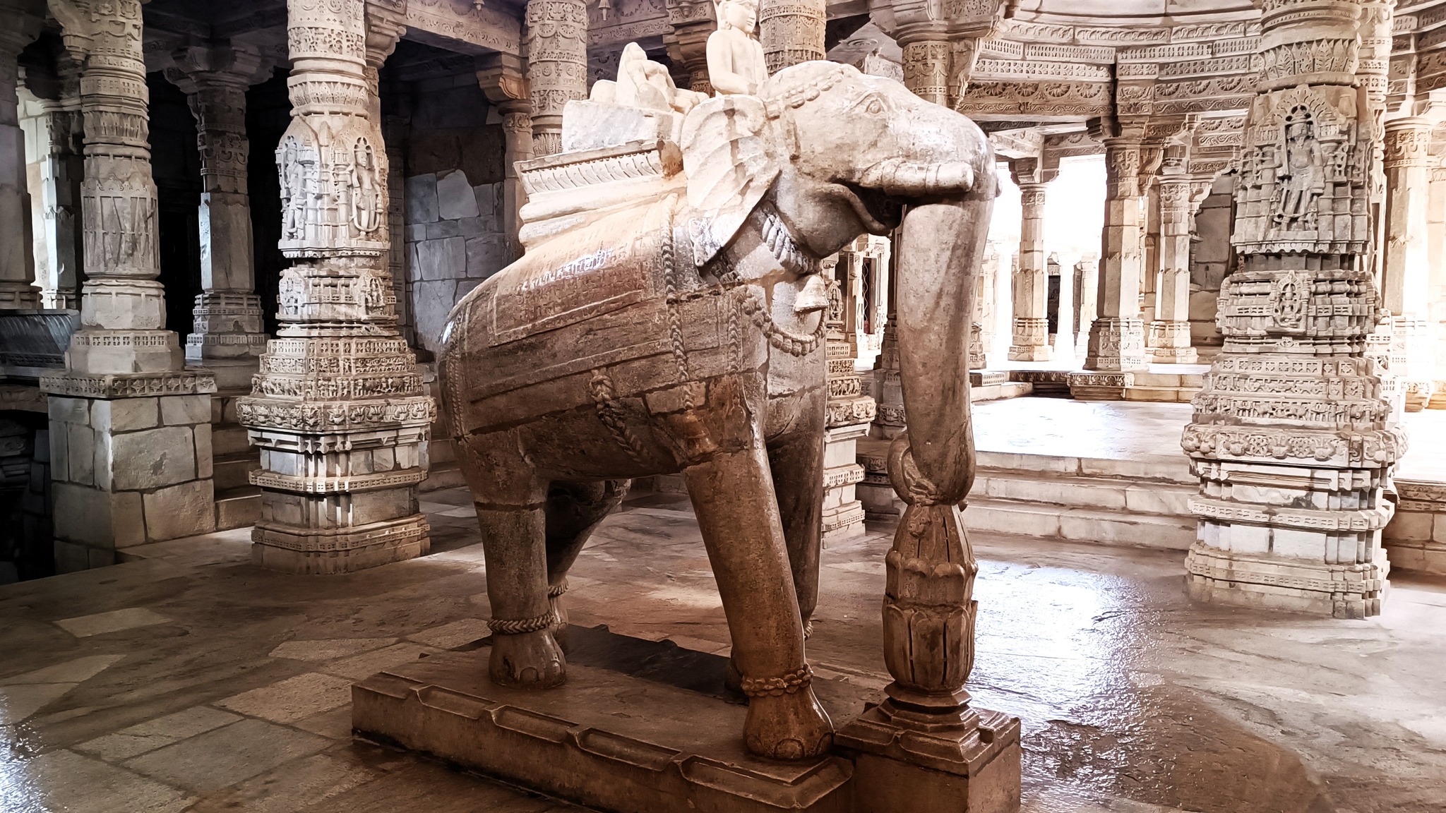
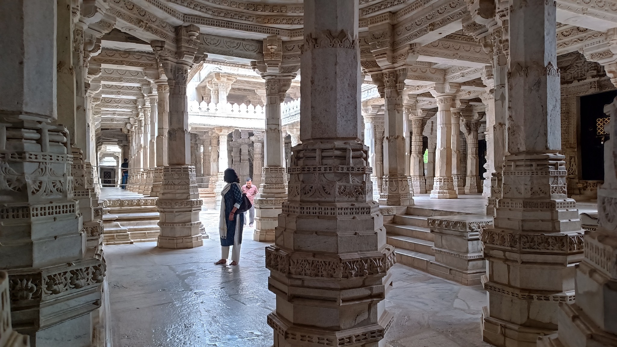
Ranakpur

A 15th century Jain temple built entirely in marble sits majestically in the jungle at the Aravalli foothills. I would put this temple alongside the Taj Mahal as a mediaeval wonder of India.
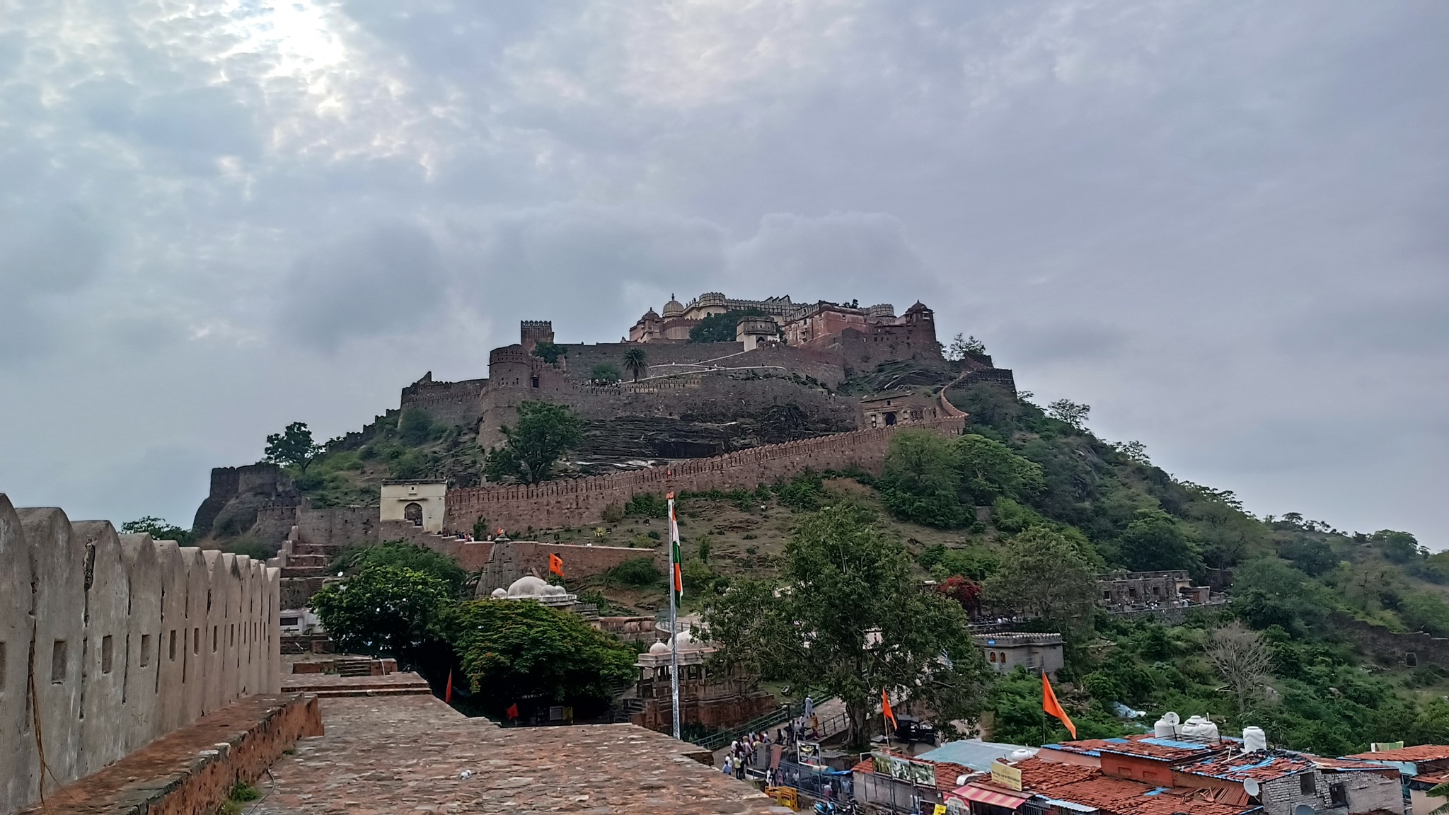
Kumbhalgarh

Another historic fort, the birthplace of the legendary Maharana Pratap, and hailed as the fort with the longest fortification wall in India (2nd in the world) at 36 km. From the top of the main palace, aptly named Badal Mahal (or Palace of the Clouds), it is said, one can see the Marwar on one side, and Mewar on the other.

Rakt Talai (Pool of Blood)

As one crosses Haldighati pass, the region around which served as the battleground between the armies of Maharana Pratap and Akbar, and reaches Khamnore, there comes a depressed patch of land where a pond is said to have existed. The pond is said to have turned red with rainwater that trickled down into it, after mixing with the blood of those fallen in the battle of Haldighati on 18 June 1576.

Trip Summary

Day 1:
Gurugram to Chittorgarh via Bijolia and Menal

Day 2:
Chittaurgarh fort, and then on to Banswara
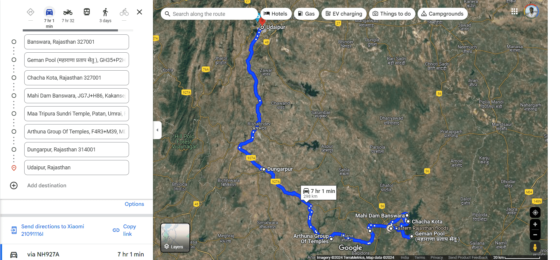
Day 3:
Banswara and thereabouts including Mahi River Bridge, Chacha Kota and Mahi Dam.
On to Udaipur via Arthuna and Dungarpur

Day 4:
Udaipur to Nathdwara, then on to Ranakpur and Kumbhalgarh, and back to Udaipur

Day 5:
Udaipur to Gurugram via Haldighati and Bhilwara

Trip maps

Trip statistics

Aravalli Archives: Rajsamand, Rayta and Ranakpur

This August, we made a quick getaway to Udaipur, with the intention of exploring the Aravalli hill ranges in and around Udaipur. It was in the vicinity of Udaipur, while returning from Mount Abu, that I had fallen in love with the Aravallis. Though on my last trip to Udaipur – the only one since the Mount Abu trip – we had ventured into the Aravallis on our excursion to Kumbhalgarh, the fact that we had limited time and little influence over the cab driver quashed any hope of indulging my love for the Aravallis and exploring the hill ranges in and around Udaipur.

Nevertheless, now that we drove our own car, we would be constrained only by time, not by ability or ambition. So, starting off around 6.30 AM from Gurugram, taking the Ajmer Expressway, we had bypassed Jaipur by 11 AM, stopping at 12.30PM for a break just on the outskirts of Kishangarh. Resuming the journey, we had to make a choice between going by the Ajmer-Deogarh-Rajsamand route using NH 58 or through Bhilwara using NH 48, the latter being the one with greater average speed. However, my main interest being in driving by the Aravallis, we chose the one through NH 58 after ascertaining from locals about the condition of the road. And were we amply rewarded for the same!

Our brush with the Aravallis started from near Ajmer, and by the time we reached Beawar, where we stopped for lunch, we were already being accompanied by continuous ranges of the Aravallis. As seen from the satellite view of Google Maps, a long chain of the Aravallis begins from below Beawar and stretches in the south-westerly direction all the way to just above Udaipur, where again there is a pass in the hill ranges nestling the historic town of Gogunda. Another chain of Aravallis starts after this pass and stretches some distance into Gujarat, ending with the Polo forest.

So, as indicated by Google Maps, we were soon running alongside the foothills of the Aravallis after crossing Beawar. We slid up and down the undulating road and swerved left and right on the roading curving around the protrusions and along the cavities on the hillside. Patches of green clothed the yellowish-brown hillsides, while patches of green pasture interspersed with small and large ponds and punctuated by the occasional hamlet dotted the slope on the other side of the road. The road cut through the hillside at many places, but seldom bent into hairpin shapes. Crevices snuggling in the hillsides held dainty pools formed of rainwater, bearing blooming lilies and lotuses floating on a carpet of leaves.

Around 5.30 PM, we reached Rajsamand, a city lying 67 km before Udaipur on the foothills of the Aravallis, home to an expansive lake carved out in the hillside and fed by water dammed on the Gomti river. The construction of the Rajsamand lake was started by Maharana Raj Singh in 1662 AD, ending in 1676AD, and is the oldest known famine relief work in Rajasthan. The lake also served as a sea-plane base for Imperial Airways for its route from London to Sydney, and as an auxiliary base for the IAF during the Second World War. A marble pavillion-cum-garden called Nau Chakki adorns a section of the lakeside. Adjacent to it, lies a building called Maharana Raj Singh Panorama depicting a brief history of Rajsamand and glimpses from Raj Singh’s life while also displaying a part of a metallic chain used for anchoring the sea-planes in the lake.

As we approached Udaipur, with the Aravallis reaching majestic heights while wearing cloaks of green with stripes of yellow, the scenery became even more picturesque. Before long we had entered a tunnel near Chirwa, and were promptly stuck in hour-long traffic, finally reaching Udaipur at 8 PM. Following a failed attempt at dining at all of the lakeside restaurants on the Ambrai Ghat, we had dinner at a restaurant in the city, and retired for the night.

The next morning, we drove our way to the outskirts on the south-west direction of Udaipur, crossed a stream and then climbed up a narrow road winding around the hillside to reach a large flat expanse of meadows on the top of a high hill called Rayta. Amidst gusts of a cool breeze and chirps of birds, we were treated to breathtaking views of swathes of green reminiscent of images from Kashmir Valley, with the landscape rendered even punchier due to the monsoons. Leaving Rayta at around 12.30 PM, the descent from the hill was equally eventful as the scary ride up, thanks to the narrowness of the road forcing us to make a couple of crossing of vehicles coming from the opposite side with supreme caution.

Driving on, first by-passing Udaipur and then turning left towards and crossing Gogunda, we took a state highway running into the interiors of the Aravallis, reaching Sayra, where we reached a fork in the road – with the right leading to Kumbhalgarh, and the left leading to Ranakpur. From Sayra, we climbed higher up the Aravallis, subsequently crossing the crest of the hill range, and came upon a descent passing through jungle, given company by and criss-crossed by a couple of rivulets. Then negotiating a 15-minute descent comprising numerous steep curves and hairpin bends, we reached the base of the hill range, where lay a place had been sitting in my wish list since 2013 – Ranakpur.

Ranakpur, located on the side of the Maghai River, is home to the 15th century Chaturmukha Dharana Vihara, or simply called Ranakpur Jain temple, built entirely in marble. Construction of the temple dedicated to Adinatha, the first tirthankara, was commenced in 1446 AD by Dharna Shah, from the Porwal community under the patronage of Rana Kumbha, and ended in 1496 AD, fifty years later. Three other temples dedicated each to Parsvanatha, Neminatha and Mahavira stand in the temple complex, while a 13th century Sun temple sits outside the complex right at a cusp of the river. Sitting majestically in the jungle at the Aravalli foothills, this temple can easily be put alongside the Taj Mahal as a mediaeval wonder of India.

At 4.30 PM, we left Ranakpur to ride back up the series of steep hairpin bends to reach our abode for the night located on top of the hill range – a resort called Aranyawas. The resort comprising cottages built in multiple tiers is located on the side of one of the rivulets that I mentioned above, which in turn is a tributary of the aforementioned Maghai River. A deck at the back-edge of the the resort affords views of the hills across the rivulet and the surrounding forests, along with that of an anicut built on the rivulet. Later, taking a curving bridge we reached the large swimming pool that stood at a higher level as compared to the rest of the resort, providing a great 360-degrees view of the place.

In the morning, we took a tour of the kitchen garden nurtured amidst the jungle inside the premises of the resort. At 10.30 AM, leaving the resort, we again passed through Ranakpur taking highway running through Pali, on the side of the chain of Aravallis opposite the one we had taken on outward journey on the first day. By 2 PM, we were in Beawar again, choosing to have lunch at the same place as on our outward journey. At 4 PM, we reached Kishangarh, where we choose to take a little detour to see the Marble Slurry Dumpyard, which lends itself to a stunning landscape resembling that of a snow yard, with greenish pools of water scattered all over it.

Moving on from Kishangarh, adventure still awaited us, since midway to Gurgaon after crossing Jaipur, we were met with traffic jams brought about my multiple stretches of road construction. At around 10 PM, with a final one hour long jam staring at us right before Bawal, an alternative route popped up on Google Maps diverting from right where we stood. Based on eye contact and a couple of lines of verbal communication with another person driving his family in his car, we took the diversion following one another, venturing into the desolate countryside. Thankfully, after a 15-minute drive through the potholed, sometimes, muddy interior roads, we were back again on the highway, having bypassed the traffic jam! By 11 PM, we were home.