After many years of dreaming of and planning a trip to Kachch and failing – in the manner similar to how people do for Goa – we finally managed to freeze a five-day block in December convenient for all our family members. But of course, the preparations had to start three months in advance – what with booking train tickets, local conveyance and accommodation, owing to our plan falling in peak season. Our trip dates would also coincide with a full moon, an occasion highly recommended for spending the night on in the ‘white desert’, warranting iterating through multiple permutations and combinations before we could firm up our itinerary.
Part 1: Rani ki Vav, Patan and Sun Temple, Modhera
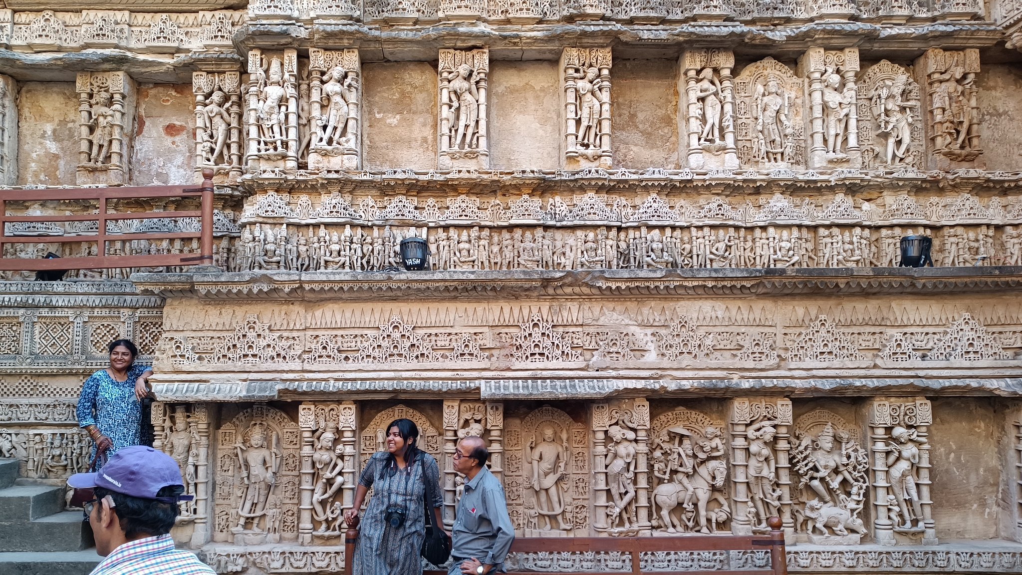
Finally, the day came, and we took the overnight Ahmedabad Rajdhani from Gurgaon, arriving in Ahmedabad at 9AM. Checking-in at our hotel, and freshening up, we were out around 1 PM headed north to Patan to see Rani ki Vav, an 11th century step-well. The stepwell has 7 layers of stairs leading to a deep circular well, with the walls, pillars, columns , brackets and beams carved exquisitely with depictions of numerous flower and animal motifs, besides those of the many Vishnu avatars and other Hindu gods and goddesses, and representing scenes from daily life. A short distance away from Rani ki Vav, are also remnants of other waterworks.

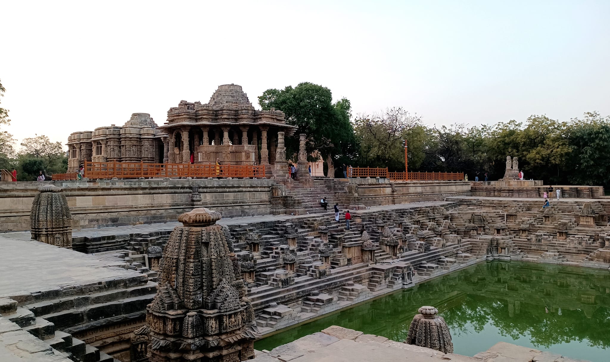
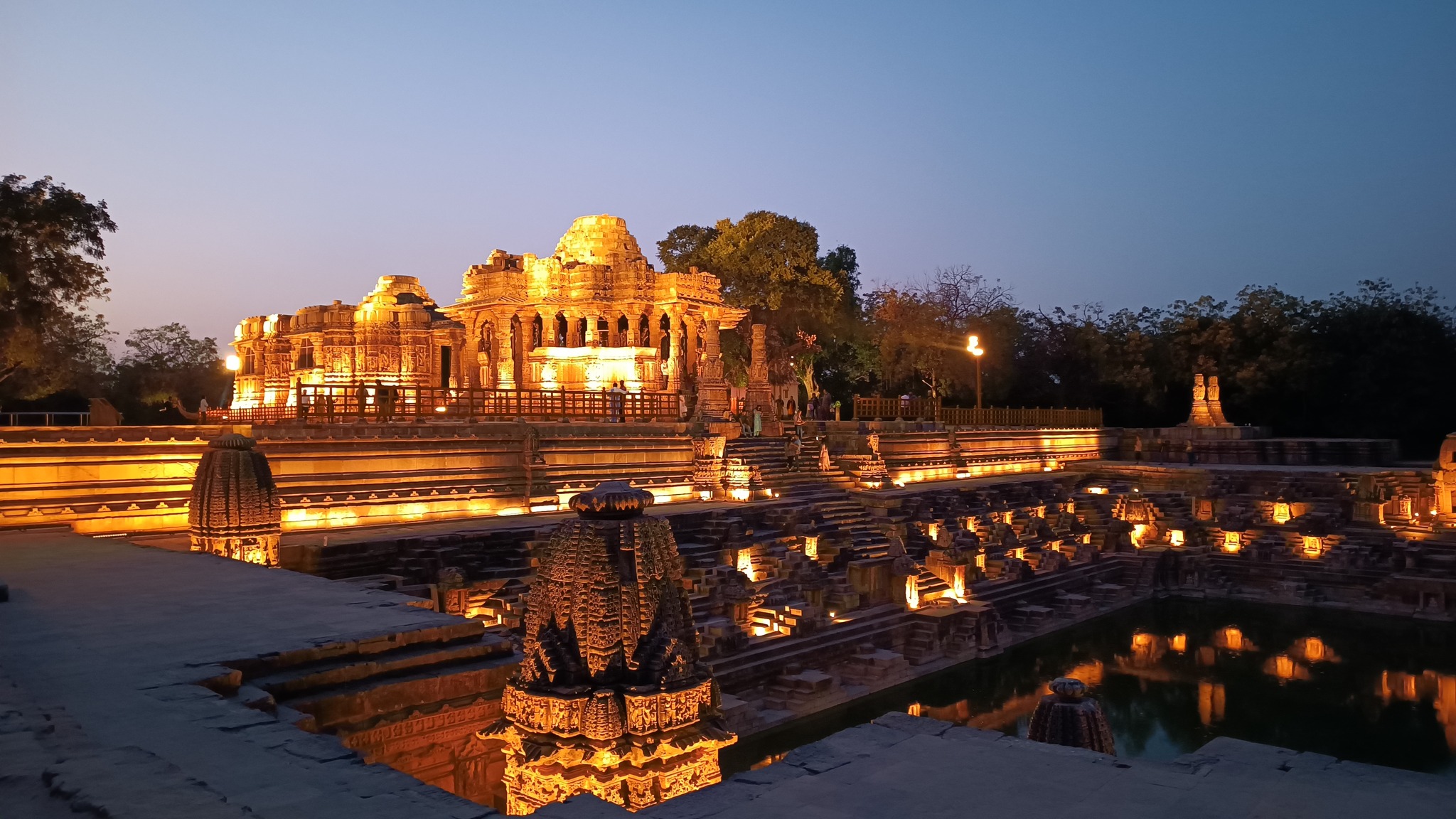
Leaving Patan around 4 PM, we headed to Modhera to see the 11th century Sun Temple, racing against time apprehensive of the fact that the temple would be closed by the time we reached Modhera. However, reaching Modhera around 5.3o PM, we learnt that the beauty of the finely built temple is enhanced manifold when the decorative lights dotting the complex, are turned on around sunset. Admiring the temple facade and the adjunct stone-built pool surface shining in the evening lights, we ended up lounging about for more time than we had budgeted for, and only left reluctantly for Ahmedabad around 7 PM.
Part 2: Dholavira
On Day 2, we started at 7 AM from Ahmedabad, headed to our first stop in Kachch – Dholavira. Pushing westward from Ahmedabad, we first passed Sanand, the automobile manufacturing hub, and then as were passing below the Little Rann of Kachch, the vegetation became gradually sparser with the ground turning increasingly brown. Then as we winded around the Little Rann to cross channels of the Little Rann draining into the Arabian Sea, we got a preview of the kind of topography we would soon be experiencing, with the vegetation becoming all but absent and the ground simply wearing a veneer of white as we got closer to the Rann of Kachch. Salt production was in full flow on both sides of the road.
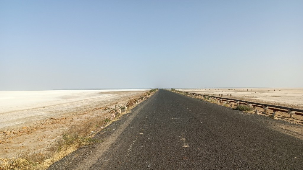
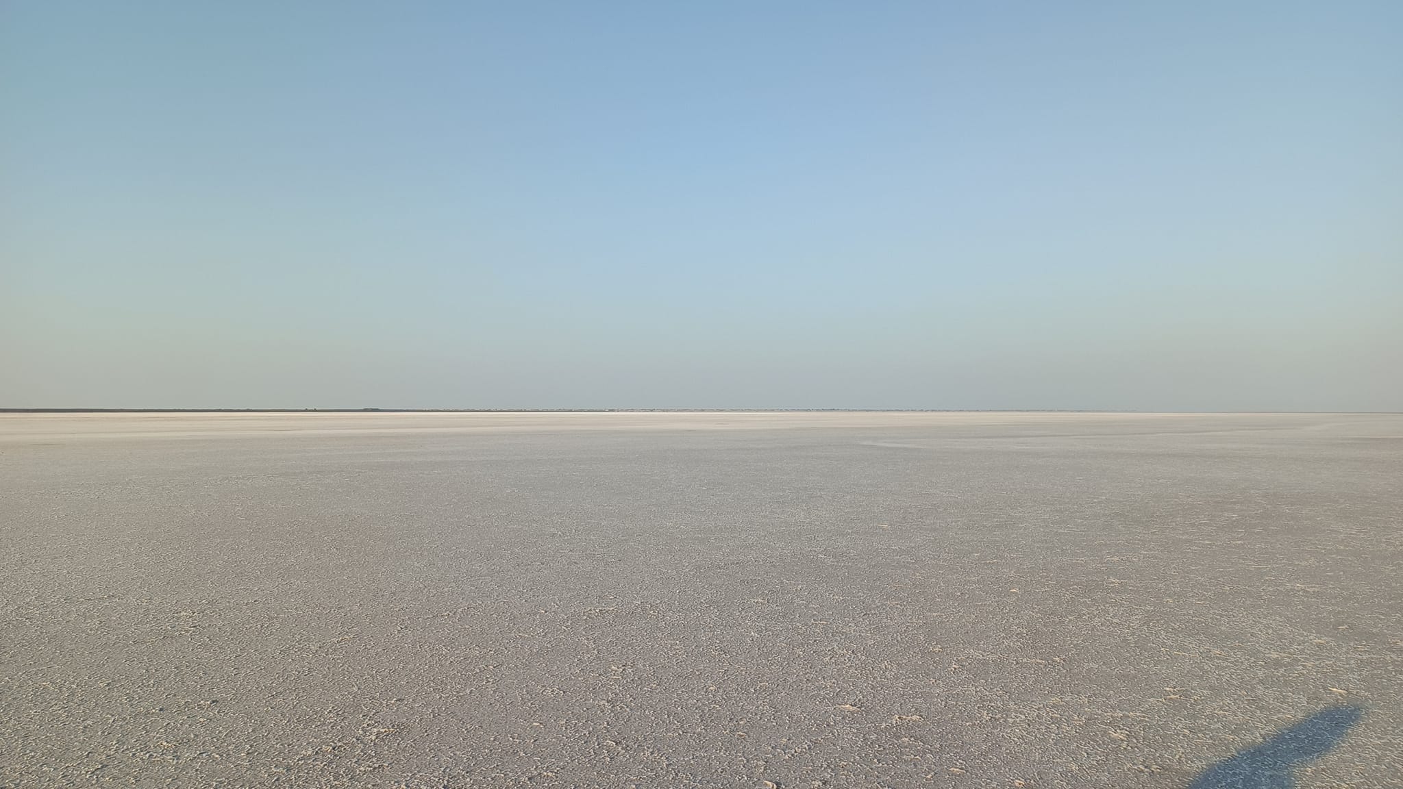
Crossing Rapar, a major town in Kachch, we then swerved left with the vegetation turning green, yet still sparse, reminiscent of the Thar. At around 1 PM, the land suddenly turned white, under a shroud of salt stretching for miles on end, only punctuated by a low hill in the distance and the tar road we were on cutting across the white expanse in a straight line – we had now entered the Rann of Kachch Lake. Crossing the stretch of white land, we were soon upon the Khadir Bet Island, where the desert vegetation was back on display. By 2 PM, we were at the Rann Resort Dholavira, our stay for the night, located right at the coast on the opposite side of the island.
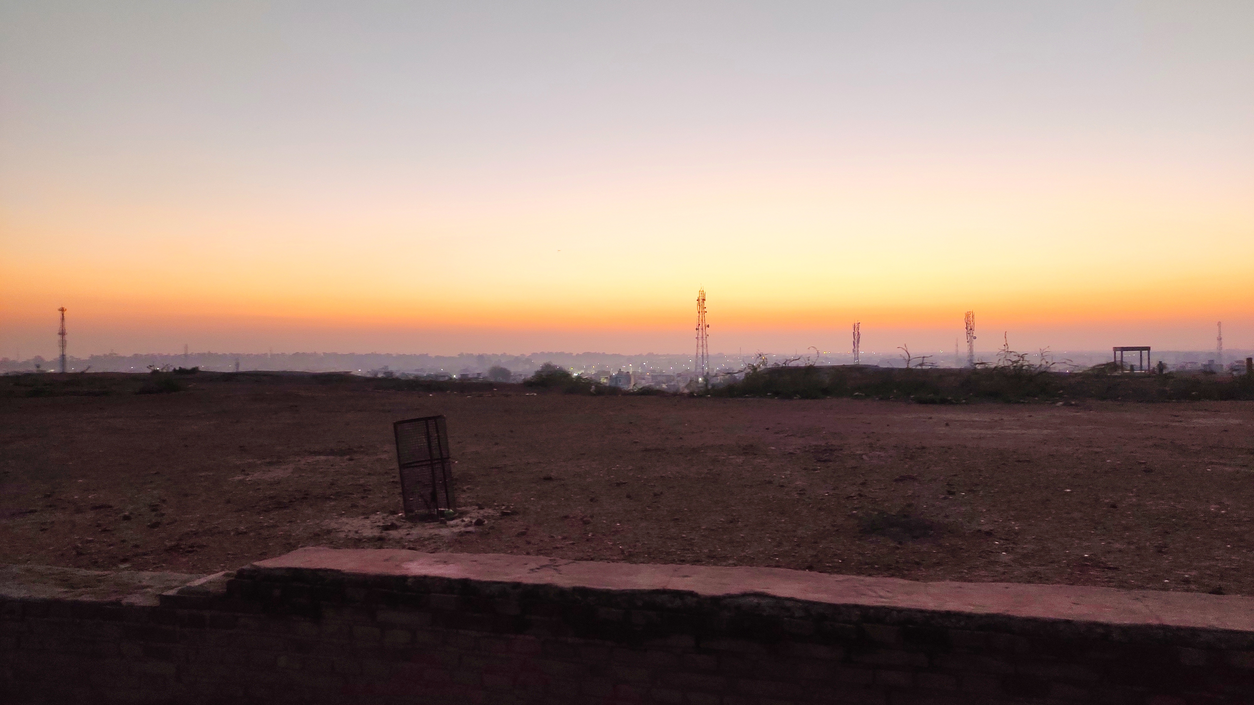
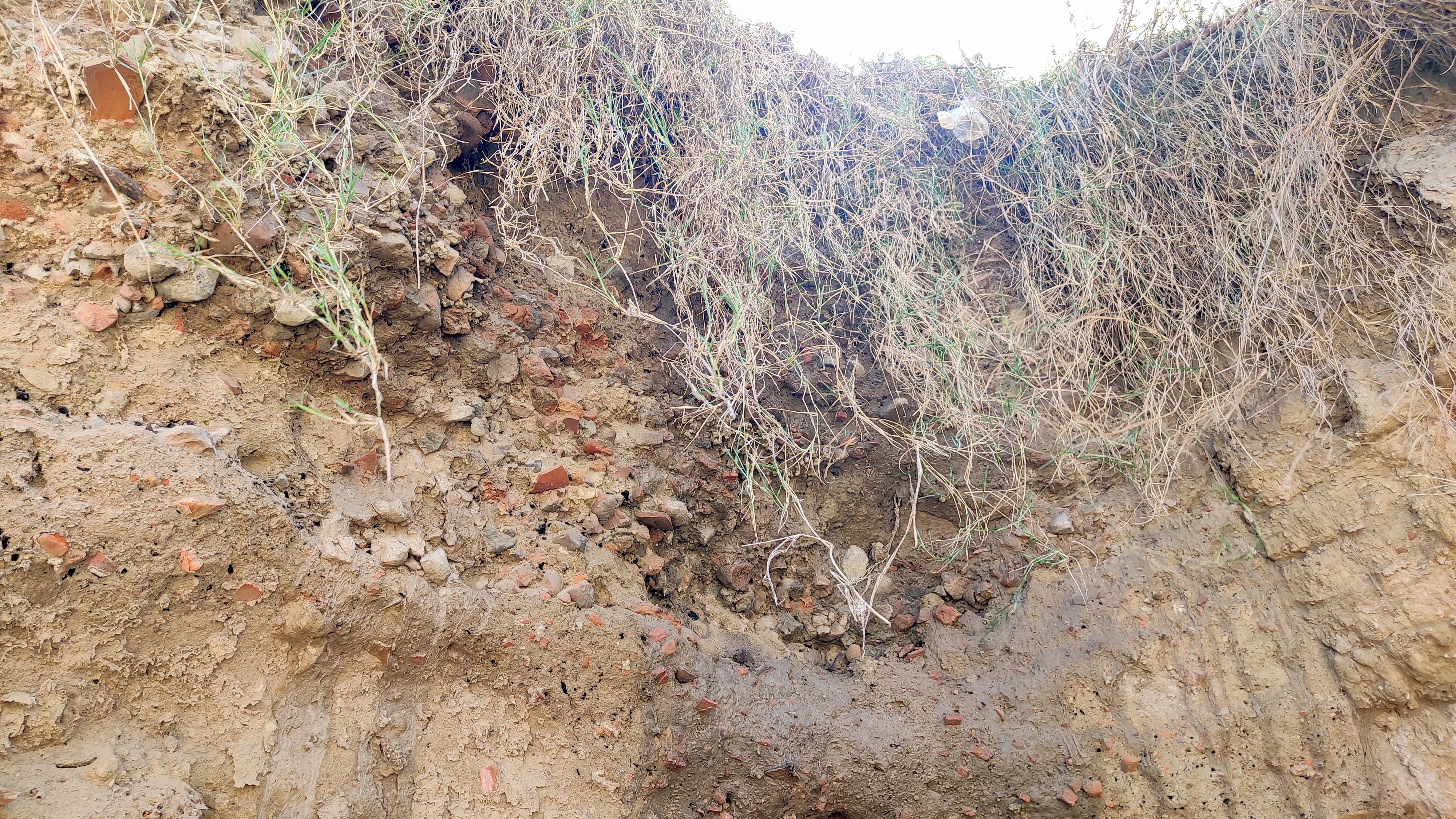
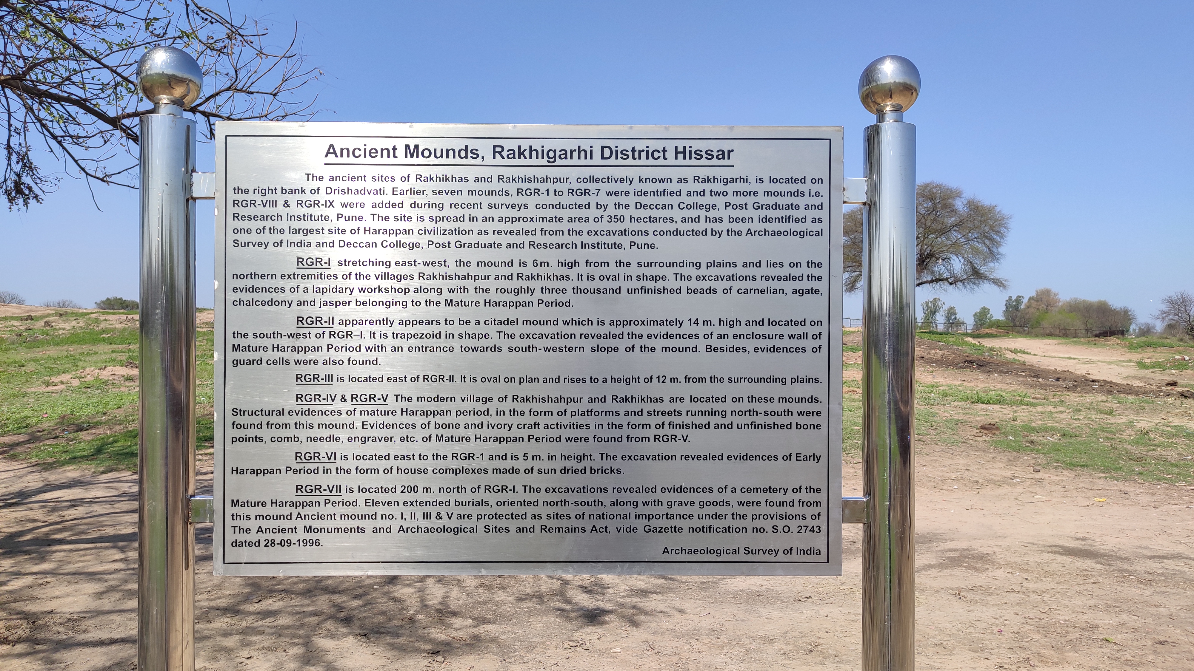
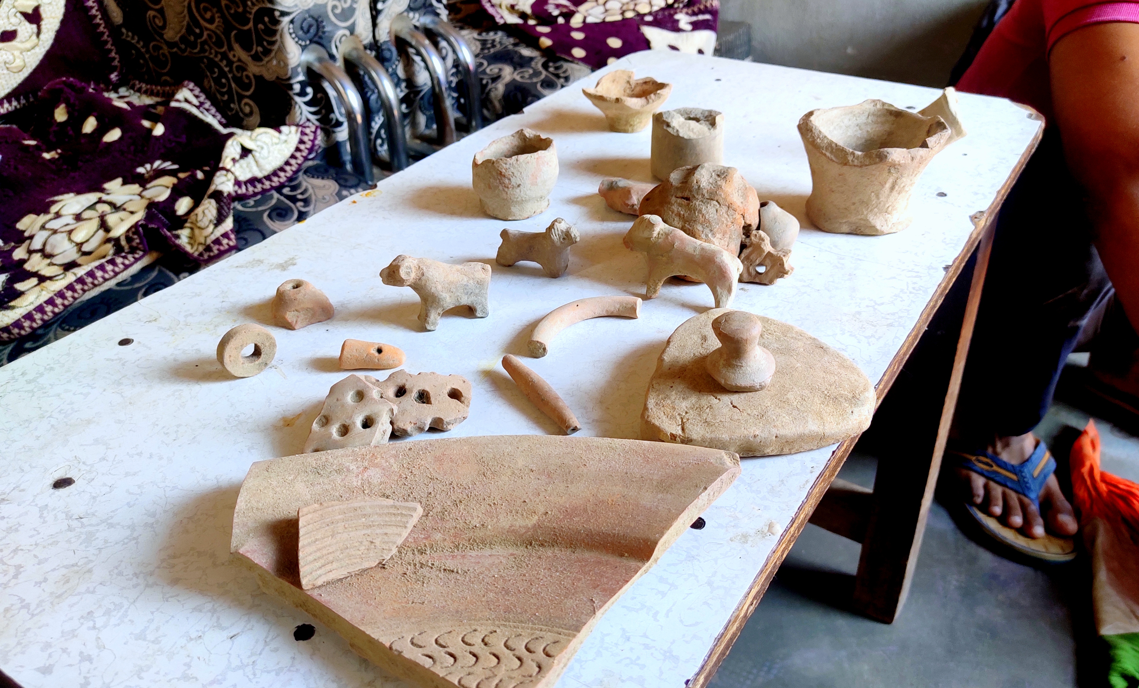
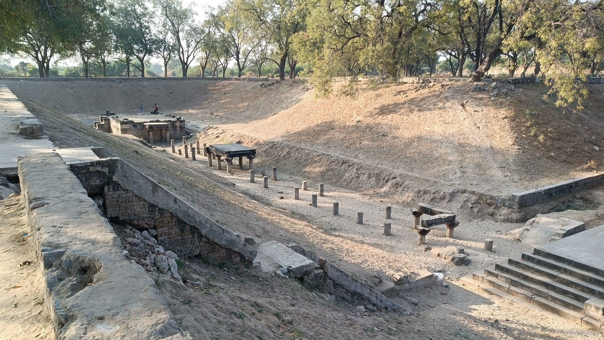
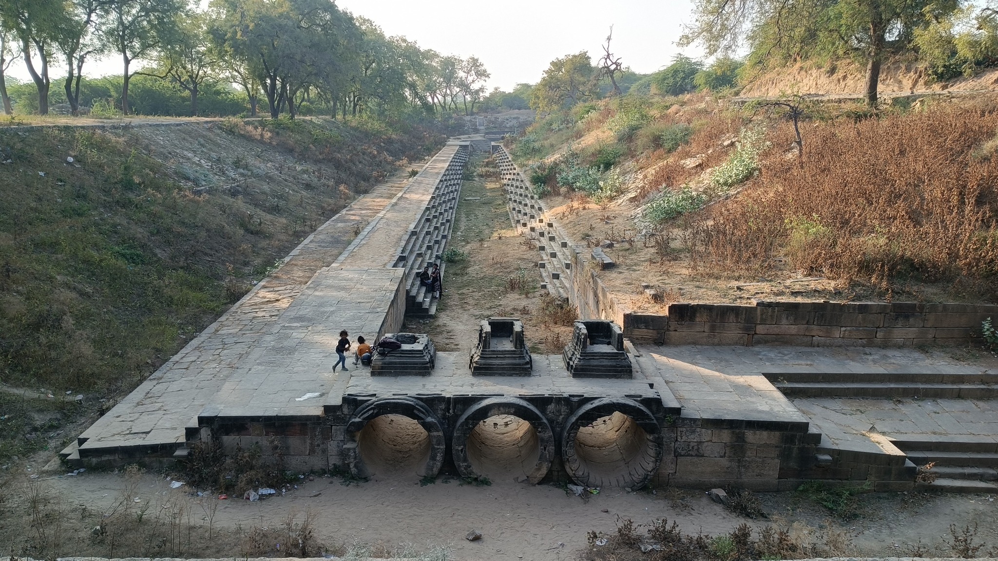
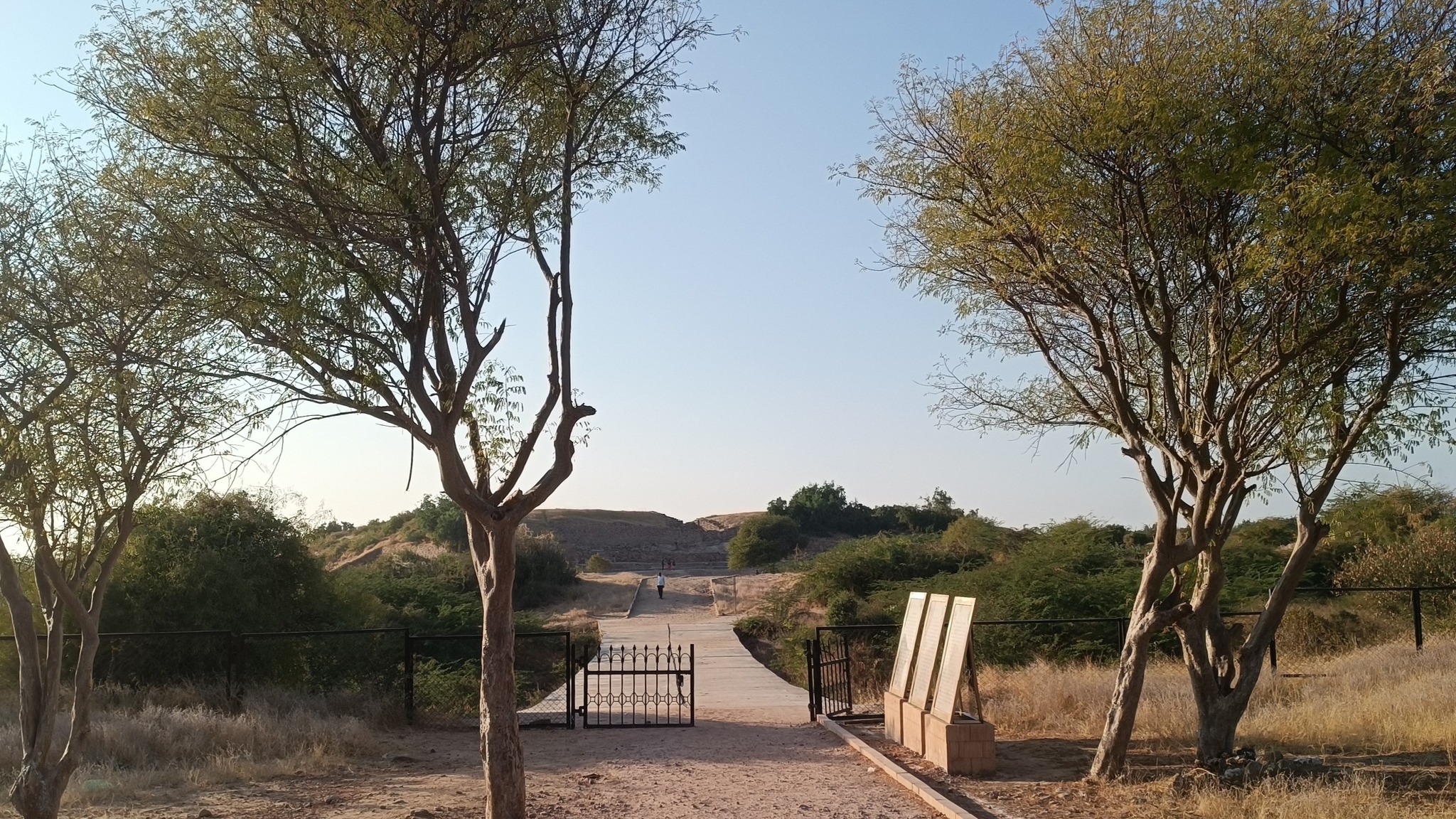
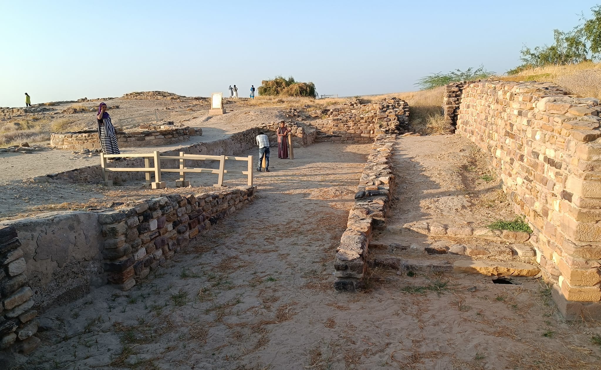
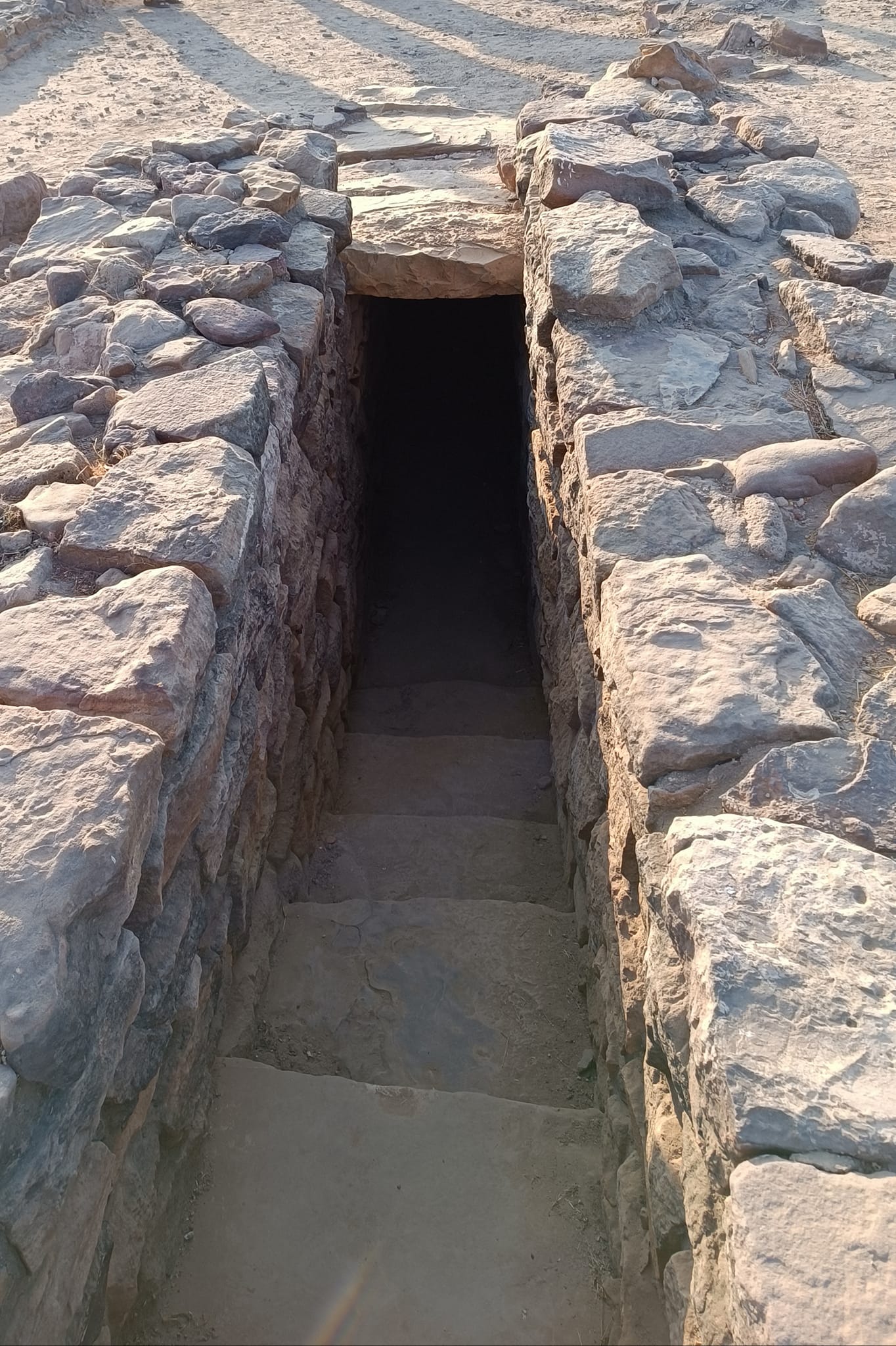
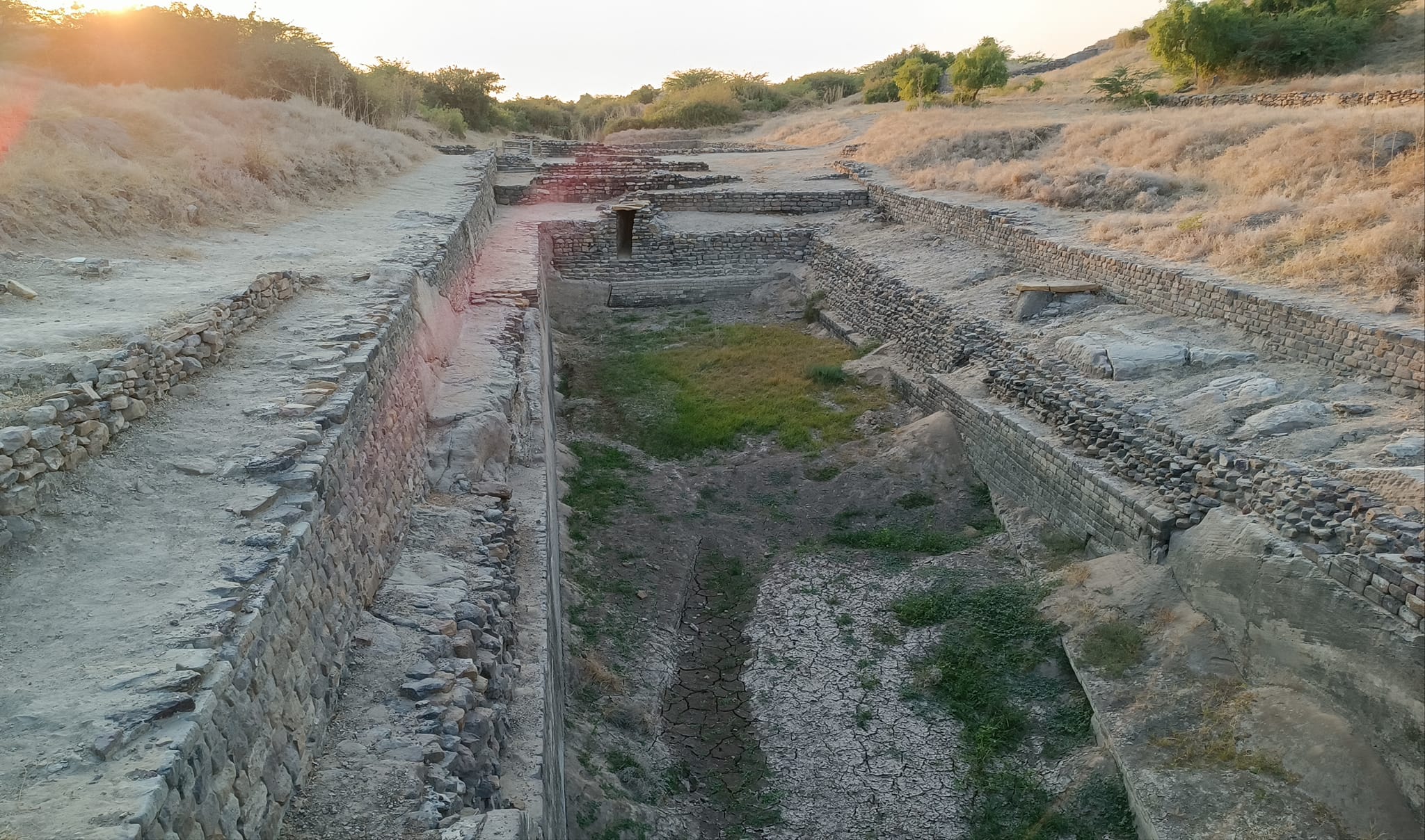
Gorging on Kathiawadi cuisine for lunch, we were soon headed out to our first site on the island – the Harappan city of Dholavira. The ruins at Dholavira have traces dating back pre-Harappan age (3500 – 2600 BC), with continuity till the post-urban Harappan age (1450 BC), when decline seems to have been set in. The site now manifests as a high flat mound formed on the ramparts and the many buildings located inside the rampart. A remarkable fact about the site is that the structures are mostly built of stone, as opposed to bricks in other Harappan sites. The Dholavira Museum located onsite showcases the finds from excavations carried out at Dholavira, and is a must-visit for anyone interested to know more about the site.
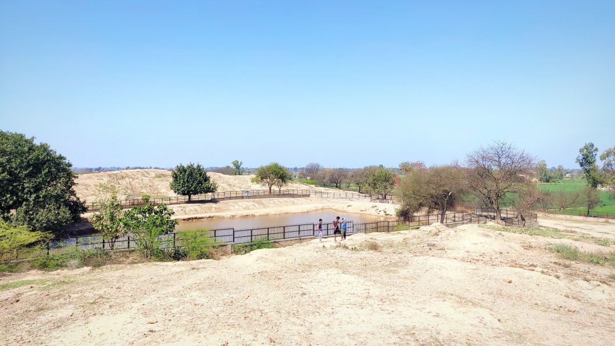
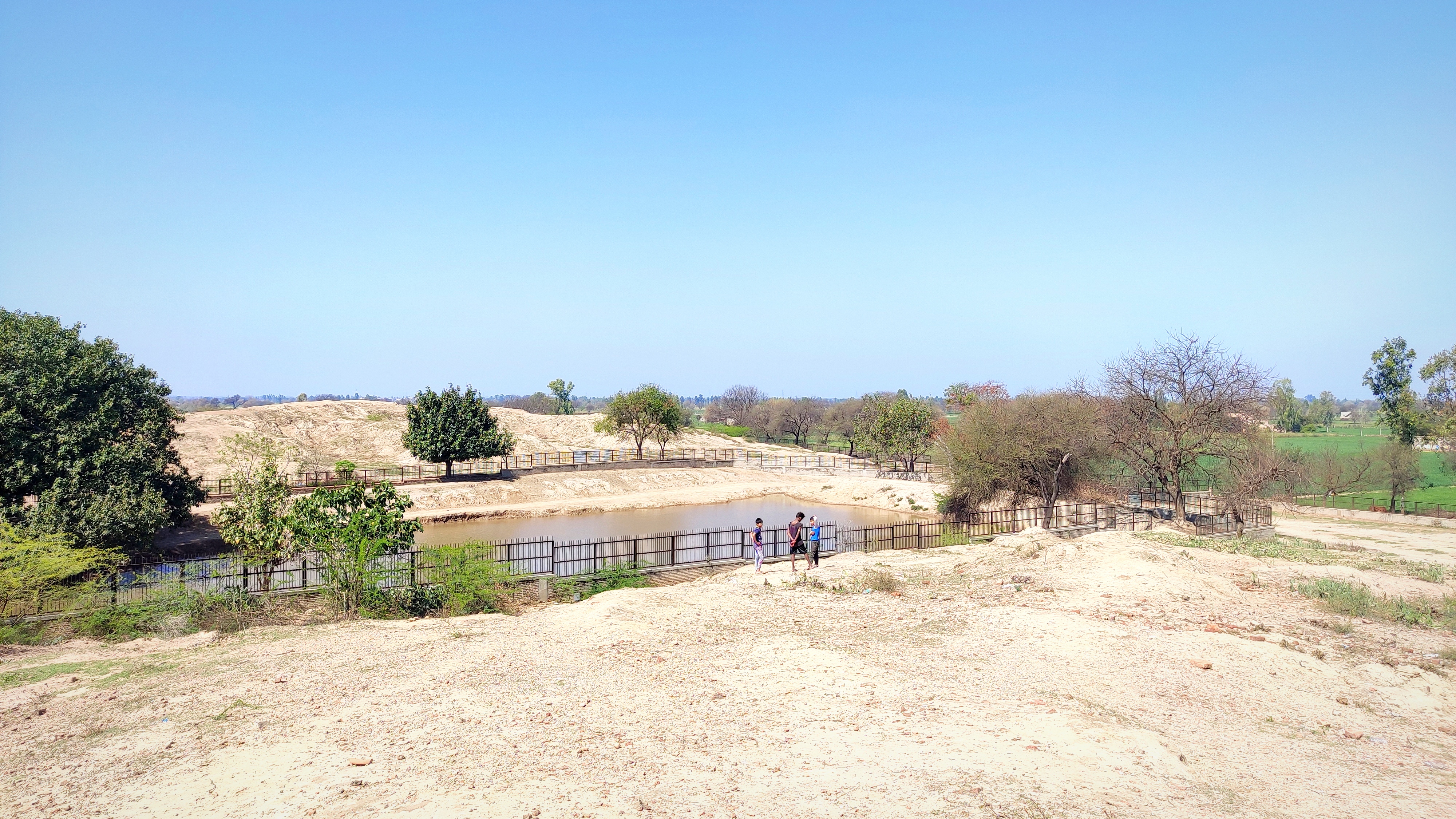
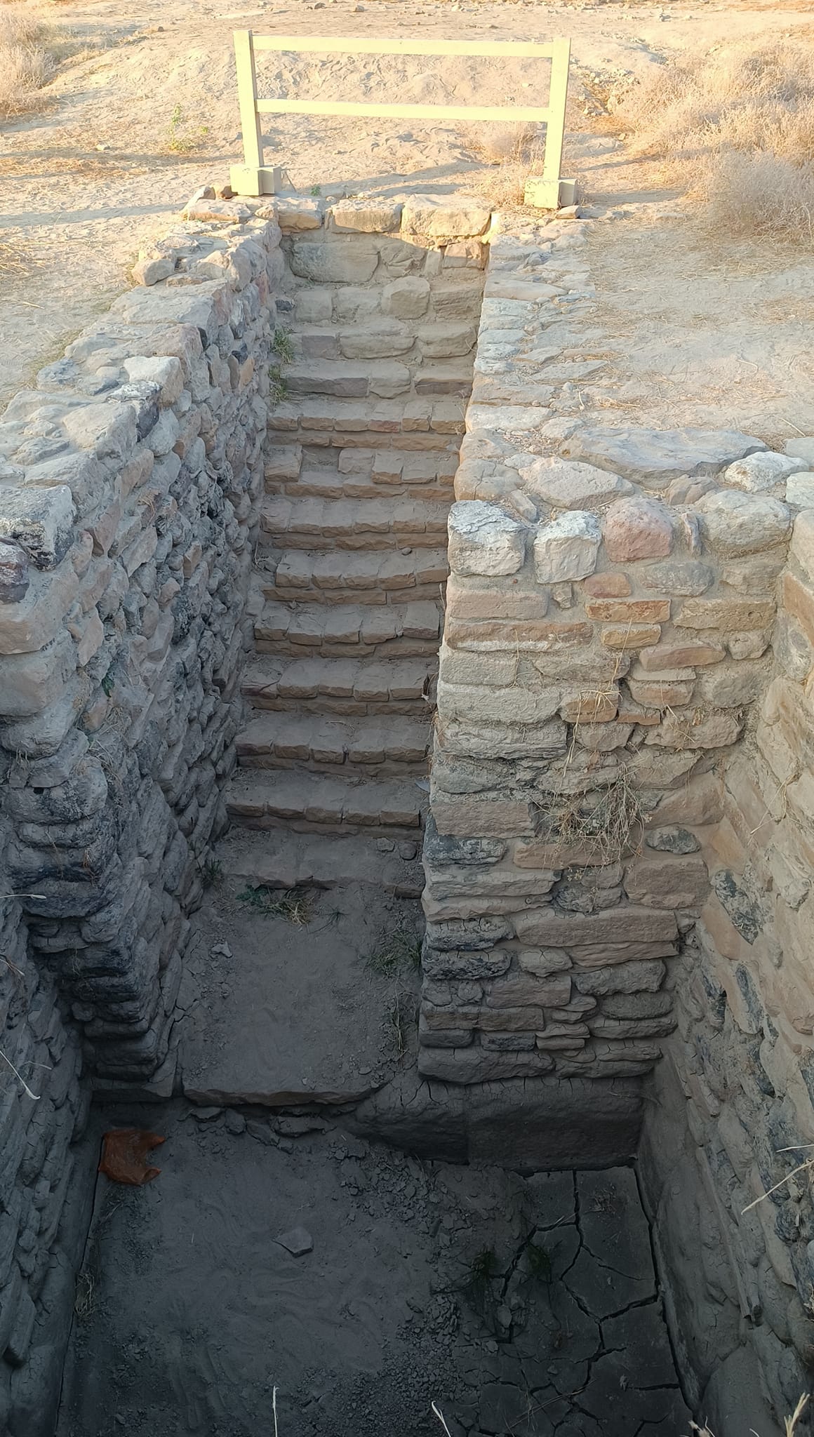
As one walks to the edge on the north side of the mound, one can see the Khadir Bet’s low mountains and desert vegetation in the distance. Below is another entry to the city where a wooden signboard showing various Harappan symbols made from gypsum was found – it is now called the ‘Dholavira signboard’ and believed to have depicted the then-name of the city. Further, the strategic location of the city between two seasonal streams, Mansar and Manhar, and the scarcity of water, entailed the construction of dams and clever usage of multi-staged reservoirs enabling storage, filtration and pumping of water. The reservoirs can be found on the south-side of the city.

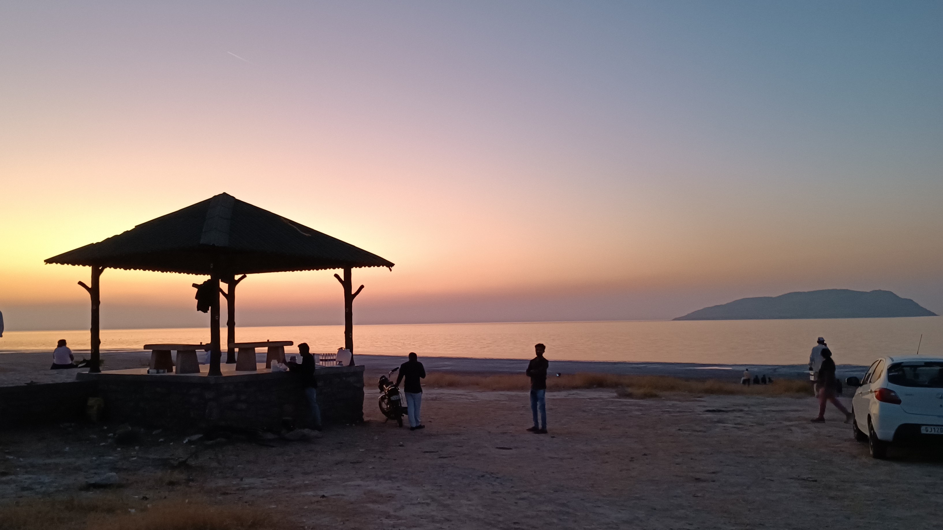
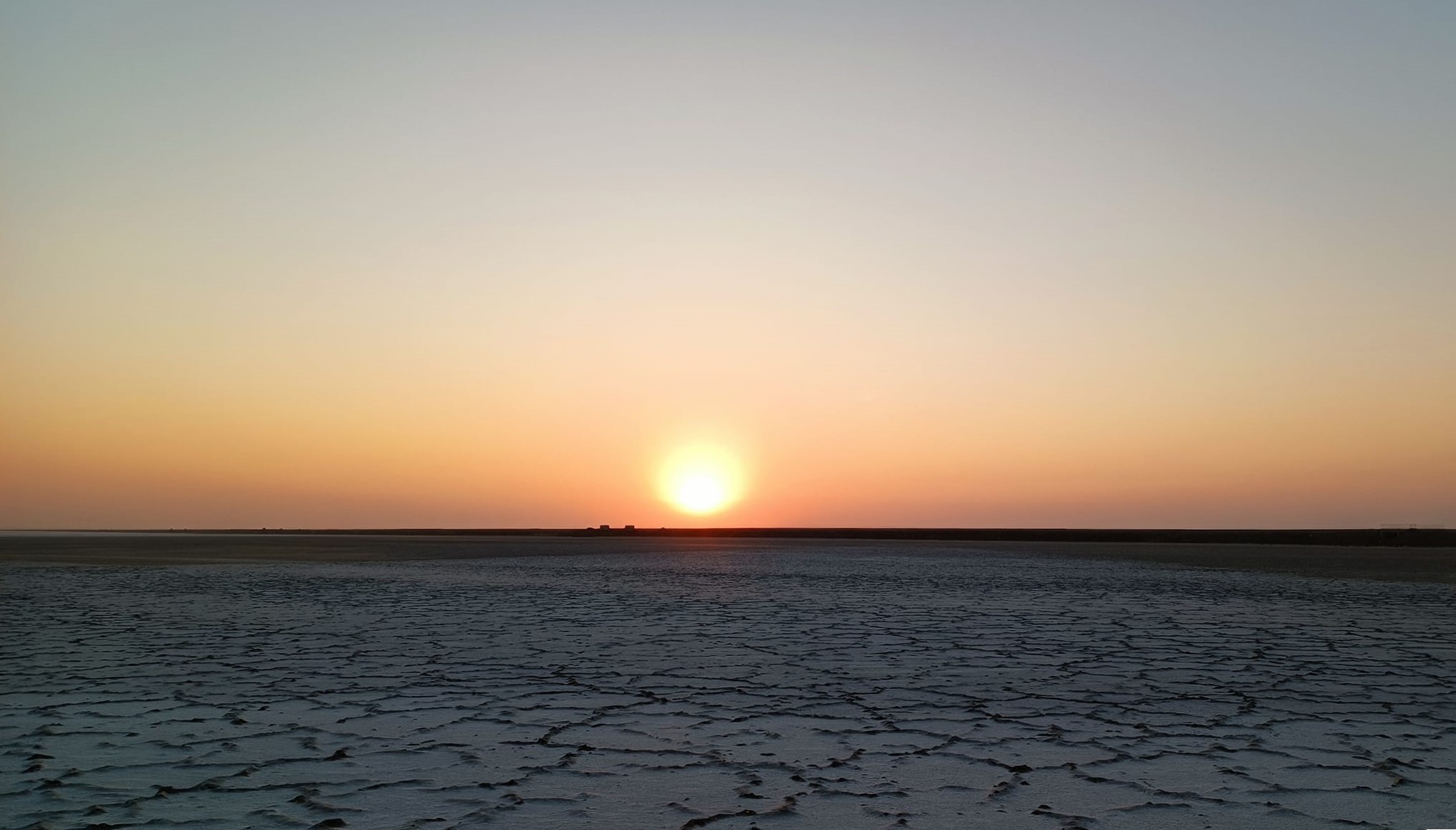
With it now already being 5.30 PM, we rode along the western coast of the island in a rush to see the sunset from the northern-most point on the island, from a location dubbed, unsurprisingly, the sunset point. In a race that we lost with time, we had to be content with seeing the sun setting from the road itself, although we did subsequently reach the sunset point to get a most exquisite view of the white marshy surface of Rann of Kachh Lake, stretching to the horizon, bathing in the twilight, with flamingoes lounging about in the distance with the back-drop of a small hillock jutting out from the white surface.
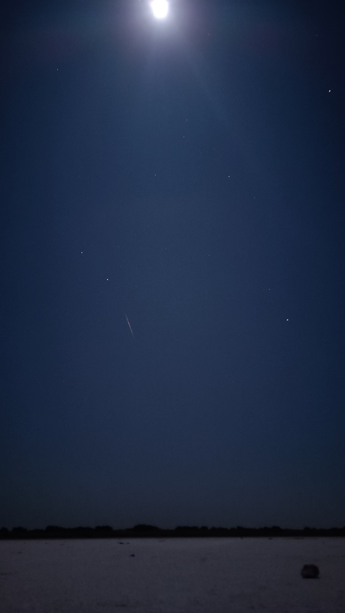
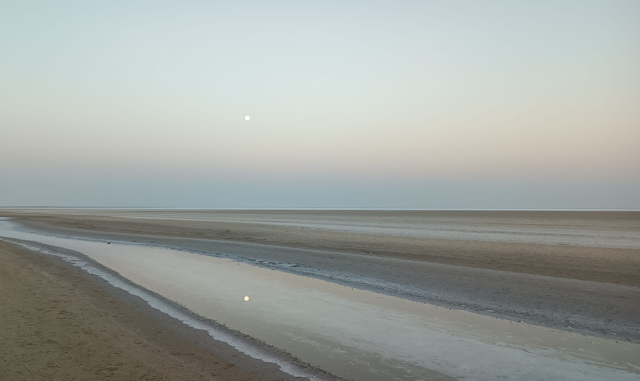
More high points were about to come later – after midnight, we headed straight into Rann of Kachch Lake on a road under construction linking the island to the other side of the lake, stopping at a point around 7 km out. Under the full moon, the salt-covered white surface shimmered and shone as far as our eyes could see, the horizon melding seamlessly with the night sky. With the winter chill hanging over the land, a foray into the vast expanse of white nothingness bathing in the moonlight is a must-have experience, especially on a full moon night.
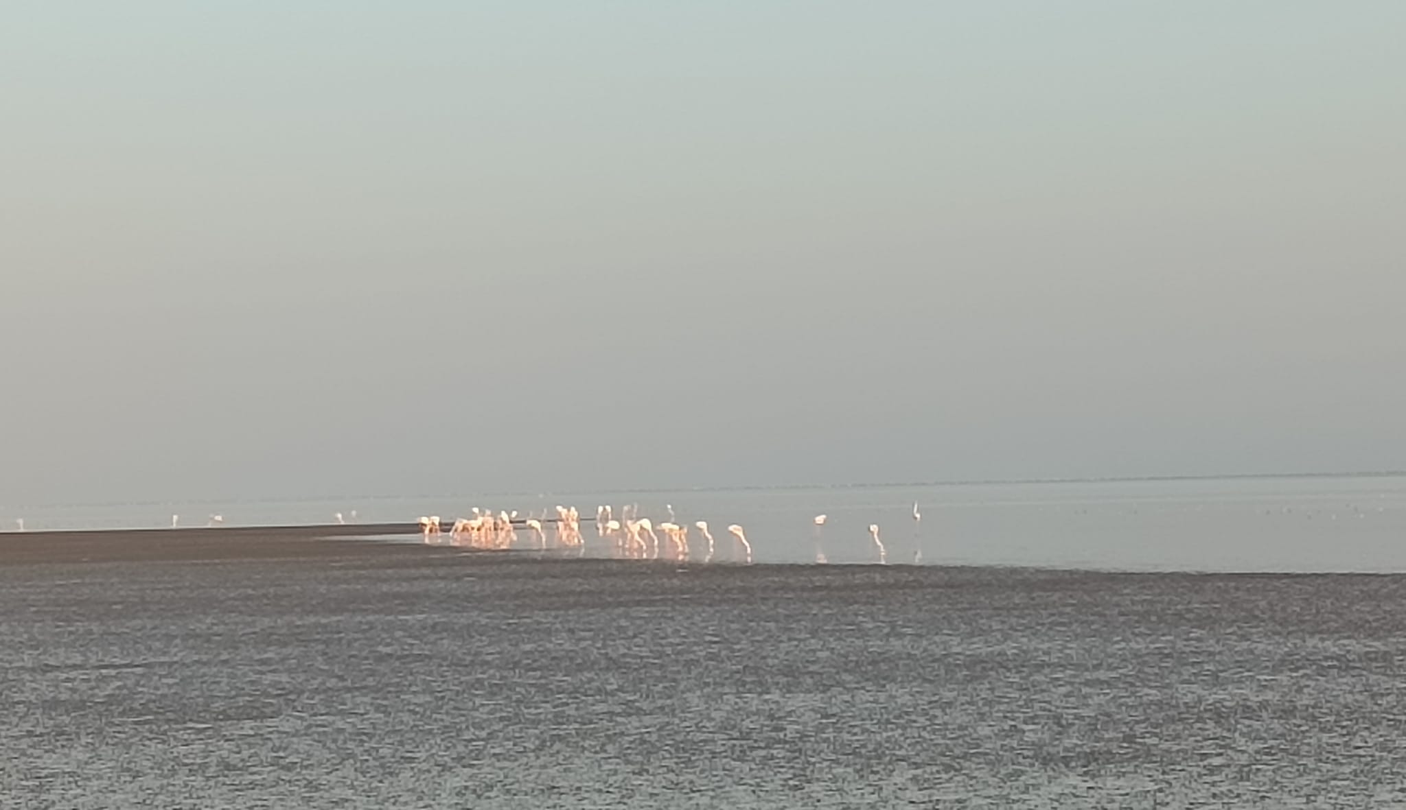
We followed up the late night adventure with a sojourn at 5.30 AM the next morning to the same point, this time, to see the sunrise, and were promptly treated to a fascinating view of the sun in ascendance in the east and the moon still hanging around in the west, at the same time. Further up the road, where the surface was marshier because the surface had not dried up completely, we saw a flamboyance of flamingoes. However, the deeper into the lake we waded through the marshy water to get a closer look at the flamingoes, the farther the flamingoes kept moving from us – preventing us from taking clearer pictures of the flamingoes through our mobile phones! Already 8 AM now, we headed back to the resort.
Part 3: Rann of Kachch and Bhuj
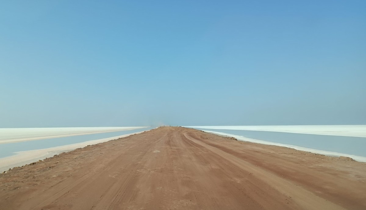
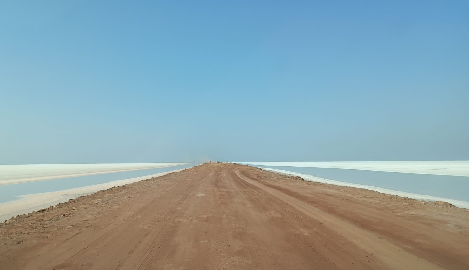
Starting 11 AM, i.e. on Day 3, following breakfast, we drove down the same road, third time already in two days, but now headed to the other side of the lake. Cutting across the lake on the aforementioned road dubbed ‘Road to Heaven’, we stopped a couple of times to take photos in the white expanse, before reaching the mainland after a drive of 30 km. The desert topography with sparse vegetation was back again, supplemented by low corrugated hills running alongside us on our right . Reaching Khavda, where we fueled-up just at the verge of our vehicle’s fuel tank going completely empty, we turned north.
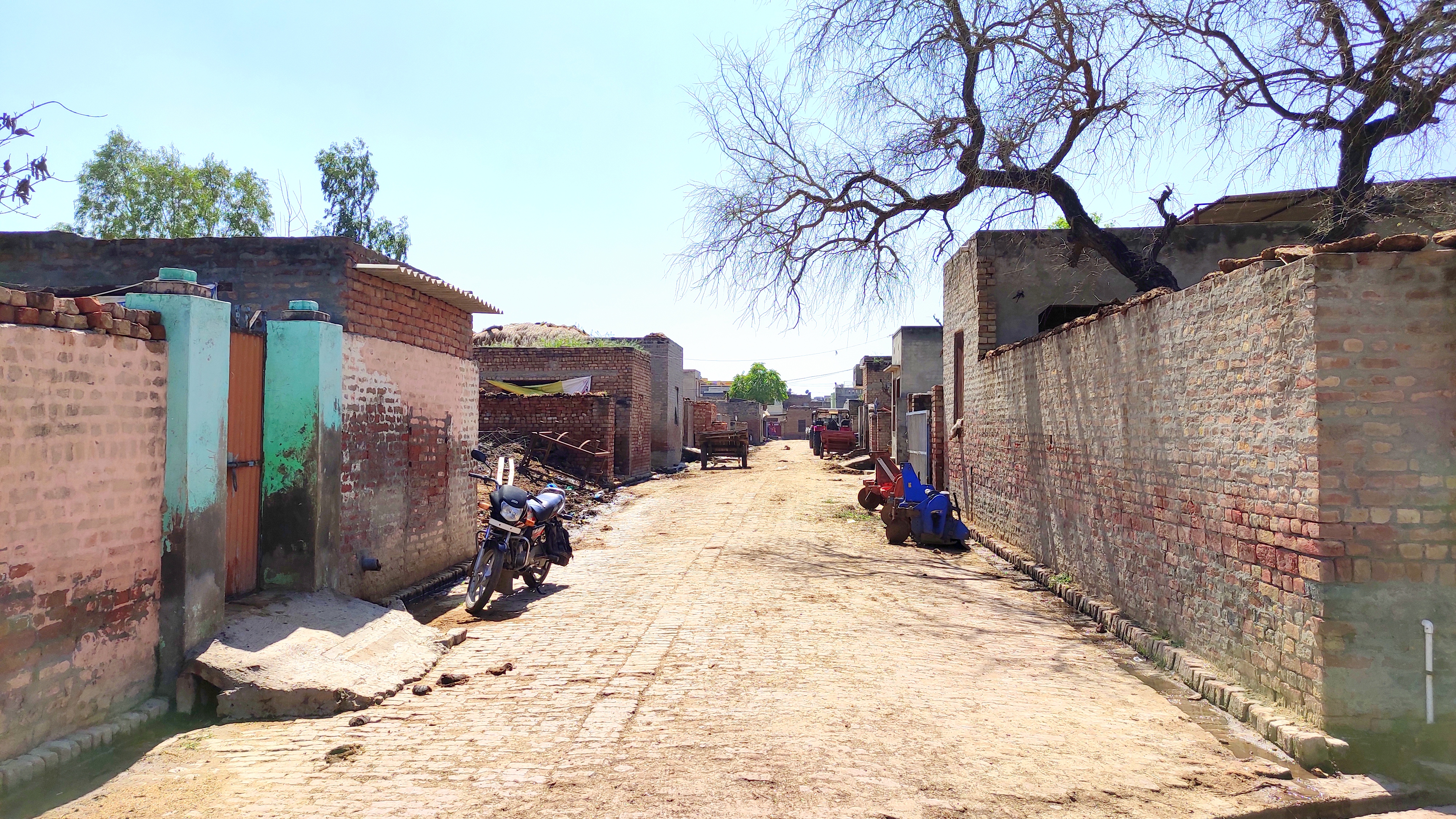
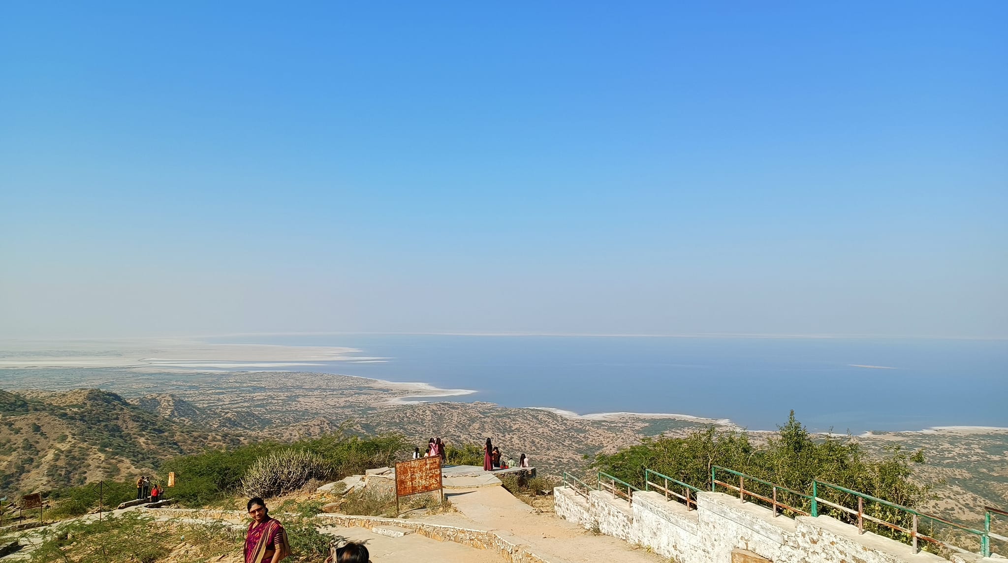
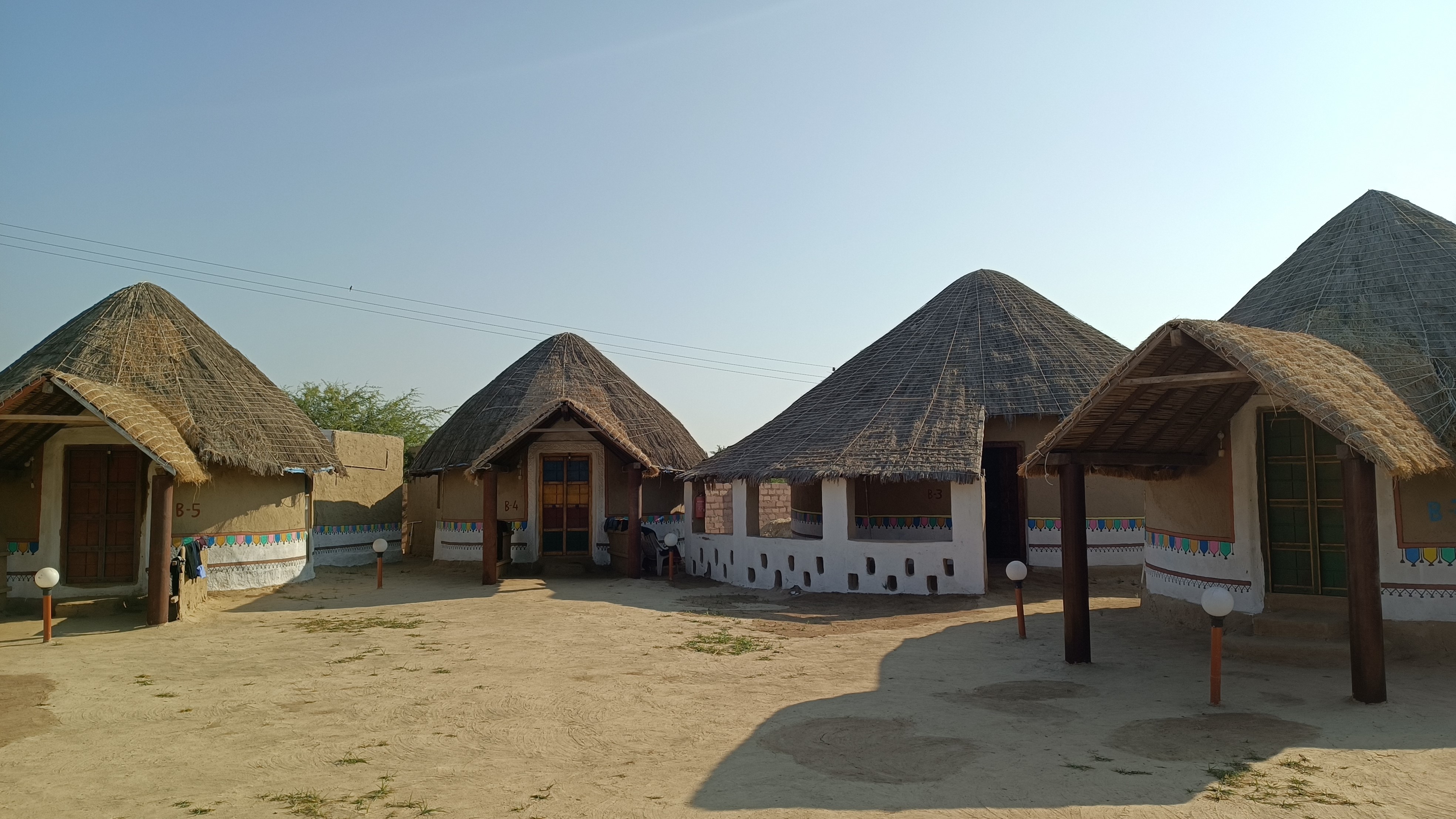
Our next stop was the highest point on this hill range, in fact, the highest point in all of Kachch – Kalo Dungar, literally, Black Hill, which we reached after driving up a winding road with a gentle slope. Standing atop Kalo Dungar, we got a panoramic view of the Rann of Kachch lake spread from one end to the other with its periphery defined only by the horizon.Descending from Kalo Dungar, we headed to our next accommodation, Kutir Craft Village, Hodka, located amidst the Banni Grasslands ecological system. Here again, we had a sumptuous Kachchi meal, and retired to our Bhungas, the traditional circular mud-huts, surrounded by thatched roofs, typical of the Kachch, with floors made of compacted dried cow-dung.

About 15 km north of Hodka, runs a band of salt flats of the Rann of Kachch, stretching from the Rann of Kachch lake on one side to the Arabian sea on the other, in the midst of which lies Dhordho, where the annual Rann Festival is held. This band of salt flats along with the Rann of Kachch Lake, together form the Rann of Kachch, Rann literally meaning desert. The Rann of Kachch is basically a marshy wetland that gets submerged in water during the monsoons, and the surface turns into white salt flats due to sedimentation of salt when the water evaporates in the dry season, which is why even the lake has salt-flats stretching for miles.
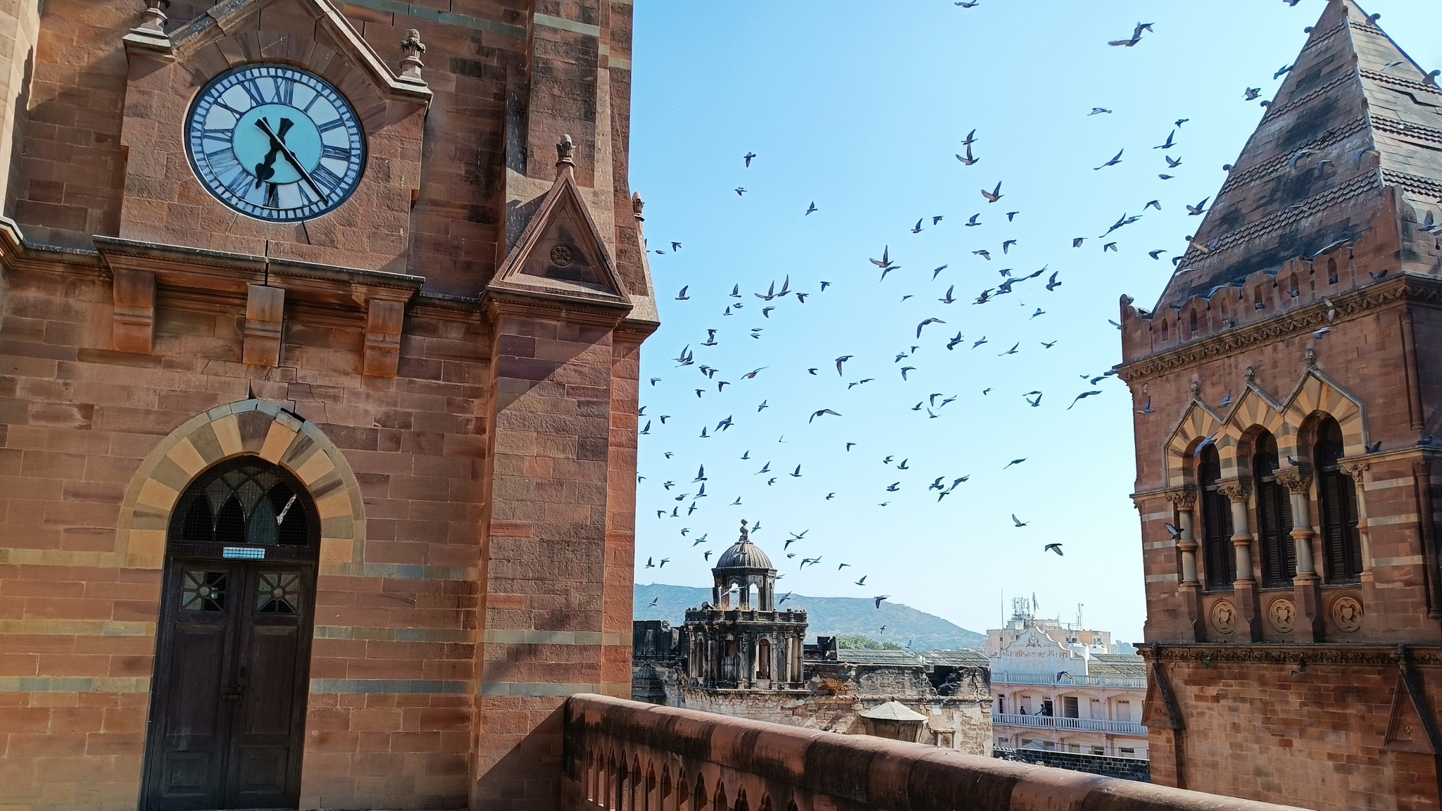
On Day 4, we started from our resort in Hodka for Bhuj, the capital of Kachch region. Founded in 151o AD by Rao Hamir and made the capital of Kachch in 1548, Bhuj, despite acknowledging Mughal supremacy, had to face multiple attacks at different times, and has been also ravaged by major earthquakes at various points of time, the latest being in 2001. At Bhuj, we first saw the Prag Mahal, a 19th century palace, now converted into a museum. Then, driving along the Hamirsar Lake, we reached the 19th century Kutch Musuem, which showcases artifacts ranging across archaeology, history, geography, the local culture and all things Kachch.
Part 4: Little Rann of Kachch
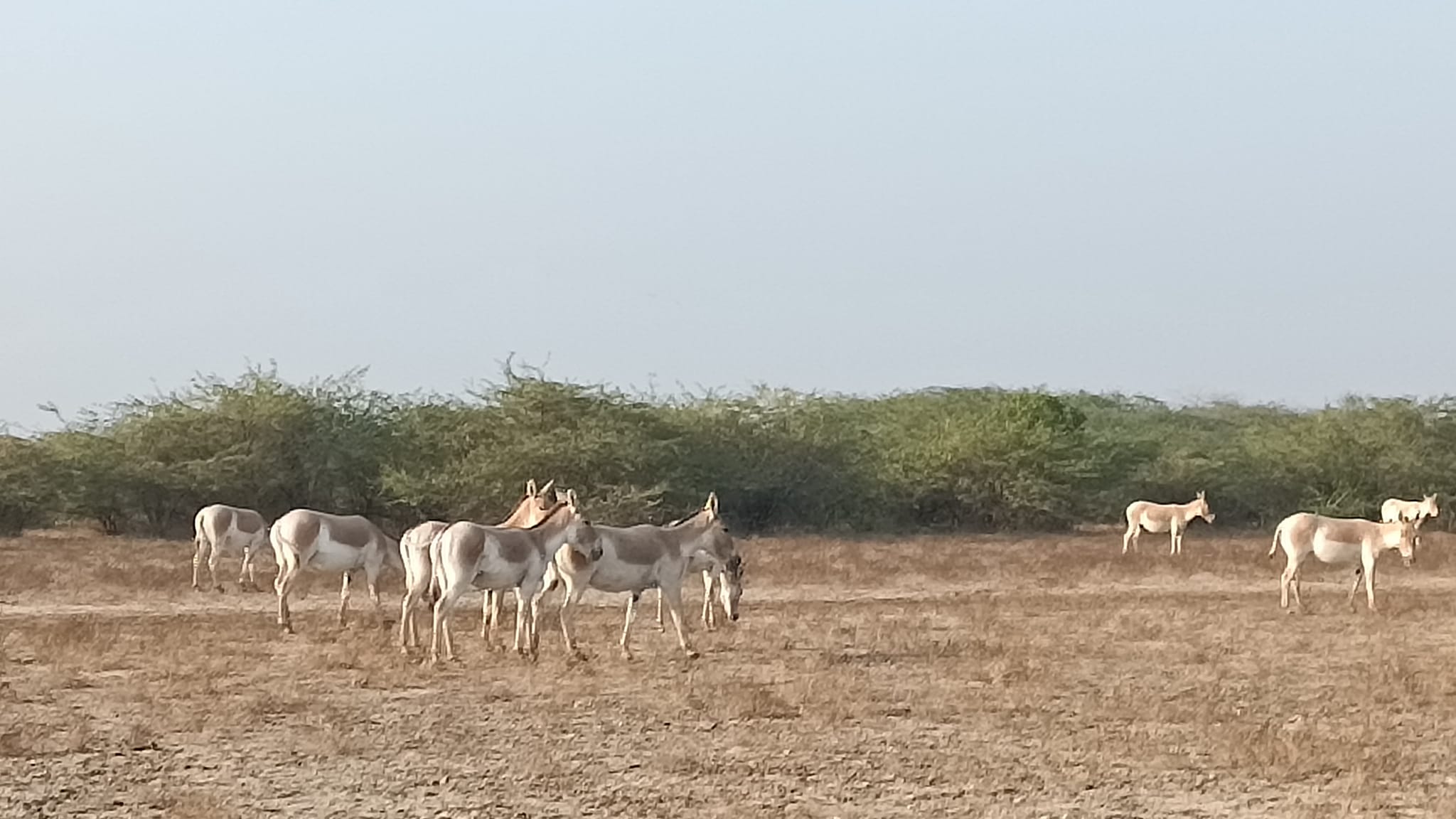
Following a sumptuous unlimited Gujarati thali meal, covering a distance of 260 km, which included winding around the southern edge of Little Rann of Kachch, and then turning north, we reached – at around 8 PM – Bhavna Resorts and Farm, in Patdi, located at the edge of the Little Rann of Kachch. Early next morning at 6 AM, i.e on Day 5, as planned, we set off, armed with packed breakfasts, snug in our jackets, on an open-jeep safari to the Wild Ass Sanctuary located in the Little Rann. The Little Rann of Kachch and its surrounding areas are the only habitat of the Indian Wild Ass currently numbering about 2100, with the Wild Ass Sanctuary established to preserve the endangered species.
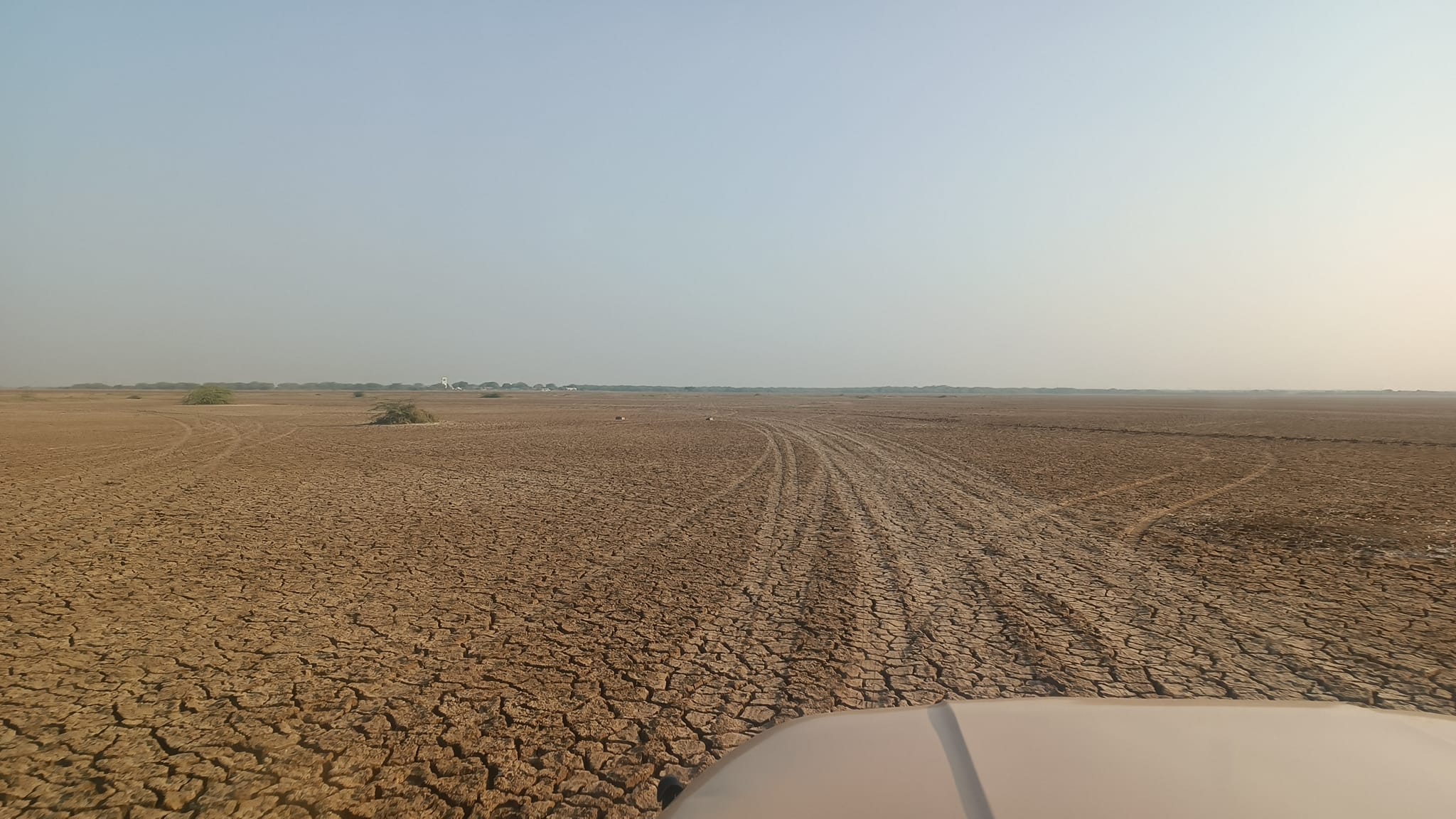
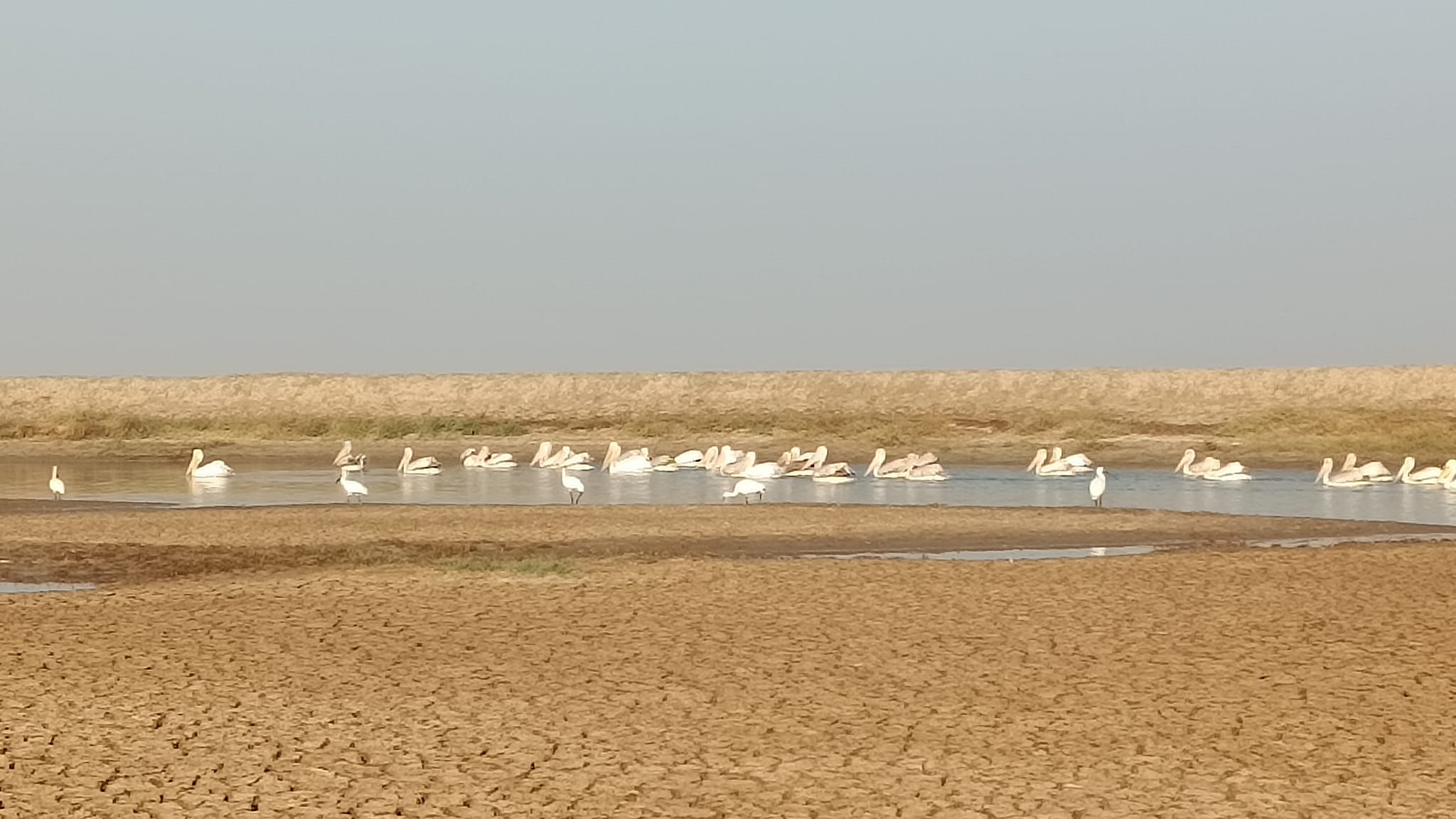
Accessing the sanctuary from the entrance at Bajana, we first drove over the sparsely grassed brown-coloured land for about a couple of kilometres in, as more shrub started appearing, we chanced upon numerous droves of the wild ass, most of them nonchalantly grazing away, and some frolicking and some rolling on the ground. As we approached them to take a closer look, the wild ass kept moving farther away. Driving further, we were awed by another form of desert – this time with a surface of mud-cracks, i.e. a mud desert. Driving for a while on the mud-cracks we reached a water-body where a pod of pelicans were lazily gliding away. Driving further up to a very large water-body, we came upon a very large population of flamingoes – and decided to have our breakfast while flamingo-watching!
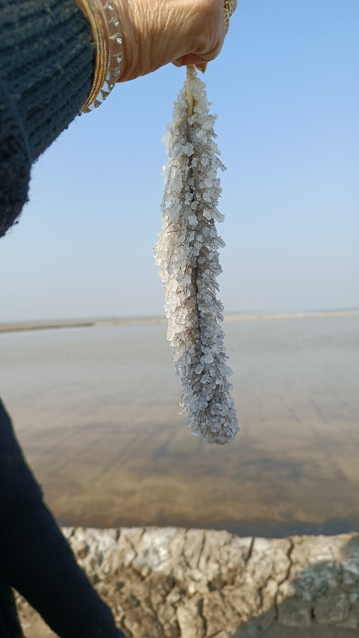
Following breakfast, we proceeded to the last section of the safari – salt-pans where salt suitable for human consumption is produced. A salt farmer explained to us the process of how after monsoons, brine water is extracted from the ground using pumps and then diverted towards the salt-pans, rectangular or square in shape with embankment on all sides, then, left for months altogether to let the water evaporate naturally, even as the solution of water and sediment left behind becomes gradually more concentrated – by March-April, the salt is ready to be commercially transported and sold.
The salt farmers, otherwise living elsewhere, themselves only come to live beside salt-pans in make-shift shanties during salt production and harvesting season. In December, which is when we visited, the salt crystals were only beginning to form. To demonstrate the phenomenon, the salt farmer took us to one of the saltpans, dipped his hand in the water and drew out a flamingo feather laced with salt crystals along its length – an amazing thing to behold! That being an apt parting sight, we bid adieu to the Little Rann, and to Kachch, as we headed back to Ahmedabad to catch the 7 PM Rajdhani Express for Gurgaon.


Travel Guide
Reaching Dholavira
Located on an island in the middle of a marshy lake, the only way to reach here is by road. You can drive down from Ahmedabad (a 7 hour journey) if driving from the east of Gujarat.
If you were coming from Bhuj or Dhordo, it is about 2 hours and 1 hour respectively, provided you take the ‘Road to Heaven’ or the Khavda-Dholavira road. In fact, in dry season, the ‘Road to Heaven’ is a must-see/must-ride!
Bhuj, in turn, can be reached by train or road from any major city in Gujarat. Also, a train originating from Delhi runs to Bhuj. Bhuj also is connected by air through direct and connecting flights from major cities in India.
Reaching Rann of Kachch
To access Rann of Kachch, you are looking to put up at a village nearby (Dhordho or Hodka) or at Bhuj. In fact, Dhordho and Hodka, lie in between the Bhuj and the Rann, and can be accessed by road.
Reaching Wild Ass Sanctuary/Little Rann of Kachch
This is a tricky one, as there are two entrances – Dhrangadhra on the south of the Little Rann and Bajana on the east side. It is possible to make a day trip to the Little Rann/Wild Ass Sanctuary from Ahmedabad by road or train – but if you’re taking the train, you will need to make a choice between Dhrangadhra station (for the Dhangadhra entrance) or Viramgam station (for the Bajana entrance).
Dhrangadhra lies on the Ahmedabad-Bhuj highway, thereby reachable by public transport bus.
Alternatively, you can put up at any of the resorts near Patdi, Zaianabad or Dasada which are near the Bajana entrance – the resort can facilitate a safari. Safari price ranges as in 2023 ranged from Rs. 400 per jeep/car (Rs. 500 on weekends) to Rs. 3500 per heavy motor vehicle (Rs. 4375 on weekends), with additional fees of Rs. 300 for a guide, and Rs. 200 for taking in a camera.
Trip Summary
Day 1:
Ahmedabad to Patan, then Modhera, then back to Ahmedabad.
Overnight stay in Ahmedabad.
Day 2:
Ahmedabad to Dholavira (on Khadir Bet island), via Sanand and Rapar.
Sightseeing at Harappan site of Dholavira and sunset watching on the coast.
Overnight stay in Rann Resort Dholavira.
Day 3:
Dholavira to Kalo Dungar via Road to Heaven and Khavda, then to Hodka.
Hodka to Dhordho for seeing salt flats of the Rann.
Overnight stay in Kutir Craft Village, Hodka.
Day 4:
Hodka to Bhuj, sightseeing in Bhuj, then to Patdi via Dhrangadhra.
Overnight stay in Bhavna Resorts and Farms, Patdi.
Day 5:
Safari to Wild Ass Sanctuary from Bajana side, then to Ahmedabad.
Trip Map