Uncovering Khetri : A Hidden Gem in the Shekhawati

In my search for places that could be visited on a single day trip from Gurugram, Khetri seemed to pop up on a few occasions. I did try to plan a Khetri trip a few times over the last three years, even attempting to rope in my colleagues once, but it was not to be, especially since it would need a detour from all the major roads. I also abolished thoughts of doing a solo drive to Khetri because I was uncertain about the condition of roads and the remoteness I would encounter.

That was until the time my parents were here in Gurugram, and we really had to find something for a day trip before they returned to Odisha. While mother is always excited for any arbitrary new place, father only agreed once I brought to the fore the connection of Khetri with Swami Vivekananda. So, off we started on a mid-December morning around 10 AM in the quest to uncover Khetri.

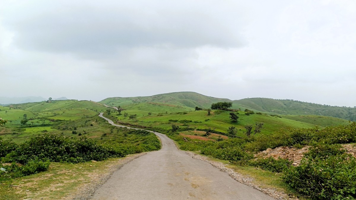
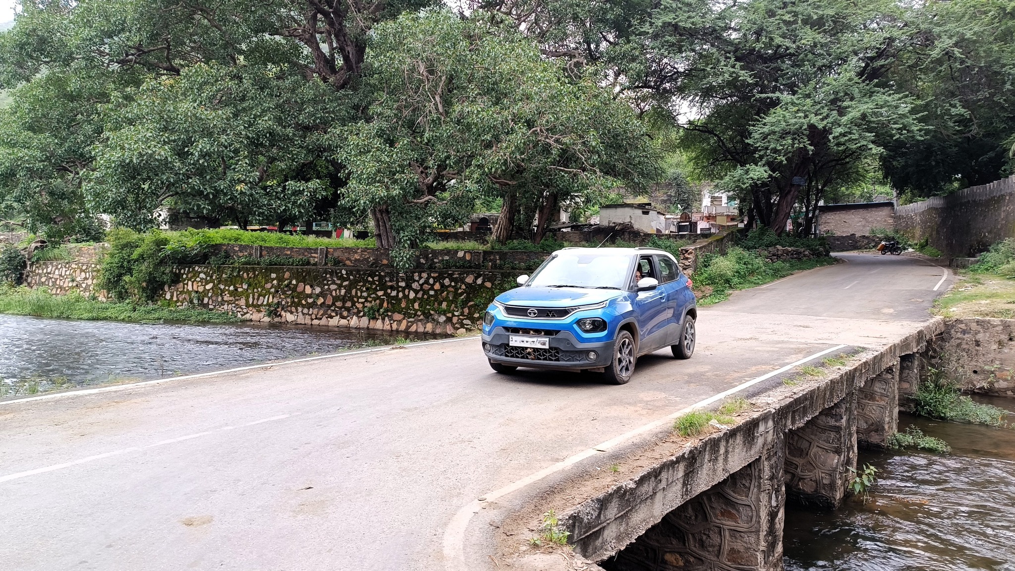
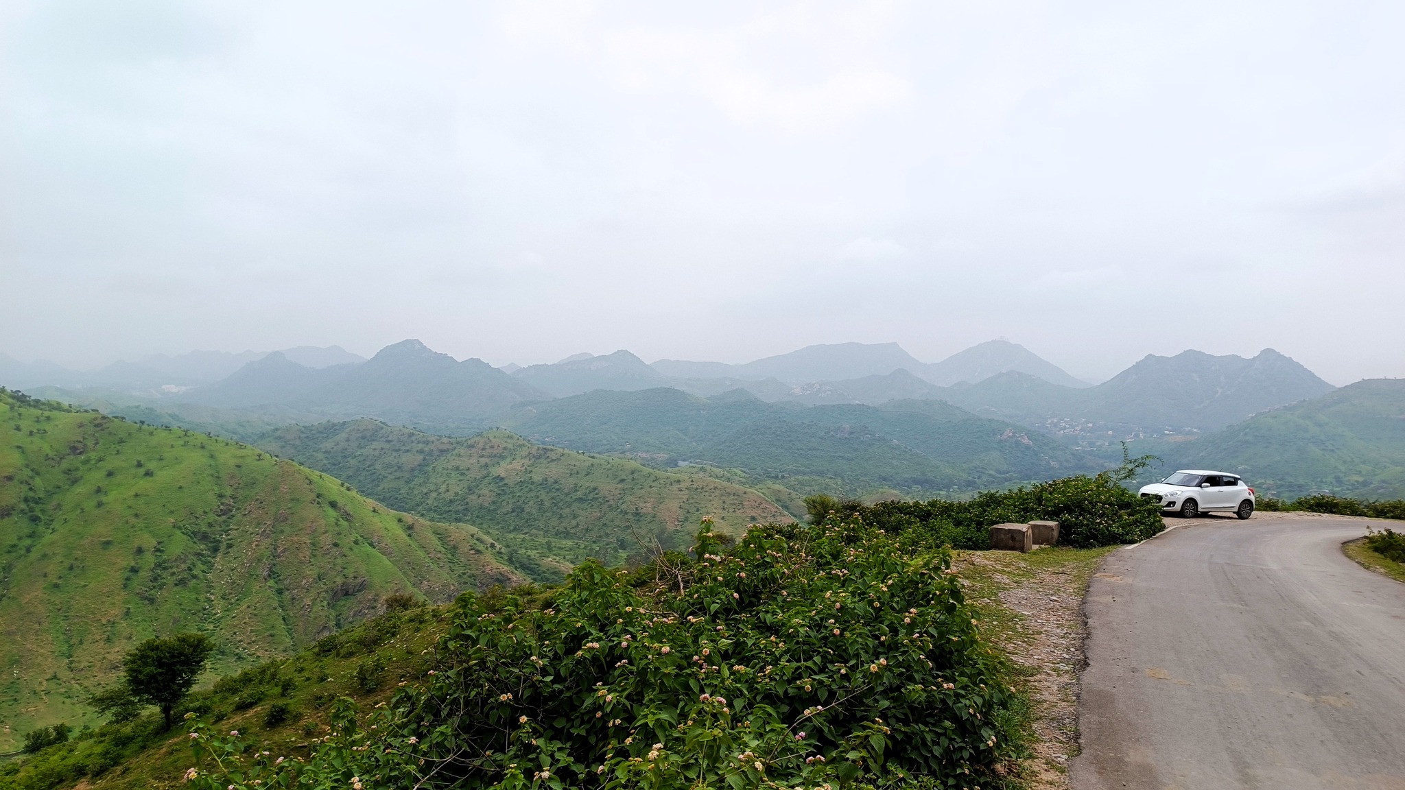
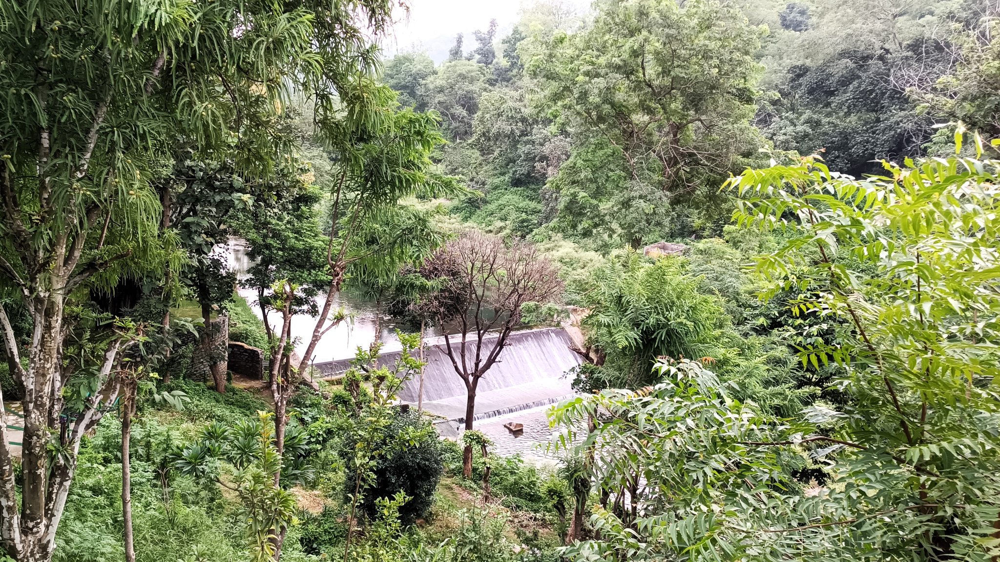
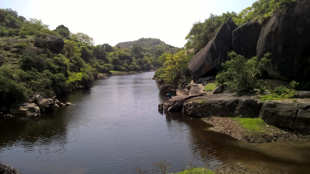
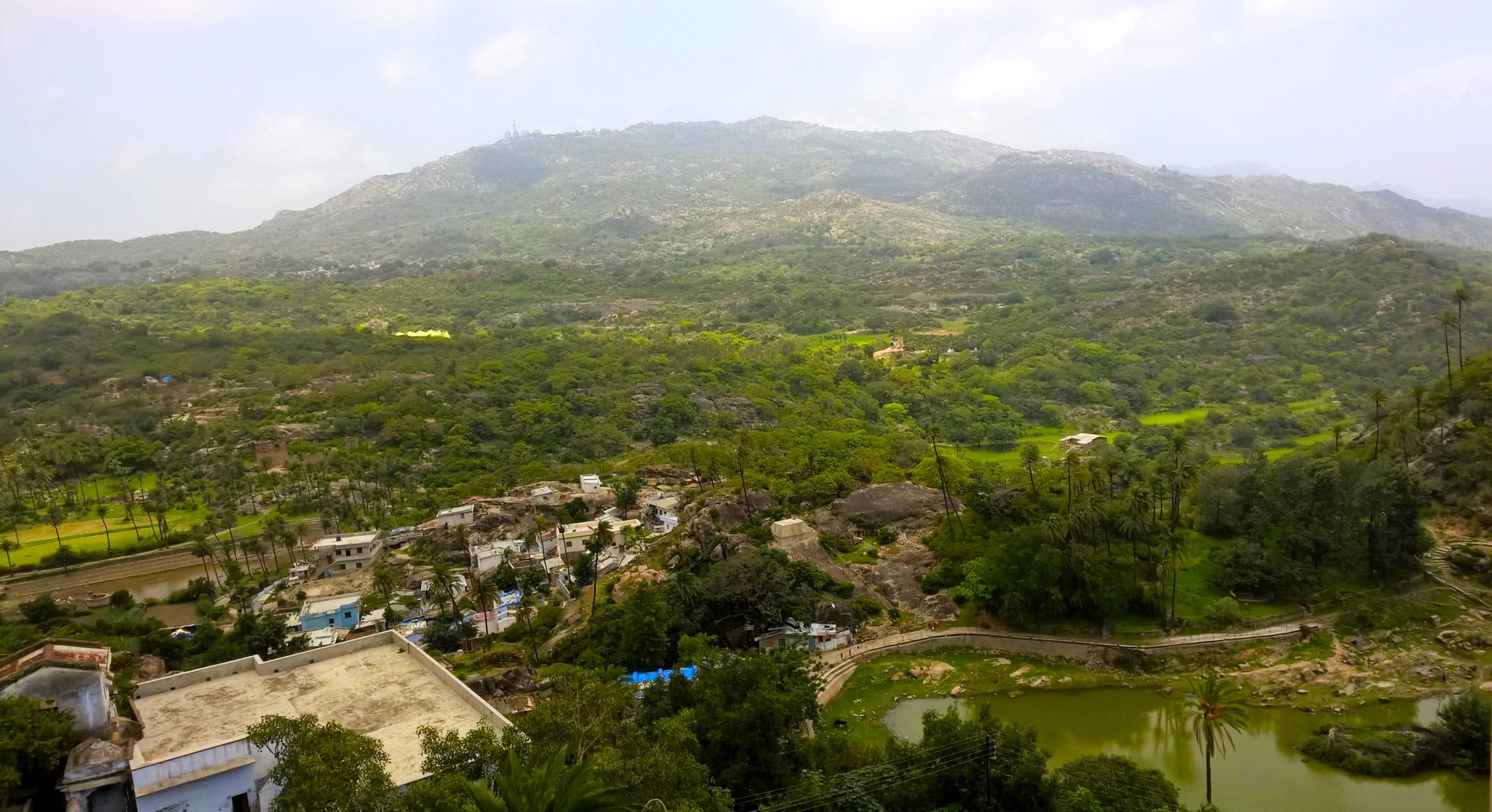
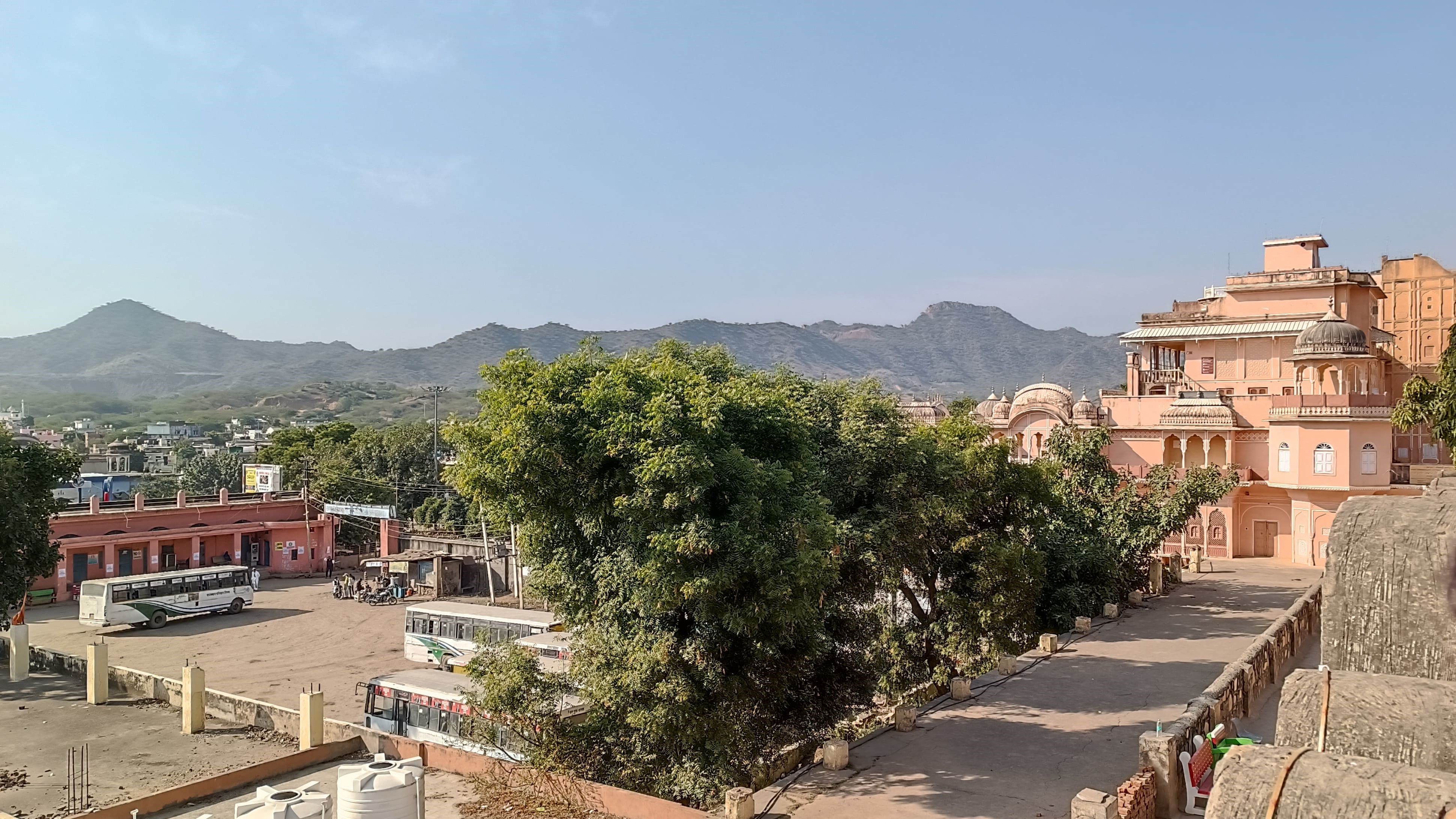
We first drove towards and bypassed Rewari, then took NH 11 – that runs westwards to Jaisalmer through Jhunjunu – till Singhana, and then turned to the left, passing first by a low stretch of the Aravalli, and then approaching a pass in a cluster of the low Aravalli hills. Soon we were flanked by the Aravallis on both the sides, as we drove up the road winding through the pass, and finally reached a wide patch of undulating land surrounded by the Aravallis, with low houses and buildings sprawling across the dry valley, and swarming with people betraying a certain laid-backness in their demeanour.

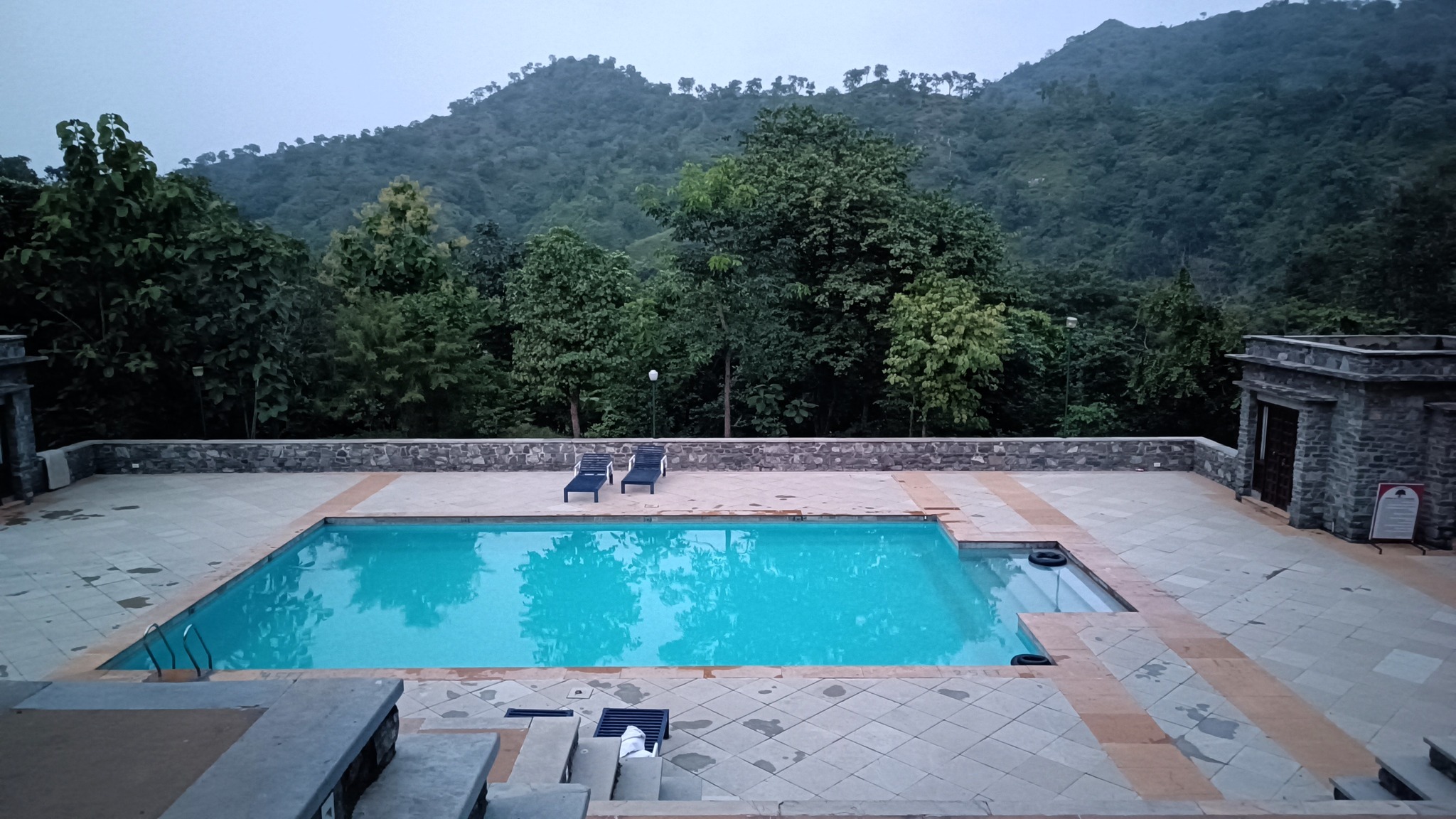
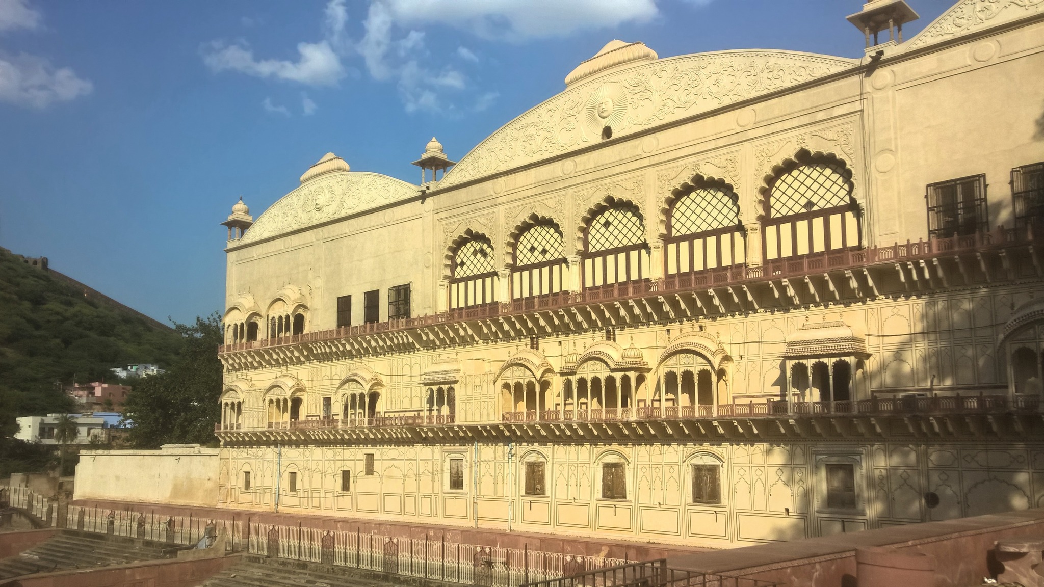
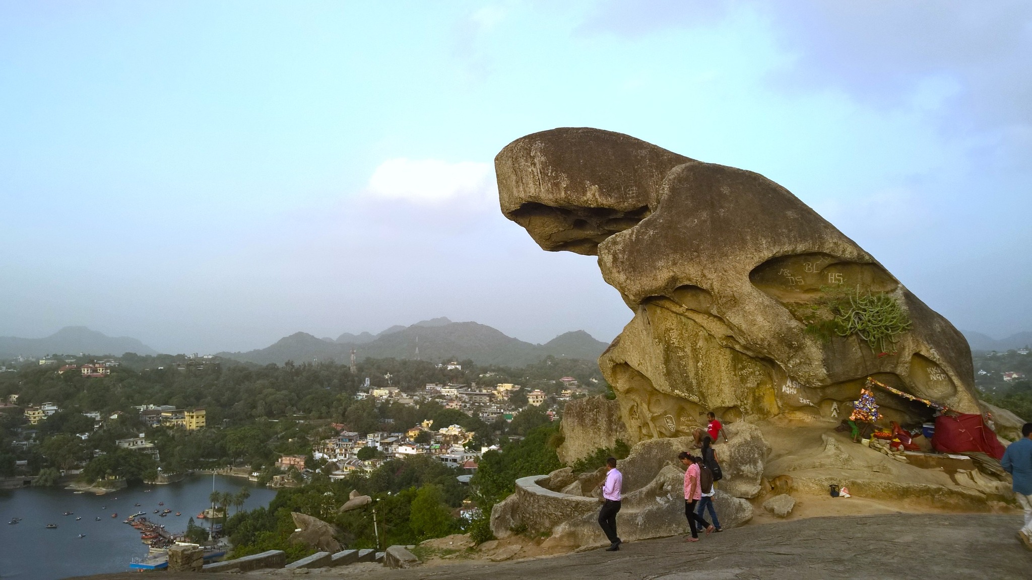
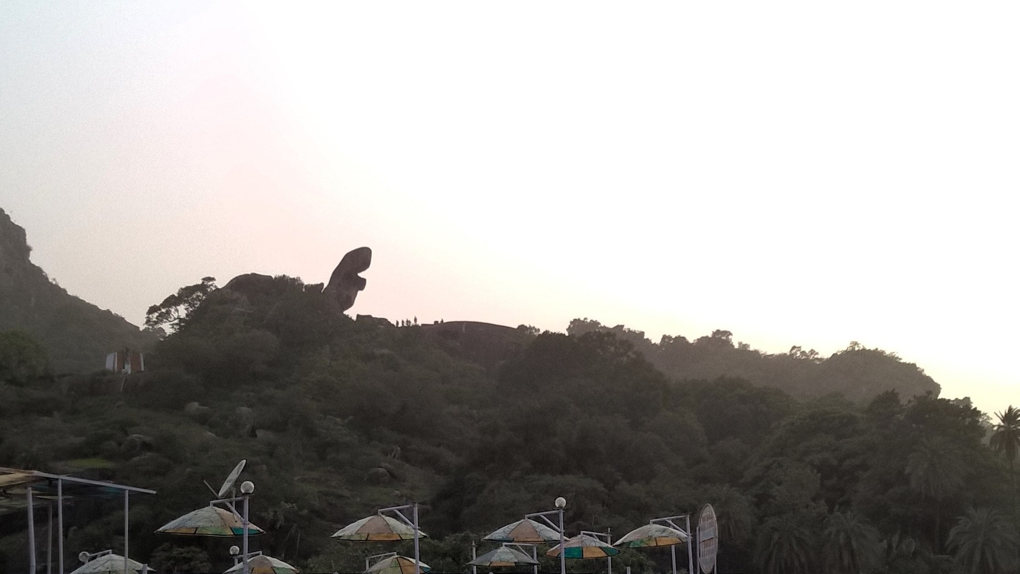
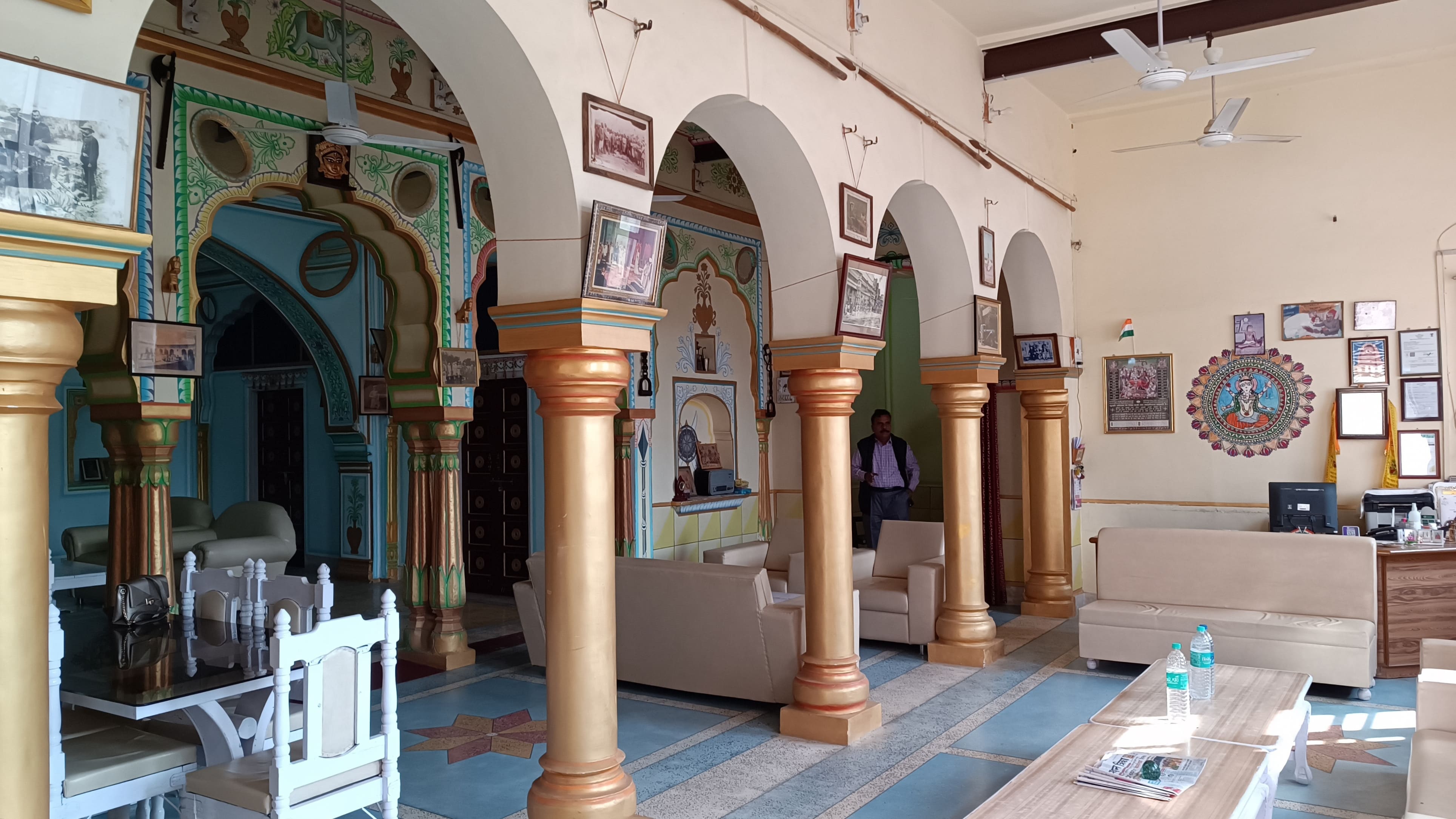
It already being 1.30 PM, we asked around for a good place to have lunch, and took a hairpin upturned bend from the main road, reaching a haveli that once belonged to the royal dynasty. Now turned into Hotel Haridiya Heritage, the haveli is located higher than most of the town, affording a view of the erstwhile king’s palace which lies almost adjacent to it, and a view of the Aravallis running on the other side of the town. Photographs and souvenirs from the past adorn the walls of the main hall transporting one to a more circumspect time, convincing us that the haveli would be a good retreat for someone looking to spend time in Khetri.

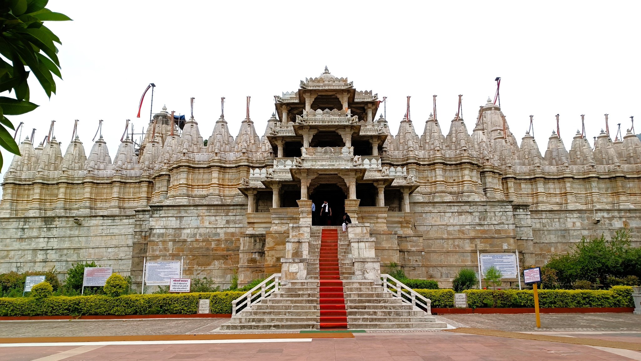
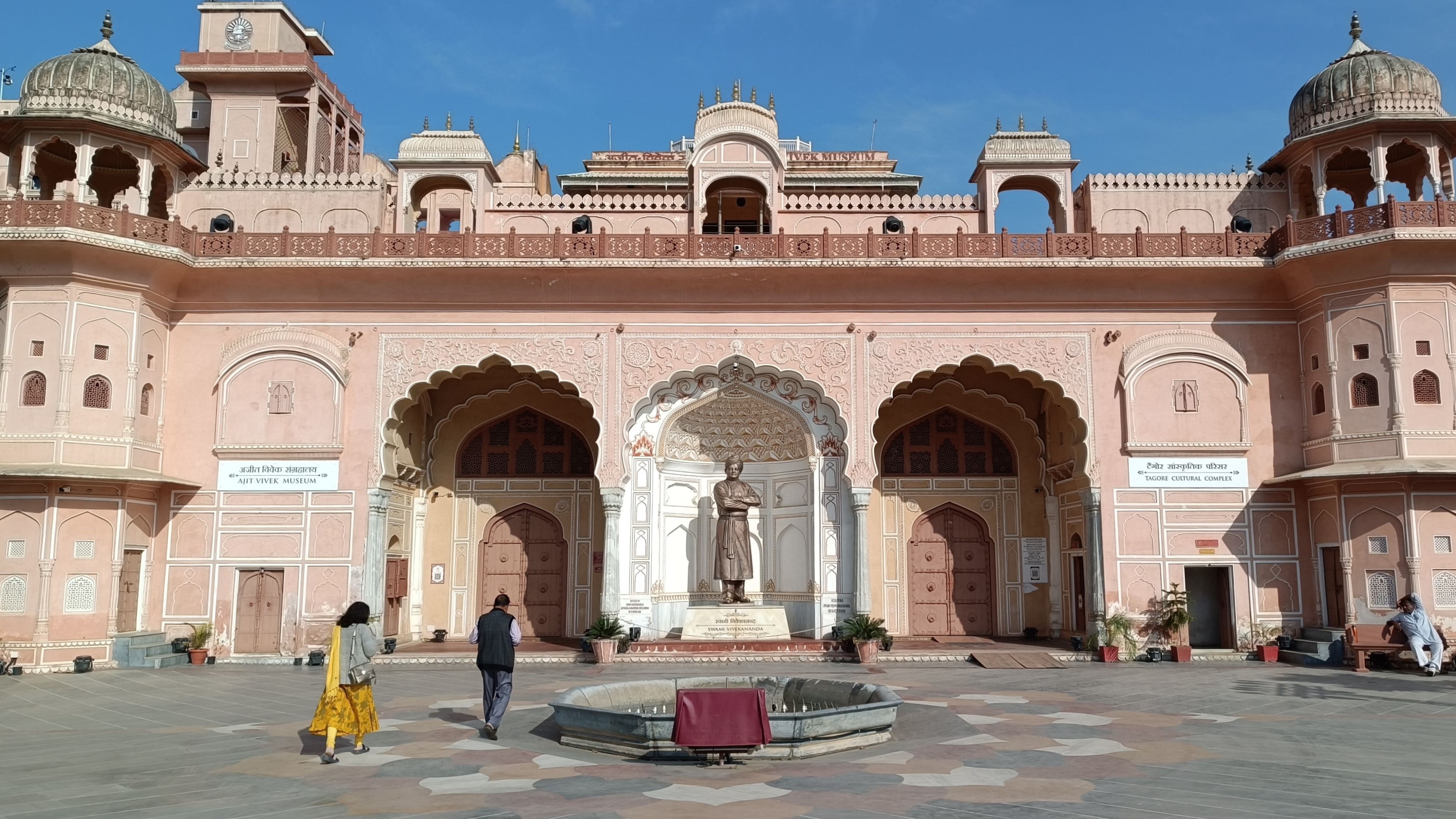
Our next stop following lunch was the royal palace which has since been given over to the Ramakrishna Mission who now run the mission in part of the palace. The remaining part has been turned into the Ajit-Vivek museum dedicated to displaying the life and teachings of Swami Vivekananda. But why is this quaint little town nestled in the Aravallis being spoken of in the same breath as a monk from Bengal, a land in the east of India? Well, this seems like a good point to take a detour and learn about the connection between Khetri and Swami Vivekananda.

Khetri and Swami Vivekananda

After starting his life as a wandering monk in 1888, Swami Vivekanand first set foot in Khetri in June 1891, meeting Ajit Singh, the ruler of the Shekhawat estate (thikana) of Khetri. Following a discussion on a wide range of subjects, Ajit Singh invited Vivekananda for dinner. Vivekananda ended up staying in Khetri from 4 June 1891 to 27 October 1891, during which period Ajit Singh taught Vivekananda to wear a turban in the Rajasthani style to protect him from the hot wind blowing in the area. With variations added of his own, Vivekananda made the turban a staple of his life, as evident from most of the well-known pictures of the monk. A teacher-disciple relationship and a life-long friendship had begun.

Vivekananda visited and stayed in Khetri a second time from 21 April 1893 to 10 May 1893. Learning of his wish to participate in the Parliament of World’s Religions as a speaker, Ajit Singh readily provided him with financial aid, and the tickets for the voyage, even escorting him till Jaipur, from whereon Ajit Singh’s Munshi escorted Vivekananda till Bombay. Purportedly upon Ajit Singh’s request, the monk also assumed the monastic name Vivekananda replacing his then-assumed name Vividishananda. The two remained in correspondence during Vivekananda’s stay in the west, with Ajit Singh providing him financial support whenever required.

Vivekananda visited Khetri a third and final time in 1897, upon Ajit Singh’s invitation, where he gave a lecture attended by Ajit Singh and many Eurpoean guests. During this visit, Vivekananda openly expressed his gratitude to Ajit Singh for his support. In 1898, Vivekananda requested that a monthly stipend given by Ajit Singh to his mother, be made permanent even after Vivekananda’s death. Ajit Singh honoured this arrangement, without publicising this, till his death in 1901 due to a collapse of a tower he was standing on, at the age of 39. Incidentally, Swami Vivekananda also died at the age of 39, the following year.

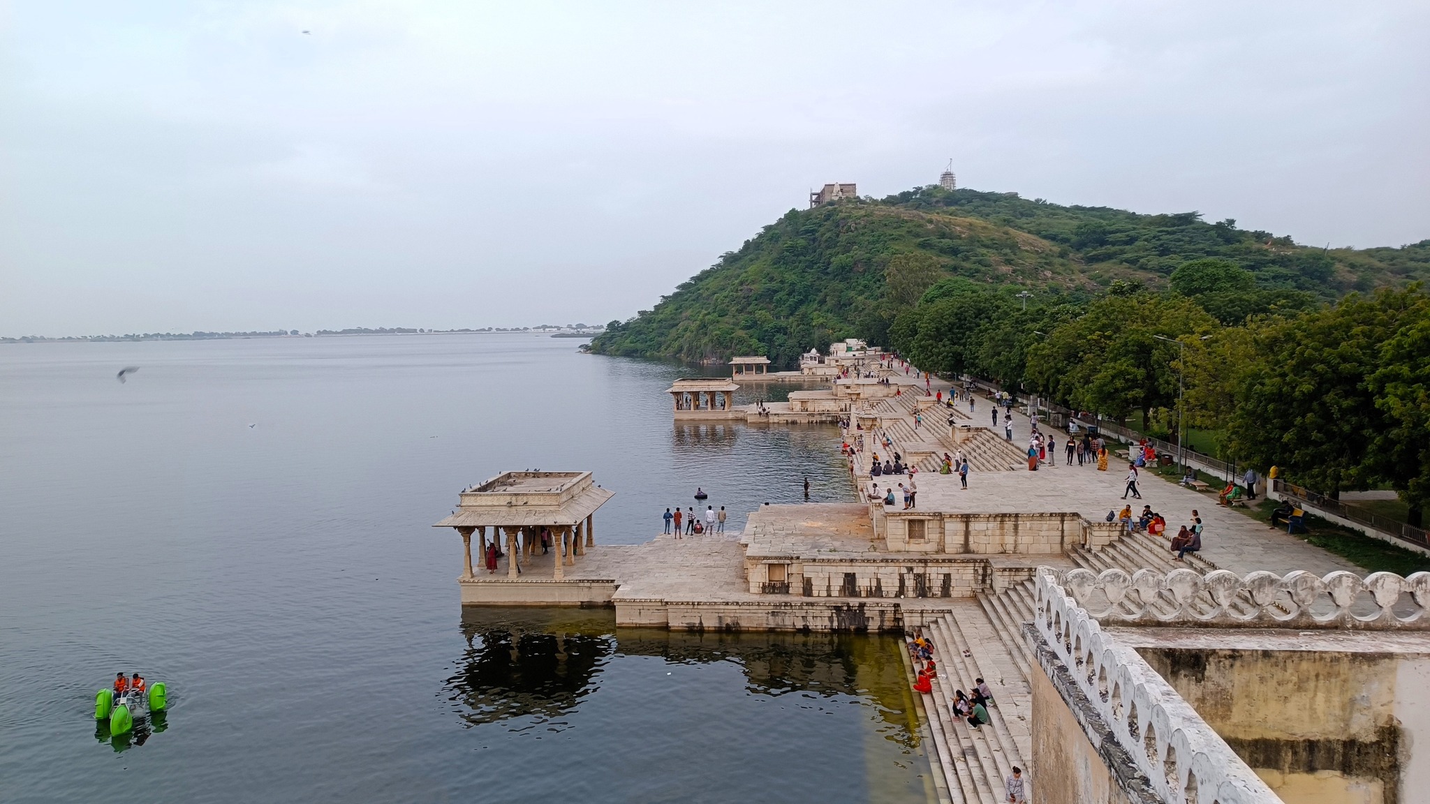
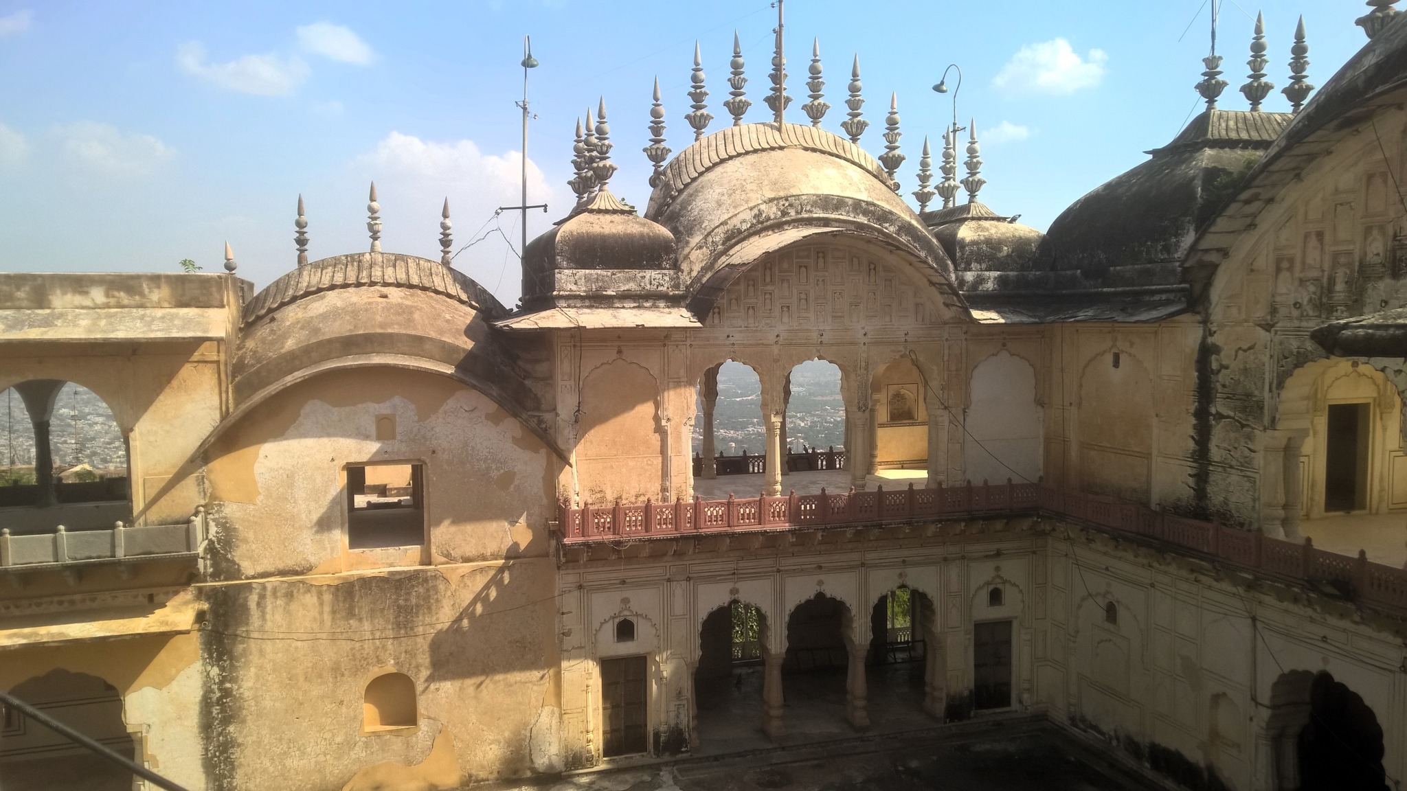
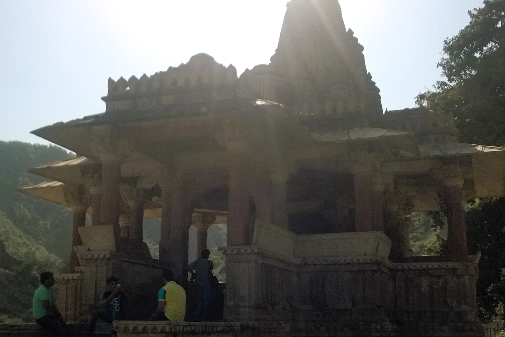
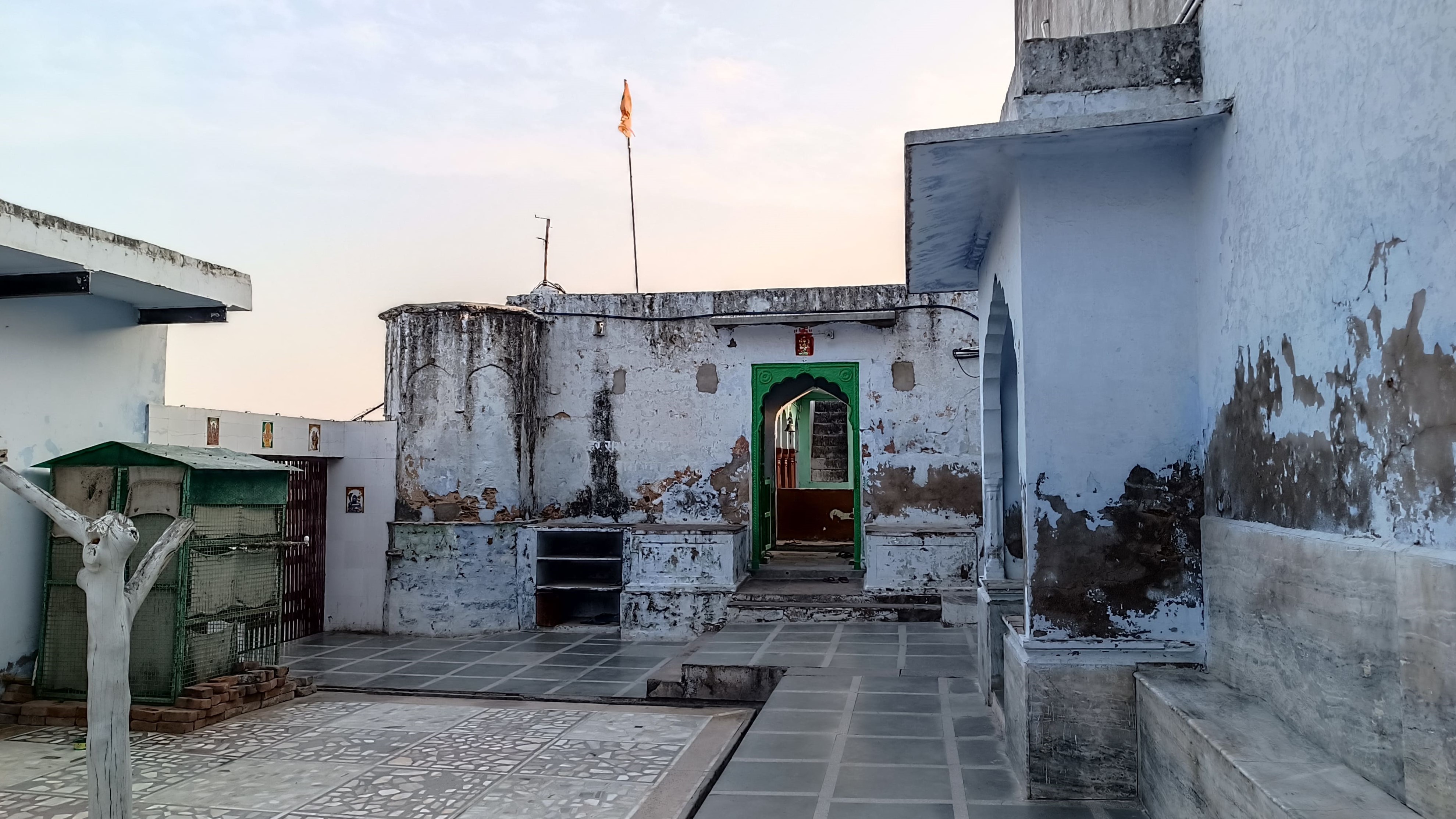
In 1958, Ajit Singh’s grandson, Bahadur Sardar Singh donated the then abandoned and dilapidated Palace of Khetri to the Ramakrishna Mission, who cleared and restored one part of the palace to establish a mission. Later, another part of the building, Fateh Vilas, was turned into a museum showing Vivekanda’s life and teachings, while also honouring Ajit Singh. The room overlooking the town and the Aravallis, where Vivekananda lived during his stays in Khetri has now been turned into a prayer room. Some letters of correspondence between Vivekananda and Ajit Singh are also on display.

*************

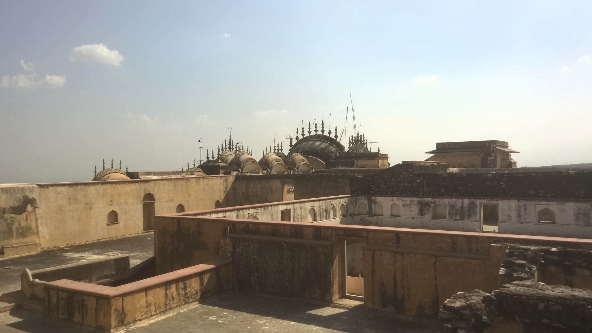
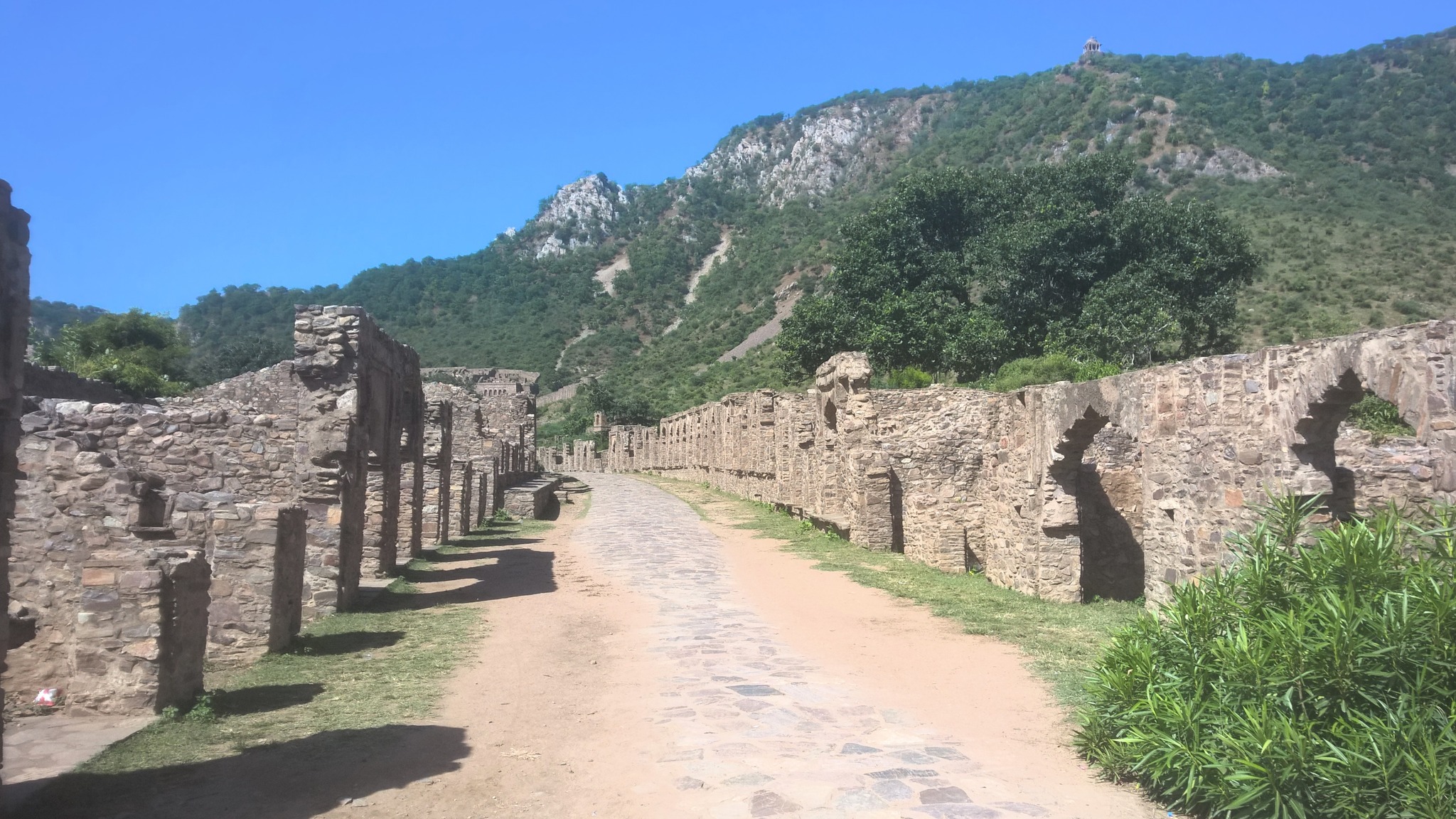
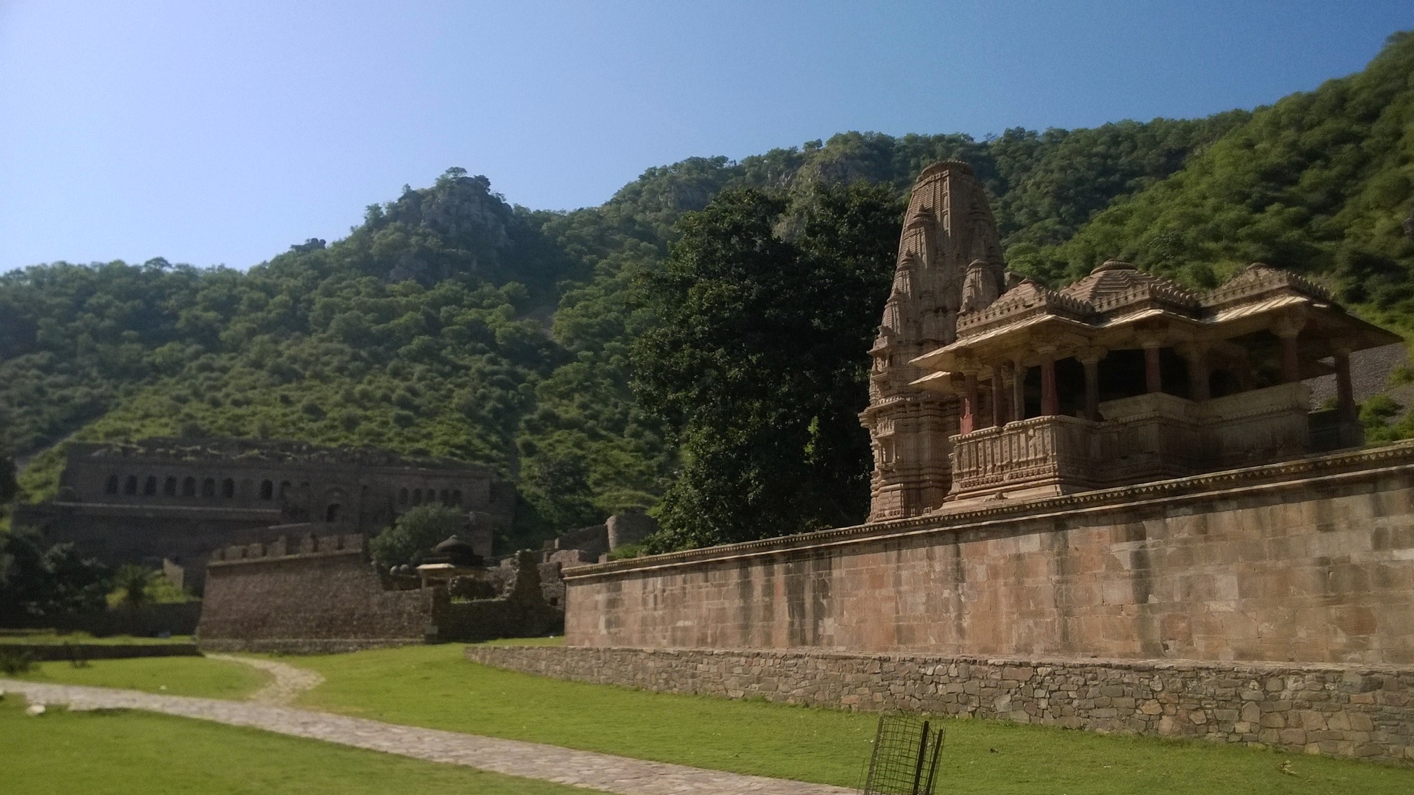
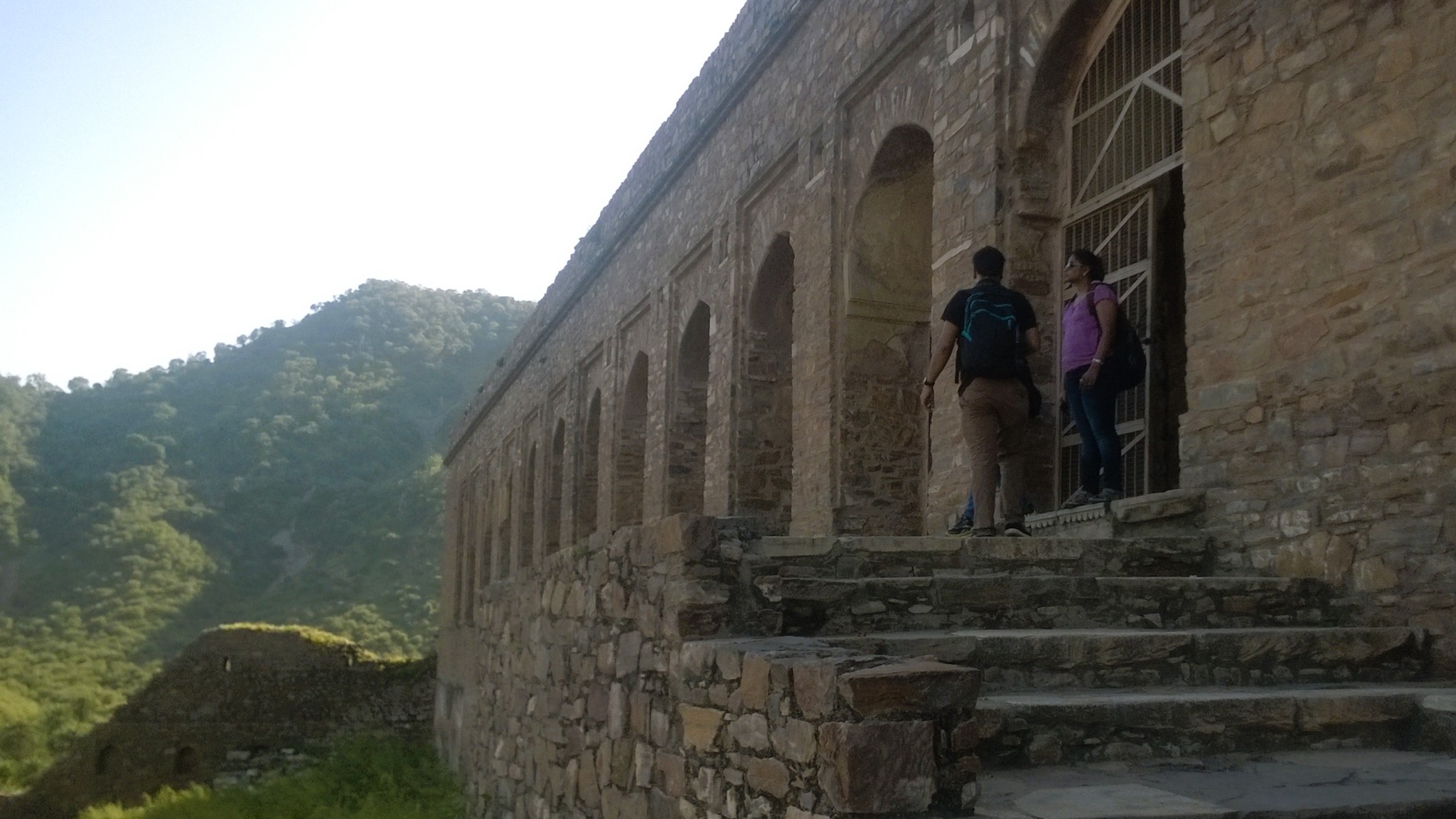
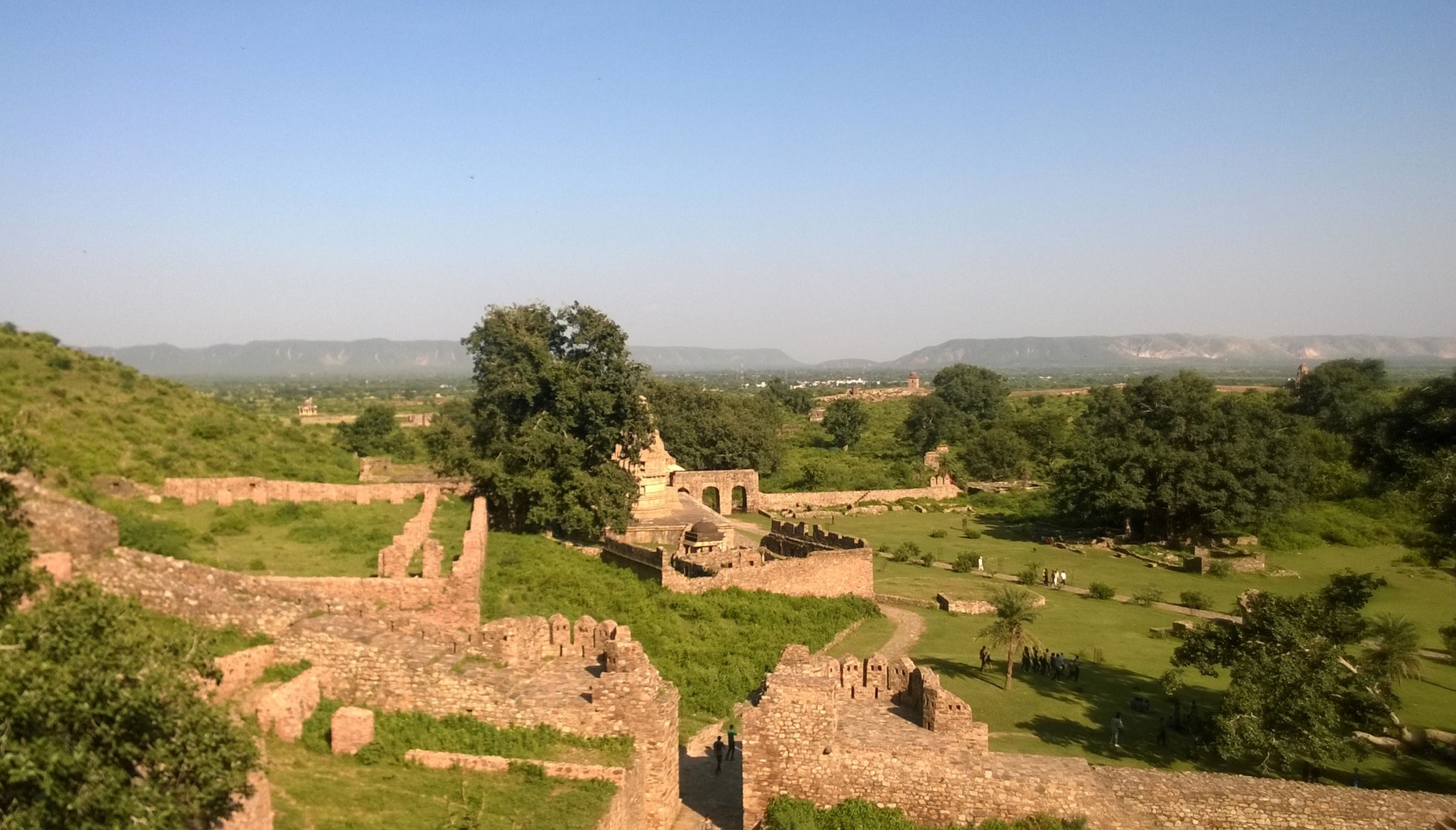
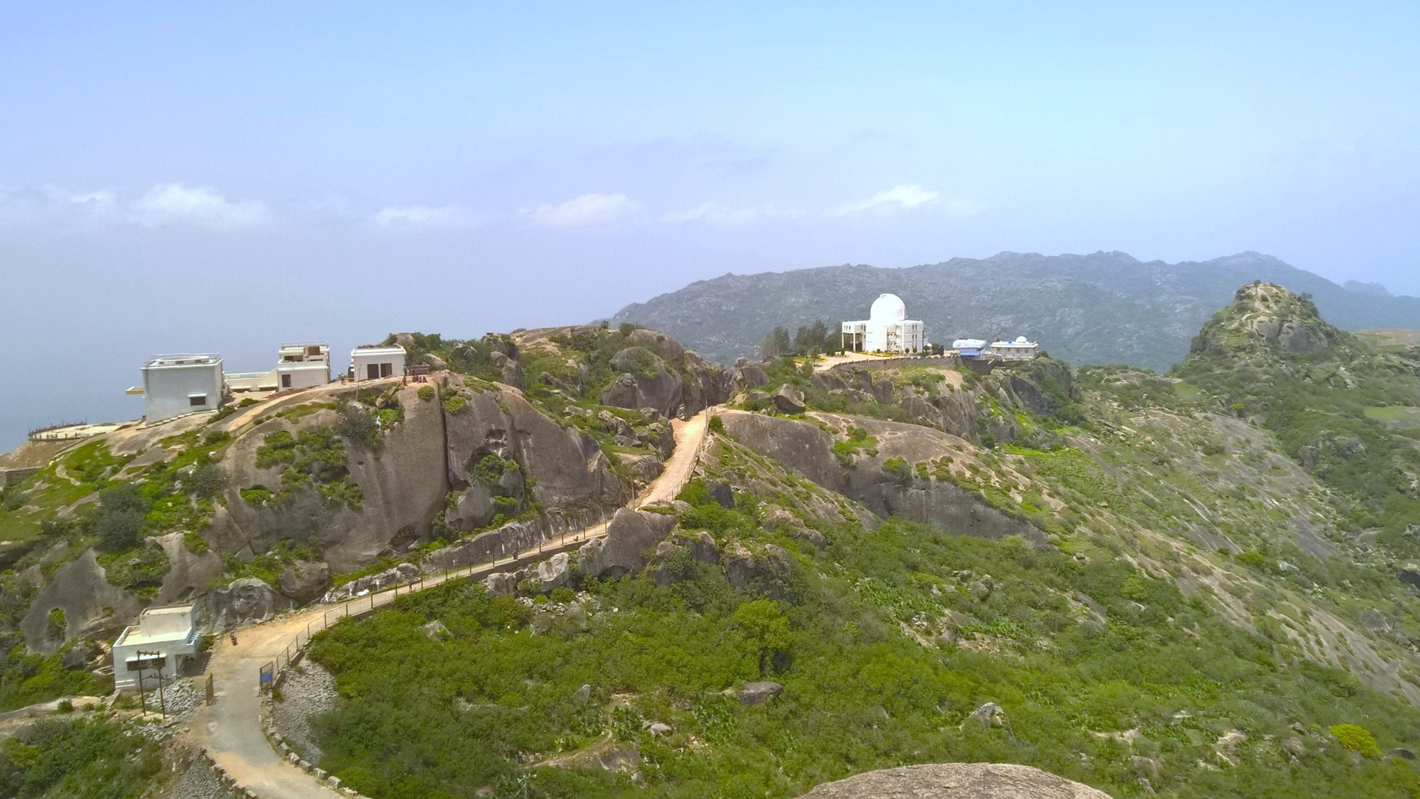
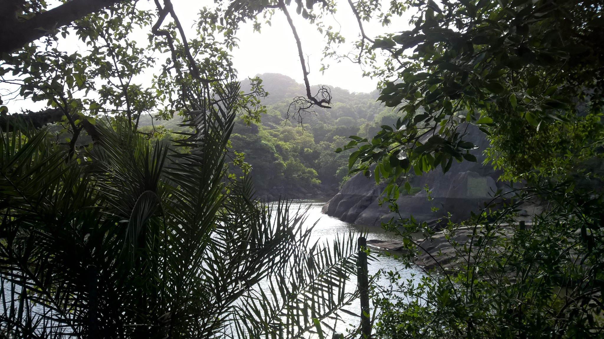
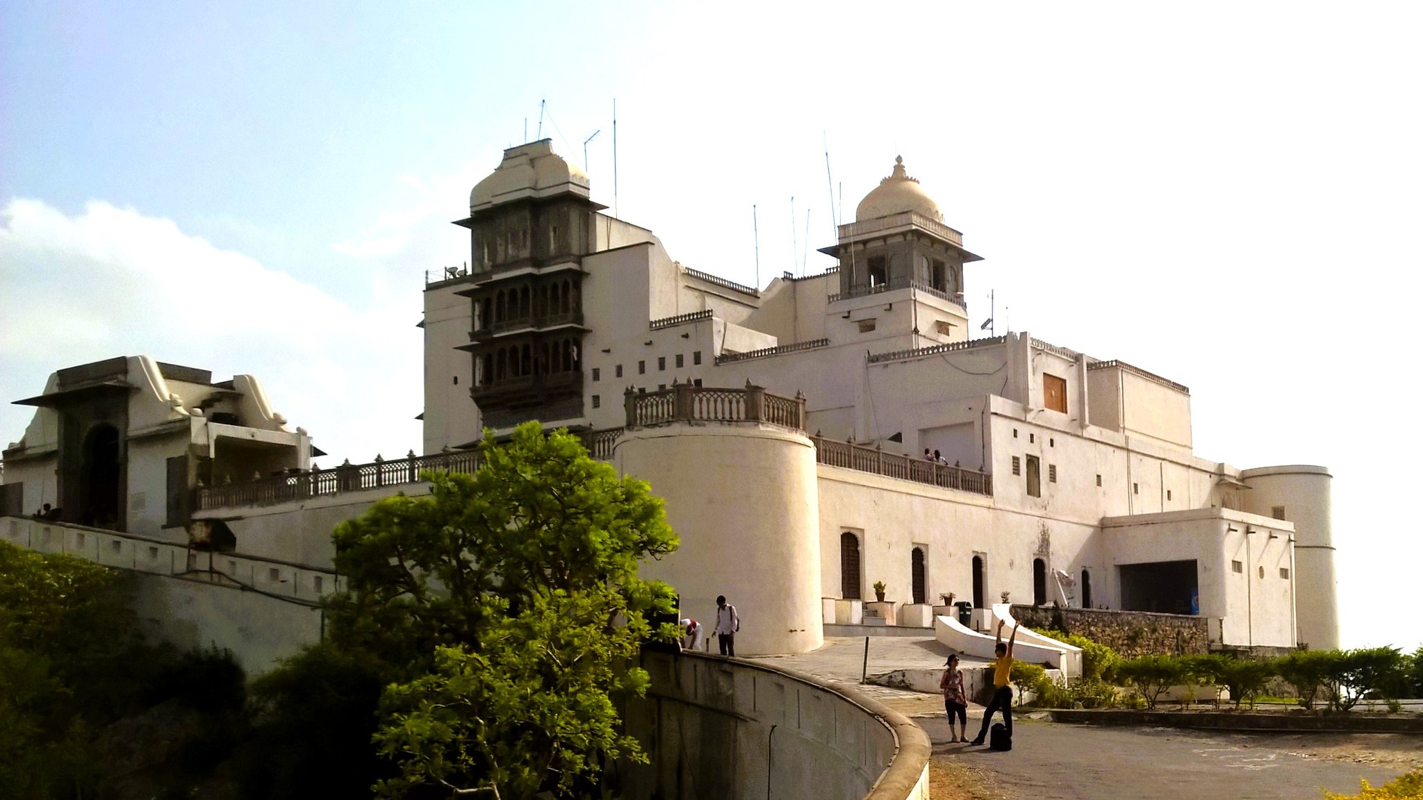
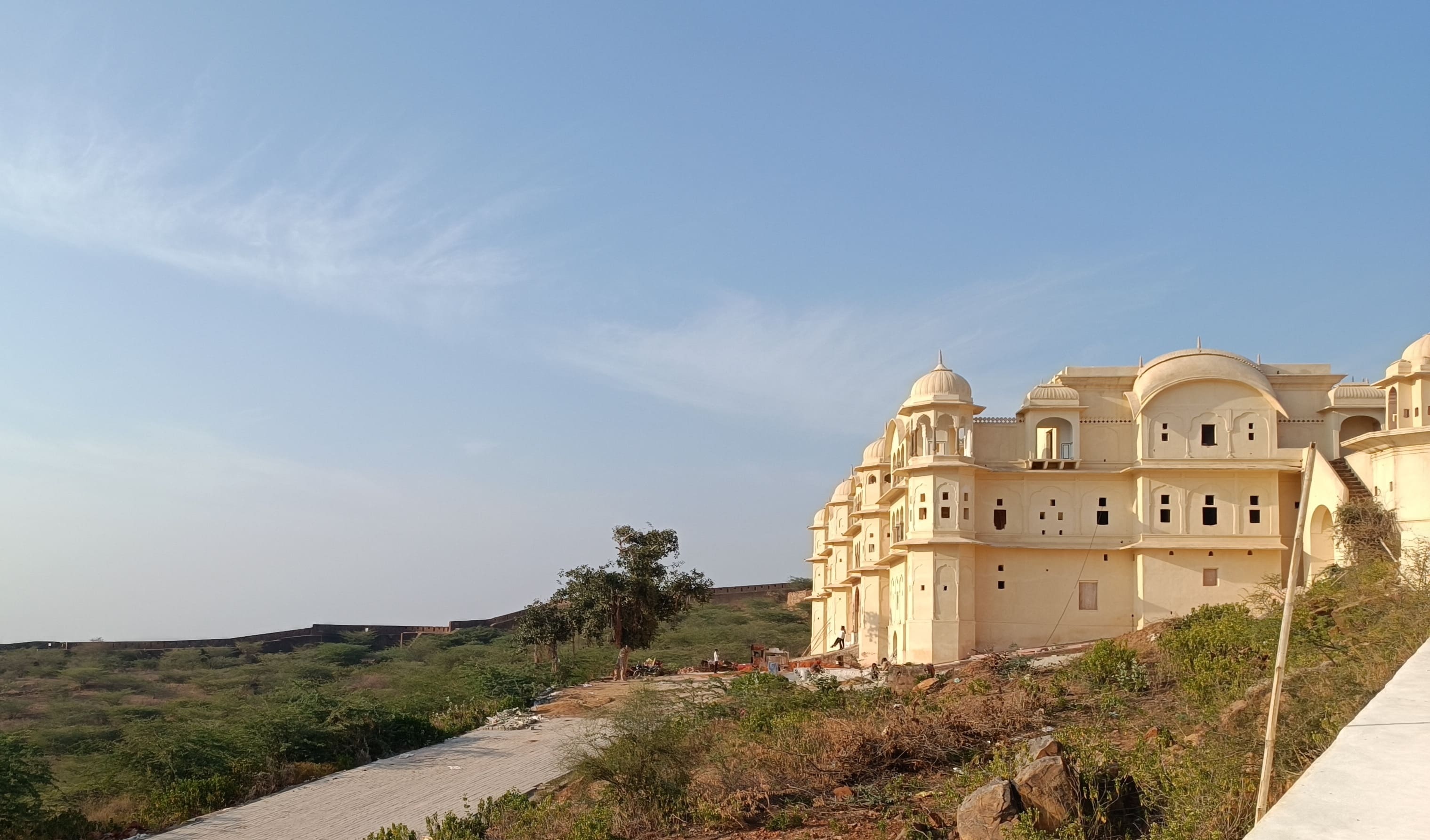
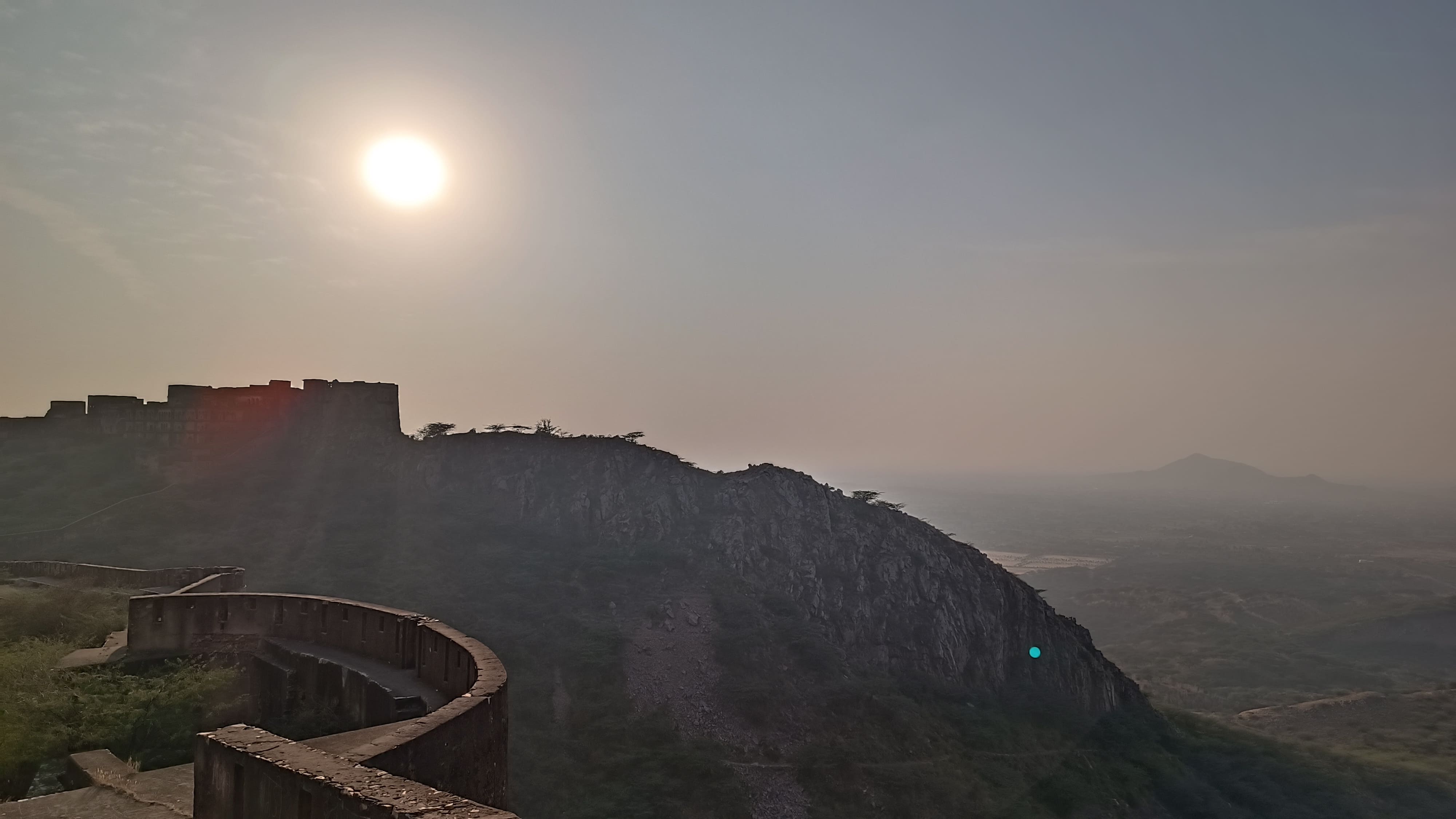
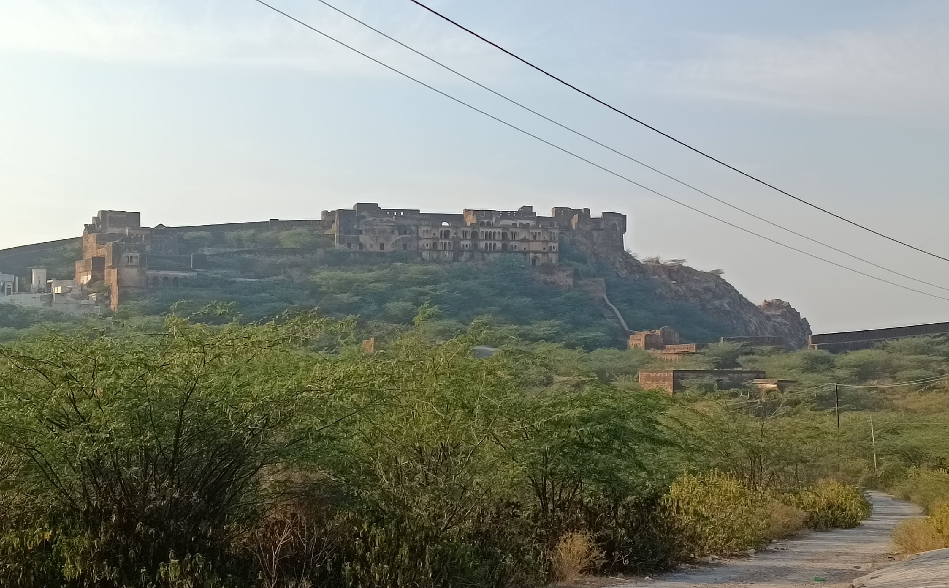
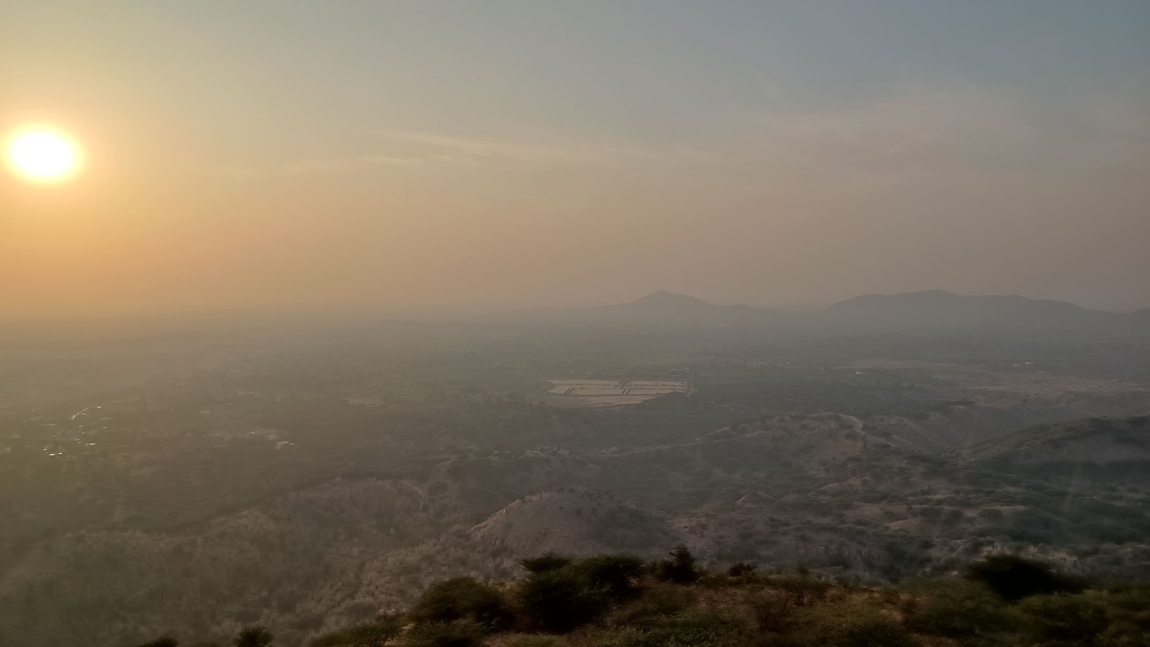
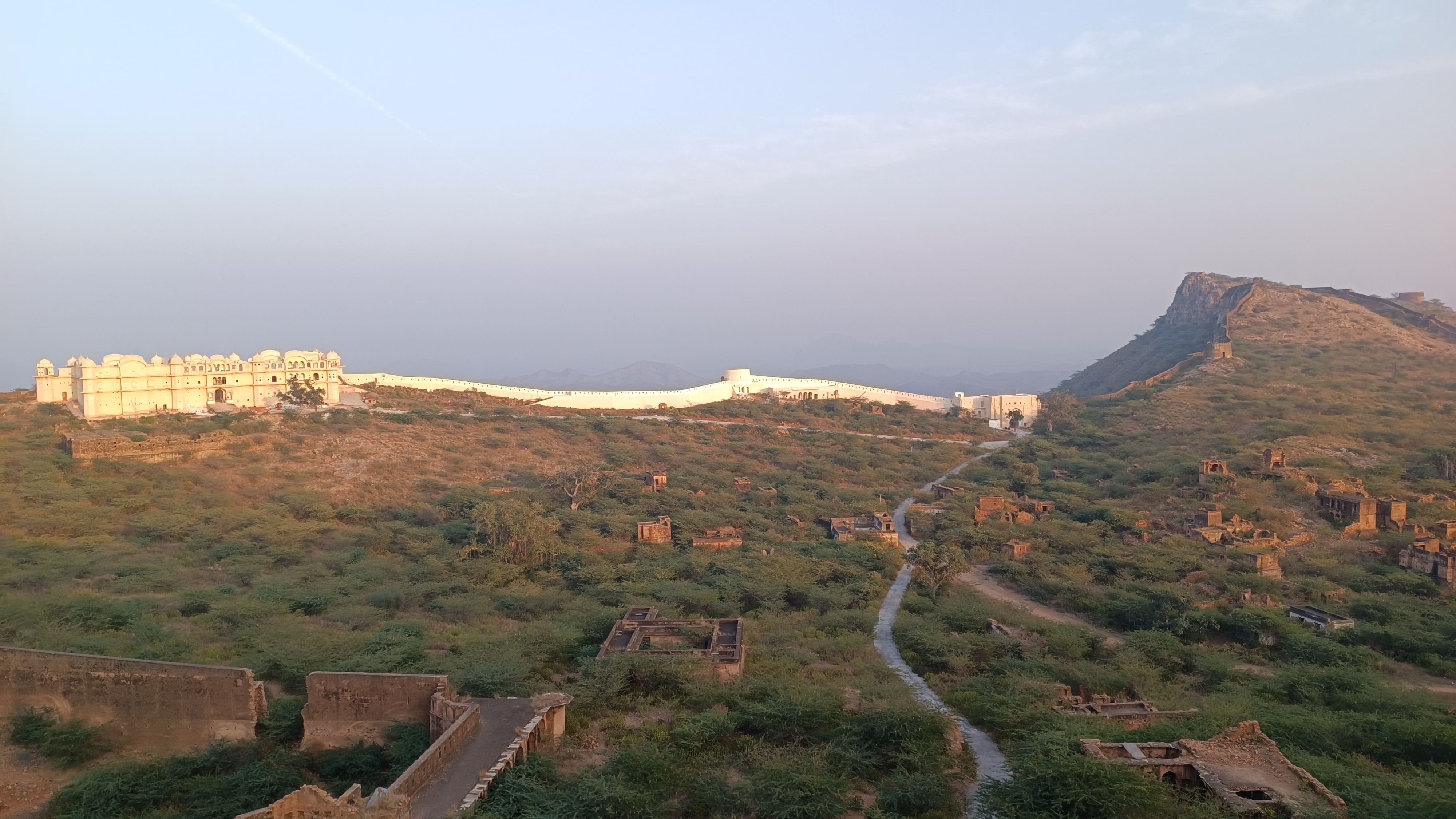
Offering our prayers in the prayer room, we then proceeded to the 270 year-old Bhopalgarh fort that beckoned us from the hilltop in the distance. Taking a steep two-kilometre winding road we were at the fort’s gate around 3.30 PM, with the Khetri town visible down below. Entering the fort premises, we immediately got a bearing of the area – the fort wall encloses an area shaped like a trapezoid, with most of the inner part depressed, resembling a wide crater.

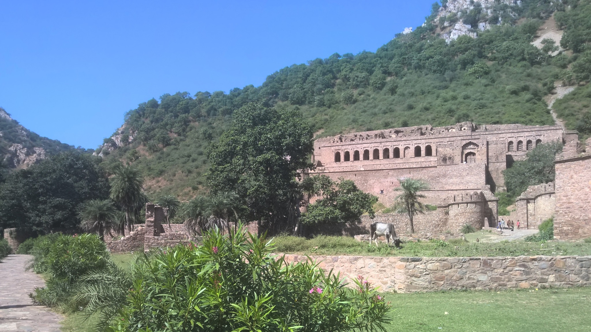
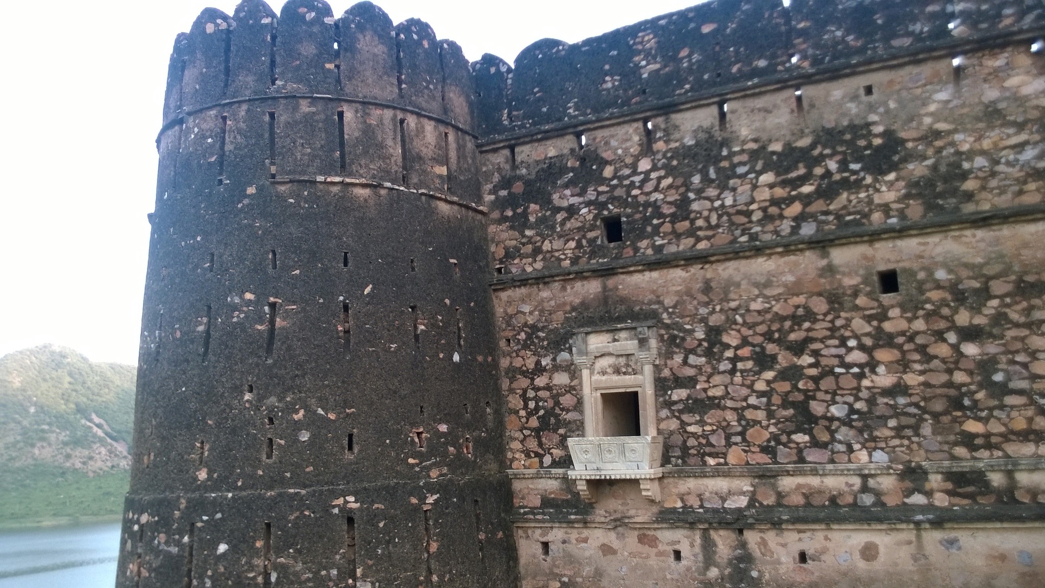
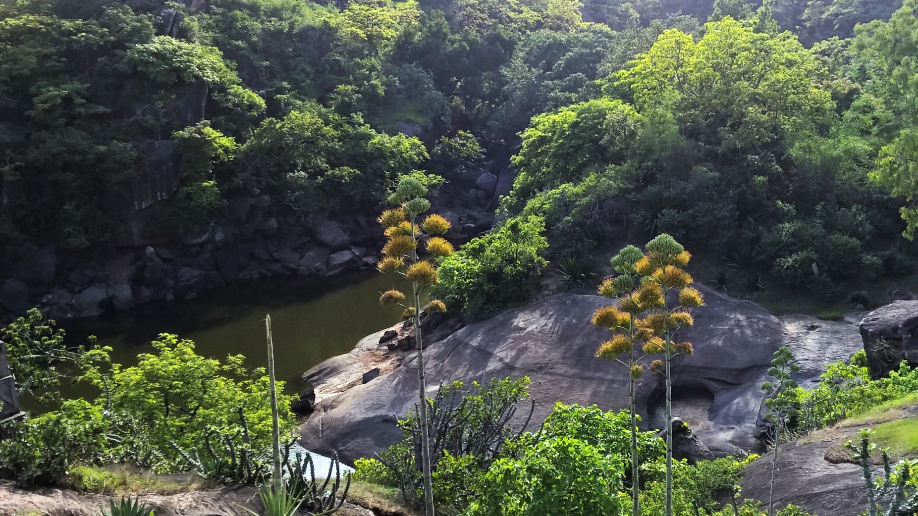
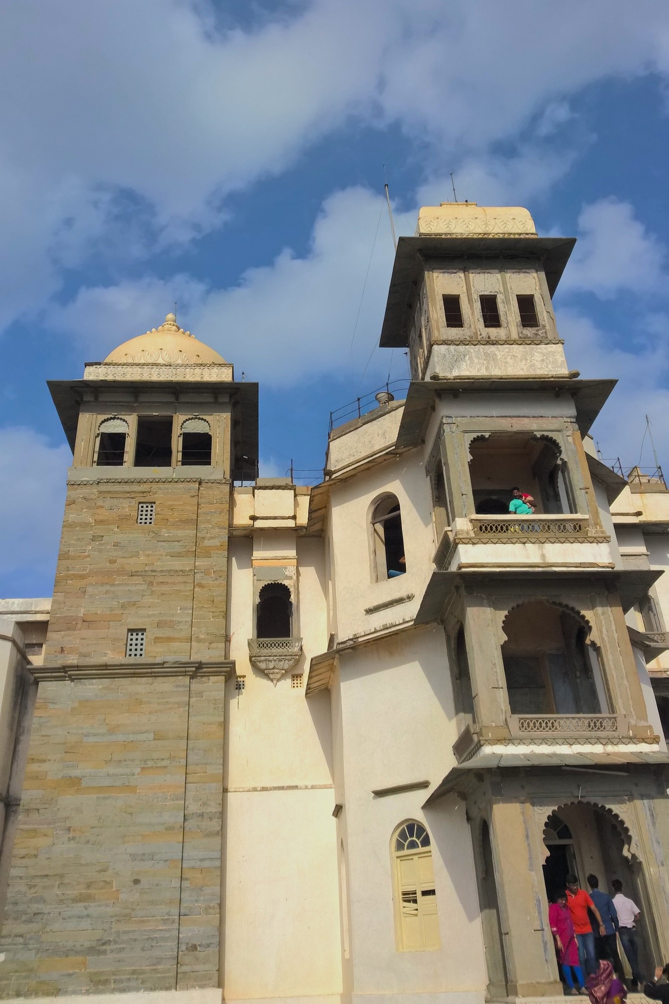
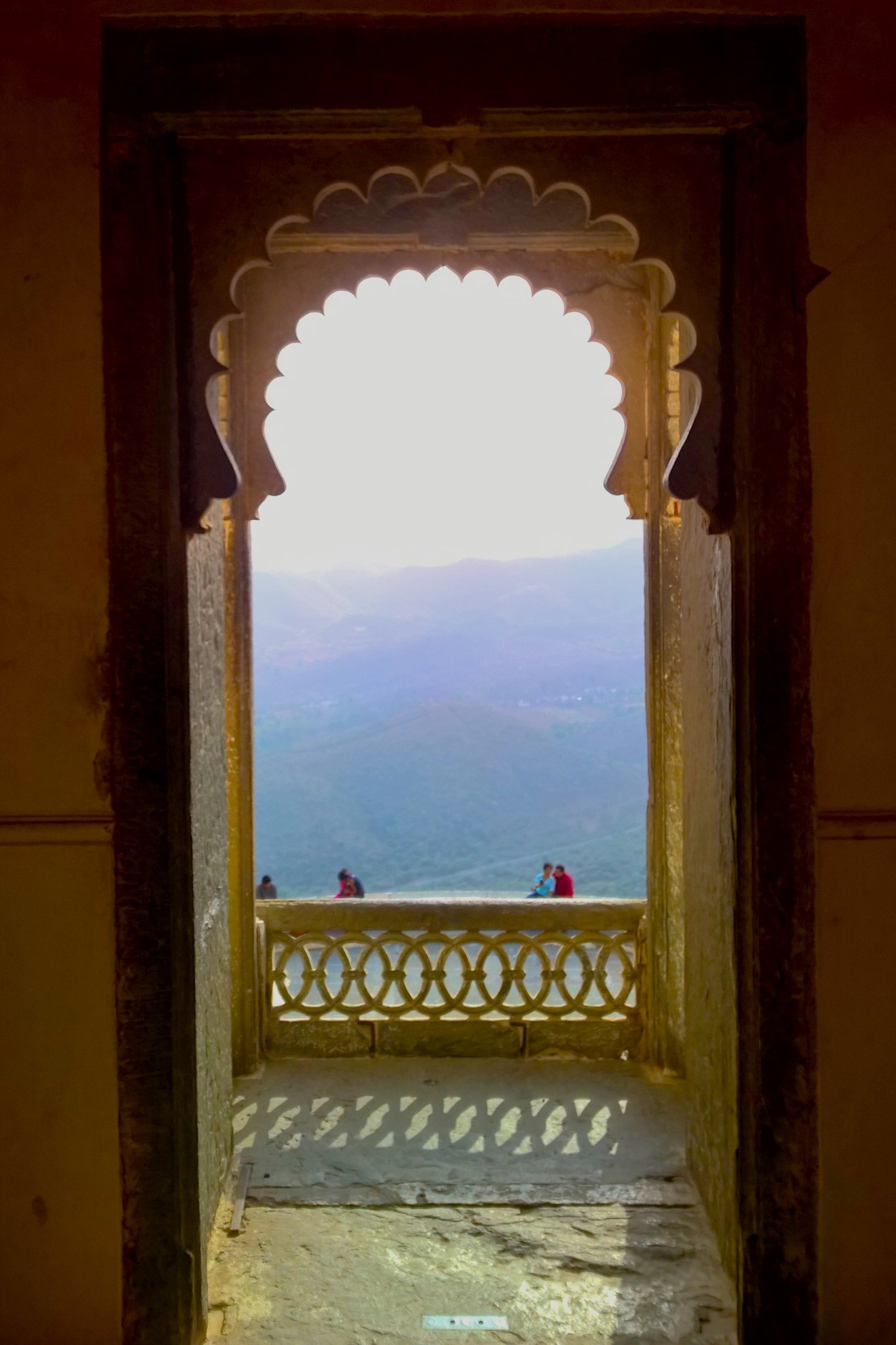
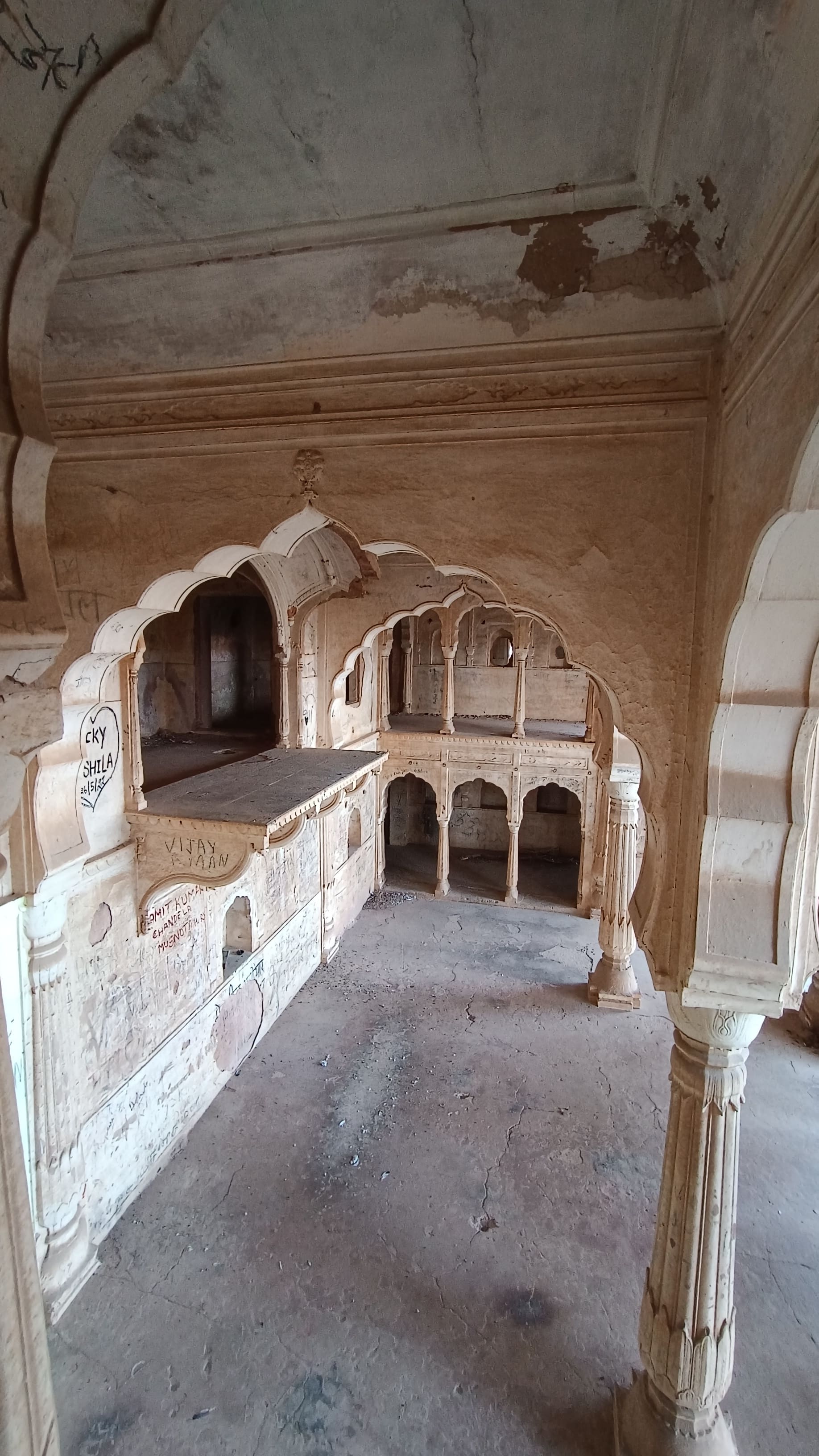
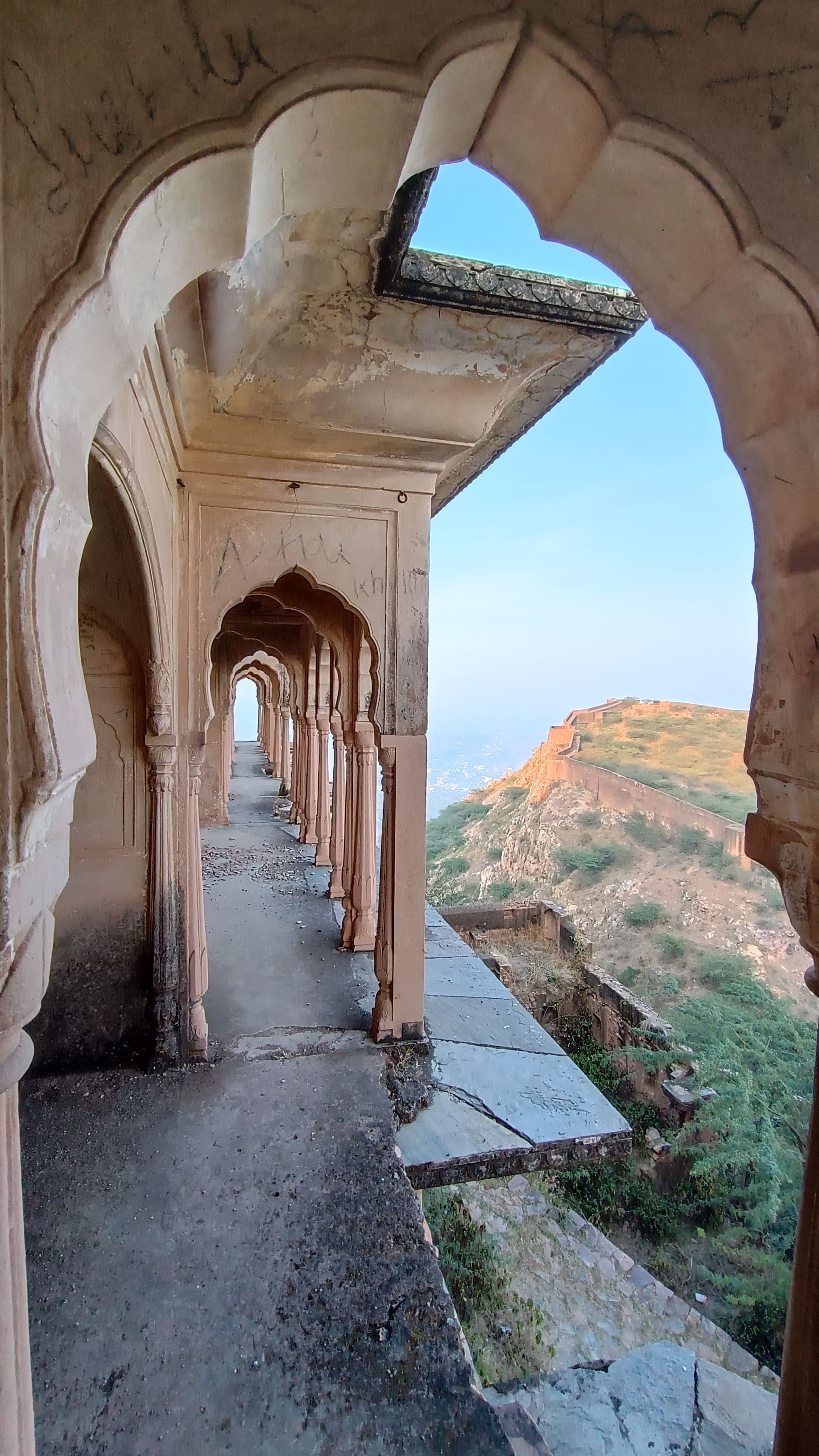
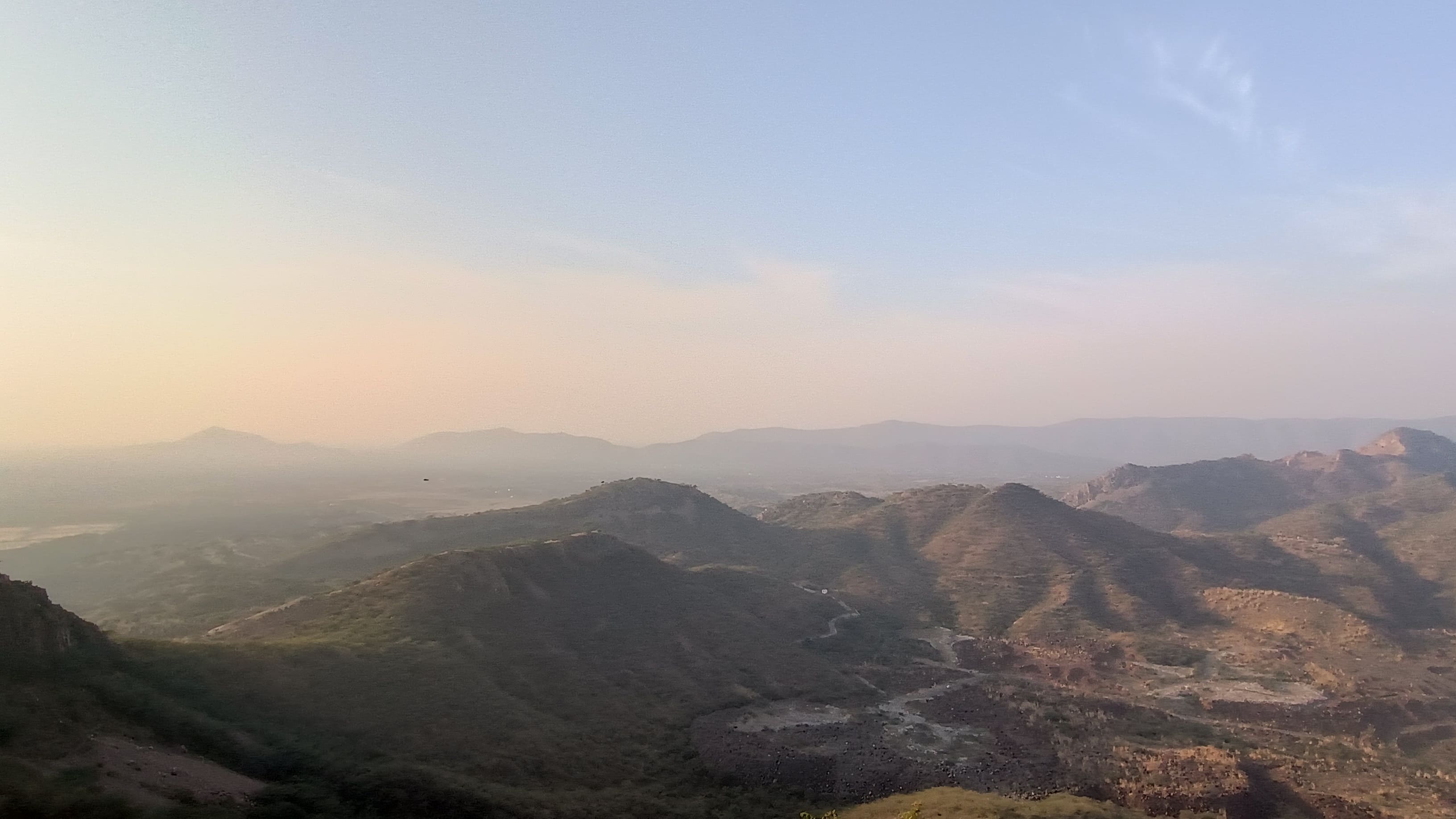
Half a kilometre to the right of the entrance, bang on the fort wall is a palace sporting multiple windows and balconies, called the Sheesh Mahal, which is currently closed for renovation. Peeking in from the corridor at the main gateway, one could see a large courtyard and multiple storied halls and rooms surrounding the hall. Walking beyond the palace on the fort wall, one gets a clearer view of the Khetri town and the surroundings, including some now-defunct copper mines, nestled in the Aravallis.

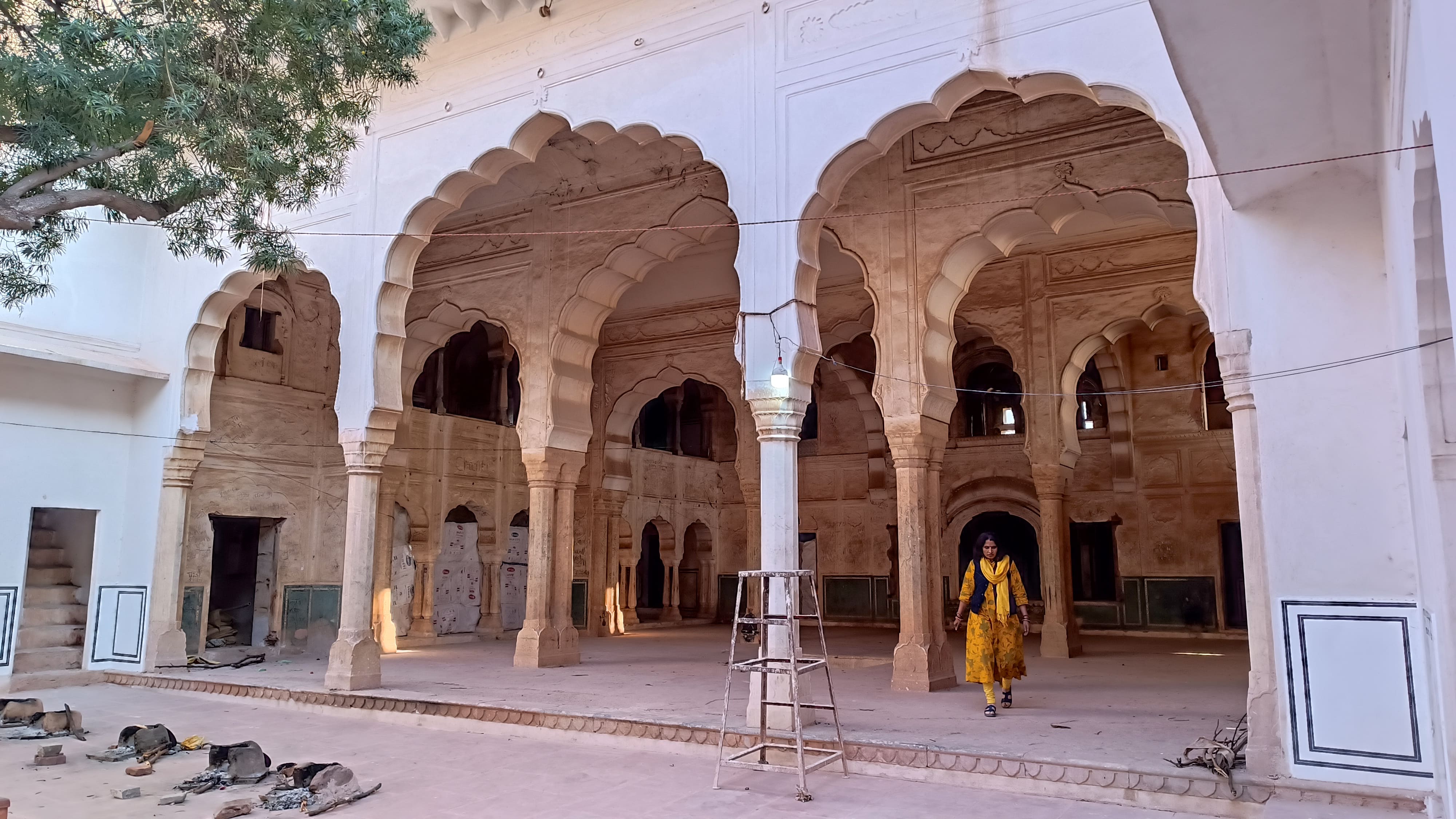
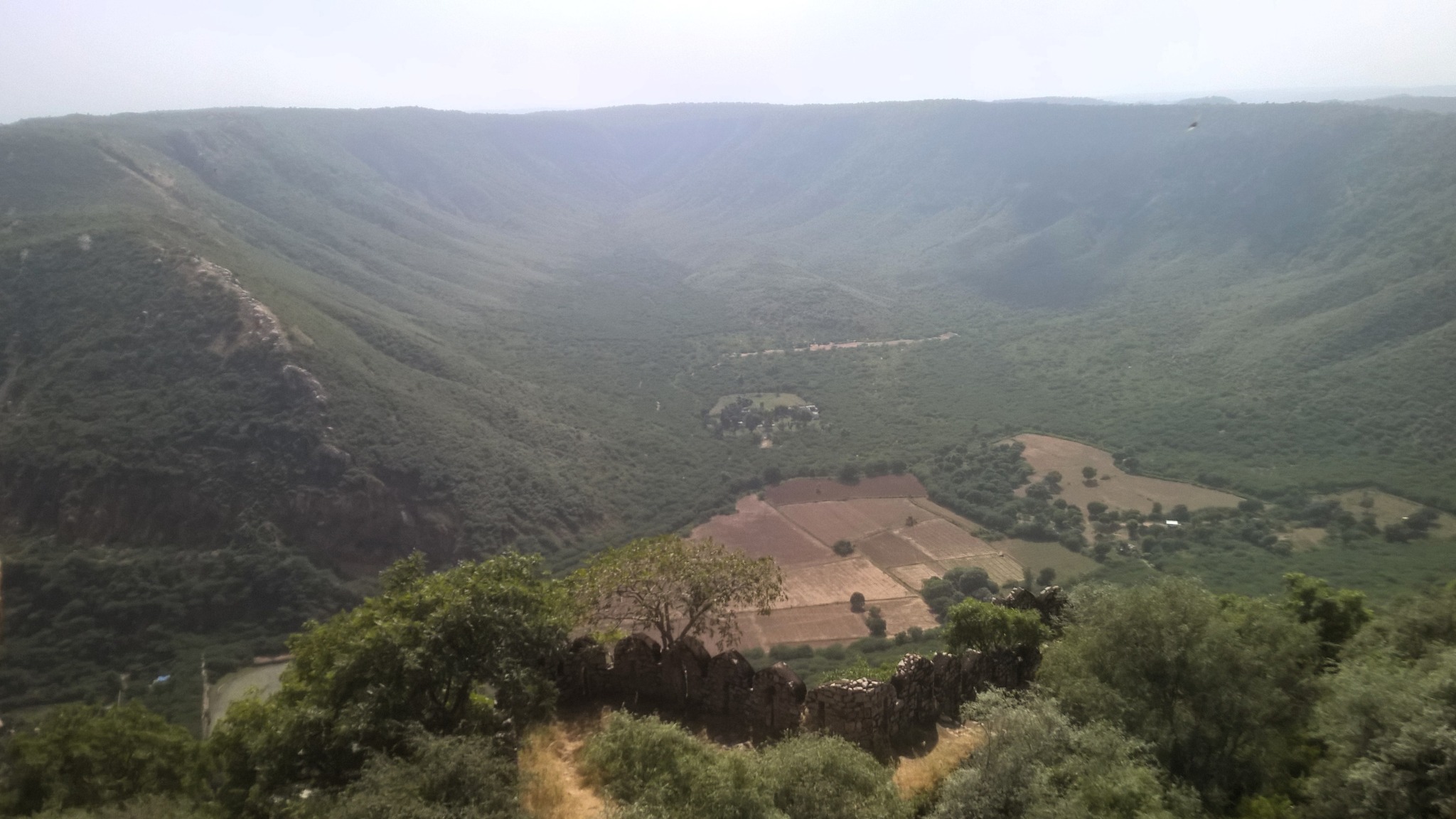
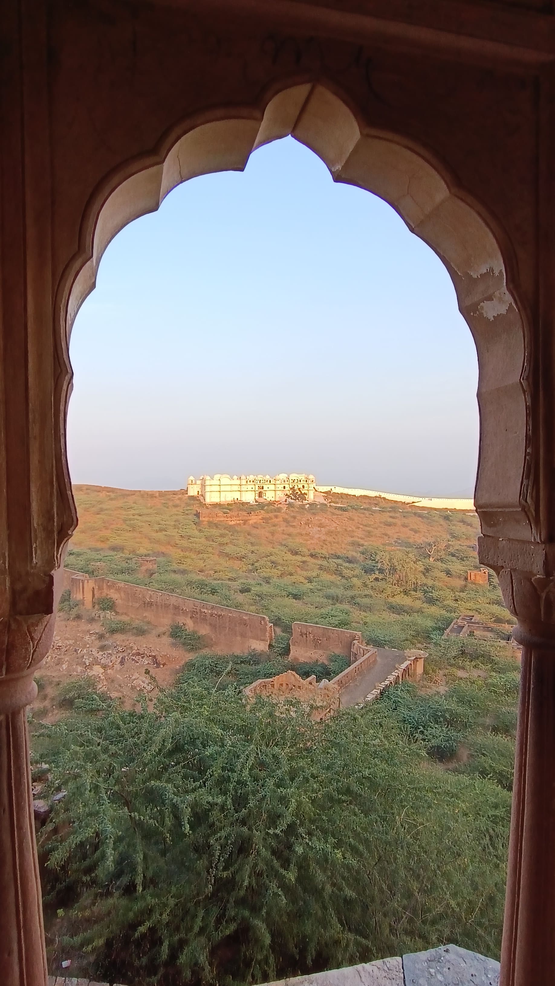
From the side of the entrance and the walls stretching on both sides of the entrance, one can clearly see the Moti Mahal, an elongated palace, located at the far opposite side of the fort. In between, in the depressed portion, lay swathes of low jungle with vestiges of more stone structures. I traversed through the jungle by foot, and found the Moti Mahal in a desolate condition with the front of the palace overgrown with thorny bush and jungle, making it look like a prohibited place. However, adjoining the Moti Mahal, is located the Gopinath temple, dedicated to Krishna, with an attached dharamsala, teeming with some people, which made the adjunct palace look less hostile.

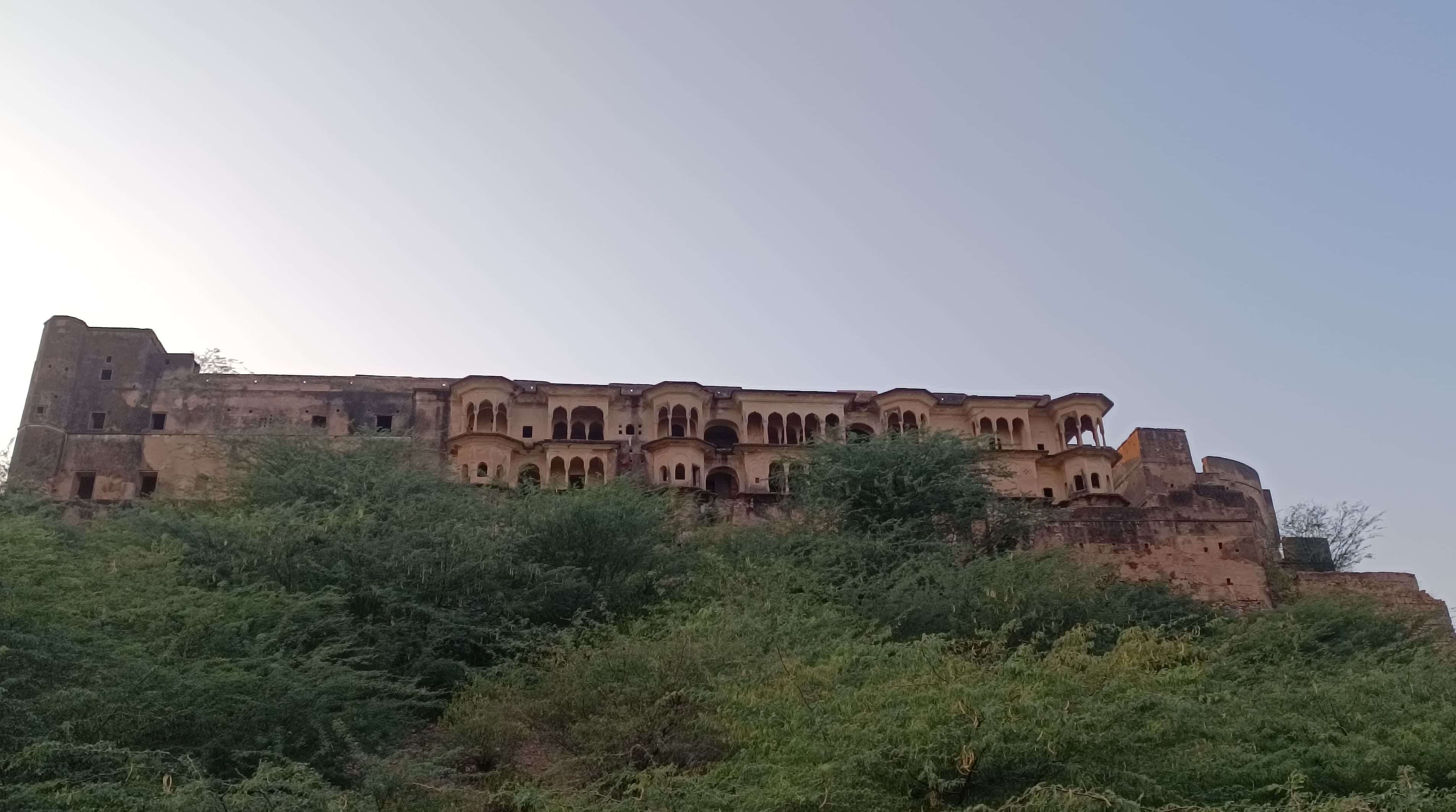
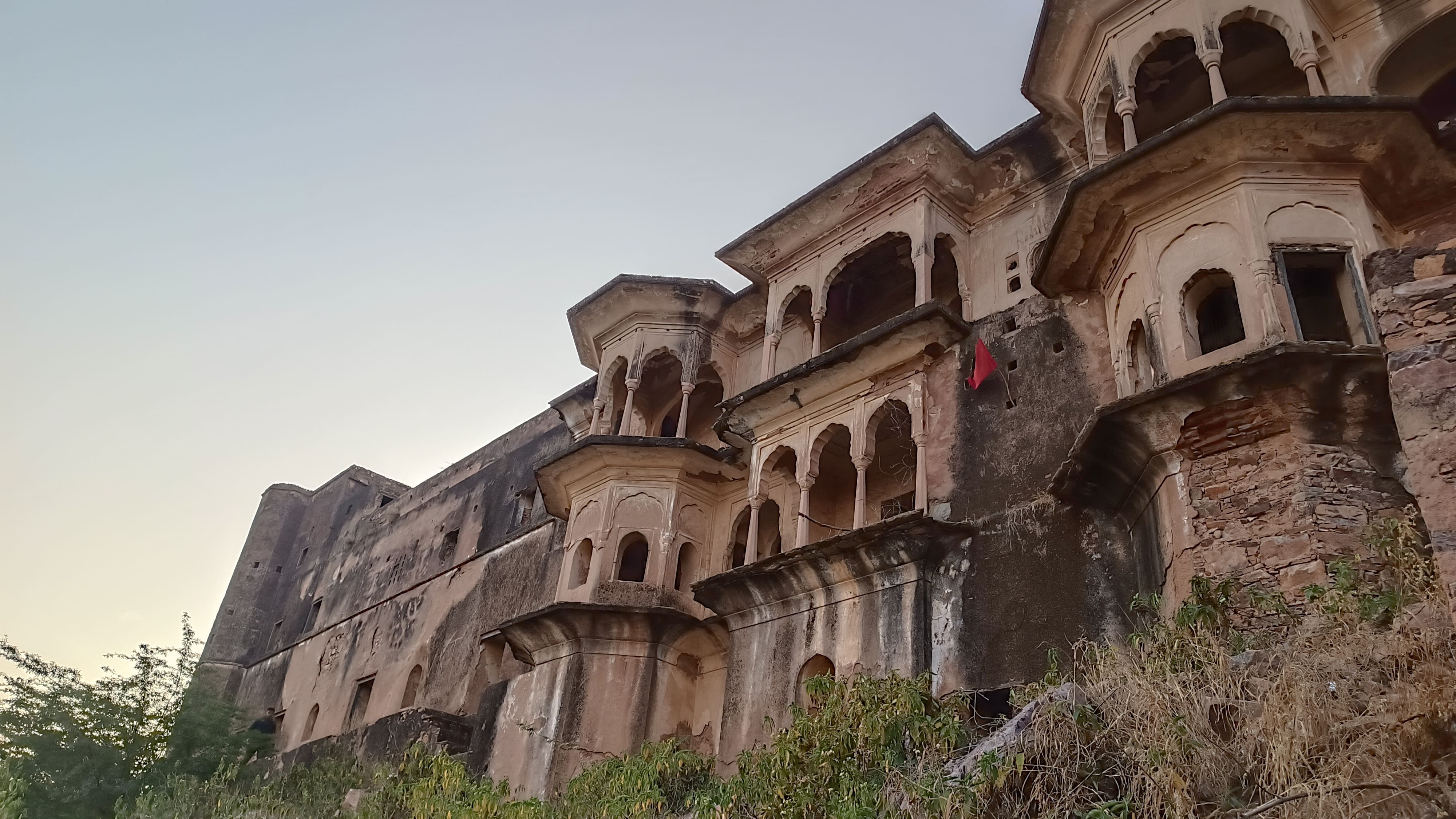
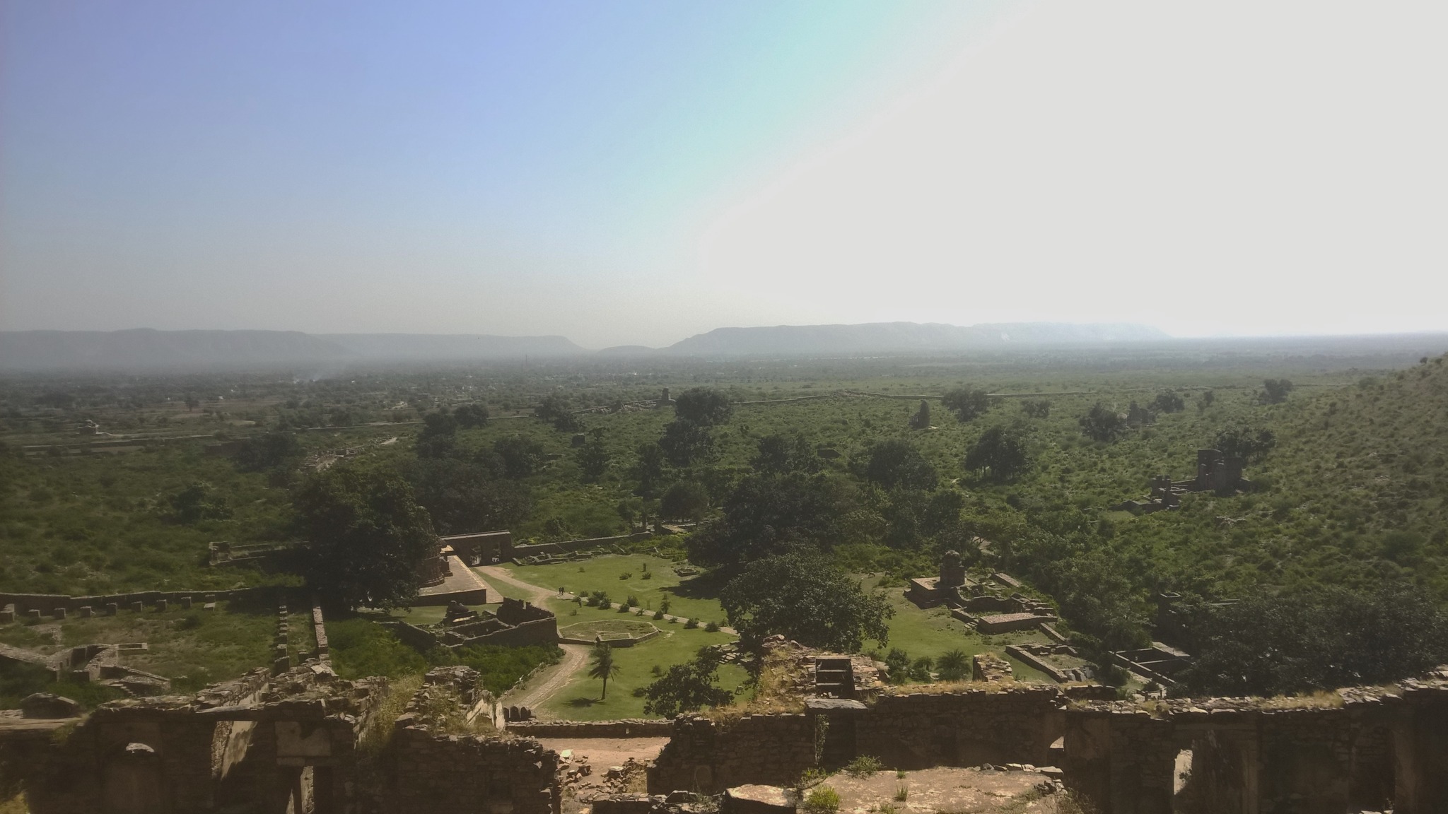
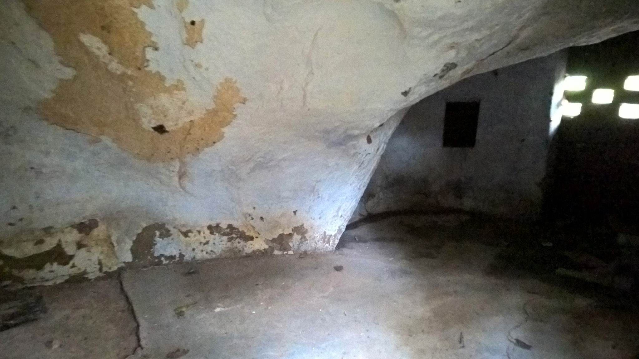
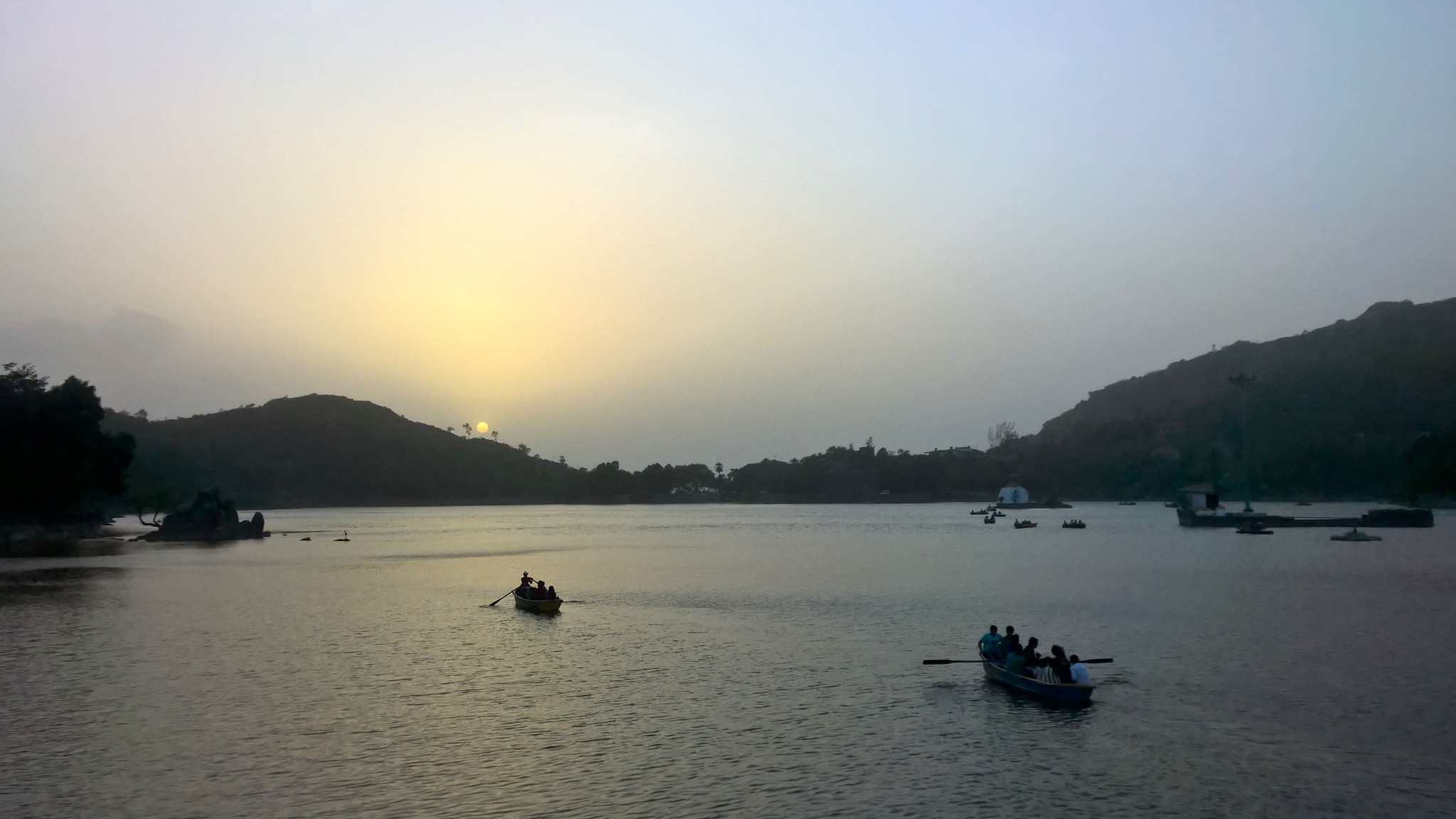
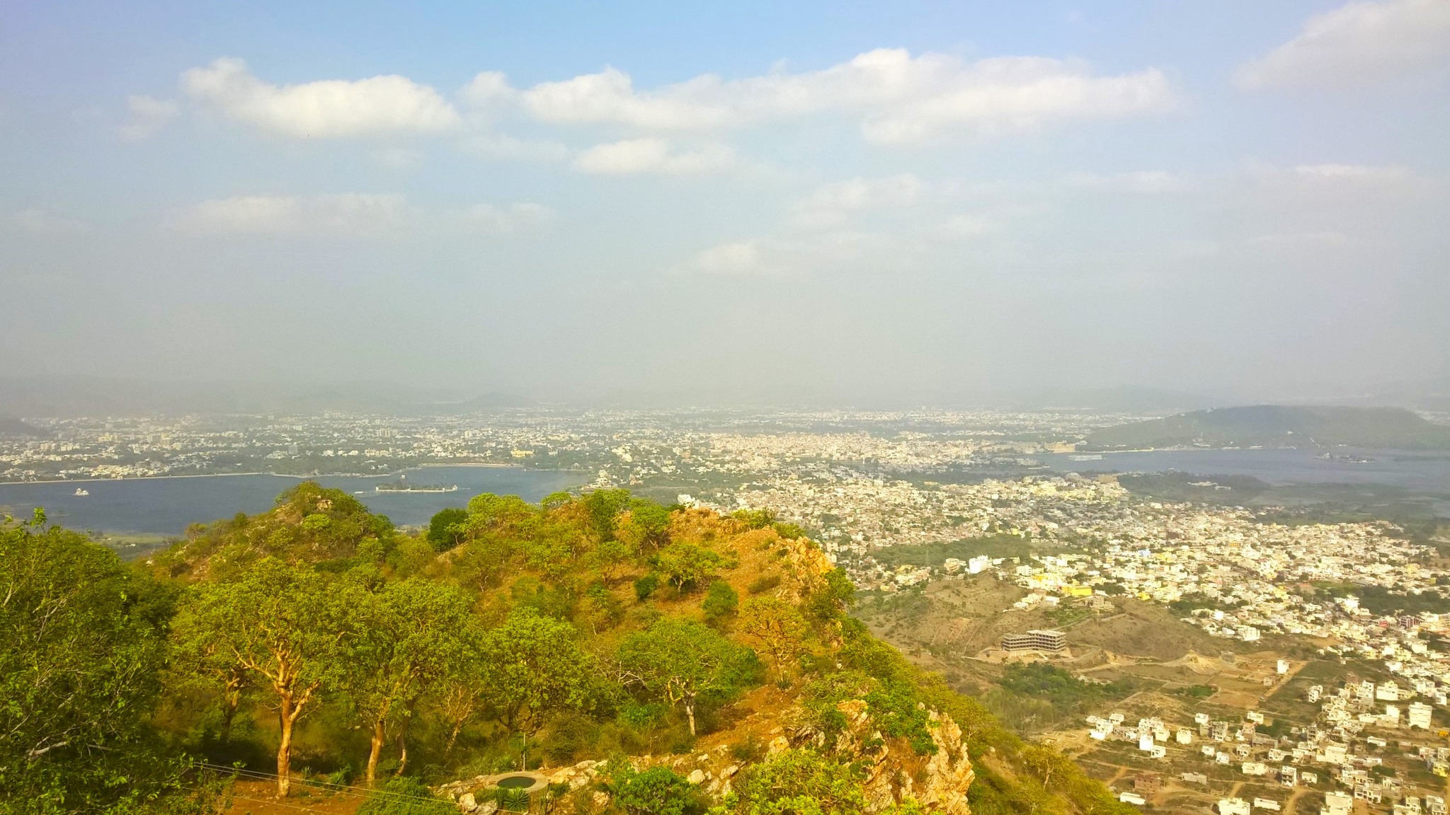
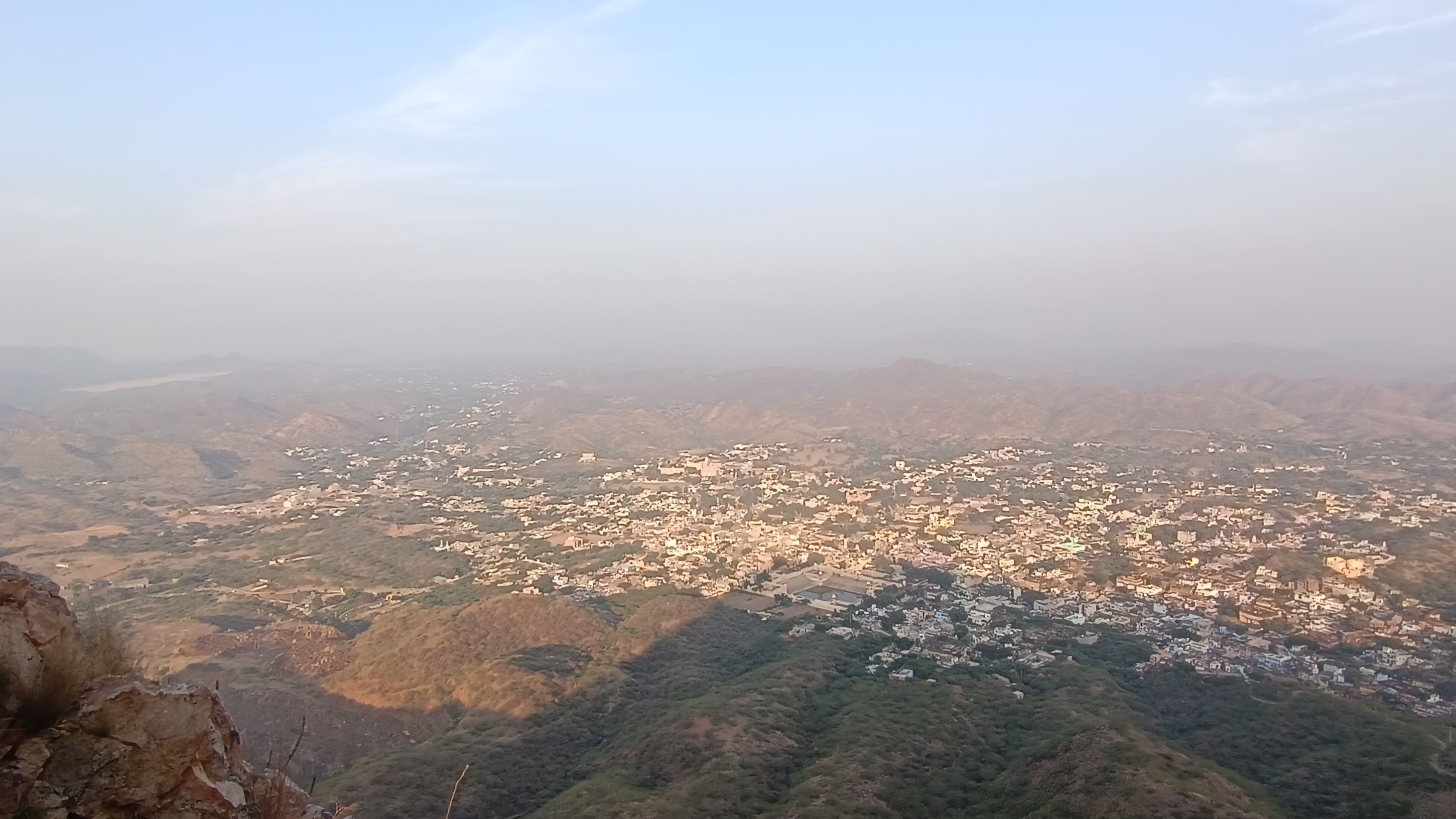
All this while, with my mind constantly racing about whether or not to enter the Moti Mahal, I kept lingering on the outside of the palace. It already being 4.30PM, with the prospect of darkness descending soon, I decided to take the plunge. With my heart in my mouth, wading through the thorny bush and jungle, I somehow managed to gain access into the palace, and was at first greeted by what looked like the king’s throne where he gave audience to the court. Walking through labyrinthine corridors and staircases, I managed to get access to the roof of the palace, from where I was treated to breathtaking views of the Shekhawat countryside chequered with low hills, and arid plains.

Around 5 PM, I descended from the roof of the Moti Mahal, intending to head back, and promptly lost my way through the labyrinthine corridors! After fumbling about in the low light, forced to use my mobile phone as a torch, for about 5 minutes, I was finally relieved to see that the exit had been present right before my very eyes – in my nervousness, I had simply not seen it! Exiting, I walked as fast as I could through the jungle to reach the fort’s entrance where my parents were waiting.

As we drove back through Khetri town, we looked with fondness at the agglomeration of houses straddling the valley in the Aravallis. Here was a town that retained the charm and compactness of a British-era princely state, and yet was no stranger to modern flourishes. It was easy to see why the monk Vivekananda would have appreciated the coziness of this town ensconced in the Aravallis, spending here 3 months at a stretch. Surely we could come back to spend 3 weeks at the least, we concurred amongst ourselves.

Aravalli Archives: Rajsamand, Rayta and Ranakpur

This August, we made a quick getaway to Udaipur, with the intention of exploring the Aravalli hill ranges in and around Udaipur. It was in the vicinity of Udaipur, while returning from Mount Abu, that I had fallen in love with the Aravallis. Though on my last trip to Udaipur – the only one since the Mount Abu trip – we had ventured into the Aravallis on our excursion to Kumbhalgarh, the fact that we had limited time and little influence over the cab driver quashed any hope of indulging my love for the Aravallis and exploring the hill ranges in and around Udaipur.

Nevertheless, now that we drove our own car, we would be constrained only by time, not by ability or ambition. So, starting off around 6.30 AM from Gurugram, taking the Ajmer Expressway, we had bypassed Jaipur by 11 AM, stopping at 12.30PM for a break just on the outskirts of Kishangarh. Resuming the journey, we had to make a choice between going by the Ajmer-Deogarh-Rajsamand route using NH 58 or through Bhilwara using NH 48, the latter being the one with greater average speed. However, my main interest being in driving by the Aravallis, we chose the one through NH 58 after ascertaining from locals about the condition of the road. And were we amply rewarded for the same!

Our brush with the Aravallis started from near Ajmer, and by the time we reached Beawar, where we stopped for lunch, we were already being accompanied by continuous ranges of the Aravallis. As seen from the satellite view of Google Maps, a long chain of the Aravallis begins from below Beawar and stretches in the south-westerly direction all the way to just above Udaipur, where again there is a pass in the hill ranges nestling the historic town of Gogunda. Another chain of Aravallis starts after this pass and stretches some distance into Gujarat, ending with the Polo forest.

So, as indicated by Google Maps, we were soon running alongside the foothills of the Aravallis after crossing Beawar. We slid up and down the undulating road and swerved left and right on the roading curving around the protrusions and along the cavities on the hillside. Patches of green clothed the yellowish-brown hillsides, while patches of green pasture interspersed with small and large ponds and punctuated by the occasional hamlet dotted the slope on the other side of the road. The road cut through the hillside at many places, but seldom bent into hairpin shapes. Crevices snuggling in the hillsides held dainty pools formed of rainwater, bearing blooming lilies and lotuses floating on a carpet of leaves.

Around 5.30 PM, we reached Rajsamand, a city lying 67 km before Udaipur on the foothills of the Aravallis, home to an expansive lake carved out in the hillside and fed by water dammed on the Gomti river. The construction of the Rajsamand lake was started by Maharana Raj Singh in 1662 AD, ending in 1676AD, and is the oldest known famine relief work in Rajasthan. The lake also served as a sea-plane base for Imperial Airways for its route from London to Sydney, and as an auxiliary base for the IAF during the Second World War. A marble pavillion-cum-garden called Nau Chakki adorns a section of the lakeside. Adjacent to it, lies a building called Maharana Raj Singh Panorama depicting a brief history of Rajsamand and glimpses from Raj Singh’s life while also displaying a part of a metallic chain used for anchoring the sea-planes in the lake.

As we approached Udaipur, with the Aravallis reaching majestic heights while wearing cloaks of green with stripes of yellow, the scenery became even more picturesque. Before long we had entered a tunnel near Chirwa, and were promptly stuck in hour-long traffic, finally reaching Udaipur at 8 PM. Following a failed attempt at dining at all of the lakeside restaurants on the Ambrai Ghat, we had dinner at a restaurant in the city, and retired for the night.

The next morning, we drove our way to the outskirts on the south-west direction of Udaipur, crossed a stream and then climbed up a narrow road winding around the hillside to reach a large flat expanse of meadows on the top of a high hill called Rayta. Amidst gusts of a cool breeze and chirps of birds, we were treated to breathtaking views of swathes of green reminiscent of images from Kashmir Valley, with the landscape rendered even punchier due to the monsoons. Leaving Rayta at around 12.30 PM, the descent from the hill was equally eventful as the scary ride up, thanks to the narrowness of the road forcing us to make a couple of crossing of vehicles coming from the opposite side with supreme caution.

Driving on, first by-passing Udaipur and then turning left towards and crossing Gogunda, we took a state highway running into the interiors of the Aravallis, reaching Sayra, where we reached a fork in the road – with the right leading to Kumbhalgarh, and the left leading to Ranakpur. From Sayra, we climbed higher up the Aravallis, subsequently crossing the crest of the hill range, and came upon a descent passing through jungle, given company by and criss-crossed by a couple of rivulets. Then negotiating a 15-minute descent comprising numerous steep curves and hairpin bends, we reached the base of the hill range, where lay a place had been sitting in my wish list since 2013 – Ranakpur.

Ranakpur, located on the side of the Maghai River, is home to the 15th century Chaturmukha Dharana Vihara, or simply called Ranakpur Jain temple, built entirely in marble. Construction of the temple dedicated to Adinatha, the first tirthankara, was commenced in 1446 AD by Dharna Shah, from the Porwal community under the patronage of Rana Kumbha, and ended in 1496 AD, fifty years later. Three other temples dedicated each to Parsvanatha, Neminatha and Mahavira stand in the temple complex, while a 13th century Sun temple sits outside the complex right at a cusp of the river. Sitting majestically in the jungle at the Aravalli foothills, this temple can easily be put alongside the Taj Mahal as a mediaeval wonder of India.

At 4.30 PM, we left Ranakpur to ride back up the series of steep hairpin bends to reach our abode for the night located on top of the hill range – a resort called Aranyawas. The resort comprising cottages built in multiple tiers is located on the side of one of the rivulets that I mentioned above, which in turn is a tributary of the aforementioned Maghai River. A deck at the back-edge of the the resort affords views of the hills across the rivulet and the surrounding forests, along with that of an anicut built on the rivulet. Later, taking a curving bridge we reached the large swimming pool that stood at a higher level as compared to the rest of the resort, providing a great 360-degrees view of the place.

In the morning, we took a tour of the kitchen garden nurtured amidst the jungle inside the premises of the resort. At 10.30 AM, leaving the resort, we again passed through Ranakpur taking highway running through Pali, on the side of the chain of Aravallis opposite the one we had taken on outward journey on the first day. By 2 PM, we were in Beawar again, choosing to have lunch at the same place as on our outward journey. At 4 PM, we reached Kishangarh, where we choose to take a little detour to see the Marble Slurry Dumpyard, which lends itself to a stunning landscape resembling that of a snow yard, with greenish pools of water scattered all over it.

Moving on from Kishangarh, adventure still awaited us, since midway to Gurgaon after crossing Jaipur, we were met with traffic jams brought about my multiple stretches of road construction. At around 10 PM, with a final one hour long jam staring at us right before Bawal, an alternative route popped up on Google Maps diverting from right where we stood. Based on eye contact and a couple of lines of verbal communication with another person driving his family in his car, we took the diversion following one another, venturing into the desolate countryside. Thankfully, after a 15-minute drive through the potholed, sometimes, muddy interior roads, we were back again on the highway, having bypassed the traffic jam! By 11 PM, we were home.

Aravalli Archives: Alwar, Bhangarh and Sariska

For many years I had seen the name ‘Alwar’ – on other buses while I waited for the bus to Jaipur or on road signage on my many forays to Jaipur. I had even passed through Alwar on one occasion on a bus, and had memories of a city glaring under the sun against the backdrop of yellowish, intermittently green hills. Alwar, despite being three hours away from Delhi, gets overshadowed by the names of bigger places, but now in October 2016, since I had ticked the big names off my list, I turned my attention to Alwar. And am I glad that I did!

Part 1: Alwar Calling

My friend and I caught the bus at 8 AM from Dhaula Kuan, from where I had boarded the Rajasthan or Haryana Roadways buses headed to Jaipur on all of my previous Rajasthan solo trips. By noon, we were in Alwar, where we had lunch near the bus-stop, and gathered information about places and access modes in Alwar. The Bala Qila (Alwar fort), perched on the hill overlooking the city and clearly visible from where we stood, beckoned to us – it was a no-brainer as to where we should start our Alwar sight-seeing with.

Hiring an auto-rickshaw, we headed off to Bala Qila, for which we took the fort road that winded around the side of the hill, passing through jungle, accompanied by a sharp drop into the valley on one side. We were pleasantly surprised by the size and condition of the main palace which was largely intact – the palace may not be the size of the palaces in the forts of Jaipur or Jodhpur, but the fort in itself was self-contained and seemed to possess every characteristic typical of a Rajasthani fort.

The origins of the fort date back to 928 AD, when it was built by Parmar Rajputs, however, it was resconstructed in 1521 AD by the Khanzada rulers who had wrested the fort from the Nikumbh Rajputs in 1492 AD. We explored the many floors of the palace and were smitten by the verdant vistas of the Aravallis from the arched windows of the palace. Later we walked on the fort wall towards a watching platform that provided a clear view of the city below.

Descending back to city at the foothills, we checked out the City Palace or Vinay Vilas Mahal, built in 1793 AD, with a part now converted to Museum and the other part housing government offices. The beautiful Moosi Maharani ki Chhatri, a cenotaph for Raja Bakhtawar Singh and his queen Moosi Rani, built in 1815 AD with marble roof and red sandstone pillars, stands adjacent to the City Palace, on the bank of water tank called Sagar Jalashay, which is fed by water flowing down the Aravallis at the foothills of which the tank lies.

Our next stop was the Siliserh lake, an artificial lake built in 1845 by Maharaja Vinay, nestled in the Aravallis, a little outside the city, providing a picturesque view of the rounded tops of the Arvallis kissing the sky. Enjoying the gentle breeze along with the views, we took a boat ride exploring the length and breadth of the lake. Thereon, we headed to the Jaisamand Lake, another artificial lake not very far from the Siliserh Lake but a little closer to the city, notable for a series of chhatris (cenotaphs).

Part 2: An Unplanned Extension

Our plan for the second day was to take a morning safari of the Sariska National Park that lies about 33 km from where we stayed. Waking up quite early in the morning, and starting around 5.30 AM, we walked about a kilometre to the main road leading to Sariska, hoping to get some sort of conveyance to Sariska. After about fifteen minutes of waiting, as the chances began to seem slim of us making it to Sariska in time for the safari, an autorickshaw driven by a Sardarji (a turbaned sikh man) drew alongside us . We negotiated a price for the half-day trip to Sariska and were soon headed to Sariska with renewed hope for the safari.

Passing through the road sliding up and down, curving ever so slightly to the right and the left, along the foothills the Aravallis, with the cool breeze hitting our faces, we soon encountered a narrow valley in the Aravallis which we crossed alongside a narrow river. In this stretch lies a place called Natni ka Bara, where a bridge stands connecting the main road to a white-coloured temple with a narrow tall spire on the other side of the river. In the early morning mist, the sight of the bridge and the temple standing in the middle of the valley was etched in my mind.

By 6.50 AM we were at the Safari Booking Office at entry gate of the Sariska National Park, where we were promptly denied entry because entry for the morning safari had already closed. We should have been there before 6.30 AM, they said, not relenting despite multiple requests, suggesting that we come back by or wait till 2.30 PM for the afternoon safari. As we were staring at a long wait, a safari guide who was hanging around suggested we do some more sightseeing instead of waiting, Bhangarh fort being his topmost recommendation.

Now, I had already been to Bhangarh fort – touted as a haunted place – and retained very fond memories of the same, but my friend had not, and I would not mind visiting Bhangarh again just to relive the aura of eeriness I had felt on my earlier visit. We calculated that we should be back to the park gate well in time for the afternoon safari, as we had five hours in hand. However, our autorickshaw driver did not seem keen at all, because it would be a 100 km round trip for him. Nevertheless, the safari guide, on account of being a local convinced him to take the ride, sweetening the deal with extra money, of course.

By 7.30 AM, we were on our way to Bhangarh, in an autorickshaw, of all things! From there on, we never lost sight of the Aravallis, which alternated between running alongside us and sliding away only to return. We hoped to reach by 9 AM, if not for the second half of the route where the road was under construction sending billows of dust in all directions including inside the auto-rickshaw as the vehicle plodded through. Soon we passed through Ajabgarh, where abandoned houses flank the road at one end of the village. Just outside the village, a compact fort sits atop a hillock against the backdrop of taller hills, while the road winds around a lake, called Jai Sagar, filled with a cover of lotus and lilies. At long last, by 9.45 AM, we were in Bhangarh.

Part 3: All is Well That…

At Bhangarh, we began by exploring the ruined marketplace and residential area near the main entrance. Then walking further flanked by a series of ruined shops on both sides, through the stretch called the Jauhari Bazaar, and crossing a stream, we entered the fort enclosure where sprawling lawns, numerous temples and the main palace welcomed us. Walking through main palace gate, we approached the first layer of buildings having two wings in the form of long pillared hallways on either side of the passage. Both wings had indications of occult practices being conducted, further bolstering the sense of haunting around the place.

After enjoying the views of the Alwar district countryside accentuated by the Aravallis standing like long flattop platforms from the top of the existing structure of Bhangarh, we walked back to the parking lot, where the auto-rickshaw driver was waiting. After another two hours of riding through the dust clouds over the under-repair road, we were back at the Sariska National Park gate by 1.15 PM, where we were faced by the next challenge – finding 4 more co-passengers for the jeep safari, else we would be paying the fees for 6 passengers for the jeep. Luckily, we ran into a family of 3, consisting of another (!) Sardarji and his wife and kid – who readily agreed to share the ride with us.

After a quick, light lunch at the canteen near the safari booking counter, we set out on the jeep safari on a trail that took us deep into the Sariska forest. We sighted sambhar, deer, peacocks and countless birds, complemented by thrilling sights of watering holes, and streams cutting through the jungle. Though we did not see a tiger, I would still count this as a very memorable safari in terms of the density of wildlife seen.

By 5 PM, we were back on our way to Alwar, with a thick layer of dust having settled on our bodies. When the sardarji finally dropped us off at the place where he had picked-up, he wore a long face, as he grappled with the sight of the coating of dust shrouding his auto-rickshaw – surely, he regretted having picked us up in the morning, and more so, for having agreed to the impromptu extension of the ride to Bhangarh. As if on cue, I handed him a couple hundred more rupees, hopping to alleviate his dejection.

Now, as we wandered around looking for conveyance to the bus station, we were approached by a couple who looked like students on separate two-wheelers. Lo and behold, it was another Sardarji (!), who along with his apparent girlfriend, offered us both a ride on their motorcycle and scooter respectively. By 8 PM, as we boarded the bus headed back to Delhi, it struck us that we had encountered the grace of good Samaritan Sardarjis every time we faced a difficult situation the whole day!

Post-script: My first trip to Bhangarh, September 2014

My first trip to Bhangarh happened by virtue of a day-long trip with a travel group called ROOTS. We had started around 6 AM from Delhi, passed through Sohna and then Alwar, and reached Bhangarh by 1 PM – a journey of almost 7 hours, a testament to the condition of roads that prevailed two years ago.

In any case, I had been awestruck by the atmosphere and ambience of the place, with the setting of the lawns and the fort etched at some height in the hillside seeming like a leaf out of a fairytale. When the tour of fort had ended, I found myself yearning more.

Leaving Bhangarh, we had then stopped by Ajabgarh, where we were intrigued by the sight of the abandoned houses lining up both the sides of the road for quite a stretch as we entered Ajabgarh village. Later, we had hiked up the hill to explore the compact fort even as darkness was falling. The hilltop also afforded a view of the expansive lake, called Jai Sagar, abounding in lotus and lilies, below by the roadside.

By then, it had already been 6.30 PM, with the twilight looming over the village, imparting it with an even eerier character. In the darkness, we had passed through the Aravallis with the moon smiling from behind the clouds, and the silhouettes of the hills accompanying us till we had crossed Sariska.

By 1 AM, we were back in Delhi, the journey turning out to be way longer than originally scheduled, but at the same time ending up being more memorable than I had ever expected.

Aravalli Archives: A Birthday in Mount Abu

Having done one solo trip every year for the last four years now, and with almost half the year already passed, I decided to schedule this year’s solo trip on my birthday in early July, and booked a train ticket two weeks in advance to Abu Road by Rajdhani Express, to see Mount Abu, a place lying on my wish list for a long time. In the week leading to my birthday which was on the coming Saturday, my friend from college who lived near Rewari, called me up asking about my birthday plans, and I invited him to join me. So, booking a waitlisted ticket on the same train, he boarded the train at Gurgaon railway station, from where we shared a single berth till our destination.

Getting down at Abu Road around 5.30 AM, we caught a public transport bus for Mount Abu. As we ascended through the hill road, we were immediately swimming in a cover of green, with an abundance of date palm trees dotting the roadside. As we gained height, I saw, through my sleepy eyes, that we were submerged in the infinite clouds of mist or actual rain clouds, which was it I am not sure. As we approached Mount Abu town, trying very hard to keep awake, I was taken in by the sight of ponds surrounded by denser forest. The many times I forced myself out of my sleep to see the scenery outside, I was reminded of my the scenery on the way to Ooty and Kodaikanal on my college trips.

At Mount Abu town, after quickly checking in to a hotel room, we set out for a South Indian breakfast at the city centre. Then, renting a scooter, we set out on the tour, the planning for which my friend entirely left to me on account of it being my birthday. So, we started off with the famous Dilwara Jain temples, the temple that had been synonymous with Mount Abu for me since I was in school, where I had read about the temples in textbooks. The Dilwara Temple complex comprise five primary temples made purely from marble, with two dedicated to Adinatha, the first tirthankara, and the other 3 dedicated to Neminatha, Parshvanath and Mahavira, were built in between 1026 AD and 1582 AD, and serve as an important pilgrimage for Svetambara Jains.

Next, ascending further up the hill road, negotiating mumerous hairpin bends, passing by ponds and patches of forests, we reached Achalgarh. At Achalgarh, climbing up a stony road by foot, we reached the marbe-built Shri Vishnu Jain temple, which also provided breathtaking views of the Aravallis. From there, we rode further up to Guru Shikhar, where we climbed the long flight of stairs to reach the highest point of the Aravallis at 1722 metres. Nearby is the Mount Abu Infrared Observatory (MIRO), which is visible from Guru Sikhar and nearabout, along with green cover on all the nearby peaks and troughs of the Aravallis.

Turning back towards Abu, we stopped whenever some view or location caught the eye, the first such stop being at Lover’s Point, from where we got a picturesque view of the Aravallis nestling the Javai Lake. Then descending a little below after manoeuvering a few curves, we reached Javai Lake itself. Rolling further down, we came upon a water-filled fissure on our right side, where getting down, I sat on the rock for a while experiencing an extraordinary state of calm. A little further, we took a short detour to reach the Mini Nakki Lake.

The stop that we made next was at the remarkable Trevor’s Tank, an artificial waterhole, tucked away in the Mount Abu Wildlife Sanctuary, which we reached after taking a kilometre-long diversion. Carved on the side of a barren rocky hill to breed crocodiles by a British engineer after whom it is named, the tank is surrounded by native flora including an abundance of cacti and ferns. The location of the tank could serve both as a picnic spot with family as well as a retreat for some solo contemplation. A trek up the hillock also provides a wider view of the picturesque tank. While this place may not be on most sight-seeing itineraries of Mount Abu, I highly recommend a detour to Trevor’s Tank.

As we neared Abu town, I made a quick but steep and long climb up 360 steps to see the temple of Arbuda Devi, a form of Durga, after whom Abu town is named. It being 6.30 PM, by the time I descended from the temple, we rushed to the Nakki Lake, located at the heart of Abu town. Swami Vivekananda lived for a while in Champaa Caves on its bank, and Mahatma Gandhi’s ashes were also immersed in its waters. On the hillside, which gives excellent views of the town as well as of the Aravallis, there is also natural rock formation resembling a toad, aptly named Toad Point – interestingly, the same rock looks like a tortoise when viewed from another angle from afar. After watching the sunset from the banks of Nakki Lake, I retired to the hotel, where my friend who had skipped the trek up the Nakki Lake hillside, joined me.

With our whirlwind Abu tour coming to an end, we pondered about how we would get back to Delhi, as I had not booked a return ticket, and had reckoned I would be easily able to get a bus back to Delhi from Udaipur, which was the nearest city to Mount Abu. As it turned out, there were only a couple of buses plying from Mount Abu to Udaipur, the earliest being at 8.30 AM. Thus, the next morning we were headed to Udaipur, again passing through the mist, delighted by views of the hillside shrouded by clouds at eye-level. Sights of streams and ponds ensconced in thick vegetation or surrounded by palm trees, were the icing on the cake.

Reaching the base of the Abu hill range, the bus still passed through the lower ranges of the Aravallis, especially as we approached Gogunda, where the sight of the yellowish sides of the hill which had been cut through to make way for the roads, triggered some sort of a reaction in my brain. That is the exact moment I knew I would want to have more of the Aravallis – these sights combined with the images of the flora I had seen back on Mount Abu, and the previous year in Jodhpur, supplemented by memories of the hill passes at Haldighati, struck a chord somewhere in my heart. What was more, the Aravallis propped up the fantastic forts that I had taken a penchant for over my journeys to Rajasthan over the last four years.

****************

So, for the third year straight, I found myself in Udaipur. I drew up a quick itinerary for us as it was my friend’s first visit to Udaipur. Starting off with a tour of the City Palace, we headed to Sajjangarh Palace, a monsoon palace whose construction was started by Maharana Sajjan Singh in 1884, atop a hill overlooking the Pichola lake. The marble palace is an ideal getaway from the humdrum of the city below, and also affords panoramic views of the city and its lakes, along with picturesque views of the Aravalli hill range behind it. We wrapped up our half-day sojourn at Udaipur with a boat-ride on the Fateh Sagar Lake.

Following dinner, we took an overnight sleeper bus for Delhi, concluding a most memorable birthday weekend. I also found a new love – the Aravallis.