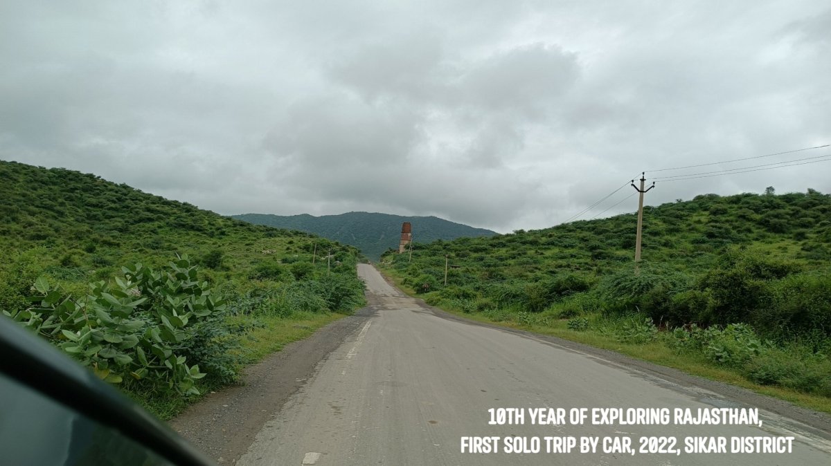
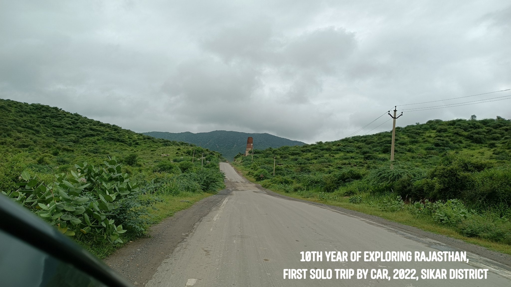
In April 2012, my first ever trip to Rajasthan was solo – by public transport, with the destination being Jaipur. In August 2022, I rounded off a decade of exploring Rajasthan by reprising the solo trip to Jaipur – only this time it was by driving on my own. A 700km self-driven solo adventure!
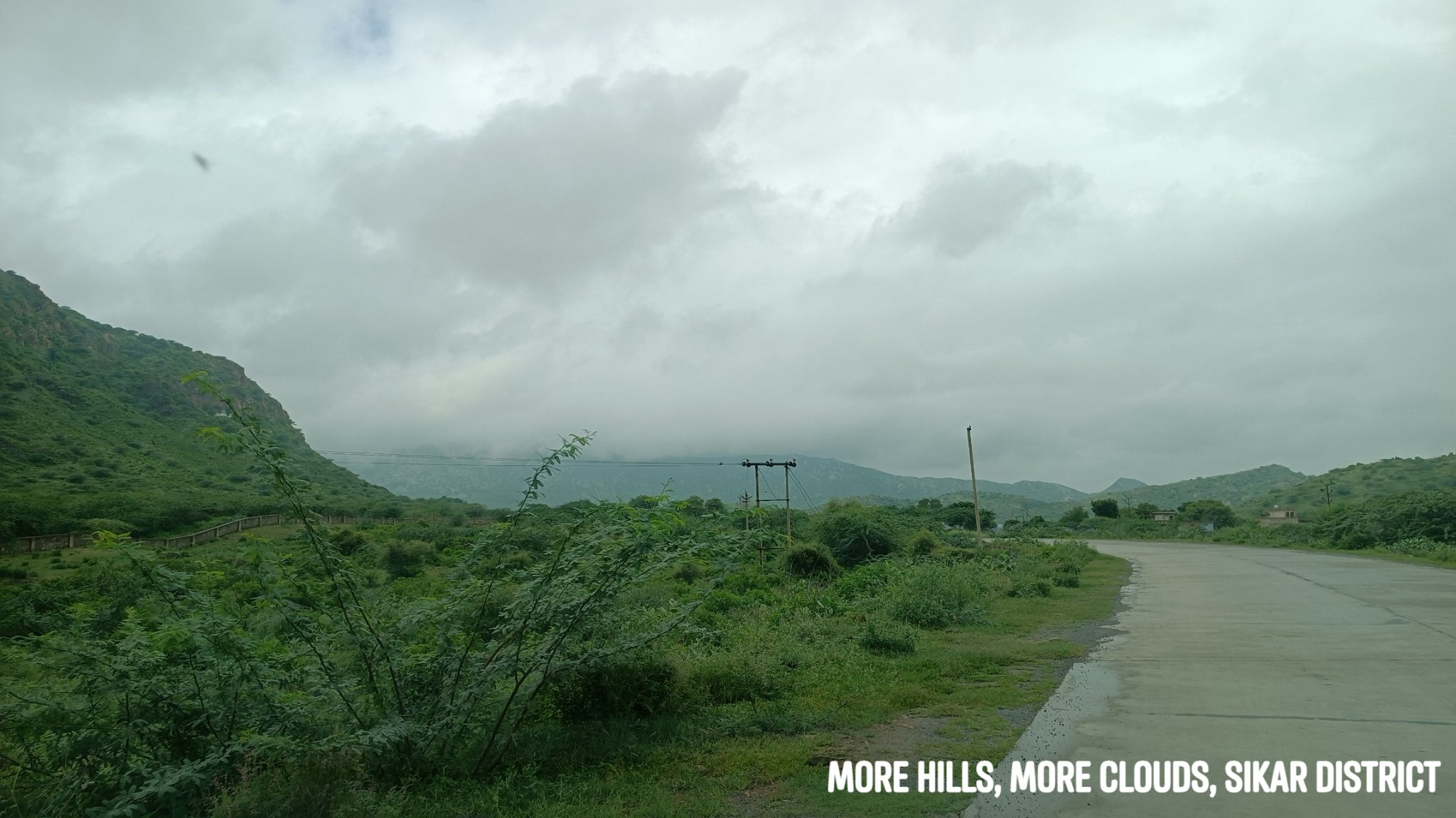
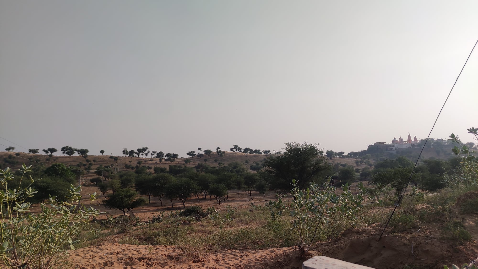
As always, it is rarely about the destination – and so off I went wandering through roads I had not trodden before, exploring a bit of the Aravallis in the Shekhawati region, while the sun and rain played hide and seek, and folds of hills lay in the distance in front and around me, their peaks crowned with fluffs of cloud.
I plead guilty to the charge of scooting off to Rajasthan every chance I get, even at the risk of inviting ridicule. ‘Why don’t you try out some other place this time – why not Himachal, Uttarakhand, UP?’, I have been asked. I say, some people love the mountains, some the beaches – as for me, I yearn most for the desert, the Aravallis, the forts…
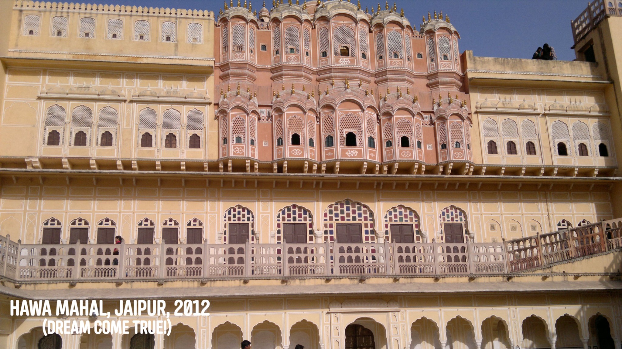
Growing up in Odisha, I had had a fascination with Rajasthan long since I could remember. In Grade 4 – the black-&-white picture of the Hawa Mahal in a textbook, and the mention of the Thar around Bikaner and Jaisalmer, images of the Vijay Stambh at Chittorgarh and the Dilwara temples at Mount Abu were imprinted in my head. A General Knowledge book addressed Jaipur as the Pink City, and Jodhpur as the Blue City. I always wondered looking at those black-and-white pictures how the cities might look like in real life in their famed hues.
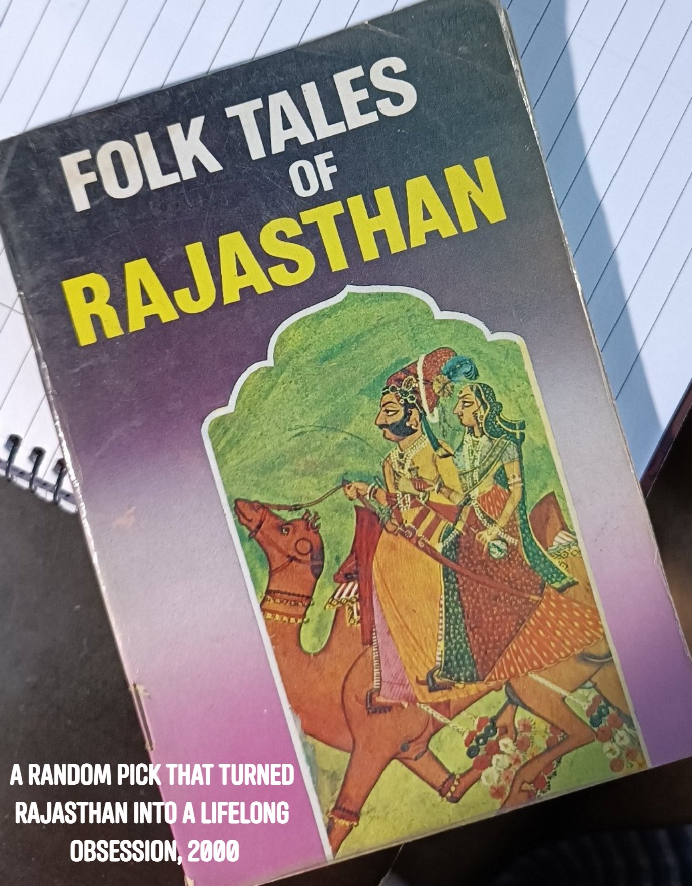
Some years later as we were embarking on a train journey, Dad let me pick up a thin paperback from the book stall on the railway station- it was called ‘Folk Tales of Rajasthan’. While on that train, in my mind, Rajasthan turned into a place of magic, of kings, bards & princesses, of Pabuji, star-crossed lovers & clever thieves, of camels & shifting sands…I was enamoured.
Rajasthan was always just too far away though, and little did I know I would later land up at the gateway to it – Delhi. Little did I know as time progressed, I would reside at a place, on the outskirts of Gurgaon, where I could simply lug a backpack on my back and in half an hour, be inside Rajasthan. Little did I know I would once also drive solo to Rajasthan…
***
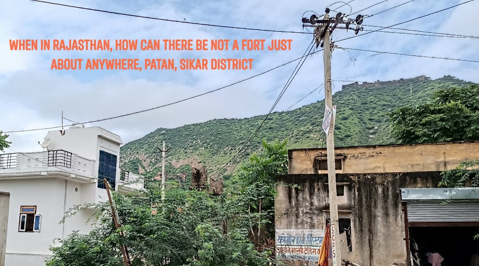
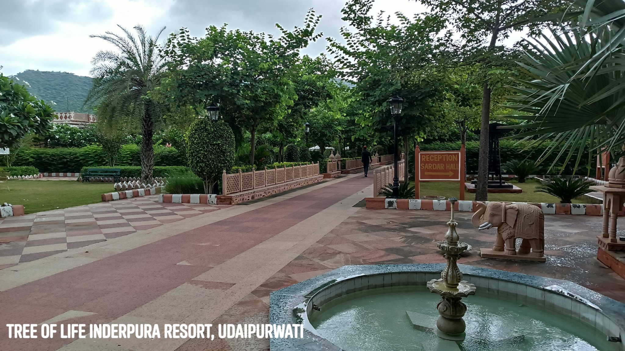
On this trip, instead of driving directly to Jaipur from Gurgaon, I took a detour midway, towards the north and drove through some of the most exotic sounding places – Kotputli, Neem ka Thana, Udaipurwati.
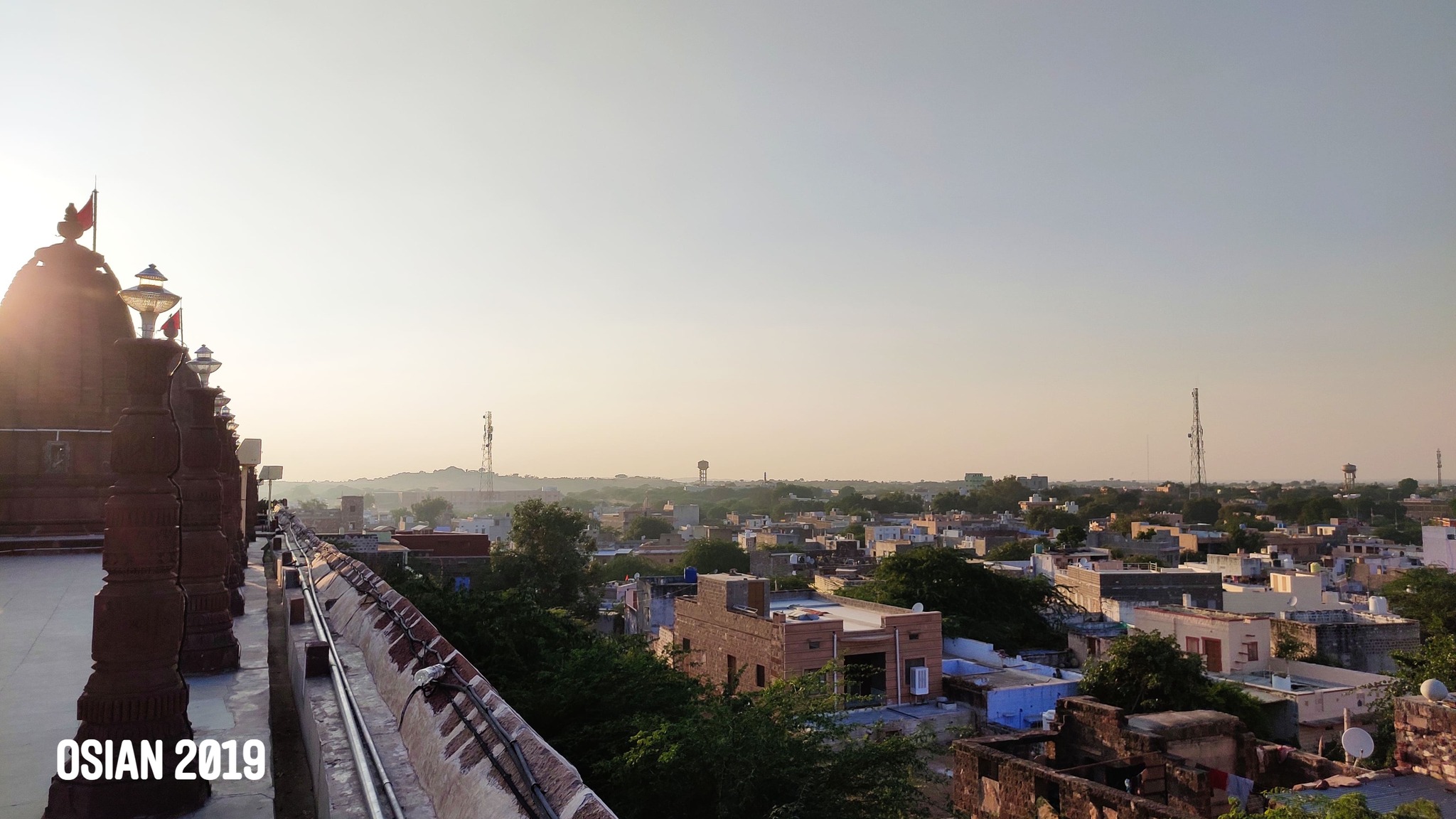
Udaipurwati
A quaint little town nestled within a gap in the Aravallis, is home to an excellent resort called The Tree of Life Inderpura.
Lohargal
Near Udaipurwati, within a crevice in the hills is a holy spot with a natural spring feeding a bathing tank and ancient Sun Temple. According to myth, weapons and armour of a Pandava army that camped here after their victory, dissolved in the water, giving the place its name: Loha (Iron)+Gal (To melt).
From thereon in Jaipur, I visited a couple of places that I had not seen before, both nestled in the Aravallis.
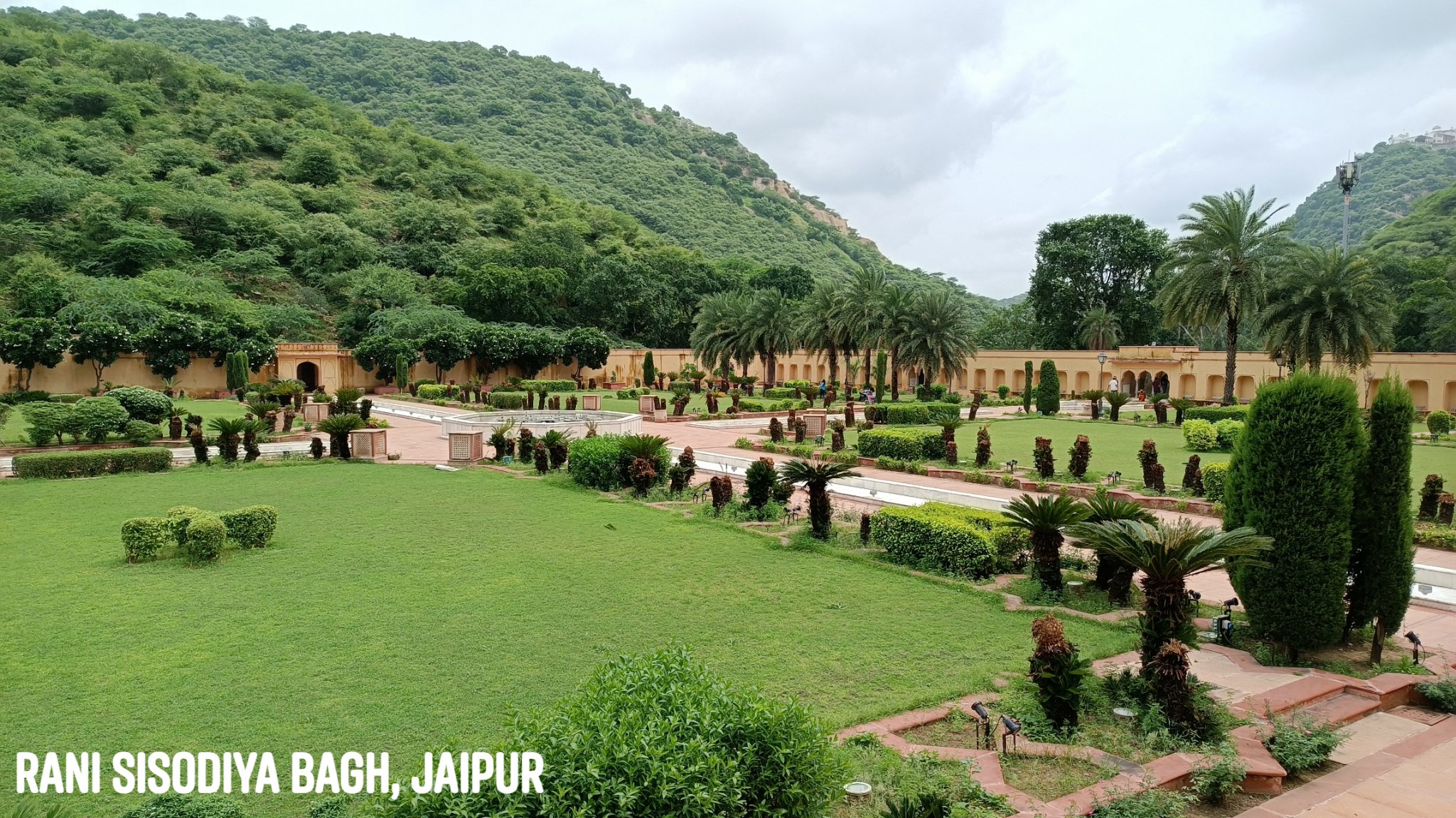
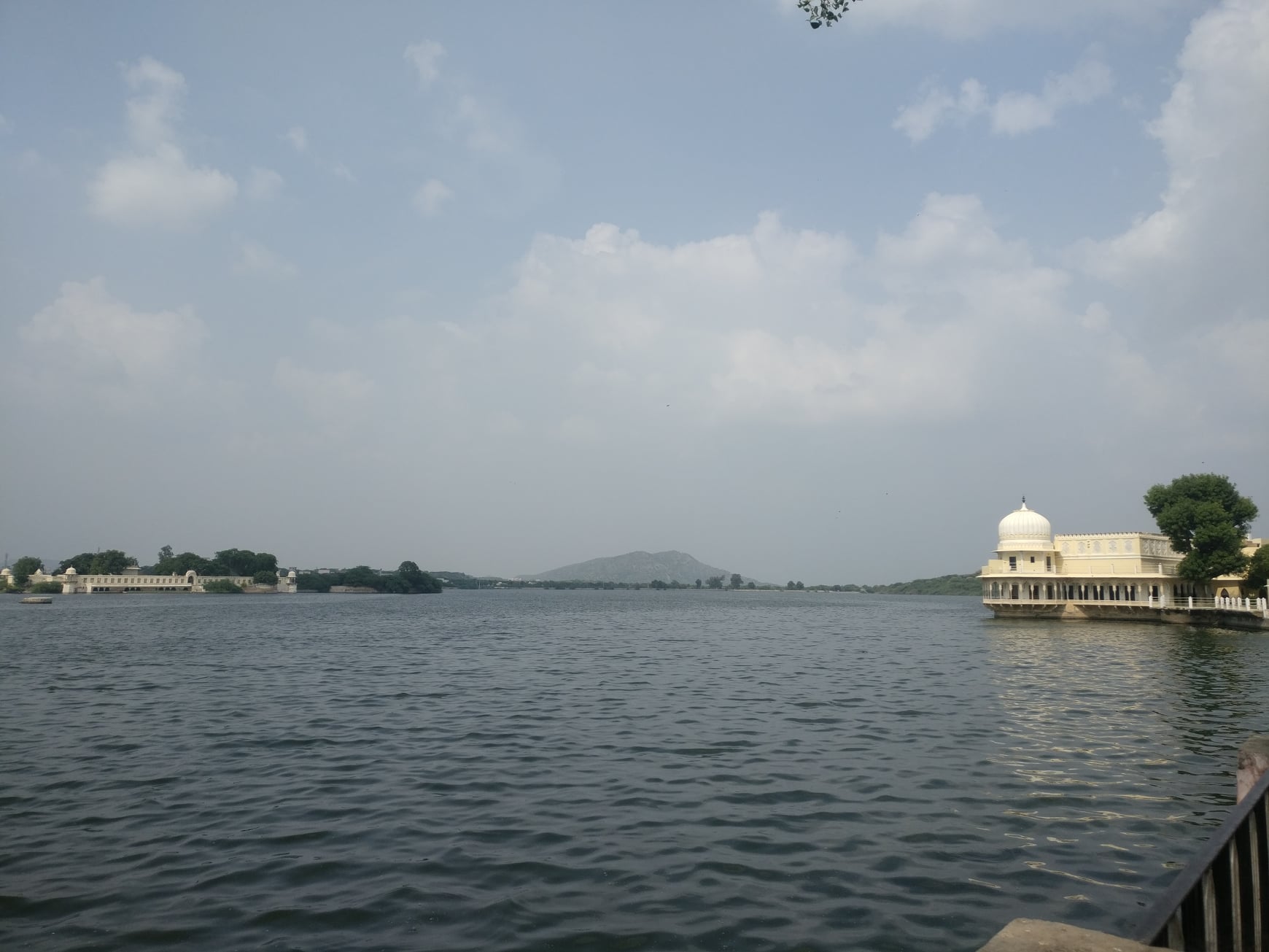
Rani Sisodiya Bagh
A hidden gem of a garden built by Sawai Jai Singh II for a princess of Udaipur, who agreed to marry him only on the condition that she be made the main queen of Jaipur.
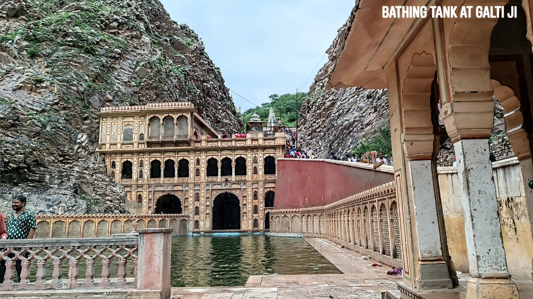
Galta Ji
Home to a bathing tank fed by a perennial spring and a temple dedicated to a hermit named Galta ji, along with temples dedicated to Krishna and Ram. At the peak of the hill is a 350 year old Sun temple, reached after a hike of about 1.5km. The first rays of the Sun reaching Jaipur apparently fall on the idol in the temple. Views from the hill are outstanding.
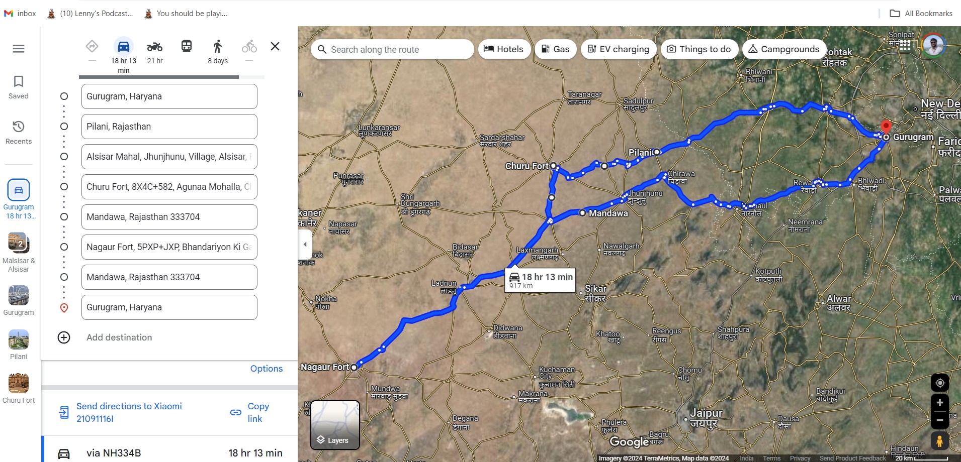
Trip Summary Day 1: Gurgaon to Udaipurwati via Neem-ka-Thana & Patan -250 km, 6 hours Udaipurwati to Lohargal – 15km, 30 min Lohargal to Jaipur via Udaipurwati & Reengus – 160km, 3 hours
Day 2: Jaipur sightseeing of Rani Sisodiya Bagh and Galtaji – 25km, 2 hours Jaipur to Gurgaon – 230km, 4 hours
My little brother paid the motherland a visit after 2 years, and before the Indian summer set in with its full glory, the family decided to make it the first ever self-driven road trip for the family. So, off we set in late March, on a 6-day road trip with an itinerary so fluid that we only knew the first 3 places we planned to visit. Deciding to let the vagaries of chance sprinkle our journey with generous doses of surprise, we did not also book a hotel prior.
And boy, was it rewarding! With a mix of the famous and the little known (or even barely-frequented), this time we forayed through the desert to brush with history stretching back to 5000 years ago, in search of a lost river and a lost civilization, chanced upon desert lakes and desert wildlife, hobnobbed with human-like rats, and delved deep into a jungle on a temple chase while the sun was going down.
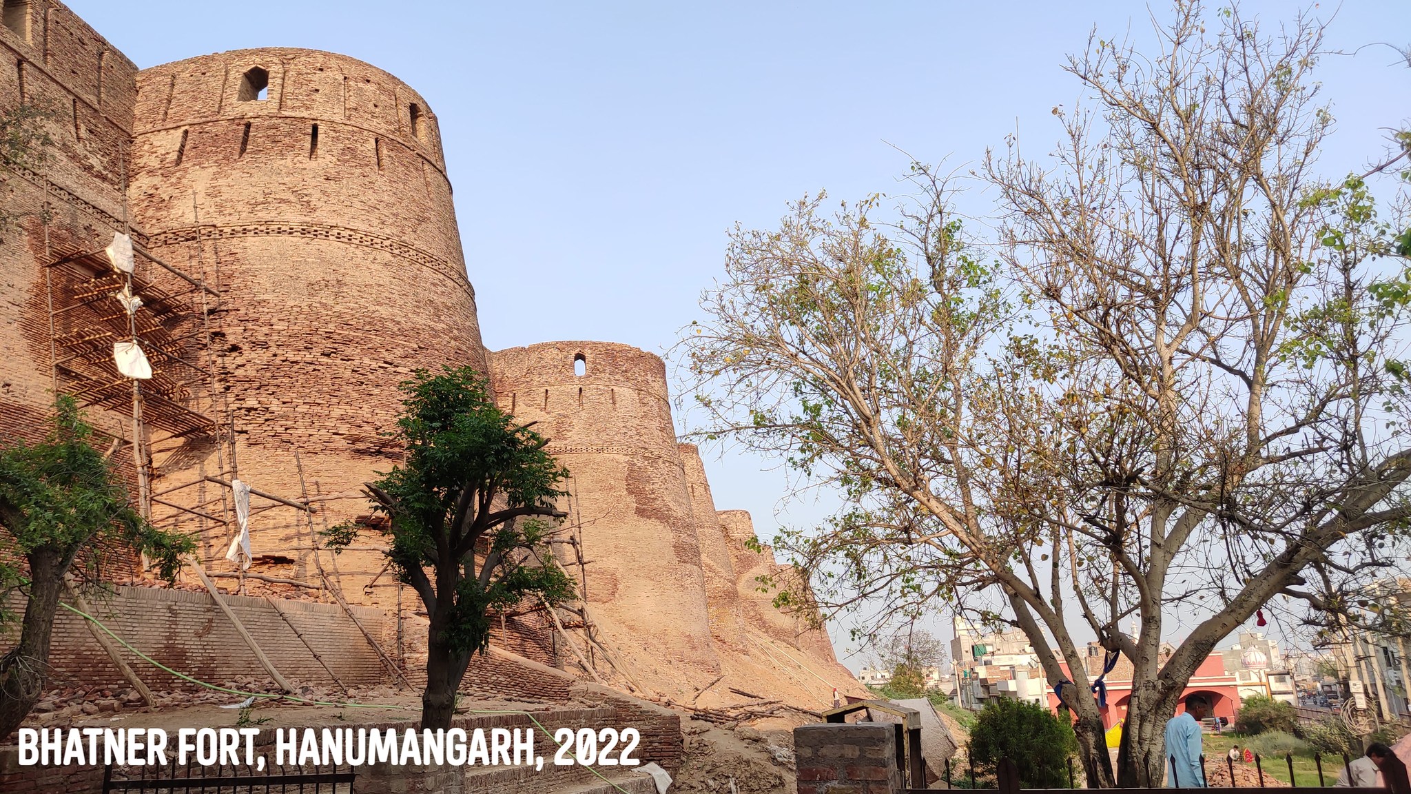
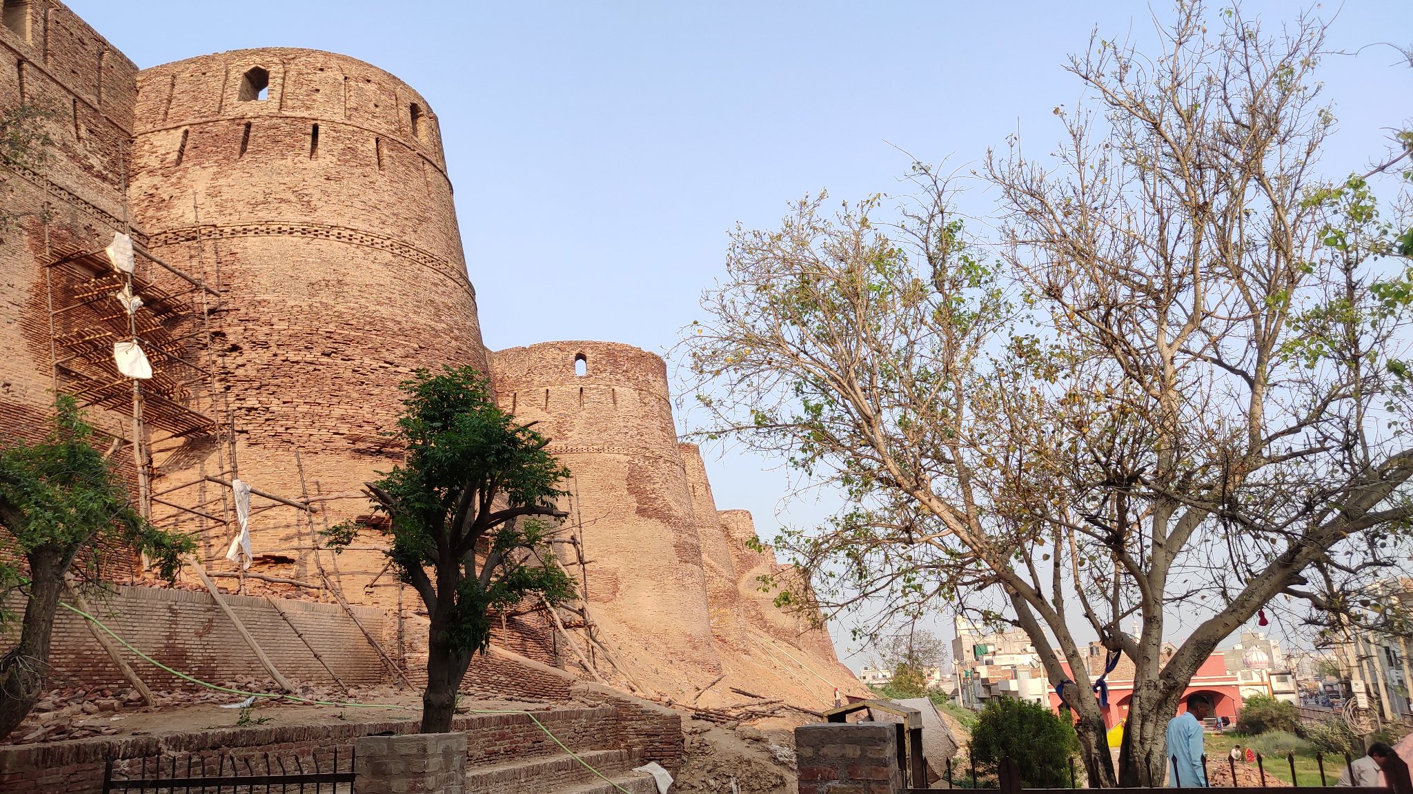
Hanumangarh
Our search of the mythical River Saraswati led us to the desert town of Hanumangarh, where we came upon the Bhatner fort, which dates its origin to the 2nd century AD. The old structures are now buried in mud, and the fort is being renovated.
Walls of Bhatner fortMounds over structures, Bhatner fort
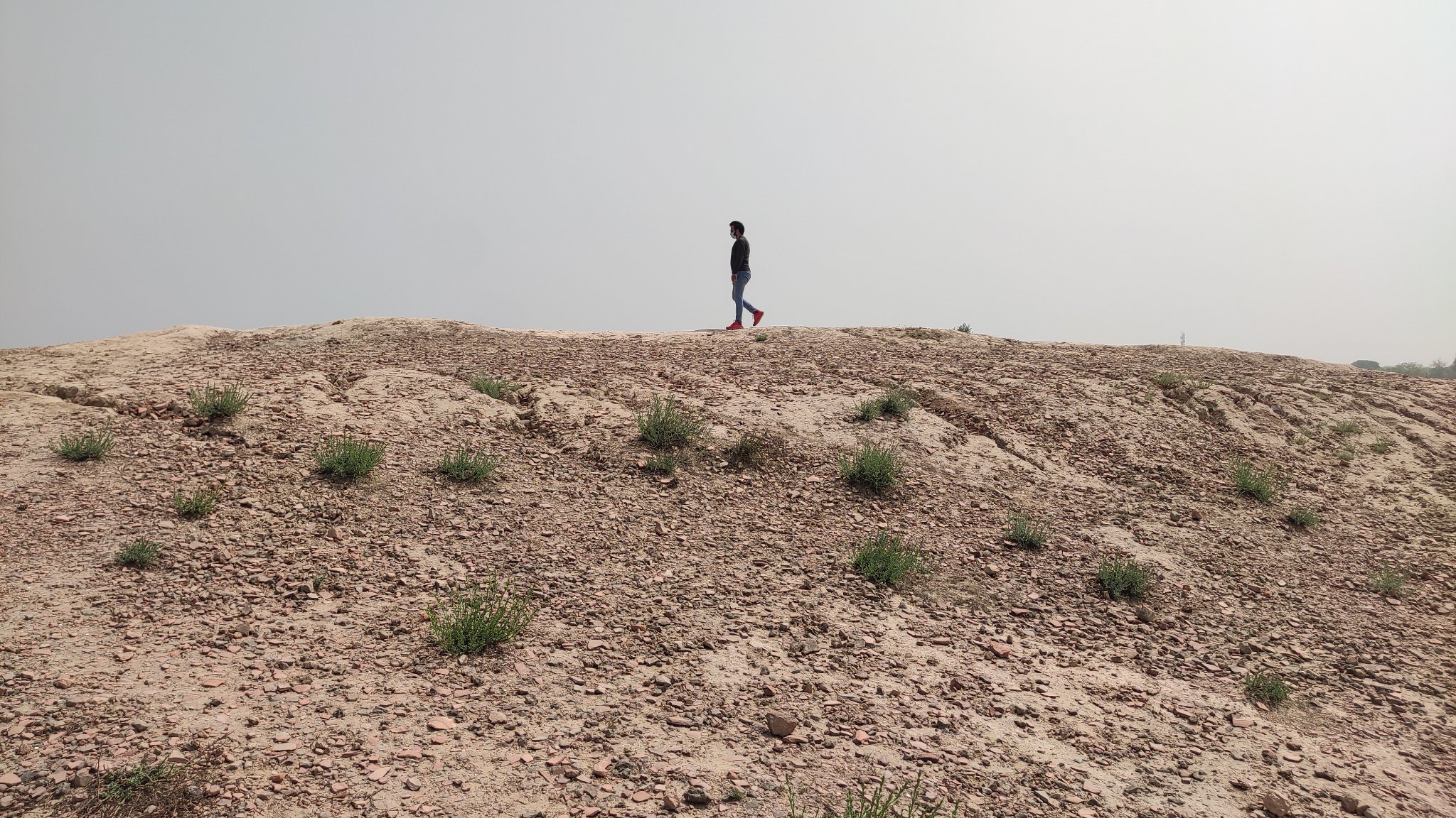
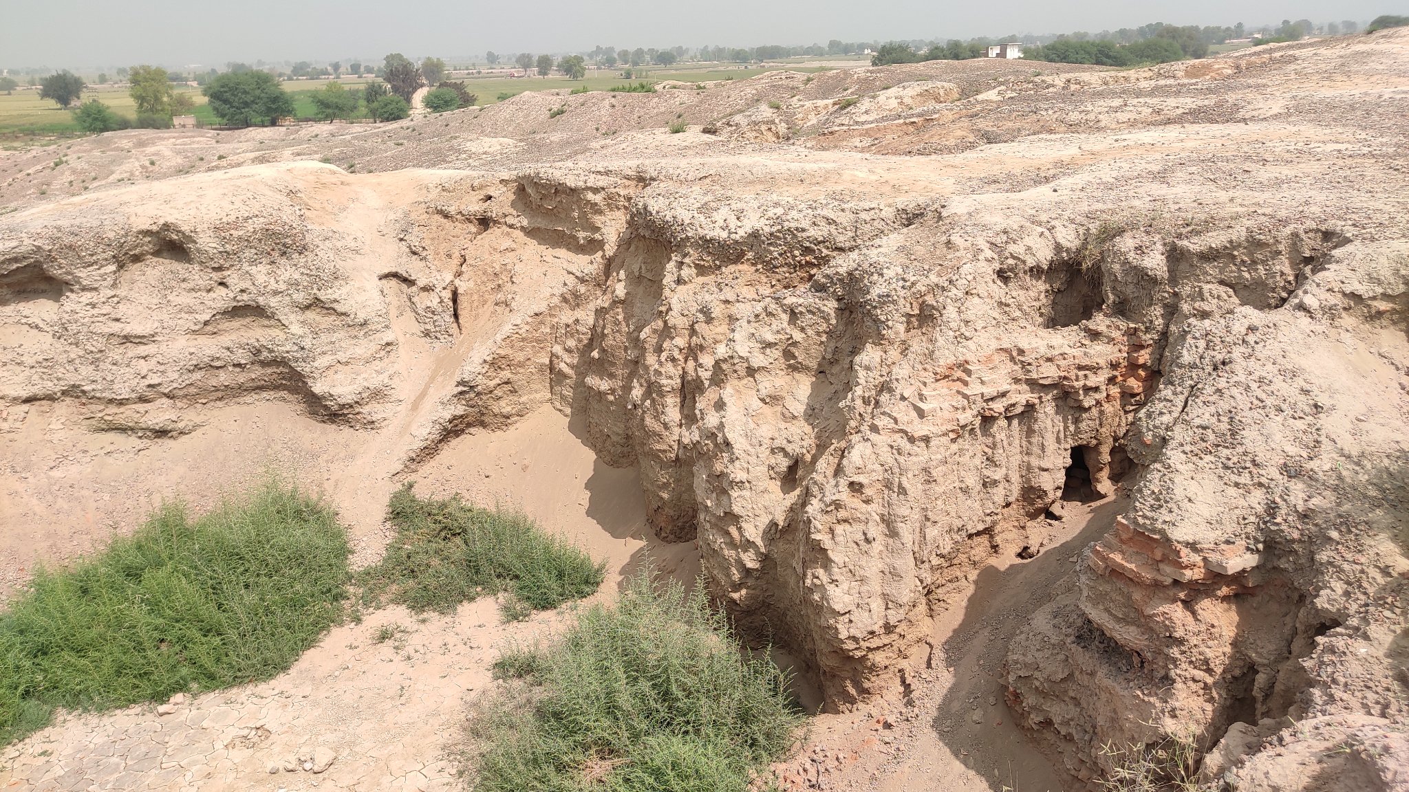
Kalibangan
One of the earliest discovered and excavated Harappan sites, Kalibangan gave us a sneak peek into 5 millennia earlier. Sadly, the ruins are buried in mud, even the excavations have been covered up by the Archaeology Survey of India (ASI) to prevent further deterioration.
Walking on 5000 years of history, a civilization now lies buried under mounds
Harappan structures lay below the mudArtifacts from the past
A Harappan
In the vicinity, we finally met the Ghaggar River, which is purported to be the Vedic Saraswati River – nothing more than a dried-up intermittent, almost obscure rivulet right now.
The dried bed of the Ghaggar river – purported to be the mythical Saraswati river
Badopal Lake
We took a slight detour through the desert hinterland to take a peek at the Badopal lake, a salt lake located beside the Badopal, an ancient mound, and part of the Rang Mahal culture.
Badopal Lake
Suratgarh
Another desert town midway between Hanumangarh and Bikaner, noted for its Thermal Power station and the air force base.
Dam on the outskirts of Suratgarh approaching from Badopal
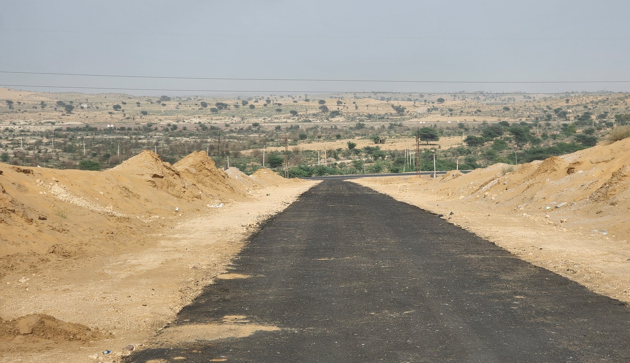
Dunes outside Suratgarh enroute Bikaner
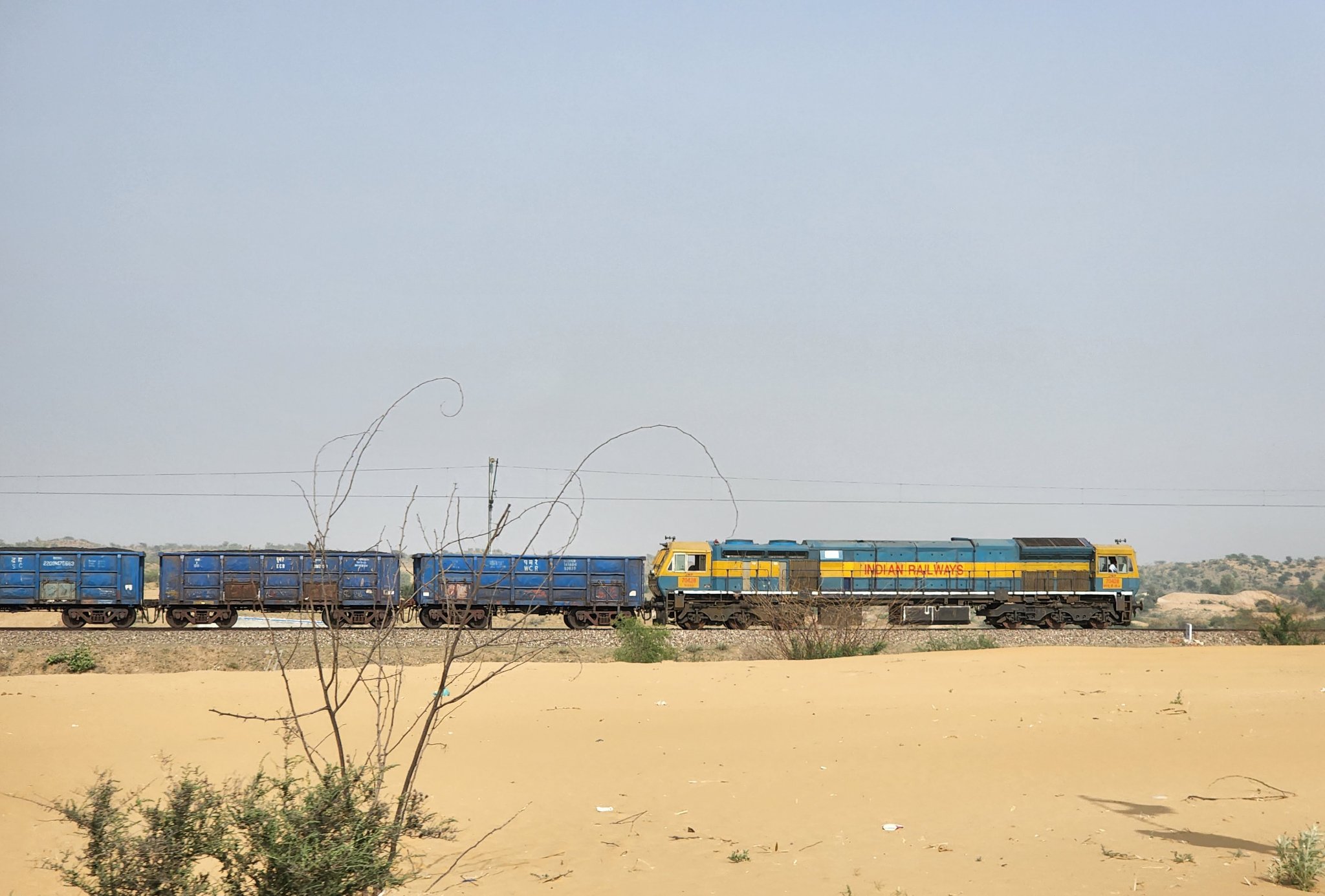
Keeping pace with a train, SuratgarhA view of the landscape, Suratgarh
Lunkaransar
A fairly expansive salt-lake that is home to migratory birds, midway between Suratgarh and Bikaner
Salt lake at Lunkaransar
Bikaner
One of the major cities of Rajasthan, founded by Rao Bika, famous for Junagadh Fort and savory sweets and snacks
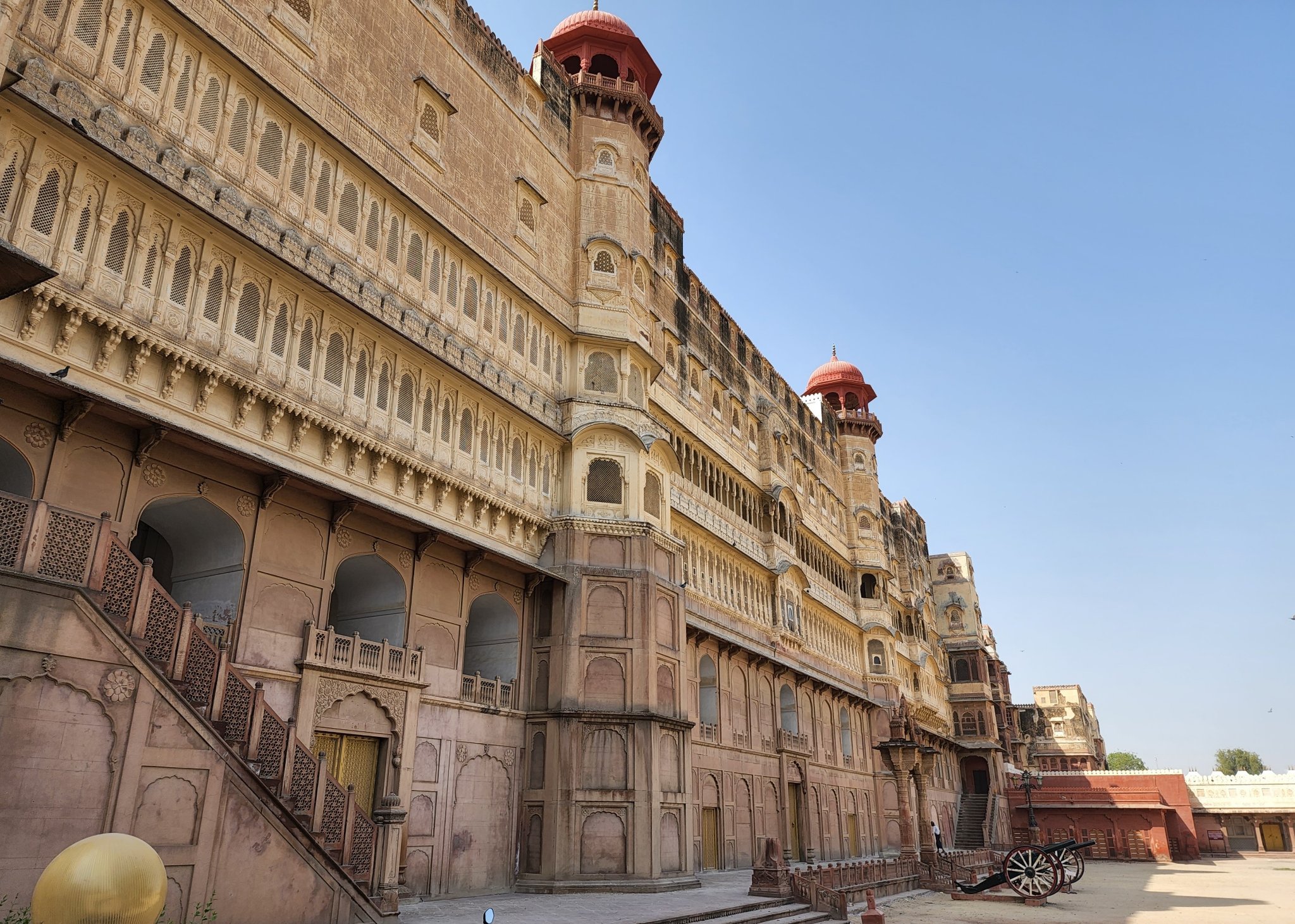
Bikaner fort
Deshnoke
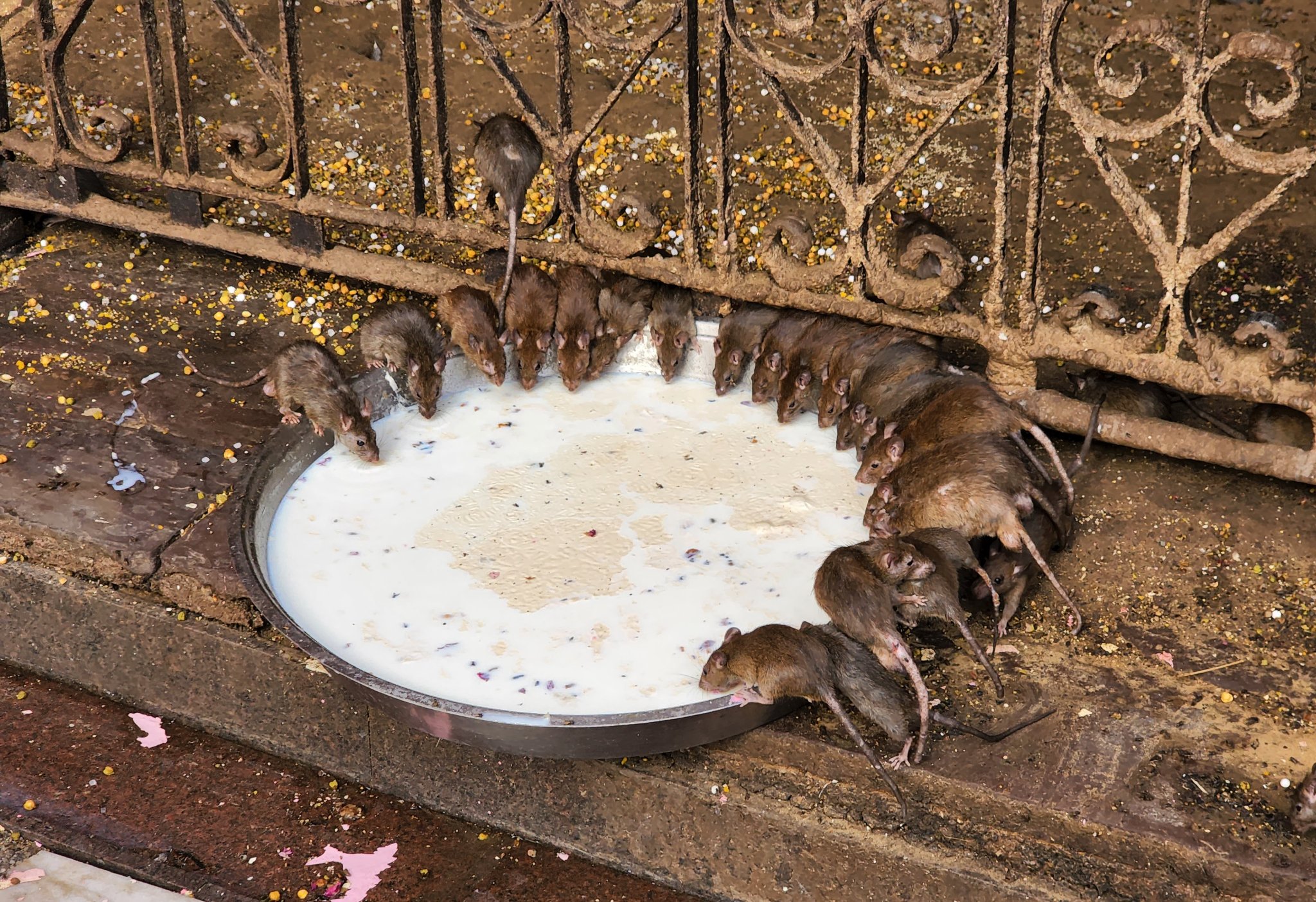
Home to the Karni Mata Temple, where rats, who are considered children of the Goddess, behave just as humans! Eating nibbled on by the rats is considered auspicious. Accidentally or deliberately killing a rat requires replacing it with one made of gold or silver as atonement.
Rats feeding on offerings at Karni Mata temple
Kolayat
The place where the Vedic Sage Kapil (Kapil Muni) is said to have shed his body. Home to a lake and temples on its bank.
Lake at Kolayat
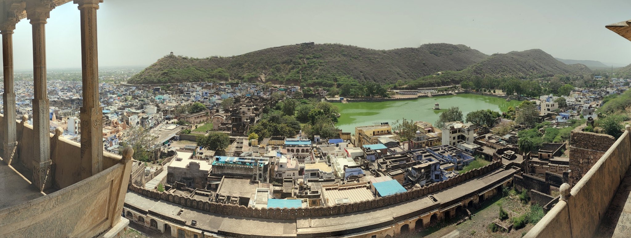
Bundi
A quaint town nestled in the Aravallis, with an imposing hill-side palace overlooking a lake.
View of the Garh Palace from the main road, Bundi
View of the surroundings from a balcony in the Garh Palace, Bundi
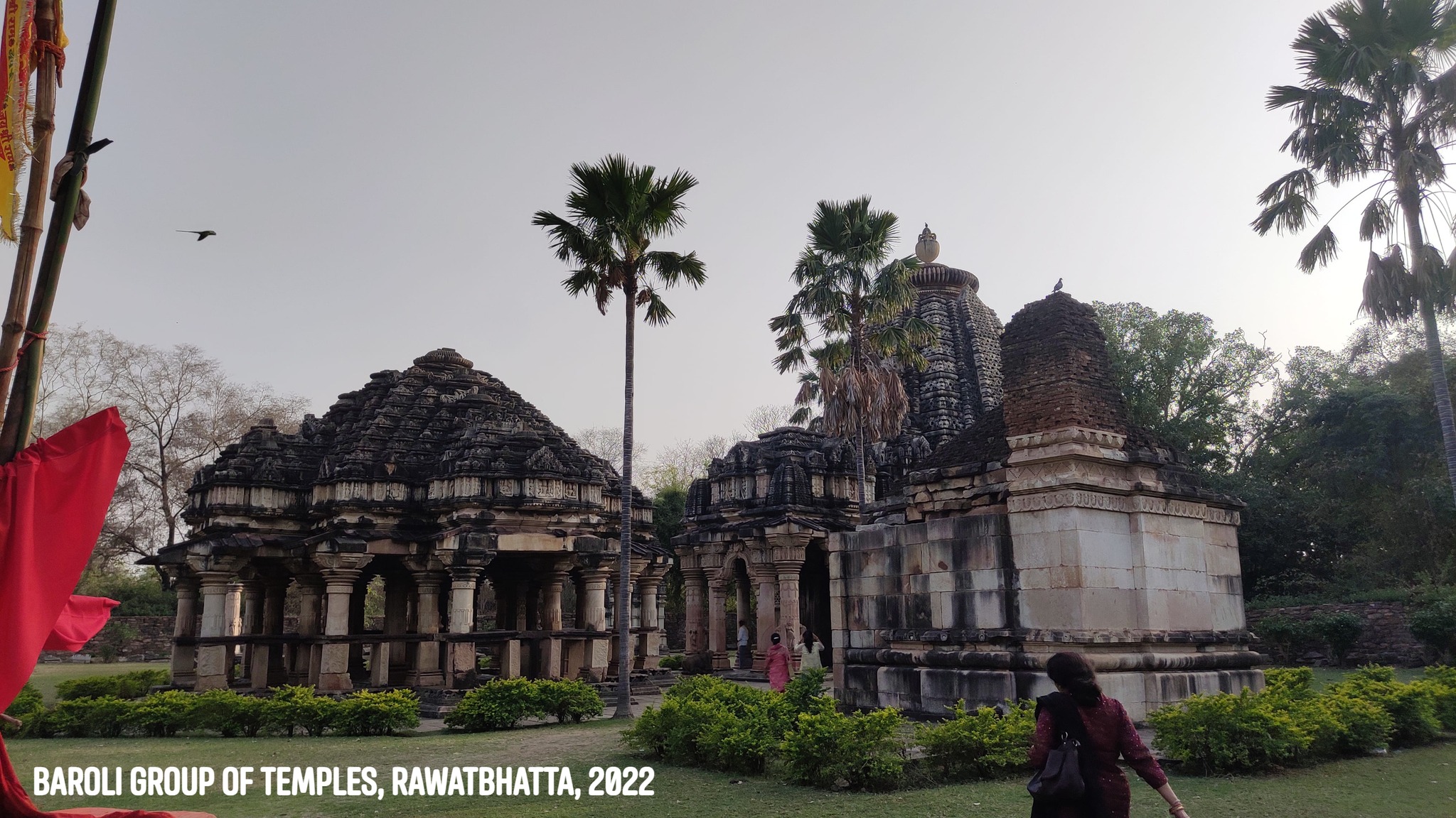
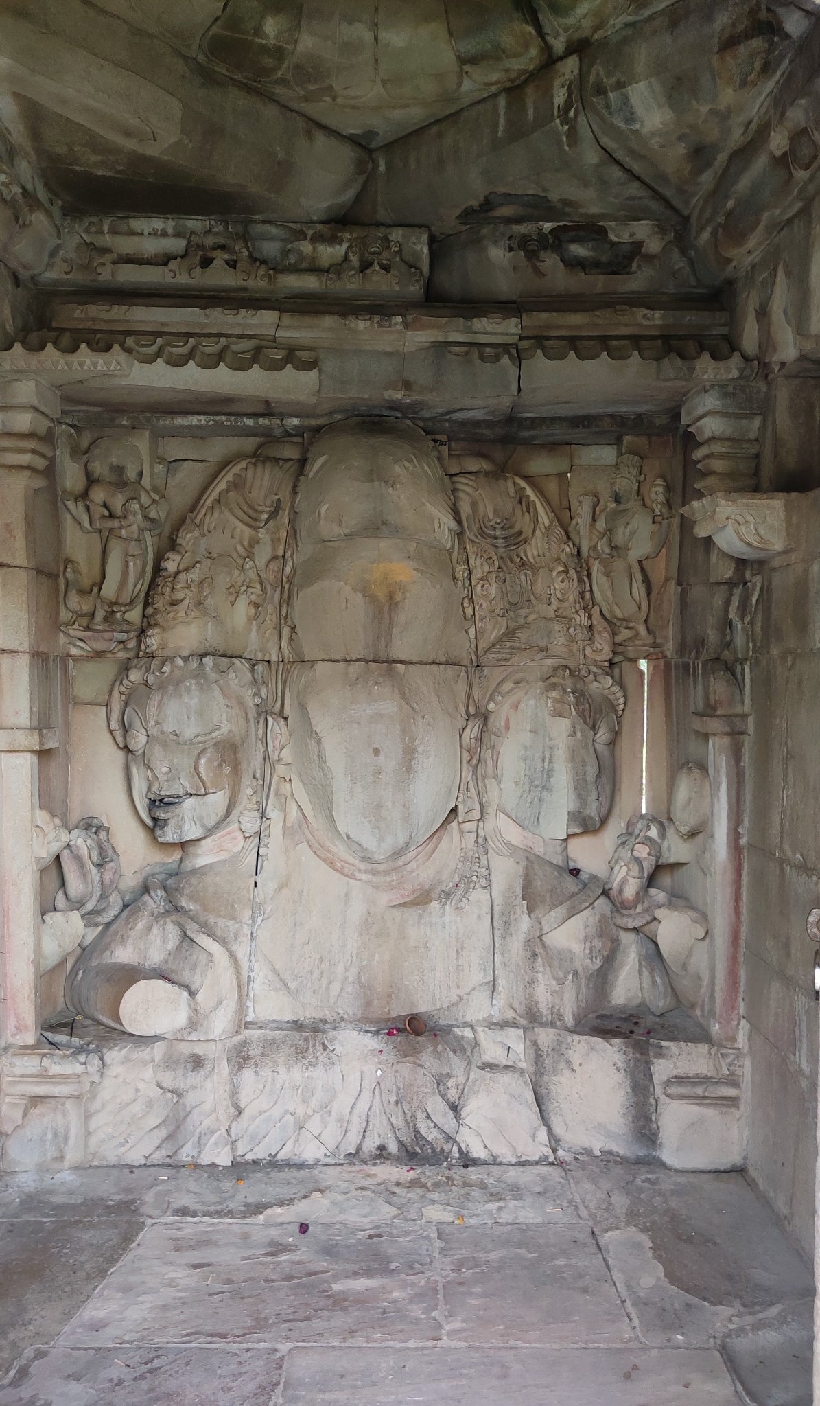
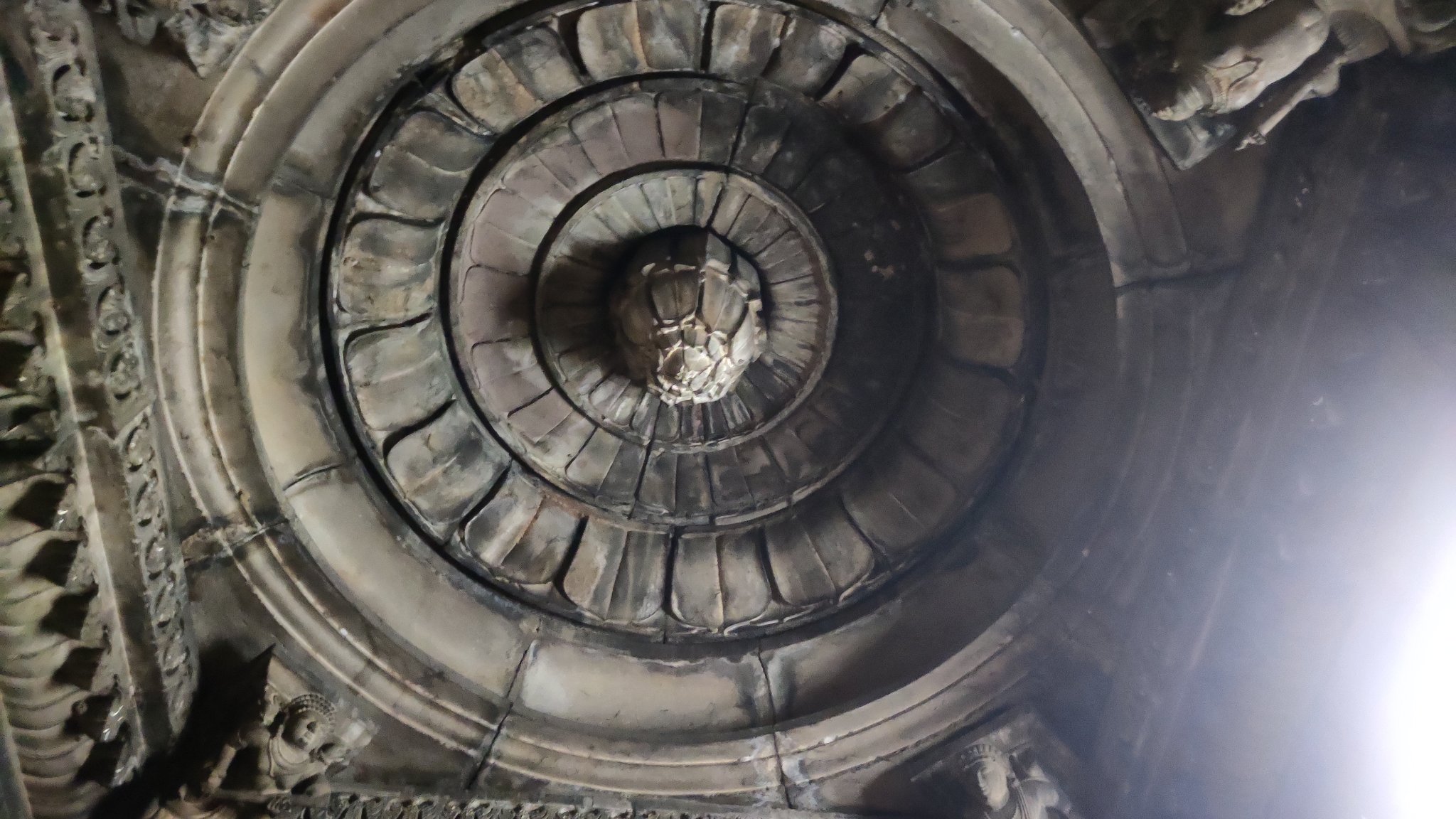
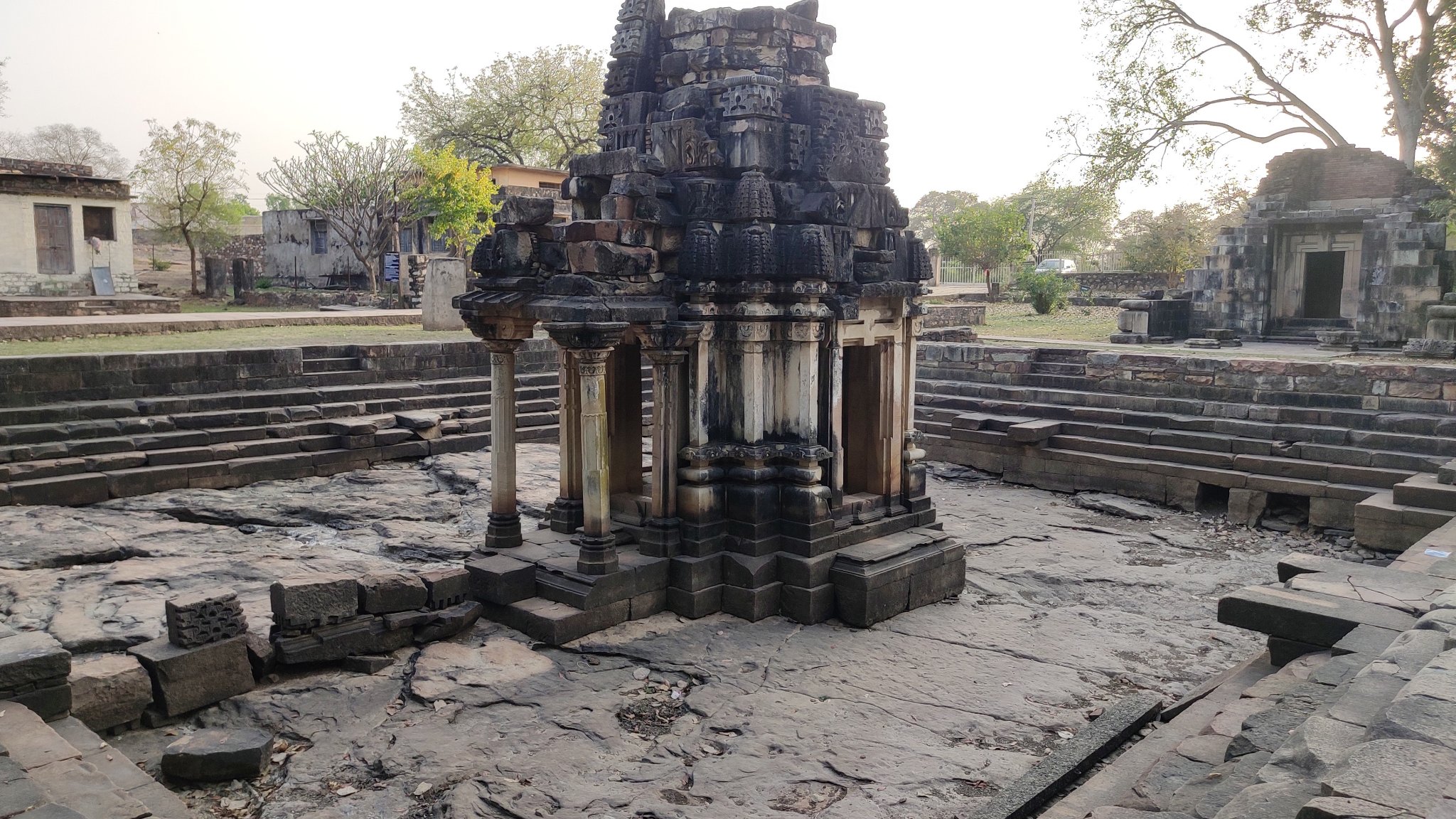
Badoli Temple Complex
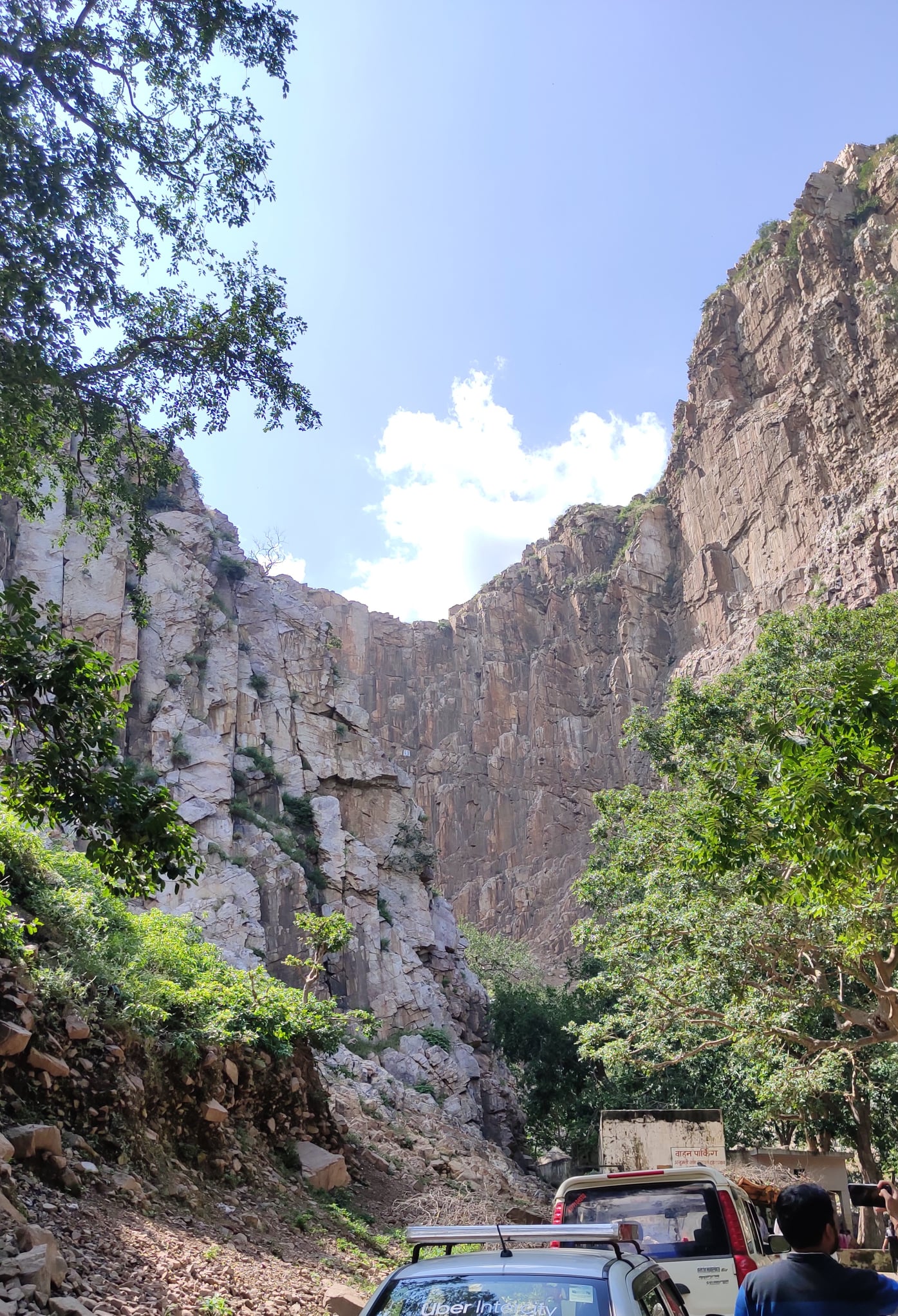
A 10th-11th century temple complex which crept into our plan by serendipity as we were short on time to visit the Gagron fort. The temples, dedicated to Shiva, Vishnu, Ganesha etc., were built by the Gurjara-Pratihara dynasty, and are described as one of the best representations of the temple. Situated on the banks of the Chambal just outside the village of Rawatbhata, it can be reached from Kota through winding roads cutting across hills and forest. As the sun was beginning to set, the ride through the forest was a race against time, and quite the adventure!
Glimpses of the Badoli Temple complex
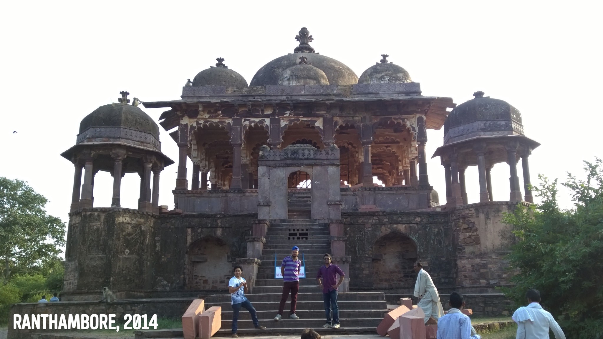
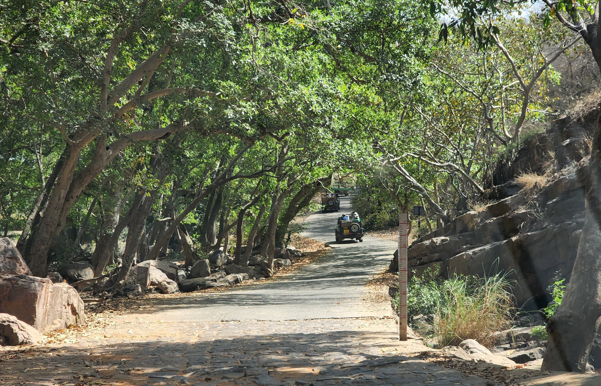
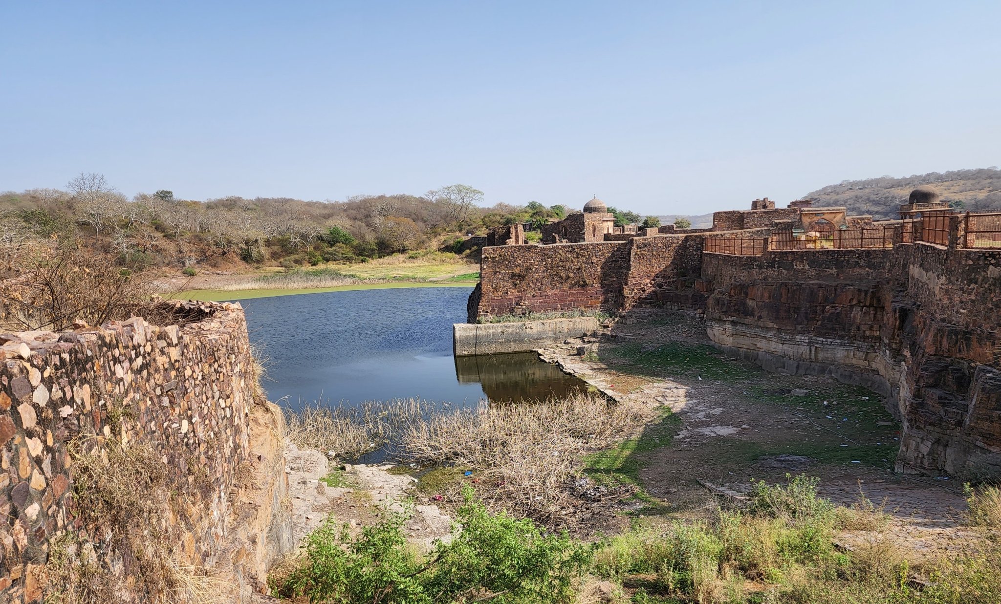
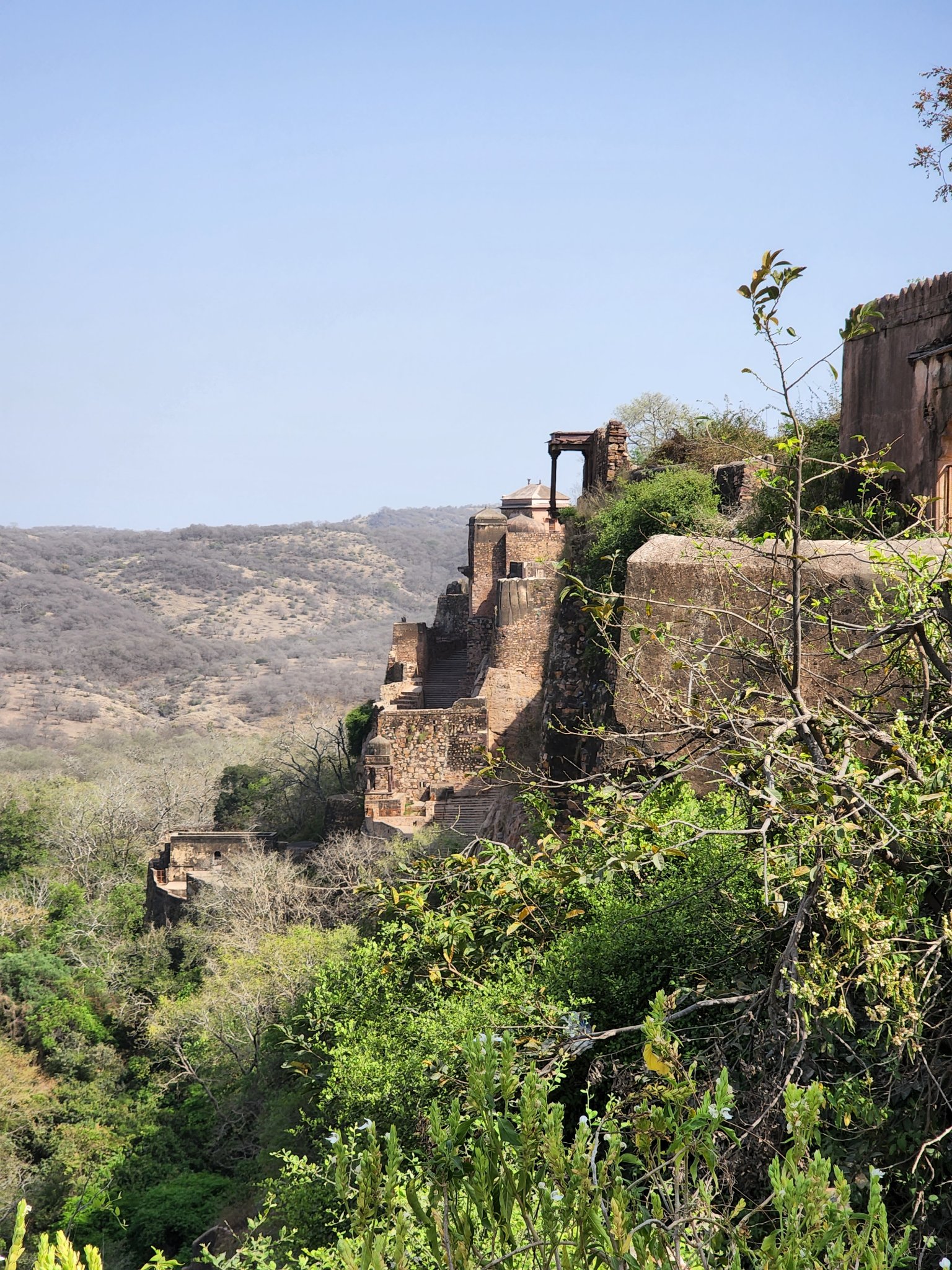
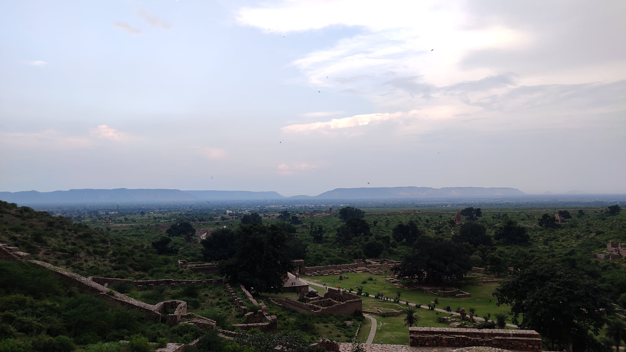
Ranthambore Fort
Rounding off the trip was the magnificent and legendary Ranthambore fort, situated on top of a hill right in the middle of the Ranthambore Tiger Sanctuary. The ride through the forest is memorable and so are the sights from atop the fort.
Approach road leading to the Ranthambore fort through the Ranthambore sanctuary
Water tank inside Ranthambore temple
The entrance road to Ranthambore fort as seen from a ledge inside the fort
Trip Summary Day 1: Gurgaon to Hanumangarh via Sirsa (lunch break in Sirsa) Saw Bhatner fort at Hanumangarh (overnight stay in Hanumangarh)
Day 2:
Hanumangarh to Kalibangan Kalibangan to Suratgarh via Badopal (lunch break in Suratgarh) Suratgarh to Bikaner via Lunkaransar (overnight stay in Bikaner)
Day 3: Bikaner fort early morning (lunch at Bikaner after seeing the fort) Bikaner to Deshnoke to Kolayat, and back to Bikaner (overnight stay in Baikaner)
Day 4: Bikaner to Jaipur via Sikar (overnight stay in Jaipur)
Day 5: Jaipur to Bundi Bundi to Badoli Temple complex (Rawatbhatta) Badoli to Kota (overnight stay in Kota)
Day 6: Kota to Ranthambore Ranthambore to Gurgaon via Dausa and Manoharpura
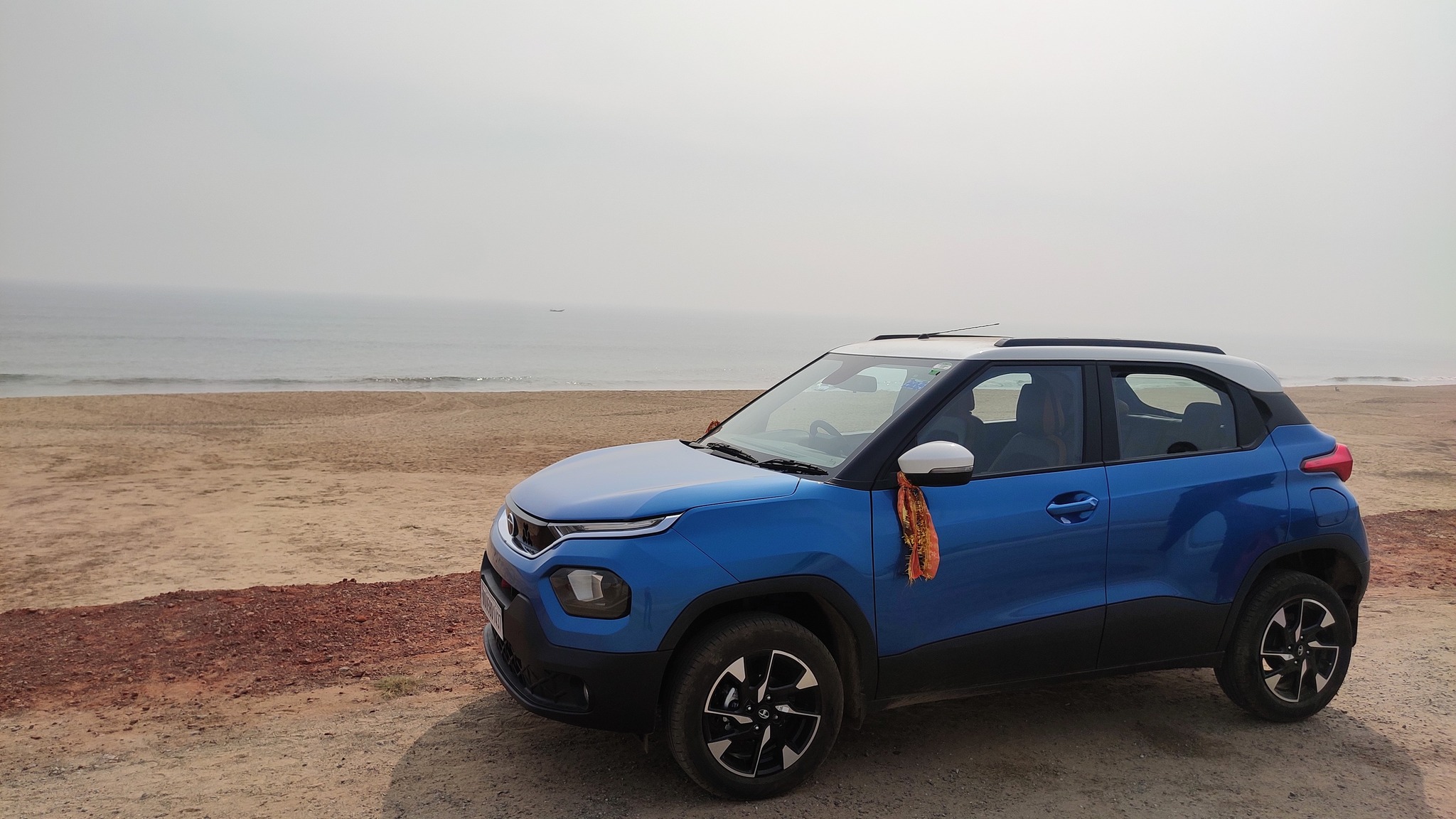
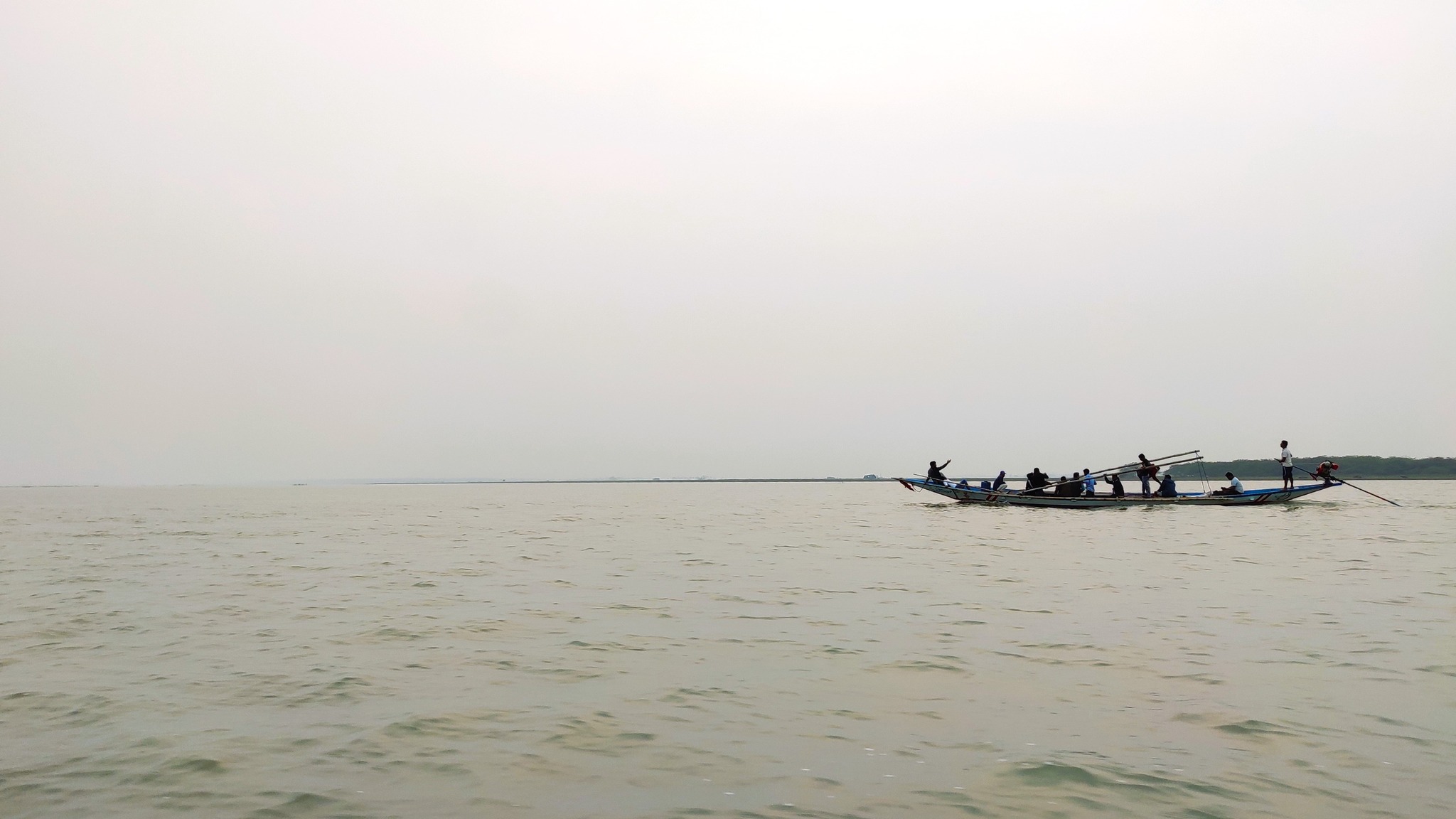
On 24th December 2021, we took the delivery of our car – the first in the family, in fact – in Bhubaneswar, and after offering our prayers, took off on our first ever road-trip in our own car, to the Chilika Lake, which is the largest brackish lagoon in the world. Chilika lake, in a distant past, was an important centre for trade and commerce and served as a shelter for ships sailing to South-East Asia.
The new car posing at Puri beach
Today, the islands on the lake with their temples and natural beauty attract visitors, as also does its status as a ‘wetland of international status’ under the Ramsar convention. The lake serves as the largest wintering ground for migratory birds on the Indian sub-continent, with it hosting over 160 species of birds in the peak migratory season. At least two areas have been declared as bird sanctuaries – the Nalaban islands and the wetlands near Magalajodi village.
To celebrate the arrival of the new car in the family, we went to two different places in the Chilika lake area on consecutive days – Mangalajodi Bird Sanctuary and Satapada.
25th December 2021: Managalajodi
Tired from the car delivery process from the previous day, we started rather late, around 11 AM, and following lunch near Jatani, proceeded by the NH 16 till Tangi where we took a left turn, and pushed towards the coast. Crossing Mangalajodi village, as we entered the wetlands, we had to drive carefully on a meandering paved road built on an embankment that protruded into the wetlands on the periphery of the lake. Reaching the end of the road, we took a boat ride on the wetlands along with a guide who showed us numerous bird species, including, various types of egrets, ducks, cormorants, jacanas, swamphens and kingfishers.
Glimpses of Managalajodi Bird Sanctuary
26th December 2021: Satapada
The next day, we started again from Bhubaneswar towards Satapada via Puri. Since we again started late, we were able to reach Satapada only around 4 PM. Satapada, name derived from a group of seven (sata) villages (pada), lies at the south-east cape of the Chilika Lake, very close to the place where the lake meets the Bay of Bengal, 50 km away from Puri. At Satapada, we took a boat ride of the lake proper, and managed to spot the Irrawady dolphins which abound in Chilika lake. The sunset was something to behold as well. Satapada also is heaven for pescetarians, especially for those interested in eating crabs.
Glimpses from boat ride on the Chilika Lake near Satapada
Just before Covid-19 burst into public consciousness, blissfully unaware of the impending pandemic, Abhijit and I set out on an impromptu trip to Bharatpur. We took the 1:15 PM Jan Shatabdi Express from Nizamuddin, and were in Bharatpur by 3.45 PM.
We took an autorickshaw to first see the Lohagarh fort located in the heart of the city. Crossing a moat that completely encircles the sturdy fort wall, we entered from the North Gate also known as the ‘Ashtadhatu’, literally, ‘eight metals’, gate. We then saw the Government Museum and the many historical structures attached to it, namely, Kachahri Kalan, Kamara Khas and Hamam (Persian Bath), followed by the Kishori Mahal, which was undergoing renovation, and the Surajmal memorial in front of it.
The Museum at Bharatpur
A hall inside the adjoining palace, BharatpurCharbhuja Gate, Bharatpur
As darkness fell, we reached the road running in front of the Keoladeo Bird Sanctuary, along which lie numerous hotels and resorts, and booked a hotel room for the night.
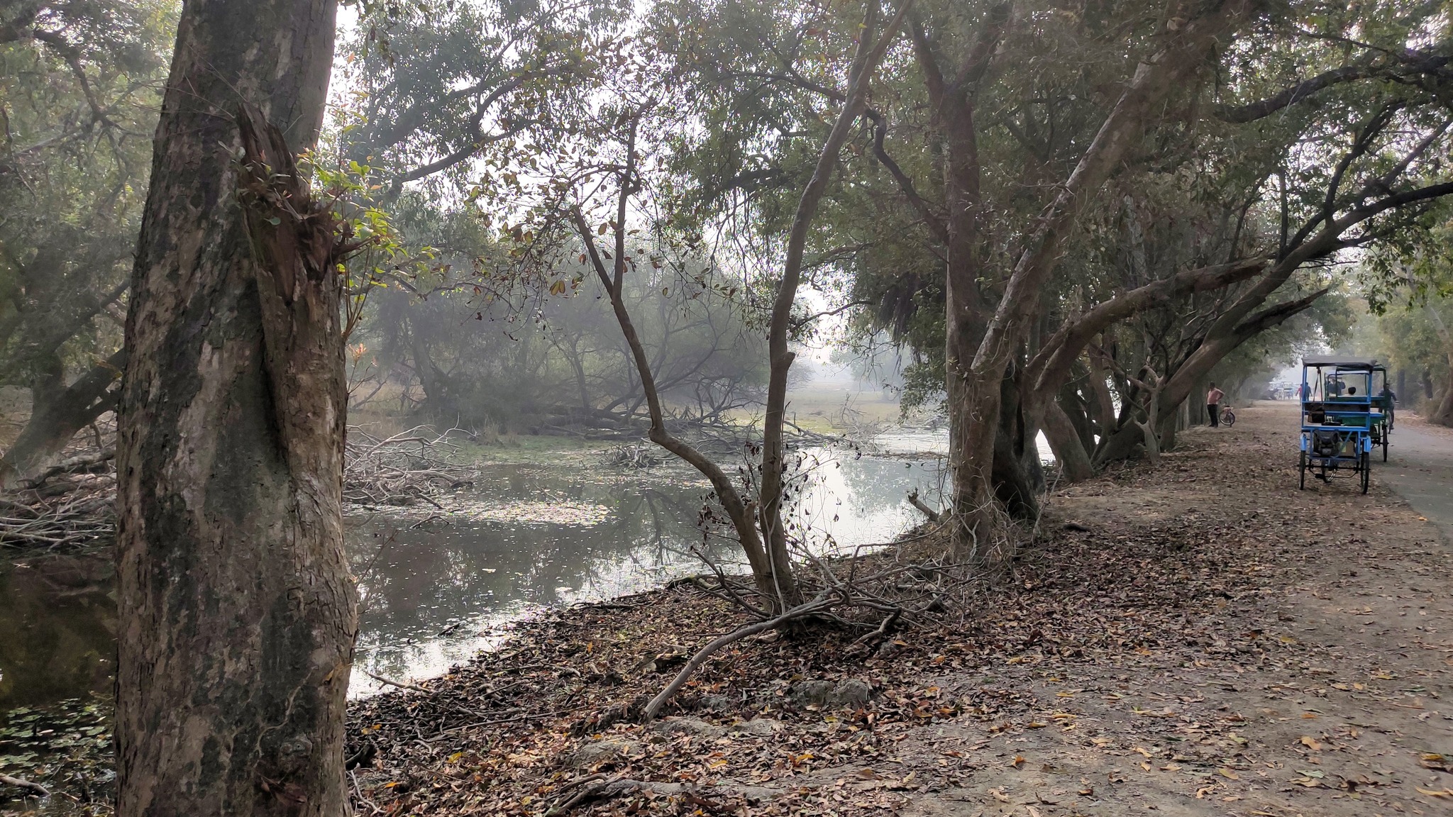
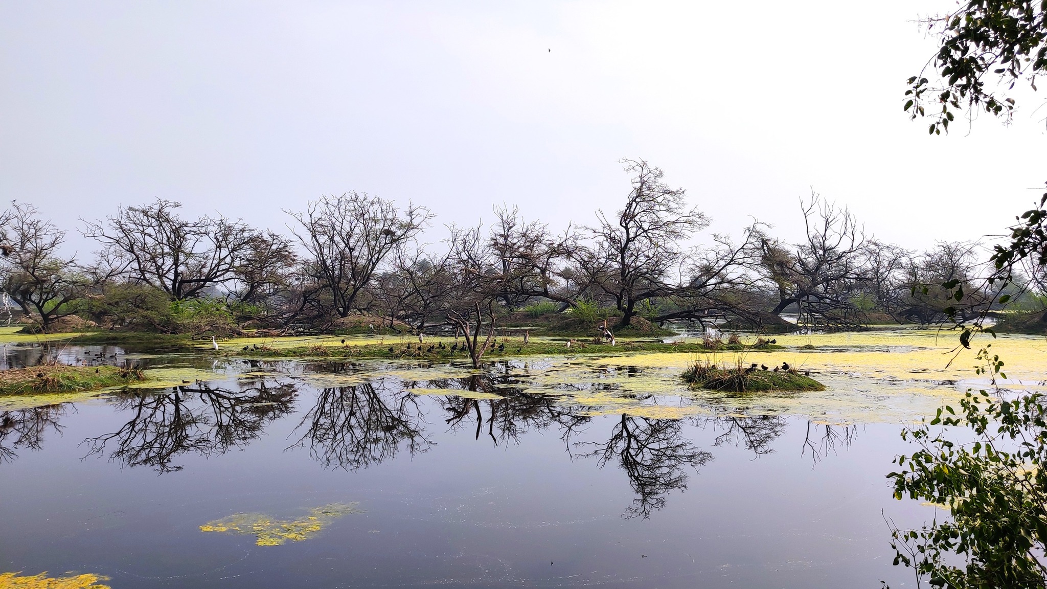
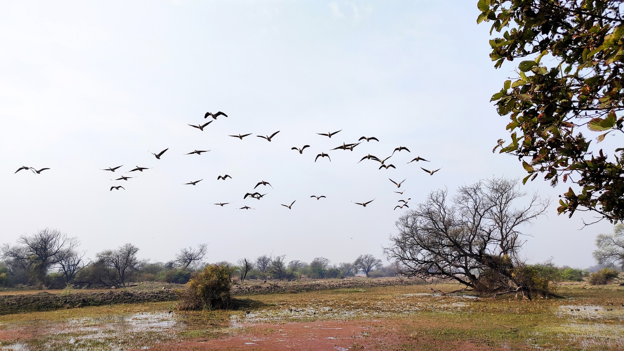
The next morning at 8 AM, we simply walked down to the Bird Sanctuary, rented out a couple of bicycles, and a pair of binoculars and hired the services of a guide. We spotted coots, herons, storks, egrets, snake birds, ibises, warblers, owls, sandpipers, jacanas, bulbuls, pheasants and many more – just wish I was a serious bird-watcher, sometimes.
Glimpses from Keoladeo Bird Sanctuary, Bharatpur
By 12, we reached the end of the sanctuary, and turned back, eventually reaching the bus-stop at 2.30 PM. Catching a 3.30 bus to Delhi, we were back home by 8 PM. A month later, the lockdown commenced.
November 2021: Fatehpur Sikri and Deeg
One morning in November 2021, when we were still wearing masks due to Covid-19 but travel had resumed, Mother and I just decided to drive to Fatehpur Sikri. Starting at 9 AM, we took the KMP Expressway from Manesar, turning eastwards towards Palwal. At Palwal, we joined the Mathura Road highway, and were at Sikri by 11.30 AM.
On our Agra trip from a decade back, we had to forego seeing Fatehpur Sikri due to paucity of time, so it was good to finally see the fortified city, built by Akbar in a village that already existed. ASI excavations have revealed structures, including, housing, temples and commercial centres from long before Akbar made the city his capital, with archaeological evidence pointing towards settlement of the region since the Painted Grey Ware period.
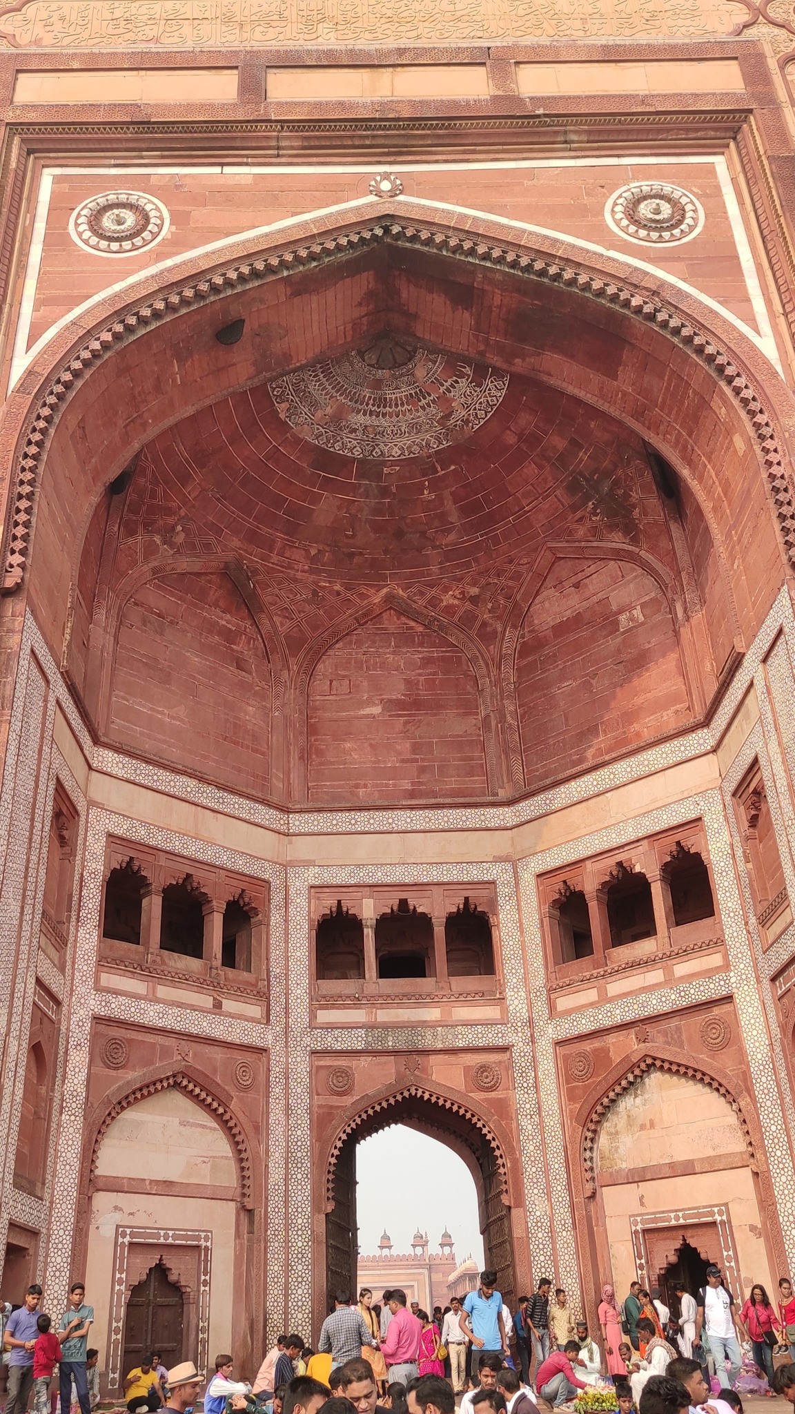
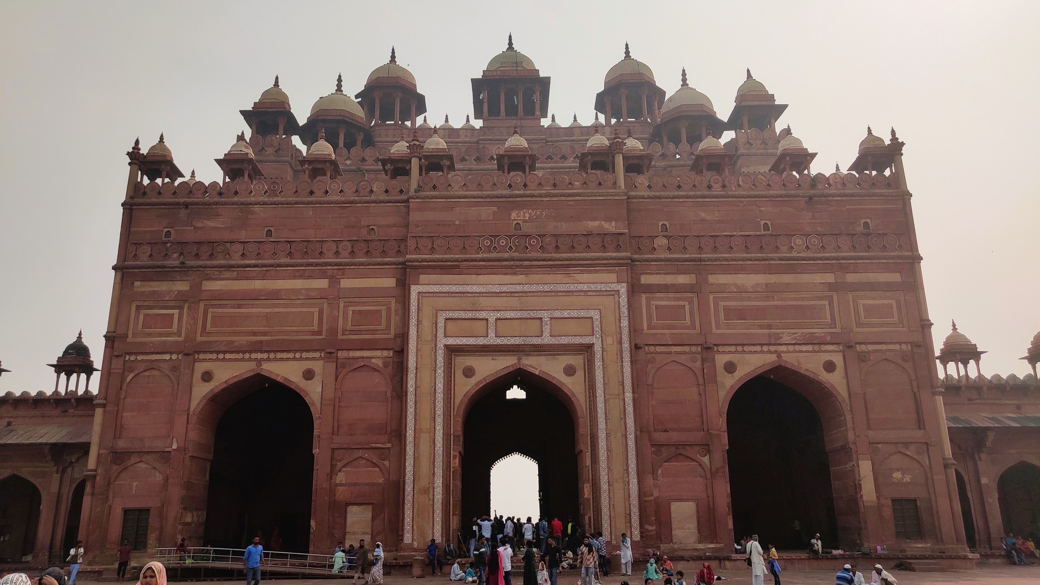
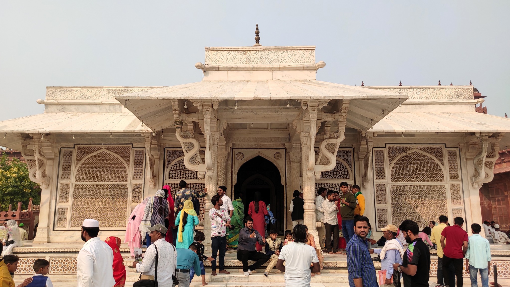
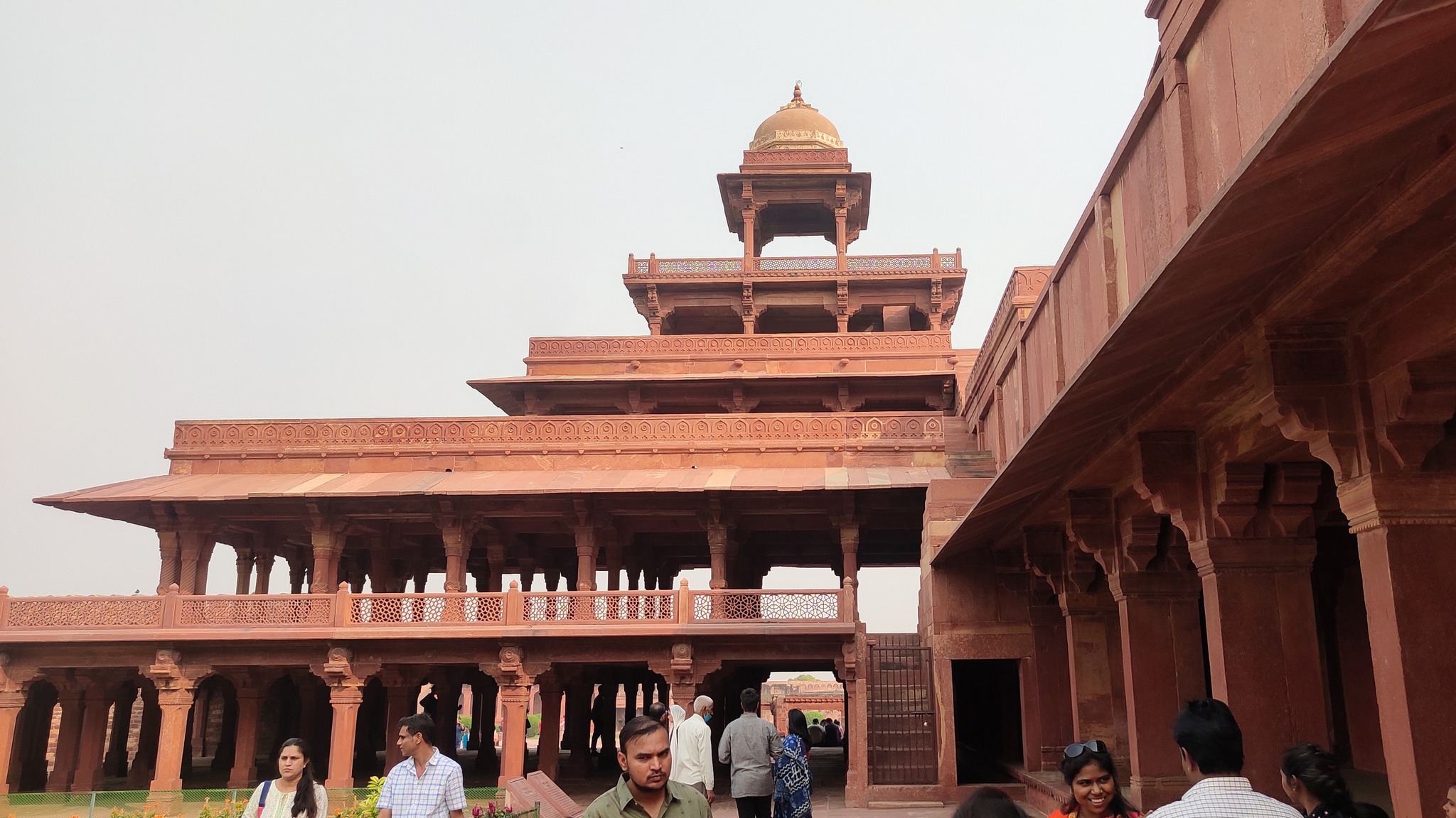
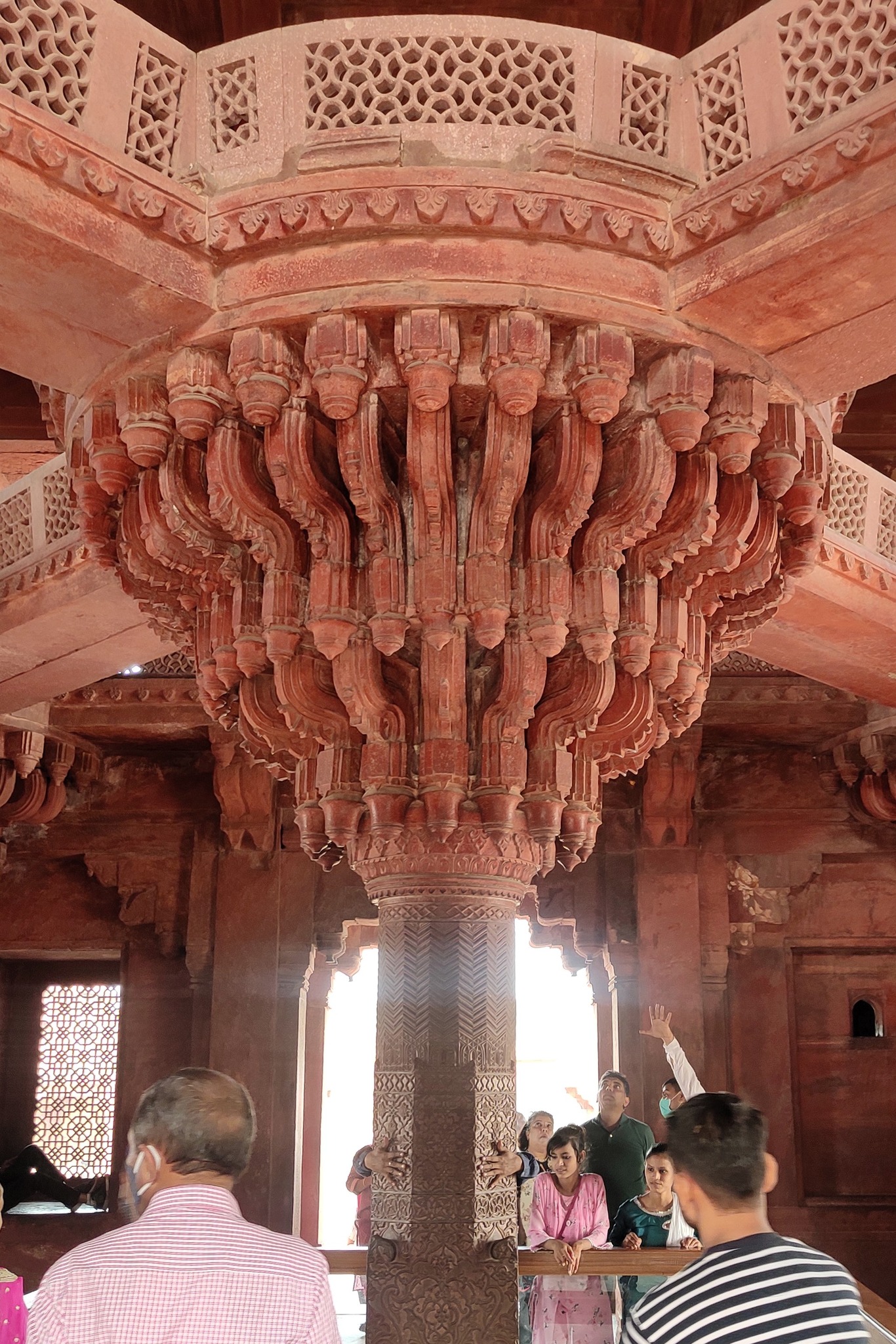
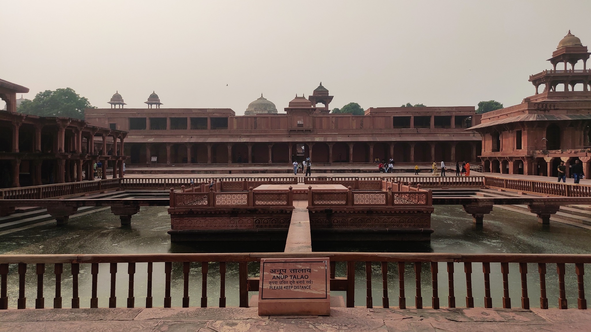
At Fatehpur Sikri, we saw the Buland Darwaza, Jama Masjid and the Tomb of Salim Chisti in the Jama Masjid Enclosure. Then moving over to the Fatehpur Sikri fort area, we saw the Diwan-i-Aam (Public Audience Hall), Diwan-i-Khas (Private Audience Hall), Ibadat Khana (House of Worship), Panch Mahal, Anup Talao etc.
Buland Darwaza from outside, Fatehpur Sikri
Buland Darwaza as seen from the Jama Masjid courtyard
Tomb of Salim ChistiPanch Mahal, Sikri fortIbadat Khana, Sikri fort
Anup Talao, Sikri fort
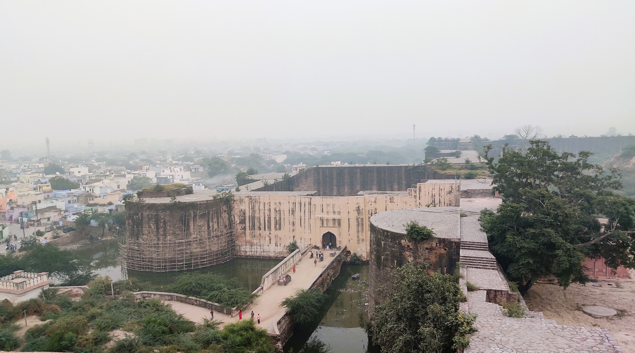
From Fatehpur Sikri, we drove to Deeg, reaching the Deeg Fort around 4 PM. From Deeg Fort, we proceeded to the Deeg Palace – also known as Jal Mahal, as it is surrounded by aesthetically manicured water bodies and gardens having 900 fountains – serving as the summer palace for rulers of Bharatpur. Deeg is 60 km from Fatehpur Sikri and 35 km north of Bharatpur.
Deeg fort entry as seen from one of the watchpoints on the fort wall
Platform for a cannon, Deeg fortDeeg Palace (Jal Mahal)
Fountains leading to the Keshav Bhavan, Suraj Bagh, Deeg Palace enclosure
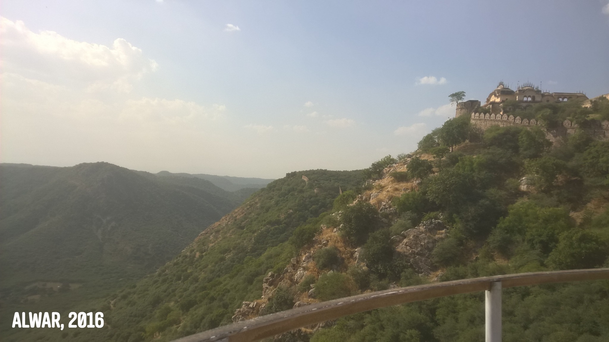
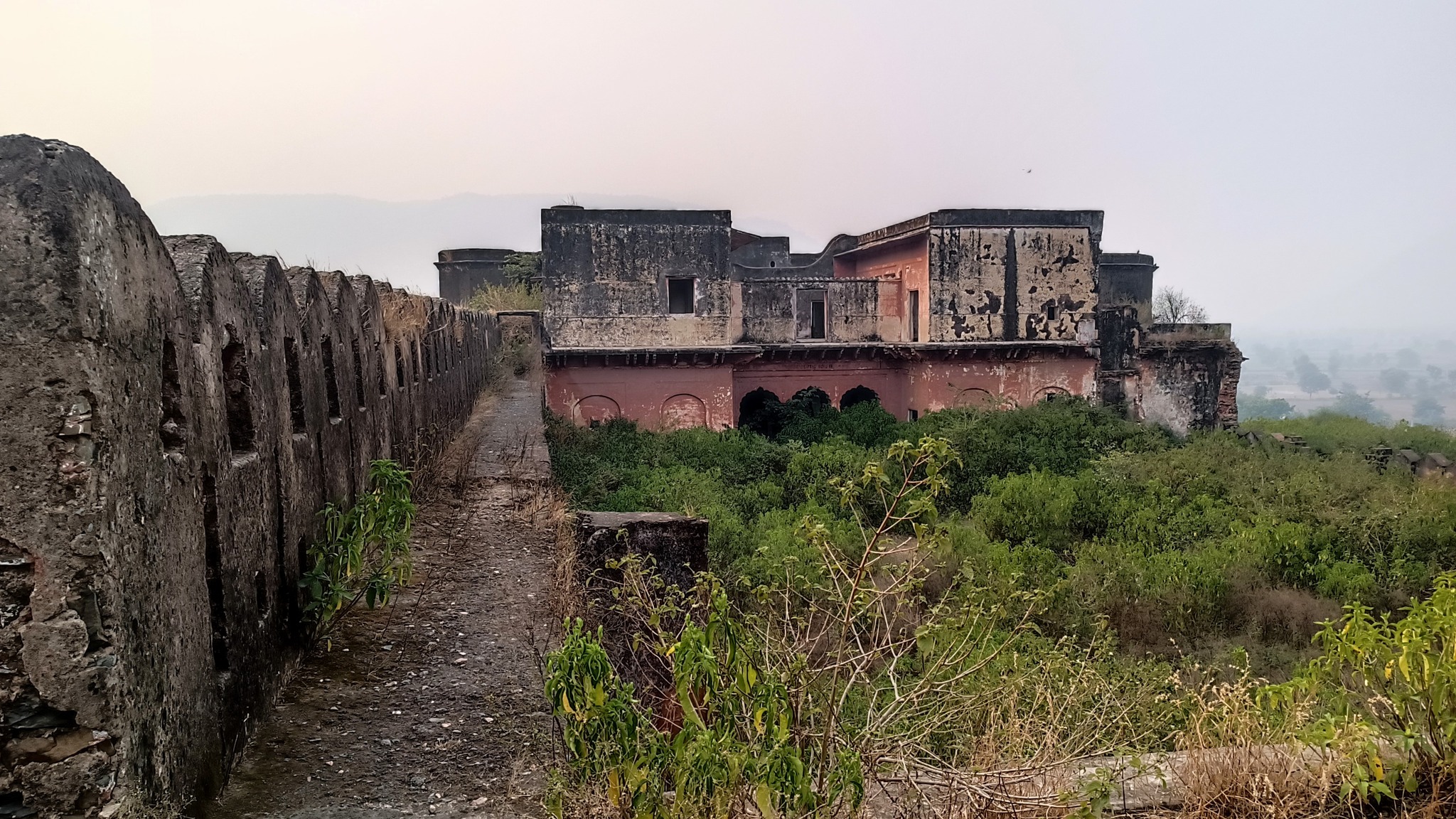
After sundown, in the dark, hurtling over some bad roads, we reached Alwar, to stay the night over. The next morning we drove up the Aravalli to check out the Bala Qila (Alwar fort), but learned that it was closed for renovation. Coaxing the gatekeeper, we managed to just get to the courtyard and climb up a roof to get a panoramic view of the lush green Aravallis.
After lunch, we went for a drive to the Sariska area, but at 4.30 PM turned back for Gurgaon, and were back home by 8 PM.
Update [December 2023]
November 2023: Khatoo, Abhaneri and Bharatpur
I would again visit Bharatpur in November 2023, this time with my parents, and as part of a longer impromptu journey. We first planned to visit Sariska Tiger Sanctuary, but upon reaching the Sariska gate, we learnt the sanctuary was closed for the day. Having a quick lunch, we decided to go to Bhartruhari temple located in the Sariska forest area.
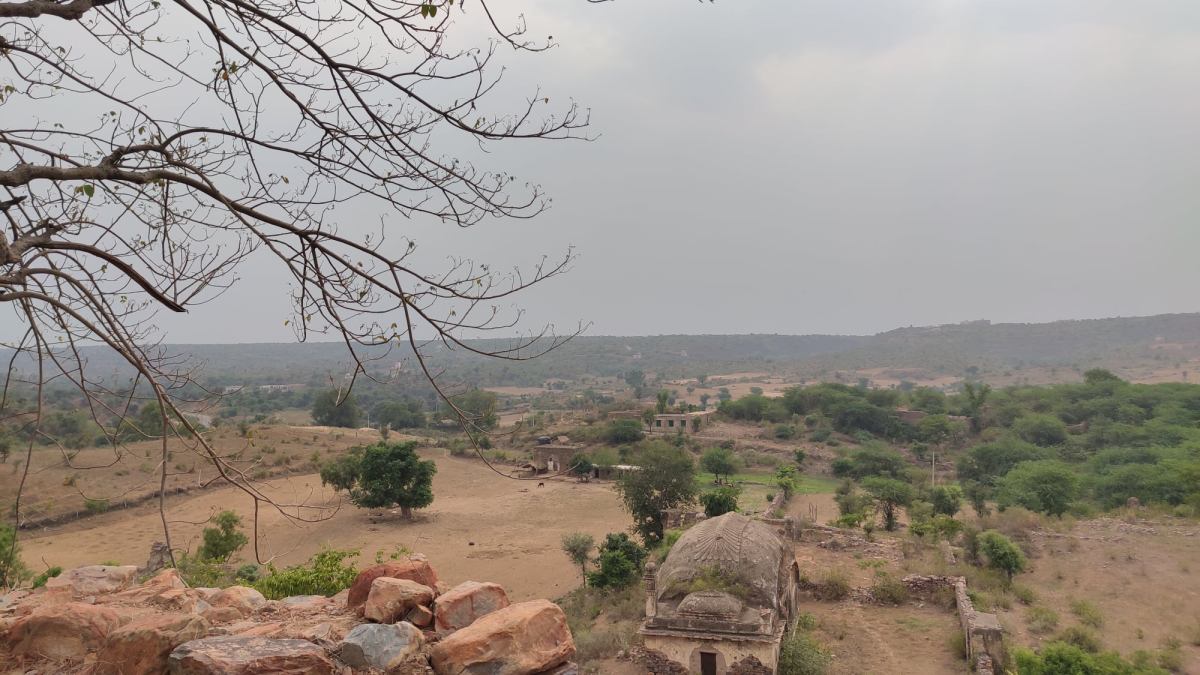
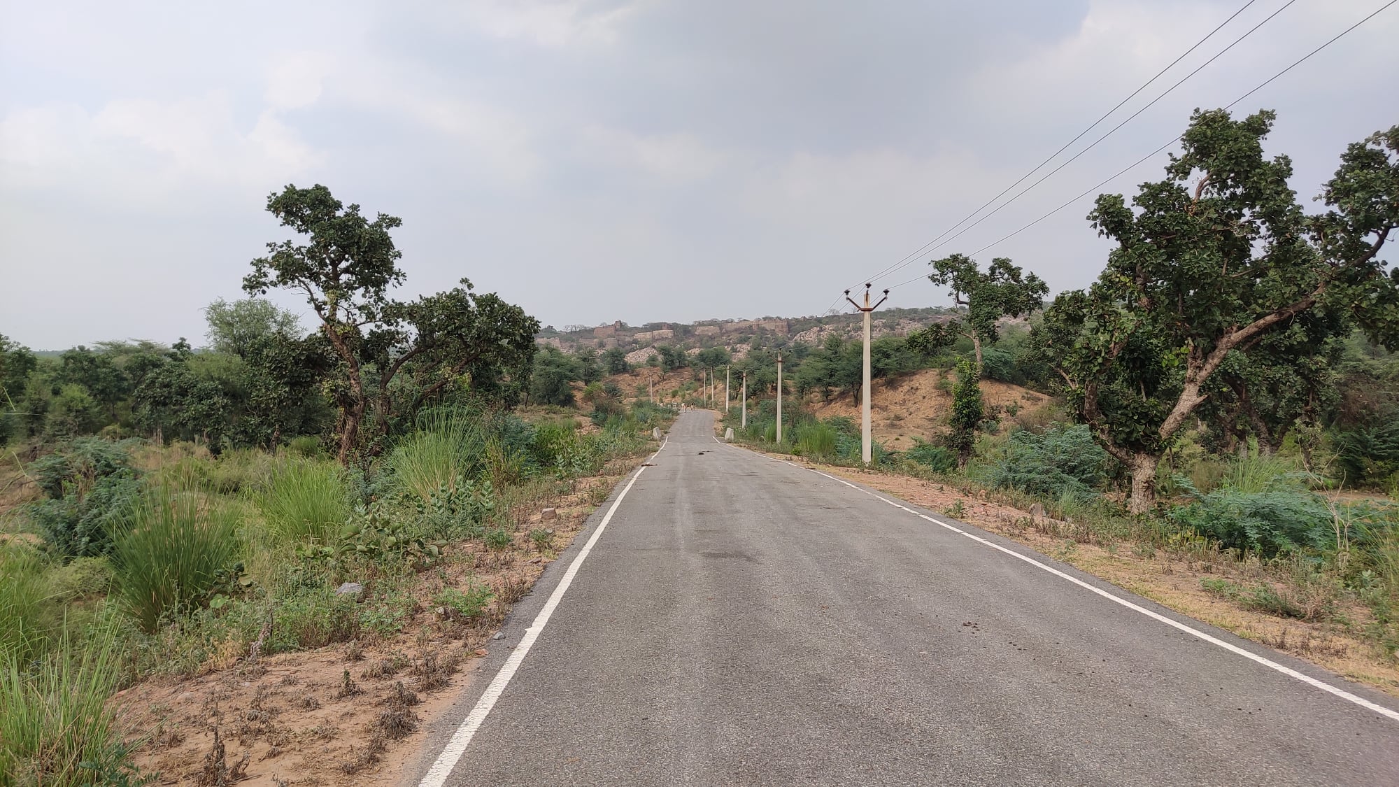
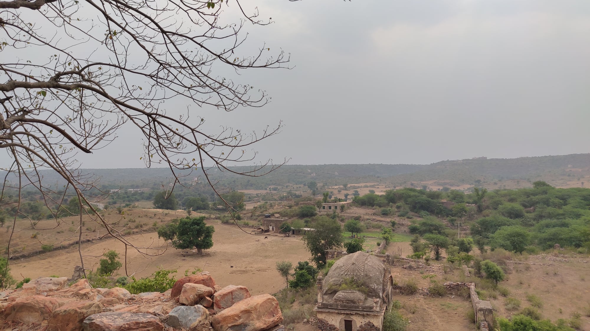
Once we had seen the temple, we made a split-second decision to proceed to Khatoo, 150 km away, via Kushalgarh and Narayanpur. At Kushalgarh, I got down to check out a tiny fort perched on a hillock – a fort I had always spotted while going to Sariska from Alwar, and back.
Kushalgarh fort as seen from the approachInside Kushalgarh fort
We reached Khatoo around 7 PM and managed to get a quick darshan of Khatoo Shyam ji. Having our dinner by 9.30 PM, we proceeded to Jaipur to stay the night over. The next morning, we drove to Abhaneri to see the Chand Baori stepwell, and then proceeded to Bayana, by when it was already 4.30 PM (read about my Bayana fort adventure here: Barely Bright and Bovine Encounters at Bayana Fort).
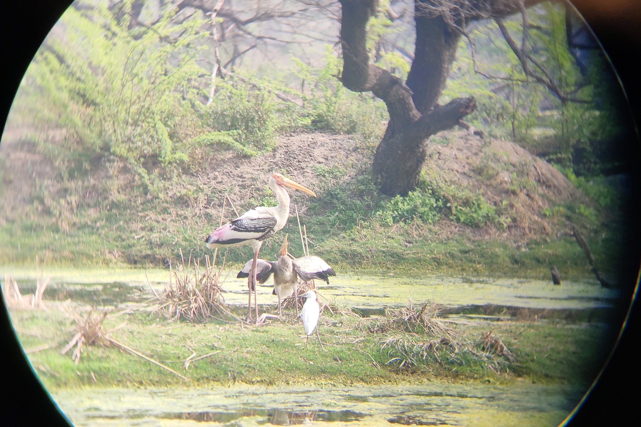
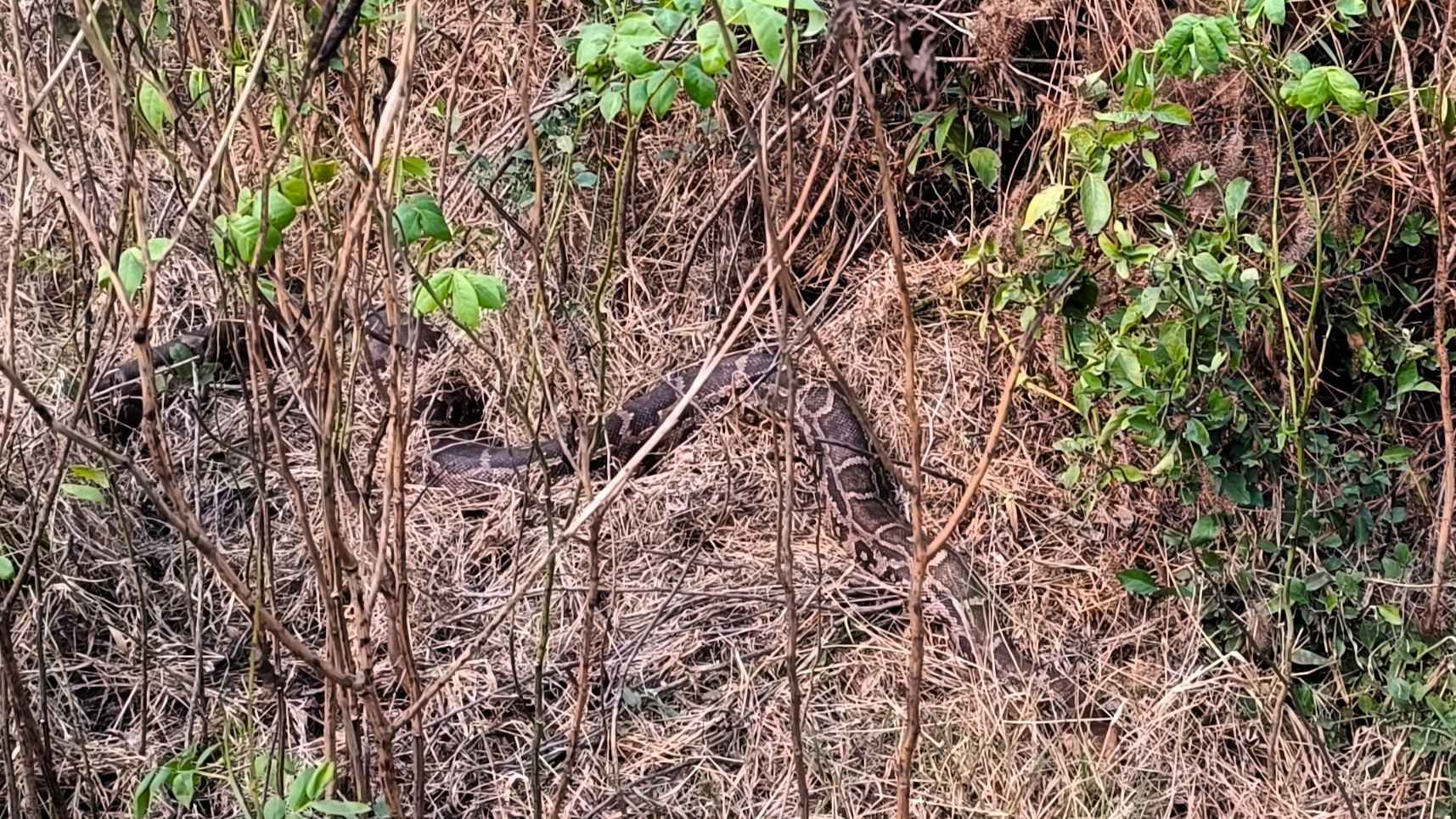
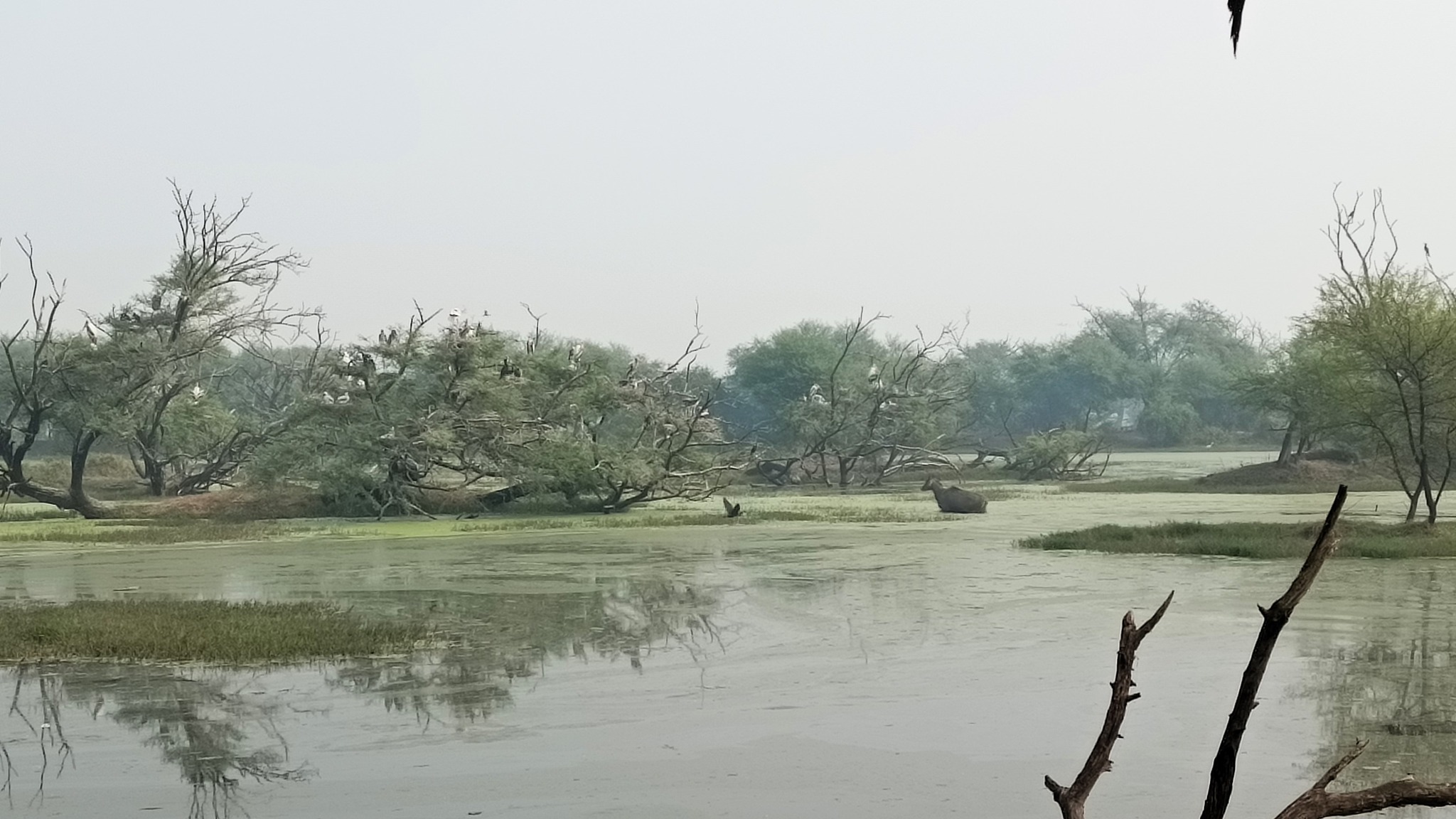
Starting from Bayana at 6 PM, we reached Bharatpur, an hour away, and checked-in to a hotel at 7.30 PM. The next day, we saw the Bharatpur Bird Sanctuary, and proceeded through Goverdhan to Vrindavan, where my parents wanted to spend a few days. I drove back to Gurgaon solo.
A python in Bharatpur Bird SanctuaryA day in the swamp, Bharatpur Bird Sanctuary
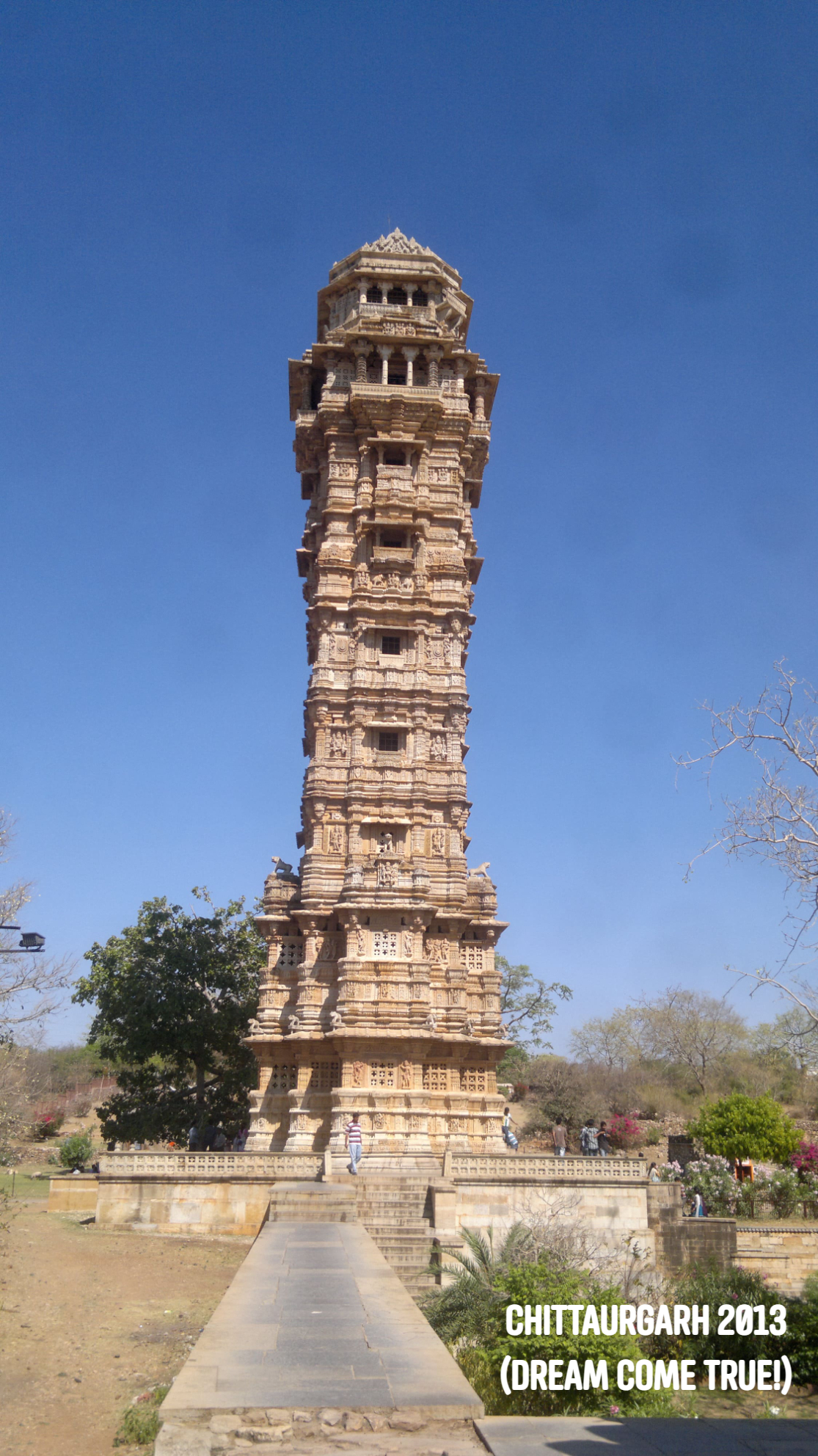
As a kid, I had been entranced by the pictures of sand dunes and forts in school textbooks and children’s magazines. One particular image from a Tinkle issue – a coloured sketch of the Vijaya Stambh at Chittorgarh fort had stuck in my mind, and in 2013, on one of my solo trips, I finally set foot on the Chittorgarh fort, and was absolutely spellbound by the location atop a table-top hill and the scale of the area bounded by its imposing walls. I have explored Rajasthan further, making it a point to explore at least one new place every year. Until before the pandemic struck, I had visited almost every major city of Rajasthan and then some.
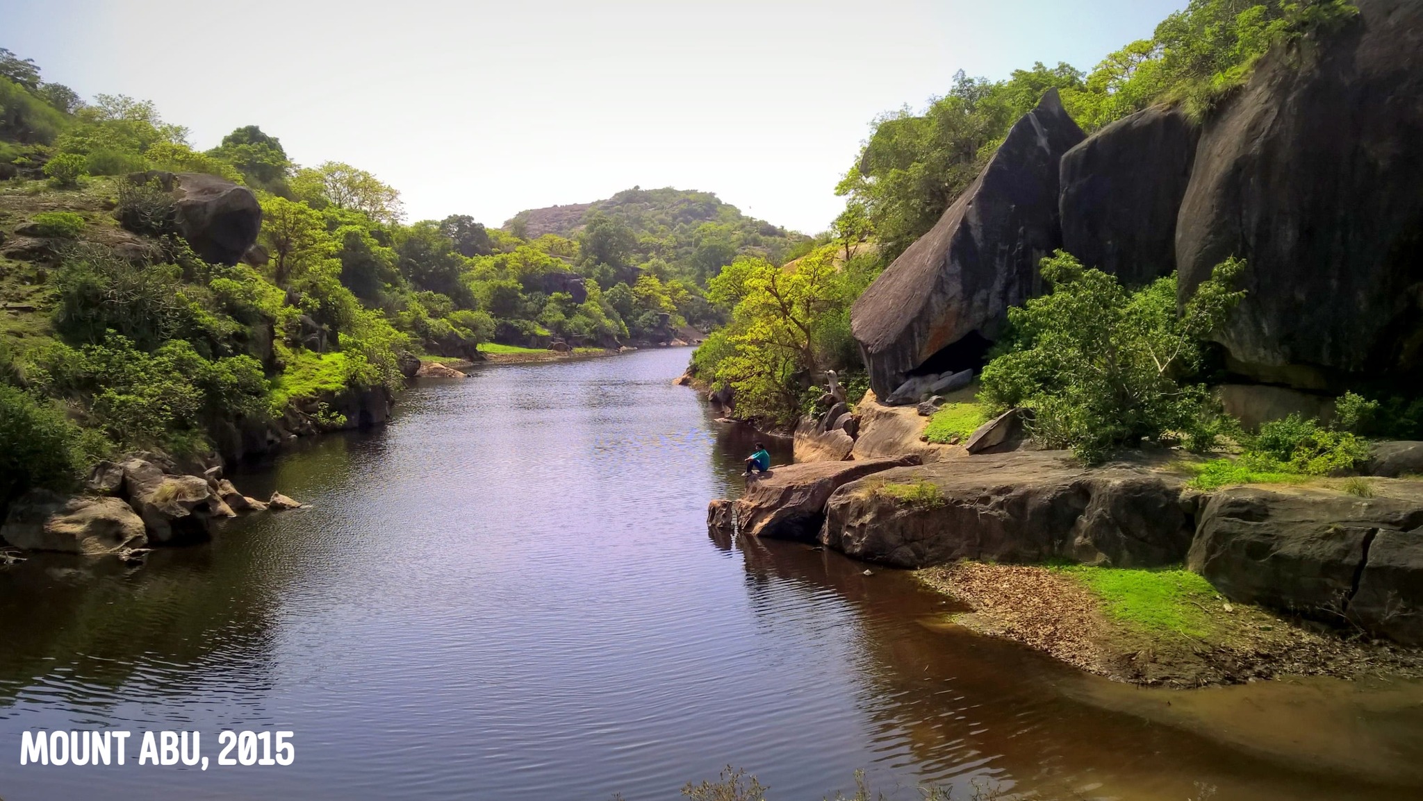
However, it has never been about the destination as far as Rajasthan is concerned. Looking through the State Roadways bus windows, or craning the neck out from cabs and fancily decked-up auto-rickshaws, I have often marvelled at the intriguing shifts in landscapes – straddled by the Aravallis intercepting you shortly after you have entered from the East, with its table-top ranges swishing across like stripes of a tiger, some covered in a rich green cloak, yet others balding with their denuding rocky surfaces exposed, flanked now by swathes of lush green agricultural land, now turning light brown or pink or yellow with short lean trees strewn around as if social-distancing since time immemorial, then slowly turning golden as the ground surface mutates into waves of sandy dunes of the Thar. Abandoned forts and fortress walls crown hill tops every few scores of kilometres. Further south near Mount Abu, the Aravallis look nothing short of a slice from the Western or Eastern Ghats.
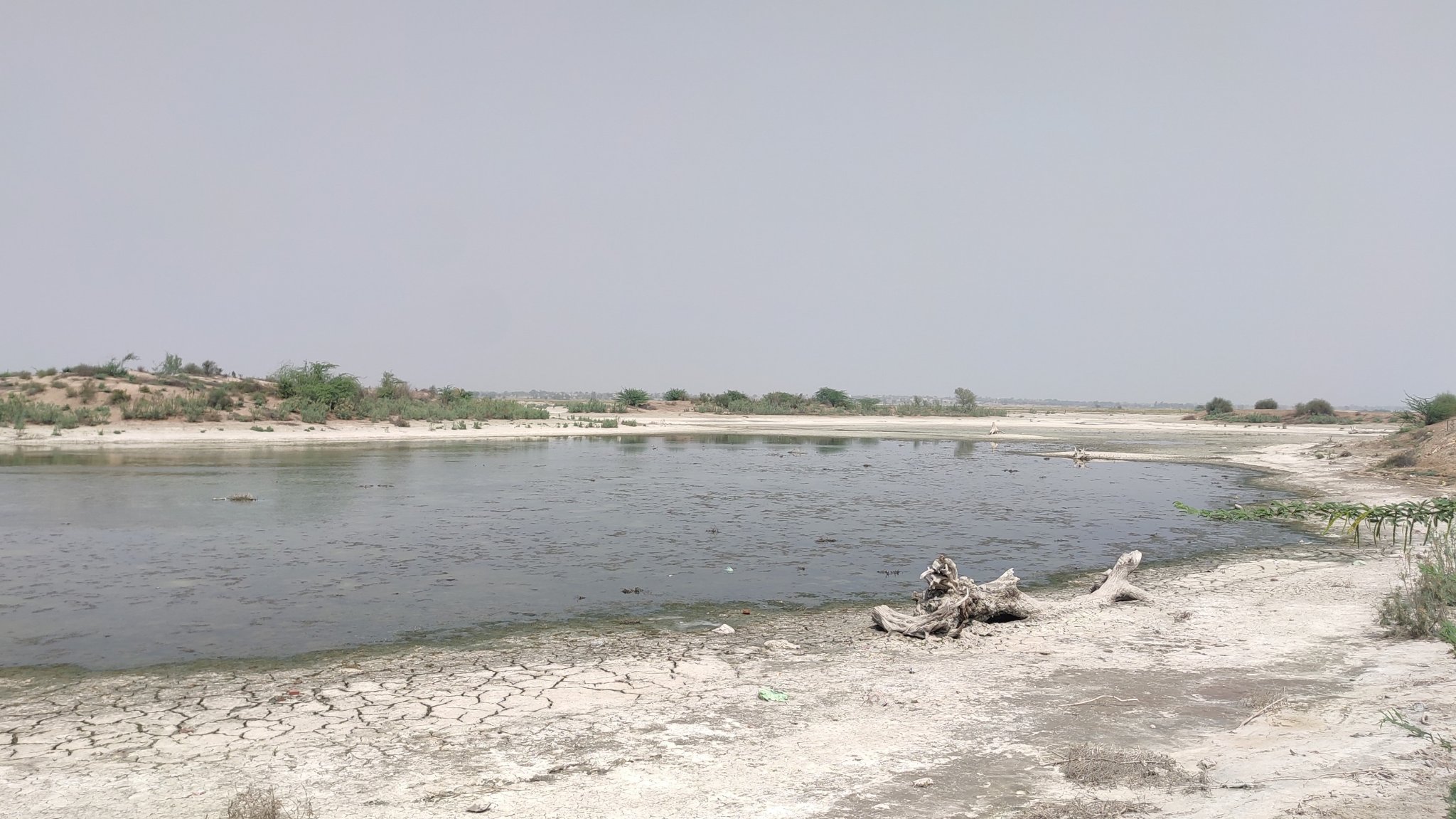
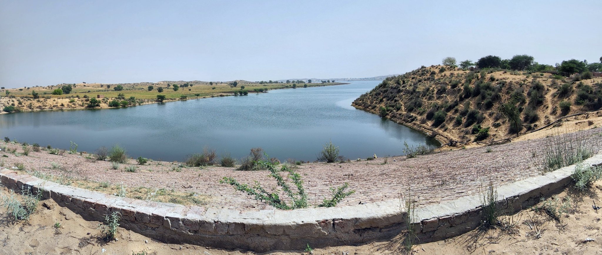
There is also a vast Salt Lake (Sambhar) somewhere at the edge of the desert in the heart of Rajasthan. Villages only turn up after long sprees of nothingness, and even then they are a collation of a handful of houses. Dried river channels cross your path occasionally, their sandy beds hinting at an older time of more abundance. Camels trundle along serenaded by their handlers, their upturned mouths betraying an indifference towards their dreary lives. Nomadic herders appear out of nowhere with flocks of little sheep and goats. Deeper in the desert, if you’re lucky, you may spot a monitor lizard or a hyena lurking amidst the shrubs.
Siliserh Lake, Alwar
Bissau, ShekhawatiFatehnagar, Shekhawati
Bhangarh
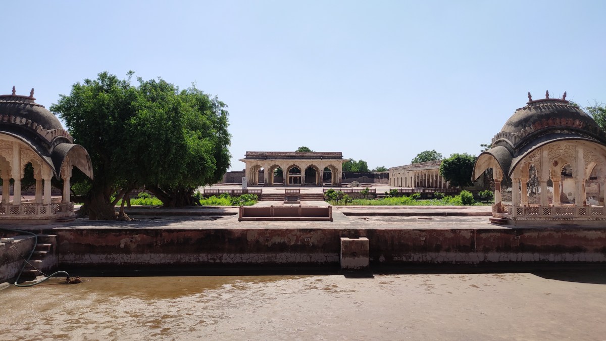
Gadwaji, AlwarAlsisar, Shekhawati
In all of my trips prior to the pandemic, I have often been constrained by the mode of transport. There have been points or locations on the routes, which I have earmarked to return to later at my own leisure, since stopping by then was not an option. There have been roads emanating from the main roads that have often left me wondering as to where they led to. Now at 35, after learning to drive, I finally have the wherewithal to indulge in the fantasies that I harboured while travelling in my erstwhile cloistered fashion. This is an album to celebrate the many facets of the Rajasthan landscape that I have chanced upon on my most recent and some of my very first ever self-driving trips, which will hopefully be enriched with future trips.
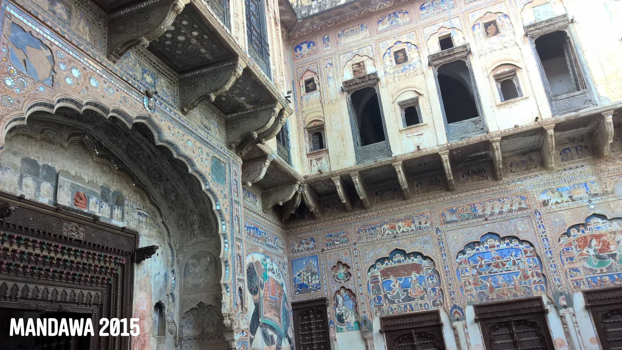
With parents finally being able to visit Gurugram after the second wave of Covid-19 pandemic had receded, it was time to unwind with a weekend trip. We decided to check out relatively lesser-known places, hoping to beat any semblance of crowds. Previously, I had visited Mandawa, and enamoured by the scenery of the areas I had passed through to reach there, I had been longing to have a taste of the larger area surrounding Mandawa – Shekhawati. With our personal vehicle at our disposal, exploring Shekhwati would now be feasible.
Part 1: Shekhawati
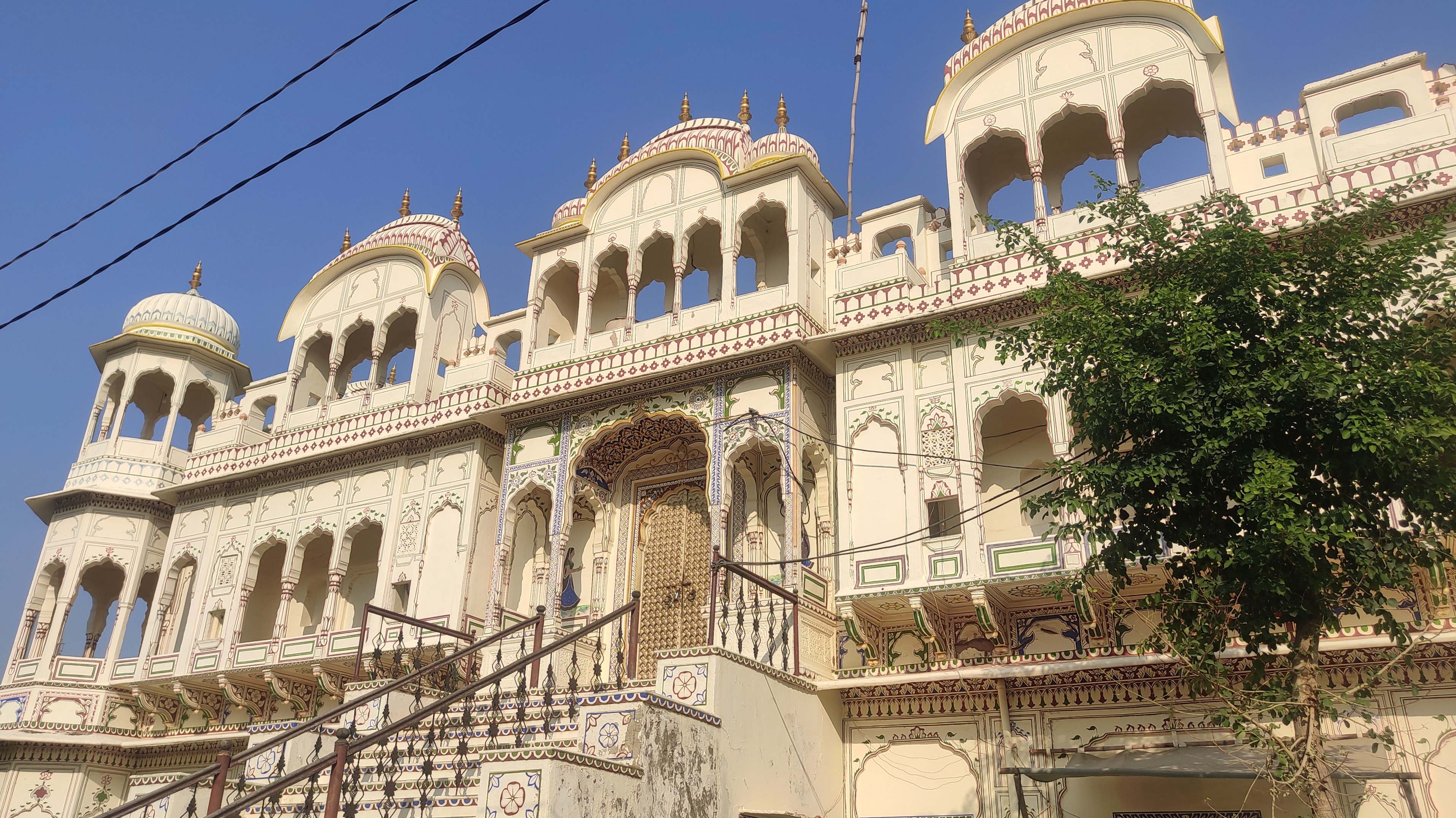
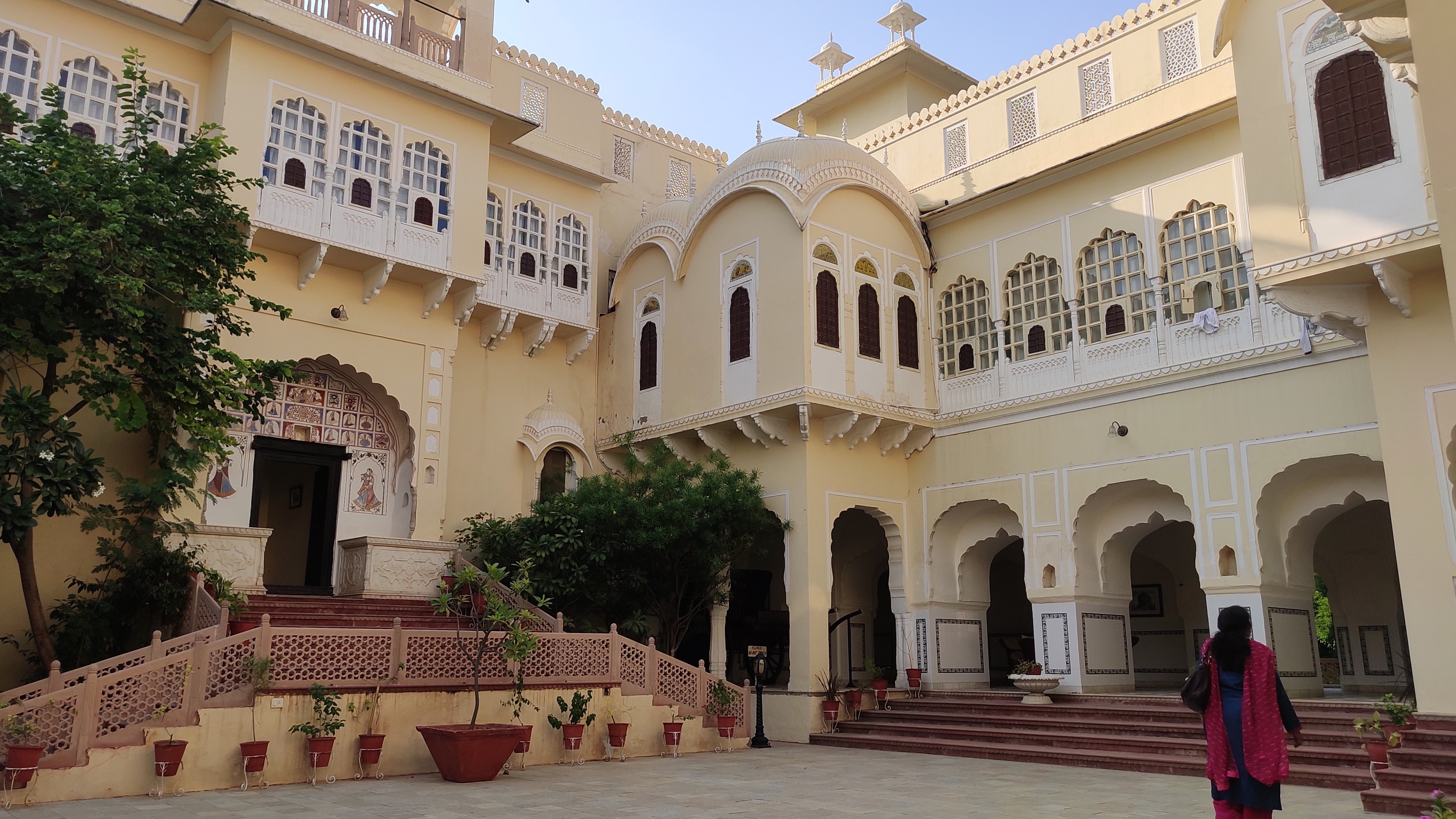
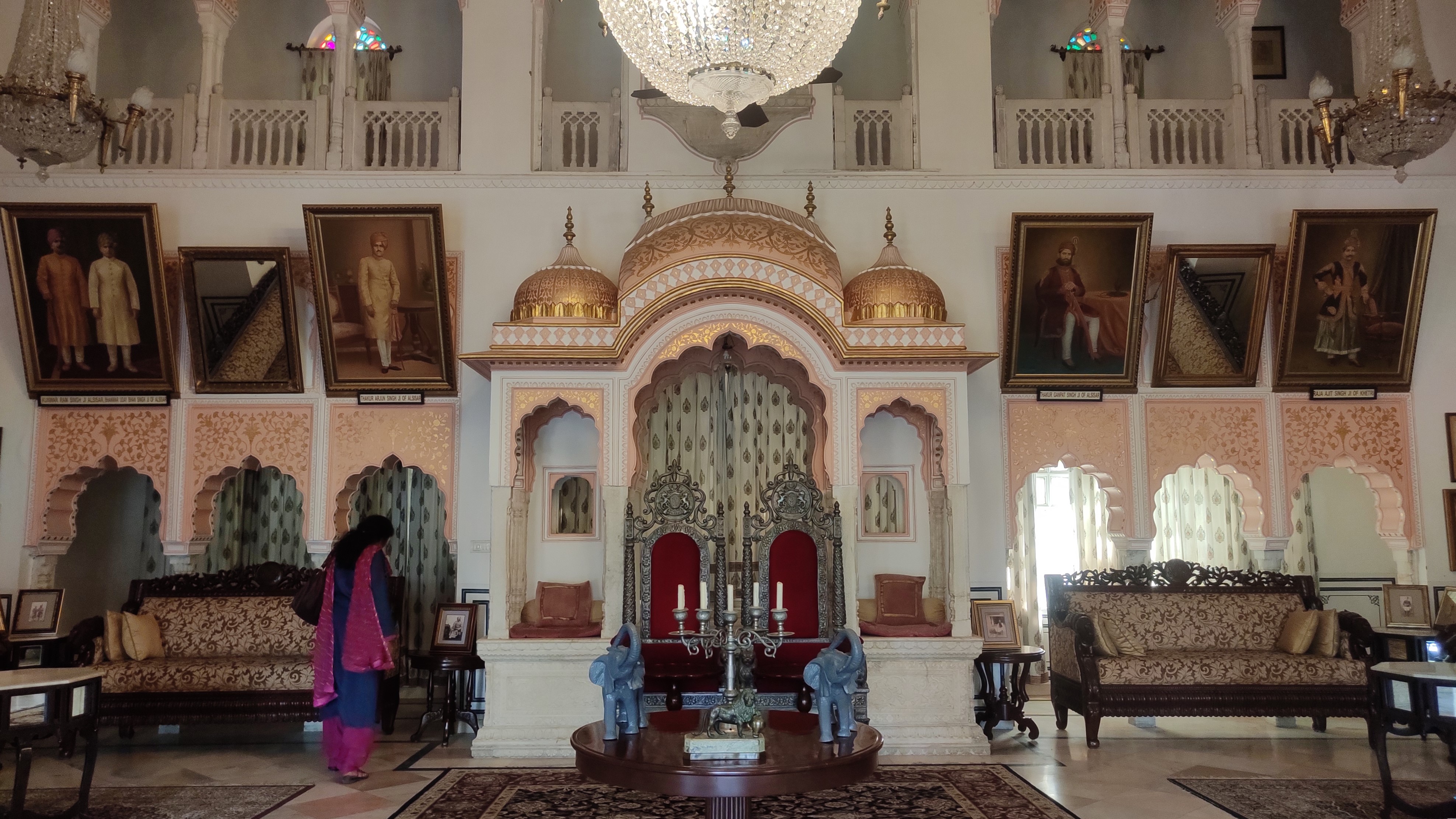
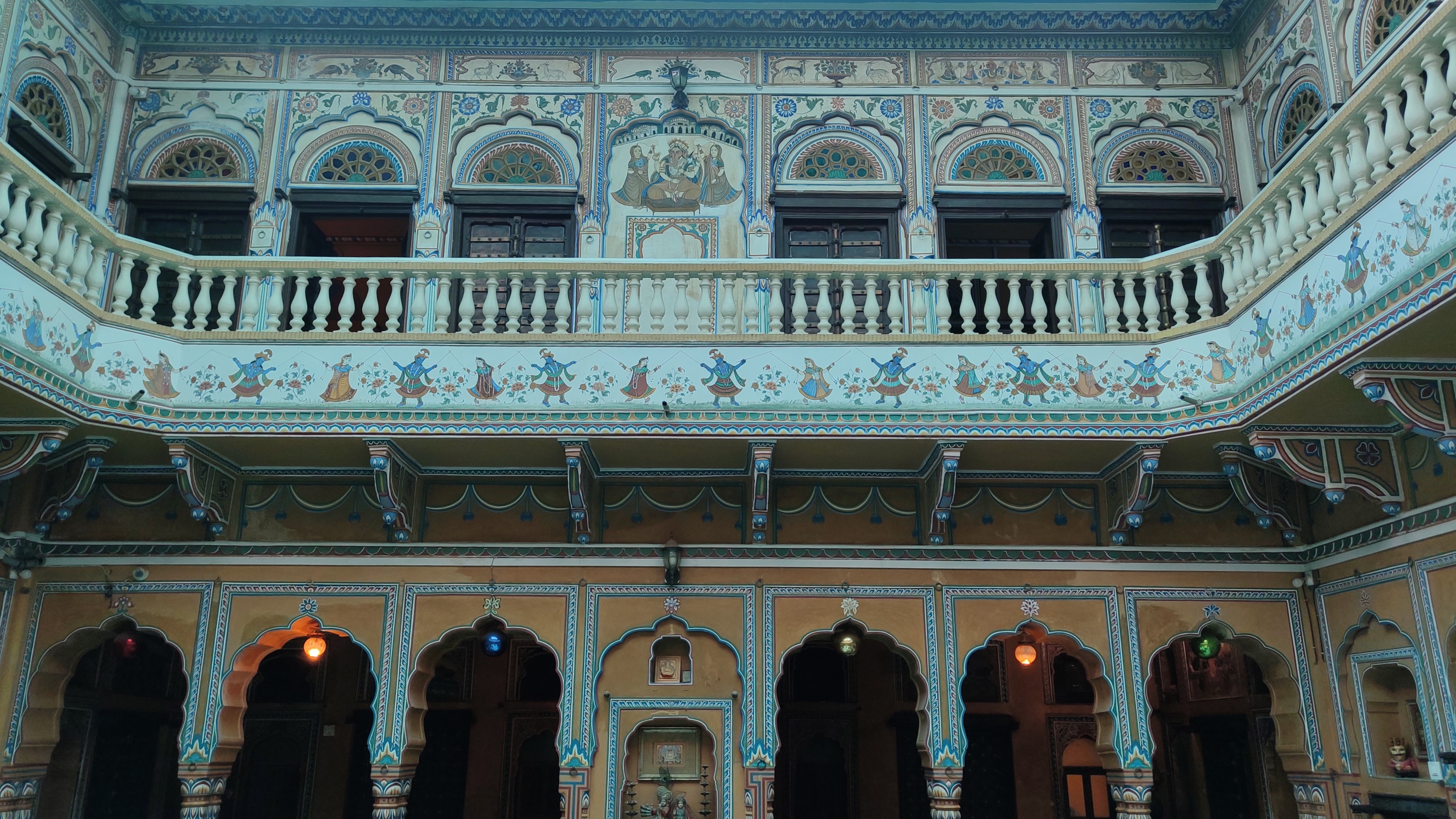
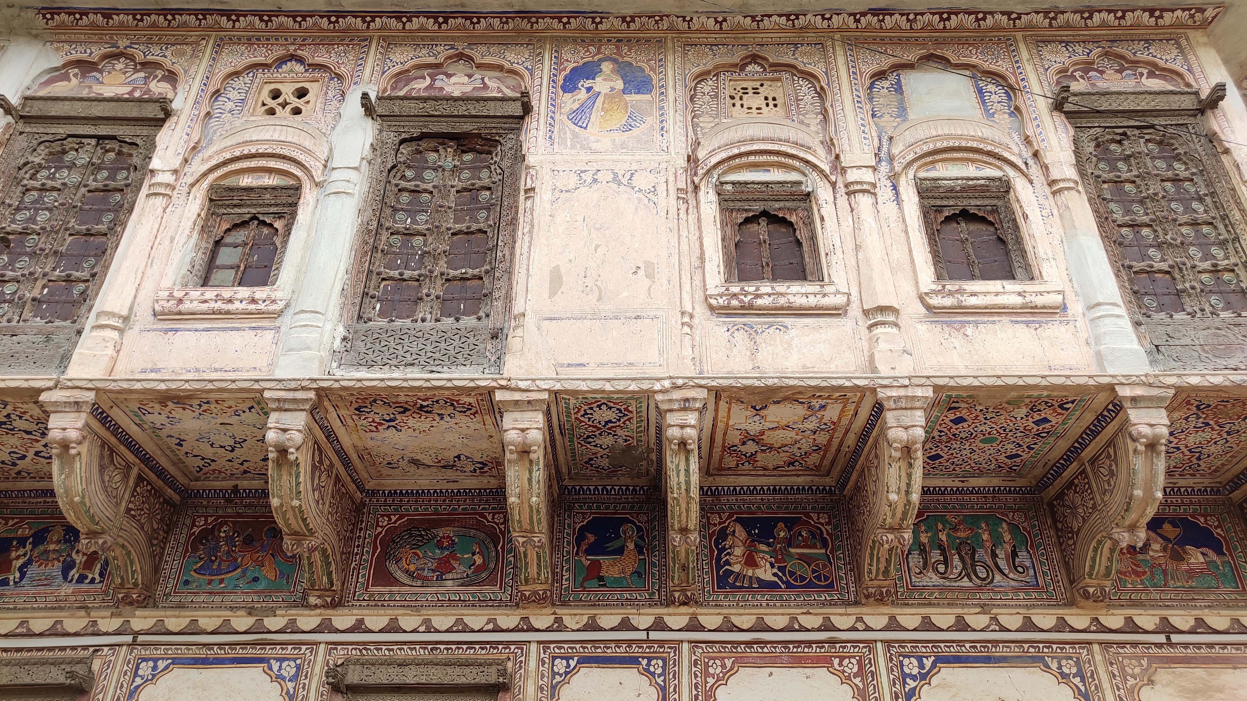
We kicked off our trip by first heading off to Pilani – which my father, on account of being an educator had wanted to see for a long time – via Loharu. After getting a glimpse of the BITS Pilani University, we proceeded to Alsisar, on a narrow arterial road that cut through cotton fields, and part-flat, part-undulating arid patches populated with khejri and babul trees. At Alsisar, cutting through the town on our way to Alsisar Mahal, we were immediately enchanted by the stately havelis sporting painted facades. A tour through Alsisar Mahal, a 18th century palace-turned-heritage hotel standing right in the middle of the town, transported us to a more wistful time.
Laxmi Narayan temple, Alsisar
A lane in AlsisarCourtyard of Alsisar Mahal
A hall in Alsisar Mahal
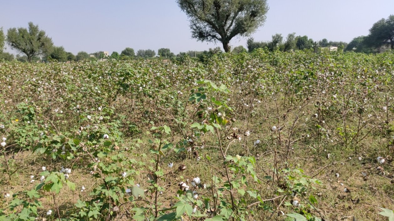
At this point, we did not have an itinerary for the rest of the day, the only objective being that we reach Mandawa by the end of the day. So, we then drove towards Malsisar, a twin town of Alsisar – it is said the towns are named after two sisters, Alsi and Malsi, respectively – and took a turn left towards Bissau just at the periphery of Malsisar. Now, as the cotton fields gave way to patches growing millet, with the landscape gradually turning more arid, cattle lounged about in the shade of the sparsely scattered trees. Soon, as we approached Bissau, dunes started appearing in the distance – we were at the edge of the Thar.
Cotton fieldsCattle lounging in shade
Sand dunes near Bissau
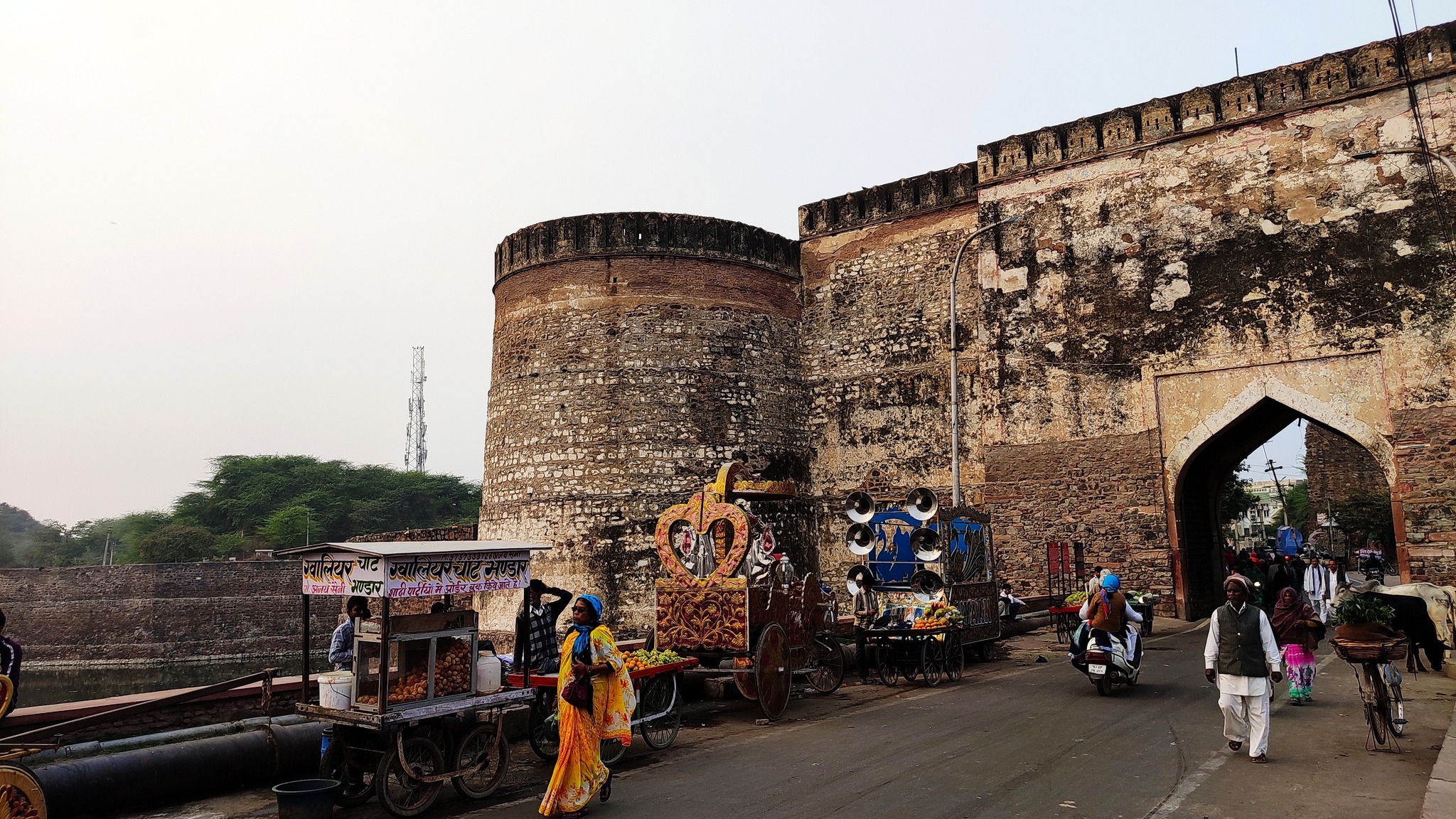
Our next stop was Churu, known as the gateway to the Thar and also one of the three largest towns of Shekhawati, the other two being Jhunjhunu and Sikar. Intent on seeing the Churu fort, we had to drive through the city centre, that was very busy on account of traffic on rather narrow roads, flanked by havelis on both sides. However, the fort not being open in the sense that tourists could visit, we concluded our Shekhwati sojourn for the day and started south towards Mandawa.
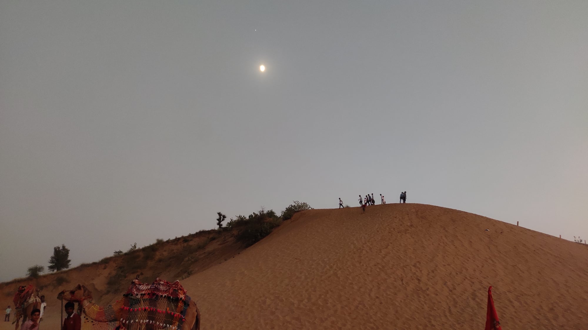
A sand dune on the outskirts of Fatehpur
As evening fell and we approached Fatehpur, we passed by sand dunes shining in the moonlight, stopping at one particular sand dune where camel rides were being offered. Soon, passing through quite narrow lanes of Fatehpur, another town abounding in havelis, we reached Mandawa around 7.30pm and checked-in for the night at a fairly new haveli. The haveli, the receptionist told us, had recently played host to a crew that was in Mandawa for shooting an OTT series featuring Sonakshi Sinha (this series later turned out to be Dahaad). Following dinner at the rooftop on the haveli, we went off to sleep, as a day-long detour from Shekhawati awaited us the following day.
Hanuman Prasad Newatia Haveli, Fatehpur
Part-2: Nagaur
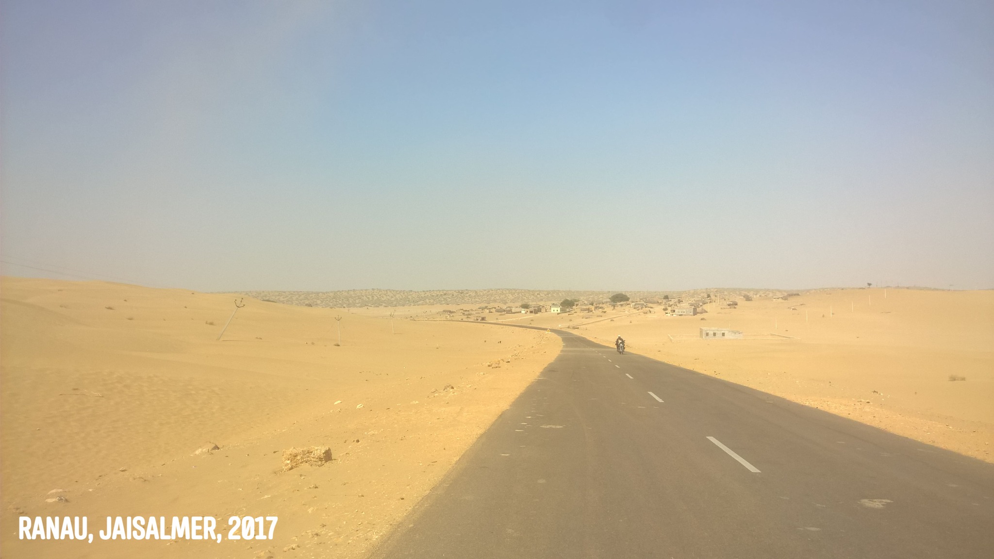
The following day, after breakfast, we started off for Nagaur, a place that had been on my radar for a few years now. Once again passing through the haveli-laden, narrow lanes of Fatehpur, we headed west this time, straight into the Thar desert. As the the density of houses grew thinner, so did vehicular traffic, however, the traffic was supplanted with hordes of saffron-clad devotees walking by foot to some place that we did not know yet. In echoes of kawad yatra that happens in North India in July, trucks laden with similarly attired devotees, playing bass and disco-beat laden devotional songs too were headed in the same direction. We realized they were headed to the Salasar Balaji Temple once we crossed Salasar.
Beyond Salasar, as the two-lane highway winded through the arid, undulating land, we would be alternating between sights of crests of low sandy mounds rolling in the distance when riding a crest ourselves and the prospect of climbing up a pass between sandy mounds when passing through a trough. The cherry on top was the tarmac, smooth and devoid of a single pothole, making it a pleasure to drive on. Sparsely populated towns, that we mostly by-passed, greeted us on the highway, before we entered the throes of the conspicuously bigger city of Nagaur, and promptly navigated through, first the wider streets, and then the narrow lanes, on our way to the older part of the city.
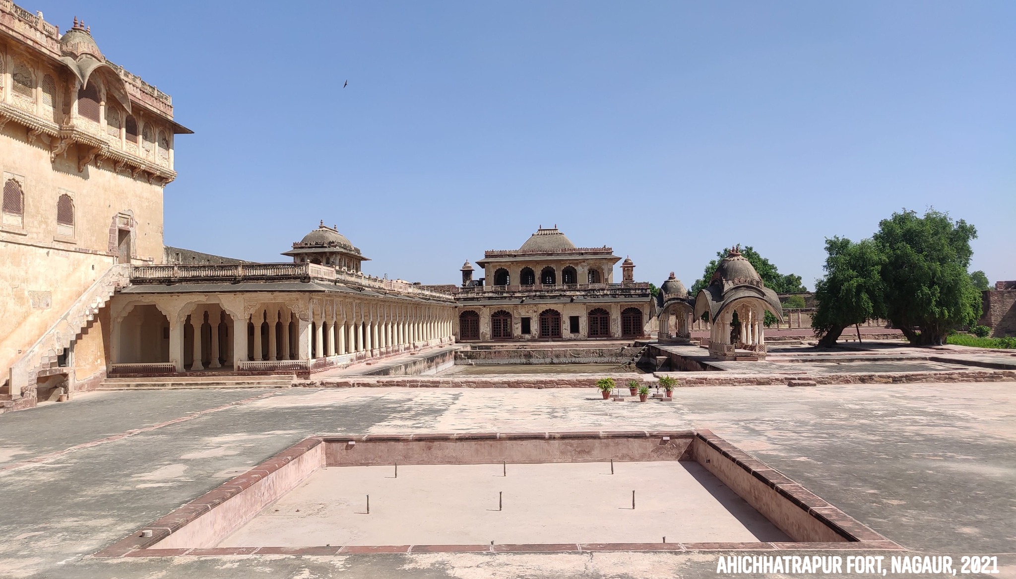
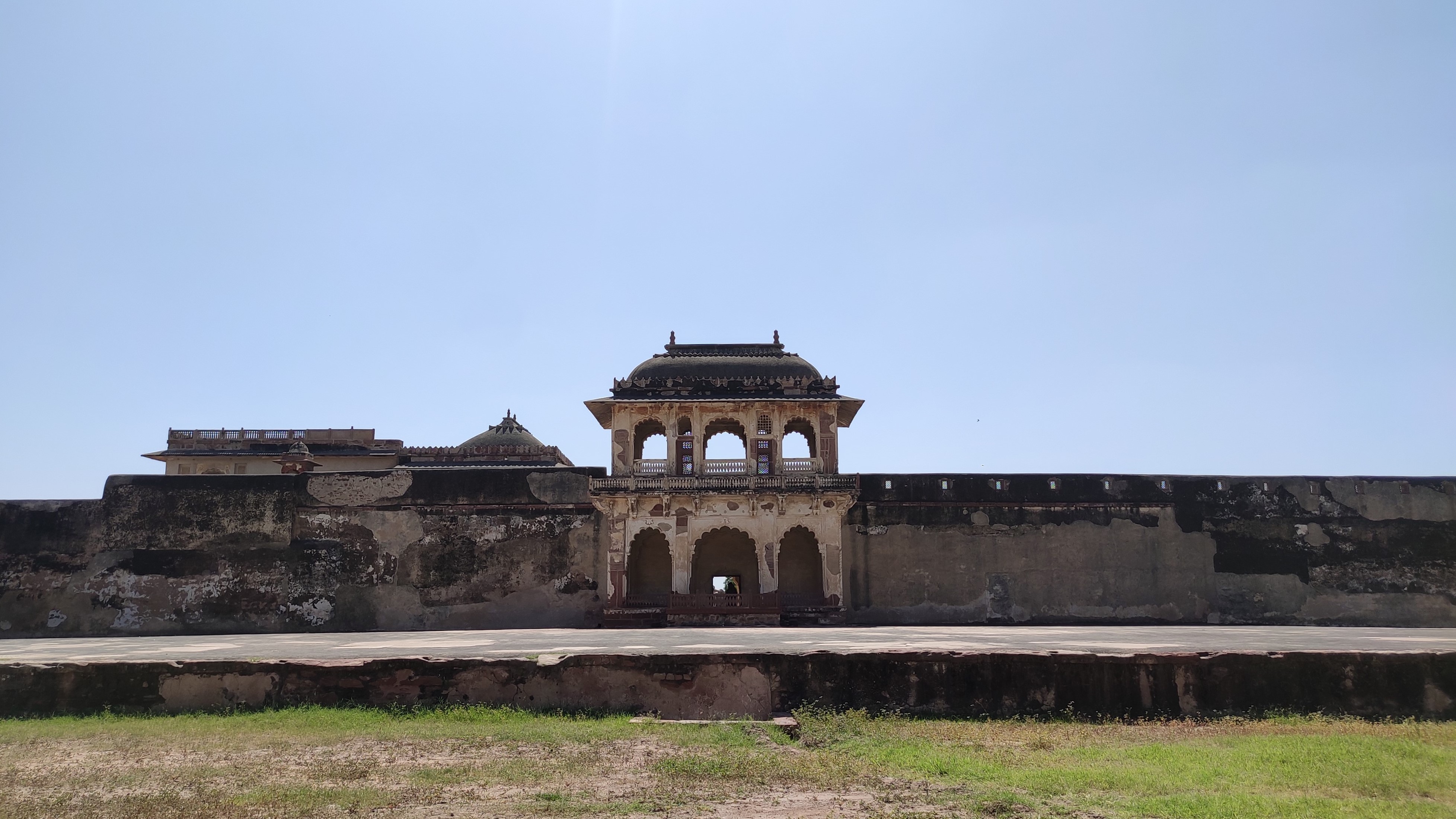
Being on the offbeat track, Nagaur is not heard of as often as the likes of Jaipur, Udaipur, Jodhpur, Jaisalmer etc., and yet turned out to be a pleasant surprise, what with a UNESCO site in the form of the Ahichhatrapur Fort or the Nagaur fort. Nagaur once served as an important stop on trade routes passing through the Thar desert. But it has had a chequered past ever since it encountered Ghanznavid invasions in the 9th-10th centuries. It kept changing hands and was fought for amidst bigger states placed around it, but its protectors fought equally hard to retain it.
Main fort gate of Ahichhatrapur fort, Nagaur
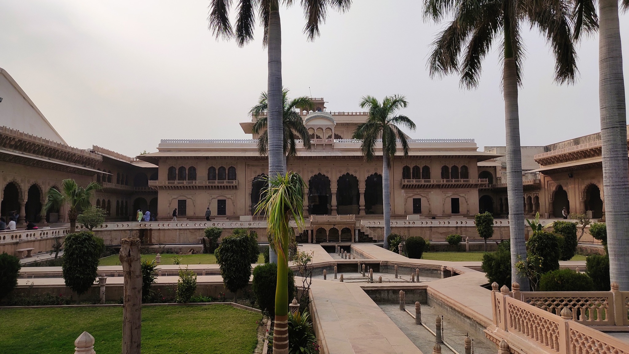
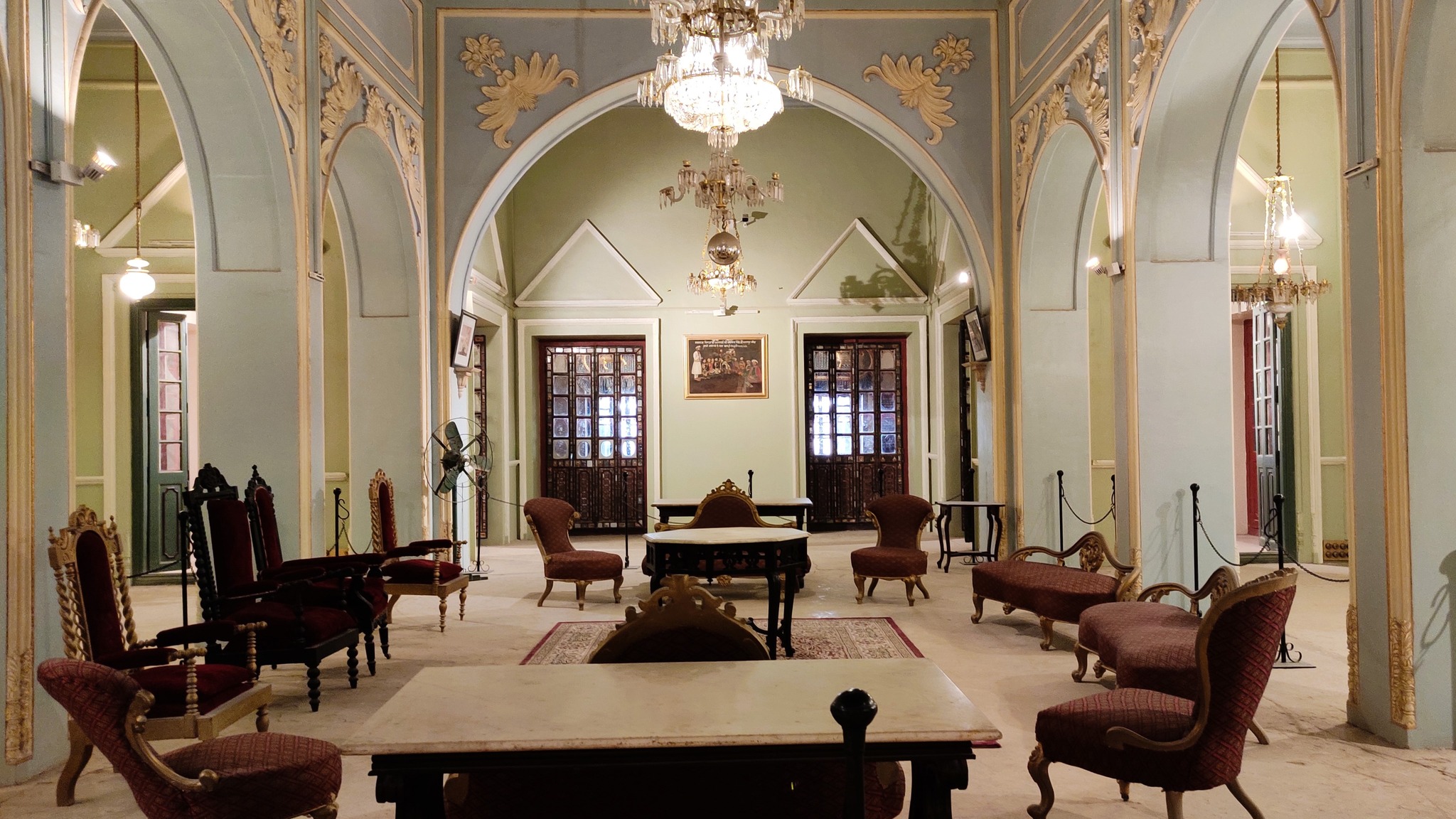
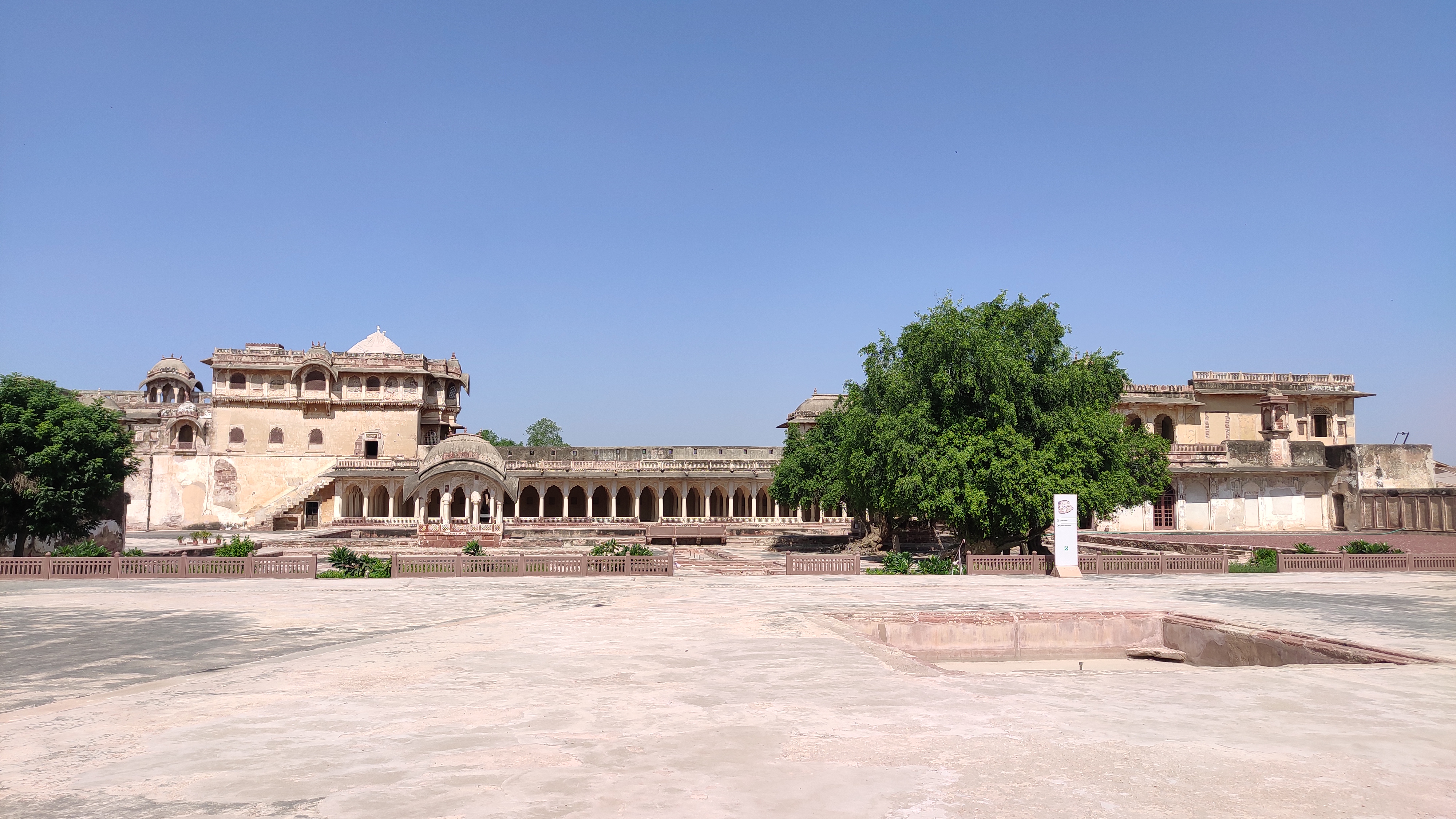
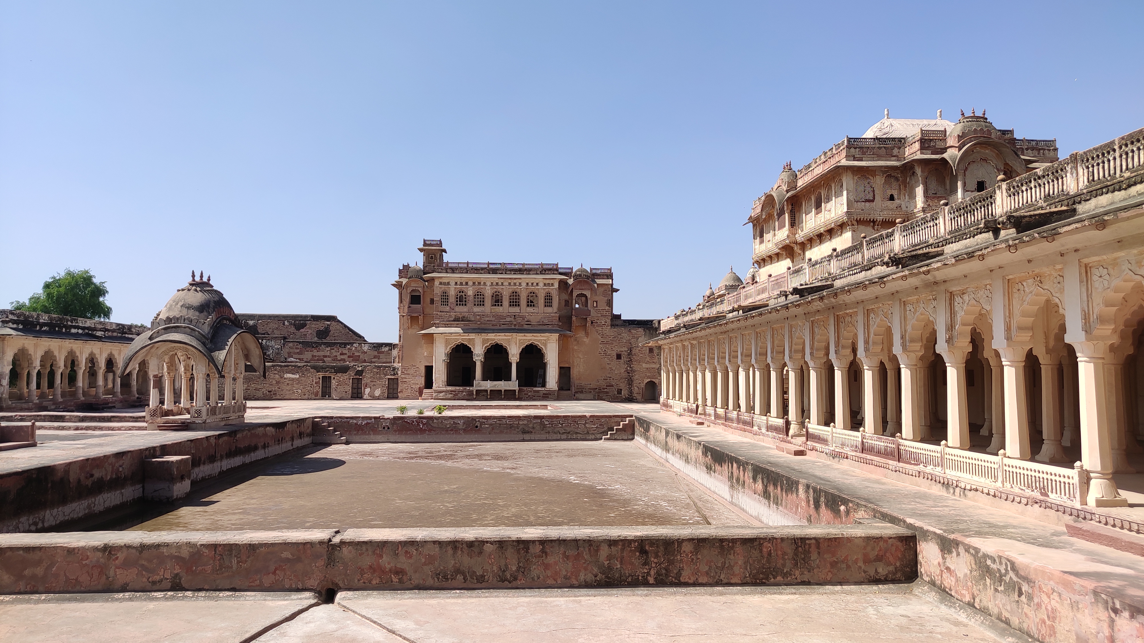
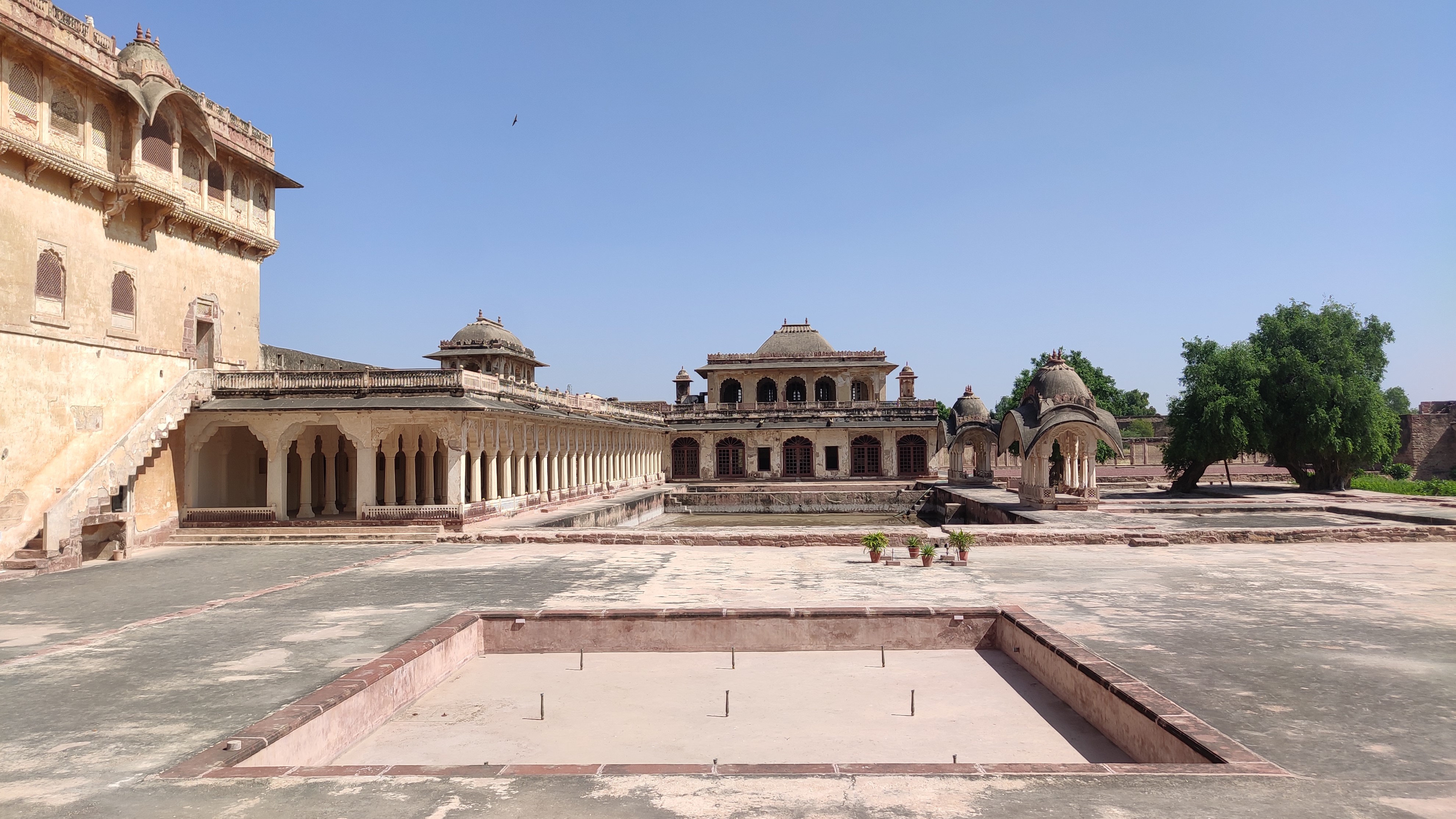
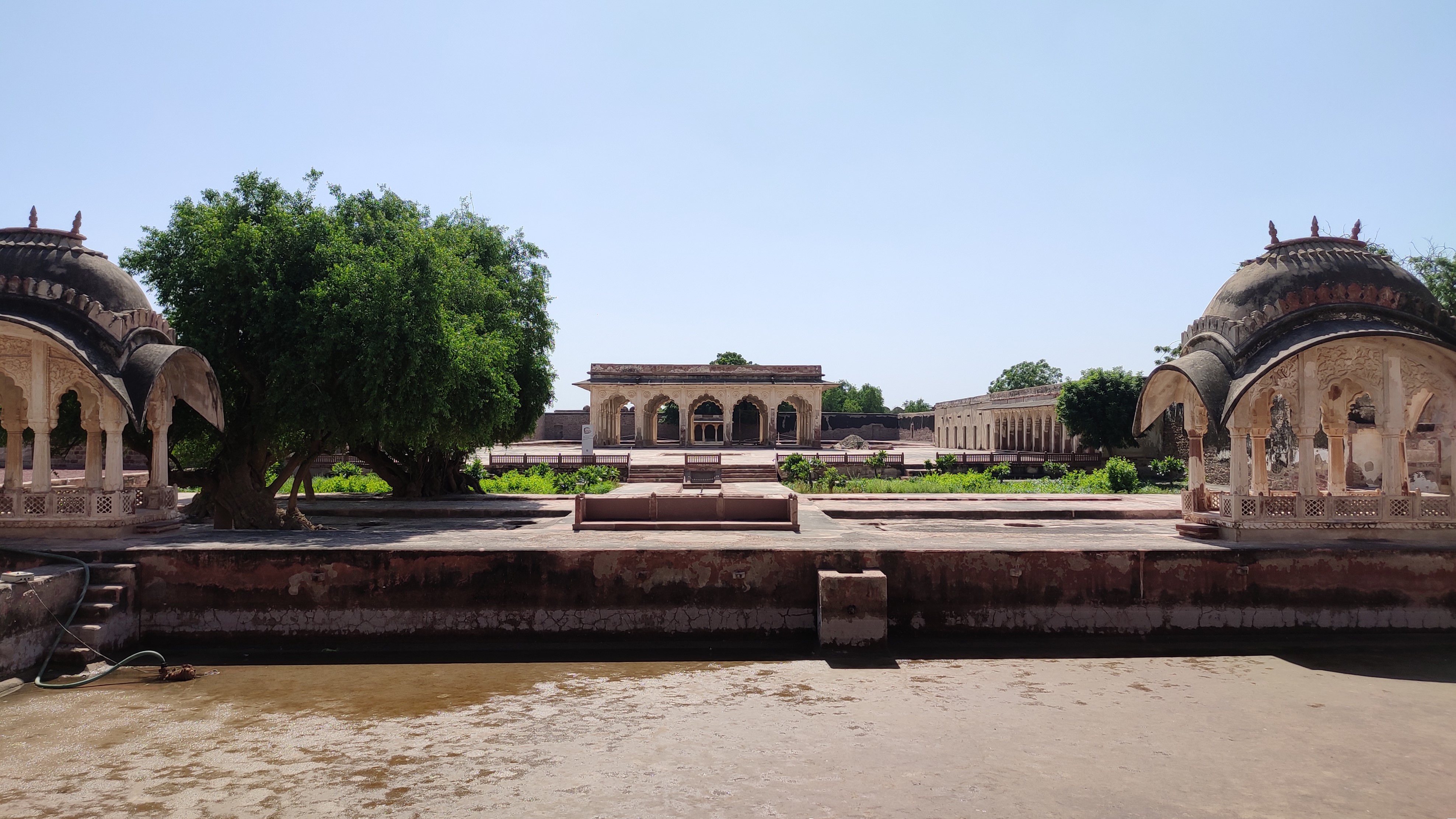
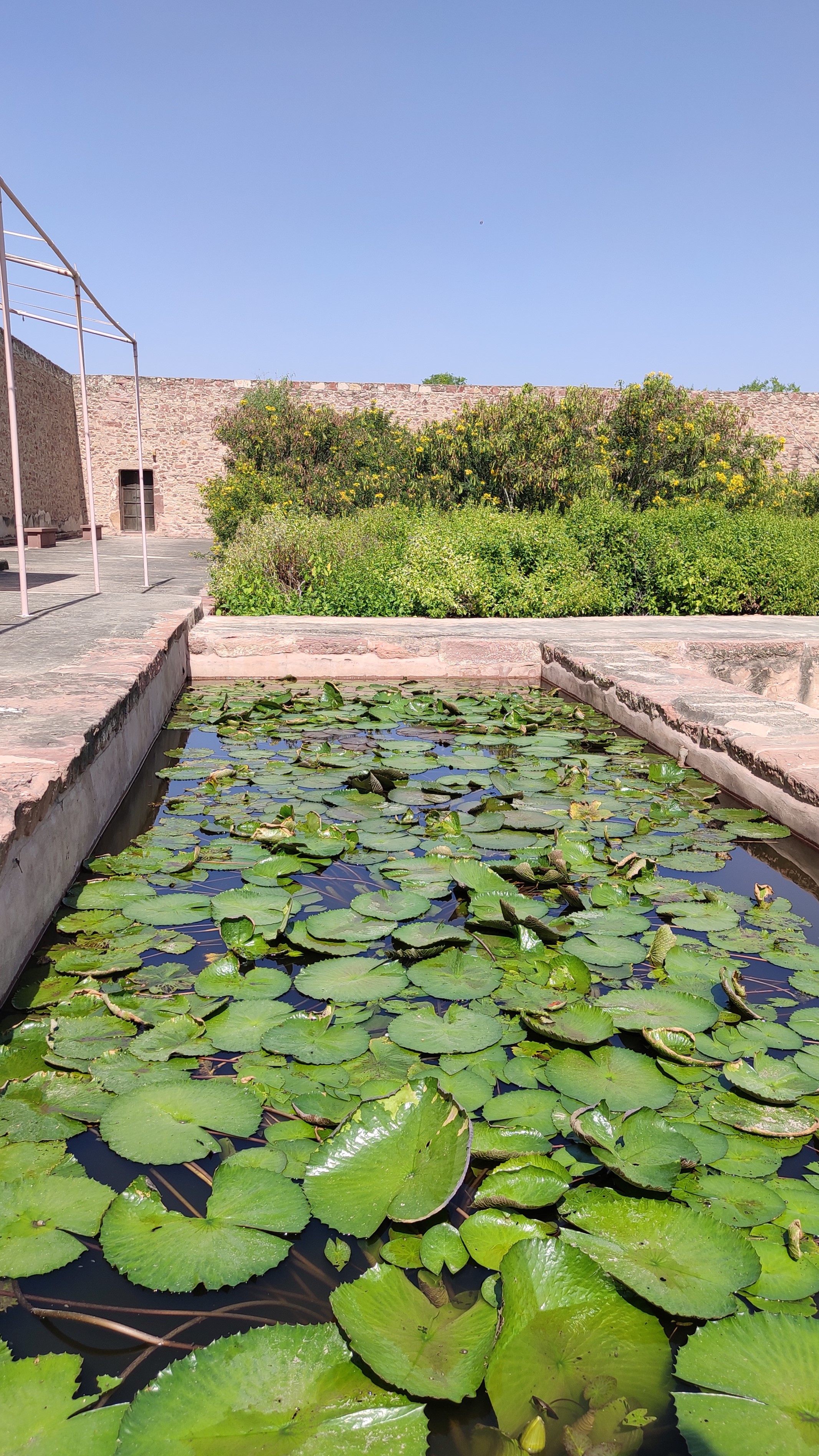
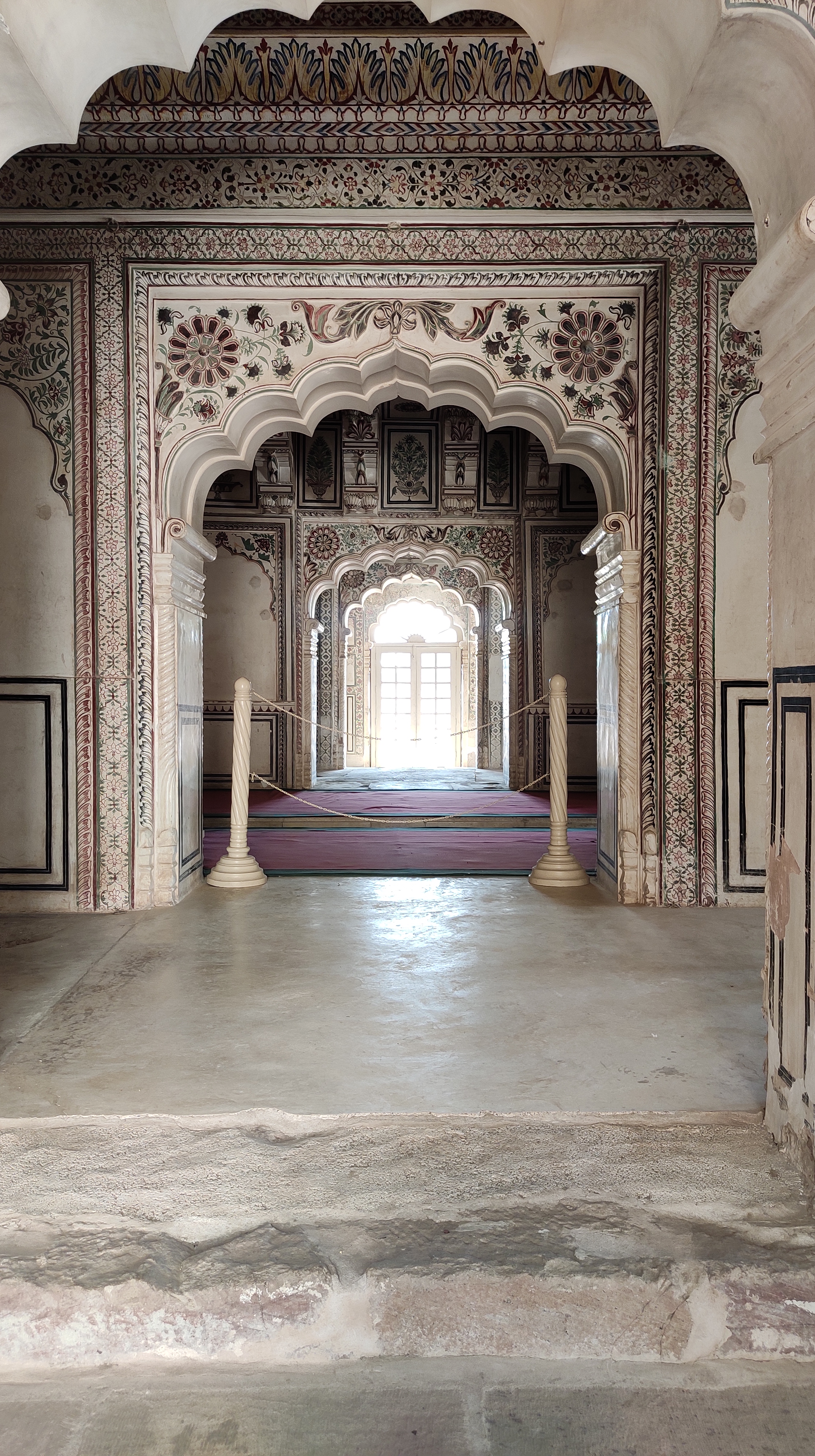
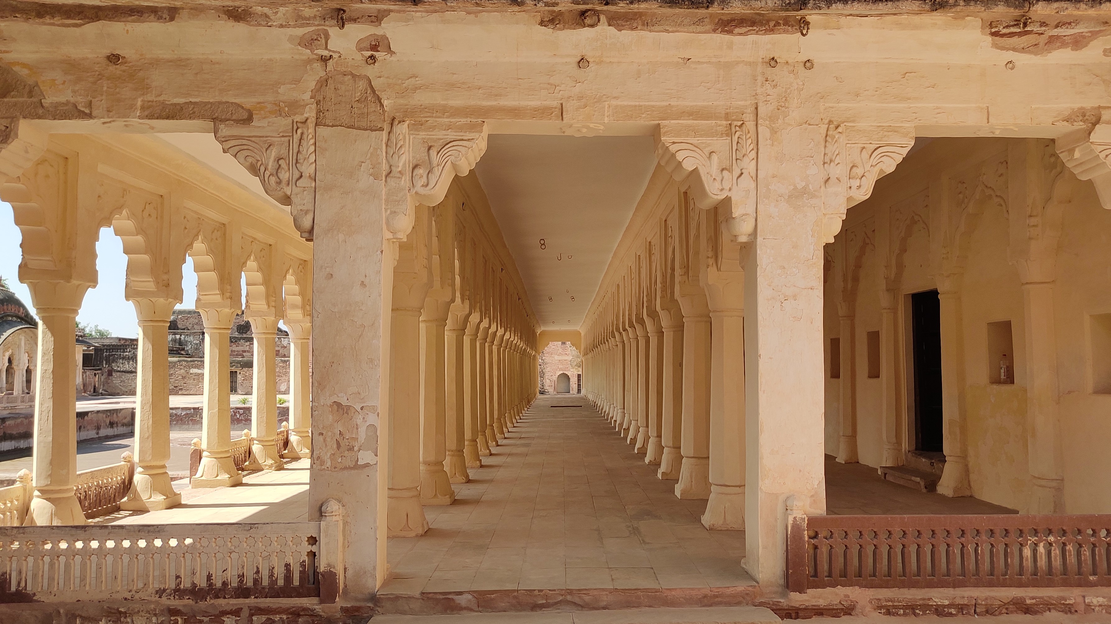
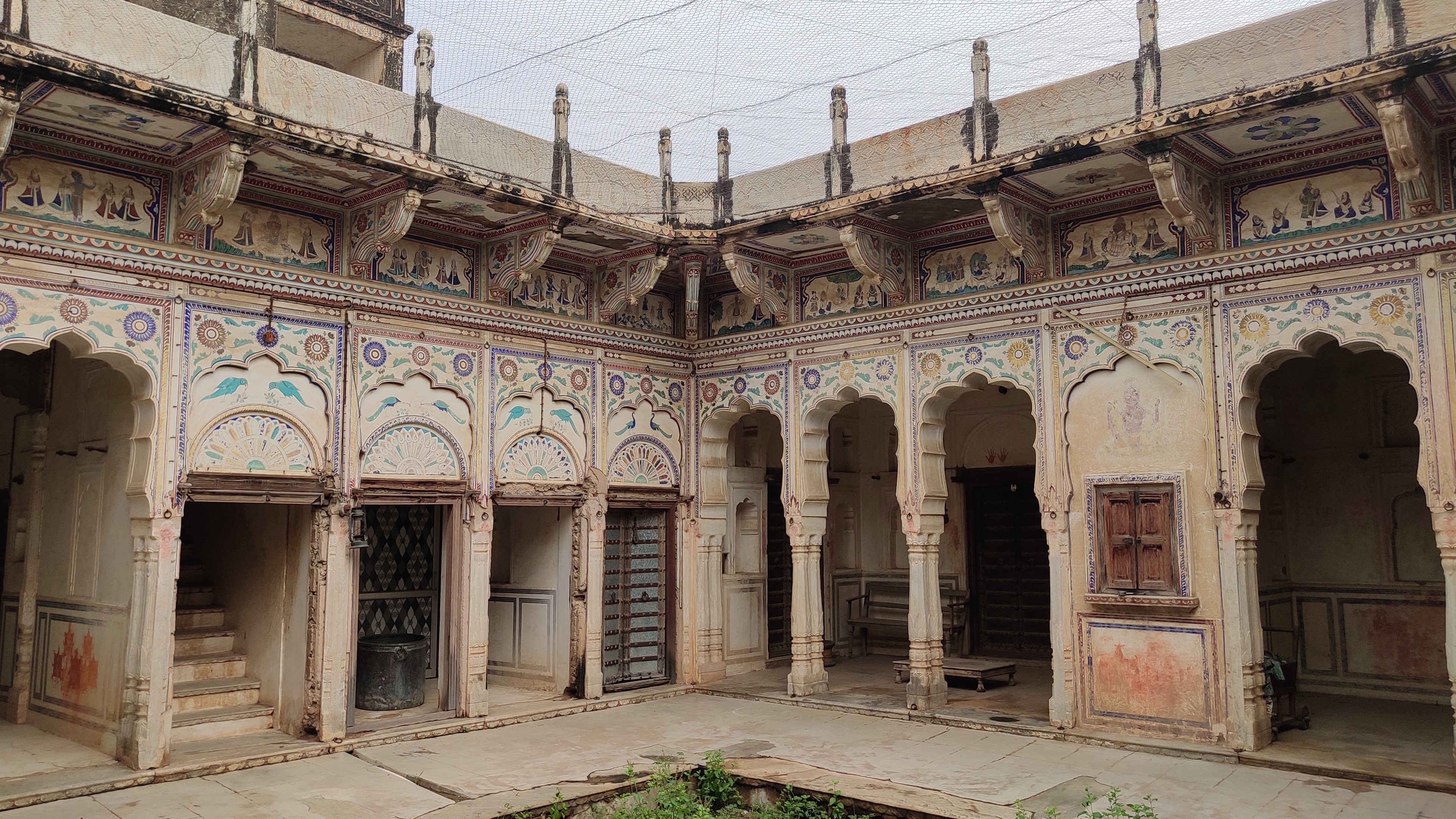
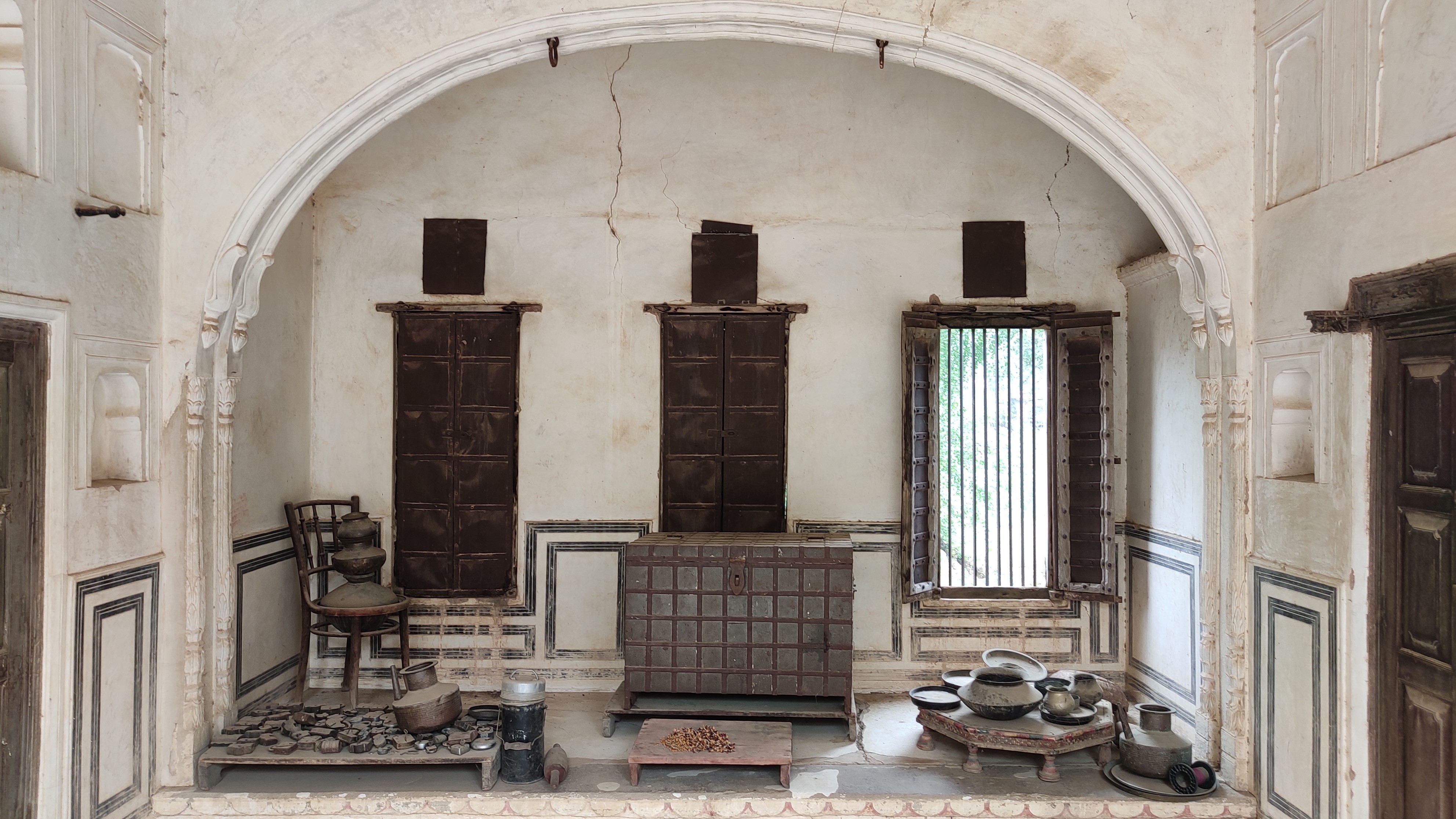
Inside the Ahichhatrapur fort, itself opulently built with a formidable fortification wall enclosure, we walked through the multiple palaces, namely, Sheesh Mahal, Deepak Mahal and the Hadi Rani Mahal, interspersed by large courtyards with lush gardens, placid pools and exquisite fountains. We lost ourselves in the corridors running from one arched-door to another, with the pillars sporting colourful motifs and the ceilings rife with frescoes. After spending almost 2 hours, being awed by the beautiful antiquities inside the fort, a different world in itself, we had our lunch around 2.30 pm and were back by 6 PM at Mandawa, where we checked into the 200-year-old Radhika Haveli.
Glimpses of the structures inside the Ahichhatrapur fort, Nagaur
Part 3: Mandawa
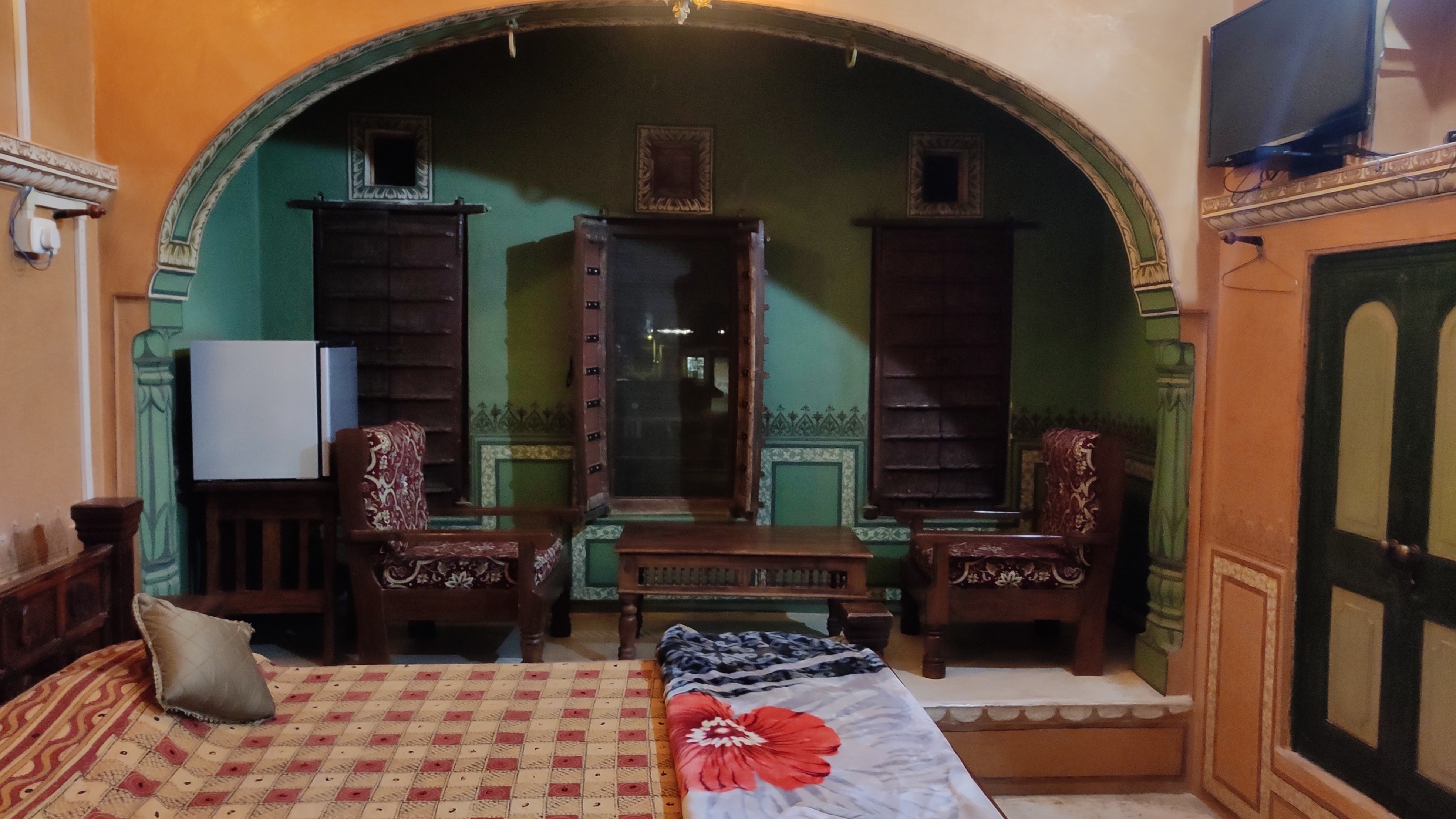
Radhika Haveli is a typical Shekhwati style haveli with a large courtyard in the middle of a rectangular-shaped two-storeyed living area. Rooms lie stacked one after another, ranging from sizes small to big, with old-style windows, with their painted and glazed wooden shutters, opening to the lane outside. We realised the floor of our room was two-tiered, with the higher tier, the narrower of the two, running by the side of the wall with the window. The old queen-bed lay between the cylindrical pillars holding up the ceiling, and a coffee table along with old-style chairs stood beside the window.
Our room in Radhika HaveliCourtyard of Radhika Haveli
At around 8 PM, stepping out by foot in search of a pharmacy, we were immediately confronted by a desolate lane, which the faint streetlights did little to illuminate, prompting us to retreat and resume the search with our car. Back in the room, when we switched off the lights using the lever on the antique round-shaped bakelite base, we were engulfed by an atmosphere of eery quietude.
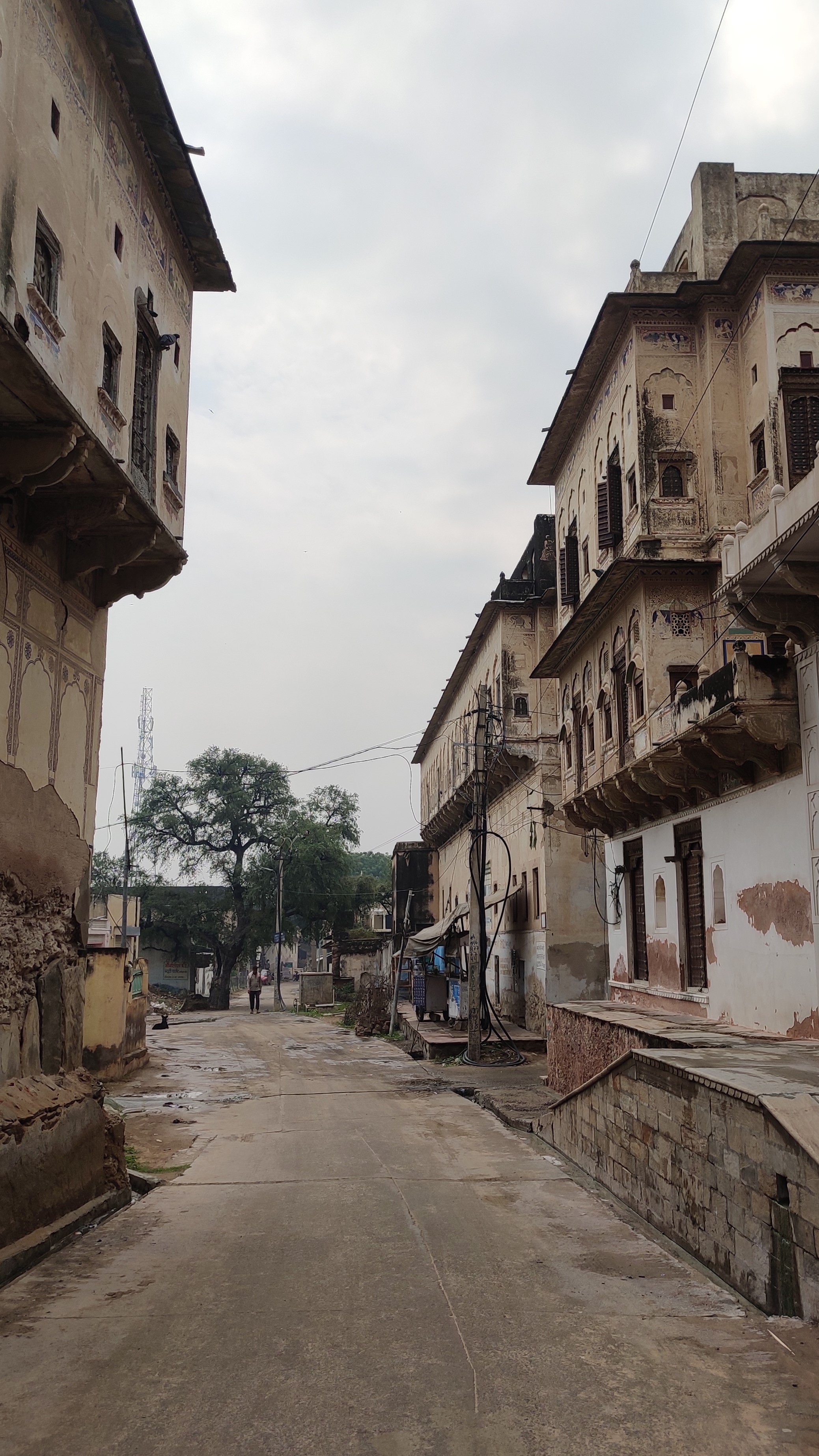
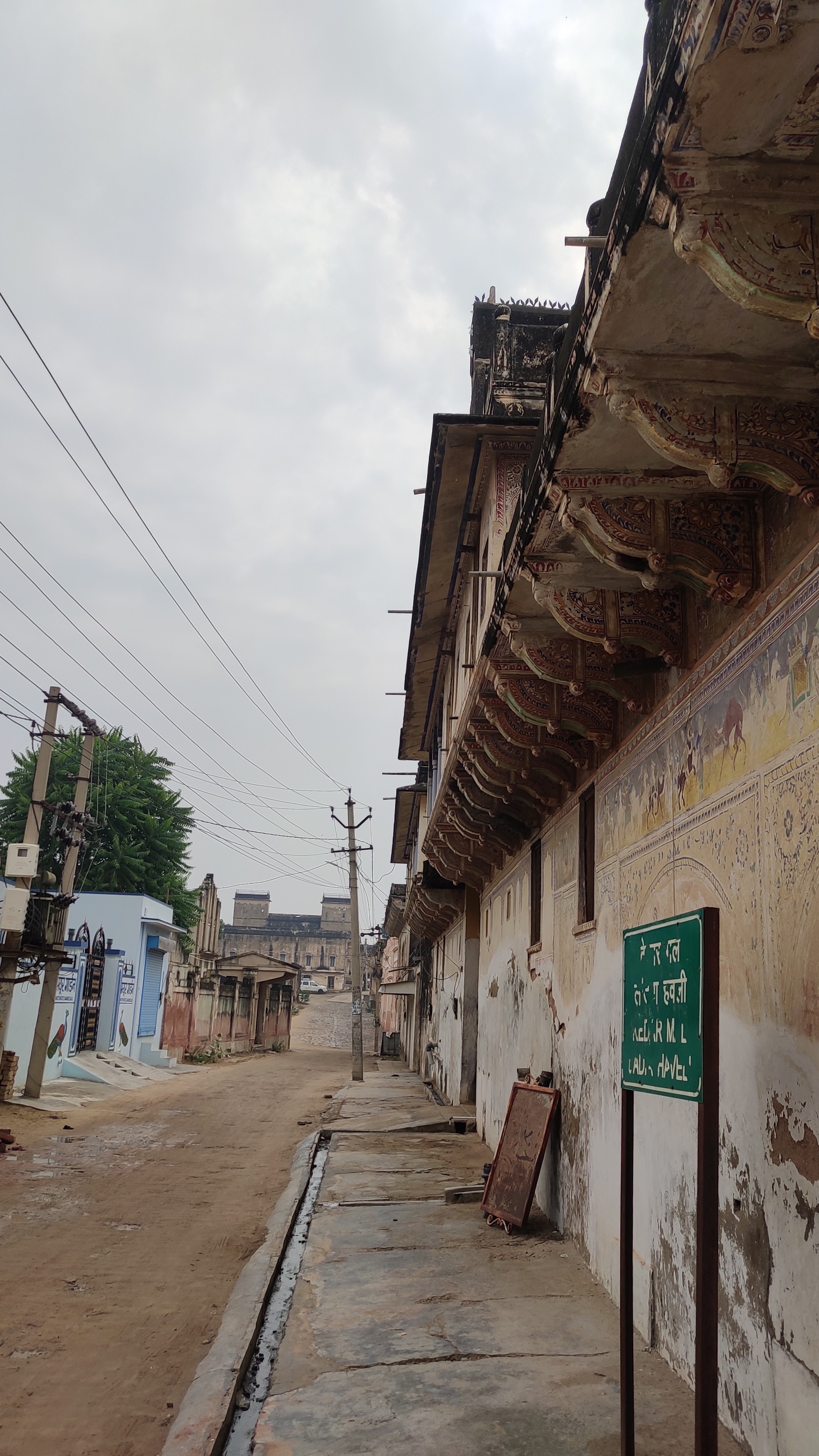
A lane in MandawaA lane in Mandawa
The next morning, the hosts at the Radhika Haveli pampered us with a complimentary sumptuous breakfast comprising poha, puri-sabzi, idli-sambhar, fruit, tea and coffee and were still flooding us with so more food, when we had to decline because we were beyond full. Thereon, through the maze of streets criss-crossing the agglomeration of painted havelis, we proceeded to do a tour of havelis, to name a few, Jhunjunwala haveli and Chokhani haveli, and spots where scenes of some famous movies, namely, P.K. and Bajarangi Bhaijaan, were shot.
Inside Chokhani haveliKitchen, Chokhani haveli
Painted facade of a haveli in Mandawa
An old well in front of Mandawa KothiInside Jhunjunwala haveli
Noon onwards, we immersed ourselves in appreciating and purchasing some of the local art and handicrafts, of which Mother was simply not getting enough of. By 2 PM, we were still not done, as the variety on offer was overwhelming, and Mother was having a hard time choosing, her misery ending when Father said, ‘why choose when you can take all!’ By 2.30 PM, with a six hour journey lying ahead of us, we had to bid adieu to Mandawa, with a heavy heart and unsatiated mind, and head back to Gurugram, reaching by 8 PM. The good thing about places that one leaves feeling pangs of ‘unfinished business’ is that one could always go back to those places.
Trip Summary
Trip map
Day 1 Gurugram to Mandawa via Pilani, Alsisar and Churu (320 km). Overnight stay in Mandawa.
Day 2 Mandawa to Nagaur and back to Mandawa (370 km). Overnight stay in Mandawa.
In August-end, a full month after the 2nd vaccine shot, we finally gathered the courage to venture out on a 1000+km road trip. It would also be my first ever 1000+km driving on my own, after having learnt driving a few months prior. Moving to the suburbs of Gurgaon has meant that I now live at the gateway to my most favourite area of this great country – Rajasthan (though it only ties with Odisha for my affection!). So, it was only natural that my first long drive be to places in Rajasthan that have been on my bucket list for ages now.
Beejak ki Pahadi, Bairat
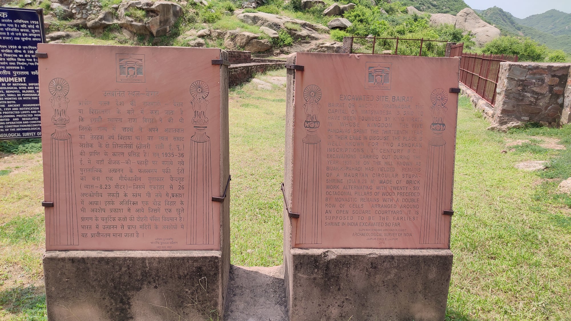
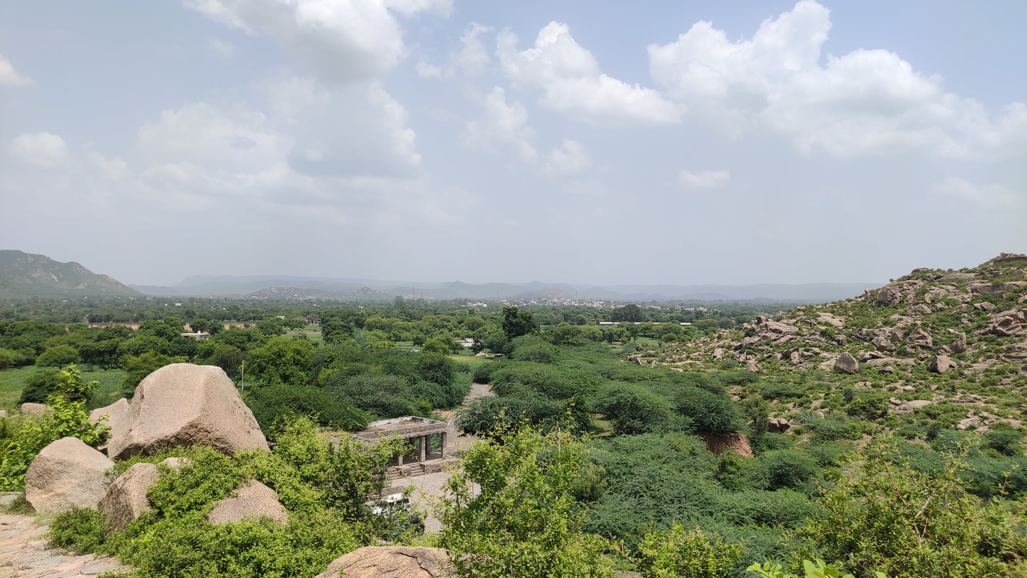
In a nook in the Aravallis, near a town called Bairat, are remains of a Buddhist Monastery of unknown antiquity, where Ashokan inscriptions from around 3rd century BC have been found. It can be reached by veering off the Delhi-Jaipur Expressway 70km before Jaipur on NH 248A, then taking a right turn onto a narrow road from Bairat town, and finally, taking a mix of long flight of steps and ramps to the top of a hill.
Bairat or erstwhile Viratnagar itself is said to have been founded by King Virata, in whose kingdom the five Pandavas (of Mahabharata) spent the thirteenth year of their exile in disguise. The site of the monastery affords a majestic view of the valley below and undulating hills on the horizon.
Steps leading to hilltopInformation plate for the site
View of the countryside from hilltop
Remains of the 3rd century BC Buddhist temple, one of the oldest recorded temples in India
P.S.: I came to know later that this is one of the oldest places of worship that we have recorded history of in India .
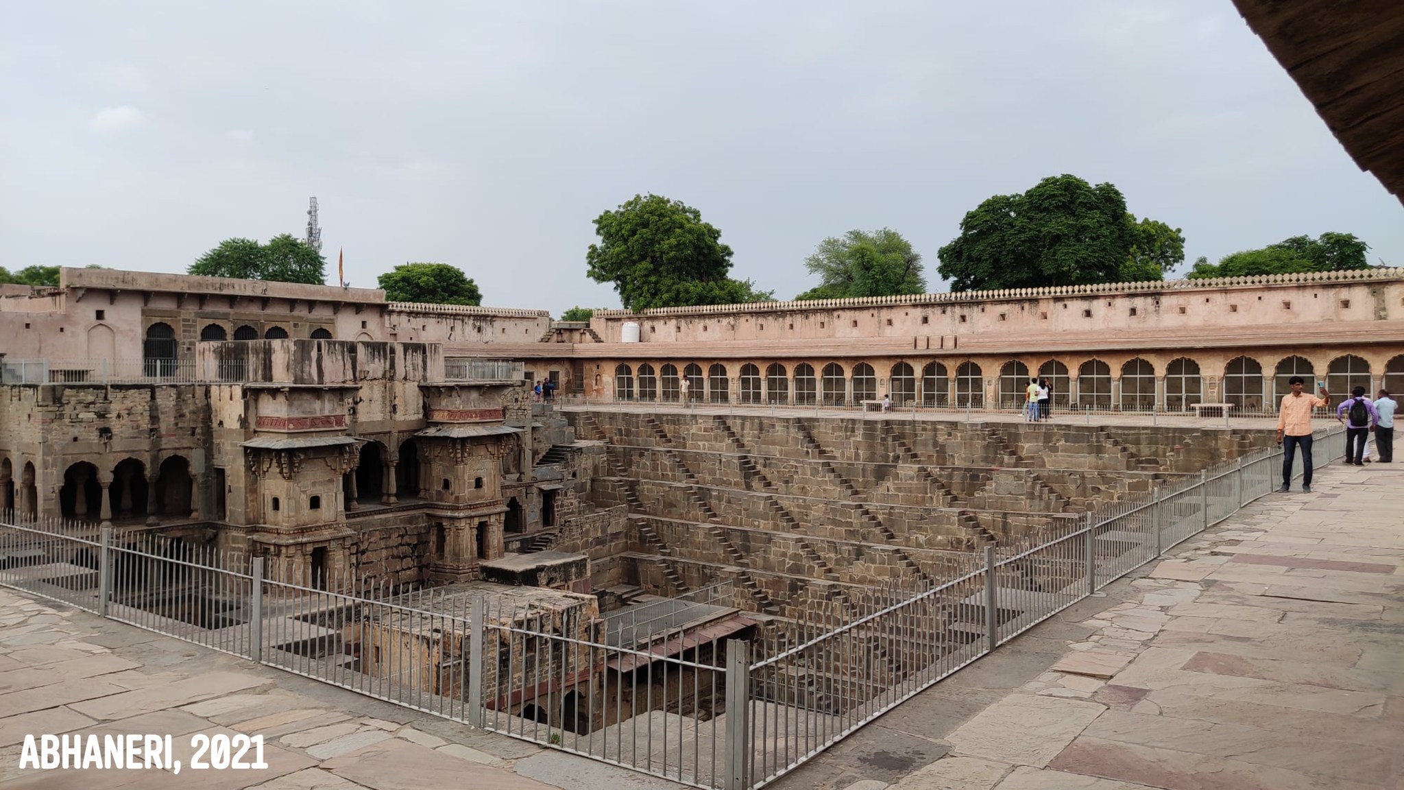
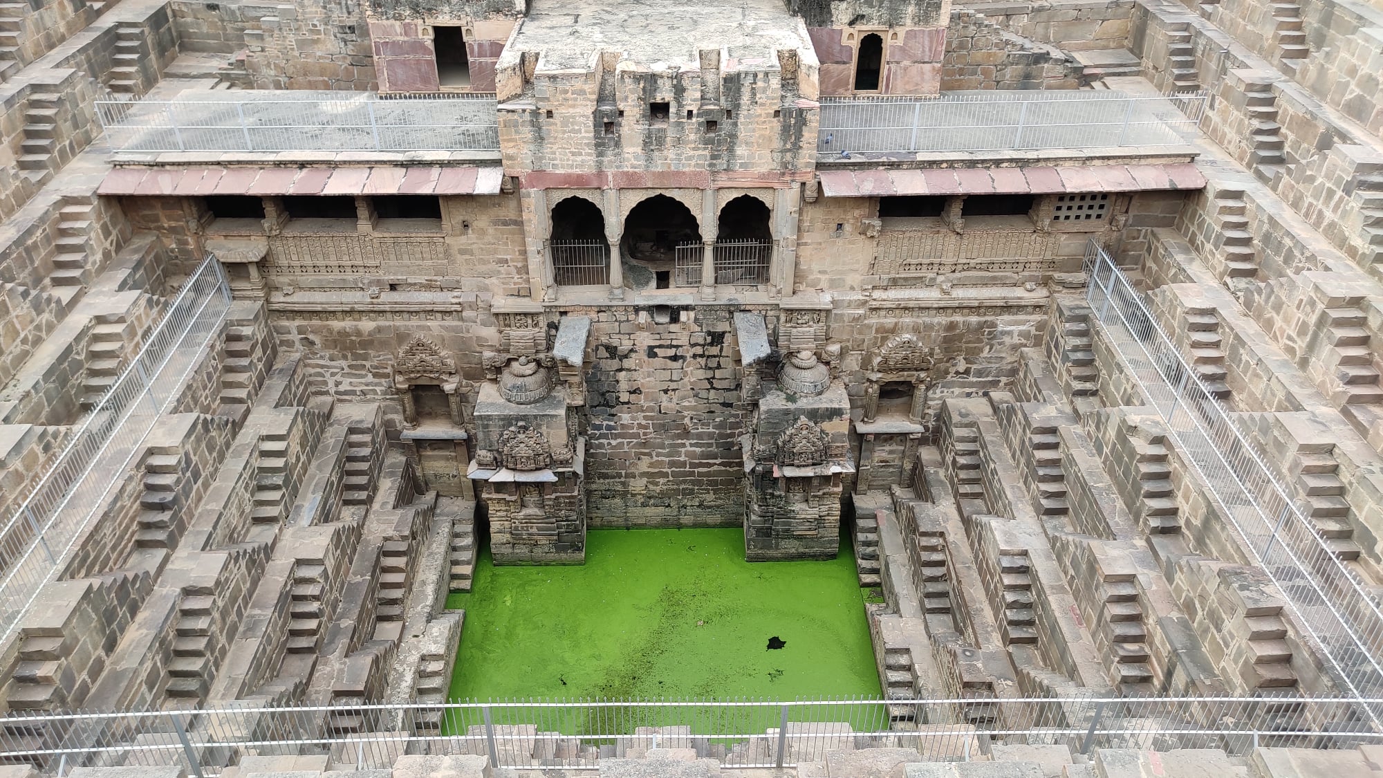
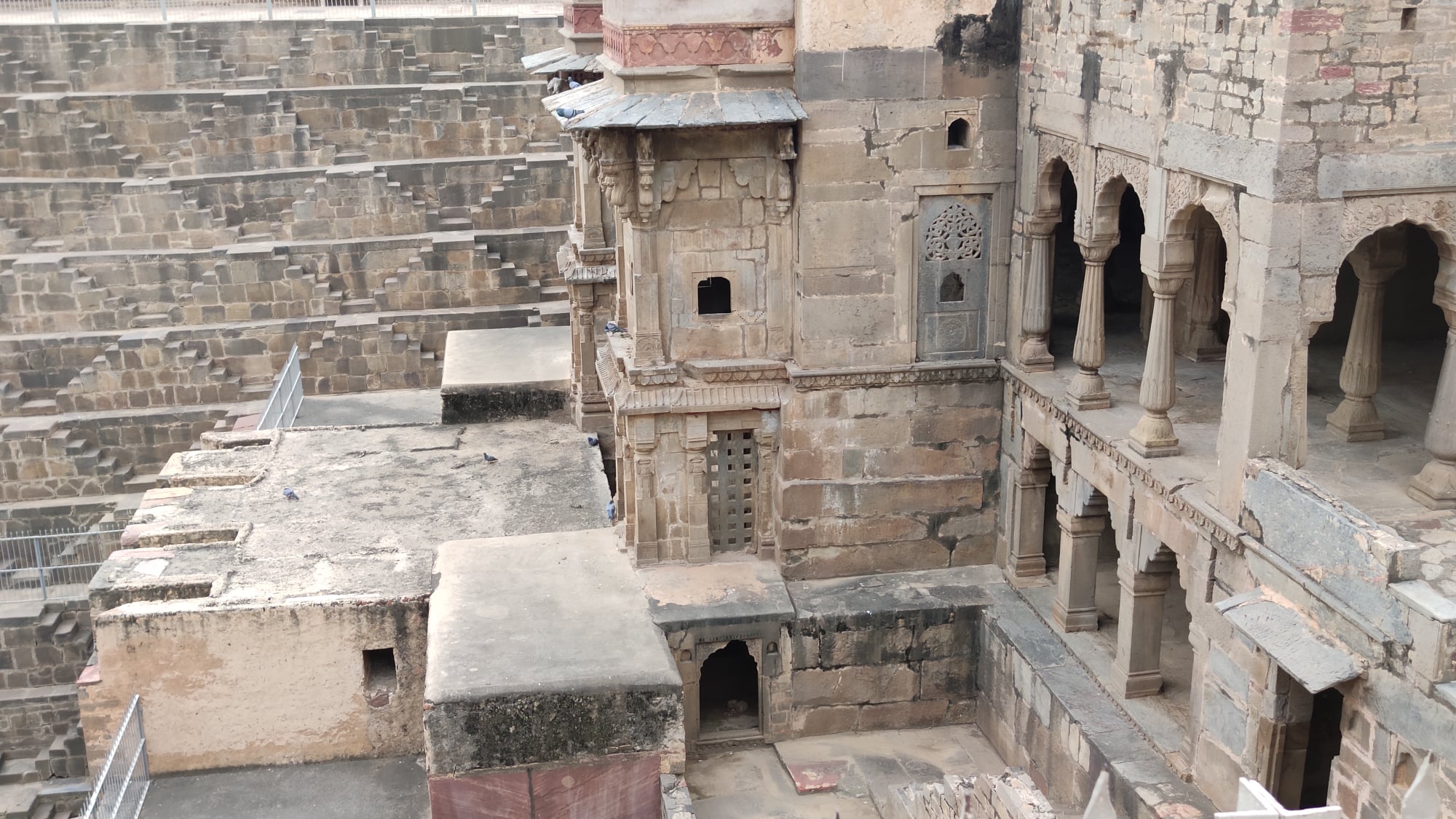
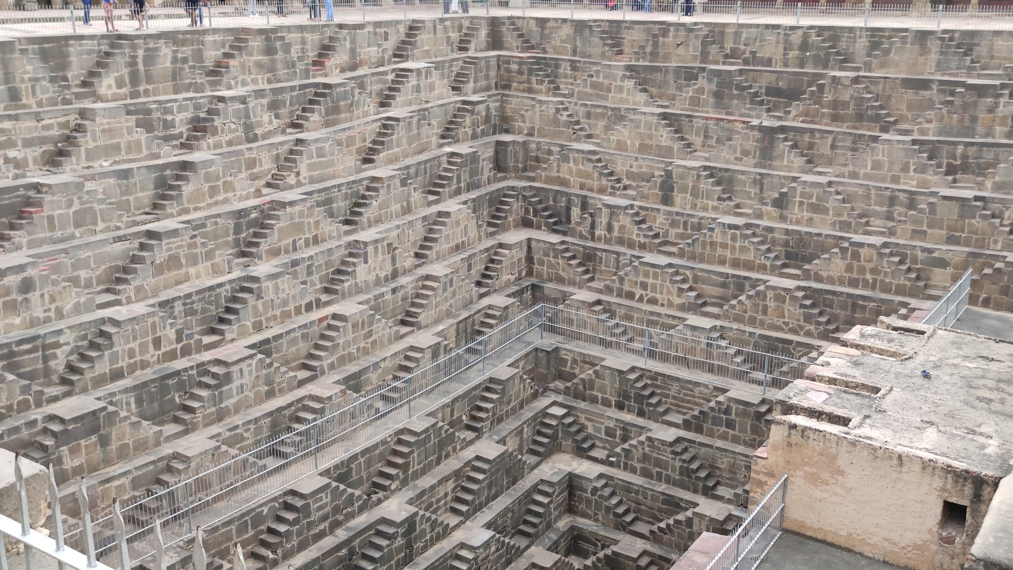
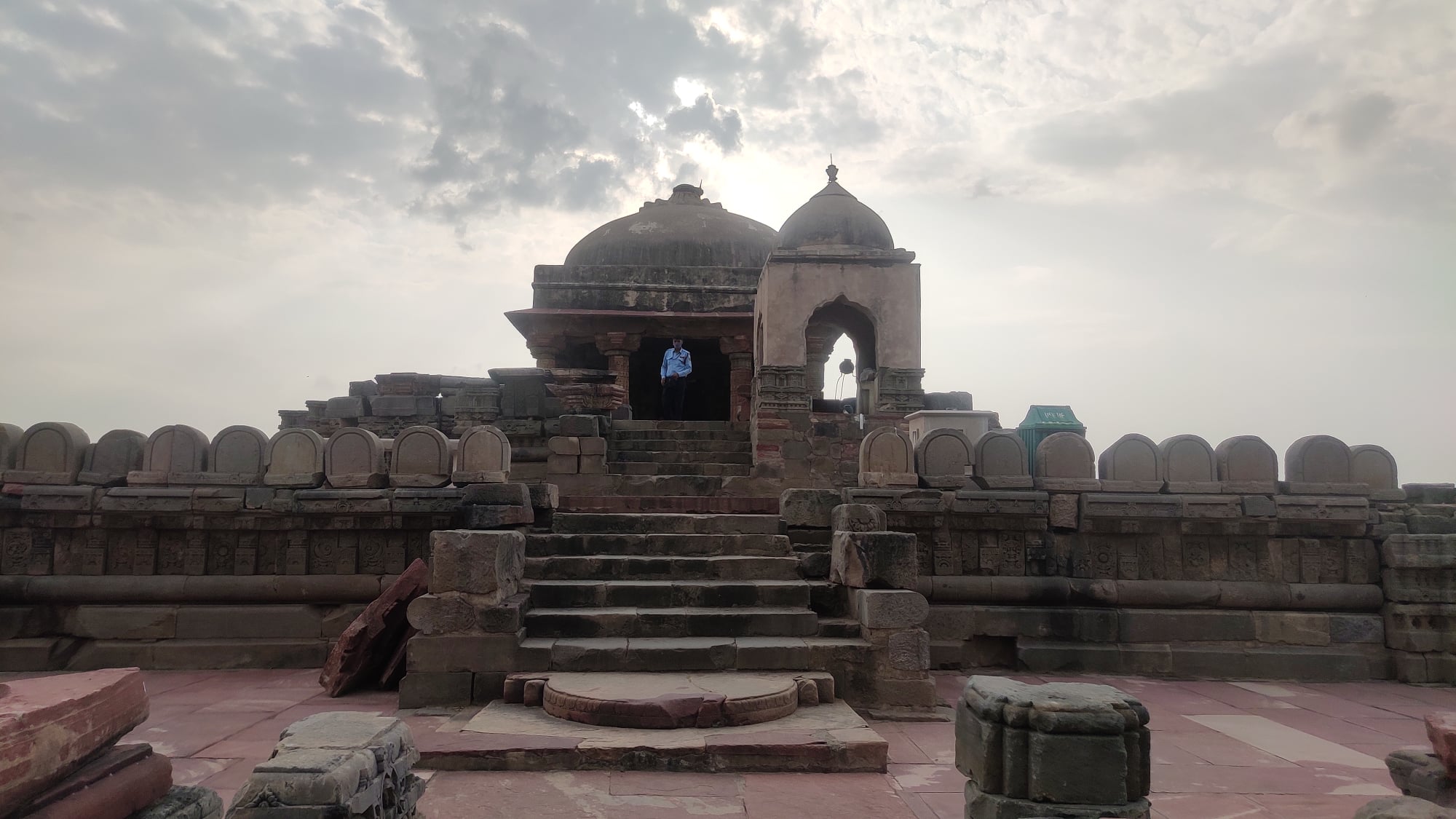
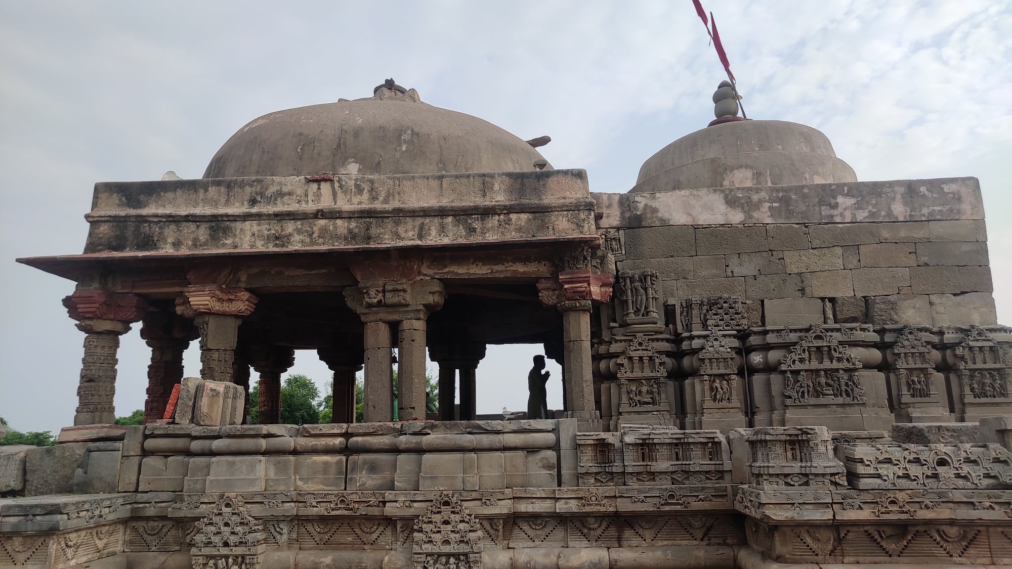
Abhaneri
A quaint little village south of Alwar that is home to an exquisite stepwell, Chand Baori, an engineering marvel in its own right and a well regarded temple dedicated to Harshat Mata. Both of these monuments are said to be 1200 years old – the stepwell’s beauty is something that can only be grasped upon seeing for oneself.
The Chand Baori stepwell at AbhaneriThe Harshat Mata temple at Abhaneri
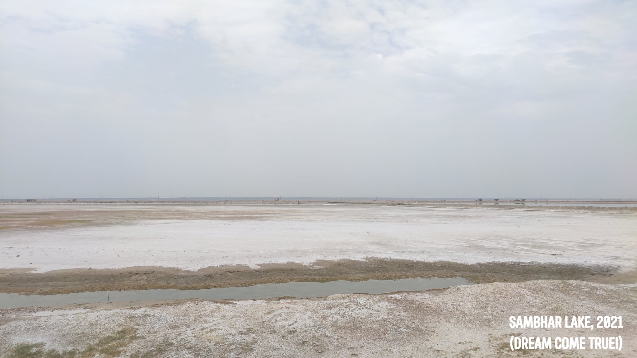
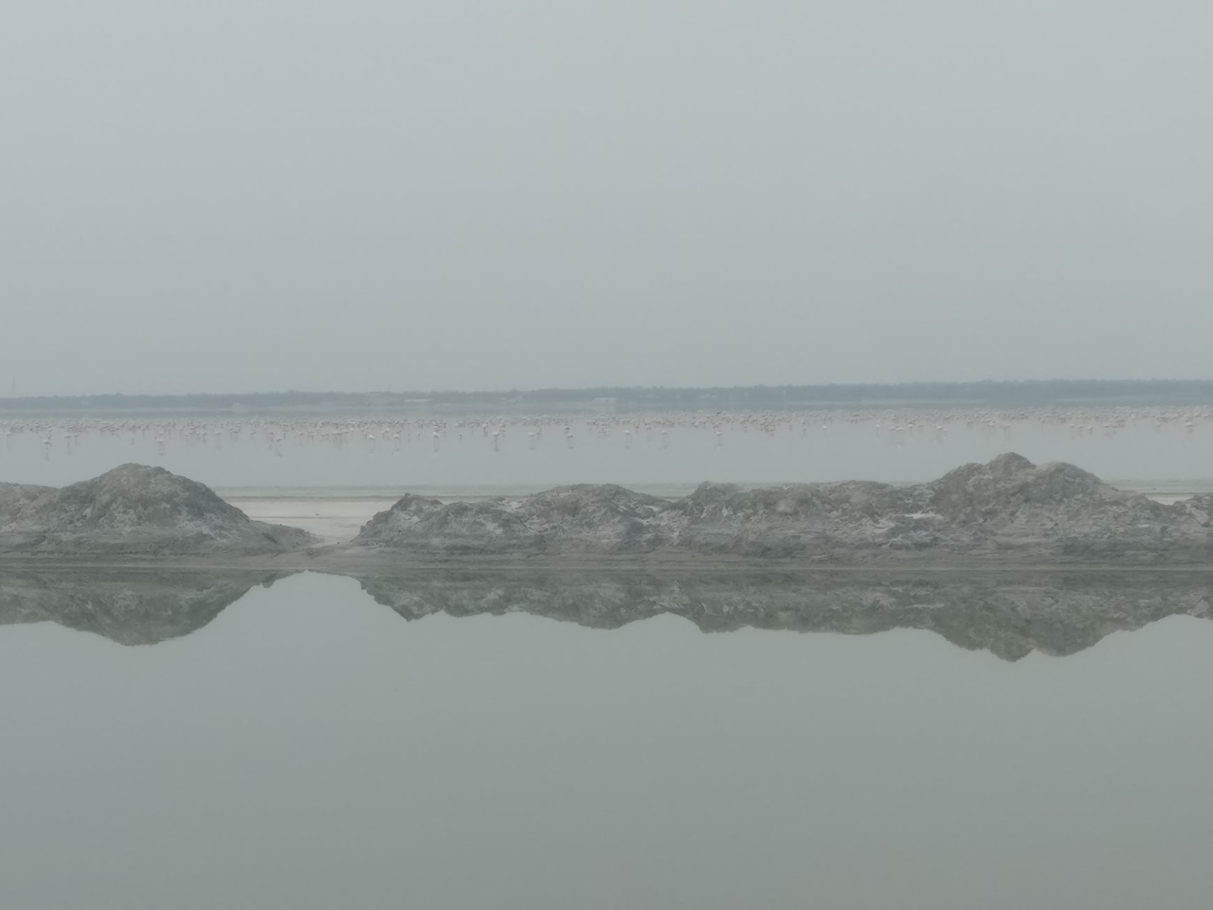
Sambhar Lake
A place that had been on my wish list since I was a schoolboy – it contributes roughly 9% of India’s total salt production and plays host to migratory birds. With swathes of white stretching as far as the eye can see, one cannot be far off calling this a mini Rann-of-Kachh. I had heard that one could spot flamingos here, but nothing had prepared me for the sight of thousands and thousands of flamingos resembling a pink stripe stretching from one end to the other. Now, if only I had binoculars, or even a DSLR camera, at hand!
A view of the saltpans
A flamboyance of flamingoes in the distance
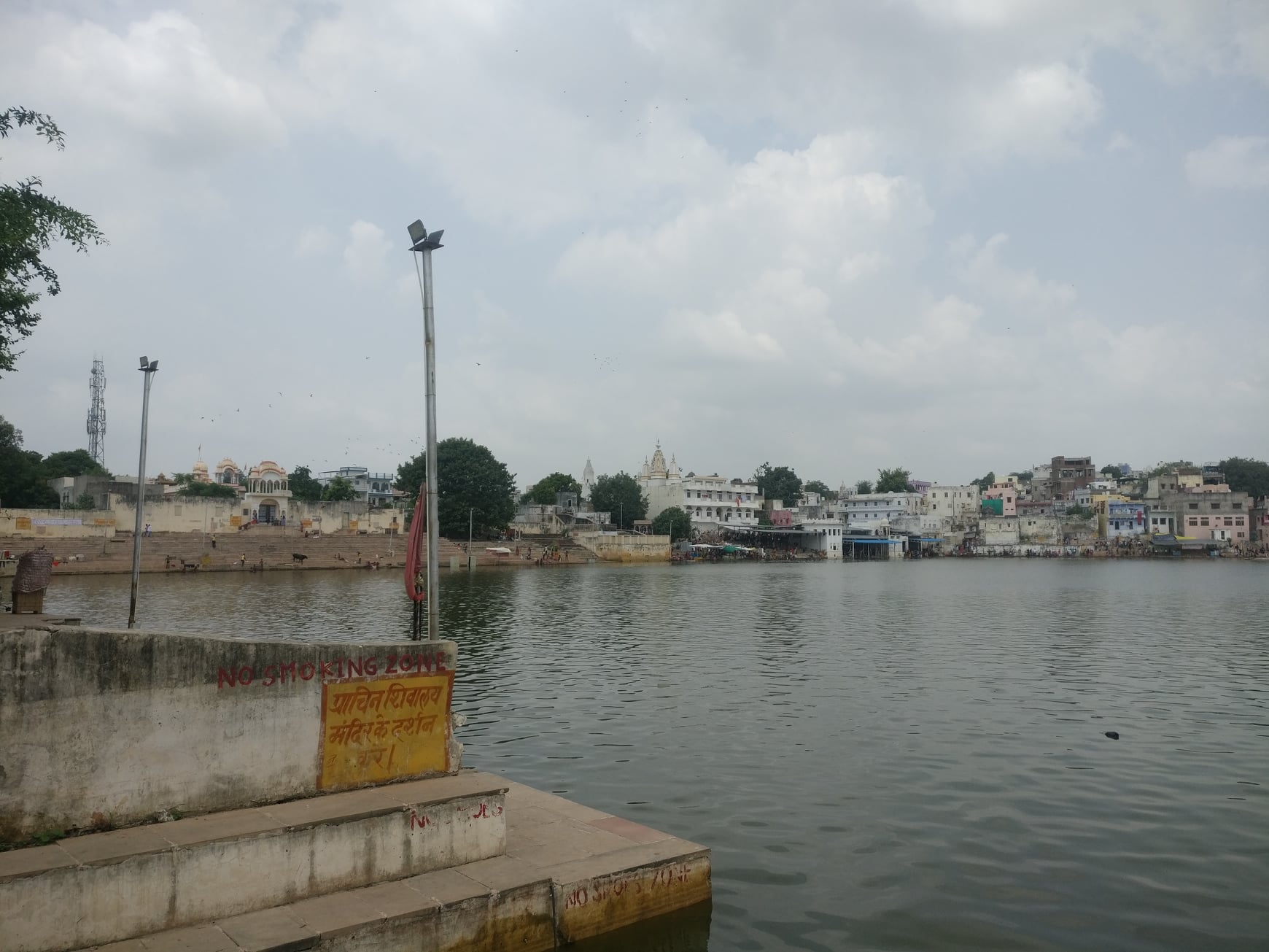
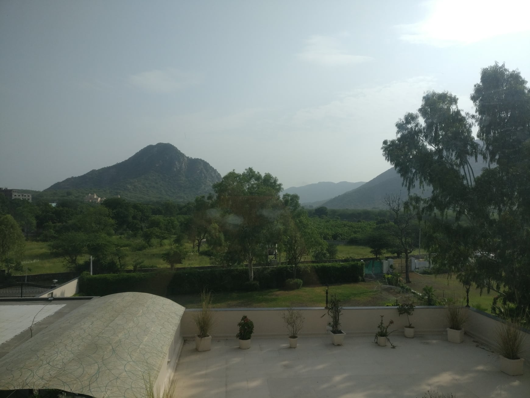
Pushkar
The holy city, according to legend, was the only place where Brahma would be worshipped as per Savitri’s curse (though a few more Brahma temples have cropped up elsewhere since). Also, as per legend, the Pushkar Lake was the source of the mythical Sarasvati river. Pushkar is nestled within the Aravallis, with amazing views of the hills against the clear skies. Another major attraction is the annual camel fair held here.
The holy Pushkar tankView of the Aravallis from the hotel
Ajmer
Separated from Pushkar by Aravallis and connected by a pass called the Pushkar Ghati, Ajmer is home to Dargah Ajmer Sharif and a gargantuan lake. Unfortunately, we could not visit any place in Ajmer.
View of the Anasagar lake and a portion of Ajmer city while coming down the Pushkar Ghati hill pass to Ajmer from Pushkar
Kishangarh
The capital of a former princely state of the same name, home to an elegant looking fort, which unfortunately is not open to tourists, and the vast Gundolav lake reminiscent of the lakes of Udaipur. Just outside the city is a National Geological Monument dedicated to Nepheline Syenite, traces of which dating back to 1590 million years to 1910 million years can be found.
Entrance of the Kishangarh fortView of the Gundolav lake
Trip Summary
Day 1 Gurgaon to Beejak Ki Pahari – 165 km, 4 hours Beejak ki Pahari to Abhaneri – 120 km, 3 hours Abhaneri to Ajmer – 250 km, 4 hours
Day 2 Ajmer to Sambhar Lake – 100km, 2.5 hours Sambhar Lake to Pushkar – 105 km, 2.5 hours
Day 3 Pushkar to Kishangarh – 40km, 1 hour Kishangarh to Gurgaon – 360km, 8 hours
Total – 1140km
How to reach Beejak ki Pahadi No public transport available, so you will have to use your private transportation (personal vehicle or cab). It is a 5 hour drive from Delhi, 2 hour drive from Jaipur.
How to reach Sambhar Lake While there is a handful of trains from Jaipur to Sambhar Lake railway station, the timings may not be suitable for a day trip. Moreover, seeing around Sambhar Lake area after getting down from the Sambhar Lake station might be a hassle due to paucity of local transport options. In the absence of public transport, you would want to either use your personal vehicle or cab. It is a 1.5 hour drive from Jaipur.
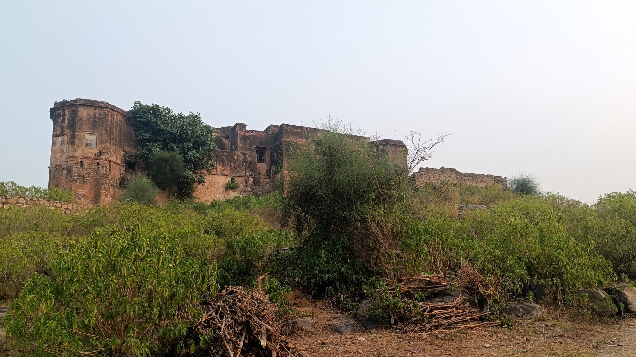
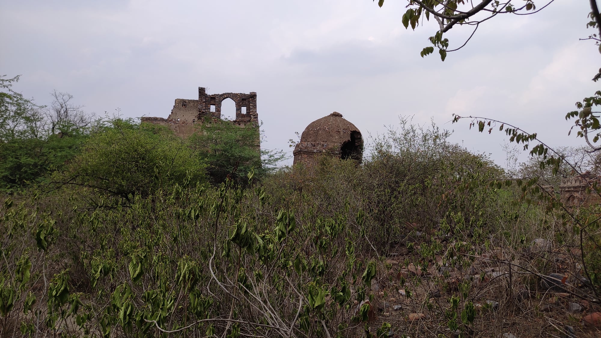
Ever since I moved to the suburbs of Gurgaon amidst the work-from-home regime, I have suddenly been presented with immense possibilities for indulging my wanderlust. On one recent weekend afternoon, I set out on my scooter in pursuit of a place called Rundh Indor which seemed on Google Maps to be home to a fort. Nestled in a cove of the low-lying Aravallis on the Haryana-Rajasthan border, Indor is a non-descript village, accessible by a narrow road that is flanked by the Aravallis on both sides beyond strips of agricultural land and a hamlet or two. The area is not so remote as it is sparsely populated.
View of the fort from the foothill
Once at Indor, from the road, I could see a long fortress wall and the domes of a few structures stretching across the left-side Aravalli hills. Tantalising as it seemed, I still did not think of accessing the fort till I came across a rubbled track that looked like the approach road to the fort. After some dawdling, I finally gathered the courage to ride up the approach road till I came upon the base of the hill, where a young duo was contemplating accessing the fort themselves. In what was already quite a desolate location, my only chance at setting foot in the fort now hinged on me joining forces with a couple of rank strangers!
View of the Aravalli from the fort
Wary of any untoward incident, I followed the duo on the trek uphill using goat tracks. Once atop the fortress wall, the vastness of the fort immediately dawned upon us. Sprawling across at least one or two square kilometres of the hillside were disparate structures – palace-like havelis interspersed with domes and grand arched gateways – all in dilapidated condition and swamped in typical Aravalli vegetation. And nary a living being in sight! We waded through the thick jungle from structure to structure, with the fear of snakes, wild animals and miscreants writ large on our faces. However, the fear was amply compensated by a breathtaking sight of the Aravallis stretching endlessly on the opposite side of the fort.
Ruined structures strewn around
It was only when the sunlight began to dim that we realized it was already 5.30pm and we had advanced a long way into the fort area. Turning, we were confronted with tracing an uncharted path back just like our way up. Luckily, climbing atop a crumbling wall gave us a clear line of sight to the place where our scooters were parked. Treating the direction as sort of a North star, we trekked down the hillside until we reached a huge depression – our final hurdle. The fortress wall swerving around the depression was broken, making access through it precarious too. Crawling over the broken portion of the wall, we were finally outside the fort precincts. Within minutes, we were back riding on the way home even as the sun set behind the Aravallis.
Alighting from the Haryana Roadways bus at Hansi, 20km before Hisar, my first reaction was one of regret. It was already 6pm and I was circumspect about the situation I had gotten myself into owing to my mad uncontrollable urge to venture into the Harappan Civilization clusters in and around Hisar. But then I fired up Google Maps and walked towards the Hansi Fort. And am I glad I did!
Earlier that day, I had ditched the India-Australia World T20 Cricket final 10 overs in, when it became clear that India were going to be decimated. And still reeling from the after-effects of finishing the book ‘The Lost River: On the Trail of the Sarasvati’, I had packed a few bare essentials and taken a bus to Hisar from Gurugram bus-stand, with no itinerary in place, except for one pointer – get as far into the purported Sarasvati Valley as possible.
The only trouble was – I did not know how to get there. A colleague from the Hisar region had earlier dissuaded me from venturing solo into that area. In fact, he did not know about the Harappan sites around Hisar. It also didn’t help that there was little material on the internet pertinent to tourists addressing these Harappan sites.
So in Hansi as I walked towards the fort through the city’s old-fashioned streets, and passed through the Barsi Gate, I pacified myself visualizing Prithviraj Chauhan’s troops rolling in. The Fort would have been closed by 6pm as per Google – still, something kept me clambering up the hilly incline to the entry point of the fort, where I realized there was no closing time, and there were most certainly no closed gates. With the sun already down, I entered the final gate and presently came upon the fort enclosure set upon the plateau atop the hill. As the few remaining visitors retreated in the twilight, I started surveying the scattered structures.
By the time I was done, it was pitch dark and not a single soul was in sight. With my heart pounding, but my blood awash with adrenaline, I was leaving a subterranean long hall-like structure with nothing but darkness inside, when I chanced upon silhouettes of 3 people sitting near the roof of the structure. If I had any survival instincts intact, my first reaction should have been to flee. But I decided to approach them to inquire about the structure. And as it would turn out – all I had to do was ask!
A view of the city from atop Hansi fort in the quickly engulfing darkness
They told me the structure was an erstwhile horse-stable, and as we spoke about the fort, they asked me as to what brought me to Hansi. I explained I had landed in Hansi since it would be the nearest hub to the Harappan sites, which I had been keen on exploring for a long time. One of these persons, who I learnt was from the Tehsil office, was so impressed with my motive that he assured me it was quite easy to reach these sites, especially Rakhigarhi, and he promptly gave me the phone number of a Mr. Ram Niwas, a Rakhigarhi resident no less! and local Tehsil official. He suggested I call him before I reached there.
So with an apparent lead in hand, I left the dark confines of the fort, illuminated with renewed hope of realizing my dream of setting foot on a Harappan site. I checked into an inexpensive lodge in front of the bus-stand, got little sleep from anticipation of the next day’s events, and woke up late! As I was stepping out after having a cheap quick breakfast, I beheld a bus headed to Jind already leaving the bus-stand exit. I ran in parallel to the driver’s window, asking in a scream if the bus was going to Narnaund. The bus slowed down, and I scurried around the front side of the bus and hopped onto it.
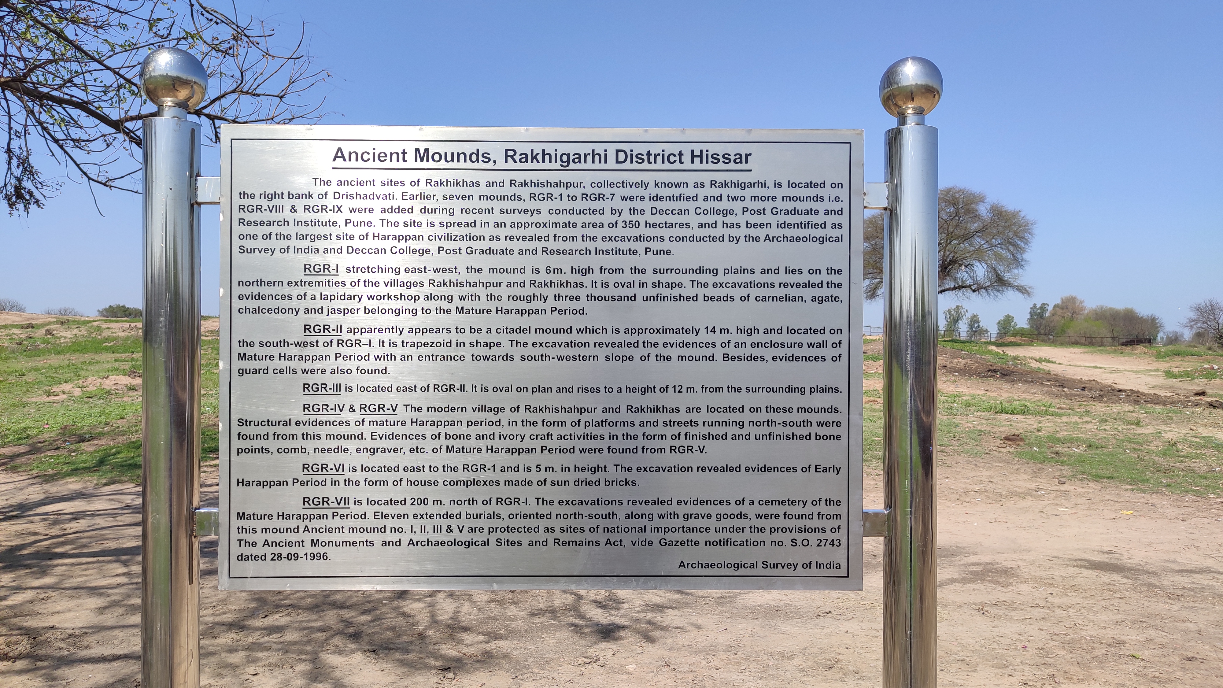
In 30 minutes, I was at Narnaund, where the diversion to Rakhigarhi originated. I called up Mr. Ram Niwas and in a short conversation comprising sentences alternating between pure Haryanvi from his end, and Hindi from mine, I only deciphered that he would indeed meet me at Rakhigarhi. I hopped onto a Scorpio that was carrying passengers headed to Rakhigarhi, and following 20 minutes of riding on a well-laid road, squeezed amidst the village folk, I was standing at the main cross of Rakhigarhi village.
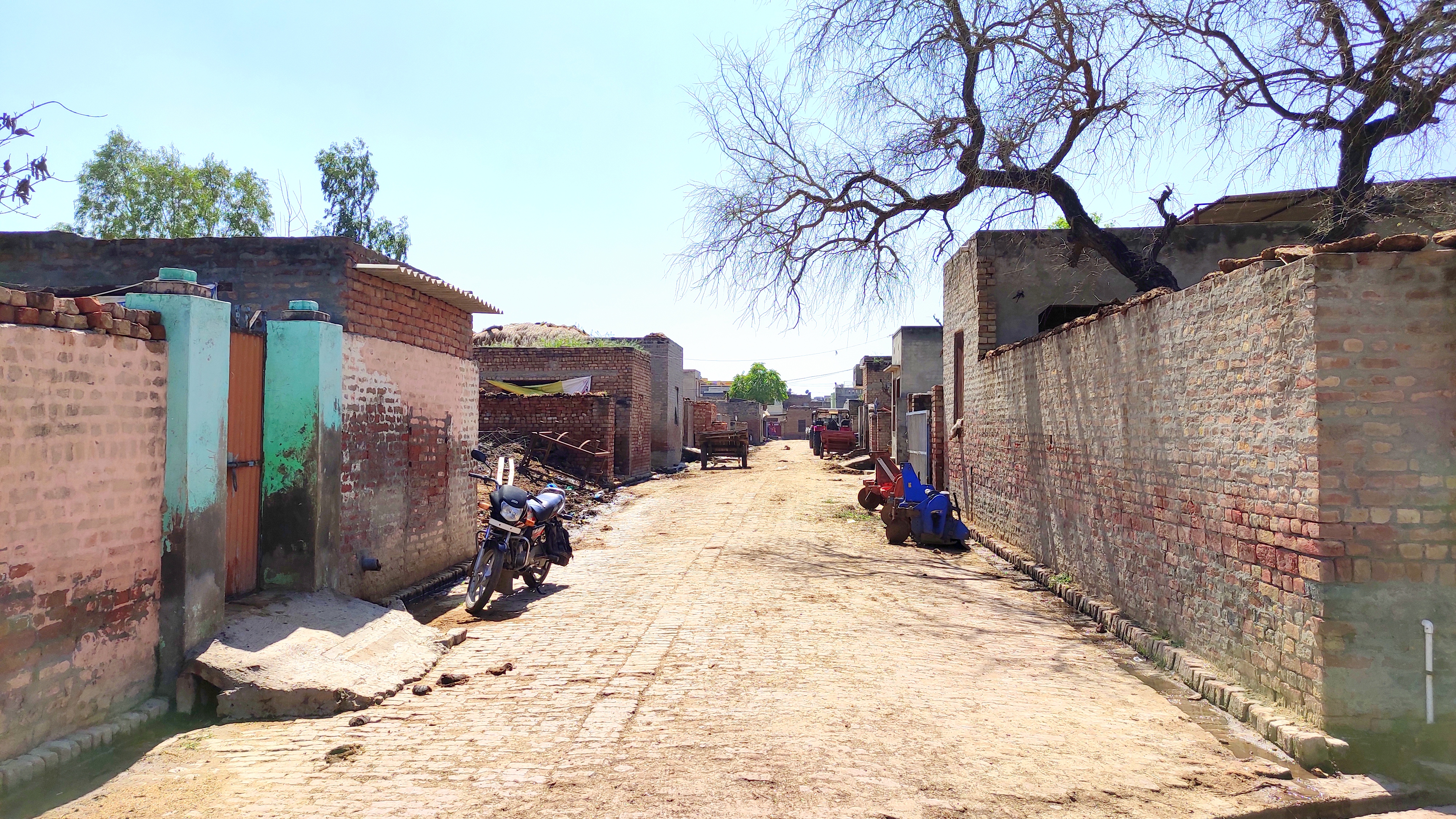
Thereupon, Mr. Ram Niwas appeared on a motorcycle. He was nothing as I had imagined. Ram Niwas ji is a lanky white-mustachioed soft-spoken elderly gentleman, somewhere in his late 50s or early 60s. After exchanging pleasantries, I rode pillion with him towards his home ensconced somewhere within the rows and rows of brick-walled houses. The brick-laid streets for the most part cut each other perpendicularly, and in places, were slushy from puddles of rainwater and patches of cow-dung. On some walls, cow-dung cakes hung drying in the sun. Neat open drains lined both sides of all the streets we traversed.
One of the wider typical Rakhigarhi streets
The route we took headed to the north, went up an incline and then sloped down, and I wondered aloud if we were on one of the Rakhigarhi mounds, to which Ram Niwas ji answered in the affirmative. As we rode further down the slope I could see two huge mud mounds before me, one straight ahead and another to its left, with iron fences delineating each from the other and from the village streets. Turning to the east for a short distance, we turned south again into a lane which again went up an incline and suddenly diverted towards the left and opened up again to reveal a couple of havelis large enough in comparison to the basic box-shaped brick houses below, of which one belonged to Ram Niwas ji.
In his quaint unadorned drawing room that opened directly into the lane, we had tea and introductions to other members of his family. Ram Niwas ji laid out the plan for the day – he would show me around all the mounds and the upcoming museum on his motorcycle, and get me to speak to somebody who would then be able to identify the mounds from the pictures I showed him. And then I would have to have lunch! To my perfunctory remonstrations, his gentle yet firm Haryanvi-laced reply was, ‘khaana toh khaana padega (lunch will need to be had).’
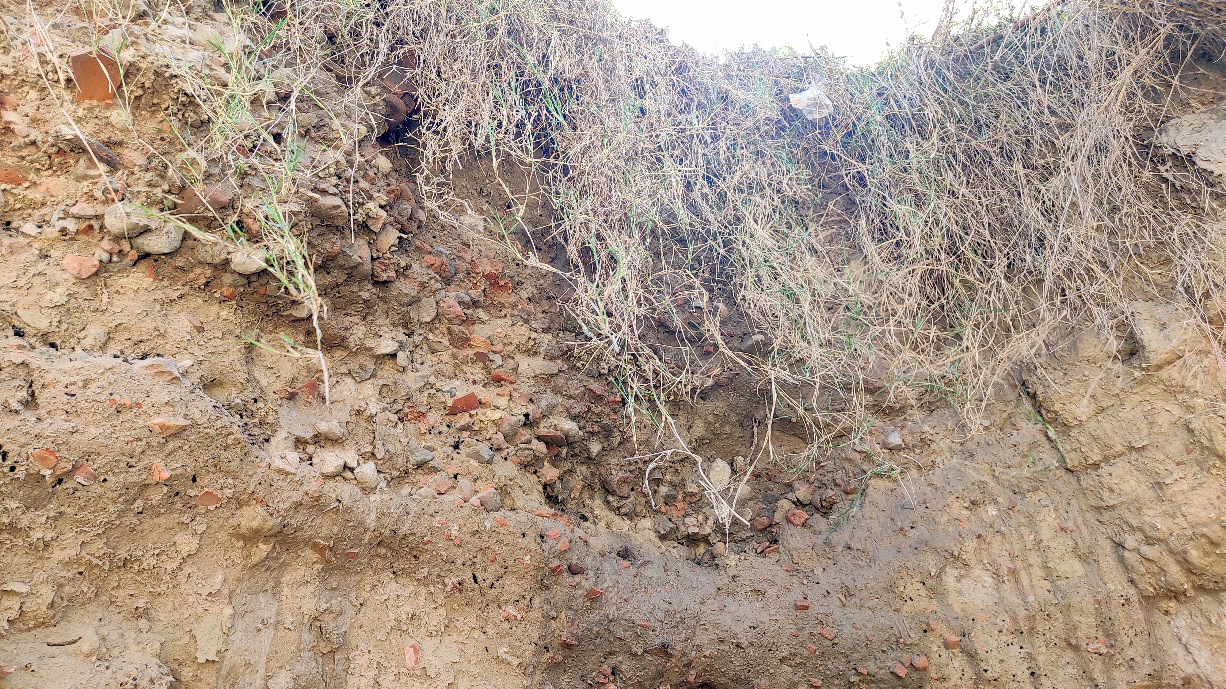
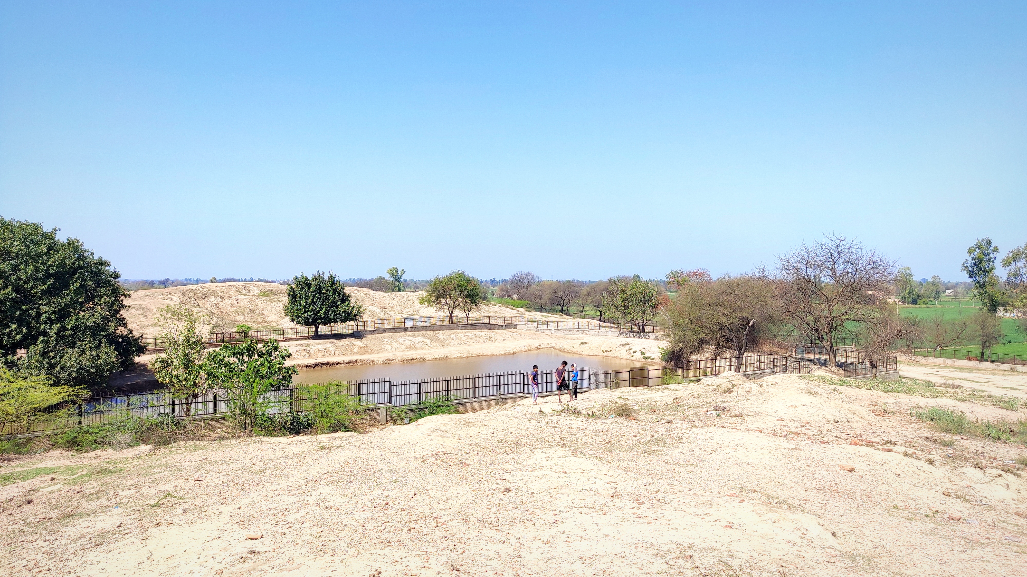
And so we went first to a mound (RGR-4) on the east side of the village where a street had been carved from one of its sides revealing the brick lining of an old Harappan structure. Taking pictures, we proceeded to the two mounds I had spotted earlier. We rode up the mound on the left first (RGR-2) upon which tall shrubs were growing and children were playing. I alighted and was taken aback by the continuous layer of pottery shards and little portions from bricks strewn across the whole surface of the mound. The mound must have been about 40m by 20m. Excavations done on this mound had been back-filled with mud on top of polymer sheets to enable easy stripping for display or exposure of the excavated parts in the future.
Old and new co-exist near this excavation on the side of Mound RGR-4Bricks of a Harappan-time structure revealed on RGR-4
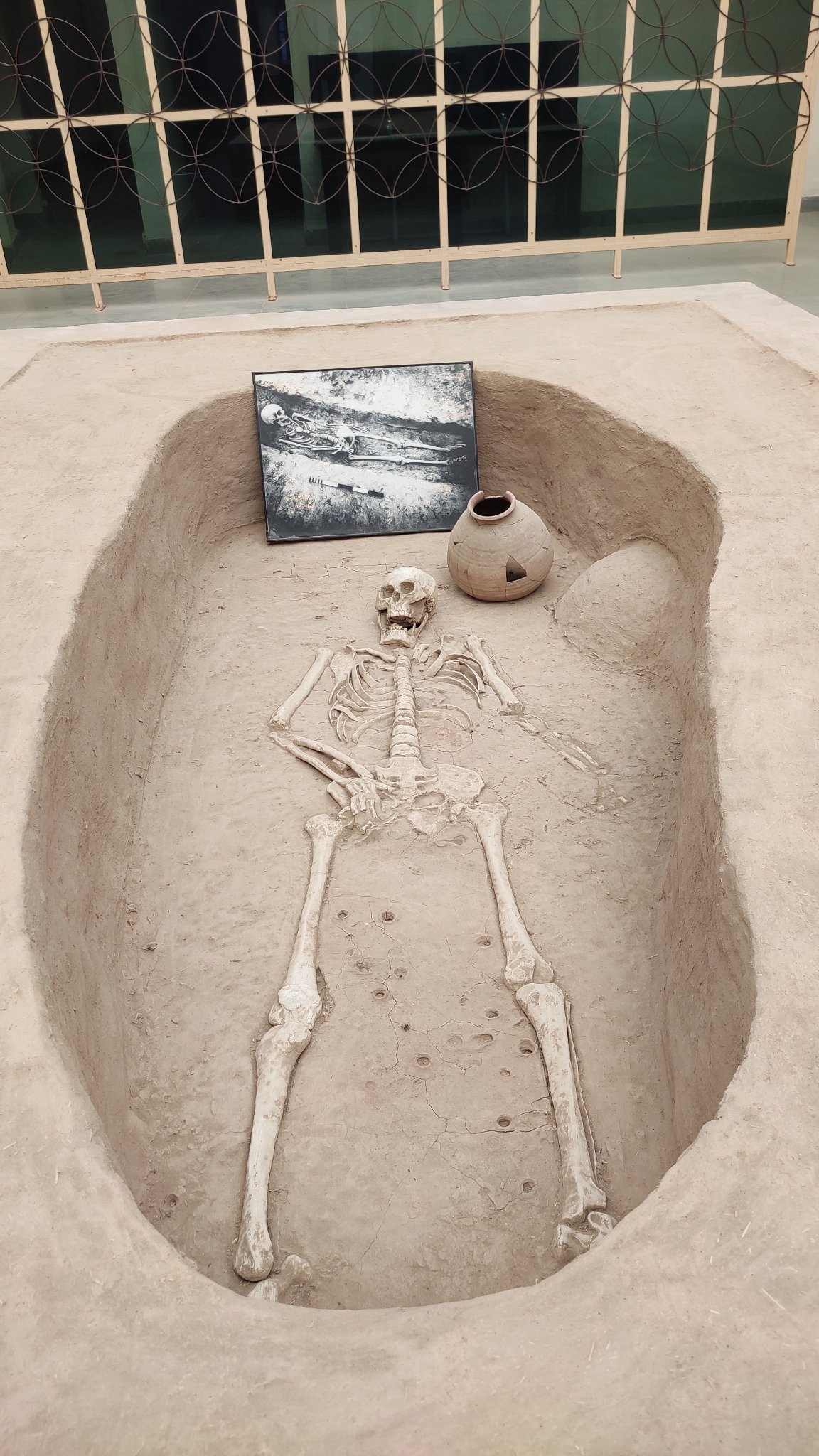
I ambled across the northern side of the mound soaking in the energy of the place, transported to a day in the lives of our ancestors who inhabited the innards of the metropolis I was standing on at present. I zeroed in on a day sometime in 2500BC, where I walked through paved streets bustling with traders and carts rumbling along loaded with earthenware, and the air imbibing the fragrance of burning wood and food getting cooked in earthen ovens in the nearby brick houses. There I stood transfixed on the luscious grain fields down below, spread to the farthest my eyes could fathom, wondering if such fields stood at the same place back then or if they were now standing on metres and metres of silt deposited over more structures underneath. Ram Niwas ji told me the famous Rakhigarhi skeleton was dug up from somewhere amidst those fields.
Standing on Mound RGR-3 and looking at Mound RGR-2
Ram Niwasji with shards of ancient pottery
The mound to the east (RGR-3) was separated from the mound I was standing on, by a small pond of clear water. I walked my way to the top of RGR-3 where a small blue-coloured structure dedicated to a Pir saint stood. This mound too had pottery shards strewn all across its surface. We then rode further east to the mound (RGR-1) that had been excavated first. The same pattern of pottery shards and brick pieces strewn across the surface repeated, with the mound too having been excavated and covered up. It had other visitors besides us – a handful of Red-naped Ibises!
Signage at RGR-1, the first mound to be excavatedAn avian visitor – a Red-naped Ibis!
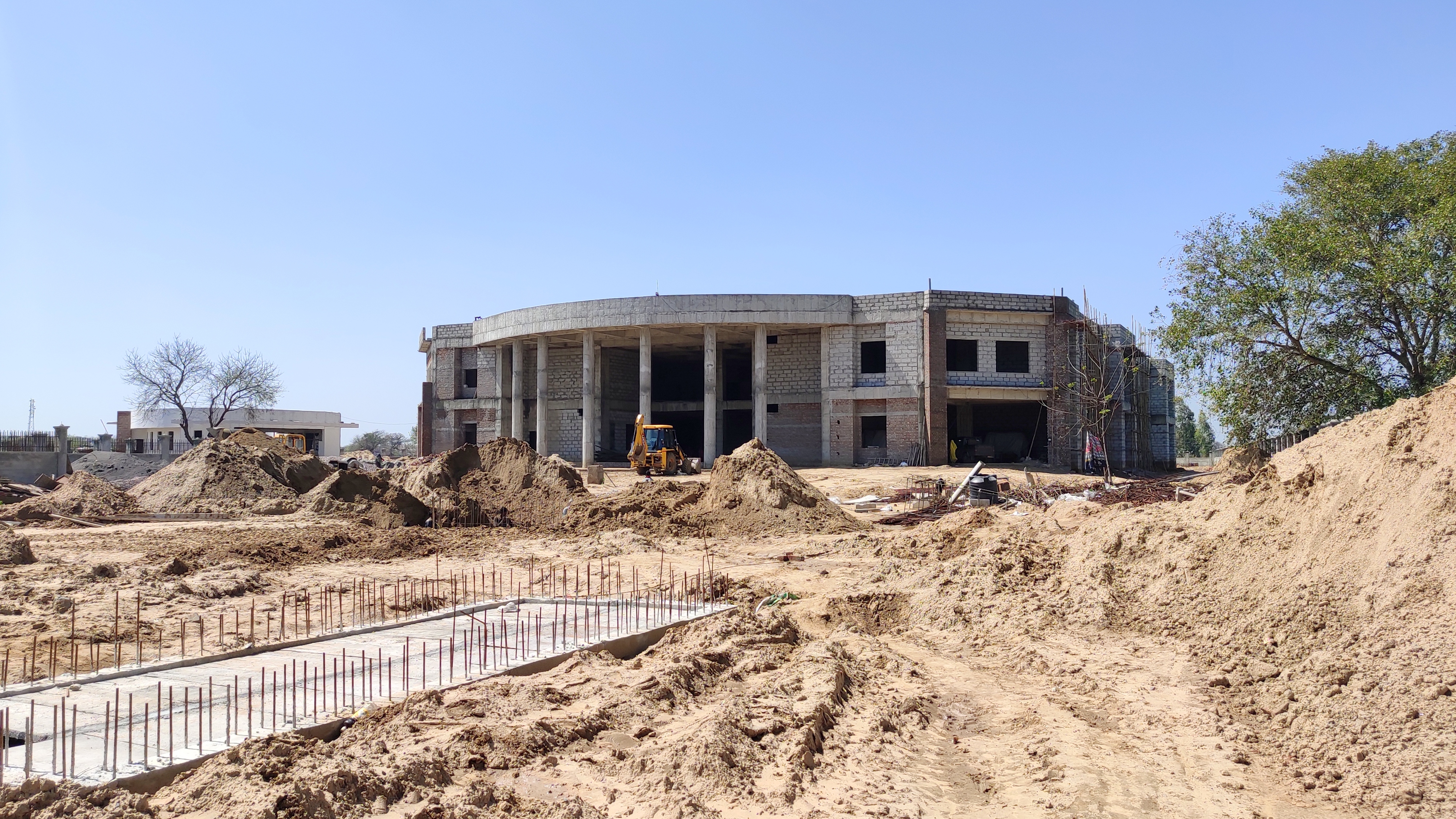
Moving further east and then turning to the north past a couple of clear-watered amply filled ponds, we got to the sprawling Rakhigarhi Museum, which is still under construction and is expected to be up-and-running in 2 to 3 years. Locals believe that once the Museum comes to life, and a settlement has been reached between the villagers and the Government with regards to the rehabilitation of locals whose houses are built on two major mounds, Rakhigarhi would be a major tourist hub.
The sprawling Rakhigarhi musuem under construction
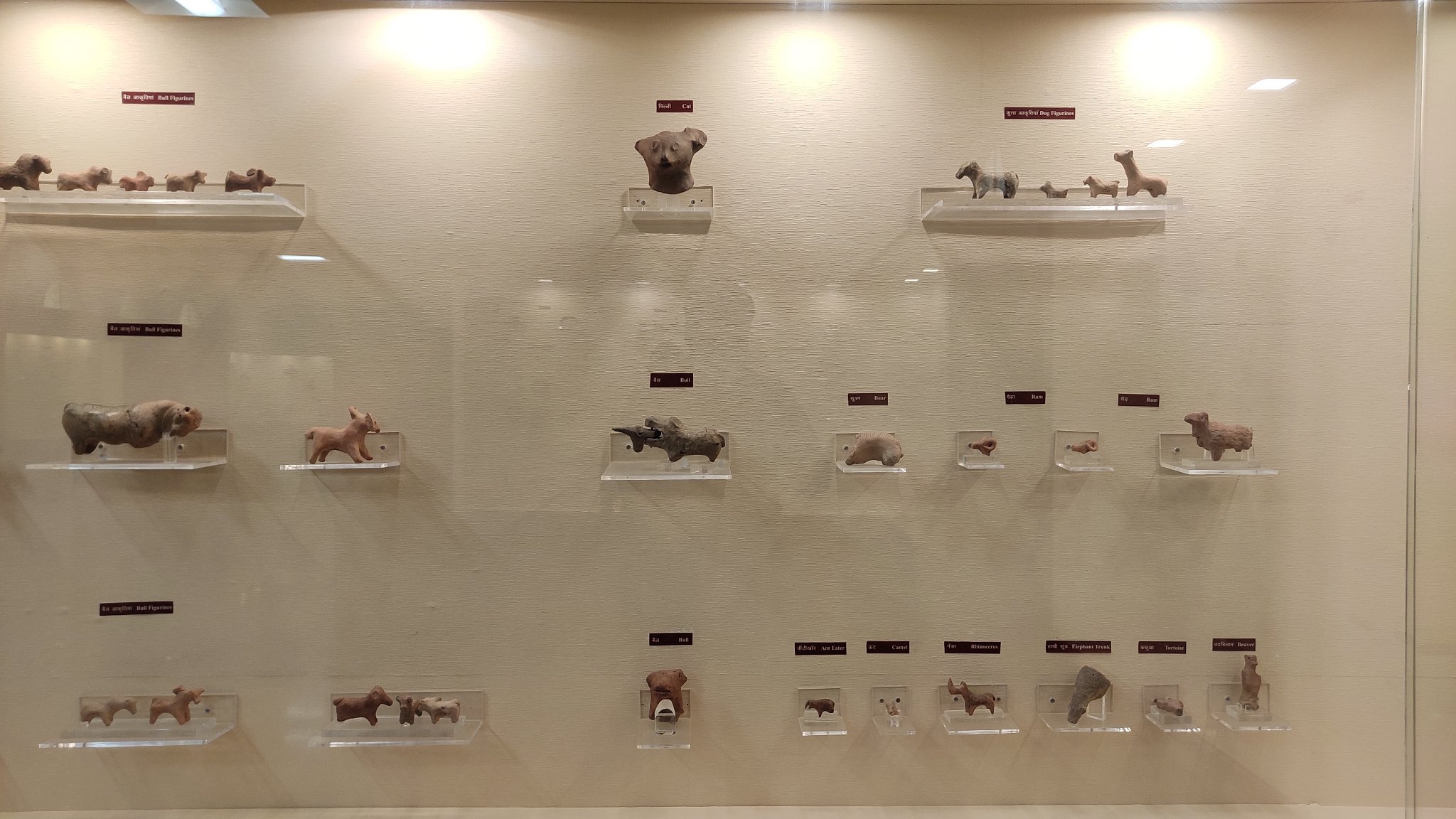
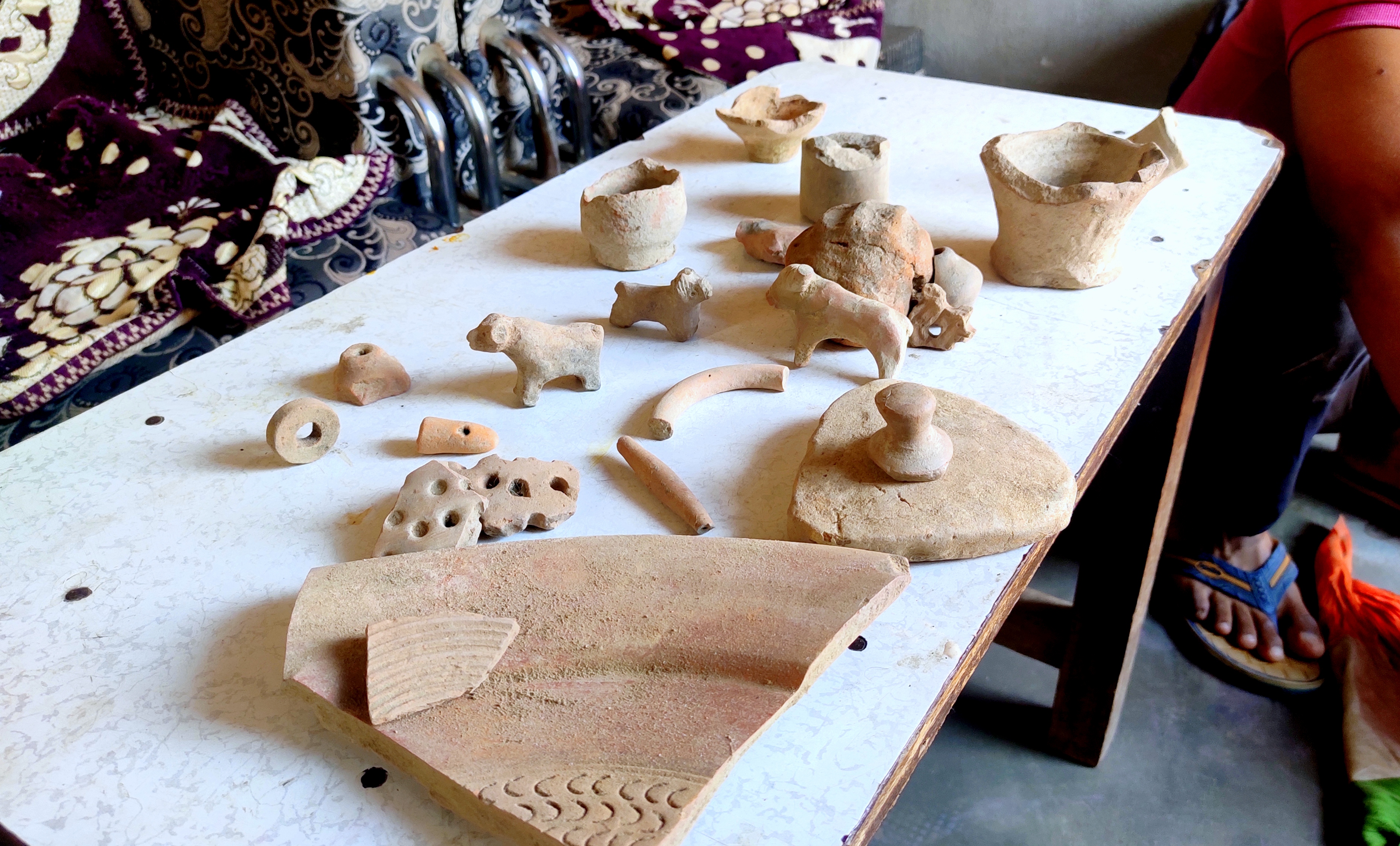
It was already 2 hours since we had been riding around, and once back at Ram Niwas ji’s place and after having a spartan yet filling meal of chapatis and raita, another surprise awaited me! Ram Niwas ji’s younger son, in his early 20s, took me to one of the rooms where a waist-high iron chest lay huddled in the corner. From there in, he extracted a cloth wrapped into a pouch and opened its knots to reveal several relics gathered from the mounds – terracotta toys including miniature animals such as the bull and the dog, pieces of pottery of different styles and a seal! He went on drawing out relic after relic – this cloth pouch being the figurative gift that kept on giving – until I asked him to stop. My glee upon being able to touch these pieces from the past knew no bounds – money couldn’t buy the preciousness of the objects I held in my bare hands!
Treasures from Harappan times – terracotta figures and earthenware
At last it was time to bid adieu. Ram Niwas ji vehemently refused to accept some money I offered as a token of my appreciation. I touched his feet and got into his car with his son, who dropped me back at Narnaund. From there as I retraced my way back to Gurugram through Hansi on a local bus on the wide smooth highway, I could not help but smile at the sight of the seas and seas of wheat and mustard fields lining both sides of the highway. Whenever I saw a mound-like elevation, I wondered if there were cities of the past buried underneath. Maybe I used to live in one of them.
Just in time for Christmas, the family set off on another ‘hidden gem’ heritage trail inside Odisha. This time we explored the Diamond triangle comprising three hill-based Buddhist hot-spots which flourished between 7th and 13th Century AD, namely Lalitgiri, Ratnagiri and Udayagiri.
The three locations set in low but sparsely populated hillsides or hilltops prove without doubt to be the most idyllic backdrop for a life of material detachment and quiet contemplation for the Buddhist monks. Consistent with Kalinga’s nature of acceptance and tolerance of all religious and spiritual dispositions, these spots display the syncretism of both the Mahayana and Hinayana schools of Buddhism.
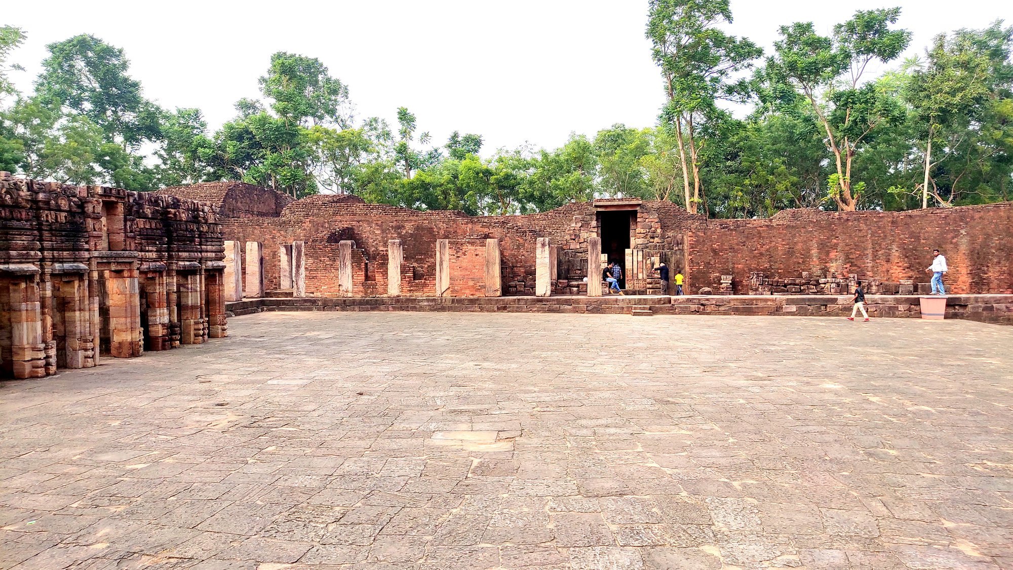
Lalitgiri
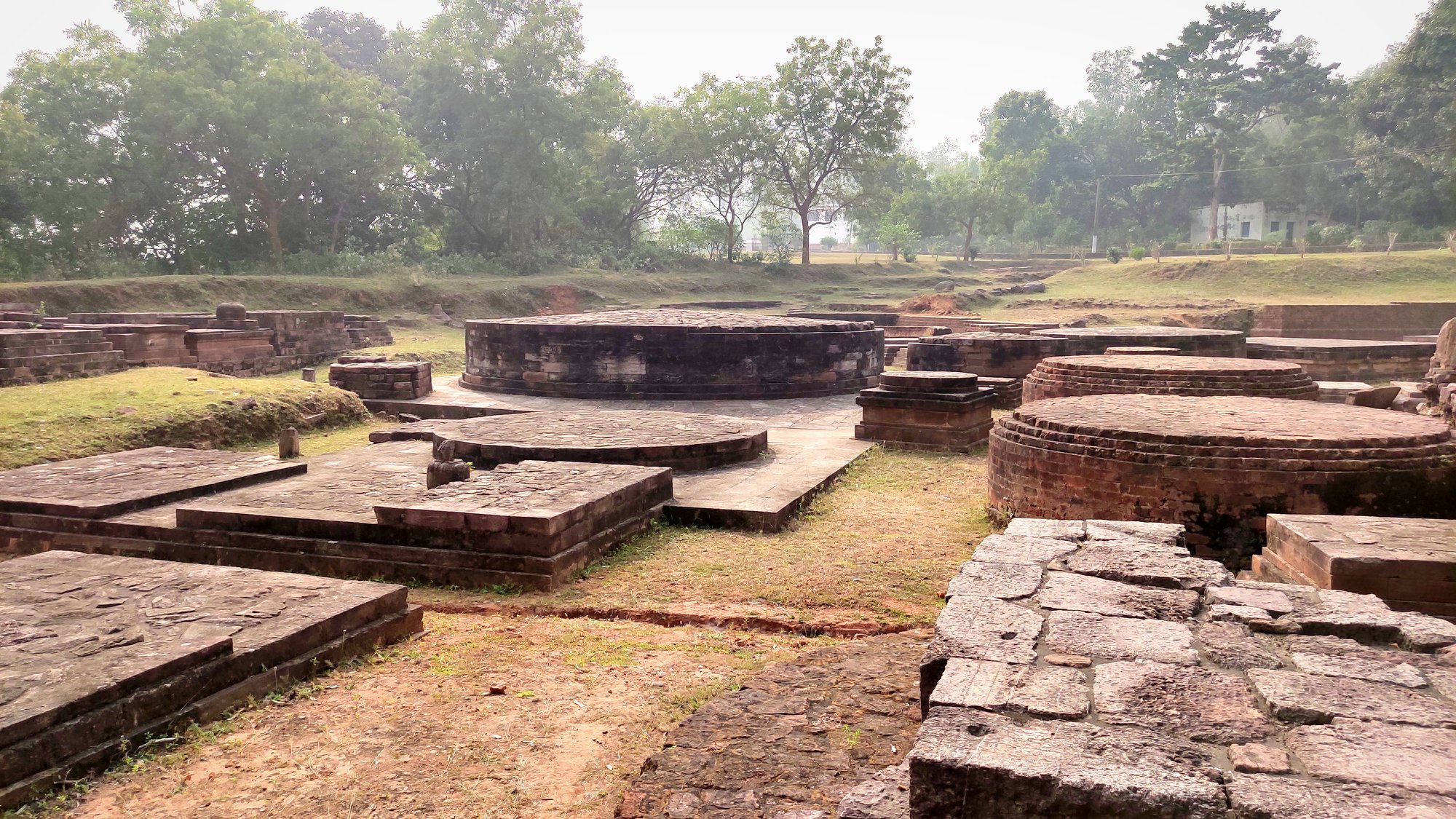
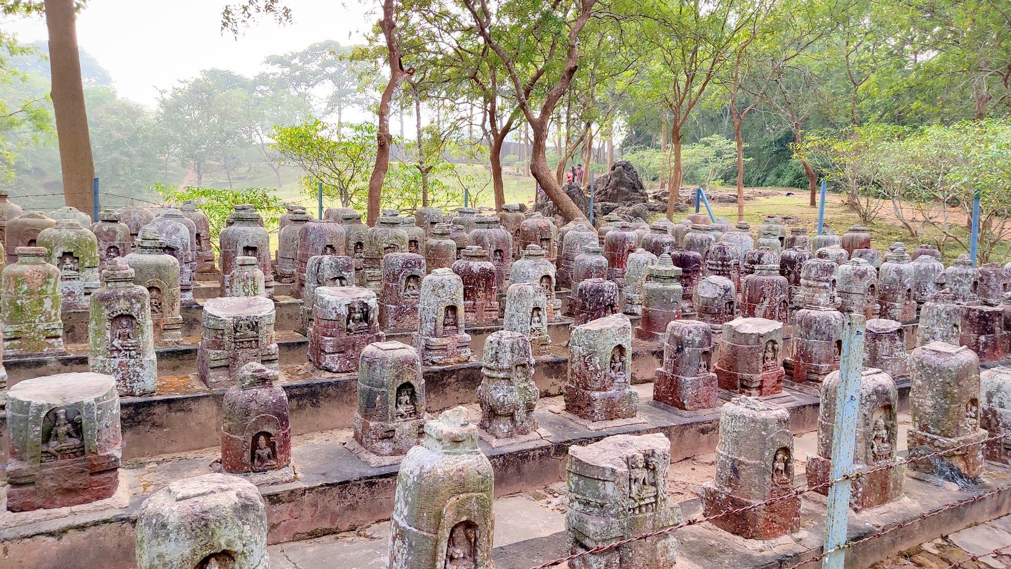
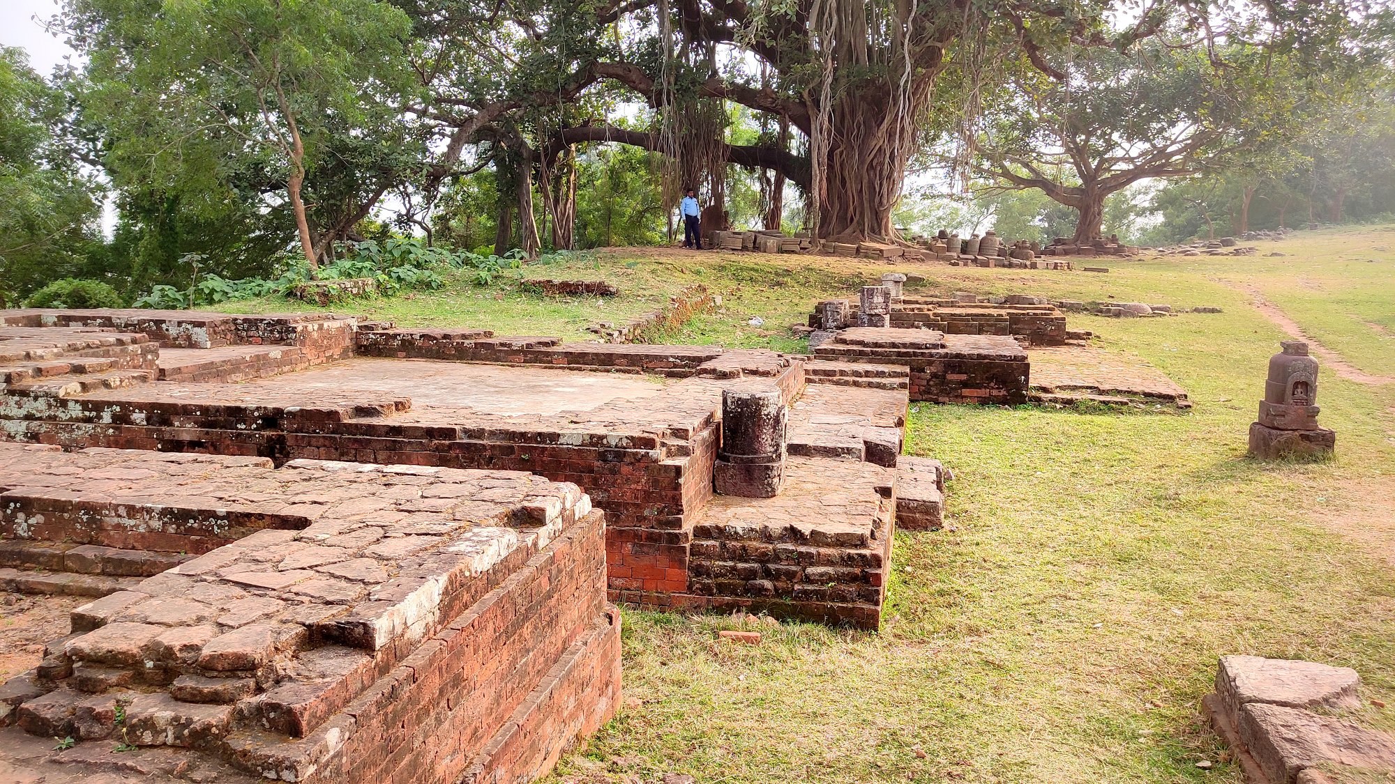
Starting off at around 9AM from Bhubaneswar, we first reached Lalitgiri around 11 AM via the Chandikhol-Paradeep road. After a walk up the hill on the wide metalled road, we first came upon the Archaeological museum which we deferred for seeing on our return from the trail. Walking further, we came upon multiple structures: Viharas (monasteries) in ruins – the monasteries dating from 9th to 11th century contained rooms, a chamber for holding a Buddha status – and a 6th-7th century Chaityagriha (prayer hall) with a stupa in the middle and several votive stupas strewn around.
Glimpses of the many monuments and surroundings at Lalitgiri
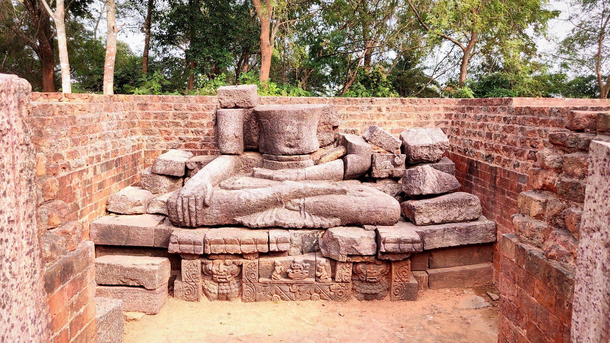
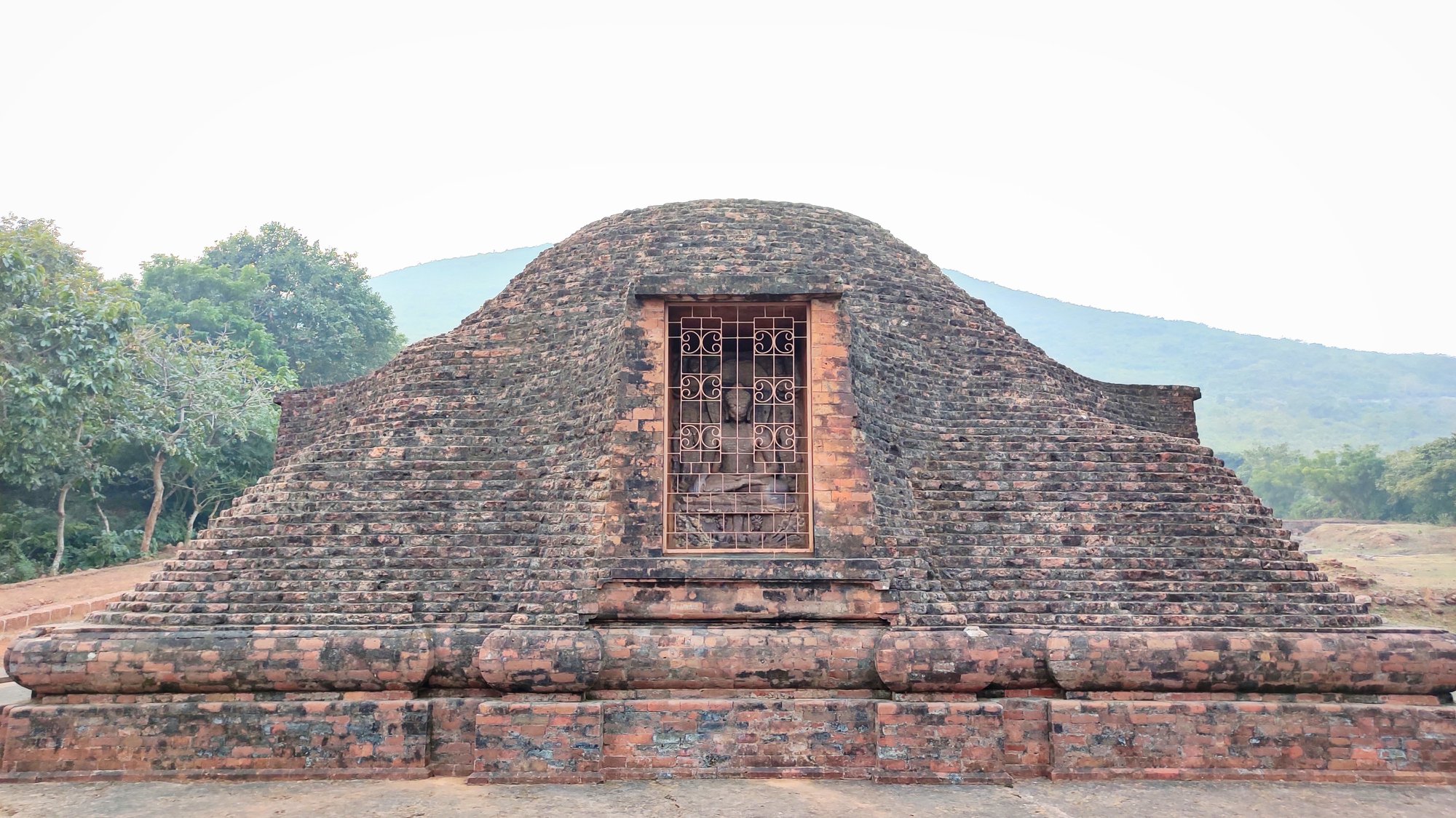
At the furthest end of the trail, atop another small hill, lay a lone relatively larger stupa, where two rare stone caskets containing relics of Buddha were found. The casket, made of khondalite, itself housed three smaller concentric caskets made of steatite, silver and gold respectively, with the innermost gold casket contain a piece of Buddha’s bone. These relics as well as well multiple sculptures, including those of the Buddha and Tara, are now displayed at the museum. All told, Buddhism is said to have prevailed at this site right from the post Mauryan period, i.e. 3nd century BC to 13th century AD.
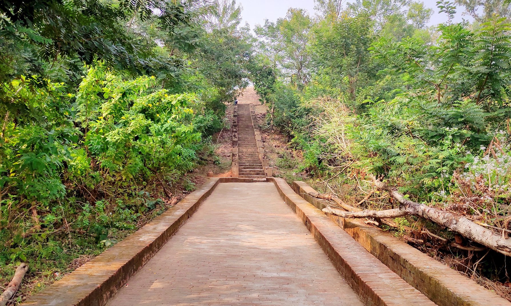
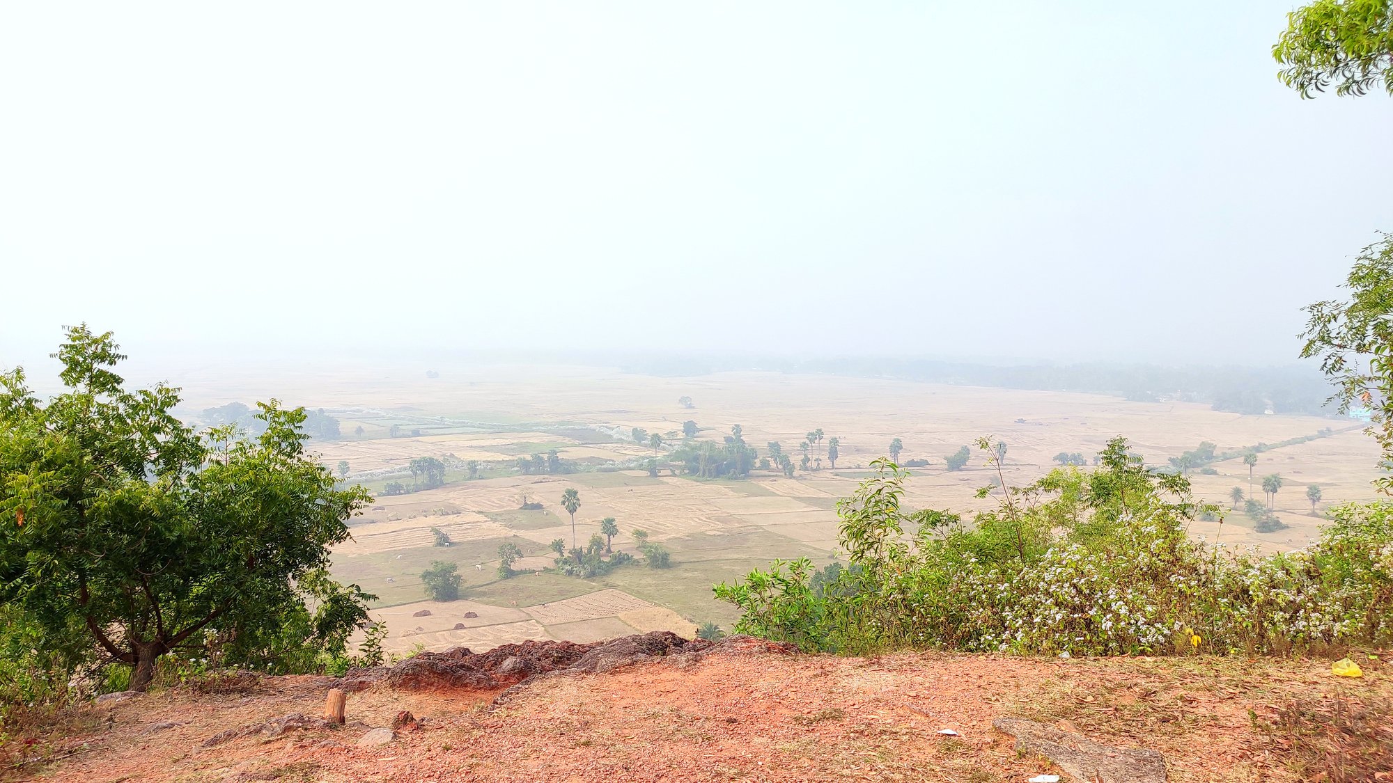
Approach to main stupaView of countryside from beside stupa
The main stupa where Buddha’s relics were found
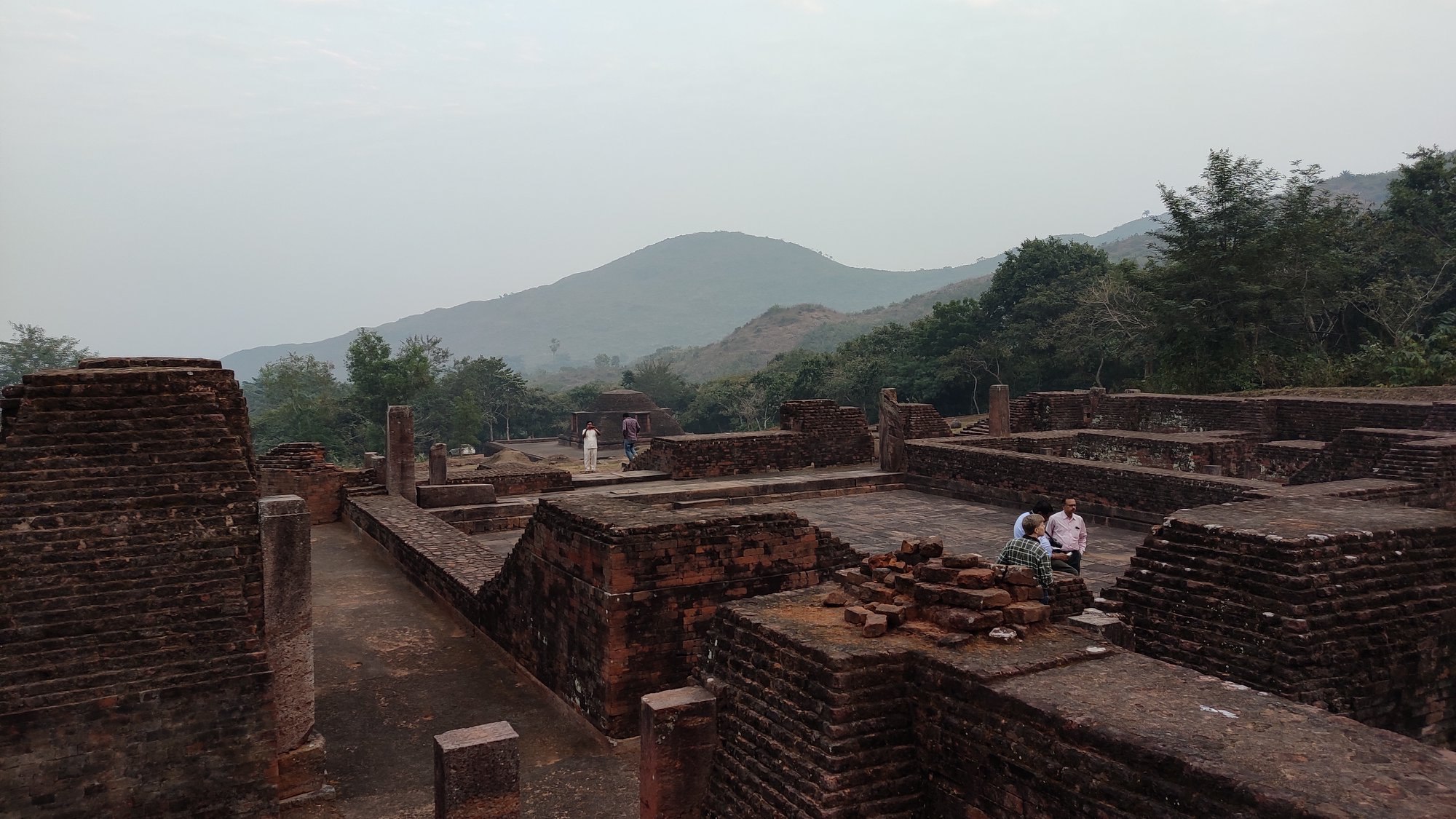
Ratnagiri
Leaving Lalitgiri around 12.30 PM, we crossed the Brahmani river and reached Ratnagiri around 1.30 PM. Ratnagiri looked unique due to fact that the road to the monasteries and stupa lay in a pass between two crests of the hill, flanked on both sides with neatly manicured lawns. Here, we decided to first see the museum, where many relics and artifacts found at the site are displayed. However, what interested me more was the additional information displayed in various sections about the history of the evolution and dissemination of Buddhism and of other Buddhist sites in India.
Approaching the Ratnagiri hill
The exquisite entrance of a monastery at Ratnagiri
Inside the monasteryInside the monsateryGlimpses of monuments and surroundings at Ratnagiri
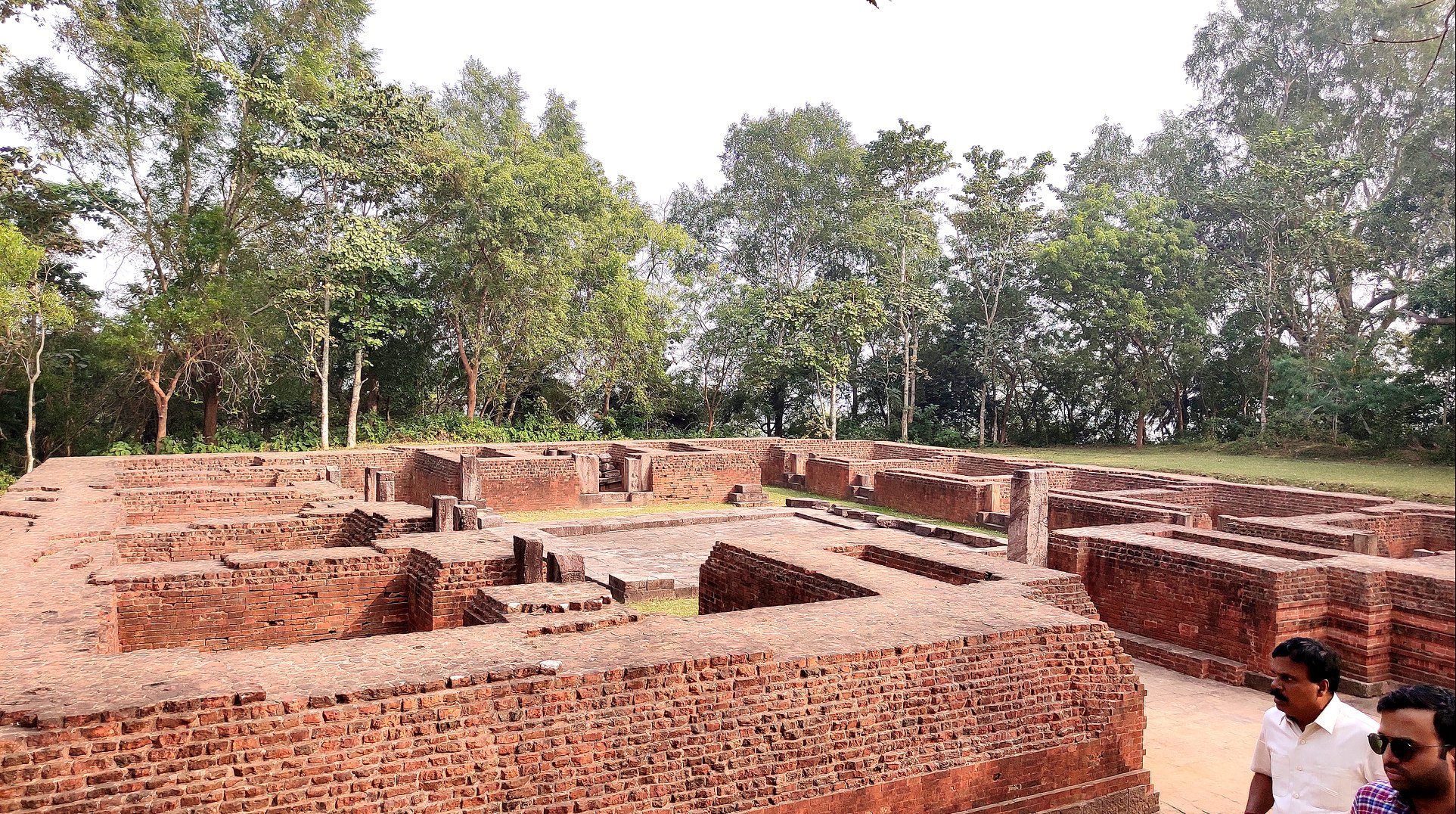
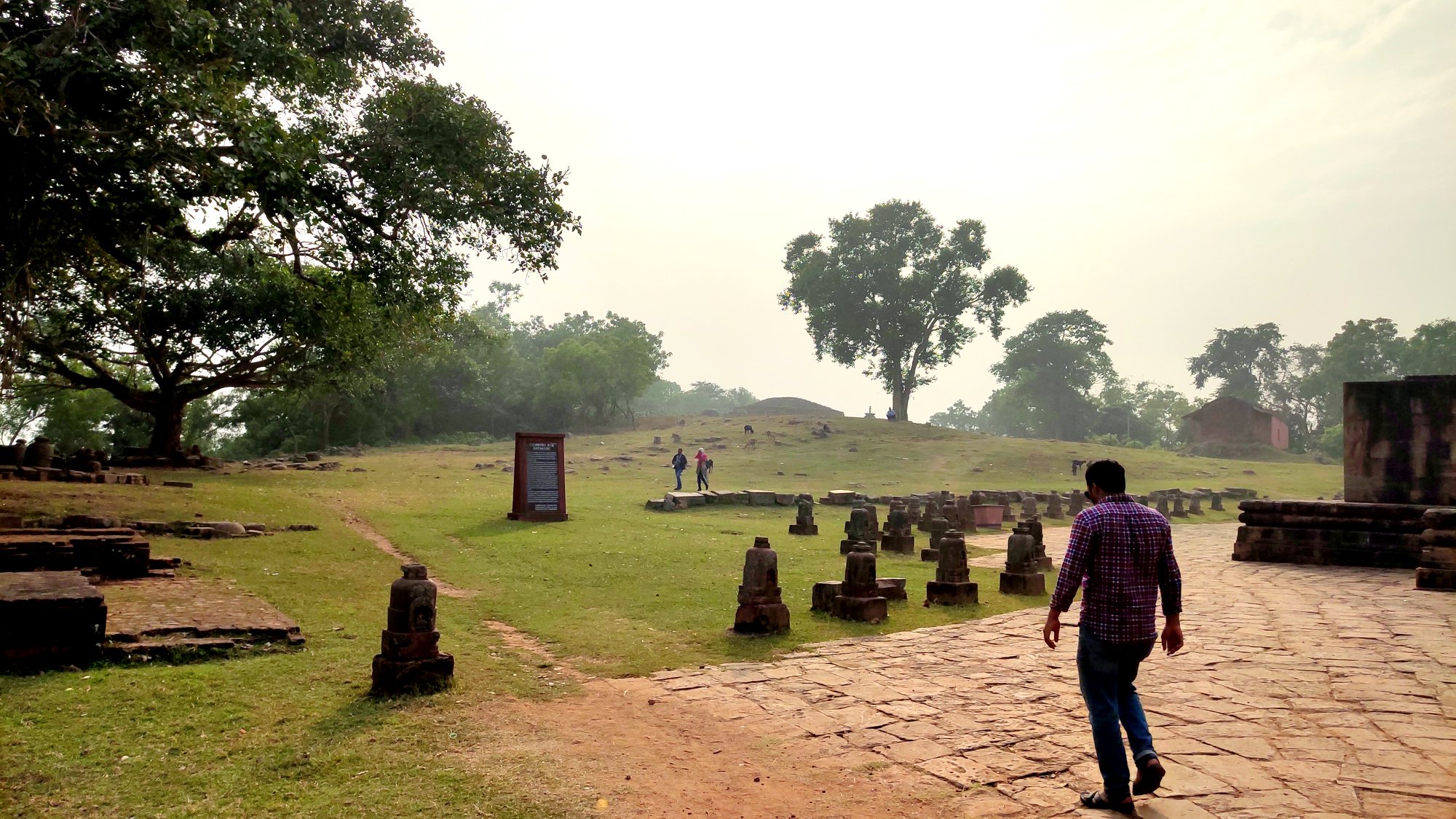
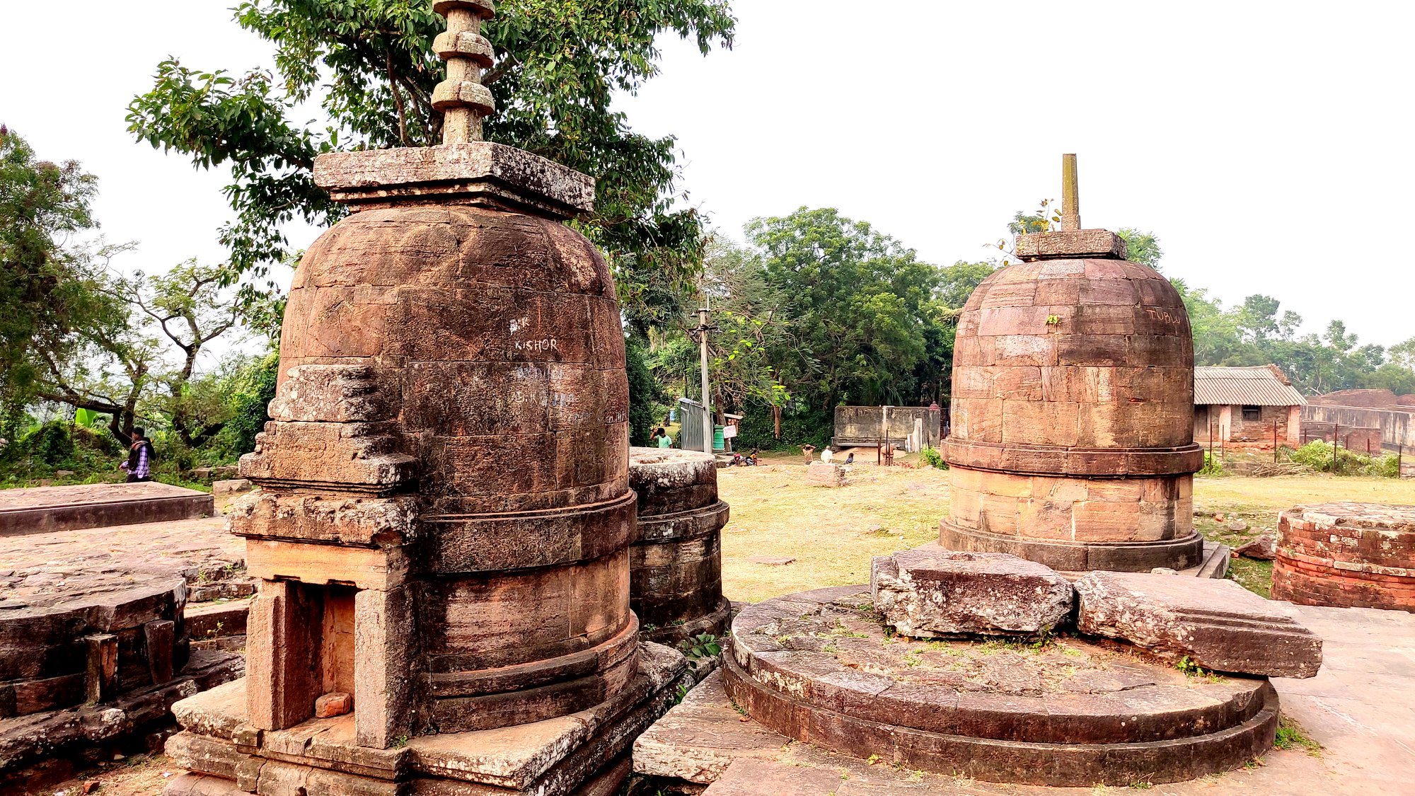
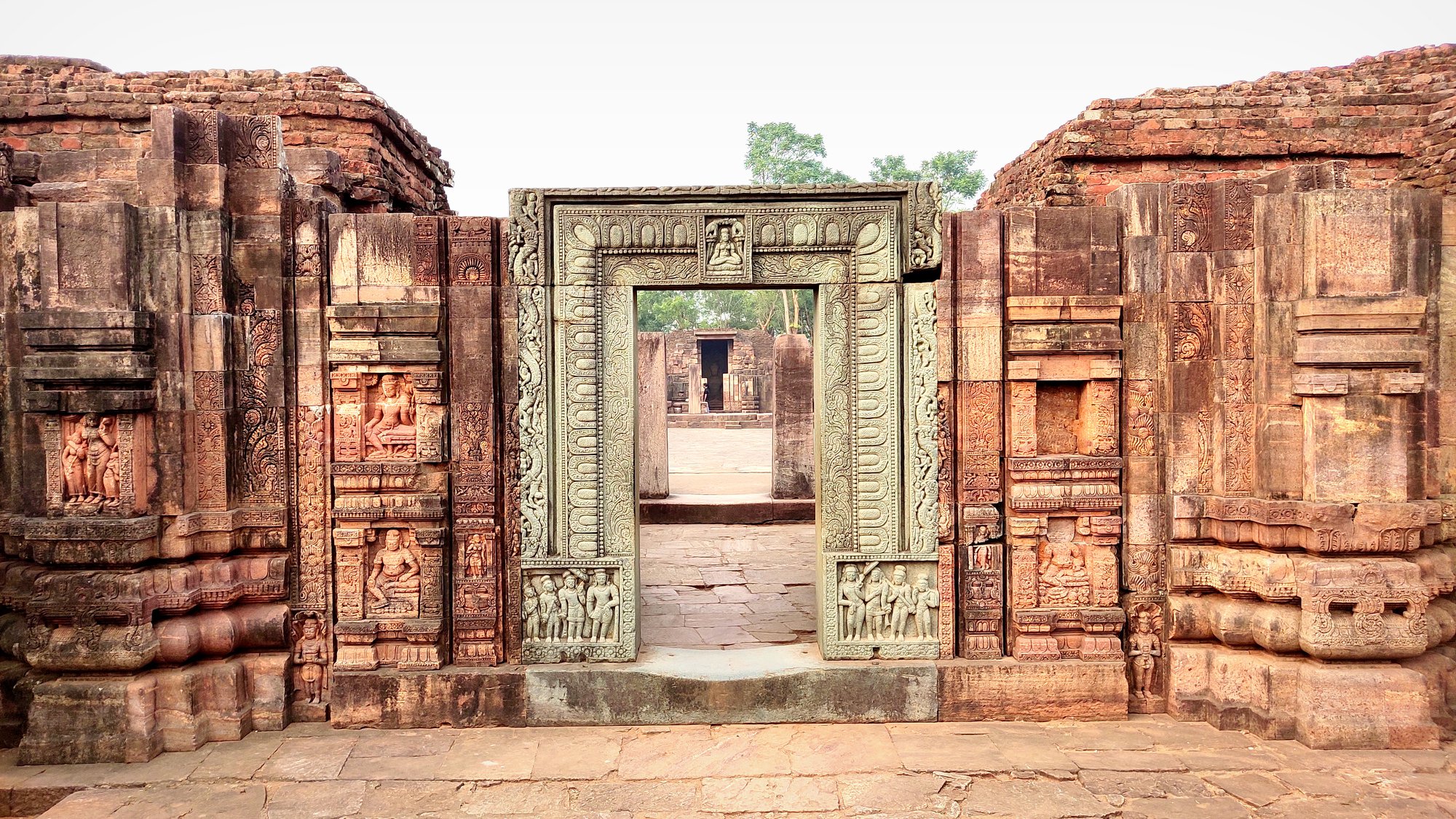
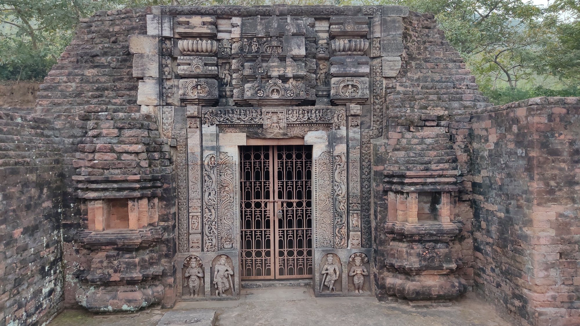
Walking up the hill, we were wowed by the iconic elaborately carved stone doorway at the entrance of the largest of the 3 monasteries, which could be dated to the 8th century. This monastery has a large courtyard with rooms surrounding the same, and a shrine for the statue of Buddha, at the wall farthest opposite from the main entrance. Besides this monastery, there are 2 smaller monasteries, and a 9th century stupa, surrounded by smaller votive stupas. Beyond all these structures, is the Mahakal Temple, built over an earlier stupa, and recently relocated to its current location by the ASI.
Udaygiri
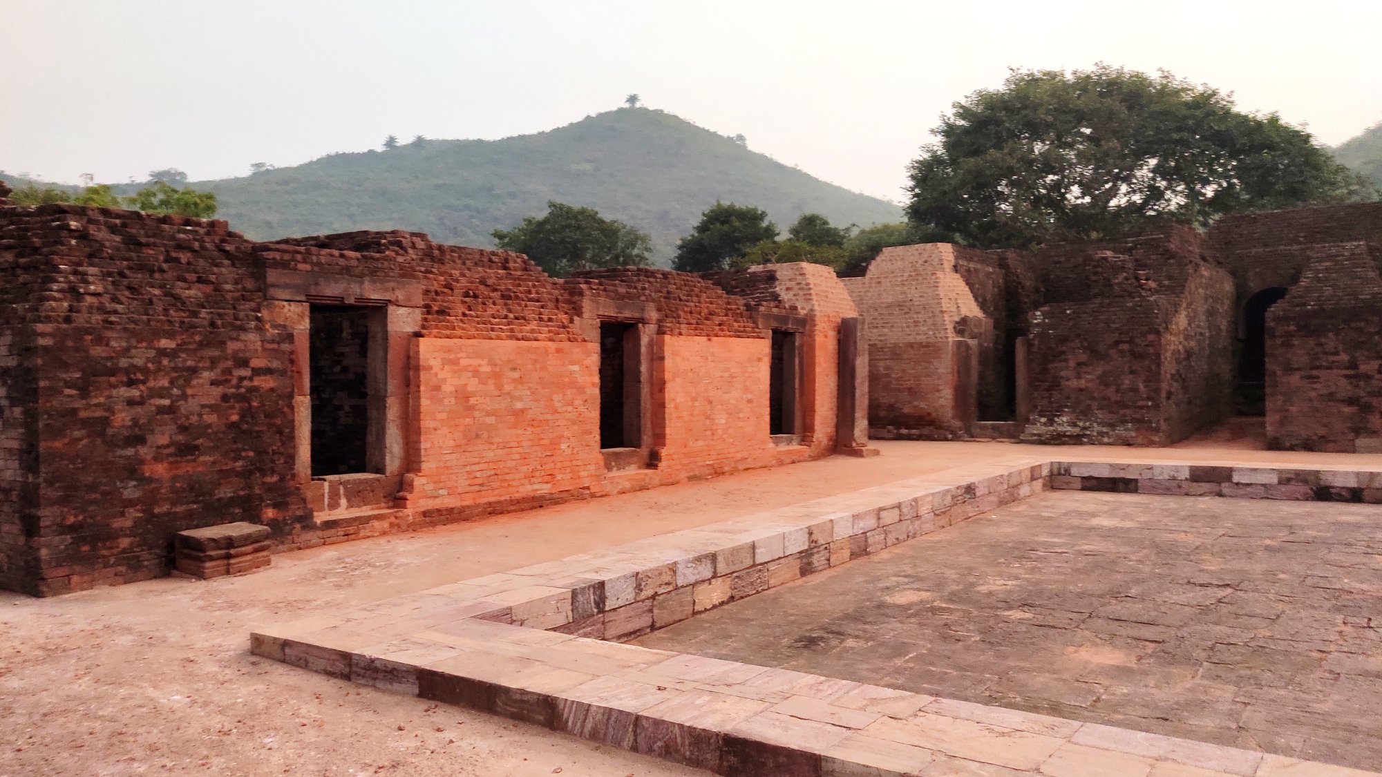
After a light meal in lieu of lunch, we crossed the Brahmani river yet again and reached Udaygiri around 4PM. Udaygiri seems, out of the three sites, to be the site with the least attention paid to maintenance. The two monasteries are far-flung not only from each other but also from the entry gate, and can be accessed after walking quite a bit through jungle. Here too the monasteries with statues of Buddha, lay in ruins.
Glimpses of the many monuments and surroundings at Udaygiri
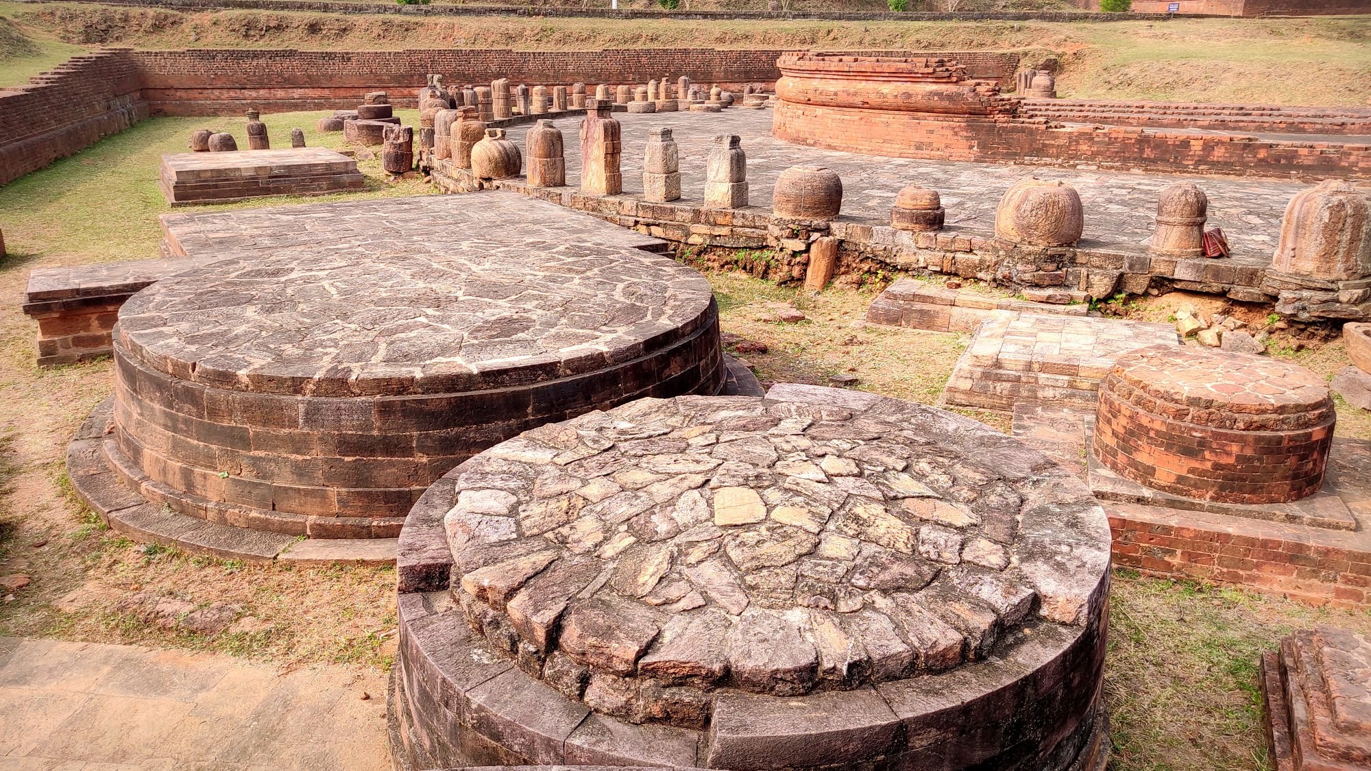
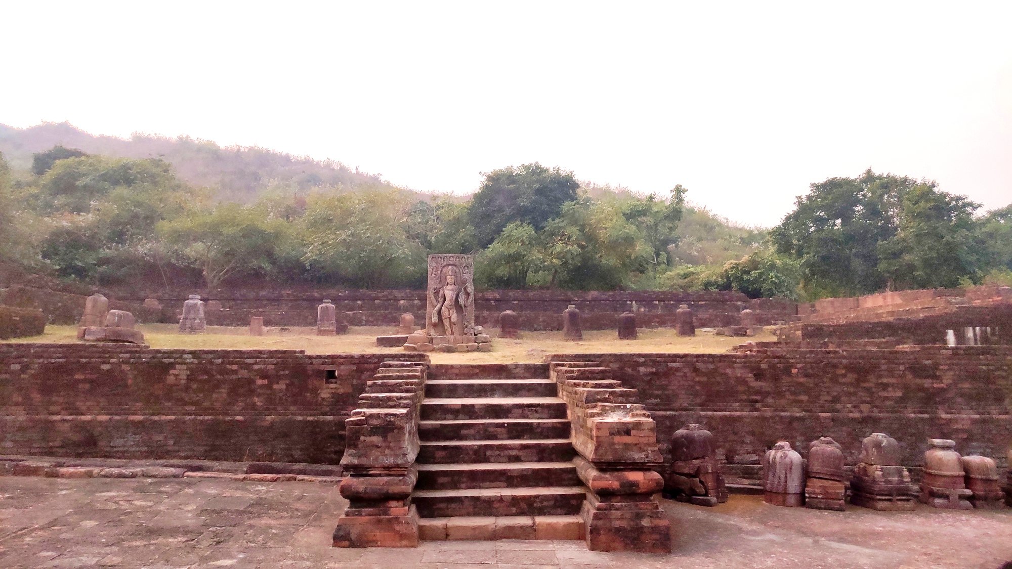
Adjunct to one of the monasteries, lies a chaityagriha with the main stupa, with several smaller stupas surrounding it – the stupas are dated between 1st and 12th centuries. Several stupas, including votive ones stand beside the other monastery too. Of note is a stepped well near the second monastery, the depth of which we could not gauge because it was already dark.
Votive stupasA well
Walking back through the forest as darkness falls
By now, it was already 5 PM, and given that it was peak winter, we were faced with the prospect of walking back through the jungle in pitch dark. Nevertheless, what is a family that does not bravely maneuver difficult paths! So, using our mobile phones are torches, we navigated our way through the narrow path cutting through the forest, making the least of sounds lest we attract undue attention from the wildlife. By 5.3o PM, we were back at the entrance, and were soon headed back to Bhubaneswar, after successfully completing the day-long Diamond Triangle trip.