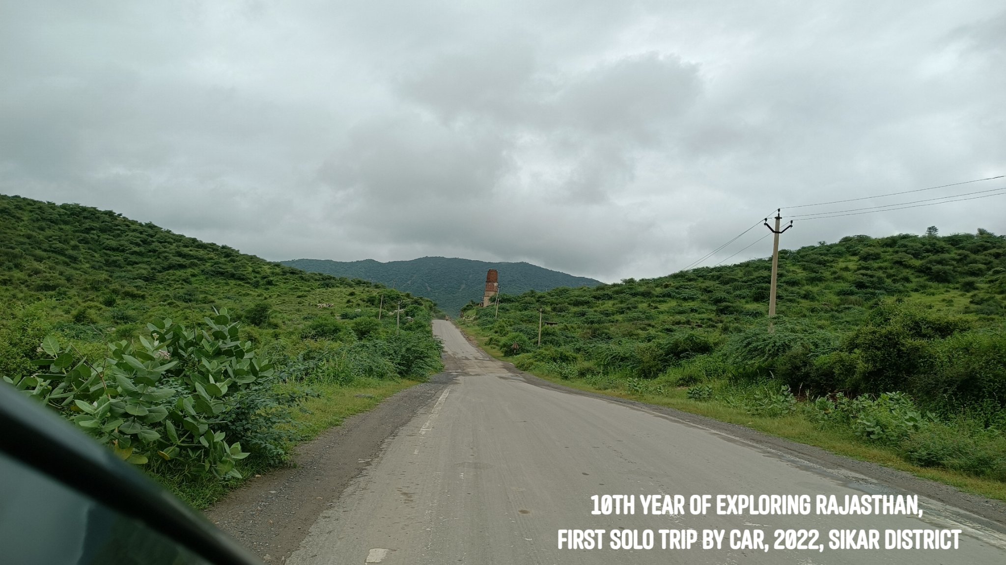
In April 2012, my first ever trip to Rajasthan was solo – by public transport, with the destination being Jaipur. In August 2022, I rounded off a decade of exploring Rajasthan by reprising the solo trip to Jaipur – only this time it was by driving on my own. A 700km self-driven solo adventure!
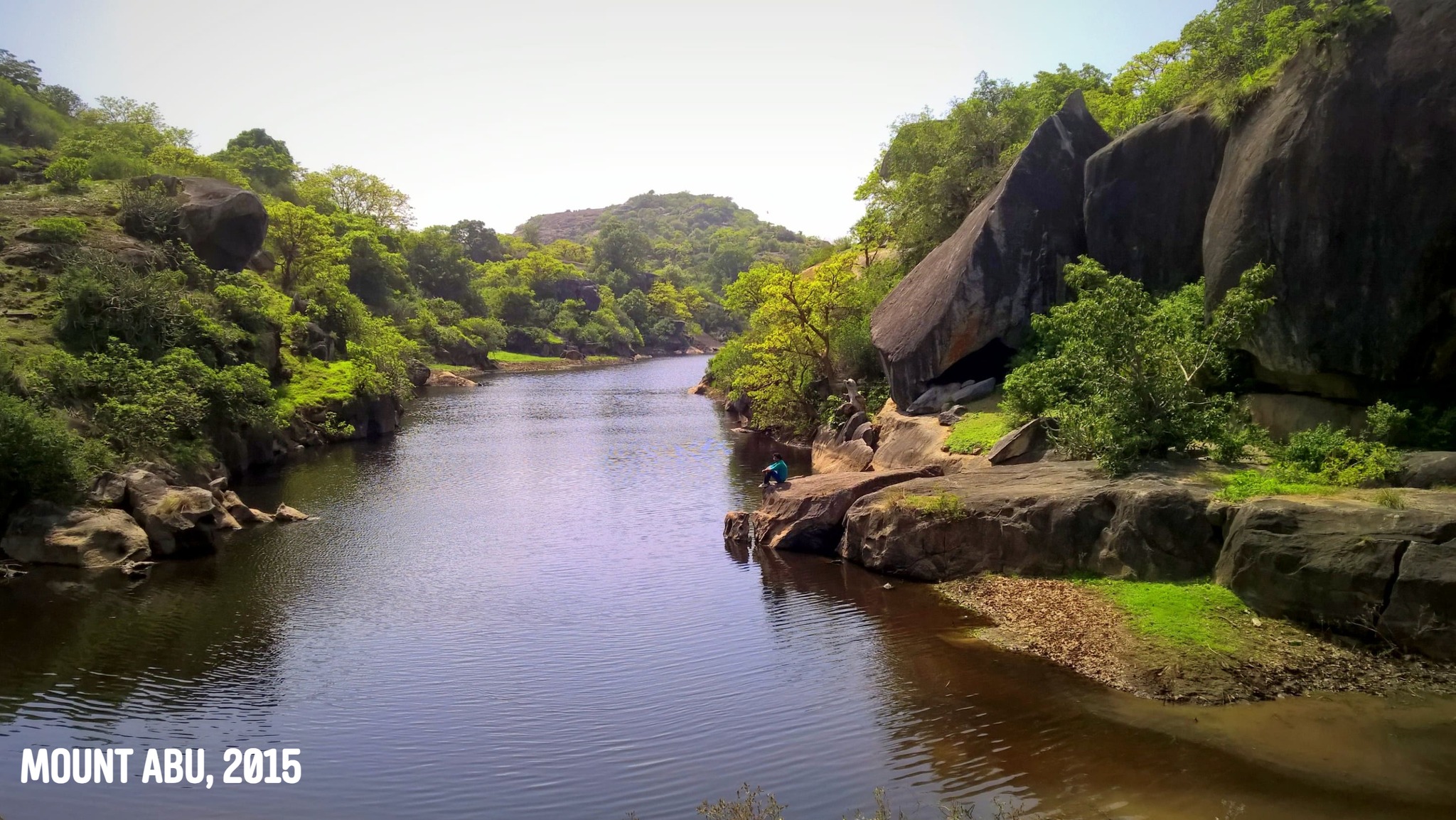
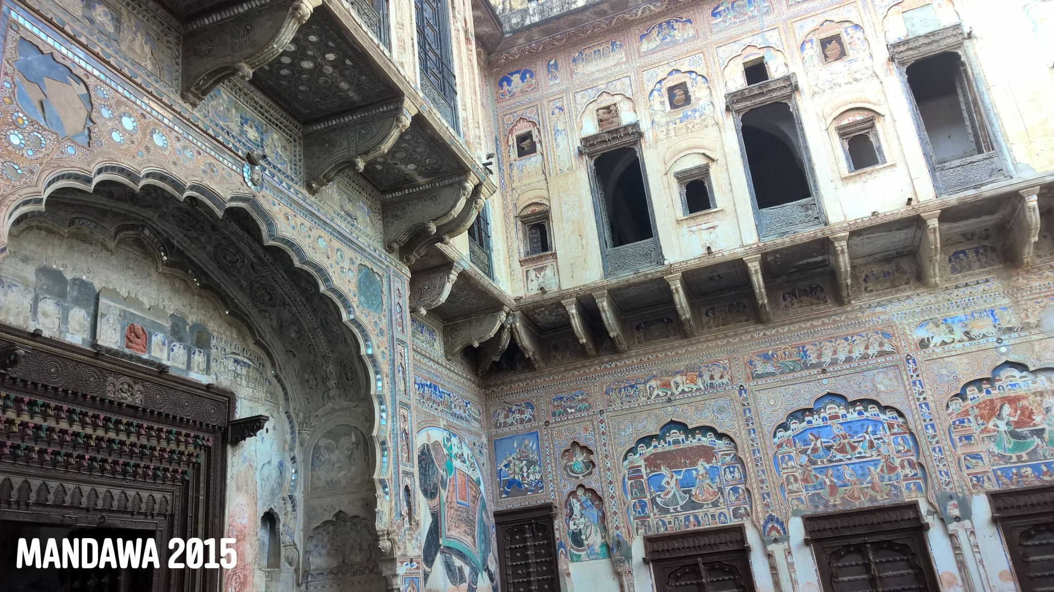
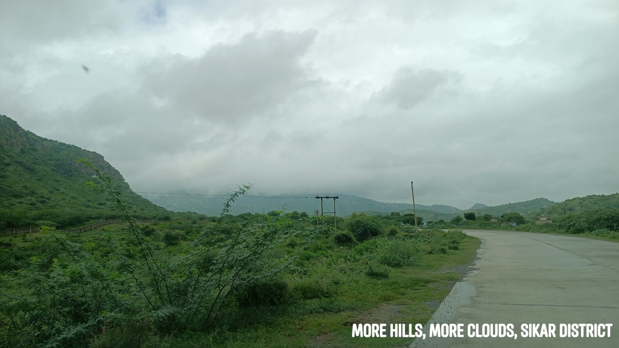
As always, it is rarely about the destination – and so off I went wandering through roads I had not trodden before, exploring a bit of the Aravallis in the Shekhawati region, while the sun and rain played hide and seek, and folds of hills lay in the distance in front and around me, their peaks crowned with fluffs of cloud.
I plead guilty to the charge of scooting off to Rajasthan every chance I get, even at the risk of inviting ridicule. ‘Why don’t you try out some other place this time – why not Himachal, Uttarakhand, UP?’, I have been asked. I say, some people love the mountains, some the beaches – as for me, I yearn most for the desert, the Aravallis, the forts…
Growing up in Odisha, I had had a fascination with Rajasthan long since I could remember. In Grade 4 – the black-&-white picture of the Hawa Mahal in a textbook, and the mention of the Thar around Bikaner and Jaisalmer, images of the Vijay Stambh at Chittorgarh and the Dilwara temples at Mount Abu were imprinted in my head. A General Knowledge book addressed Jaipur as the Pink City, and Jodhpur as the Blue City. I always wondered looking at those black-and-white pictures how the cities might look like in real life in their famed hues.
Some years later as we were embarking on a train journey, Dad let me pick up a thin paperback from the book stall on the railway station- it was called ‘Folk Tales of Rajasthan’. While on that train, in my mind, Rajasthan turned into a place of magic, of kings, bards & princesses, of Pabuji, star-crossed lovers & clever thieves, of camels & shifting sands…I was enamoured.
Rajasthan was always just too far away though, and little did I know I would later land up at the gateway to it – Delhi. Little did I know as time progressed, I would reside at a place, on the outskirts of Gurgaon, where I could simply lug a backpack on my back and in half an hour, be inside Rajasthan. Little did I know I would once also drive solo to Rajasthan…
***
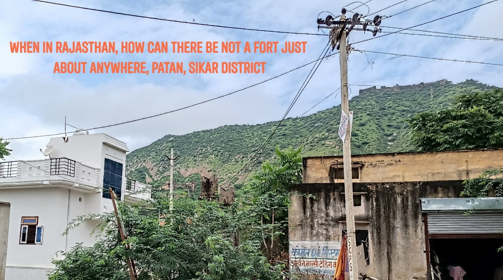
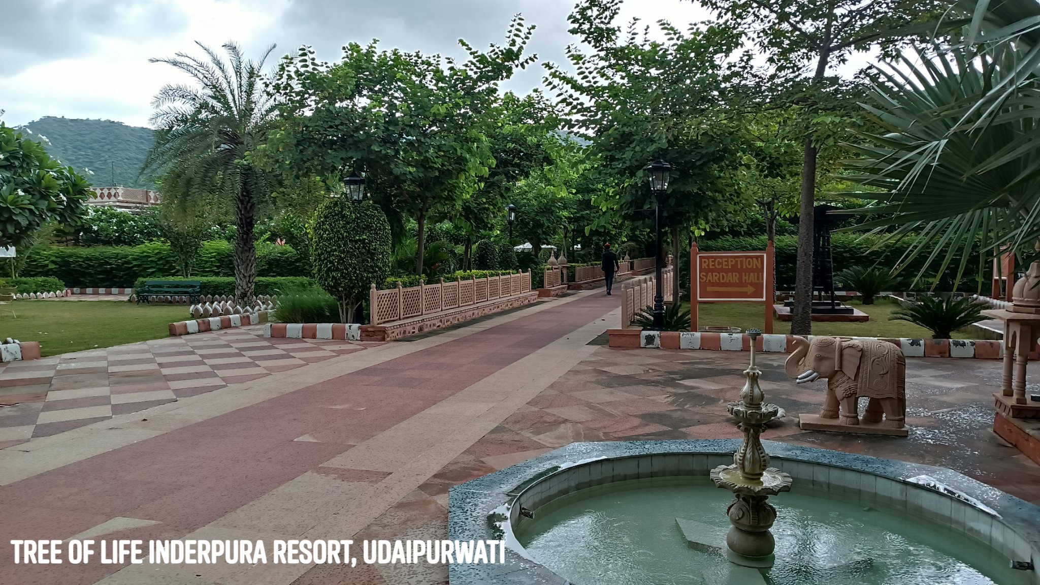
On this trip, instead of driving directly to Jaipur from Gurgaon, I took a detour midway, towards the north and drove through some of the most exotic sounding places – Kotputli, Neem ka Thana, Udaipurwati.
Udaipurwati
A quaint little town nestled within a gap in the Aravallis, is home to an excellent resort called The Tree of Life Inderpura.
Lohargal
Near Udaipurwati, within a crevice in the hills is a holy spot with a natural spring feeding a bathing tank and ancient Sun Temple. According to myth, weapons and armour of a Pandava army that camped here after their victory, dissolved in the water, giving the place its name: Loha (Iron)+Gal (To melt).
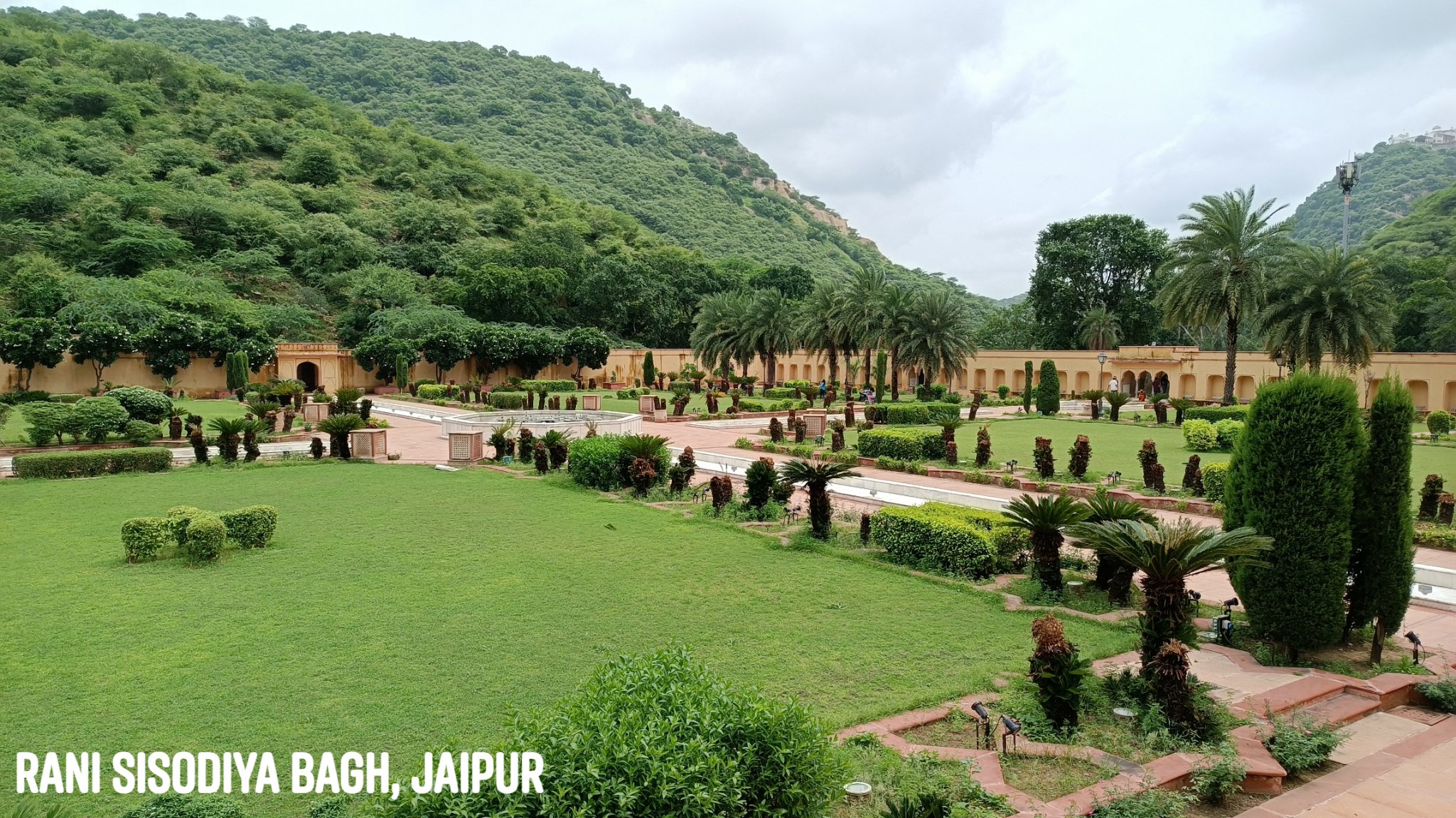
From thereon in Jaipur, I visited a couple of places that I had not seen before, both nestled in the Aravallis.
Rani Sisodiya Bagh
A hidden gem of a garden built by Sawai Jai Singh II for a princess of Udaipur, who agreed to marry him only on the condition that she be made the main queen of Jaipur.
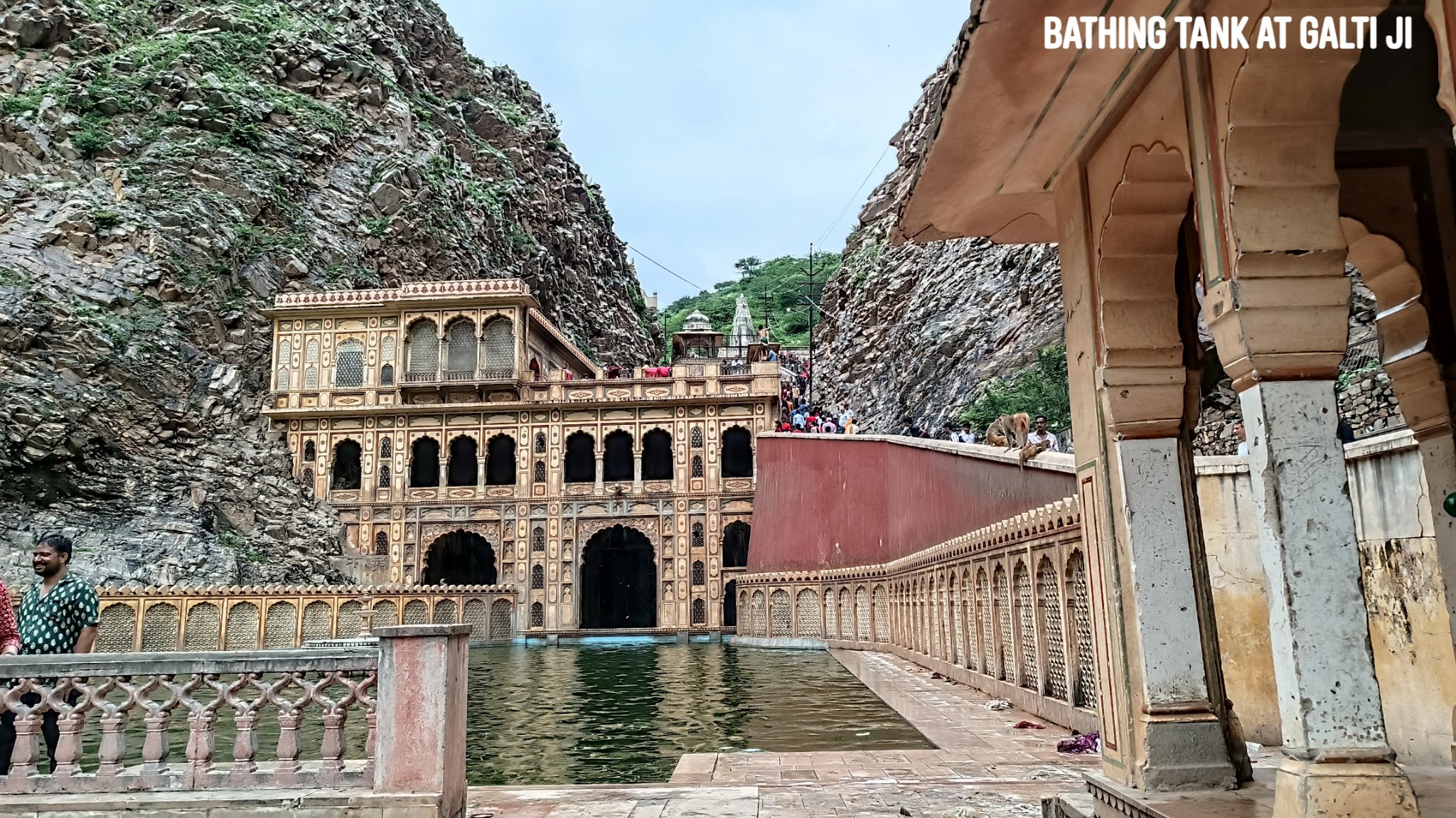
Galta Ji
Home to a bathing tank fed by a perennial spring and a temple dedicated to a hermit named Galta ji, along with temples dedicated to Krishna and Ram. At the peak of the hill is a 350 year old Sun temple, reached after a hike of about 1.5km. The first rays of the Sun reaching Jaipur apparently fall on the idol in the temple. Views from the hill are outstanding.
Trip Summary Day 1: Gurgaon to Udaipurwati via Neem-ka-Thana & Patan -250 km, 6 hours Udaipurwati to Lohargal – 15km, 30 min Lohargal to Jaipur via Udaipurwati & Reengus – 160km, 3 hours
Day 2: Jaipur sightseeing of Rani Sisodiya Bagh and Galtaji – 25km, 2 hours Jaipur to Gurgaon – 230km, 4 hours
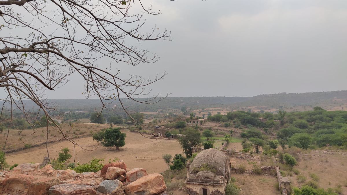
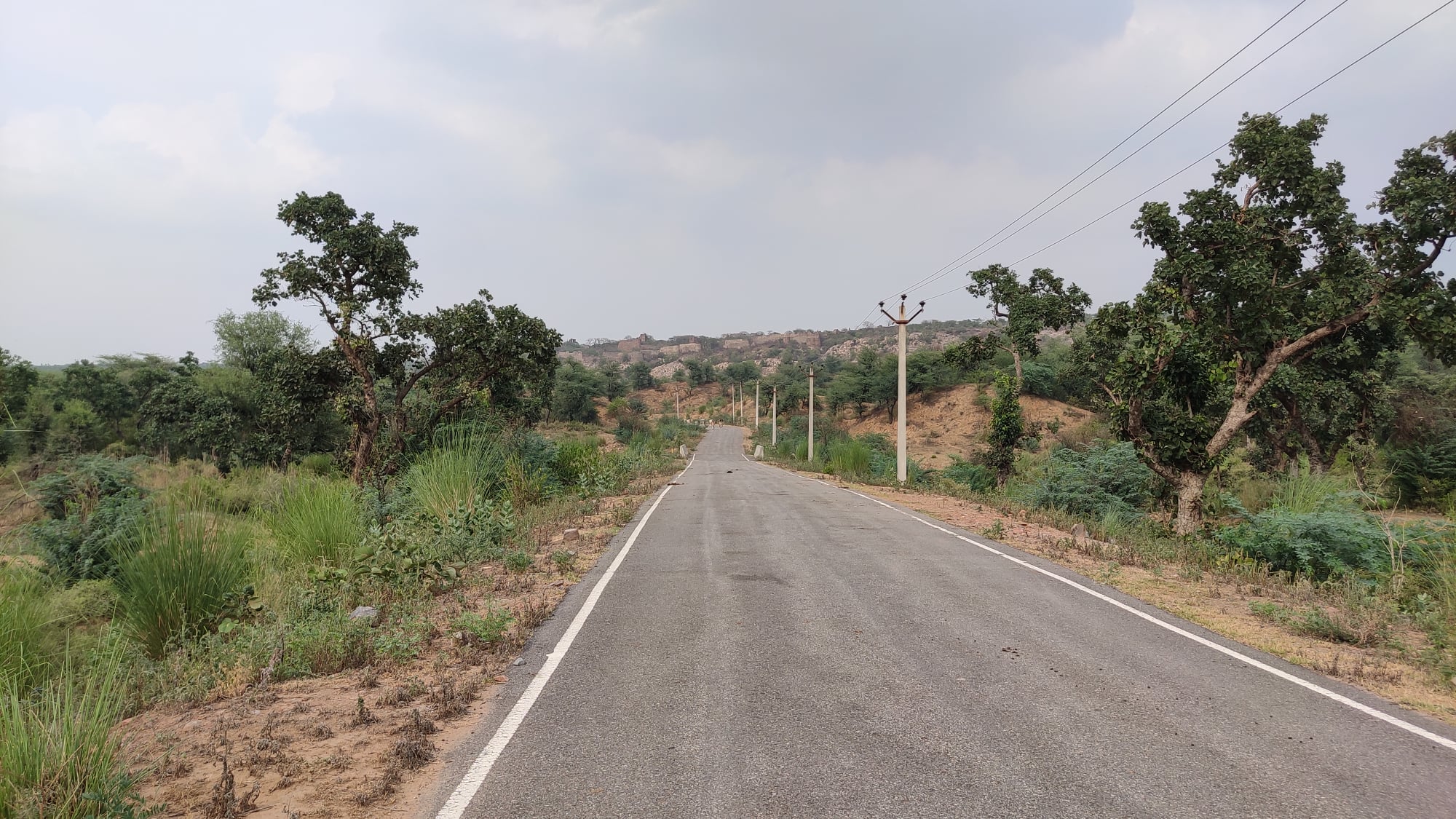
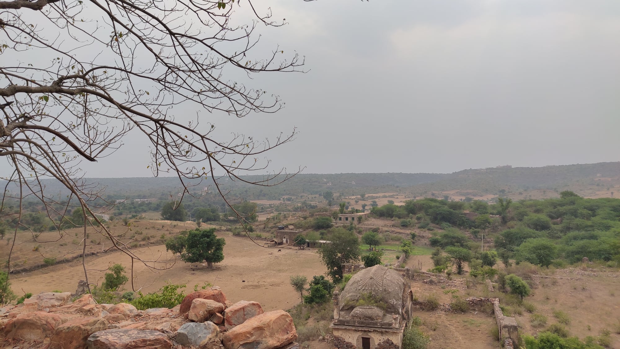
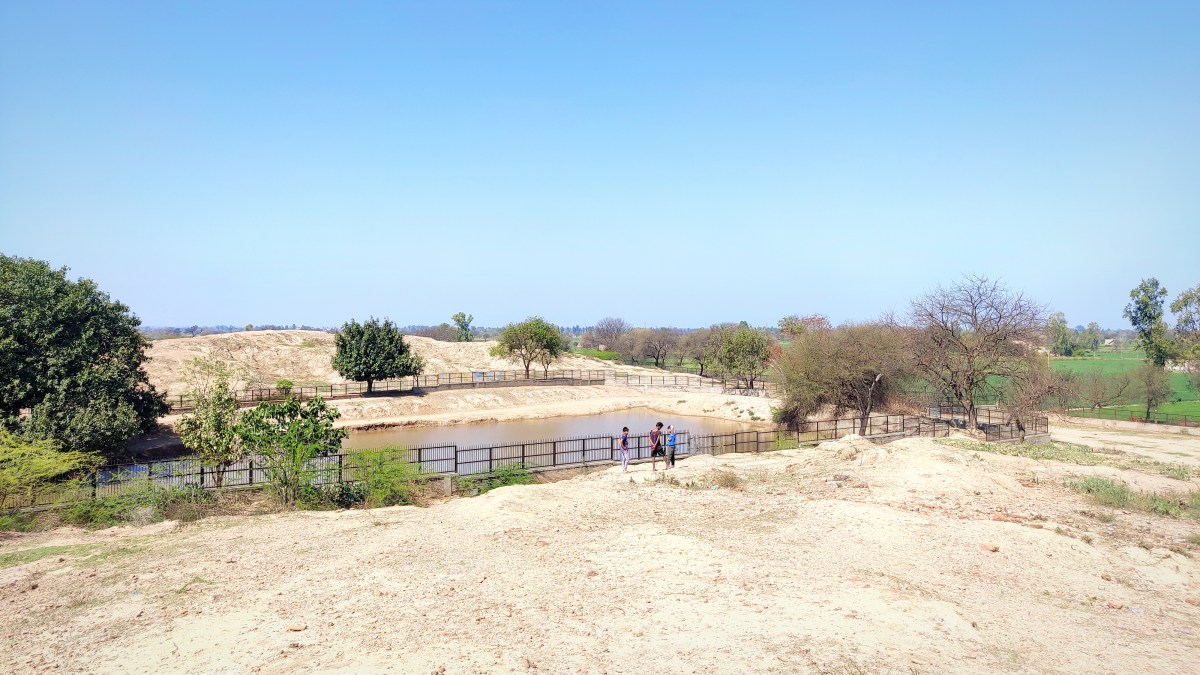
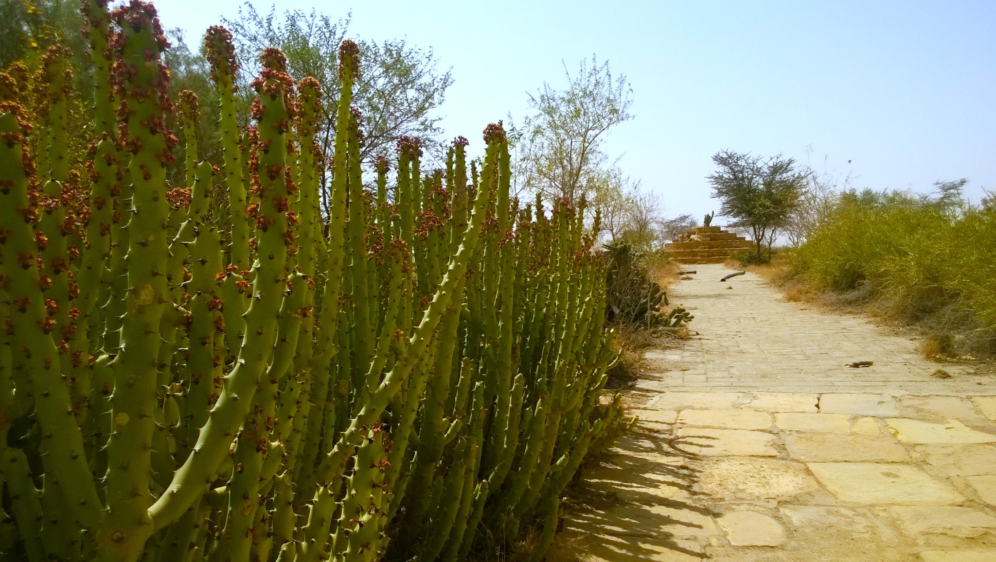
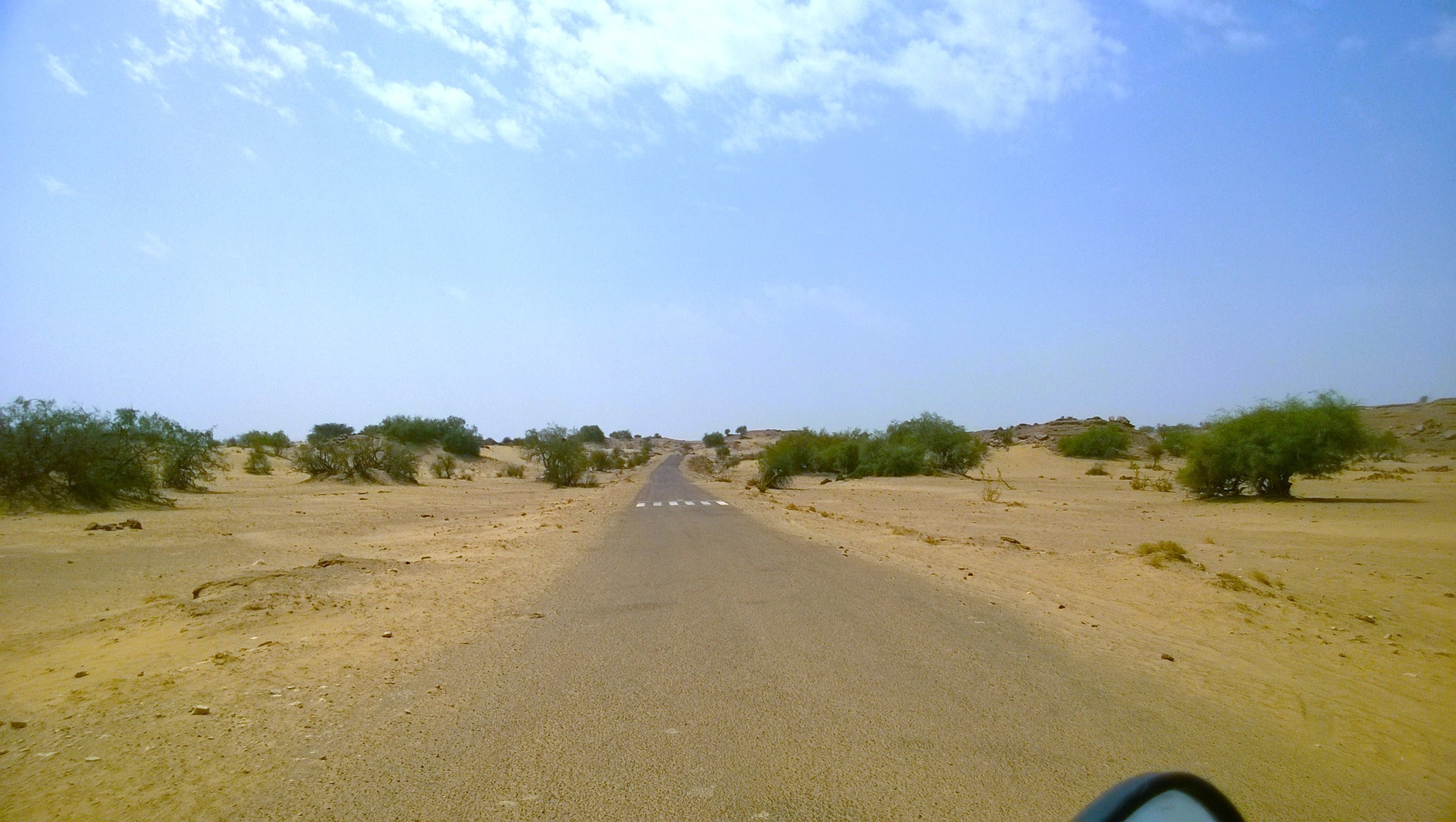
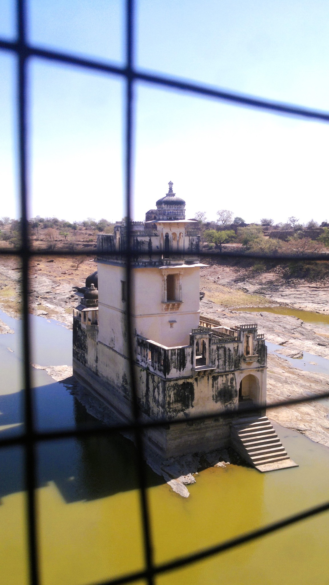
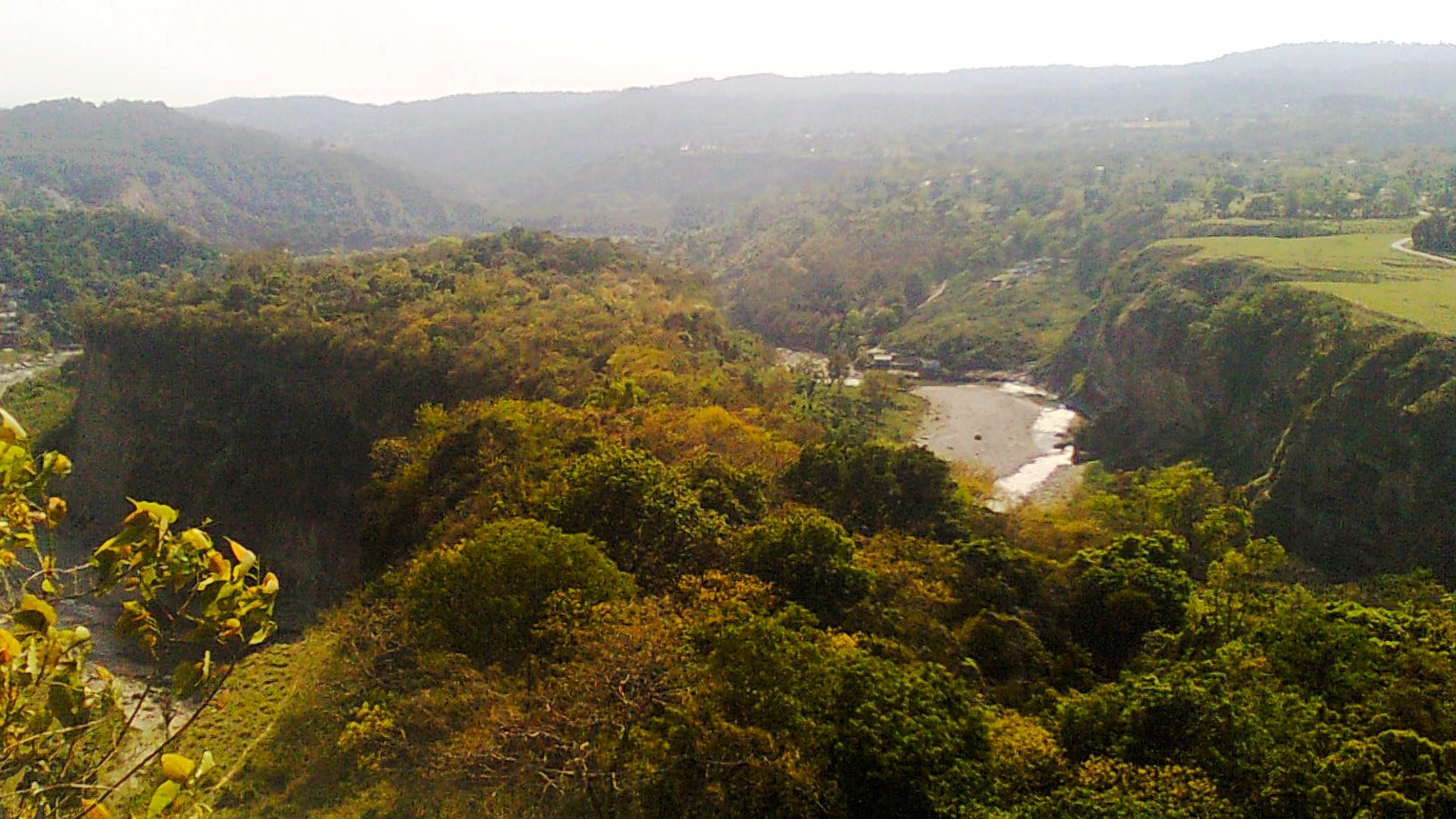
Ever since I moved to the suburbs of Gurgaon amidst the work-from-home regime, I have suddenly been presented with immense possibilities for indulging my wanderlust. On one recent weekend afternoon, I set out on my scooter in pursuit of a place called Rundh Indor which seemed on Google Maps to be home to a fort. Nestled in a cove of the low-lying Aravallis on the Haryana-Rajasthan border, Indor is a non-descript village, accessible by a narrow road that is flanked by the Aravallis on both sides beyond strips of agricultural land and a hamlet or two. The area is not so remote as it is sparsely populated.
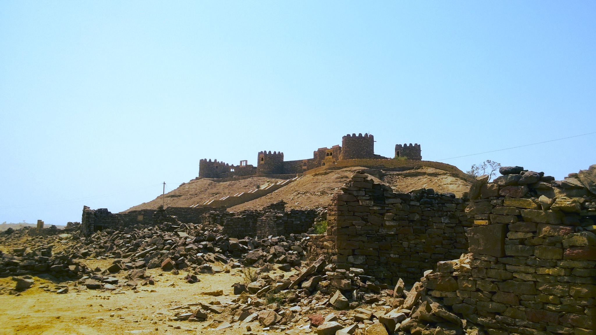
View of the fort from the foothill
Once at Indor, from the road, I could see a long fortress wall and the domes of a few structures stretching across the left-side Aravalli hills. Tantalising as it seemed, I still did not think of accessing the fort till I came across a rubbled track that looked like the approach road to the fort. After some dawdling, I finally gathered the courage to ride up the approach road till I came upon the base of the hill, where a young duo was contemplating accessing the fort themselves. In what was already quite a desolate location, my only chance at setting foot in the fort now hinged on me joining forces with a couple of rank strangers!
View of the Aravalli from the fort
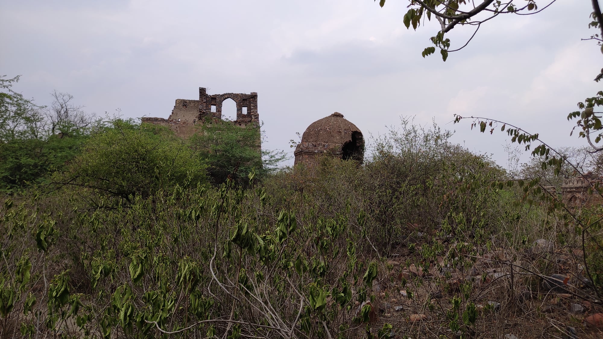
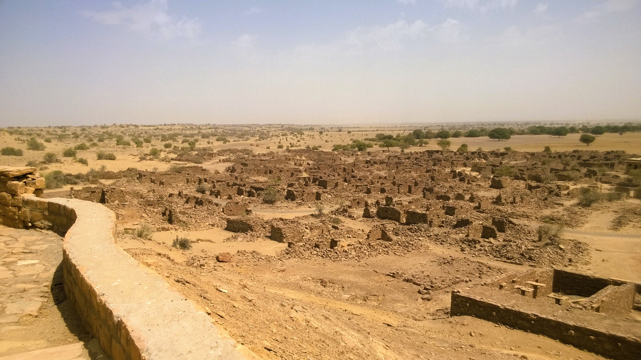
Wary of any untoward incident, I followed the duo on the trek uphill using goat tracks. Once atop the fortress wall, the vastness of the fort immediately dawned upon us. Sprawling across at least one or two square kilometres of the hillside were disparate structures – palace-like havelis interspersed with domes and grand arched gateways – all in dilapidated condition and swamped in typical Aravalli vegetation. And nary a living being in sight! We waded through the thick jungle from structure to structure, with the fear of snakes, wild animals and miscreants writ large on our faces. However, the fear was amply compensated by a breathtaking sight of the Aravallis stretching endlessly on the opposite side of the fort.
Ruined structures strewn around
It was only when the sunlight began to dim that we realized it was already 5.30pm and we had advanced a long way into the fort area. Turning, we were confronted with tracing an uncharted path back just like our way up. Luckily, climbing atop a crumbling wall gave us a clear line of sight to the place where our scooters were parked. Treating the direction as sort of a North star, we trekked down the hillside until we reached a huge depression – our final hurdle. The fortress wall swerving around the depression was broken, making access through it precarious too. Crawling over the broken portion of the wall, we were finally outside the fort precincts. Within minutes, we were back riding on the way home even as the sun set behind the Aravallis.
Alighting from the Haryana Roadways bus at Hansi, 20km before Hisar, my first reaction was one of regret. It was already 6pm and I was circumspect about the situation I had gotten myself into owing to my mad uncontrollable urge to venture into the Harappan Civilization clusters in and around Hisar. But then I fired up Google Maps and walked towards the Hansi Fort. And am I glad I did!
Earlier that day, I had ditched the India-Australia World T20 Cricket final 10 overs in, when it became clear that India were going to be decimated. And still reeling from the after-effects of finishing the book ‘The Lost River: On the Trail of the Sarasvati’, I had packed a few bare essentials and taken a bus to Hisar from Gurugram bus-stand, with no itinerary in place, except for one pointer – get as far into the purported Sarasvati Valley as possible.
The only trouble was – I did not know how to get there. A colleague from the Hisar region had earlier dissuaded me from venturing solo into that area. In fact, he did not know about the Harappan sites around Hisar. It also didn’t help that there was little material on the internet pertinent to tourists addressing these Harappan sites.
So in Hansi as I walked towards the fort through the city’s old-fashioned streets, and passed through the Barsi Gate, I pacified myself visualizing Prithviraj Chauhan’s troops rolling in. The Fort would have been closed by 6pm as per Google – still, something kept me clambering up the hilly incline to the entry point of the fort, where I realized there was no closing time, and there were most certainly no closed gates. With the sun already down, I entered the final gate and presently came upon the fort enclosure set upon the plateau atop the hill. As the few remaining visitors retreated in the twilight, I started surveying the scattered structures.
By the time I was done, it was pitch dark and not a single soul was in sight. With my heart pounding, but my blood awash with adrenaline, I was leaving a subterranean long hall-like structure with nothing but darkness inside, when I chanced upon silhouettes of 3 people sitting near the roof of the structure. If I had any survival instincts intact, my first reaction should have been to flee. But I decided to approach them to inquire about the structure. And as it would turn out – all I had to do was ask!
A view of the city from atop Hansi fort in the quickly engulfing darkness
They told me the structure was an erstwhile horse-stable, and as we spoke about the fort, they asked me as to what brought me to Hansi. I explained I had landed in Hansi since it would be the nearest hub to the Harappan sites, which I had been keen on exploring for a long time. One of these persons, who I learnt was from the Tehsil office, was so impressed with my motive that he assured me it was quite easy to reach these sites, especially Rakhigarhi, and he promptly gave me the phone number of a Mr. Ram Niwas, a Rakhigarhi resident no less! and local Tehsil official. He suggested I call him before I reached there.
So with an apparent lead in hand, I left the dark confines of the fort, illuminated with renewed hope of realizing my dream of setting foot on a Harappan site. I checked into an inexpensive lodge in front of the bus-stand, got little sleep from anticipation of the next day’s events, and woke up late! As I was stepping out after having a cheap quick breakfast, I beheld a bus headed to Jind already leaving the bus-stand exit. I ran in parallel to the driver’s window, asking in a scream if the bus was going to Narnaund. The bus slowed down, and I scurried around the front side of the bus and hopped onto it.
In 30 minutes, I was at Narnaund, where the diversion to Rakhigarhi originated. I called up Mr. Ram Niwas and in a short conversation comprising sentences alternating between pure Haryanvi from his end, and Hindi from mine, I only deciphered that he would indeed meet me at Rakhigarhi. I hopped onto a Scorpio that was carrying passengers headed to Rakhigarhi, and following 20 minutes of riding on a well-laid road, squeezed amidst the village folk, I was standing at the main cross of Rakhigarhi village.
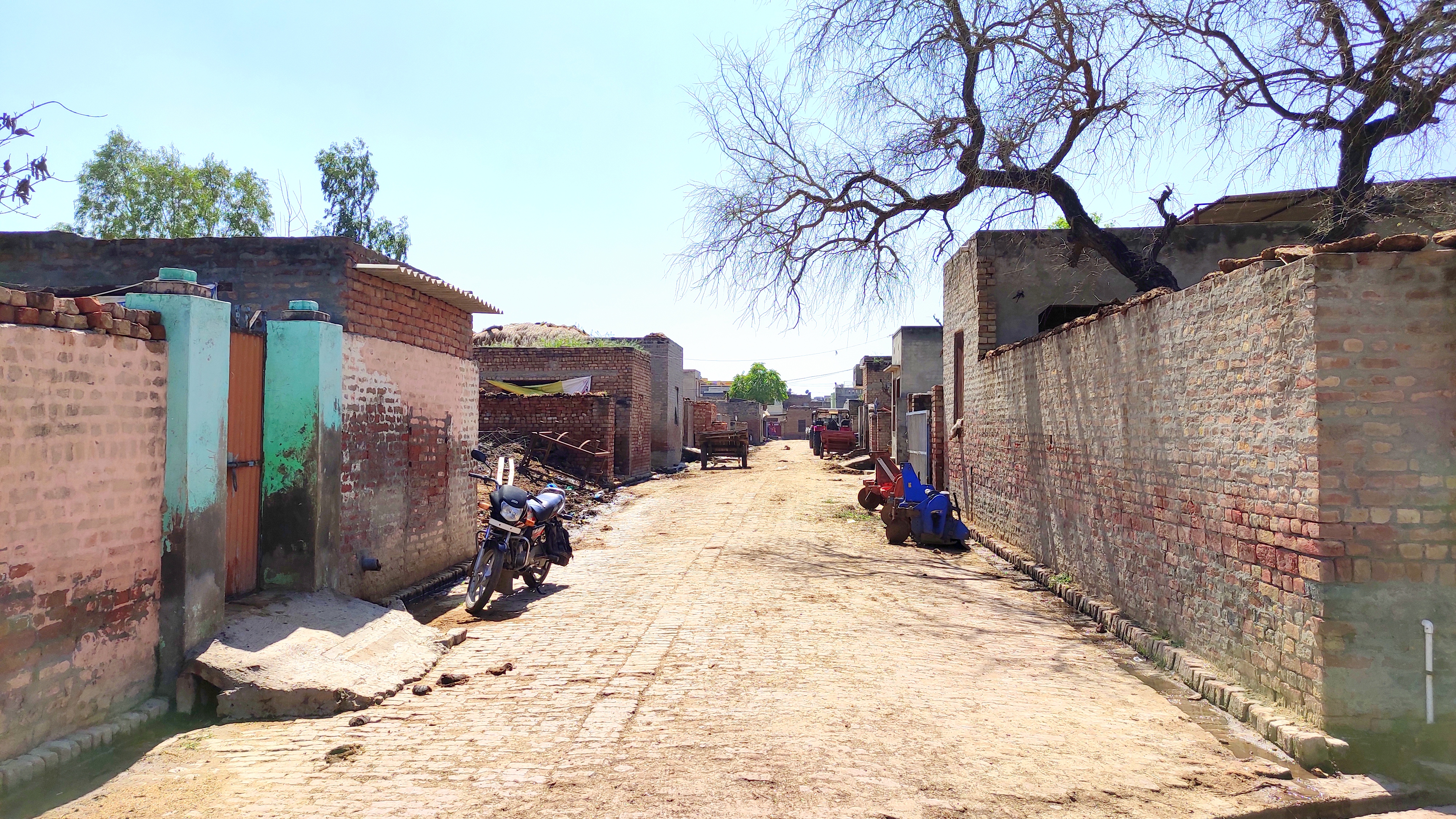
Thereupon, Mr. Ram Niwas appeared on a motorcycle. He was nothing as I had imagined. Ram Niwas ji is a lanky white-mustachioed soft-spoken elderly gentleman, somewhere in his late 50s or early 60s. After exchanging pleasantries, I rode pillion with him towards his home ensconced somewhere within the rows and rows of brick-walled houses. The brick-laid streets for the most part cut each other perpendicularly, and in places, were slushy from puddles of rainwater and patches of cow-dung. On some walls, cow-dung cakes hung drying in the sun. Neat open drains lined both sides of all the streets we traversed.
One of the wider typical Rakhigarhi streets
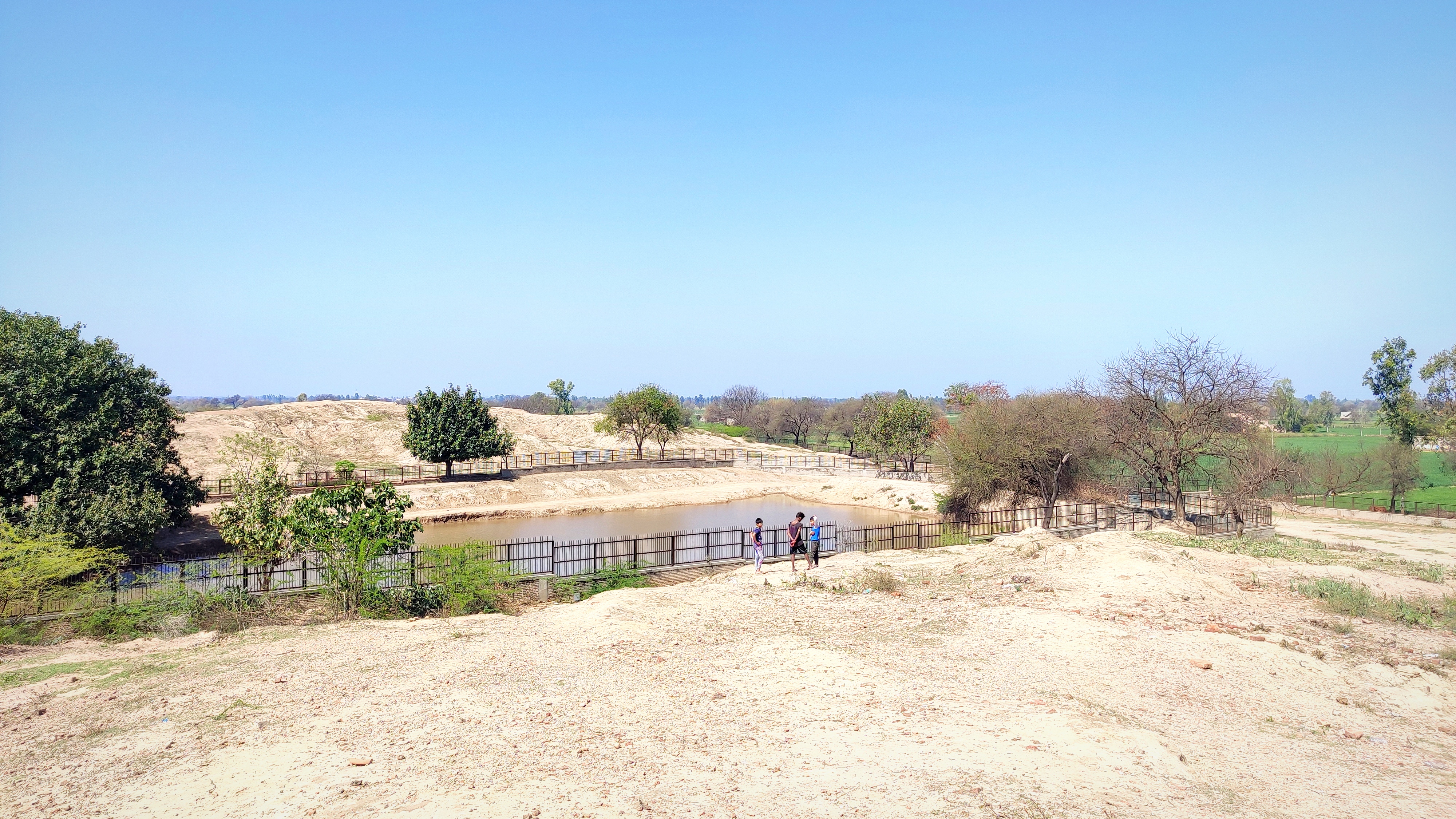
The route we took headed to the north, went up an incline and then sloped down, and I wondered aloud if we were on one of the Rakhigarhi mounds, to which Ram Niwas ji answered in the affirmative. As we rode further down the slope I could see two huge mud mounds before me, one straight ahead and another to its left, with iron fences delineating each from the other and from the village streets. Turning to the east for a short distance, we turned south again into a lane which again went up an incline and suddenly diverted towards the left and opened up again to reveal a couple of havelis large enough in comparison to the basic box-shaped brick houses below, of which one belonged to Ram Niwas ji.
In his quaint unadorned drawing room that opened directly into the lane, we had tea and introductions to other members of his family. Ram Niwas ji laid out the plan for the day – he would show me around all the mounds and the upcoming museum on his motorcycle, and get me to speak to somebody who would then be able to identify the mounds from the pictures I showed him. And then I would have to have lunch! To my perfunctory remonstrations, his gentle yet firm Haryanvi-laced reply was, ‘khaana toh khaana padega (lunch will need to be had).’
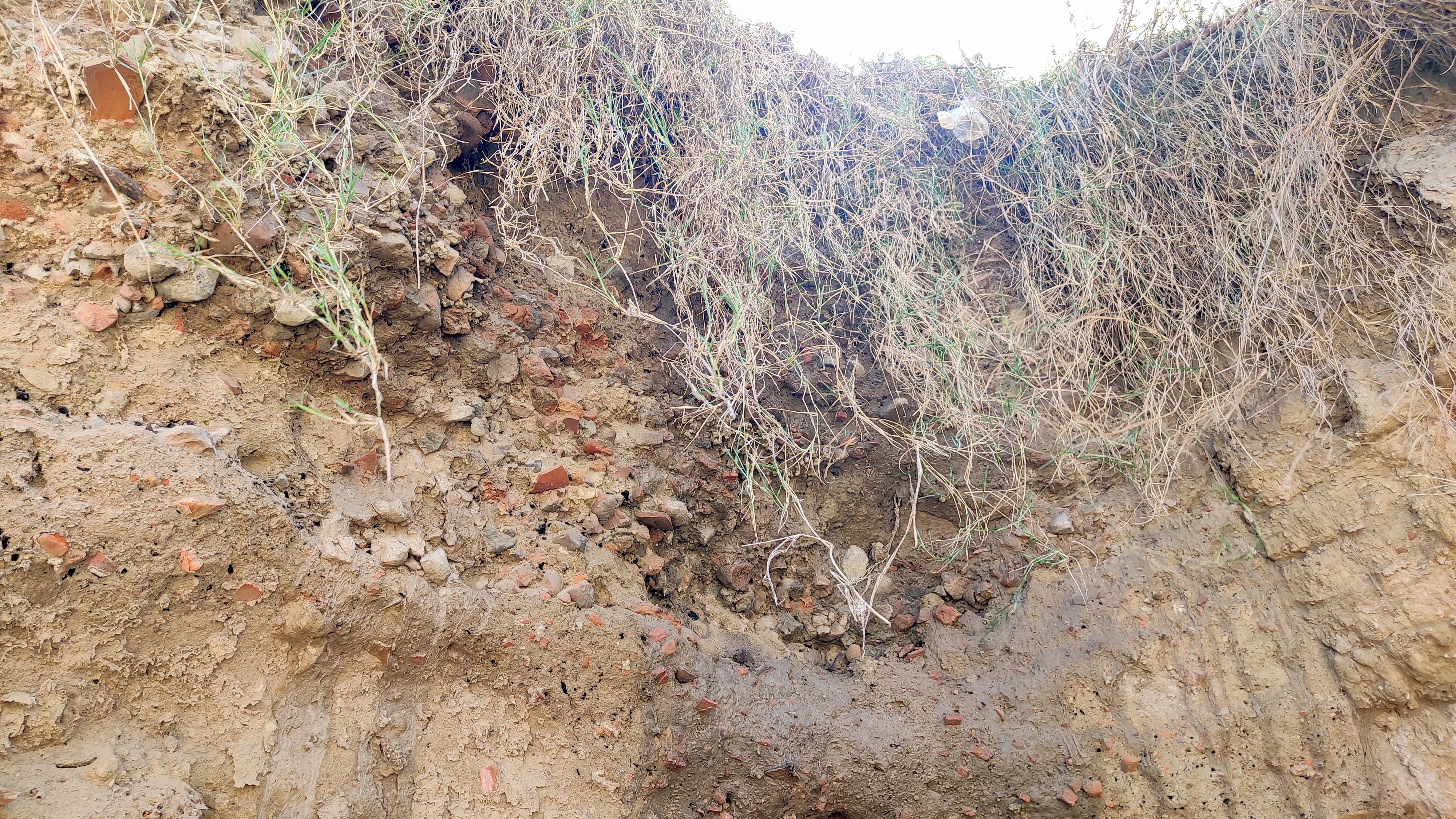
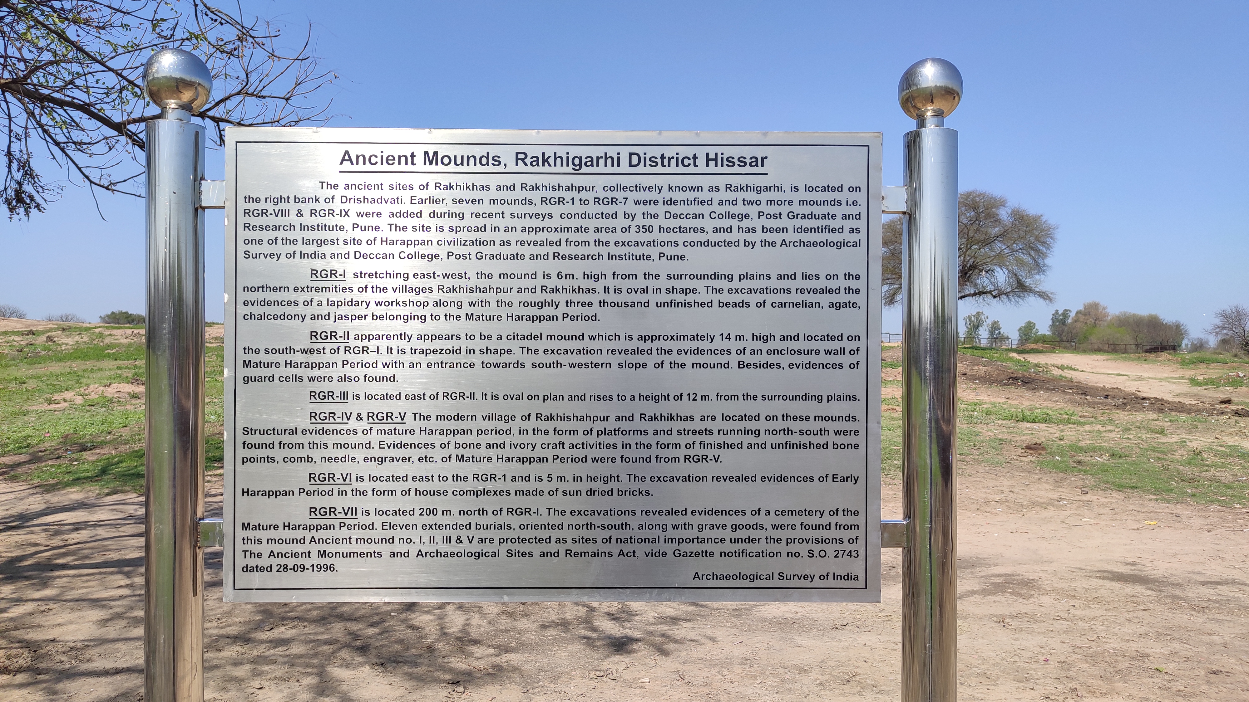
And so we went first to a mound (RGR-4) on the east side of the village where a street had been carved from one of its sides revealing the brick lining of an old Harappan structure. Taking pictures, we proceeded to the two mounds I had spotted earlier. We rode up the mound on the left first (RGR-2) upon which tall shrubs were growing and children were playing. I alighted and was taken aback by the continuous layer of pottery shards and little portions from bricks strewn across the whole surface of the mound. The mound must have been about 40m by 20m. Excavations done on this mound had been back-filled with mud on top of polymer sheets to enable easy stripping for display or exposure of the excavated parts in the future.
Old and new co-exist near this excavation on the side of Mound RGR-4Bricks of a Harappan-time structure revealed on RGR-4
I ambled across the northern side of the mound soaking in the energy of the place, transported to a day in the lives of our ancestors who inhabited the innards of the metropolis I was standing on at present. I zeroed in on a day sometime in 2500BC, where I walked through paved streets bustling with traders and carts rumbling along loaded with earthenware, and the air imbibing the fragrance of burning wood and food getting cooked in earthen ovens in the nearby brick houses. There I stood transfixed on the luscious grain fields down below, spread to the farthest my eyes could fathom, wondering if such fields stood at the same place back then or if they were now standing on metres and metres of silt deposited over more structures underneath. Ram Niwas ji told me the famous Rakhigarhi skeleton was dug up from somewhere amidst those fields.
Standing on Mound RGR-3 and looking at Mound RGR-2
Ram Niwasji with shards of ancient pottery
The mound to the east (RGR-3) was separated from the mound I was standing on, by a small pond of clear water. I walked my way to the top of RGR-3 where a small blue-coloured structure dedicated to a Pir saint stood. This mound too had pottery shards strewn all across its surface. We then rode further east to the mound (RGR-1) that had been excavated first. The same pattern of pottery shards and brick pieces strewn across the surface repeated, with the mound too having been excavated and covered up. It had other visitors besides us – a handful of Red-naped Ibises!
Signage at RGR-1, the first mound to be excavatedAn avian visitor – a Red-naped Ibis!
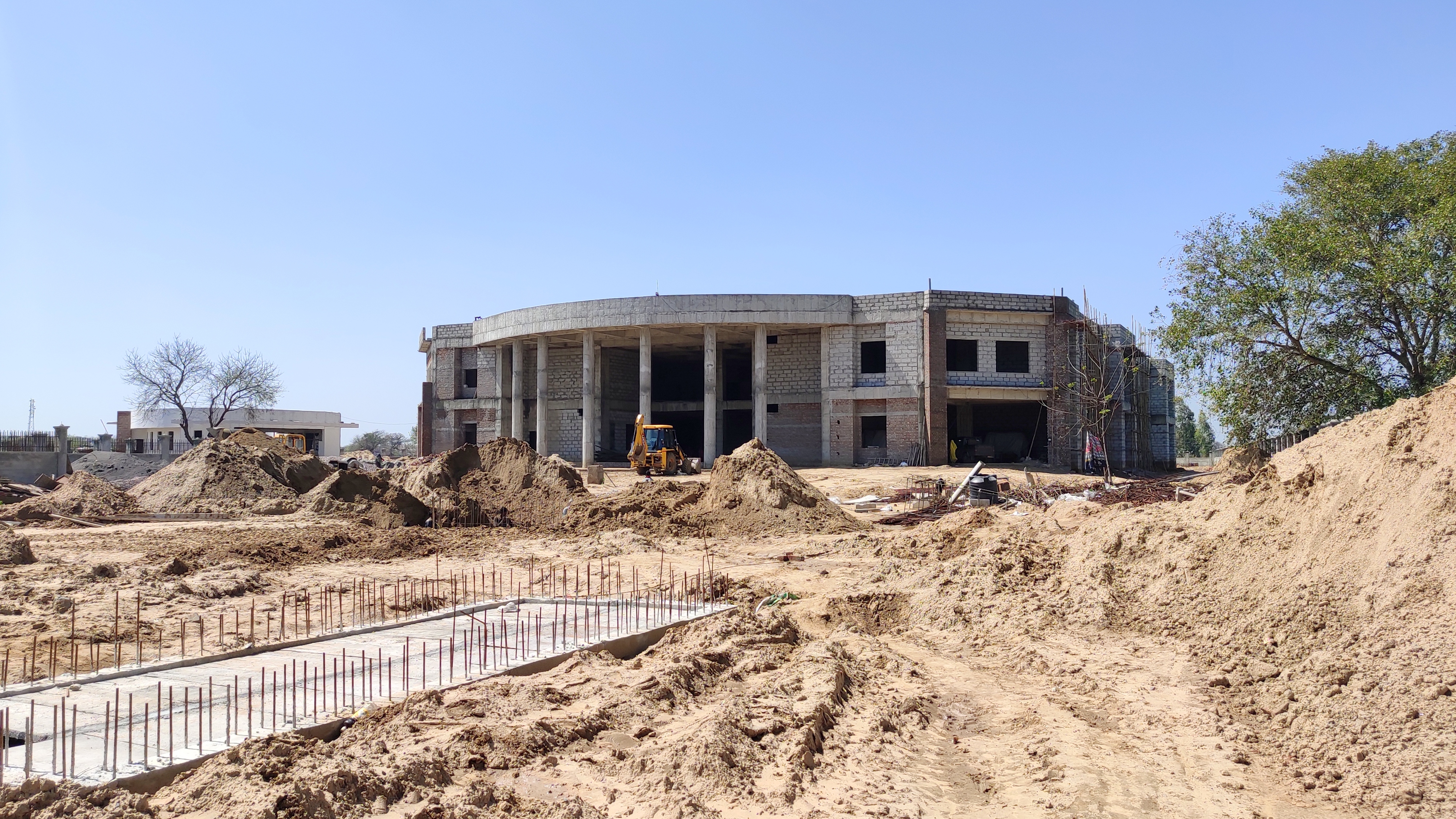
Moving further east and then turning to the north past a couple of clear-watered amply filled ponds, we got to the sprawling Rakhigarhi Museum, which is still under construction and is expected to be up-and-running in 2 to 3 years. Locals believe that once the Museum comes to life, and a settlement has been reached between the villagers and the Government with regards to the rehabilitation of locals whose houses are built on two major mounds, Rakhigarhi would be a major tourist hub.
The sprawling Rakhigarhi musuem under construction
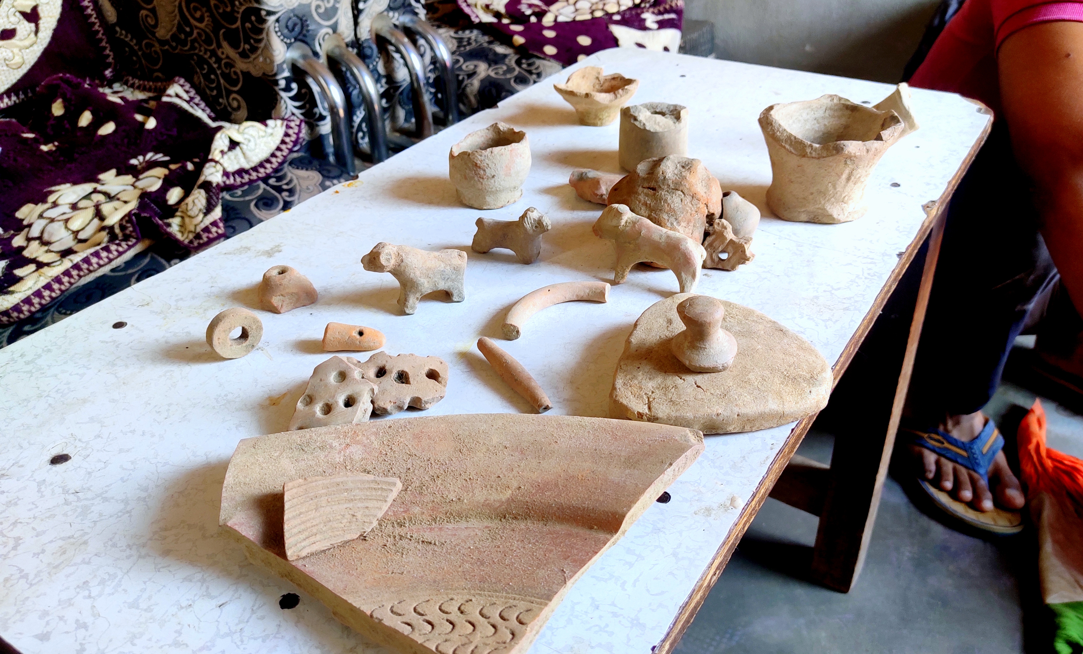
It was already 2 hours since we had been riding around, and once back at Ram Niwas ji’s place and after having a spartan yet filling meal of chapatis and raita, another surprise awaited me! Ram Niwas ji’s younger son, in his early 20s, took me to one of the rooms where a waist-high iron chest lay huddled in the corner. From there in, he extracted a cloth wrapped into a pouch and opened its knots to reveal several relics gathered from the mounds – terracotta toys including miniature animals such as the bull and the dog, pieces of pottery of different styles and a seal! He went on drawing out relic after relic – this cloth pouch being the figurative gift that kept on giving – until I asked him to stop. My glee upon being able to touch these pieces from the past knew no bounds – money couldn’t buy the preciousness of the objects I held in my bare hands!
Treasures from Harappan times – terracotta figures and earthenware
At last it was time to bid adieu. Ram Niwas ji vehemently refused to accept some money I offered as a token of my appreciation. I touched his feet and got into his car with his son, who dropped me back at Narnaund. From there as I retraced my way back to Gurugram through Hansi on a local bus on the wide smooth highway, I could not help but smile at the sight of the seas and seas of wheat and mustard fields lining both sides of the highway. Whenever I saw a mound-like elevation, I wondered if there were cities of the past buried underneath. Maybe I used to live in one of them.
With just three weeks remaining for my post-graduate course in Hyderabad to complete, I decided to head for a quick weekend trip to a place that had been on my bucket list for a long time – Hampi. So, I took an overnight bus from Hyderabad and was in Hampi by 8.30 AM. After checking in at Clark’s Inn, I went about hiking around Hampi – the capital of the legendary Vijayanagara empire – taking a walk through the annals of history.
Hampi is identified with Kiskindhya of the Ramayana, where Bali and Sugriva, the vanara brothers lived. Anjanadri Hill near Hampi is believed by locals to be the birthplace of Hanuman. Hampi is also called as Pampakshetra because of Pampa, an old name for the Tungabhadra River, which runs through the area. Hampi is also said to be the village of Pampa Devi, another name of goddess Parvati, Shiva’s wife. Another explanation is that Hampi became a place where five faces of Shiva (Paramesvarasya Panchamukhnam), namely, Virupaksha, Jambunatha, Somesvara, Vanibhadresvara and Kinnaresvara, began to be worshipped in the form of Panchalingas (five lingas).
Highlights of the trip are below:
Day 1
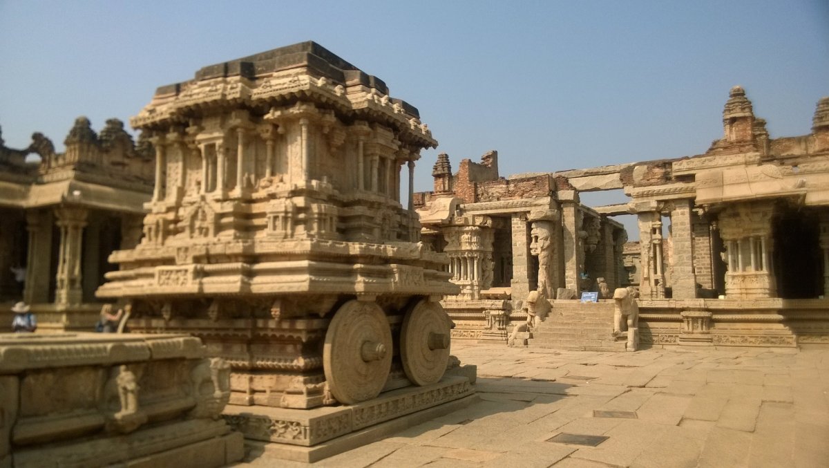
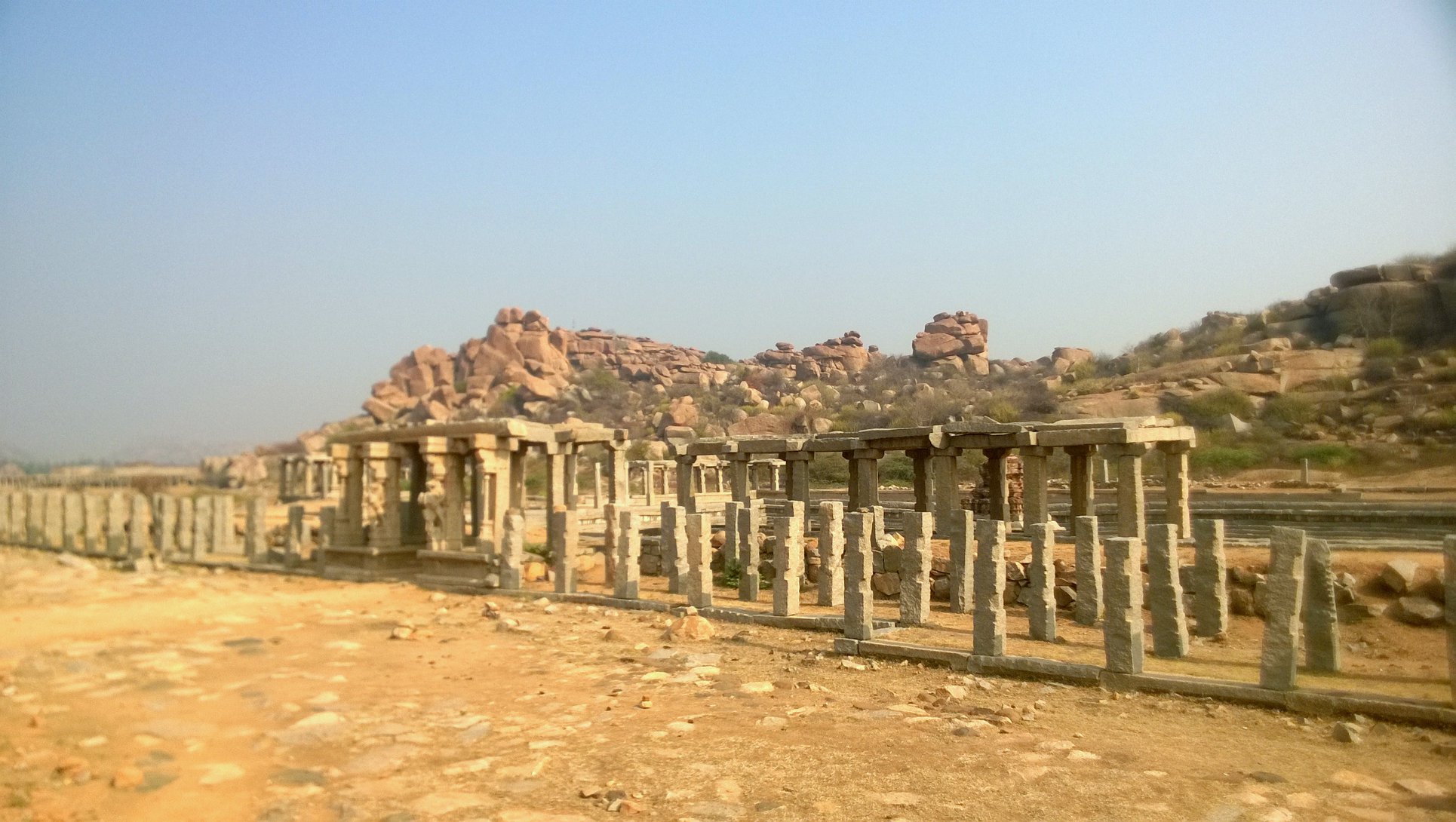
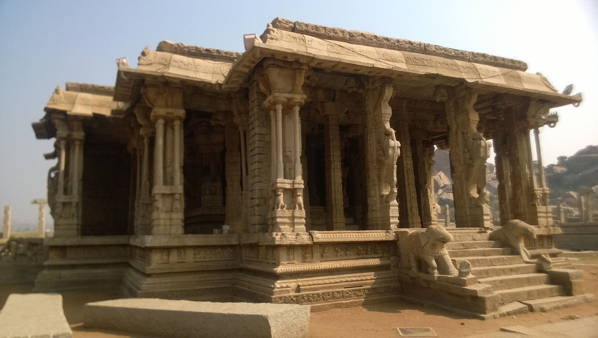
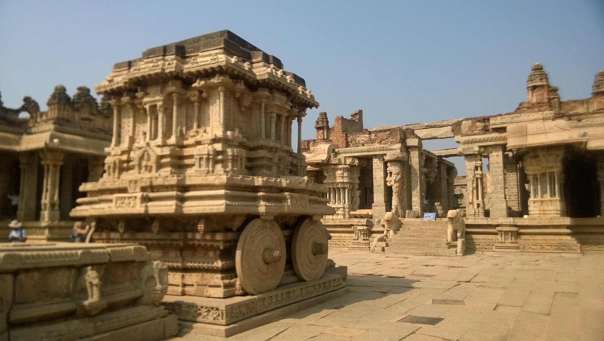
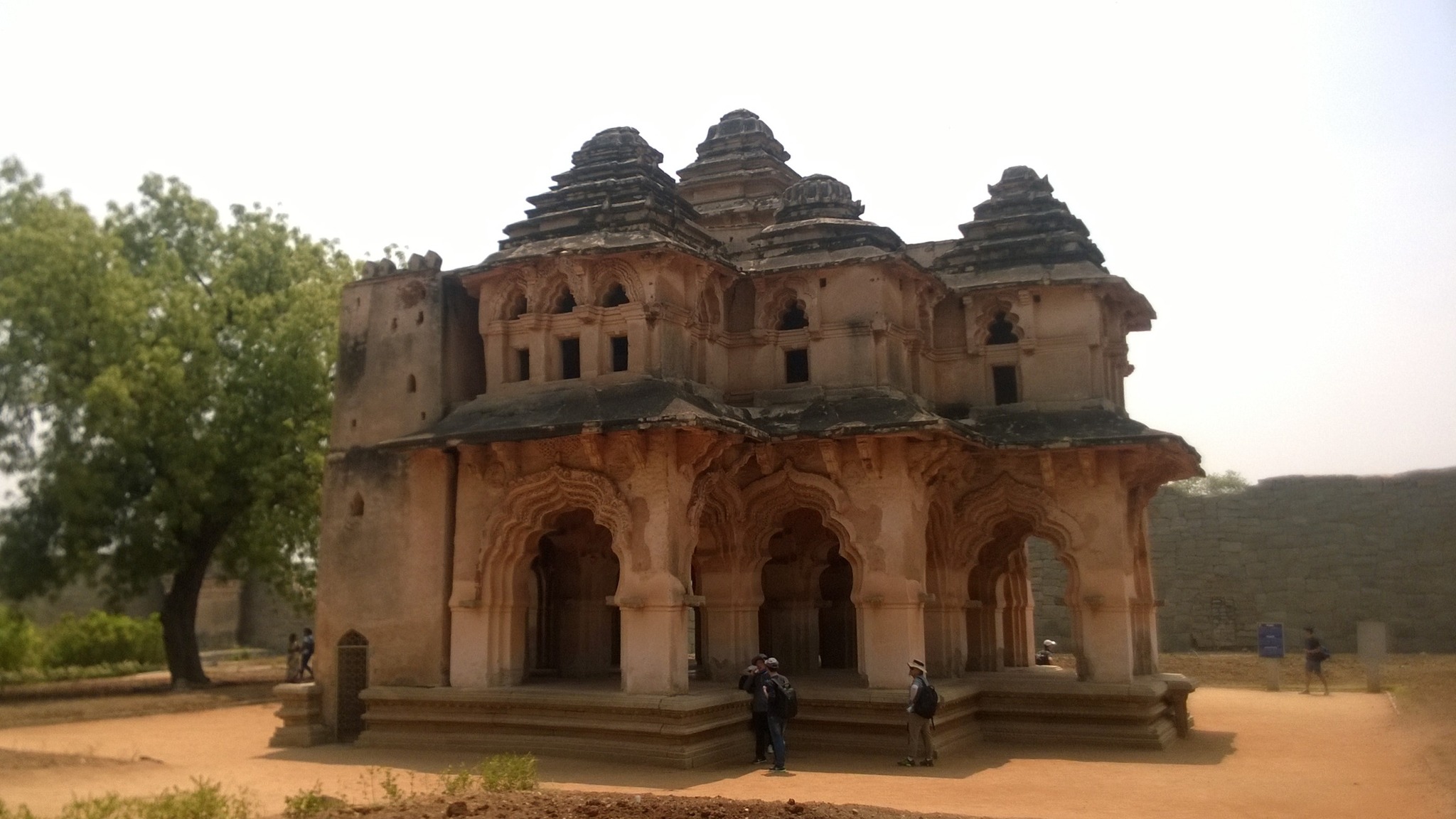
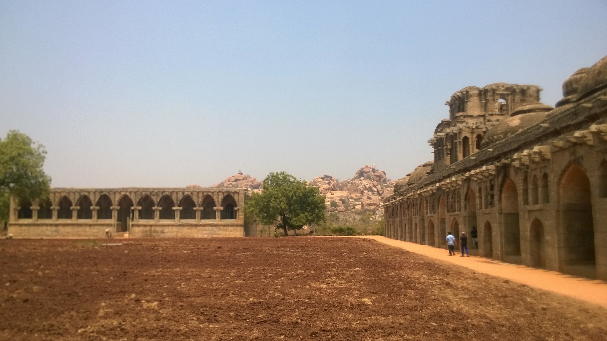
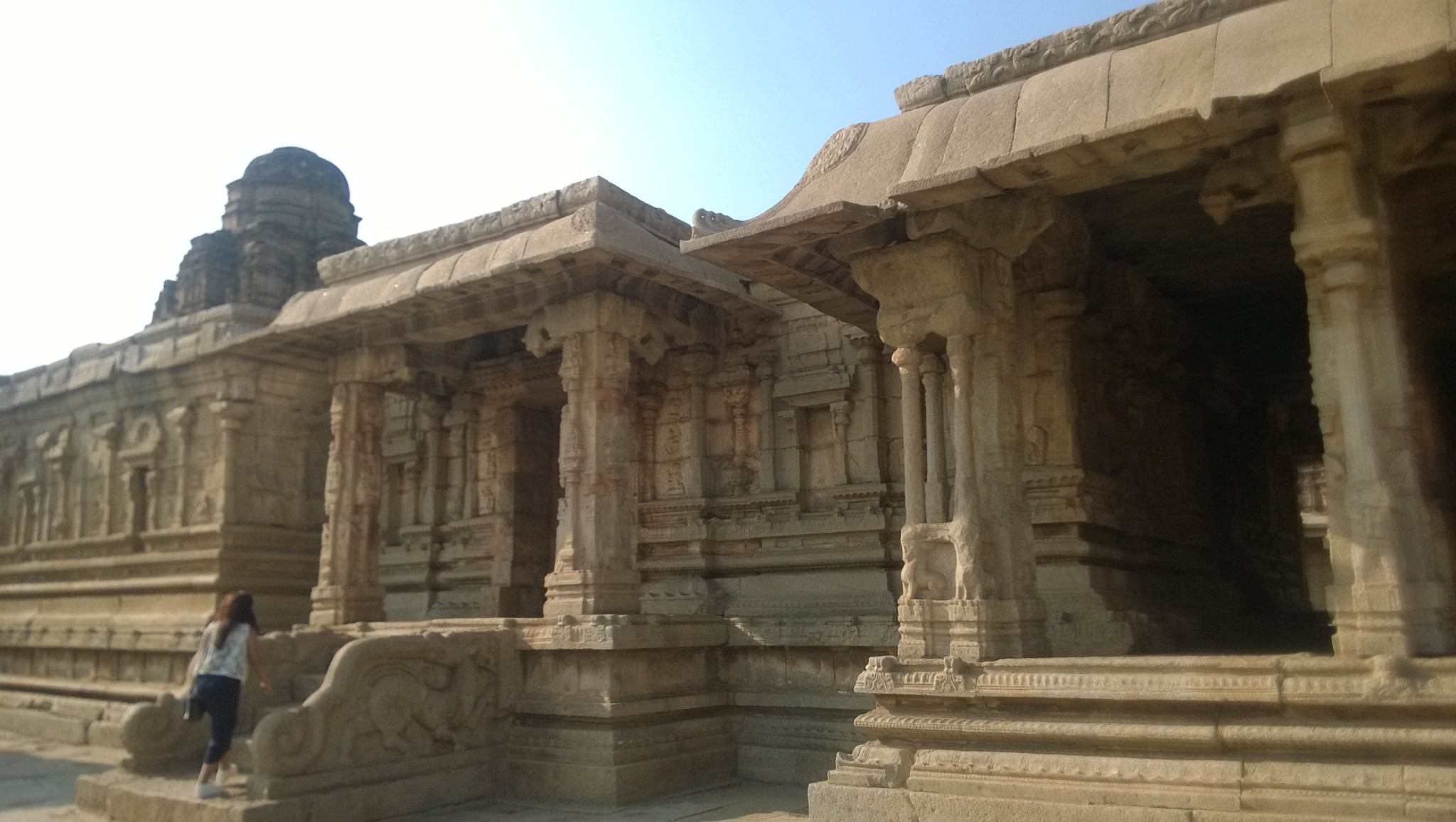
Vitthala Temple and Market complex
The 15th century temple, construction of which was started by Devaraya II and continued during the reign of Krishnadevaraya and later kings, is famous of the musical pillars and the stone chariot placed in front of the main temple structure. The carvings and sculptures on the temple and all structures around it, is a testament to the high workmanship achieved by the artists of Hampi.The long straight boulevard leading to the temple complex is flanked on both sides by long continuous lintels supported by a series of pillars – these structures once contained shops. Behind one of the shopping arcade is a pond.
The boulevard cutting through the Market complex enroute Vitthala temple
Utsava mandap in Vitthala templeGlimpse of musical pillars
The iconic stone chariot inside the Vitthala temple premises
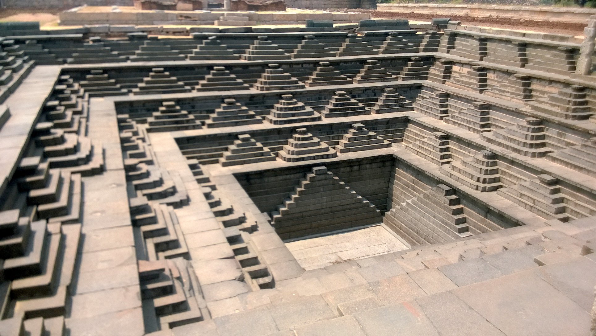
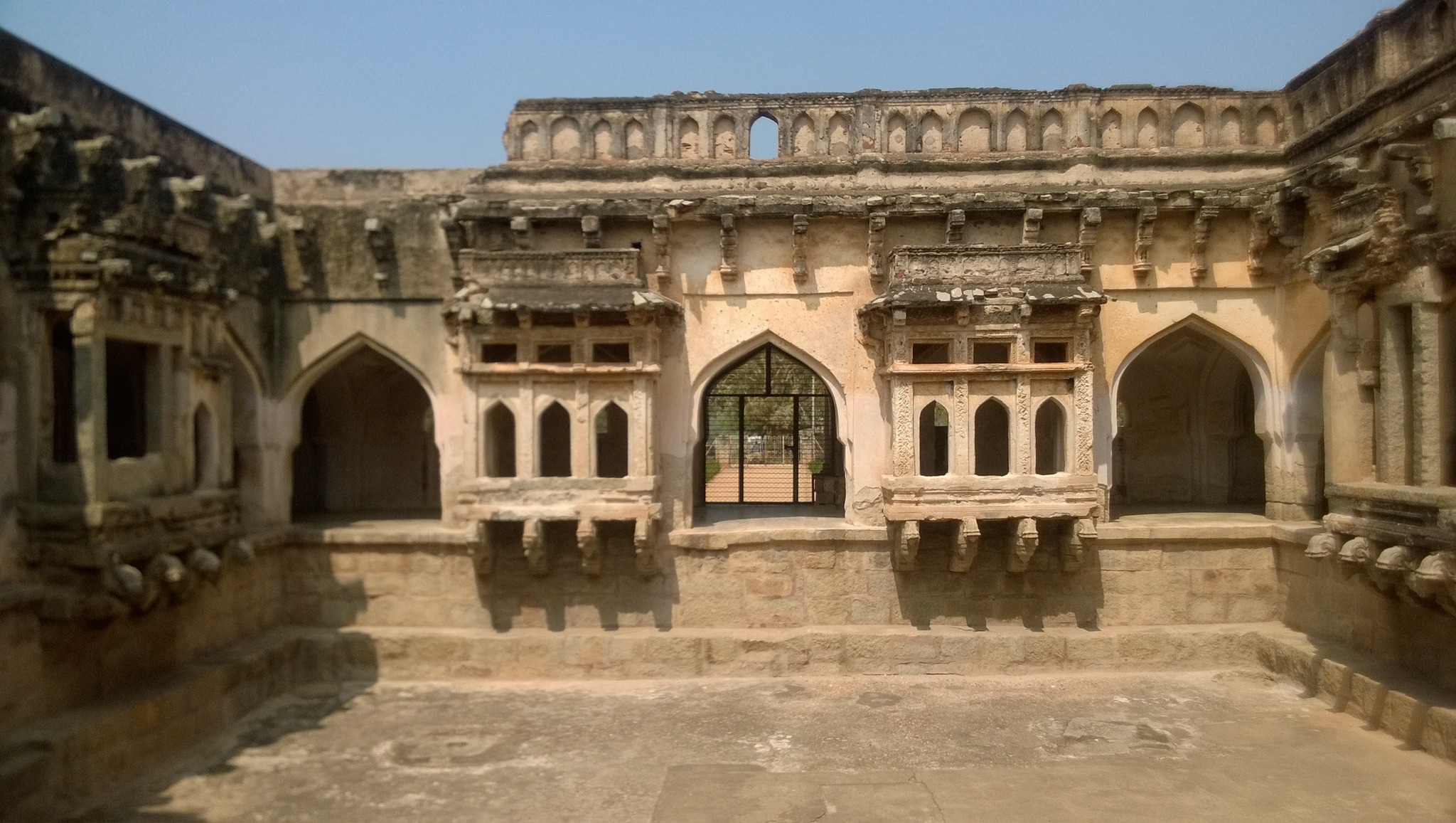
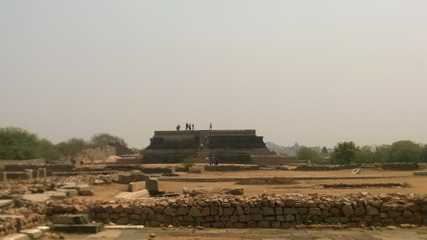
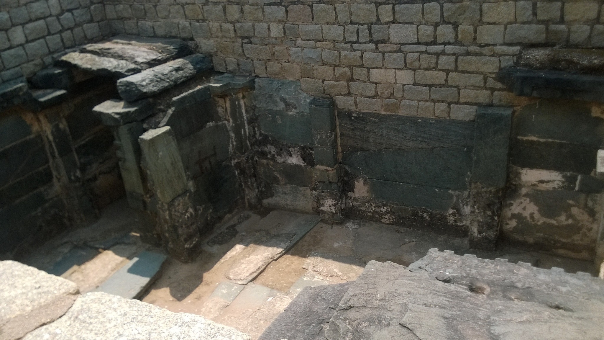
The Royal Enclosure
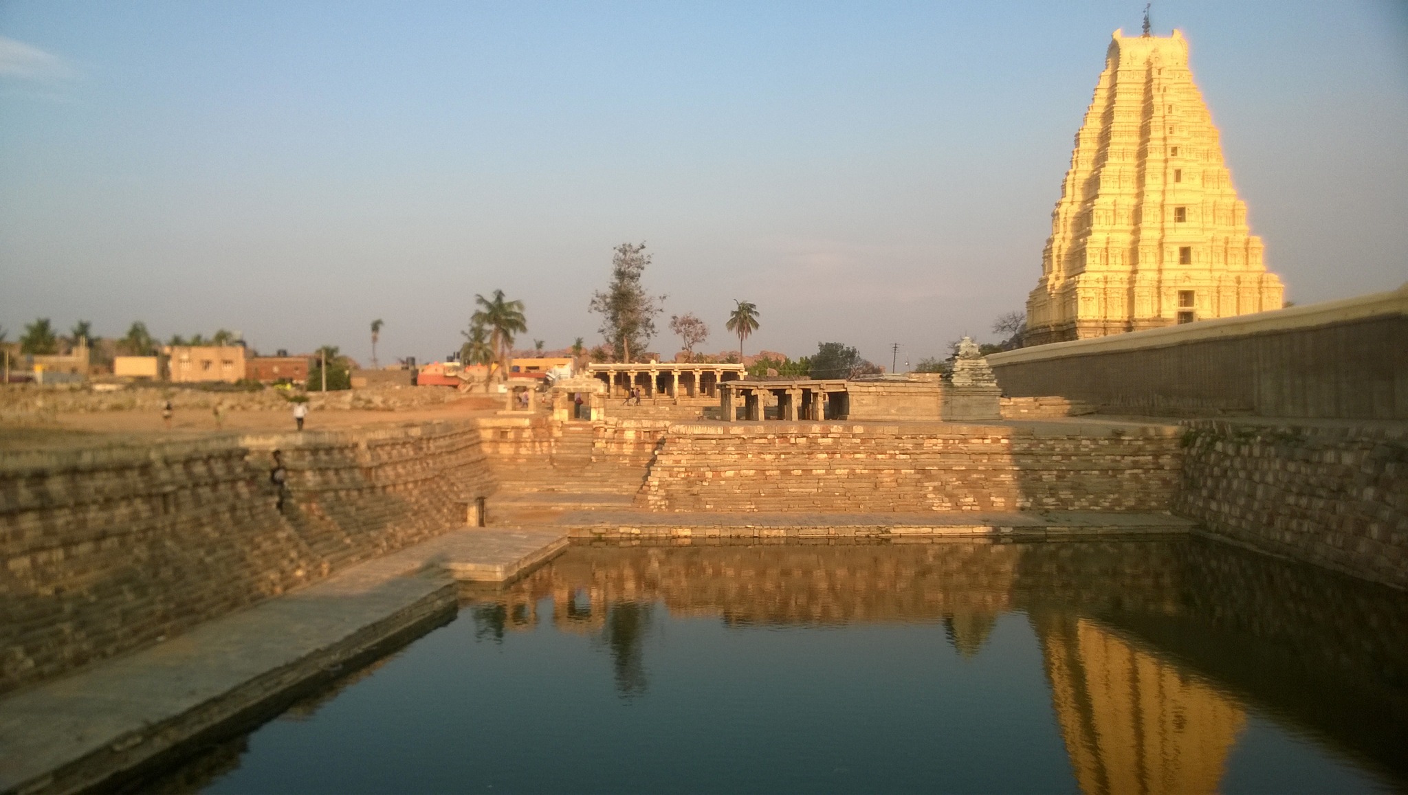
The Royal Enclosure is the area where the royal family lived and administerefdfrom. The major highlights of the area include a stepped tank called the Pushakarini Kola, a platform for conducting ceremonies called the Mahanavami Dibba, an ornate bath complex called the Queen’s bath, a hall purported to be for the King’s public audience, and a labyrinthine building with secret underground chambers. A little farther from the above mentioned structures are a structure of unknown antiquity and purpose called the Lotus Mahal that employs an Indo-Islamic style of architecture, and the elephant stables.
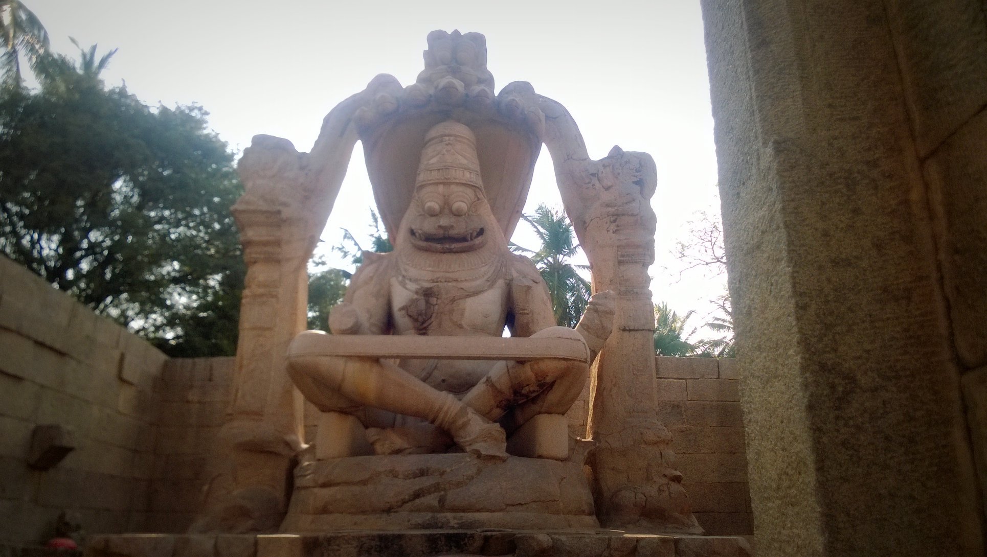
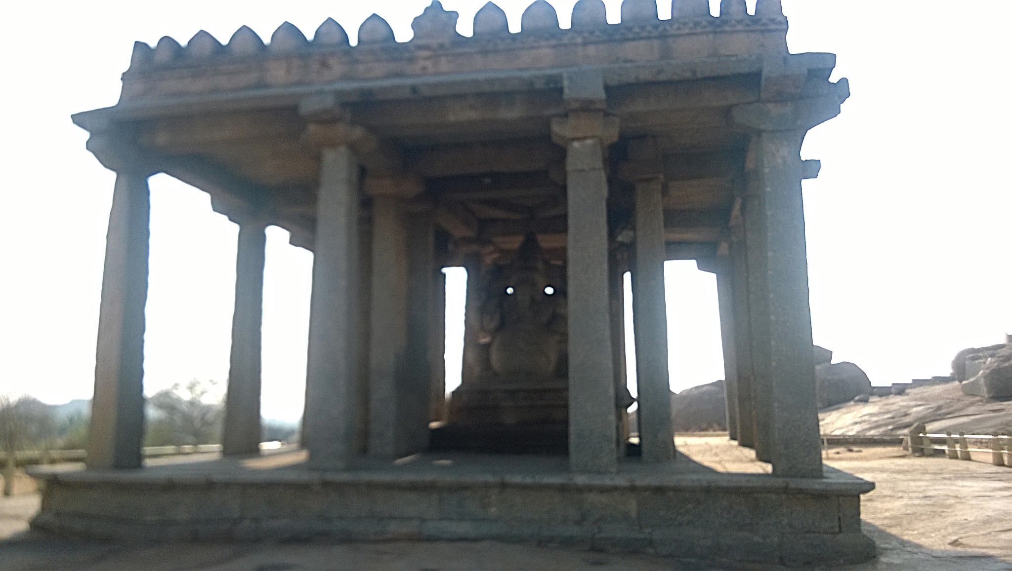
Further on the trail, were a series of temples and shrines, namely, Madhaba (Ranga) temple, temple built in 1545 AD exclusively for holding concerts of dance, vocal and instrumental music; Shri Lakshmi Narsimha temple, built in 1528 AD, houses a fearsome monolithic 6.7 meter statue of Lord Narasimha; Shree Badavilinga Gudi – a near-3 meter high shivlinga, whose lower part remains in water drawn from the Tungabhadra river, throughout the year; Krishnawamy temple, an ornate temple built by Krishnadevaraya in 1513 AD, with a Balakrishna image sourced from Odisha; Saasivekaalu Ganesha a 2.4 meter 16th century monolithic four-armed idol of Lord Ganesha
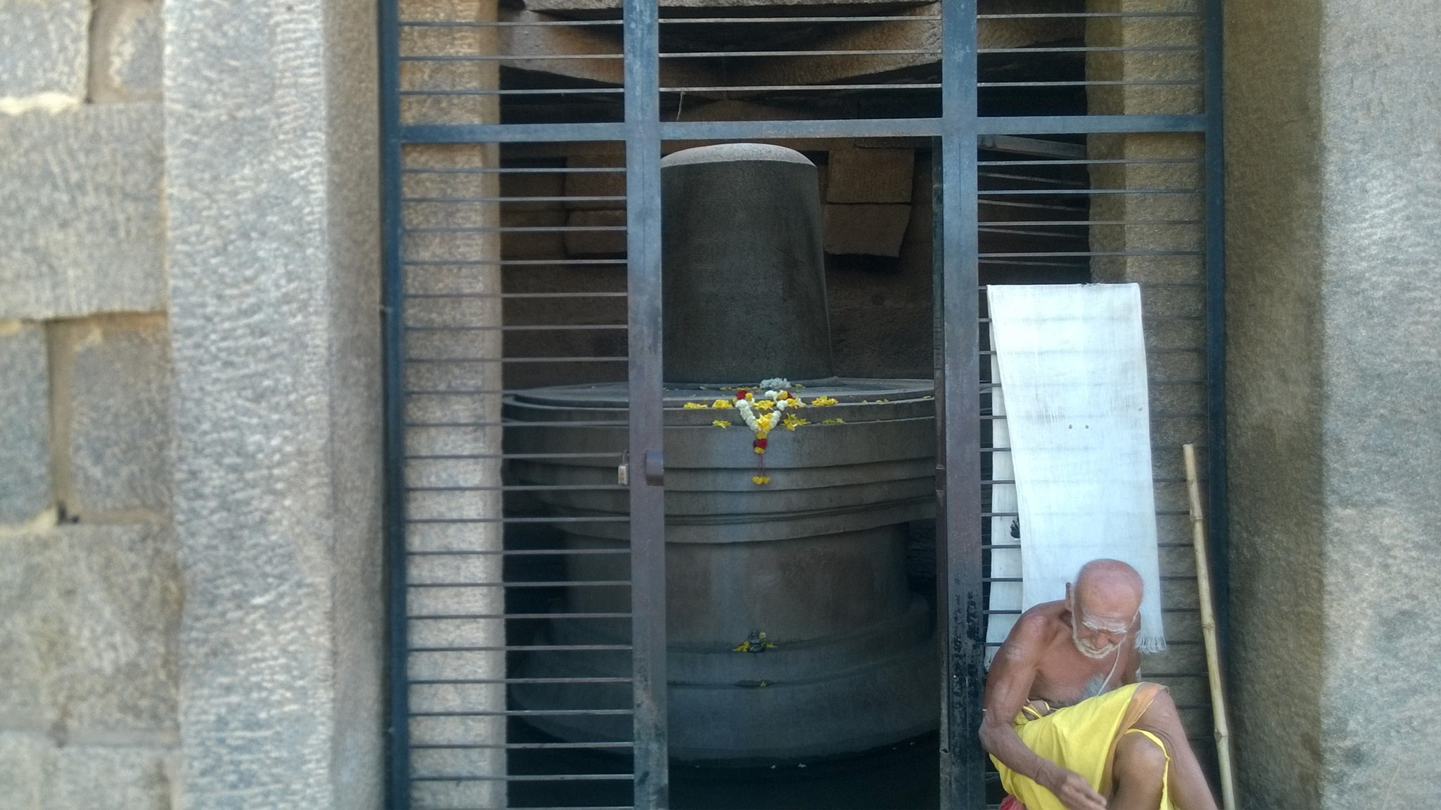
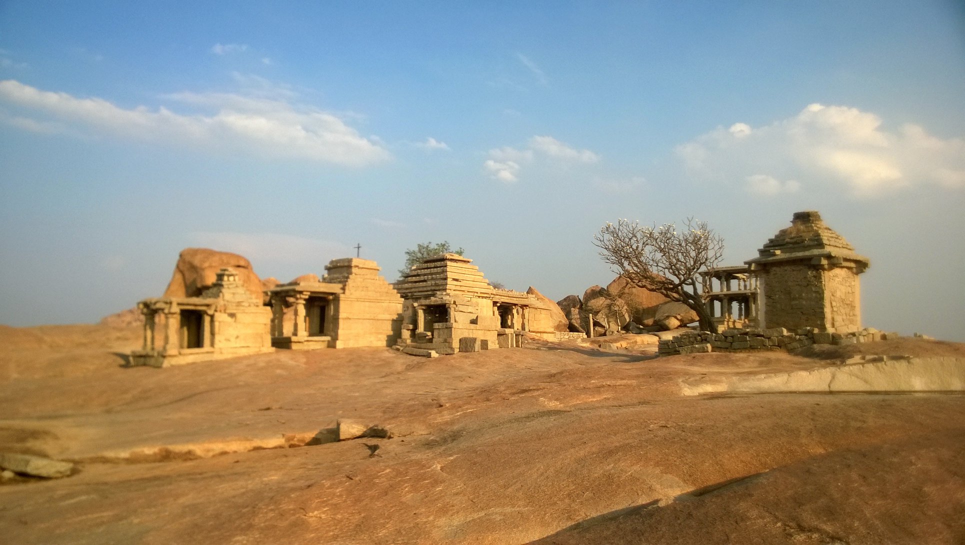
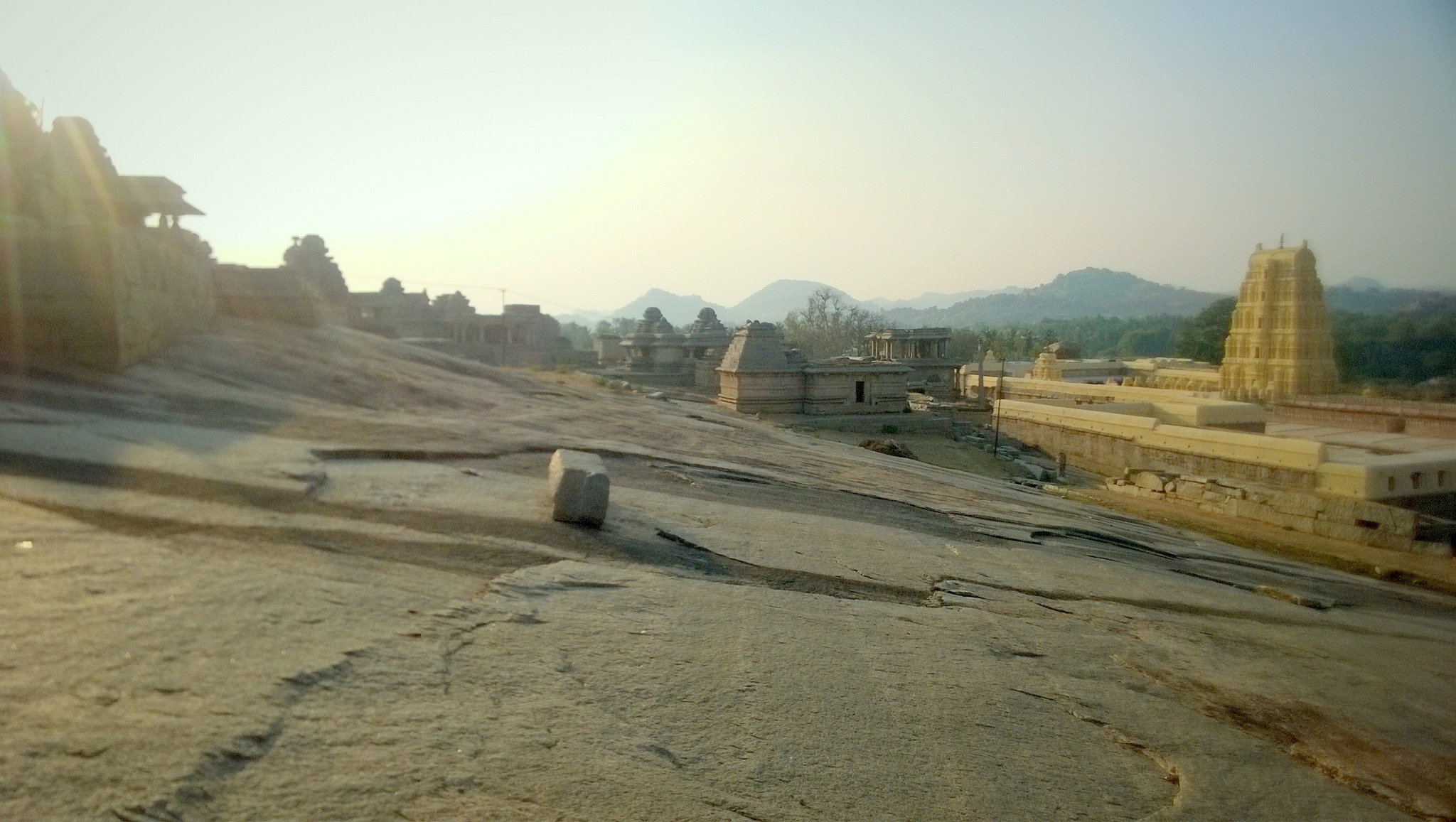
Walking a little further up the Ganesha idol, there is a bald hillock, upon which stands a cluster of temples – about 30 in number – of varying shapes and sizes, and datable between 9th and 16th century AD. Legend says Shiva was meditating on the Hemakuta hillock at the time the gods wanted Parvati to marry Shiva, and sent Manmatha, the god of love, to distract him. Infuriated, Shiva opened his third eye, thereby burning down Manmatha, and also melting down stones and boulders causing them to collected as pool called the Manmatha Honda at the foothills. Hemakuta hill affords a nice view of the sunset as well as of the Virupaksha temple and the Tungabhadra river.
A few monuments on the Hemakuta hill
Virupaksha temple from Hemakuta hillManmatha Honda
Virupaksha templecomplex
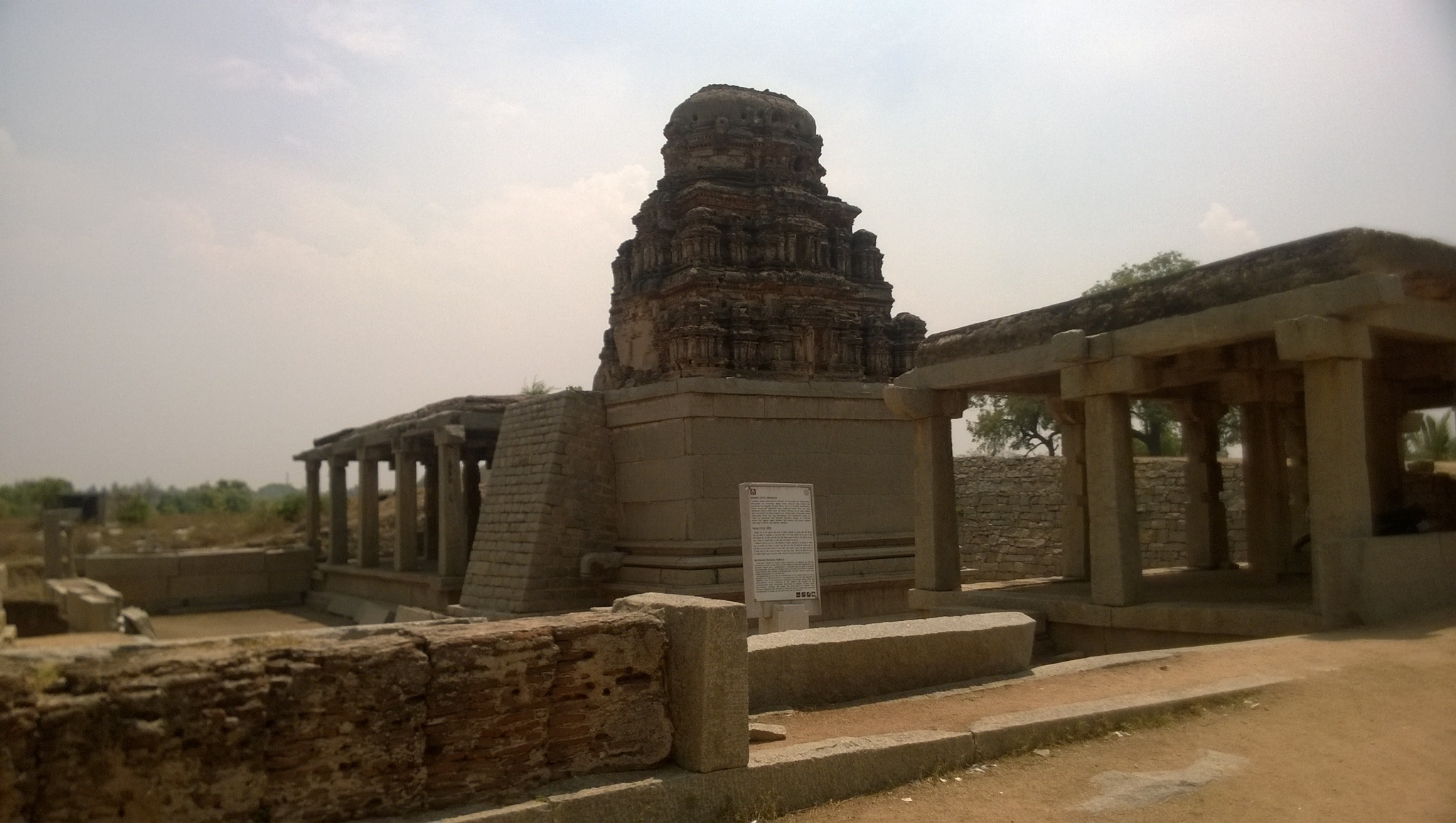
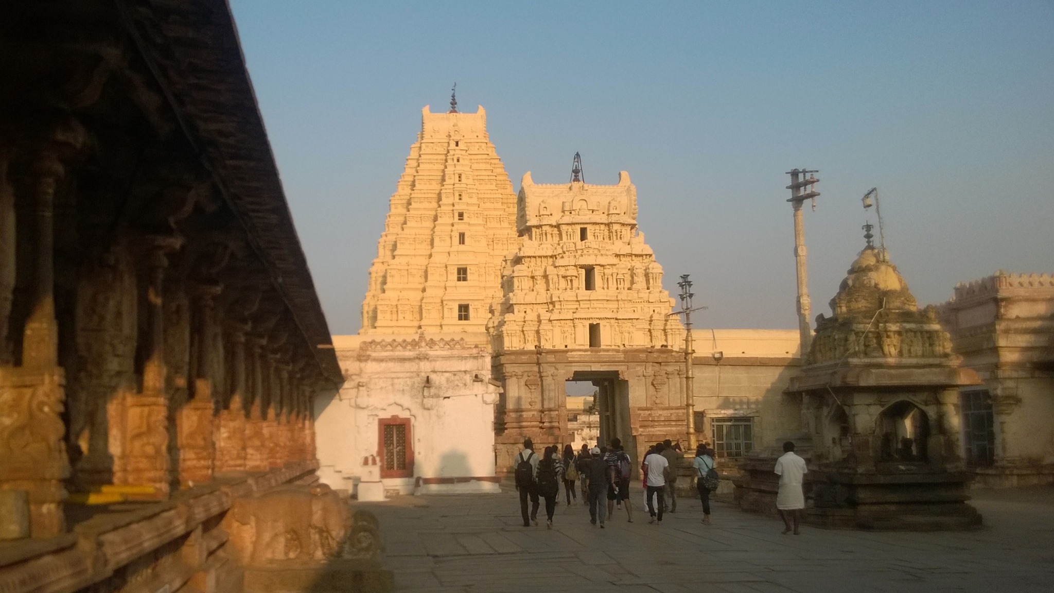
Descending the hillock from the other side, one reaches the Virupaksha temple that was expanded into its current imposing form in the first half of the 16th century. Standing on the bank of the Tungabhadra river, the temple complex has two large courtyards with numerous subsidiary shrines. The humongous main sanctum houses Virupaksha, a benign form of Shiva shorn of anger, the tutelary deity of the Vijanagara kings. The temple is most sacred of all sites in Hampi, and puja rituals are unfailingly performed in accordance with norms laid down by sage Sri Vidyaranya, beginning with drawing water from the Tungabhdara, considered equivalent to the holy Ganga.
Entrance of the Virupaksha temple
Matanga Hill
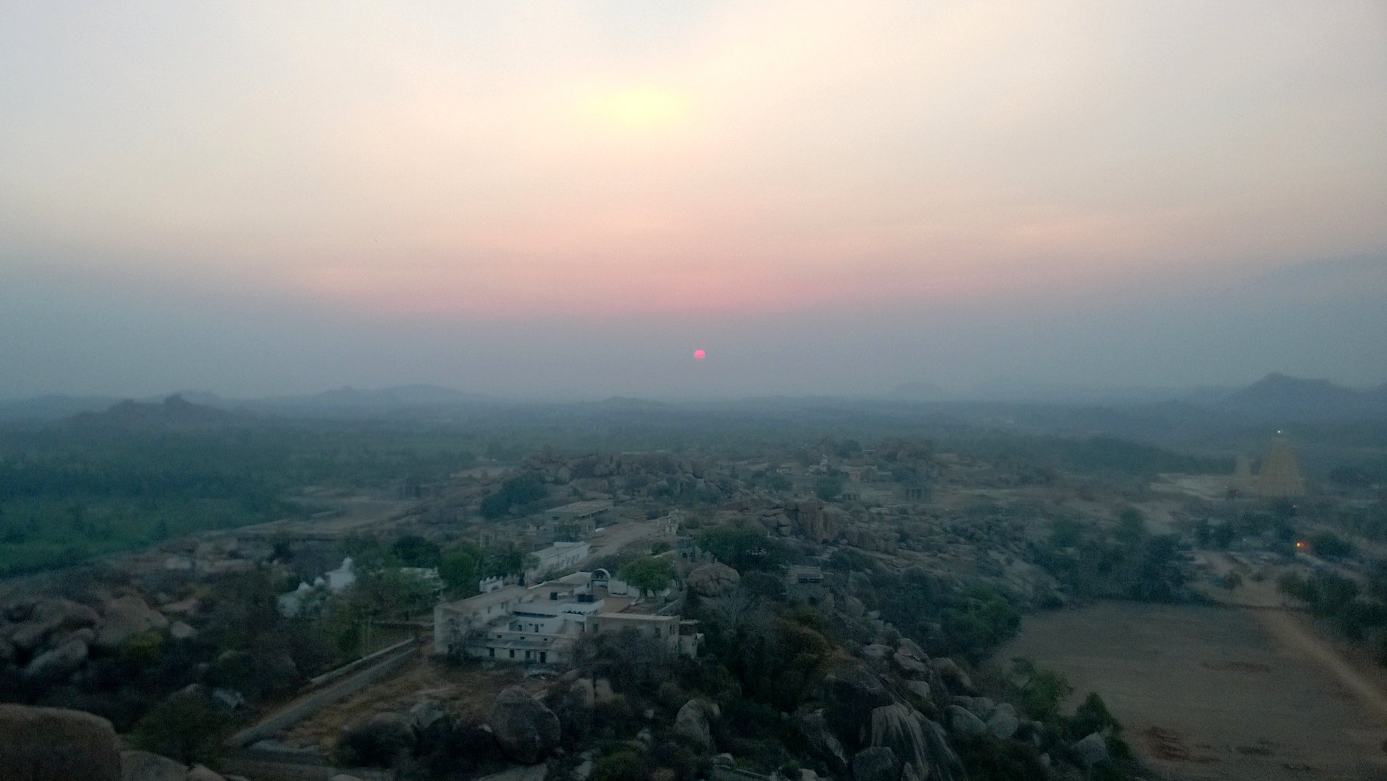
Finally, to close off the day, I hiked up the Matanga Hill, stopping many times to catch my breath before being treated from the hilltop to a breath-taking view of the sun setting with the crimson sky in the backdrop.
View of Sunset from Matanga Hill
Day 2
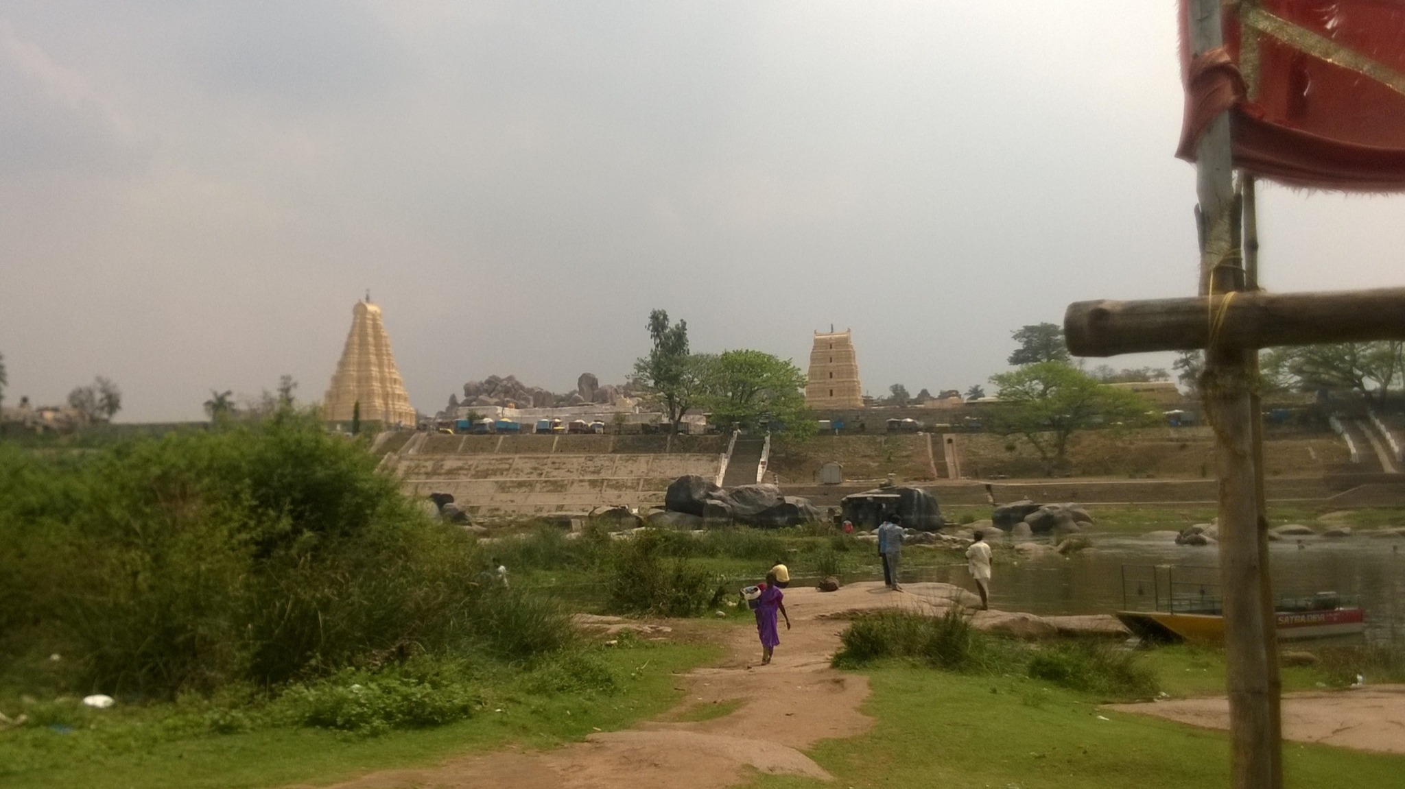
Virupapuragade or Hippie Island
The next morning, I went back near the Virupaksha temple complex, since adjacent to the temple complex lay the Ferry Point, that facilitates transport to Virupapuragade, a granite outcrop in on the Tungabhadra river. It acquired the nickname Hippie Island on account of providing an atmosphere for relaxation by virtue of the many shacks and cafes serving all sorts of cuisine accompanied by music, both live and recorded, and also abounds in shops selling souvenirs. This is also where one could rent scooters and bikes, which is what I did.
Virupaksha seen from Hippie IslandA cafe on Hippie Island
Thankfully, the channel separating the island from the other bank of the Tungabhadra, is shallow or virtually, non-existent, and the low connecting road runs parallel to an ancient aqueduct that now lies in ruins.
Ancient aqueduct on the other side of Hippie Island
Sanapur Lake
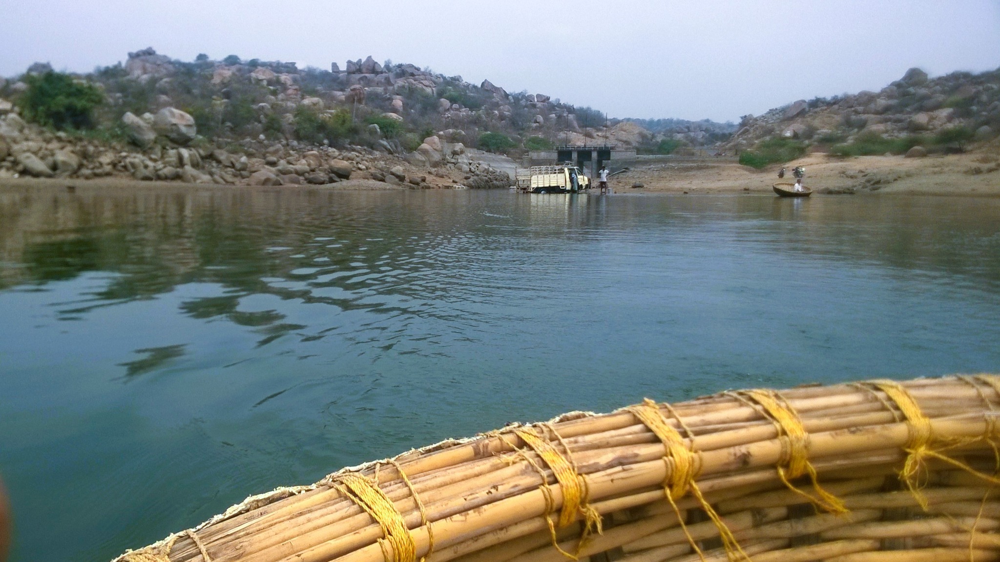
On the rented scooter, I proceeded to Sanapur Lake, about 5 km north-east of Hippie Island, on a road winding through paddy fields and barren hills, until I reached a bend that curved around a boulder hill and took me across a dam to a coracle point.
Coracle ride on Sanapur Lake
After a peaceful coracle ride, as I was setting off for my next stop, the scooter refused to budge. Despite the spotty mobile network, I somehow managed to call the rent-a-bike shop-owner, and thankfully, got a replacement scooter, delivered to me within 30 minutes.
Anegundi
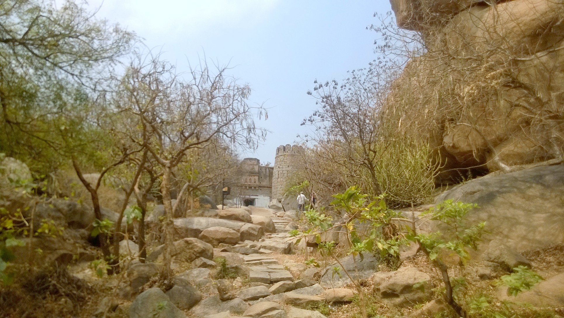
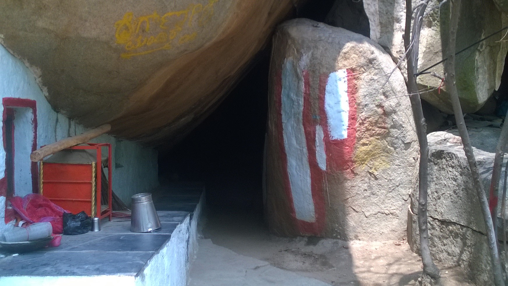
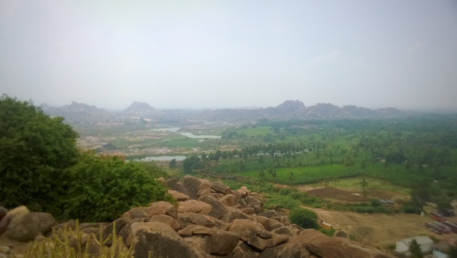
Racing against time, I rode, again flanked by barren boulder hills, paddy fields and water bodies, 8 km alongside the Tungabhadra river to Anegundi, where a hike up the hill leads to the Anegundi fort. Entering the fort premises, after a short hike, is a cave that legend identifies as the place where the vanara king Bali lived. Further hiking up, I reached the top of the fort, wherefrom I got a panoramic view of the countryside replete with boulder-hills, paddy fields, and the boulder-strewn Tungabhadra.
Approach to the Entrance of Anegundi fort
Bali’s Cave
View of the countryside from atop Anegundi hill
By 2 PM, back on Hippie Island, I returned the scooter, and following a lunch, I boarded a 4PM bus for Hyderabad, with the hope that I would return to Hampi someday.
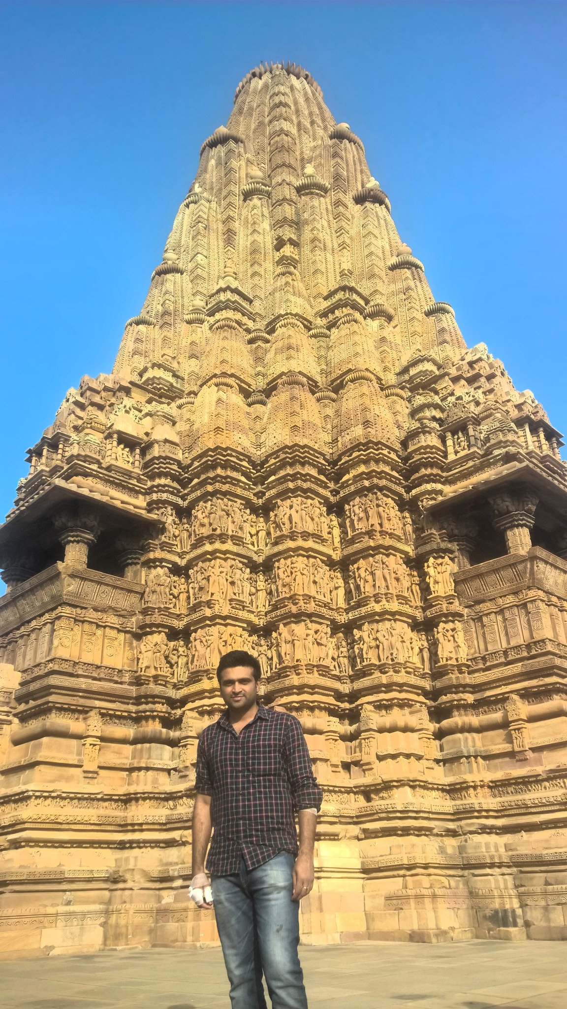
For more than 15 years, I harboured a longing to see Khajuraho, a dreamy place that I had read about in my school history textbooks, whose mention and descriptions conjured up images of a culturally rich and advanced town bustling with activity in the middle of dense forests.
In December 2016, as I awaited the admission results for the B-school I had applied for, and to keep myself preoccupied to counter anxiety on the exact date the results would be coming out, I scheduled a three-day solo trip to Khajuraho as below: Day 0: Take overnight train from Delhi to Khajuraho Day 1: See the temples of Khajuraho Day 2: See Raneh Falls and Panna Sanctuary, and proceed to Jhansi later in the day Day 3: See Orchha, and take the evening train from Jhansi and reach Delhi by midnight
But, as Robert Burns said, “The best-laid plans of mice and men often go awry.” Consider the ensuing circumstances I describe below.
With intense anticipation as I reached the Nizamuddin Railway station for the train scheduled at 8 PM, I learned that the train would start with a 6 hour delay, starting eventually at 3 AM. Then, due to intense fog, the train got further delayed, and finally reached Khajuraho at 6 PM, 12 hours late!
With a complete day wiped off from my itinerary, I improvised. I would proceed with the original plan for Day 2, i.e. see the Raneh Falls and the Panna sanctuary, and cram the temple visit in the later half of the day. I would then leave for Jhansi and Orchha early the following morning. Accordingly, on Day 2, I got up earlier than my routine, had an early breakfast, promptly rented out a scooter, fueled it up, then put on the rented helmet, took a glance at the tourist map given to me by the hotel receptionist, and set off for Raneh Falls by 9 AM.
I never got to Raneh Falls though. About two kilometres after taking a right turn for Raneh, with still 13 km to go, and 7 km from Khajuraho, I encountered a patch of sand that had spilt over to the curving road, and I applied my brakes, immediately telling myself, “Uh-oh, you shouldn’t have done that!” The next thing I remembered was my helmet hitting with a thud on a surface, and me lying on the ground. I stood up, but there was no strength in my knee, causing me to fall back on the ground, even as locals gathered around me.
The locals surveyed the damage both I and my scooter had incurred, and reckoned that both were probably fine, but that I most certainly needed some medical attention. They asked an auto-rickshaw driver who had stopped by, to take me to a nearby public health clinic, whereas another local inquiring of me as to where I had put up, offered to deliver the scooter at the hotel.
Shortly, I was on my way to the clinic on the auto-rickshaw, with the pain kicking in as the adrenaline wore off, making me realize that I had a deep cut in my right palm, a wide bruise on my left elbow almost exposing the bone, and a feeling of limpness and burgeoning swelling around my left knee. The doctor strapped a knee cap on my left leg, cleaned up and bandaged my wounds, gave me a shot of painkiller, and prescribed a ton of medicines. Thankfully, there was no fracture, and it seemed to be a case of soft tissue injury, the extent and nature of which were not immediately clear.
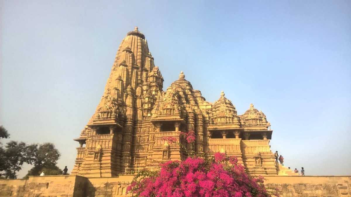
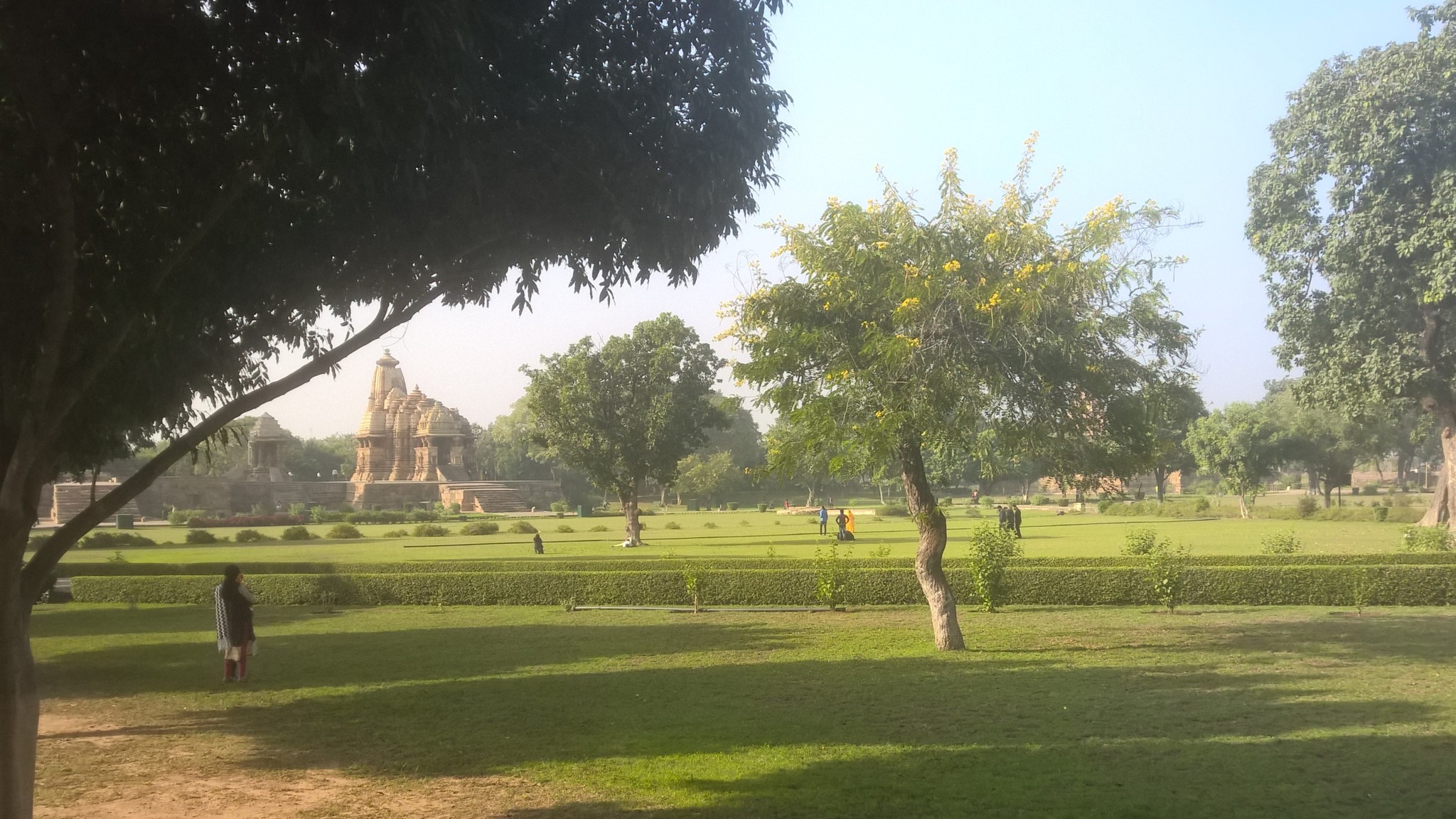
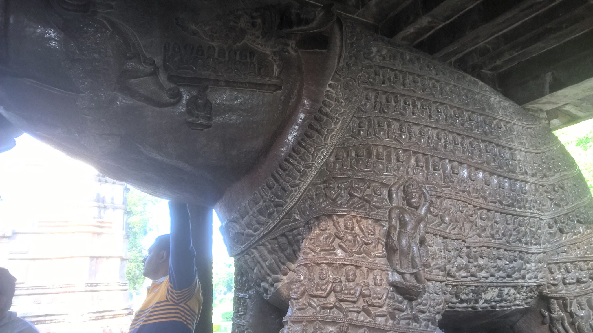
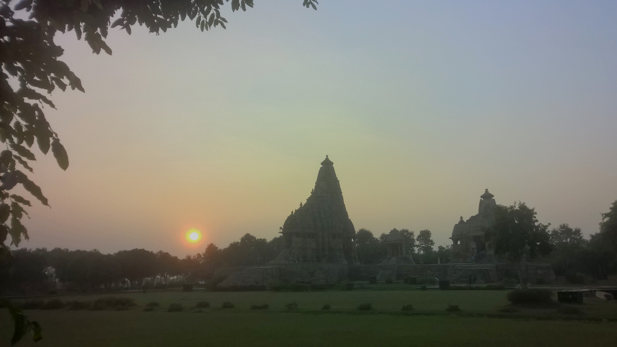
By 12.30 PM, I was back in the hotel – and so was the scooter – and laid down, soothed by the effect of the painkiller. Nevertheless, I was not going to be bogged down by this setback, given that I had waited 15 years to visit this place, and so around 4 PM, I set out to see the Western Group of temples which was just a stone’s throw away.
Soon inside the premises of the temple complex and absorbed by a tourist guide into a larger group, I was hobbling across the sprawling lawns and staggering from temple to temple, lumbering up and down the high platforms, taking photographs of the exquisite sculptures and carvings on the temple walls, even as the pain kept stabbing through the shroud of the painkiller. Hanging around for the amazing Light-and-Sound show that is conducted every evening, I was finally back at the hotel, where I had to take another round of painkiller to counter the intense pain.
Western Group of Temples, Khajuraho
The Kandariya Mahadev temple
The proof of the accident is in the bandages
Varaha (boar) idol, Khajuraho
Scultpures and carvings on the wall of a temple, Khajuraho
Sunset at the temple complex, Khajuraho
Now it was clear that the improvised plan for Day 3 was off the plate, and my only objective for the day would be to reach the Jhansi Railway station well in time to catch the train. So, on Day 3, after taking my medicines following breakfast, I was dropped at the bus-stand by a generous local, where I was told I should change buses at Chhatarpur. In the bus itself, the bus conductor, looking at my condition, gave me a place to sit even though the bus was filled to the brim.
At Chhatarpur, I limped from the bus I was in to another, where I got a decent seat by the window, and was soon headed to Jhansi. The road to Jhansi seemed unusually long, what with my injuries giving me rather gentle reminders about their existence, and the looming B-school admission result prompting me to frequently check my email inbox, but mainly because reconstruction on long stretches of the road hampered the bus’s progress.
With the bus permeated by clouds of dirt as we neared Jhansi, I saw an email from the B-school. With the pounding in my heart instantly notching to many gears higher, I opened the email to read that I had been accepted – talk about a silver lining!
In Jhansi, as I got down the bus, I realized for the first time that something was seriously off in my knee, when I felt a bit of wobbling between the femur and tibia – most likely, the result of a torn ligament. Later, aboard the Shatabdi Express which itself had arrived an hour late, with the pain setting back in again as the painkillers wore off, I realized I had forgotten my medicines at the hotel!
Getting down at Delhi, I hailed a cab, and picked up a new stock of the prescribed medicines on my way home, and slowly clambered up the three flights of stairs to my place on the third floor, one step at a time, virtually dragging along my near-lifeless but excruciatingly painful left leg. Back in my bed, I contemplated my next course of action, as I stared at a long path to recovery, amidst the workload at the office, medical consultations and the upcoming B-school admission.
March 2014. Spring was here, again, bringing with it pangs of fernweh – a feeling of ‘far-sickness’, a longing for distant places – nagging away at my being. The train of heartbreak had barely left the station, all the more reason why I needed to get away in the opposite direction, all on my own, reinforcing at least to myself, the sense of liberation that came of detachment from all things that brew emotional dependence.
However, I could not detach myself from the yearning for the distant lands I had read about in school or seen on TV – the so-called sand dunes and camel rides in the Thar desert in and around Jaisalmer and Bikaner. And then there was Jodhpur, which a General Knowledge book addressed as the Blue City, something about the colour describing a city only piquing the curiosity to see the place in person. I had also taken a liking for forts, my favorite being Chittorgarh, and all these places in the Thar – Jaisalmer, Bikaner and Jodhpur – wore their forts on their sleeves.
After gaining ample confidence from my solo trips to Jaipur and Udaipur in the two preceding years, it was now time to up the ante or increase the dosage, if you will, given how the duration of my previous two Rajasthan trips had incremented by a day each, with the Jaipur sojourn being one day long and the Udaipur one being for two days. Also, the destination on the second trip, Udaipur, was farther from Delhi than was Jaipur, making it imperative that I strike out even further into Rajasthan this year. With these thoughts in mind, choosing the Holi long weekend, Holi falling on 17th March 2014, a Monday, I straightaway booked well in advance a train ticket for my return from Jaisalmer for the evening of Holi.
Finally, on the evening of 13th March, a Friday, I was standing again at Iffco Chowk after office waiting for the next state road transport bus headed to Jaipur. On the bus, it was a familiar feeling with familiar sights, passing through the outskirts of Gurgaon, then passing through the hill forest beyond Manesar, where I remember listening to the Mad Season album by Matchbox Twenty, and then crossing the barrage near Rewari. By 10 PM, I was in Jaipur, where after having a Rajasthani dinner, I hopped onto a state transport bus to Jodhpur, getting a seat beside a foreigner lady accompanied by his Indian guide. By 6 AM next morning, I was in Jodhpur, where like in my Udaipur trip, I simply walked some distance and checked-in to a budget hotel. And started feeling feverish!
Exploring the Blue City
Nevertheless, feeling feverish was a familiar feeling on my solo trips, which I countered this time, by taking a paracetamol tablet following a breakfast of poha. Then, like on my previous trips, I hired an auto-rickshaw with a whole-day tour package that I determined based on the recommendations given by the hotel receptionist, and reached Umaid Bhawan Palace, the current residence of the ruling dynasty of Jodhpur. Located on a hillock, the construction of the palace was started in 1929 by the Maharaja Umaid Singh, 37th Rathore ruler of Marwar state to provide employment to famine-strike farmers, and was completed in 1943, when the Maharaja started occupying it.
The Umaid Bhawan Palace
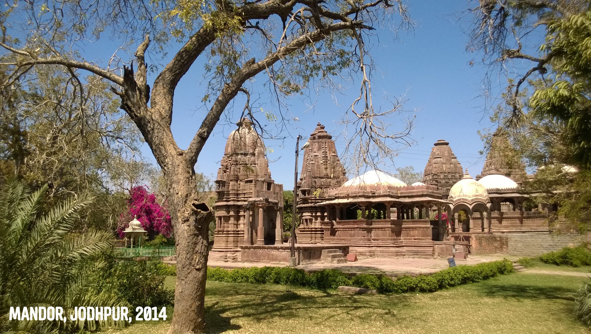
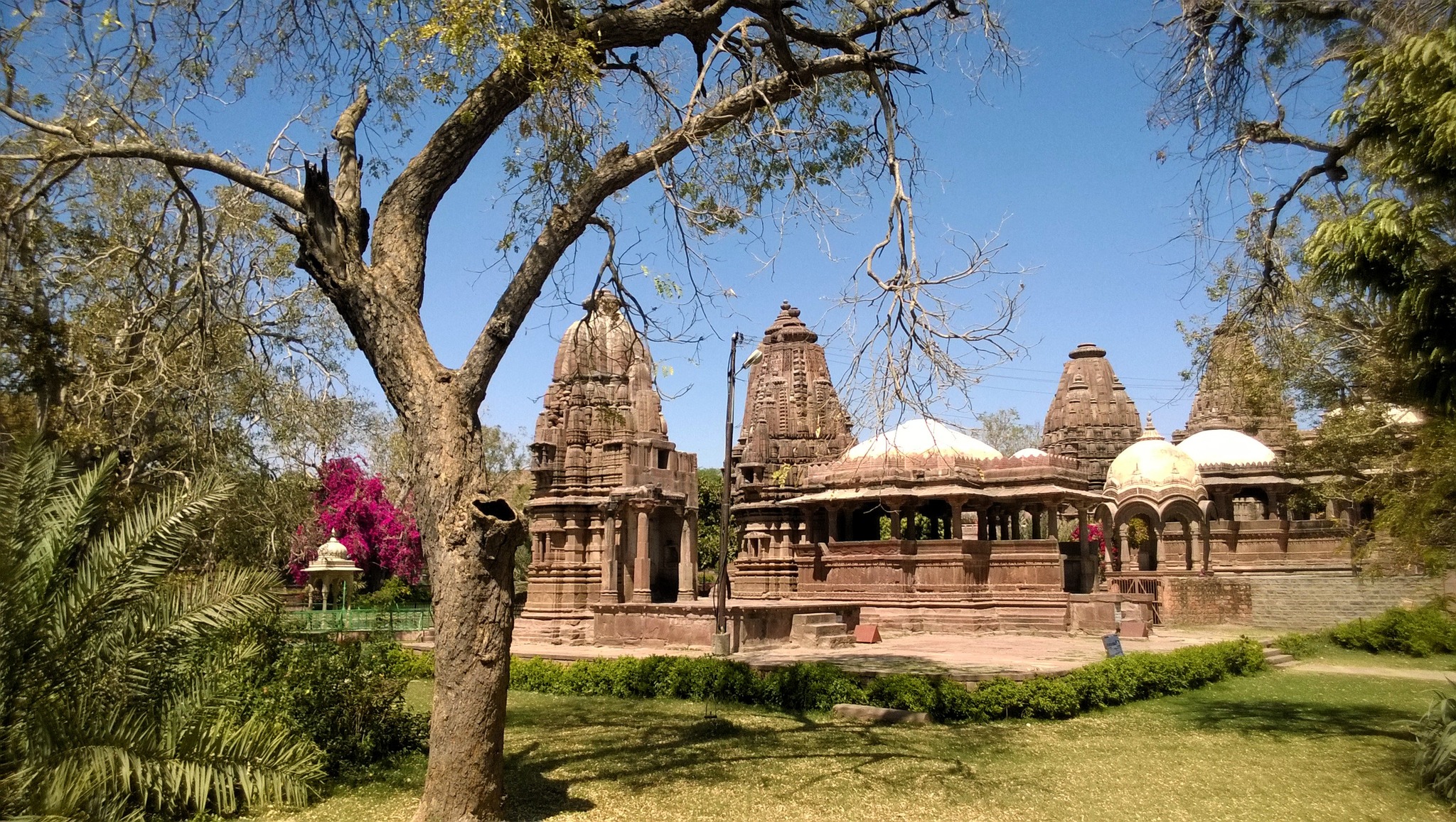
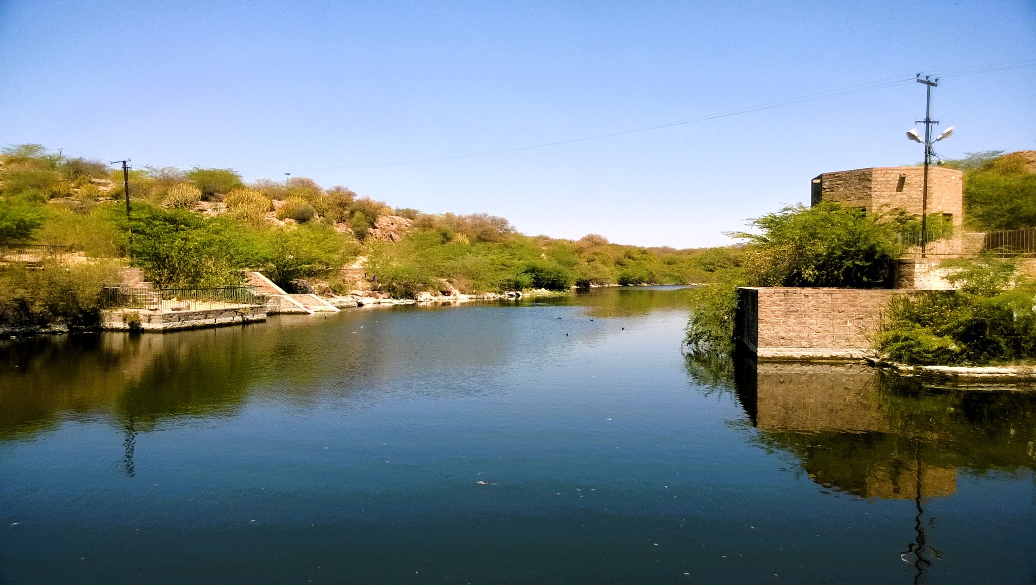
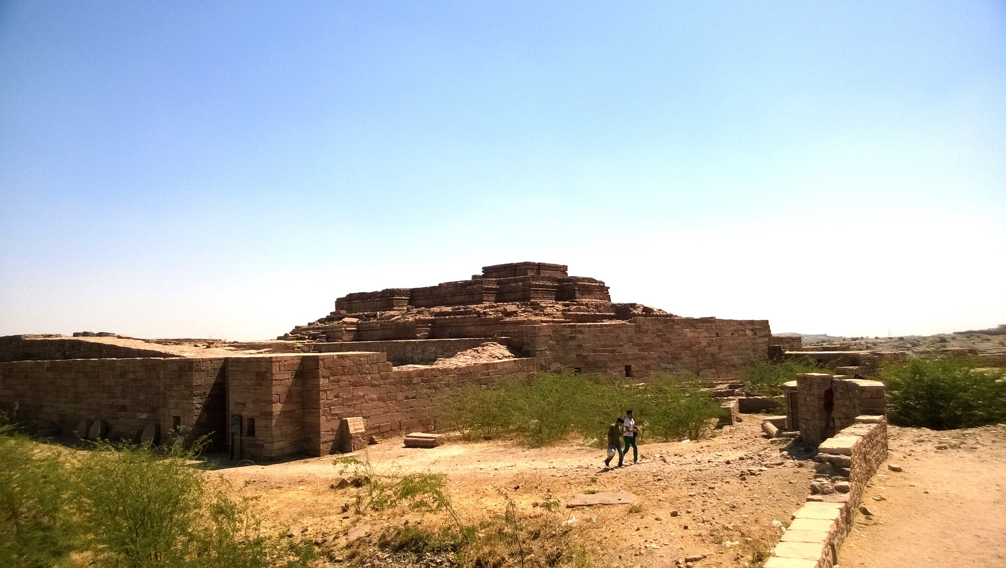
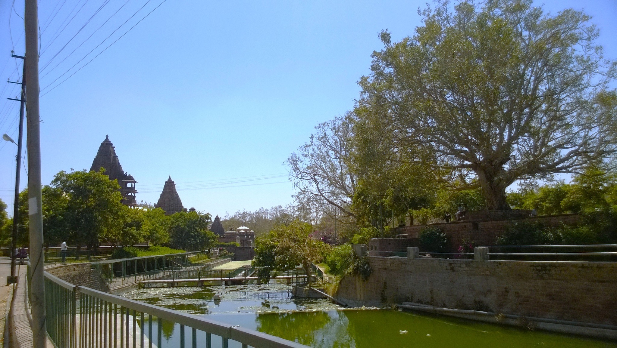
From there, I proceeded to Madore, a place that I only learnt about in Jodhpur, located about 8 km from the city, purported to be the native place of Mandodari, Ravana’s wife. Historically, Mandore, the seat of the Gurjara-Pratiharas in the 6th century AD, later became the capital of the Rathores before Rao Jodha shifted to the newly-founded city of Jodhpur. At Mandore, I was completely mesmerized by the scenes unfolding in front me – beautifully manicured lawns surrounding sandstone temples and cenotaphs, with a stone path trailing beside a canal abounding in lotus and lilies, that crossed a water tank and winded up the hill, with a the ruins of a fort lying on top of the hill. From the hilltop, spires of temples, the domes of the cenotaphs and the lushness of the lawns down in the garden below presented the most eye-pleasing views.
Temples in Mandore Garden
A swimming tank in Mandore GardenRuins of the Mandore fort
A canal inside Mandore Garden
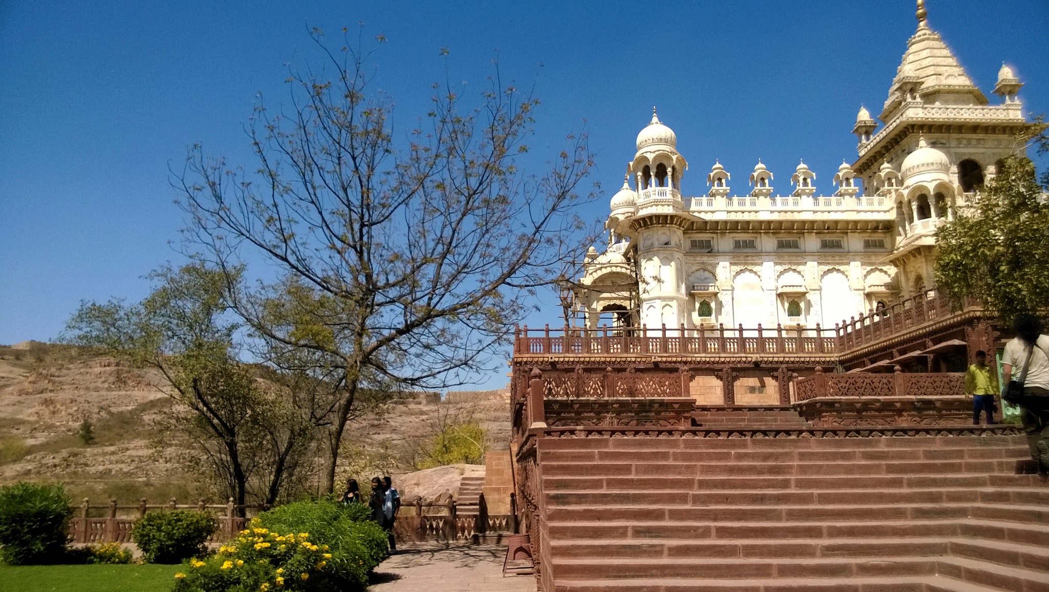
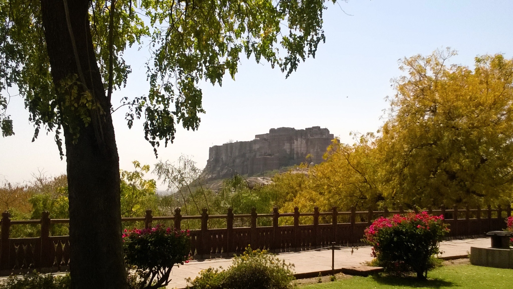
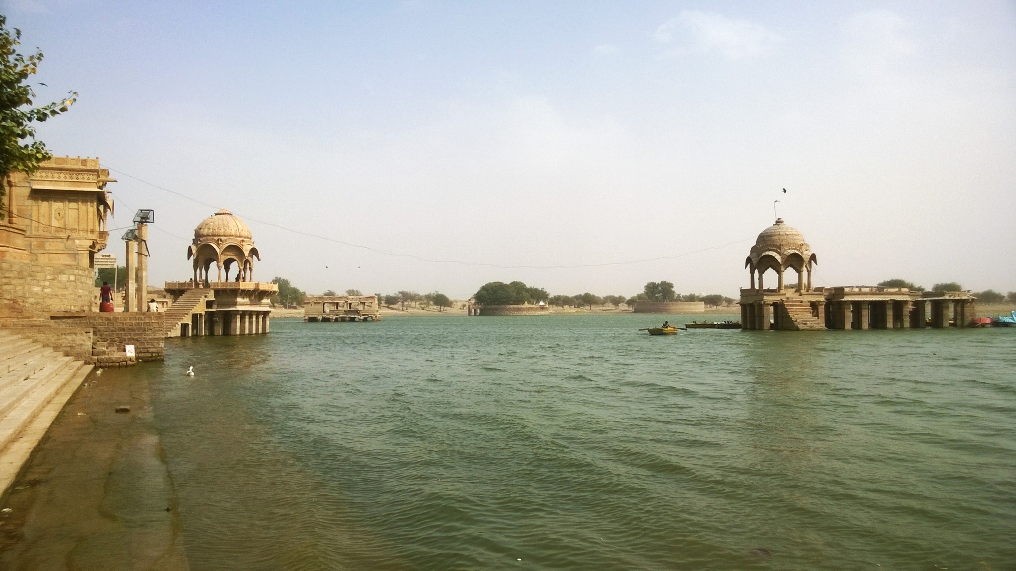
Leaving Mandore with reluctance, the autorickshaw driver drove me to Balsamand Lake, on the banks of which lies a summer palace, and from there, returned inside the city, stopping at Jaswant Thada. The Jaswant Thada, a cenotaph built of Makrana Marble for Maharaja Jaswant Singh II in 1899, itself is located on the top of a flat, barren red-coloured hill of igneous rock, only punctuated with water pools and barely any vegetation, and has the scenic backdrop of the Mehrangarh fort on one side. After admiring the striking landscape around the Jaswant Thada, I moved on to the Mehrangarh fort.
Landscape around Jaswant thadaSide view of the Jaswant Thada
View of Mehrangarh fort from Jaswant Thada complex
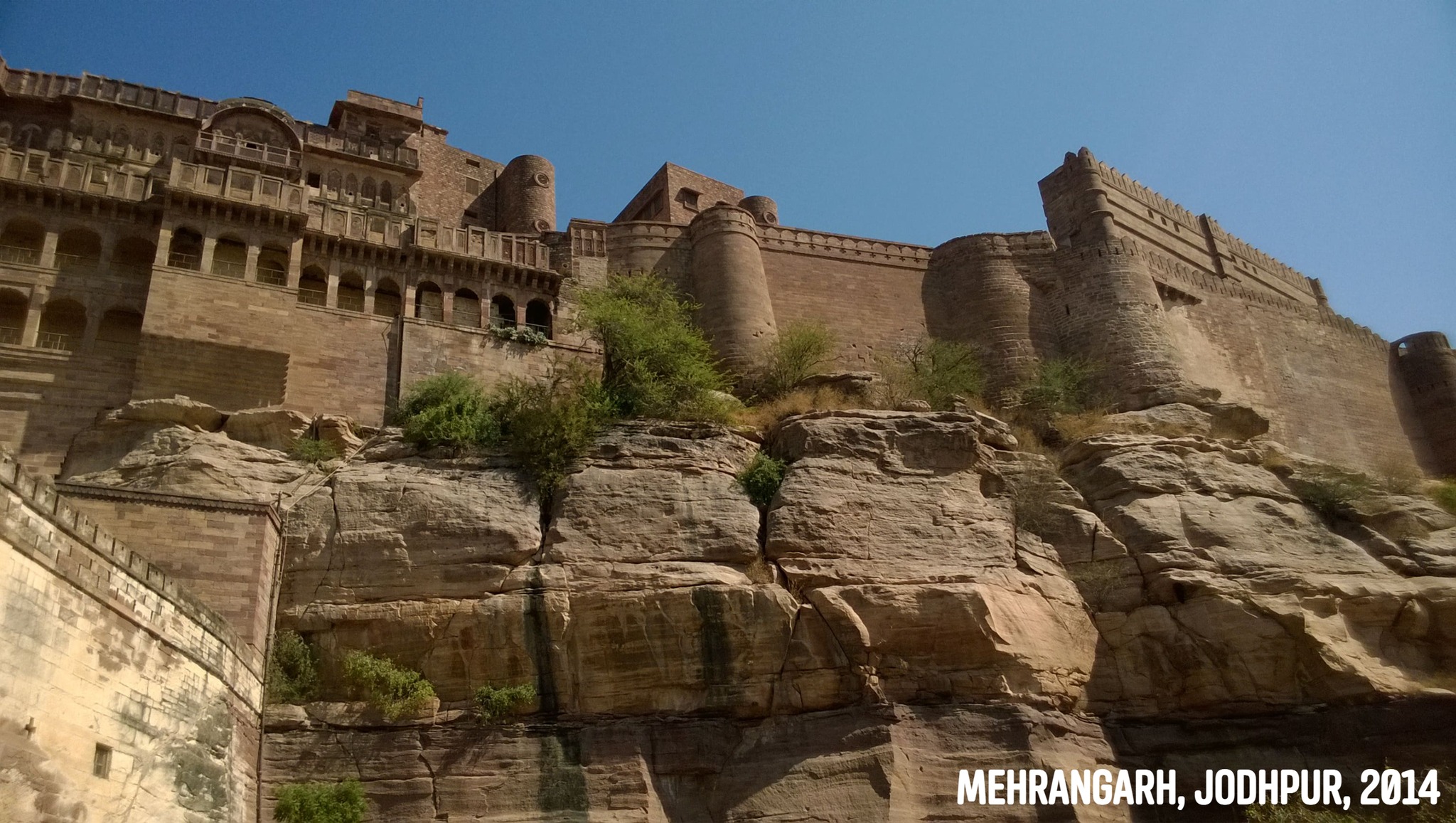
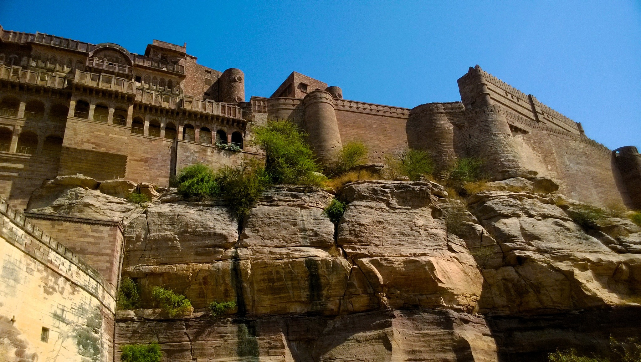
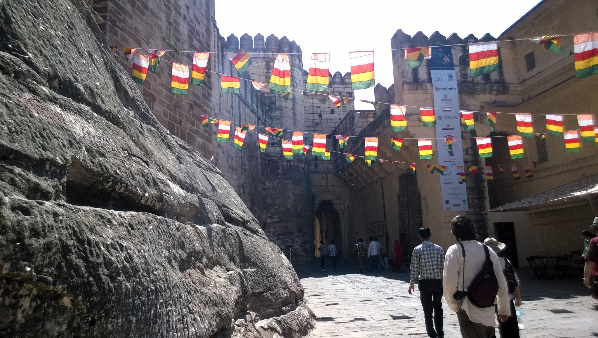
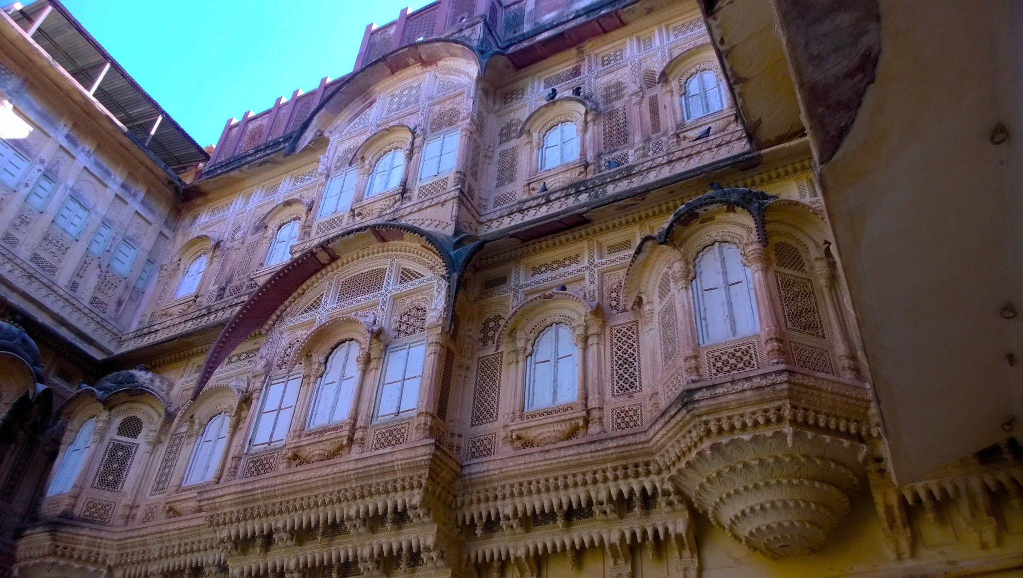
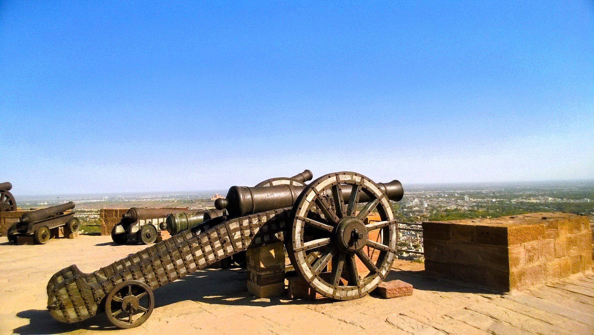
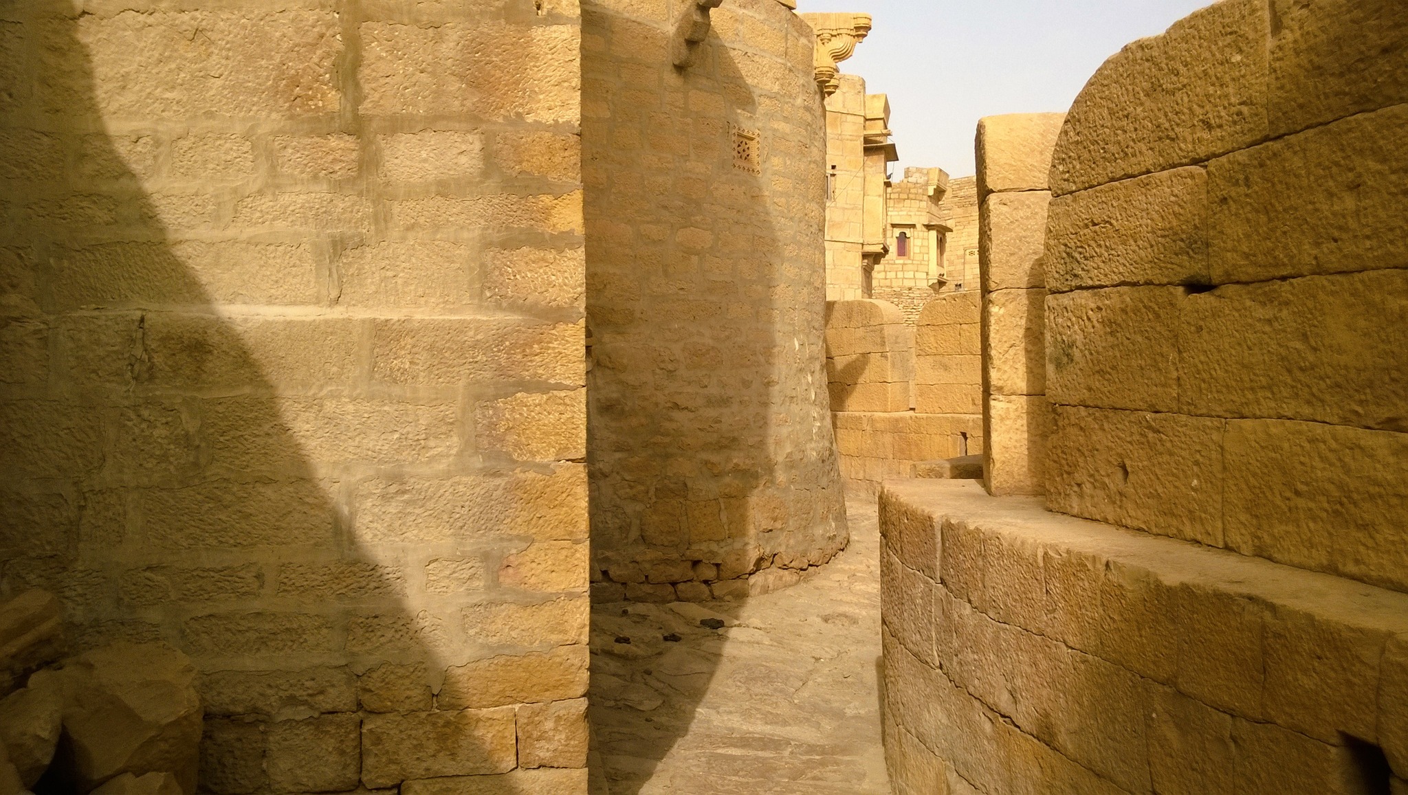
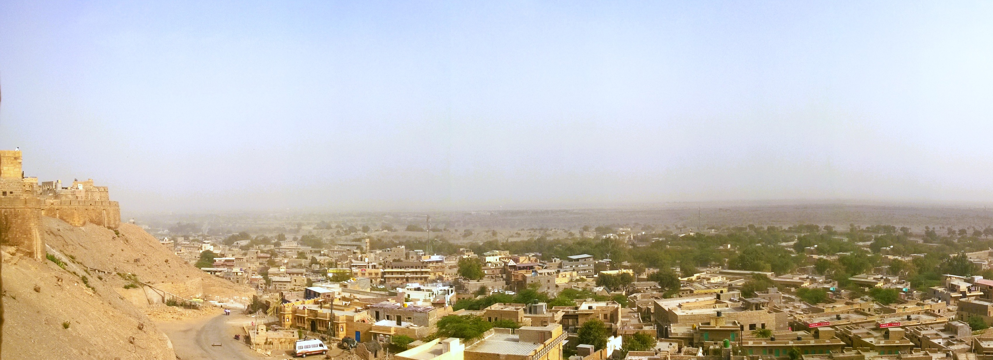
The construction of Mehrangarh fort was started in 1459 AD by Rao Jodha, who founded Jodhpur city after moving from Mandore the same year, with most of the current structures being constructed in the 17th century. The fort stands atop a 122 metre high rocky hill overlooking the city, with its distinct red sandstone profile with the red coloured hill base standing out and visible from long distances all around. I walked through the numerous tall arched gates, and then gawked at the imposing palaces and exquisitely done interiors, before ending the tour at the raised long platform lining the fort wall the end of the fort where the cannons stand.
Mehrangarh fort
An entrance gate of Mehrangarh fortPalace facade inside Mehrangarh fort
Cannons inside Mehrangarh fort
Descending from Mehrangarh, we again headed to the outskirts, this time in the west passing on a road flanked by kumat plants with their golden coloured ears, to Kaylana lake, an artificial lake built by Pratap Singh in 1872, in the midst of igneous rock formations. After spending the sunset on the Kaylana Lake, I returned to the city, stopping at the clock tower, and retired to bed, after a day well spent, with my heart throbbing in anticipation of seeing the desert the next day.
Off to the Dunes
The next morning, I left the hotel and was inside a road transport bus headed to Jaisalmer by 8.30 AM. As we left the city, the landscape became progressively arid, with it becoming more distinctively barren and sandy as the bus approached Pokhran, where khejri trees stood scattered with large expanses of empty space between each other. I distinctly remember listening to the album The Bends by Radiohead as I marvelled at the white-yellowish sparsely vegetated soil shimmering under the sun. At 3 PM, as I stepped down at Jaisalmer, a streak of electrified excitement passed through my body. Soon, I was picked up by a local who I had called beforehand based on a colleague’s referral.
Landscape on the way to Jaisalmer somewhere between Jodhpur and Pokhran
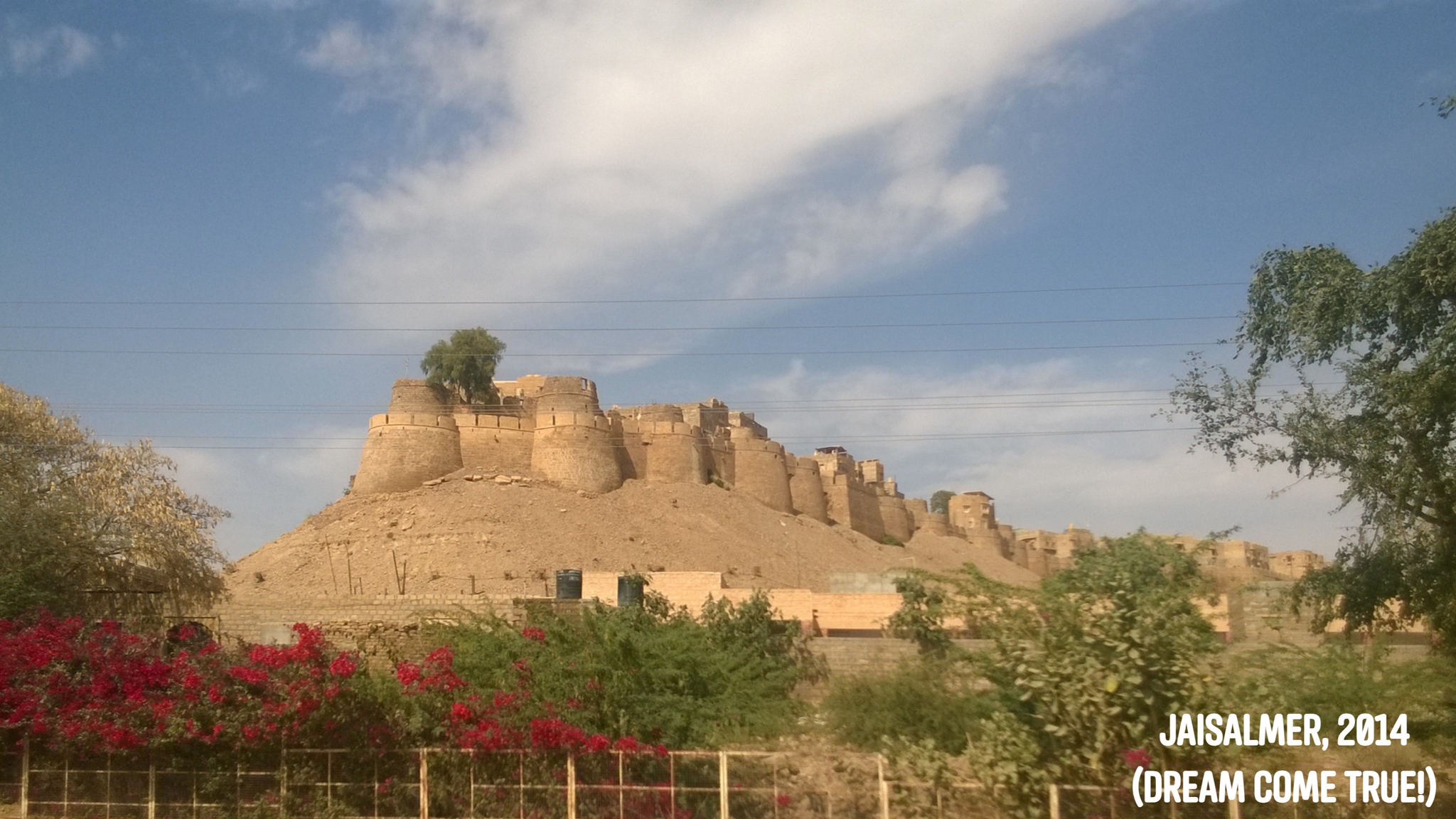
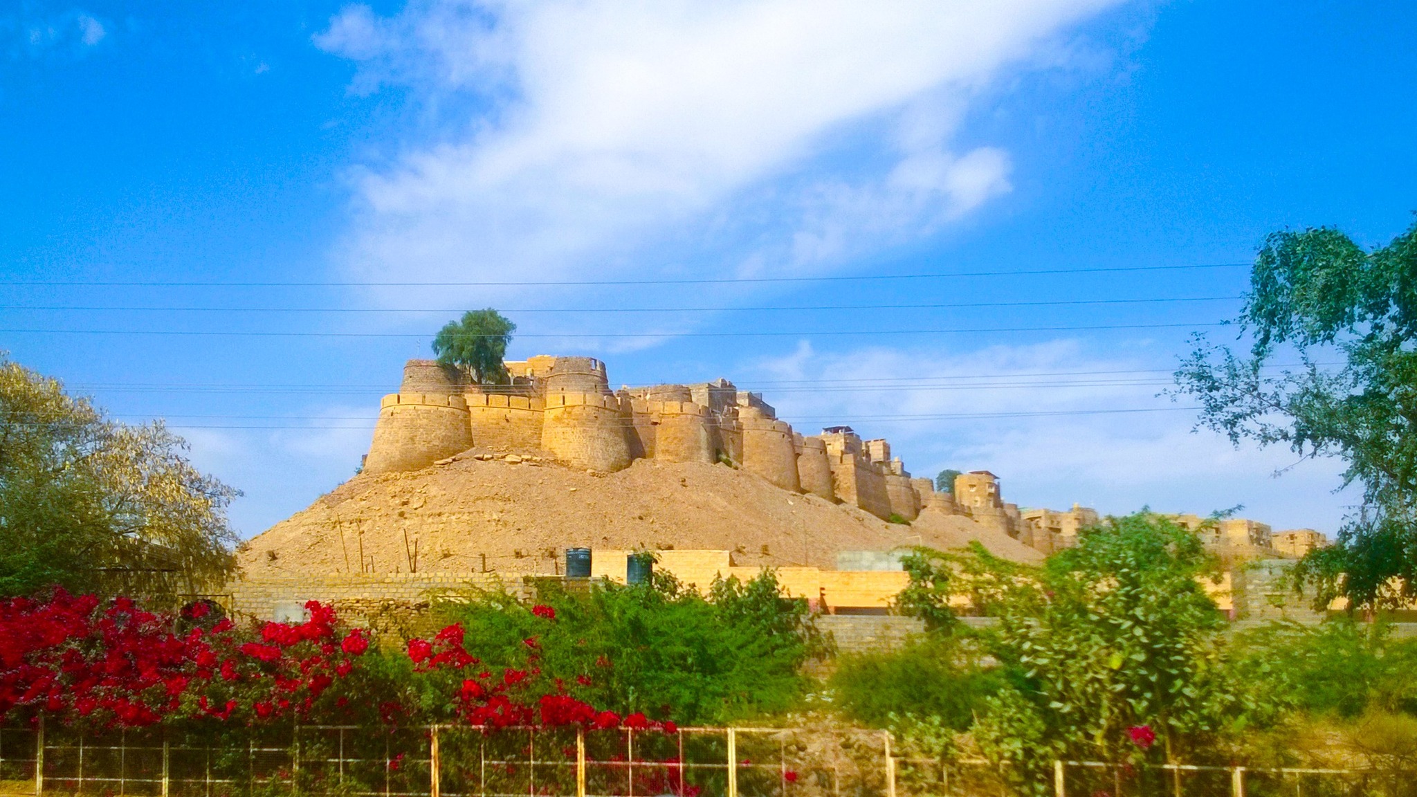
The first sight that struck me as I rode pillion on the local’s motorcycle was that of the Jaisalmer fort radiating in all its golden glory with multiple golden coloured stony turrets stacked one after the other along the edge of a golden coloured rocky hillock. It was the physical manifestation of the images that I had created in my mind from reading in a book or hearing in the context of a movie (Sonar Kella by Satyajit Ray) or seeing in pictures or documentaries. But stepping physically inside that physical manifestation of my mental image had to wait, for there was yet another mental image born from childhood dreams that I had to physically soak in first – the sand dunes.
View of Jaisalmer fort (‘Sonar Kella’, or golden fort, as nicknamed by Satyajit Ray)
So checking into a budget hotel at the foot of the hill on which the fort is located, I rented a scooter from a nearby shop, and armed with a map and directions provided by the rent-a-bike shop scooted off towards Sam. As I left the periphery of the city, habitation and vegetation disappeared, while the road dipped and rose in curves streaking across the arid landscape shooting and disappearing into the horizon. Alongside the road, stood tall windmills in the midst of tall grass, with the skyline in the background lined by a long sandy ridge running from one end to another end of the purview.
As I rode up and down the wavy road, stopping at places to click photographs of the landscape, the thin clusters of huts and the camels either solitary or in groups whiling away time, I was welcomed by flat patches of sand with sparse vegetation on both sides. After almost an hour of riding, resorts in the form of desert camps started appearing, signalling the arrival of the Sam Sand Dunes. Right at the location where the Jaisalmer local’s contact person at Sam Sand Dunes had indicated earlier over the phone, there stood a camel with its minder waiting for me. And soon, the camel, with its minder and I seated on its back, heaved with a jerk from its kneeling position to stand upright, even as I saw the ground beneath sinking away, and lurched into the vast expanse of shimmering mounds of sand lying in front of me.
Glimpses of the landscape on the way to Sam Sand Dunes from Jaisalmer city
After staggering up and down the peaks and troughs of the dunes for about a kilometer, the camel stopped, and the minder beckoned me to get down, and soak in the atmosphere and the sands. As I sat on the sand, sifting through it, taking a fistful of it, and letting it stream down from my hands, I was overcome by the delight and glee of a child that has been left to play in a theme park. I sat marvelling at nature’s unique creation, observing the ribbed contours formed on the sand due to effects of wind, and the trails of footprints left behind by camels and humans and the tracks of the wheel carts swishing across the undulations. Beholding the sun setting behind the dunes, I turned around only to be awestruck by the near full moon hovering just over the horizon in the opposite direction.
The Sam Sand Dunes
A moonlit meeting
In the twilight, I trod by foot over the sand dunes back to the point where I had parked my scooter, and headed across the road to the resort where the Jaisalmer local had arranged for my dinner. After witnessing a folk programme of Rajasthani music and dance, and gorging on the buffet of Rajasthani cuisine, I headed back on my scooter to the city. Riding all alone at 8.30 PM in the night, with the seas of moonlit sands glimmering all the way to the horizon on both sides of road, the near full moon hanging right over my head keeping me company and the cool breeze blowing against my face, I reckoned that I had transcended all bounds of the material world – I was floating in a meditative plane, wanting the ride to never end. It was pure bliss.
Folk programme inside a desert camp resort
Riding alone through the desert on a moonlit night
Desert Frenzy
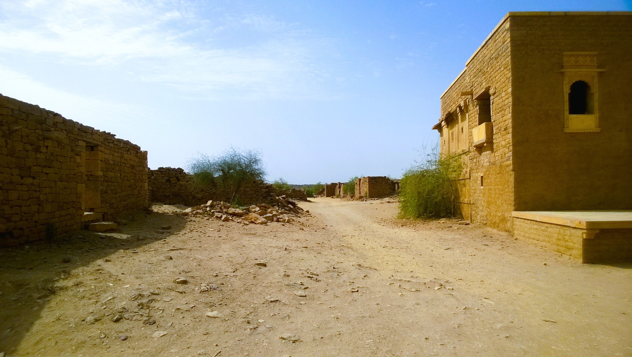
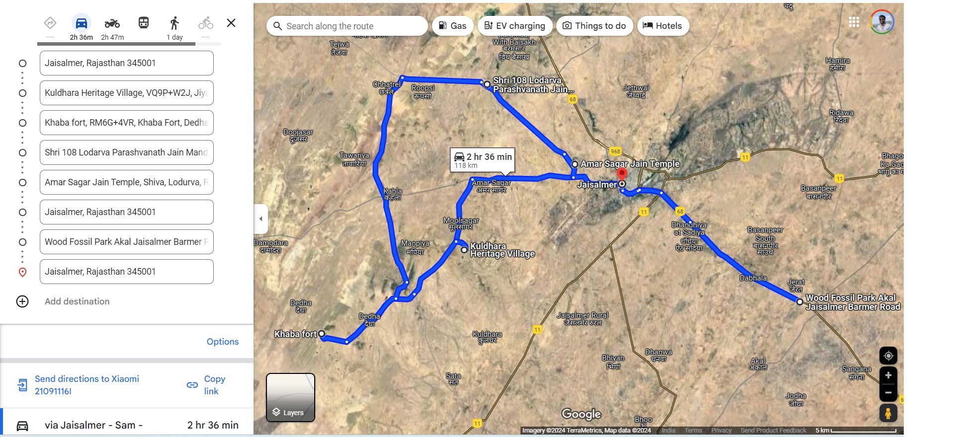
The next day was going to be jam-packed, what with my return scheduled on the 6 PM train that evening. So, I started around 9.30 AM after breakfast on the scooter, and headed back on the same road leading to Sam Sand Dunes. Midway though, I took a left turn and headed off on the narrow road piercing the desert, and reached Kuldhara, an abandoned village, also touted as a haunted site, right in the middle of the desert. At Kuldhara, there lay rows of abandoned stone houses with only their walls remaining, alongside a temple around which the town’s life seems to have centered around. Adjacent to the lies a garden dubbed Jurassic Cactus Park, with a fascinating assortment of cactus varieties.
Established in the 13th century by Paliwal Brahmins who had emigrated from Pali, and is said as per a local legend, to have been abandoned overnight and cursed by the villagers when the prime minister Salim Singh set eyes on the village chief’s daughter and threatened the villagers with dire consequences if they defied his wish. However, research seems to suggest that Kuldhara and other such villages nearby were abandoned gradually over time, mainly due to damage due to earthquakes and dwindling water supply, and the abandonment seems to have been precipitated by early 19th century due to the oppressive tax regime of Jaisalmer state propagated by Salim Singh.
Ruins at Kuldhara village
Cacti at Jurassic Cactus Park in Kuldhara village
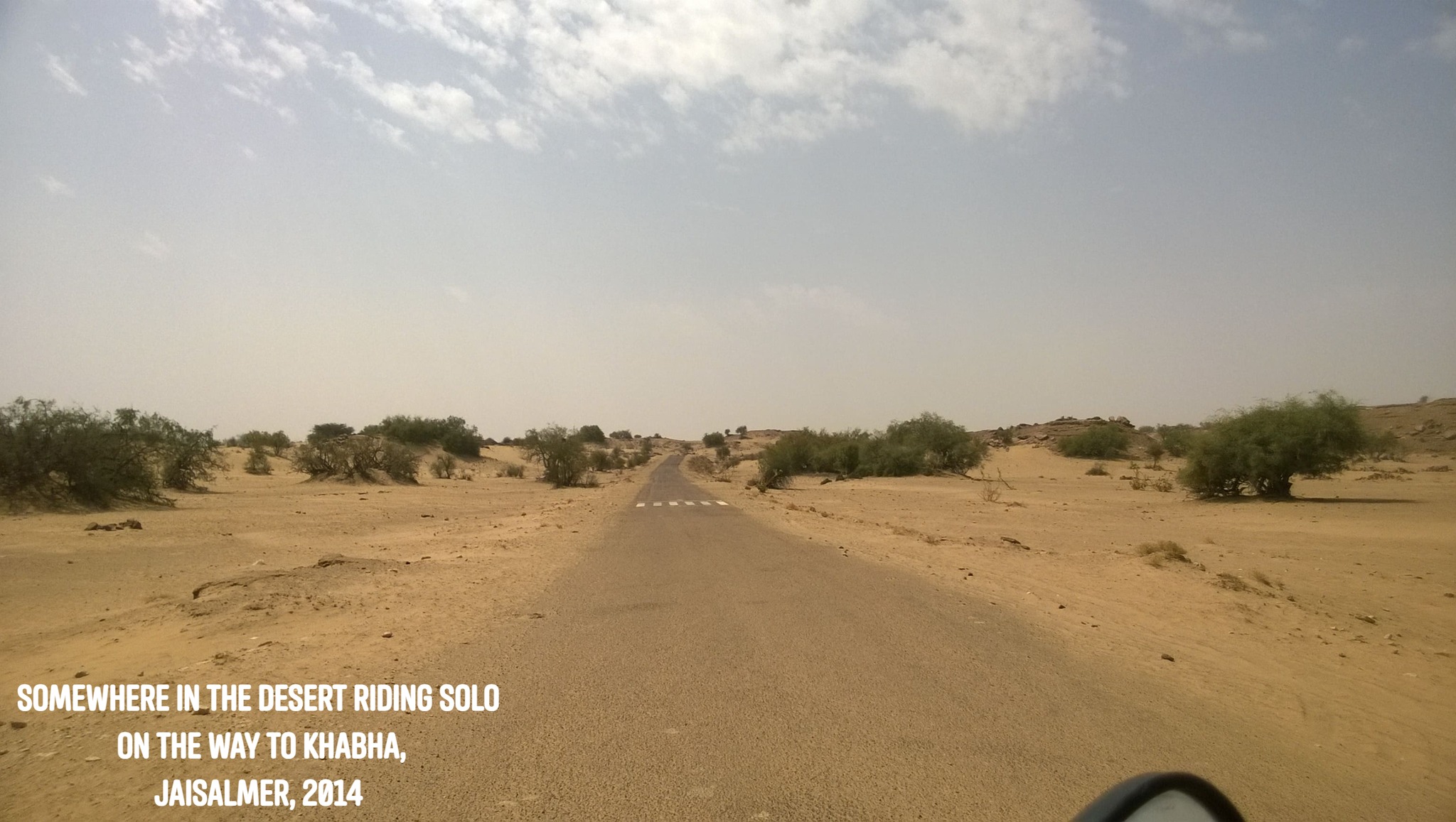
Pushing further into the desert, all alone on the scooter, with nary a human in sight, I headed towards Khabha. About half an hour later, passing through sands with occasional patches of 3 feet tall grass beneath some of which, one or more camels would be resting, I beheld a ridge, resembling a plateau on which stood a compact golden-coloured fort. Ascending up the ridge, I was soon inside the Khabha fort, with tiny turrets lining its peripheral wall, where I was amazed to find a museum of natural history. The fort stood all alone in desolation, a lone sentinel on the edge of a low cliff in the middle of the desert, overlooking, in the escarpment below, the stony ruins of an abandoned village, a sight similar to that I had just seen in Kuldhara.
Somewhere in the desert on the way to Khabha
View of Khabha fort from the foot of the ridge
Ruins at Khabha as seen from Khabha fort
Leaving Khabha, I rode back towards the Sam road, and crossed it to move over to the other side, where the landscape was relatively greener, and then riding parallel to the Sam road but towards Jaisalmer, I reached Lodurva, which was the capital of the Bhattis before Rawal Jaisal founded Jaisalmer in 1156 CE. At Lodurva, I visited the Shree Parshvanath temple, dedicated to the 23rd Tirthankara, built in the 9th century in yellow limestone and sandstone, which was destroyed in 1152 by invaders, and later renovated and repaired in 1615 AD. Riding further, I was accosted by a couple of youth on a motorcycle who were intent on smearing rangoli, since it was Holi. I sped as fast as I could, with the duo in hot pursuit, finally managing to lose them, and only stopped, nearer to Jaisalmer, at the Amar Singh Jain temple.
The Parshvanath temple at Lodurva
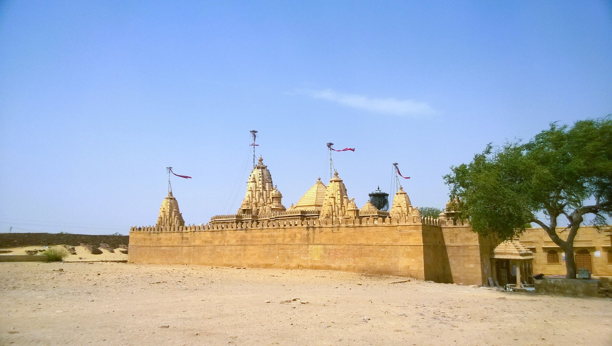
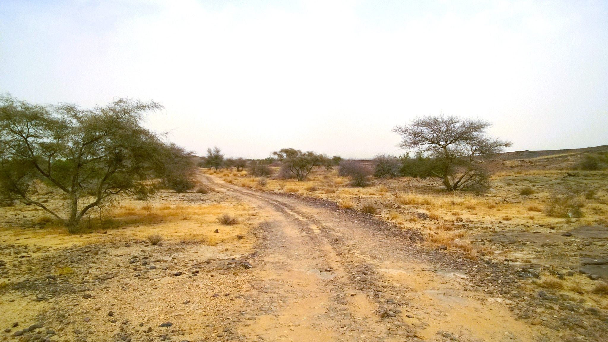
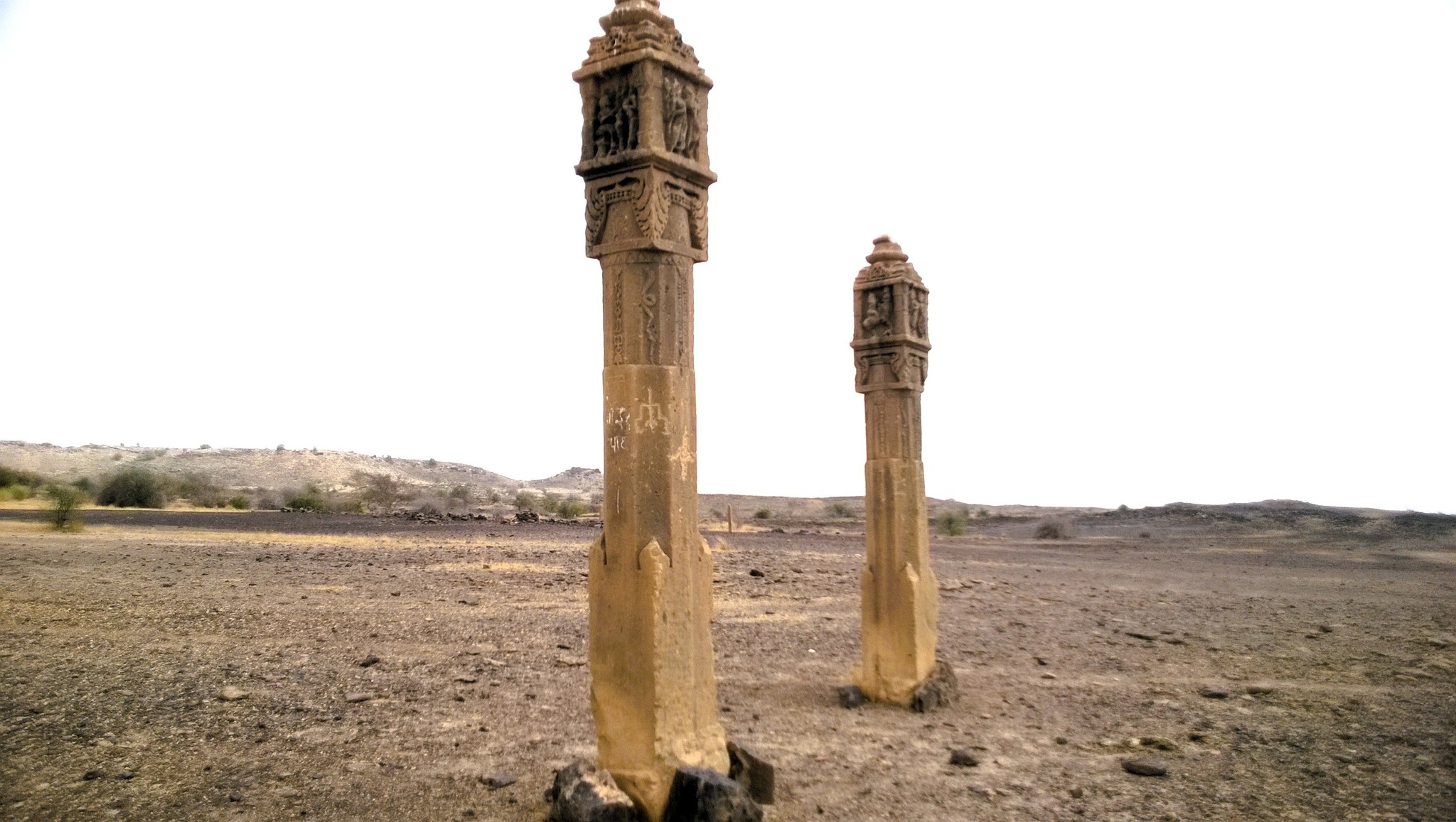
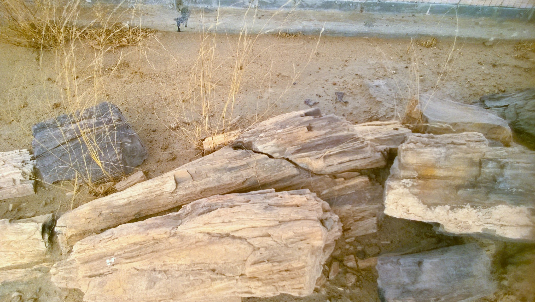
It was now 1 PM, and I had on my wish list, still one more outstation site to see, but this site was located on the other side of the city. Calculating the time I had in hand, I crossed Jaisalmer city, and sped on the Barmer highway to reach Akal Wood Fossil Park, lying about 18 km south-east of Jaisalmer, where I was welcomed by a couple of emus and an assortment of wood fossils dating back to 200 million years. I rode through the desolate desolate brown rocky land, coming across more preserved fossilized wood dating and pairs of pillars for which there was no explanation. After wandering for a while inside the fascinating park, I headed back to the city, where I stopped at Gadisar Lake, an artificial lake created in 1156 to serve as the main water source for the then newly-founded city.
Welcomed by emus in Akal Wood Fossil Park
Riding deep into the Akal Wood Fossil Park
A pair of pillars in Akal Wood Fossil ParkWood fossils in Akal Wood Fossil Park
Gadisar Lake in Jaisalmer city
After surrendering the scooter at the rent-a-bike shop, at around 4 PM, I finally found myself inside Jaisalmer fort. Soon, I was walking through the streets of the bustling town lying inside the fort premises. After whizzing past the courtyards, corridors and halls in the palaces, I came upon the the alleys running along the ramparts of the fort, winding around the turrets, in maze-like form. Standing on the ramparts, I was treated to breathtaking views of the cityscape and the barren, desert landscape beyond it with its meeting point with the sky shrouded in a haze of sand, leaving me in a trance.
Inside Jaisalmer fort
Walking on the ramparts of Jaisalmer fort
Panoramic view of the city and beyond from the ramparts of Jaisalmer fort
My reverie was broken when the local who had arranged my accommodation and camel ride at Sam Sand Dunes called, asking if I was prepared to be dropped at the railway station. Walking down the fort road, I was not able to escape an assault of rangoli launched by a passerby, rendering patches of colour on my shirt and hair, leaving me fuming. But then, I saw a group of white tourists who had completely immersed themselves enjoyment of the festival of colours, and I told myself, what’s the big deal?, and greeted them, followed by exchanges of polite colour smearing.
As I mounted the motorcycle to sit behind the Jaisalmer local, with my backpack lugging on my back, I took one parting look at the mesmerizing golden fort sitting proudly and timelessly on the rock. An hour later, I was inside the train, fondly scrolling through the gallery on my Nokia Lumia phone, with the photographs on my phone, the smudges of rangoli on my person, and the wistfulness in my heart, being the only remaining and undying vestiges of my tryst with the Thar.
March 2013. It was that time of the year again – the spring slowly receding to give way to the advancing heat of the Delhi summer. If I did not make my foray into Rajasthan now, then I would have to wait till the monsoons had gone. After testing the waters with a short venture to Jaipur the last year, I was now ready to take a bigger leap, and naturally, that leap would have to land me in Udaipur, the city of lakes, that I had heard so much about – Chittorgarh, that famed land of brave hearts, would be a nice addition.
On 29th March 2013, just like on my previous trip to Rajasthan, I boarded an ordinary road transport bus to Jaipur after office from Iffco Chowk in Gurgaon. Listening to one studio album after another, each from start to finish, of my favorite band Michael Learns to Rock, I reached Jaipur around 10 PM. After a quick dinner and some inquiring, I got on a private operator’s bus headed to Udaipur – in hindsight, I should have taken a state transport bus only, for the seat was uncomfortable, with pathetic headroom. I remember getting woken up more than a couple of times due to bumping my head into the hardwood baggage shelf above, leading me to some soreness on my scalp.
I remember the bus passing through Bhilwara in the middle of the night when I was yanked out of my sleep, and as the dawn descended, the bus cutting through mist that shrouded the less-than-usual vegetation and isolated huts and houses sprinkled across the landscape in an envelope of haze. The next time I opened by eyes, I was informed by the bus conductor that the railway station had come – that was my cue to get down. Soon, just walking a few steps on the road running parallel to the railway station, I checked in to a hotel. Not wasting too much time, upon advice of the receptionist, I booked a cab to take me around Udaipur for about 1400 rupees.
Seeing Udaipur and Nearabouts
We started by heading off to the outskirts of the city, to the Eklingji temple located at Nagda, the first capital of Mewar, 25 km away from Udaipur. The original temple dedicated to Eklingji, the ruling god of the Mewar princely state, was built by Bappa Rawal, the founder of the Guhila Rajput dynasty, who established the Mewar kingdom in the 8th century AD. The temple underwent cycles of destruction by Turkic forces and re-construction, most notably in 14th century by Rana Hammir, the progenitor of the Sisodia clan to which Maharana Pratap belonged, and in 15th century by Rana Kumbha. The last major re-building with installation of the current idol was done in late 15th century by Kumbha’s son, Rana Raimal, after the temple had been devastated by the Malwa Sultanate forces.
After offering my prayers in the temple, we drove through a valley in the hills, which I was told were the Aravallis, that seemed largely yellow but splattered with patches of green. After about another half-hour of driving through alternating patches of flat land, clusters of hamlets, flanked by the Aravallis, we reached the Chetak Samadhi, built at the location where as per legend, Maharana Pratap’s horse Chetak breathed its last after taking its master to safety in the Battle of Haldighati against Akbar’s forces on 18th June 1576. Just another kilometer further, the road cuts through a narrow pass in the hill whose sides are barren and coloured pitch yellow with an orange tinge – the is the legendary Haldighati Pass, located at around a distance of 44 km from Udaipur.
Retreating from the Haldighati Pass, near the Chetak Smarak, I checked out the Maharana Pratap Museum that depicts the life and times, the exploits and achievements of Maharana Pratap. Maharana Pratap, the eldest son of Udai Singh II who founded Udaipur, was crowned in Gogunda as the 54th ruler of Mewar in 1572, inheriting a kingdom that had been weakened by the 1567-1568 siege of Chittorgarh. His refusal to form an alliance with and become a vassal of the Mughals and conitnued conflicts with the latter led to the legendary Battle of Haldighati on 18th June 1576, which the Mughals won although they could not capture Maharana Pratp or his close family members.
Entrance of Eklingji templeThe Chetak Samadhi
Maharana Pratap Museum
The pass in the Aravallis near Udaipur passing through Gogunda, encountered when going to Haldighati
Forced to flee to safety of the hills with a trusted coterie of warriors and loyalists, amidst annexation after annexation of most key areas of Mewar including Gogunda, Udaipur, Kumbhalgarh etc., Maharana Pratap led sustained attacks using guerilla tactics against the Mughal forces, and won back major chunks of Mewar, with an exception being Chittorgarh, leading to Mewar’s revival by 1588 AD. Celebrated as a folk hero in Rajasthan, Maharana Pratap’s legend later spread to Bengal where he became a symbol of resistance for anti-British revolutionaries, leading to him becoming a leading icon of heroism, alongside the likes of Rani Laxmi Bai, in India’s freedom struggle.
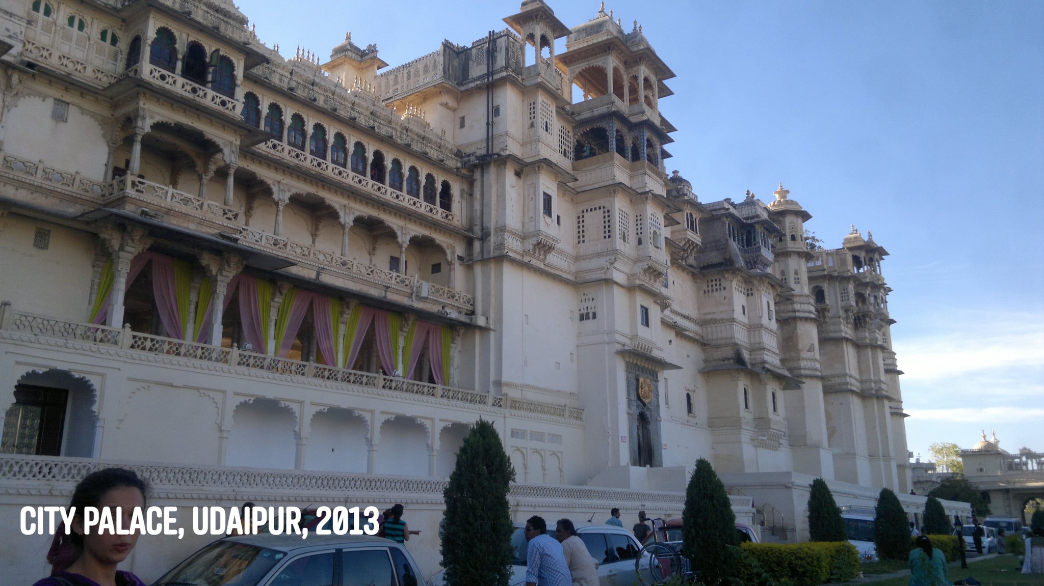
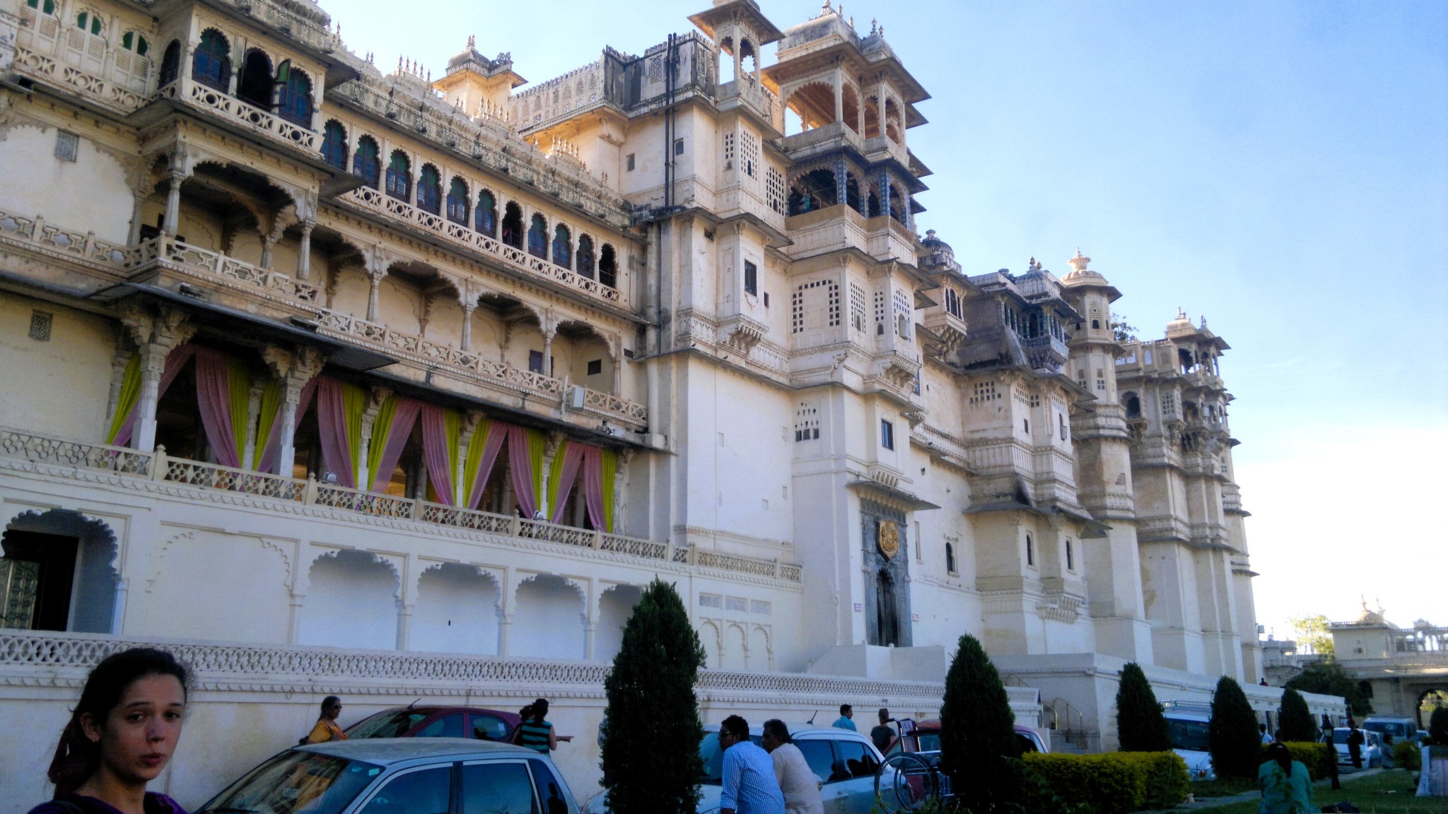
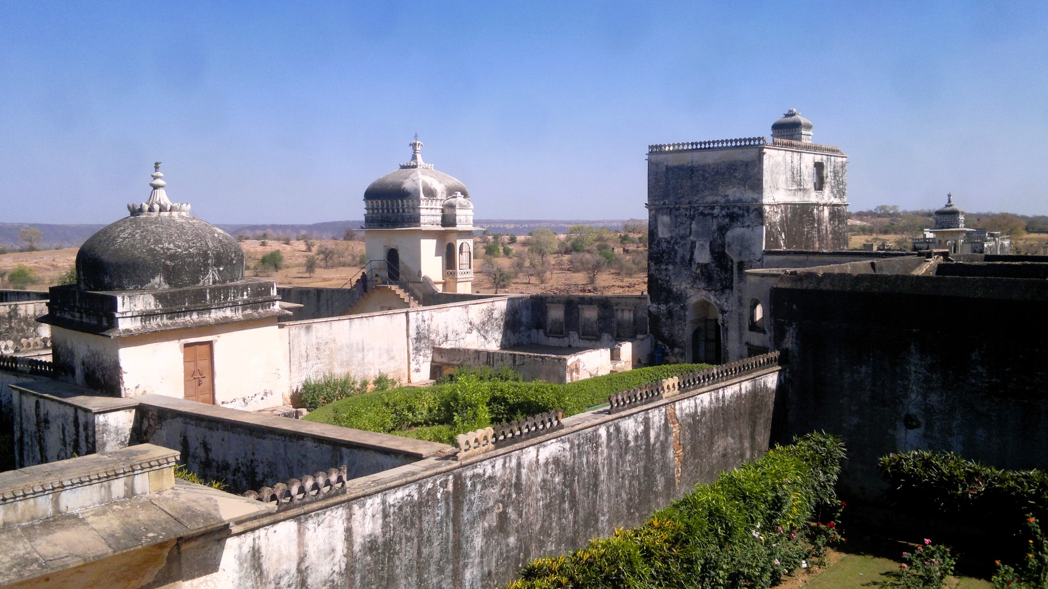
Again driving through the Aravallis, we re-entered Udaipur city, where I straightaway where we first stopped by the Fateh Sagar lake, and then proceeded to the City Palace where I dismissed the cab. The construction of City Palace on the bank of Pichola lake commenced in 1559 AD, when Rana Udai Singh II moved his capital from Chittorgarh to Udaipur on the advice of a hermit, much before the siege of Chittorgarh by Akbar in 1567-68. Successive rulers of Mewar, including Maharana Pratap and Maharana Amar Singh I, occupied palace adding more layers to it. The palace complex, built entirely in granite and marble, comprises components such as courtyards, palaces and balconies, with intricate mirror work, murals, marble work etc. are a fine representative of Rajput architecture.
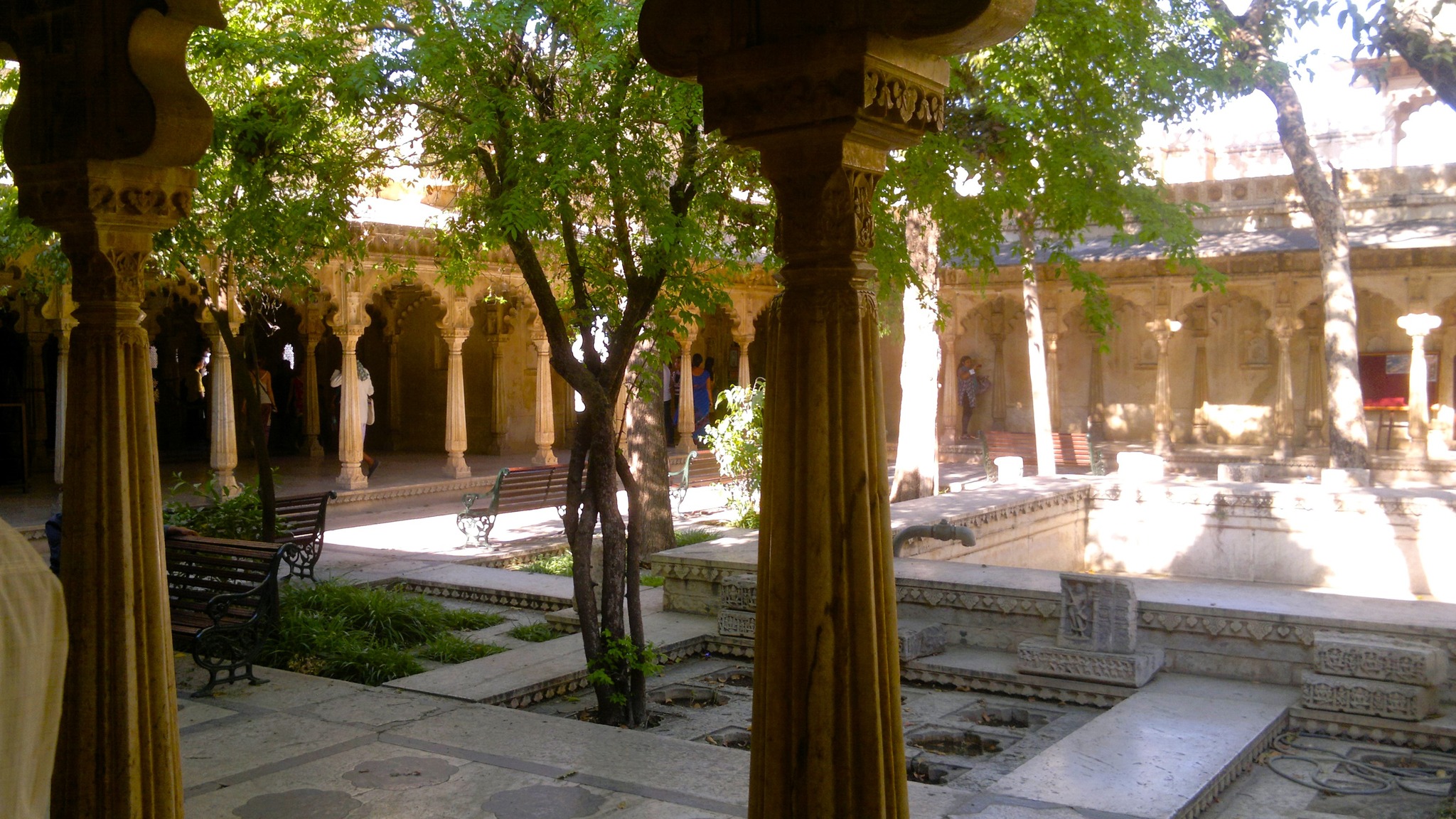
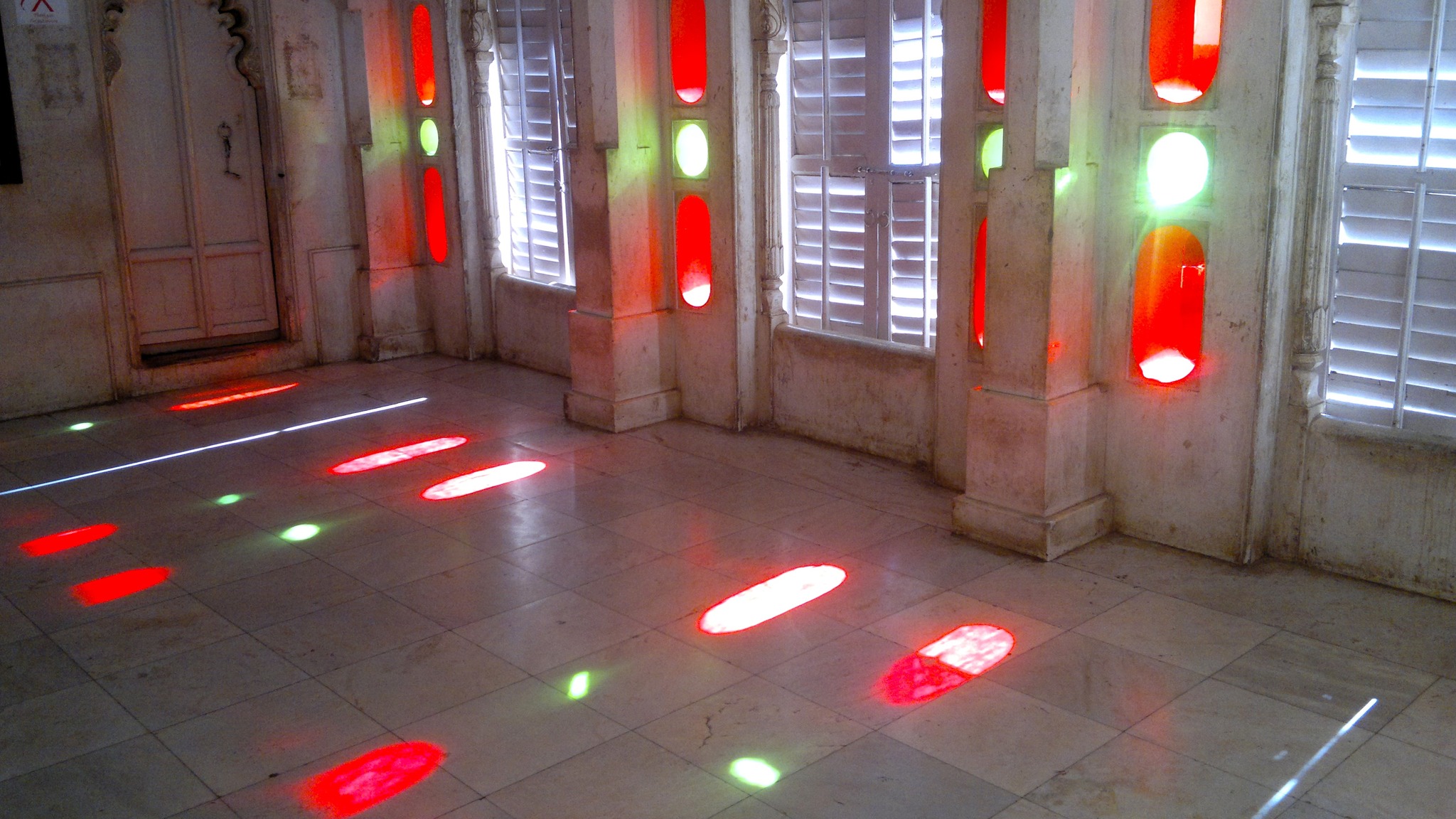
Inside the City Palace premise
A courtyard inside the City PalaceSheesh Mahal inside the City Palace
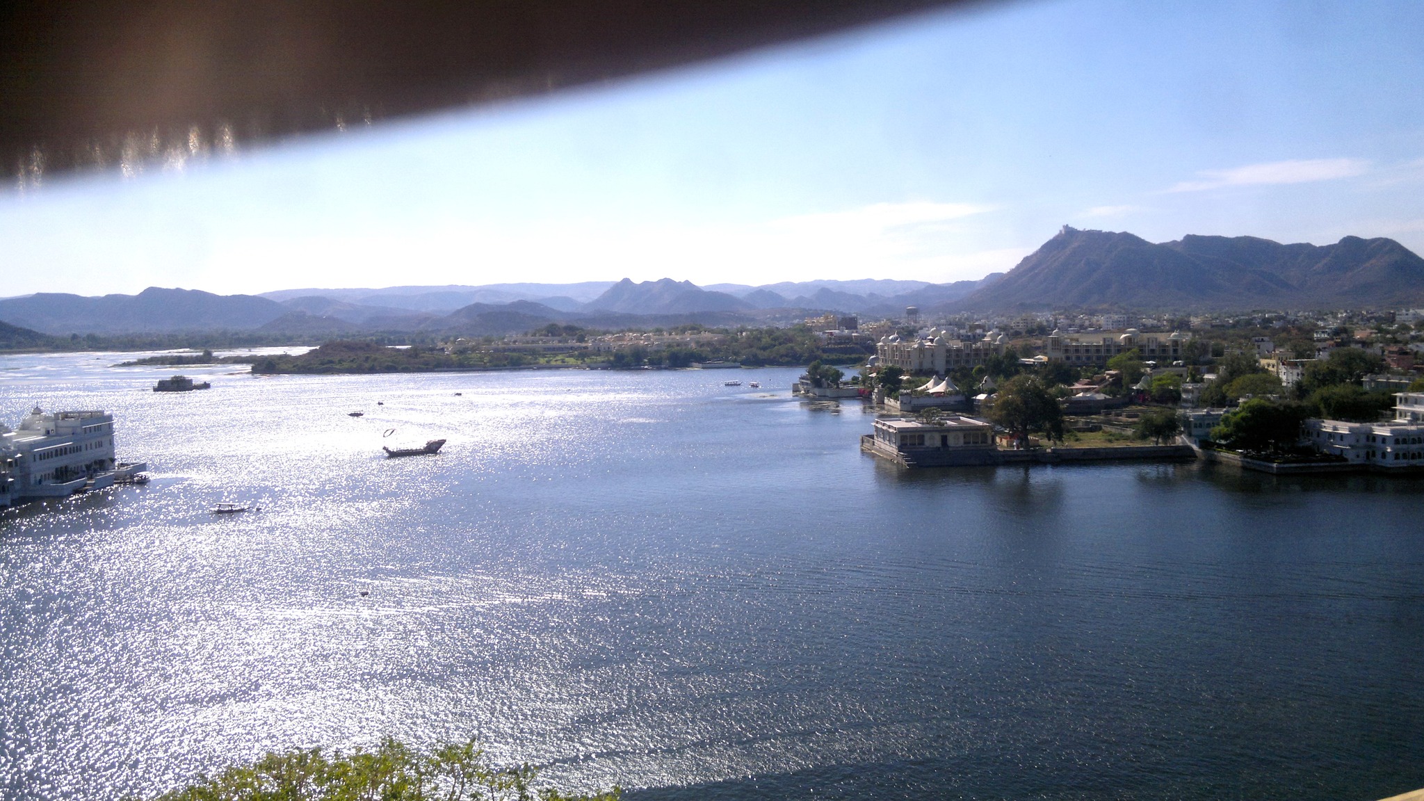
View of Pichola lake from the City Palace
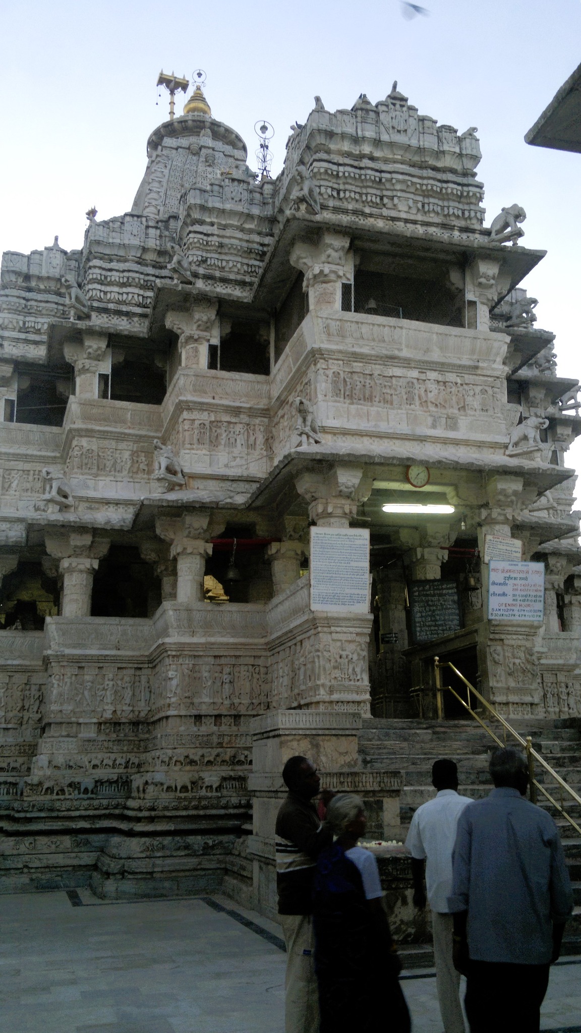
A room inside the City PalaceThe Jagdish temple outside the City Palace
Taking in the grandeur and aesthetics inside the City Palace, coupled with amazing views of the Pichola Lake with the Aravallis in the background and the city, I exited the City Palace to directly walk into the Jagdish temple. Built by Maharana Jagat Singh in 1651, where Lord Jagannathi in the form of an idol carved out of a single black stone is worshipped, the temple is a fine example of Māru-Gurjara architecture. Spending some more time by Pichola lake, and admiring the spots of illumination emanation out of the Lake Palace (Jag Niwas) and Jagmandir Palace lying in the middle of the lake, I walked through the streets and then the main roads back to my hotel near the railway station, following a day well spent.
Chittorgarh
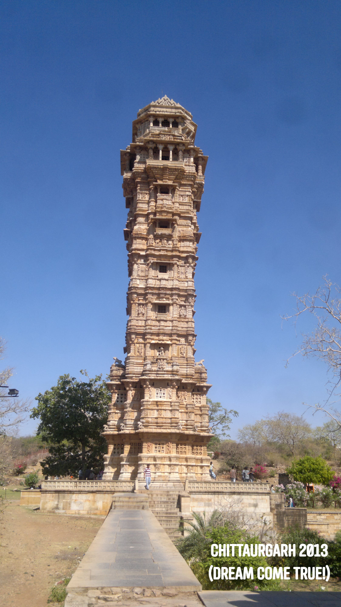
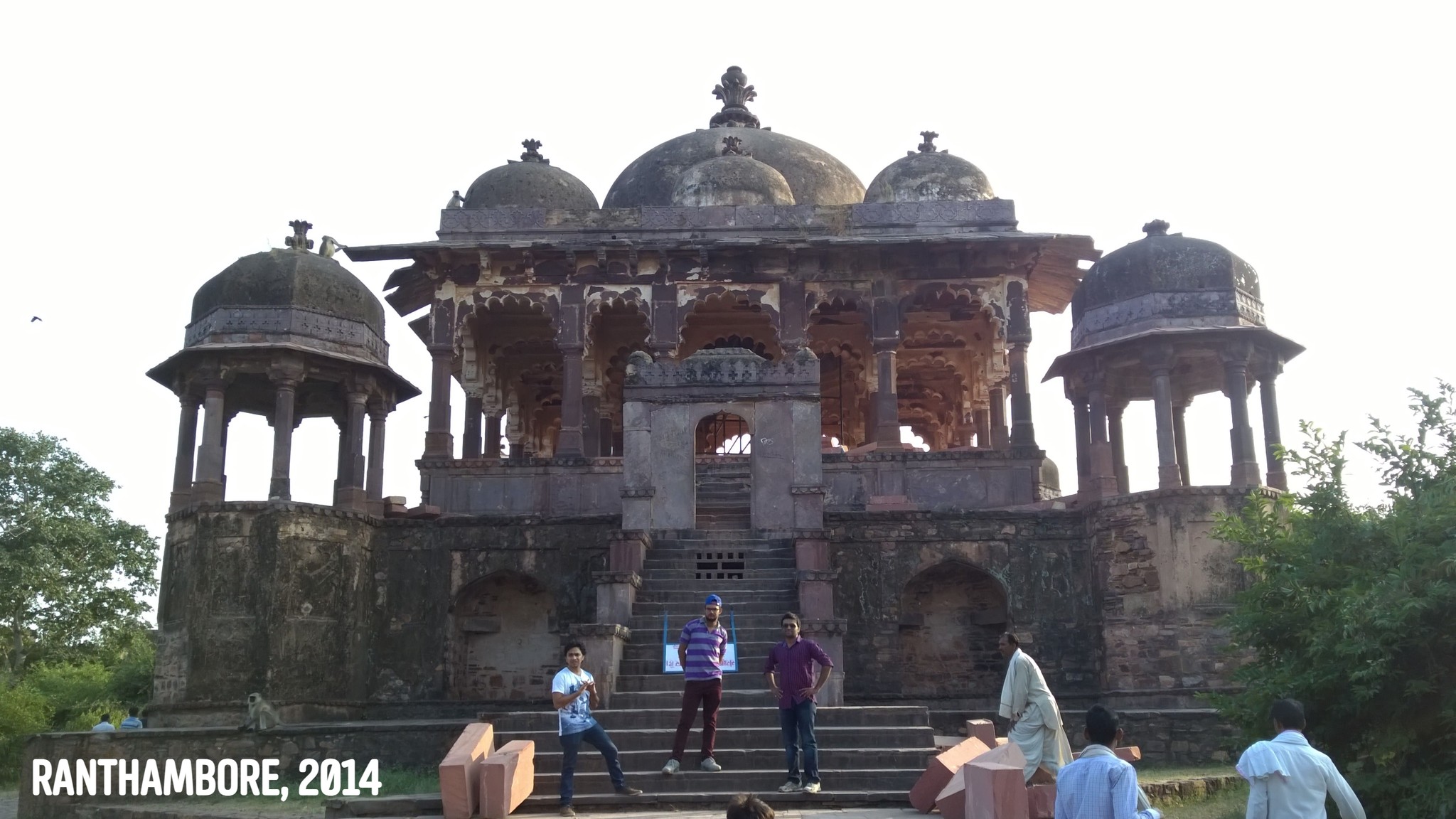
The next day I pondered over two options – to go to Kumbhalgarh or to Chittorgarh. At that point in time, I knew only of Chittorgarh, being enamored by sketches of a tower called Vijaya Stambh that appeared in an issue of Tinkle magazine. Perhaps at the same time in the same magazine or later, I had read about the legend of Panna Dai, who replaced the prince with her own son when the prince’s uncle attacked. Later came the story of queen Padmini. With the image of the Vijaya Stambha and the name Chittor stuck in my head for so many years, and the prospect of seeing the Vijaya Stambha for real knocking at my doors, it was rather easy to choose which place to go to.
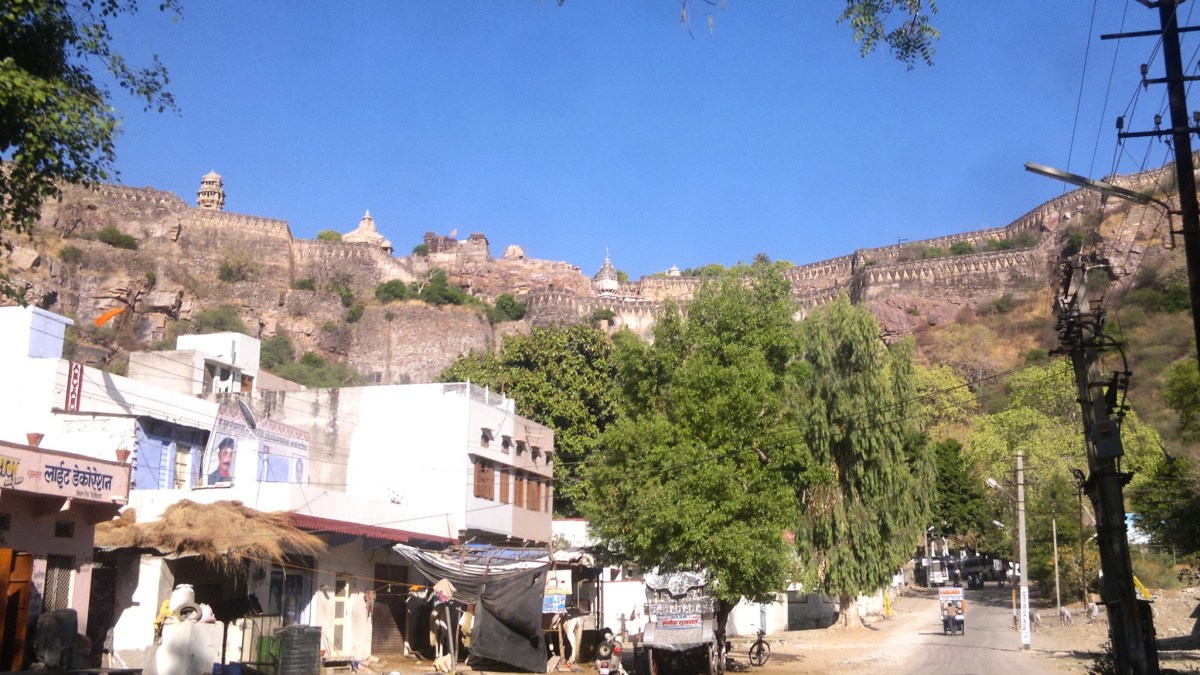
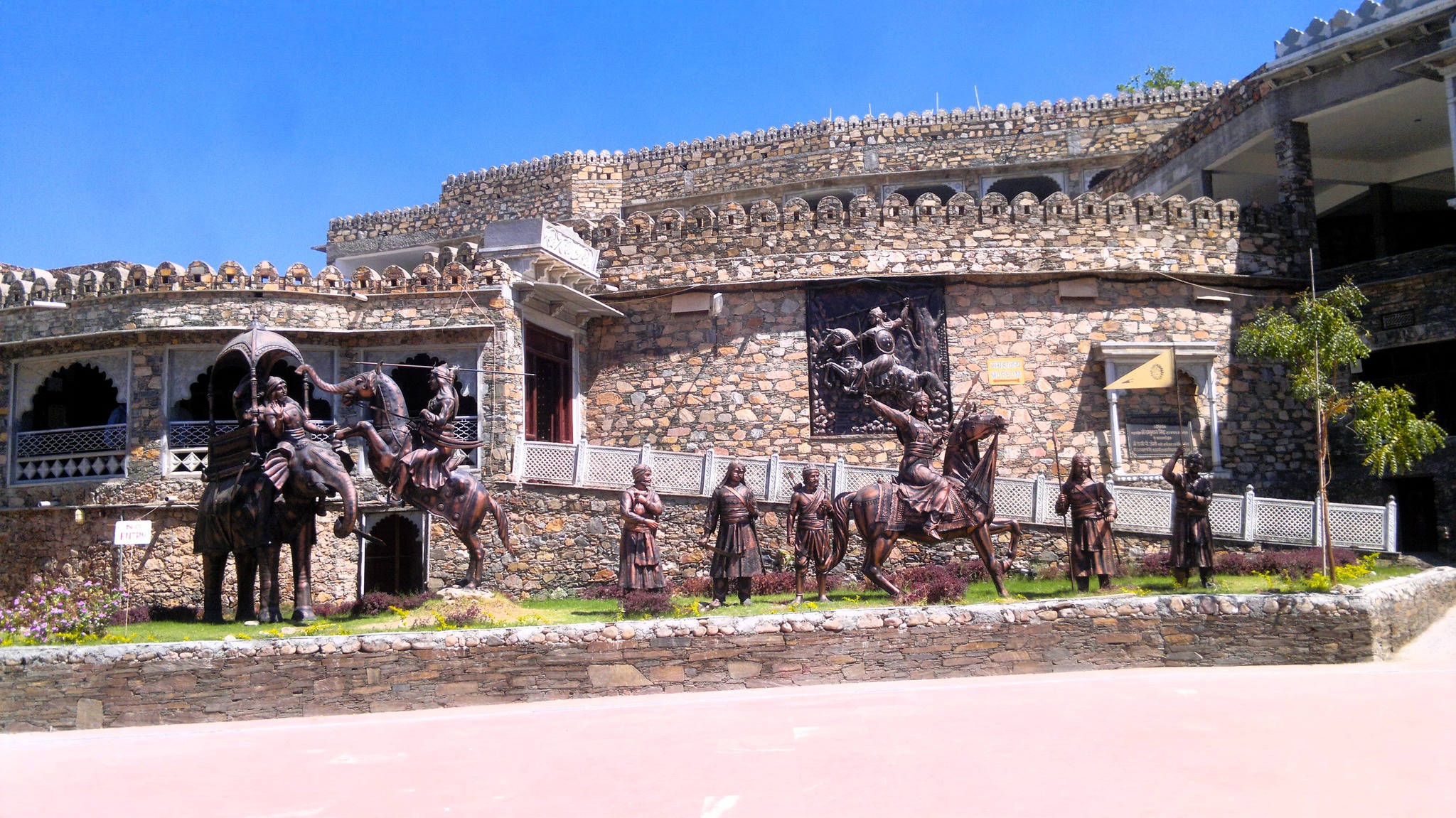
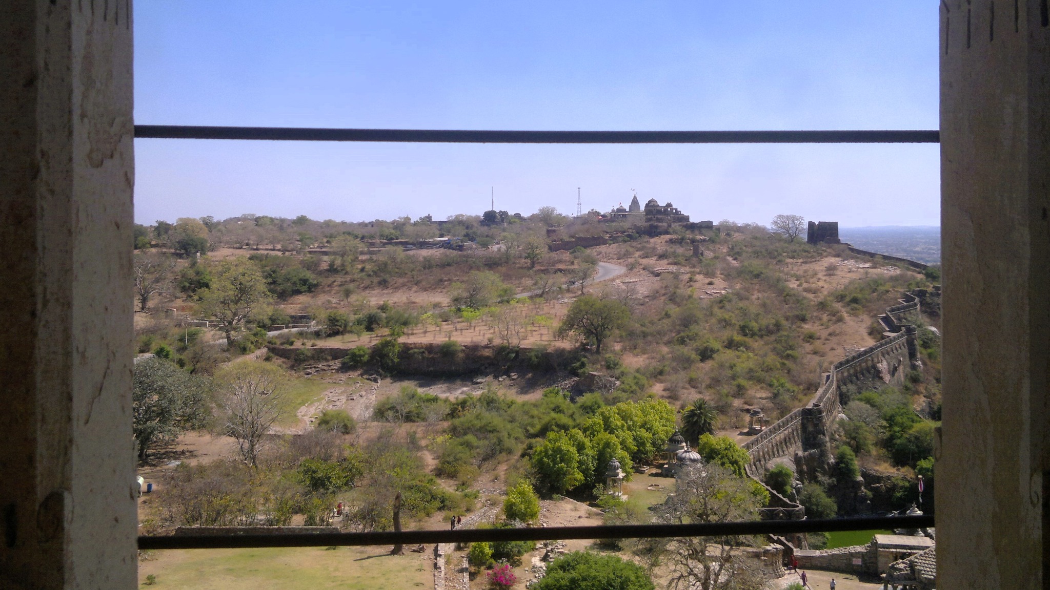
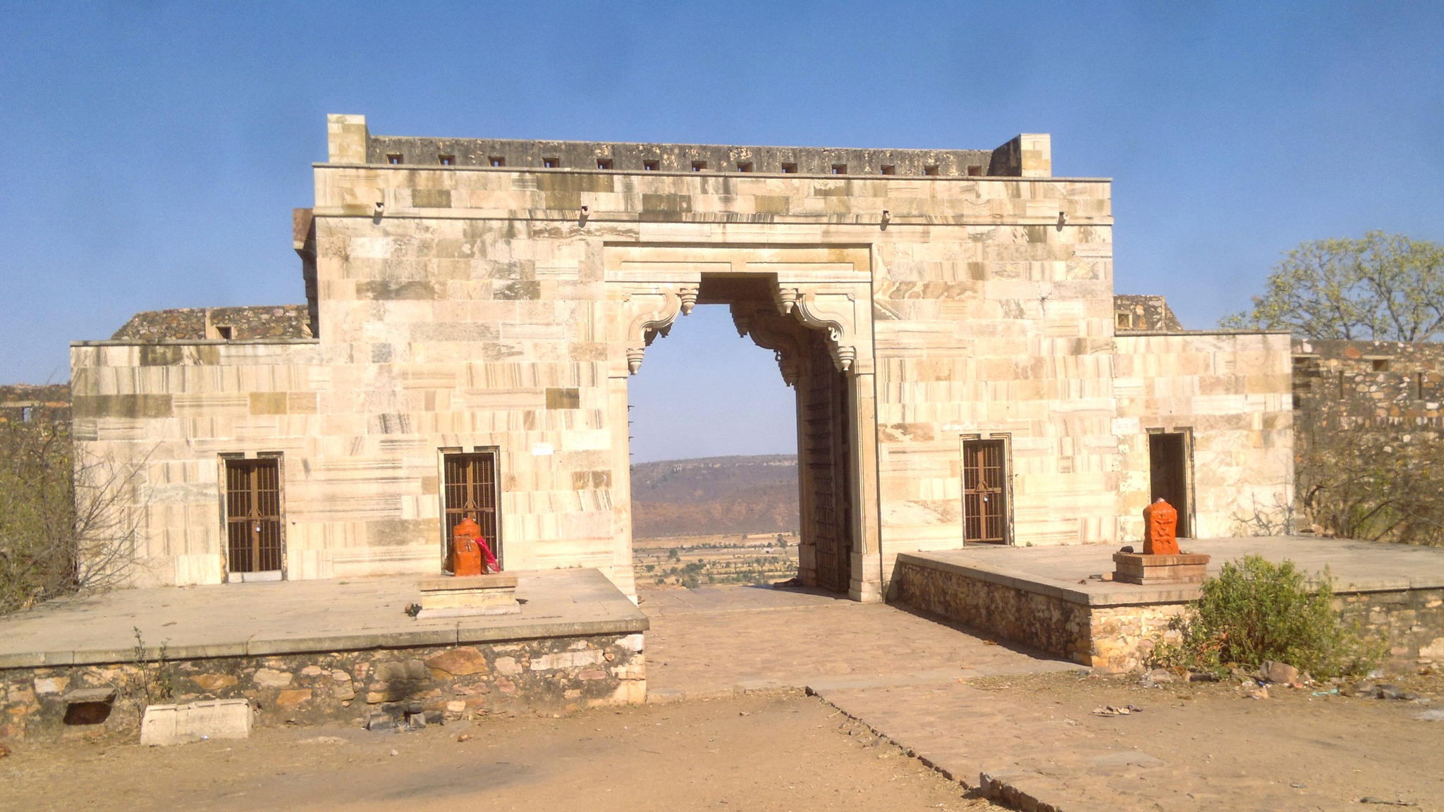
By 9 AM next morning, I was in a state transport bus headed to Chittorgarh, which I reached by 11 AM. There, I hired the services of a middle-aged autorickshaw driver who doubled up as my guide for tour of Chittorgarh fort – the package costing me 500 rupees. Right from where we started, I could see the fort wall streaming up and down over the rugged edge of the hill in the distance. As we drew closer and closer to the hill above which the fort lay, I saw the outline of several structures jutting out into the sky – a narrow vertical structure stood taller than the others, and I wondered aloud if that was the Vijaya Stambha, to which my guide replied, yes.
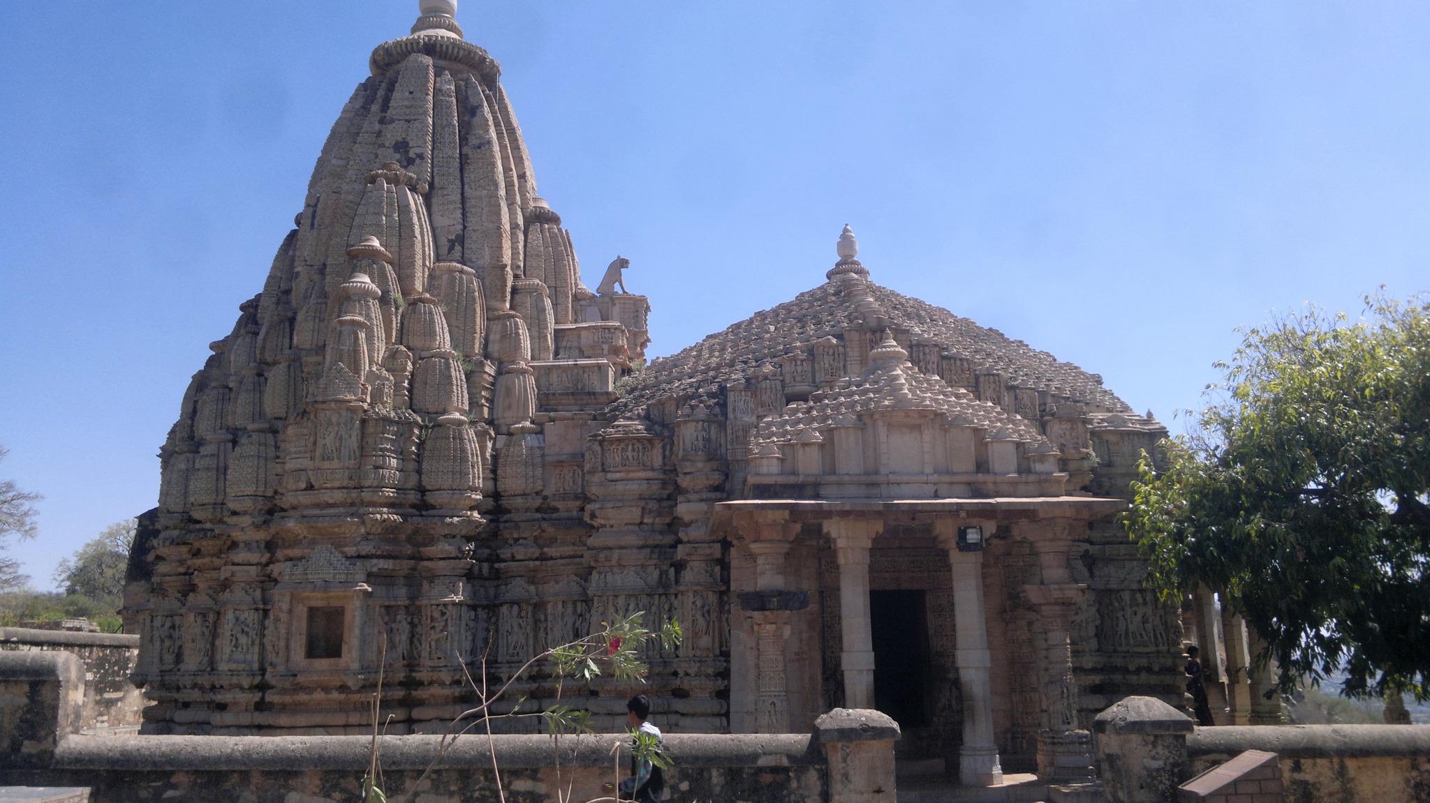
Soon, the autorickshaw was clattering up the winding road, passing through multiple stone arched gates, called pols, one after another. At long last, passing through a cluster of normal but old looking houses, looking very similar to a village, we came on to an open clearing on flat around where the ticket counter stood. Buying my ticket, we rode further on the road towards the south until we reached a crossroads with multiple structures occupying the space on all sides of the crossroads. A palace stood right beside me, which I learnt was Kumbha’s palace. A cluster of marble built Jain temples stood on my left side, while two stone-built Hindu temples stood diagonally opposite side.
I got down at the crossroads to first see Kumbha’s palace, and then proceeded a little to the south to see the aforementioned two temples, namely, Kumbhashyam temple and Meera temple, the latter being a Krishna temple where Meera Bai from Merta who had married into Chittor, immersed herself in devotion to Krishna. Back outside the temple complex, as I turned my gaze a little to the south-west, I saw that right in front of me at a distance stood a tower that looked eerily similar to the one I remembered from the sketch from the magazine – it was indeed the Vijaya Stambha. Without further ado, I beckoned my guide to head straight to the Vijaya Stambha.
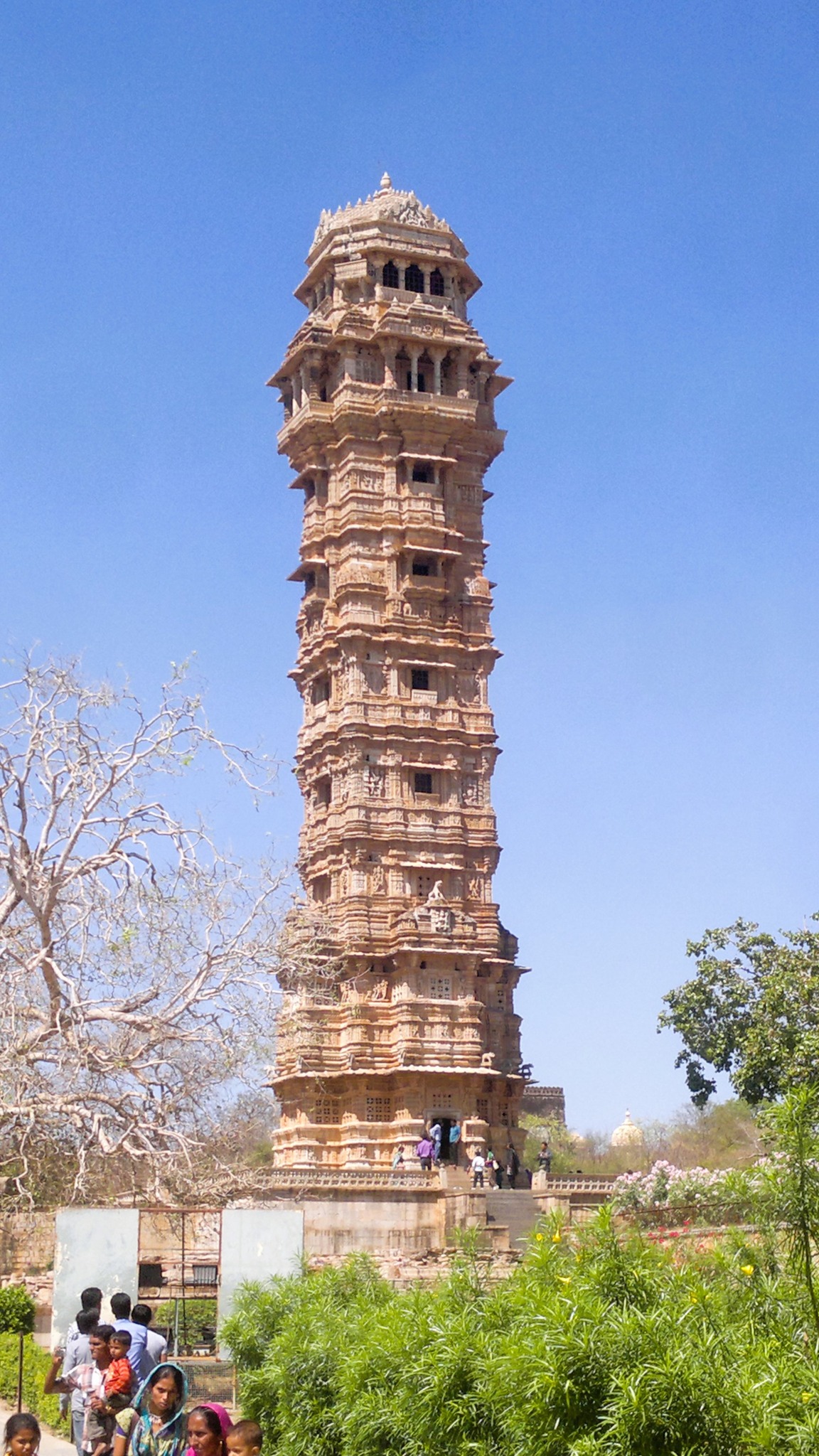
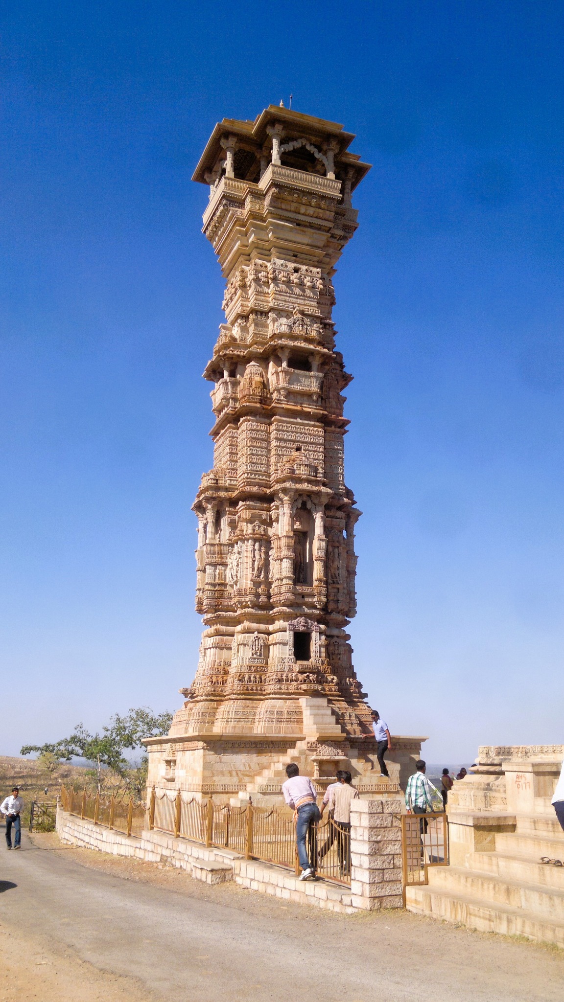
Reaching the foot of the Vijaya Stambha, I beheld the physicality, the carvings and the design of the structure with glee and wonder that would only be elicited in a child that has finally seen something that it had seen in a dream or on TV. The Vijaya Stambha was built in 1488 by Rana Kumbha to commemorate his victory over the forces of Malwa in the Battle of Sarangpur. Dedicated to the god Vishnu, it is said to be visible from anywhere inside the fort, and also from the city. What is more – it was possible to climb up the tower using the staircase located inside the structure, which is what I did with sheer excitement. Reaching the topmost of the 9 storeys, I got a breathtaking view of the city underneath and other structures inside the fort on the hill.
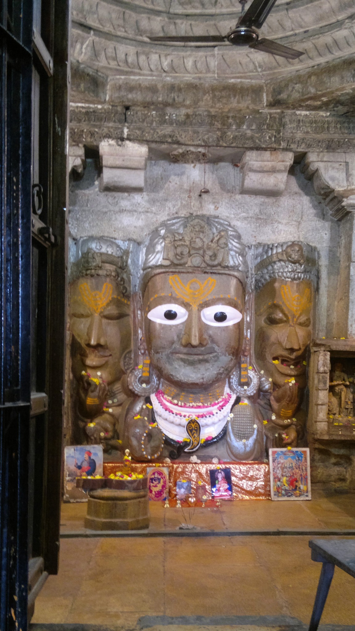
Getting down from the tower, I proceeded from beside the Jauhar place to Samadhishwara temple, which houses a three-faced Shiva idol. Behind the temple is the iconic water tank appearing in most circulated posters of Chittorgarh. Descending the steps I went to a crevice in the hillside from where emanates a water spring from an stone opening built in the form of a cow’s (Gau) head (mukh) filling up the water tank, thereby giving it the name Gaumukh Kund. From there, I got back on the autorickshaw and moved further south past a water tank to reach the Kalika Mata temple. Then further to the south, I stopped by the Padmini Palace, where a legend, albeit with no historical backing, of Ala-ud-din Khalji getting a glimpse of queen Padmini through the reflection on a mirror, is rooted in.
Kumbha’s PalaceKumbhsyam temple (right) and Meera temple (left)
The iconic Vijaya Stambha
View of an area inside the fort from the top storey of Vijaya Stambha
The Samadhiswara temple
The Gaumukh KundThe three-faced Shiva in Samadhiswara templeThe water spring feeding the Gaumukh Kund
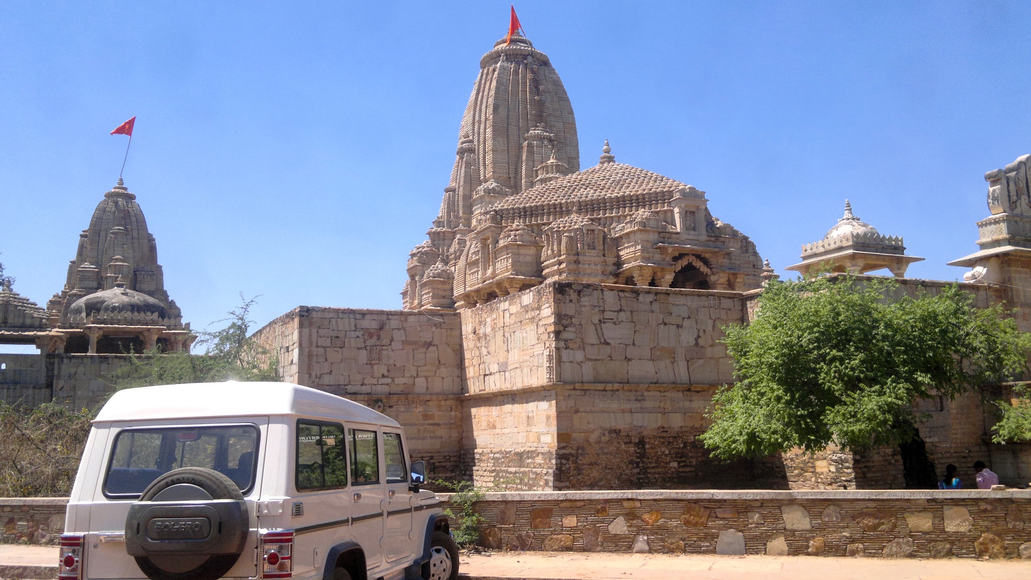
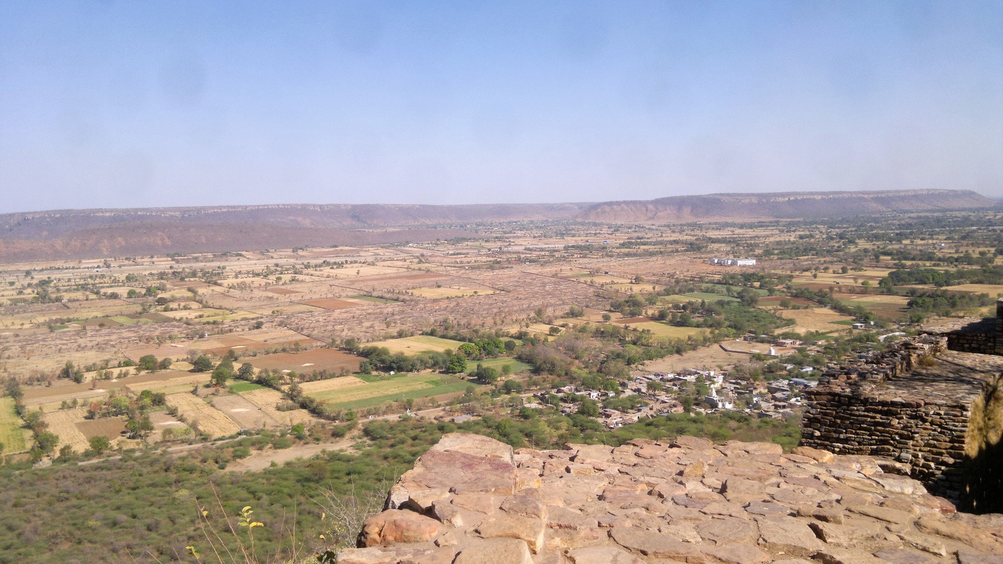
Pushing further south, the road curved around a water tank with a deer park occupying the outer side, and turned 180 degrees towards the north, with thin jungle flanking on both sides. Now heading a couple of hundred metres, we came upon the main gate of the fort, which overlooked the sparsely inhabited valley below. A stony curving path led from the valley below to the gate, with a low flat hill stretching from one end to another in the background, while ramparts streamed along the edge of hill from both sides of the gate. Moving further to the north, we came upon a cluster of Jain temples, amidst which stood another tower, looking like a prototype of the Vijaya Stambha, called Kirti Stambha, which is dedicated to Adinatha and was built in the 12th century.
The restored main gate on the east side of the fort
View of the valley on the east side of the fort where the main entrance of the fort lies
The Kirti Stambha
Pushing further north for another kilometer or so, we reached the north end of the hill, where a full fledged village is located. Again turning a full 180 degrees, we were headed in the south direction again, first passing through the village and then, meeting the road by which we had first entered the village on our way up to the fort. As we rolled down the hill through the numerous gates on the winding road, I looked wistfully at the ramparts above me, a little dismayed that I had to say goodbye to the place that I had been fascinated with for so long. As we stumbled back into the city at the foothill, I took one last glance at the hillside that wore the the stone ramparts as a crown and supplemented it with structures as if bedecked with gems.
A parting shot of the fascinating Chittorgarh as seen from the foothill
It was 5 PM when I took a road transport bus back to Udaipur. After a quick dinner, I boarded a pre-booked 9.30 PM bus to Delhi, and fell asleep, only waking up when the bus arrived in Dhaula Kuan in Delhi the next morning.
Post-script
In the end, what struck me most after visiting Chittorgarh is how it is a self-contained city spread upon a vast flattop hill, like on a plateau. The palaces and structures are far-flung interspersed with water tanks and jungle. If you’ve read The Lost World, then imagine a place that is removed from the remaining world that lies beneath, and one that transports you to another era as a time machine. All said and done, Chittorgarh, a place I had loved since I was a child, since before I even set foot in Rajasthan, turned out to be place that lived up to and went beyond the hype and visuals I had created in my mind.
March 2012. Spring was drawing to a close, and before the Delhi summer started knocking on the city’s doors, I decided, emboldened by first ever solo trip from the previous year, to set out on my next solo trip – my first ever trip to Rajasthan.
My fascination with Rajasthan had begun while growing up in Odisha through a myriad of stimuli – black-and-white pictures of the Hawa Mahal and Jantar Mantar in an English literature textbook, a travelogue of Bikaner and Jaisalmer in my Odia literature textbook, sketches of the Vijaya Stambh and the legend of Panna Dai of Chittaurgarh in Tinkle Magazine, images of Sambhar Lake and Dilwara Temples of Mount Abu in geography textbook, and so on. And now, close to three years after I had moved to Delhi, it was time to indulge the fascination and see in person what I had seen only in pictures. What better place than Jaipur, the city in Rajasthan nearest to Delhi, to begin the exploration with?
On the many occasions that I had passed through Dhaula Kuan, I had seen buses having Jaipur written on their boards waiting to pick passengers up, and had wondered as to when I would get a chance to board one of those. I had seen the same buses stopping at Iffco Chowk in Gurgaon very close to where I worked. And so on the evening of 23rd March 2o12, an evening that I remember very clearly, leaving the office at around 4.30 PM, I stood at Iffco Chowk, squinting through the fog of dust enveloping the area, for the next road transport bus headed to Jaipur. By 5.30 PM, I was on a bus, not seated by the window, but comfortable enough at the fourth row from the rear.
The bus kept moving through the suburbs of Gurgaon for a while, and then rose up a gentle slope through a jungle of shrub, and a while later passed through another wooded area that seamlessly melded into a barrage. These are the sights I remember from around the time of sunset and the twilight before darkness fell. The bus stopped at multiple places, interspersed with spells of zooming on the highway whenever possible, even as people alighted from, and new passengers boarded the bus. A air of Haryanvi and Rajasthani-flavoured Hindi hung inside the bus, while I sat in utter anticipation of my arrival in Jaipur.
Around 10, the city walls appeared and the bus passed an arched gate – Jaipur was here. Soon, I got down at the Sindhi Camp bus-stand, looking clueless, which was obviously picked up by an cycle-rickshaw puller, who accosted me proposing to take me to a hotel. Not knowing anything better, and given the time of day, I was soon on the rickshaw, when the rickshaw puller asked me if I would be interested in staying in a hotel that featured in a movie Chalo Dilli, released the previous year, to which I agreed. Thus, in half-an-hour I found myself inside a room with no window in Hotel Red Tomato Palace. Needless to say, thanks to the absence of ventilation, compounded by the excitement of seeing Jaipur the next day, I did not get a wink of sleep the whole night.
The whole night, questions swam in my mind – how would Jaipur city would look like? The GK book I read as a child addressed Jaipur as the Pink City – would Jaipur really look pink, and if it did, would be it because of the houses, or because of the soil or the skies? At long last, morning came, and I headed, with a foldable brochure on Jaipur sight-seeing in hand, to the bus-stand. As informed by the hotel receptionist, there is a system in place in Jaipur, whereby auto-rickshaw drivers offer fixed price package tours of Jaipur. Arriving at the bus-stand, I did not even have to try, as an autorickshaw driver promptly approached me with offers for many types of package tours – I chose a single day tour worth 700 rupees.
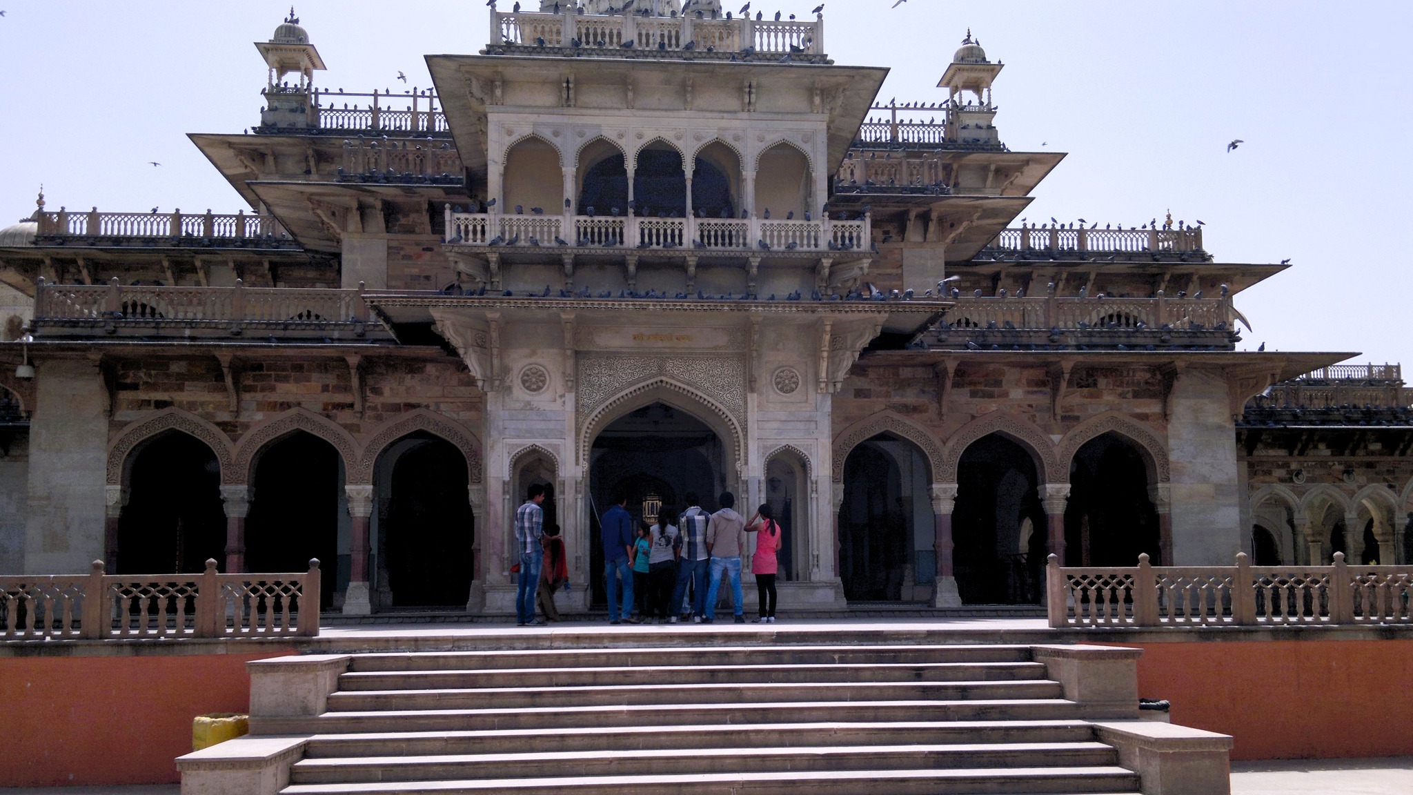
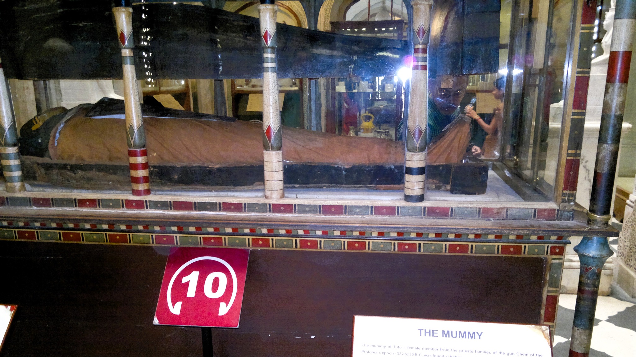
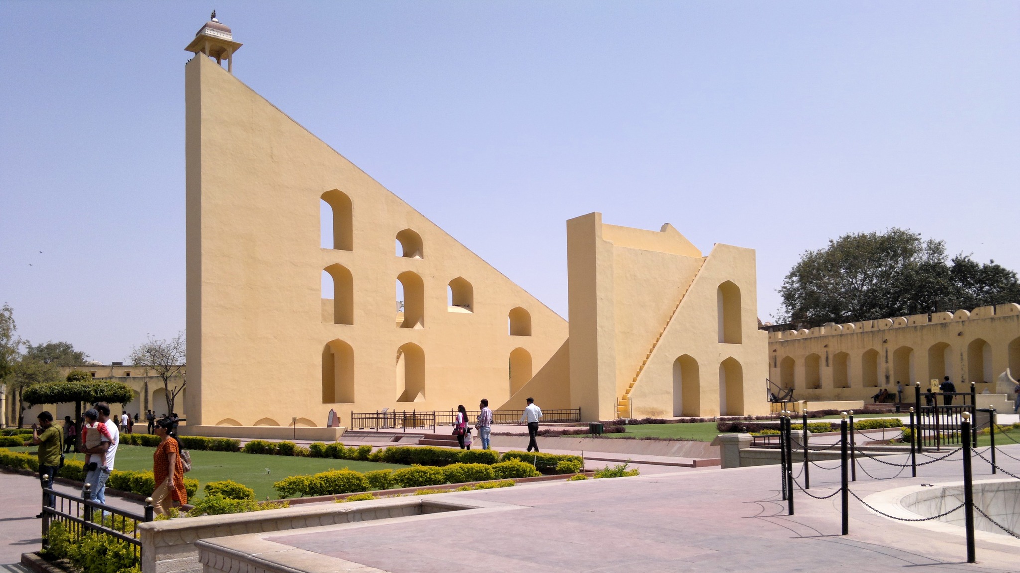
The tour started with the Jaipur Zoo, which I only agreed to keep in the package because I was curious to see what a zoo in a city with a desert in the vicinity, looked like. Sauntering through the zoo, I moved just across the road to Albert Hall Museum, the oldest museum in Rajasthan, where artifacts displayed also include those from Ancient India and Egypt, the highlight being an Egyptian Mummy. It was also at Albert Hall Museum where I learnt I could buy a single consolidated ticket that would allow entry to many of the monuments in Jaipur, including for Jantar Mantar, Amer Fort and Hawa Mahal. From there, as I moved towards Jantar Mantar, a site that had captured my imagination from when I was a kid, I first beheld the arrays of shops painted pink, explaining the epitaph of ‘the Pink City’.
Glimpses from Albert Hall Museum
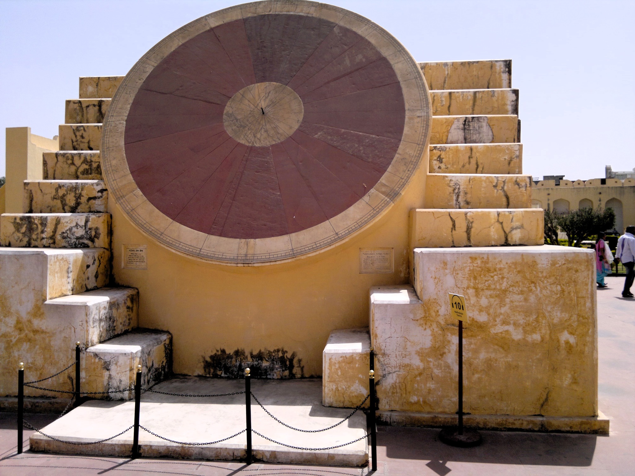
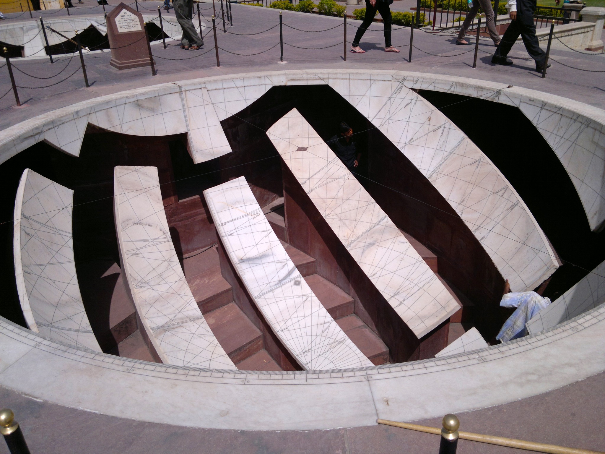
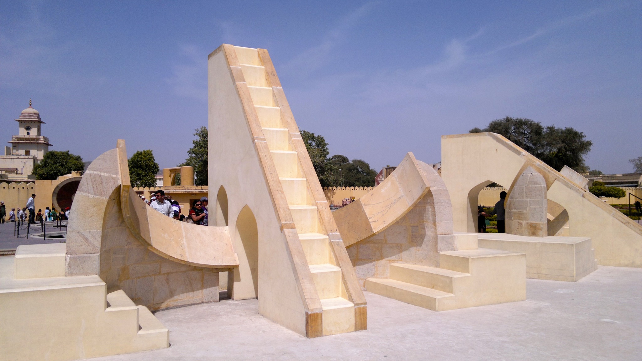
Built in between 1728 and 1734 by the avid astronomer king Sawai Jai Singh, the Jantar Mantar comprises 19 astronomical instruments built from stone and marble, that allow observation of astronomical positions with the naked eye. This, along with similar observatories later built at 5 other locations, including in Delhi and Ujjain, helped in more accurate calculation of celestial positions for the astronomical tables that were continuously used in India for over a century. After going through alternating periods of use and disuse, interspersed with some spells of restoration, including some during the British colonial rule, and a final restoration by 2006, it was designated a UNESCO World Heritage Site in 2010.
Glimpses from Jantar Mantar
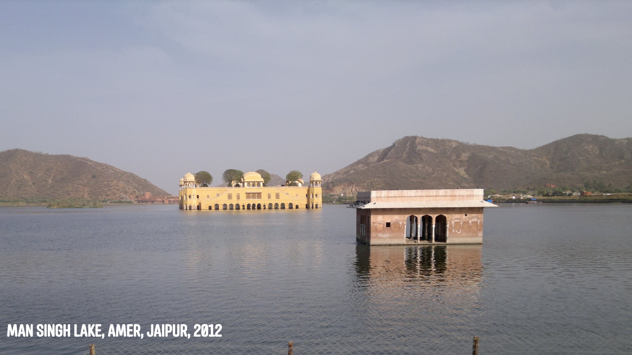
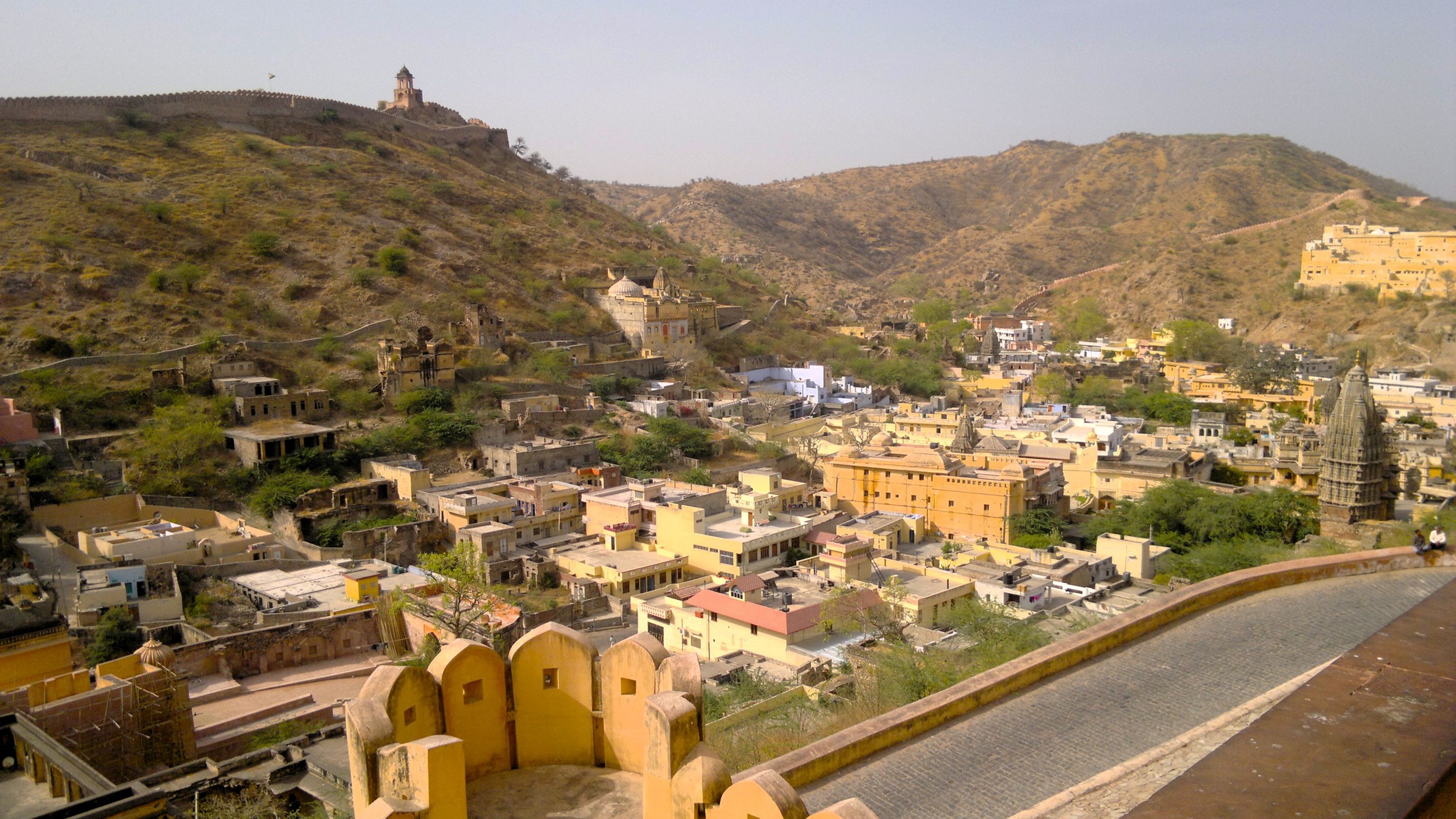
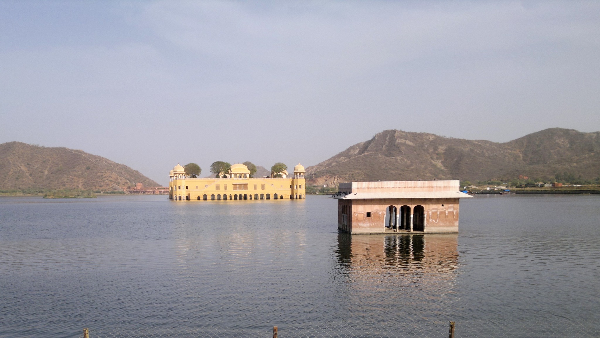
From Jantar Mantar, I moved through the street lined by pink-coloured shops through the Old City centre towards the hills that stood overlooking the city in the north. Soon, the autorickshaw passed by the expansive Man Sagar Lake, and climbed up the road that ran into the hill. A little up the hill, I stopped at Kanak Vrindavan, a beautiful garden with a temple, fountains, trees and chhatris, built by Sawai Jai Singh 275 years ago, where scenes of many movies, most notably, Lamhe, have been shot. Further, passing through a long stretch of the road cut through the hill and was lined with wood on both sides, the autorickshaw finally reached a wide section on the road, where countless vehicles were parked. Beside the section lay a lake with a spice garden in the middle, and above on the crest of the hill stood an imposing fort – Amer fort.
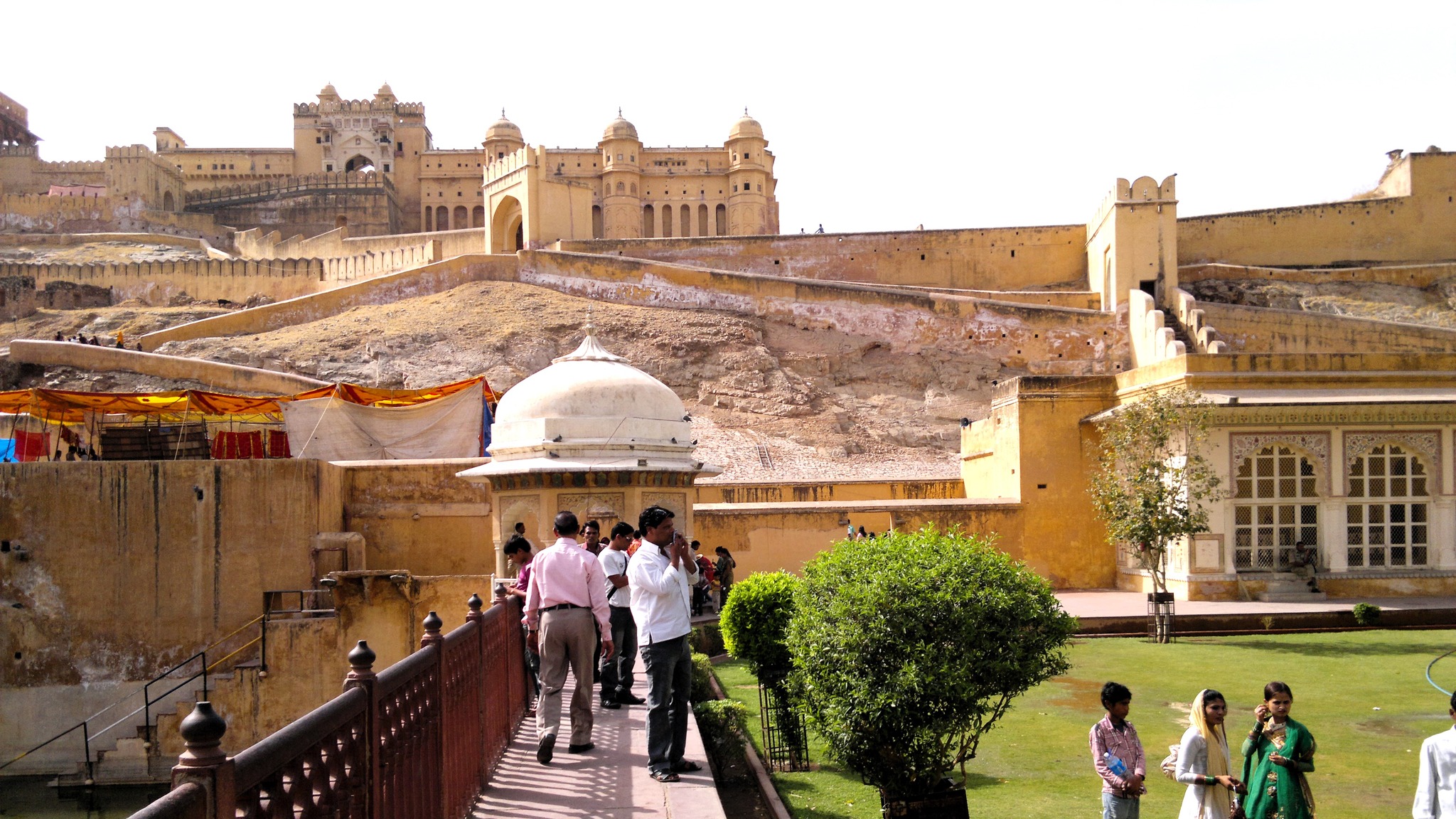
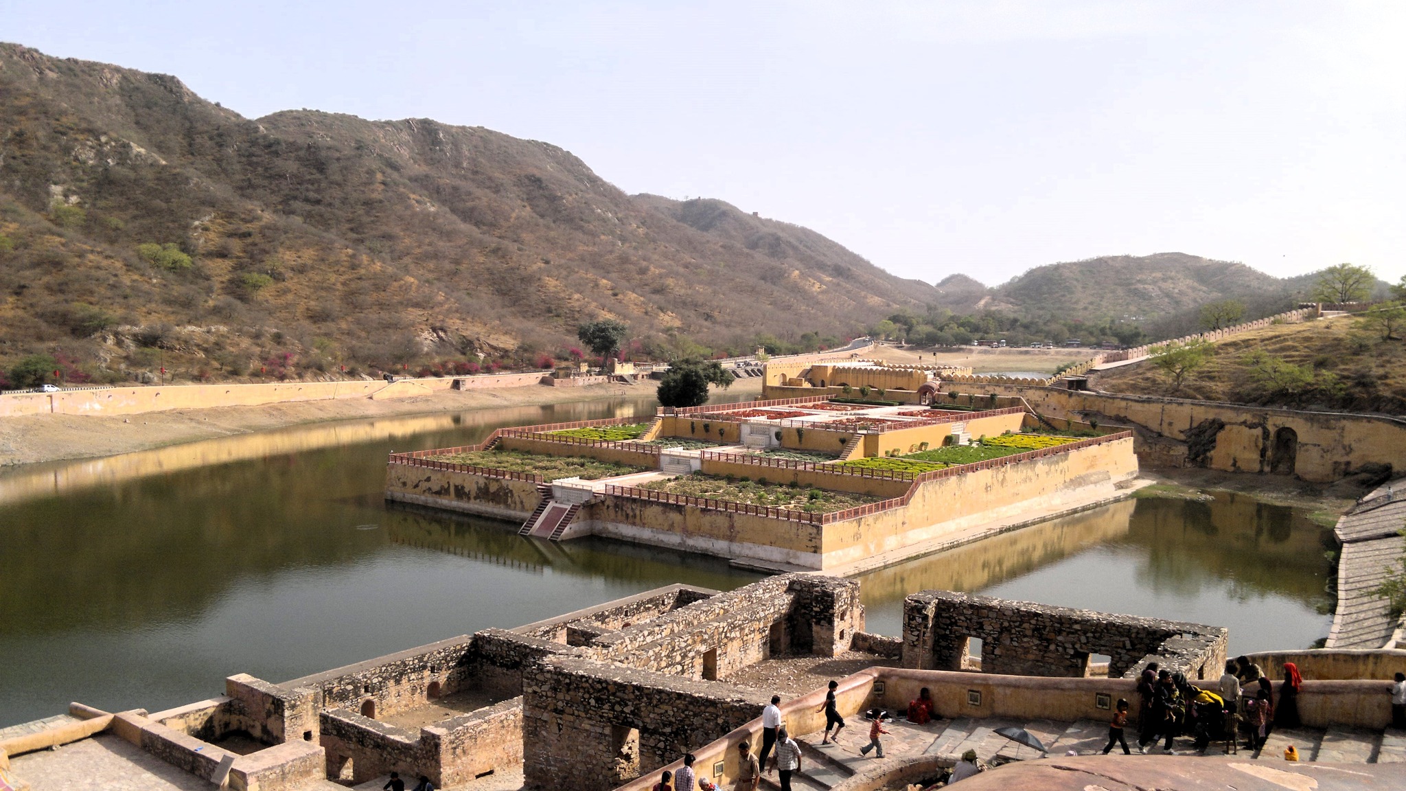
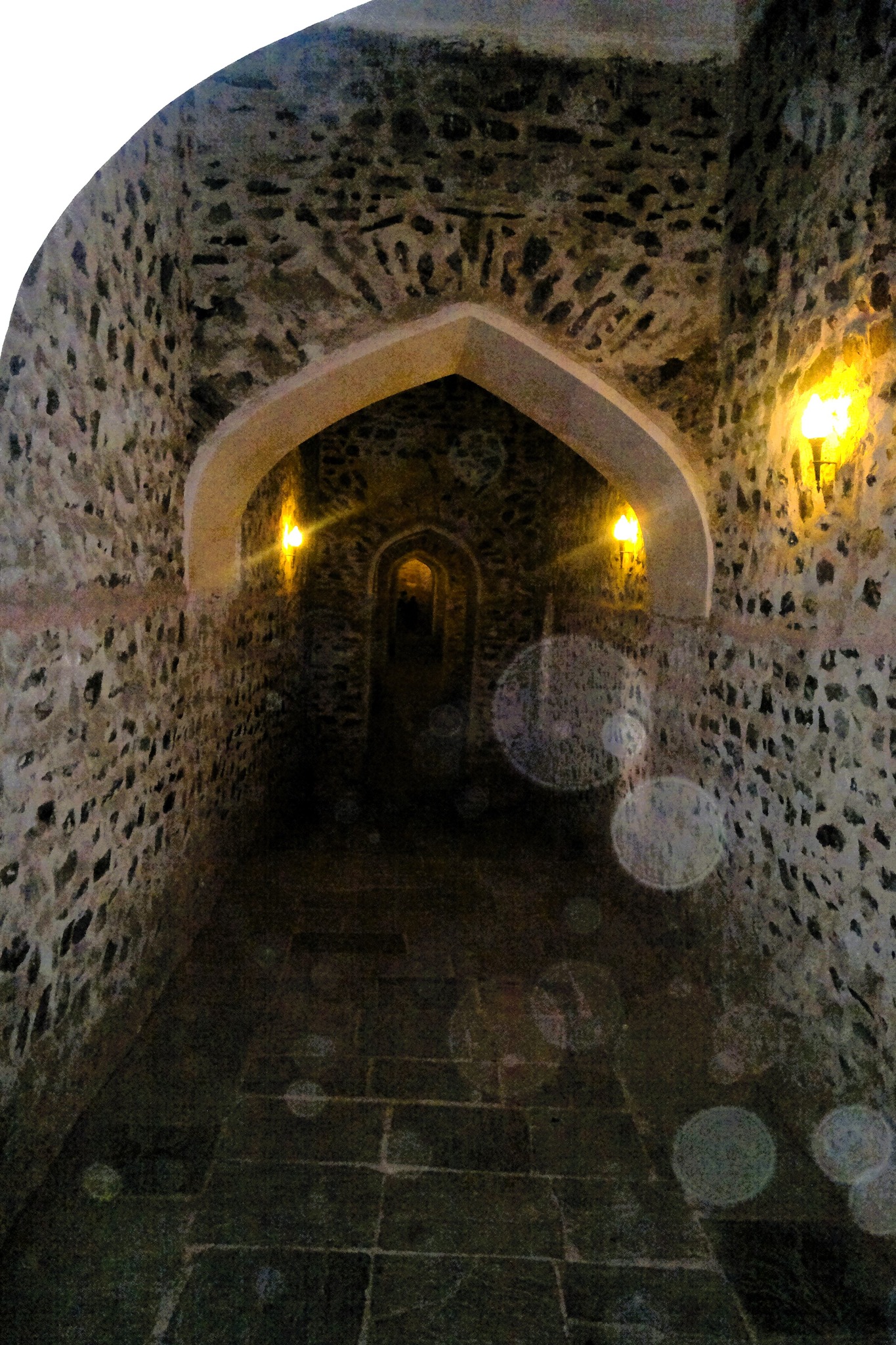
The Amer fort, built in 1592 AD by the Kachhwaha king Man Singh, became the mainstay of the ruling family of Amer or Dhundar state, which was ruled by the Kachhwahas since 1037 AD. Amer, the area ensconced in the Aravallis where the fort is located, was the capital of the Kachhwahas until 1727, when Sawai Jai Singh II built a fortified city called Jaipur at the foothills of the Aravallis. The fort itself was expanded by successive kings, and today consists of the six main sections, with the temple dedicated to Sila Devi, prominently standing in the first courtyard, a Diwan-i-aam or Public Audience Hall, many palaces including Sukh Mahal, Sheesh Mahal and that of Man Singh I. A tunnel, that runs partly subterranean, leads to Jai Garh fort, a military fortress situated at a nearby peak. Views of the landscape from the fort are breathtaking.
Approach to Amer fort
View of spice garden in Maota lake
An intricately decorated entrance gateA tunnel leading to Jaigarh fort
View of Amer area from Amer fort
Glimpses from Amer fort
View of Jal Mahal in Man Sagar Lake
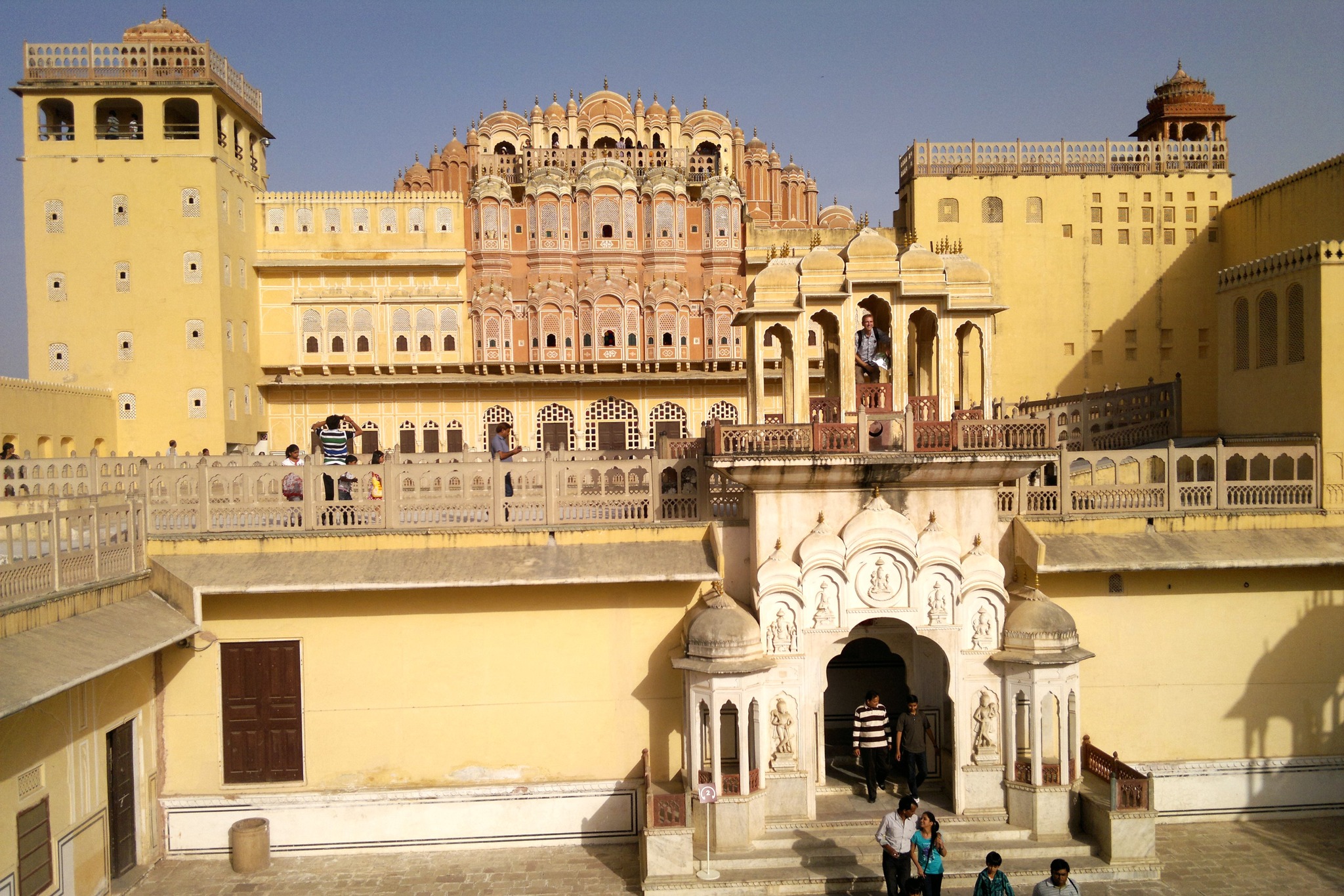
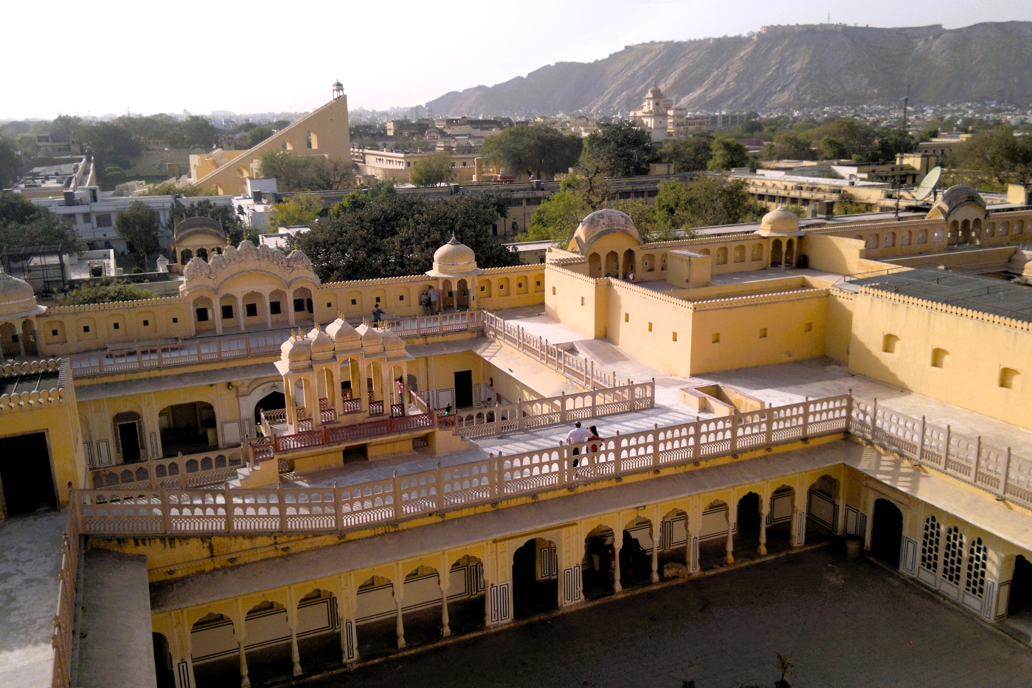
Now it already being 3.30 PM, I headed back towards the Old City centre, again stopping by the Man Sagar lake, and reaching the Hawa Mahal just in time before it closed for the day. Hawa Mahal, another structure that had fascinated me since my childhood, perhaps best typifies the character of the Old City, with its pink coloured facade. The palace, built in 1799 by Sawai Pratap Singh, the grandson of Jai Singh II, the founder of Jaipur, is unique because of the rows of latticed windows, small and big, with some decorated with coloured glasses, adorning the facade making the facade resemble a honeycomb. Walking through the multiple levels of the Hawa Mahal, I got excellent views of the city skyline as well as of the hills in the distance.
Inside Hawa Mahal
View of Jantar Mantar and Nahargarh fort from Hawa Mahal
With the day drawing to a close, I bid adieu to the autorickshaw driver, and rested for a couple of hours in the hotel room. I pondered about what to do the next day, but soon started feeling a fever setting in – something that I had encountered on my first ever solo trip the previous year too. It may have been a combination of sleep deprivation and the day-long exposure to the sun, but I decided it was best to rest at my place in Delhi as opposed to in Jaipur. So, I checked out, had dinner, and caught an overnight bus to Delhi. Slipping in and out of consciousness, I was in Delhi the next morning, glad to get the whole Sunday to rest and recover from the fever.
April 2011. I remember it like it was yesterday. My first ever solo trip. My friends who had planned a Dharamshala trip with me for the Good Friday weekend ditched me at the last moment. But I had already made up my mind, and so I set out all alone. I simply lugged my backpack, took the metro to the Kashmiri Gate ISBT, and was soon looking for the counter for the buses leaving for Himachal Pradesh.
It was around 9.30 PM. Every bus counter had long queues stretching for half a mile each. There were no more direct buses scheduled to Dharamshala that night. So I joined the one for Chandigarh, and when I finally reached the counter window around 10.30 PM, I was told I would be getting tickets only for the 1.30 AM bus. Left with no choice, and not intent on turning back home, I bought the ticket, and was inside the bus at 1.30 AM.
The bus was an ordinary road transport one, with thin cushioned seats, no AC, with windows that you had to keep open for ventilation. Fortunately, I got a window seat, that too, right near the main door. After the bus started at around 2, I was in and out of sleep, and before I knew it I was in Chandigarh, where I got to know I had to take a city bus to the Sector-43 ISBT to catch a bus to Dharamshala, which I did.
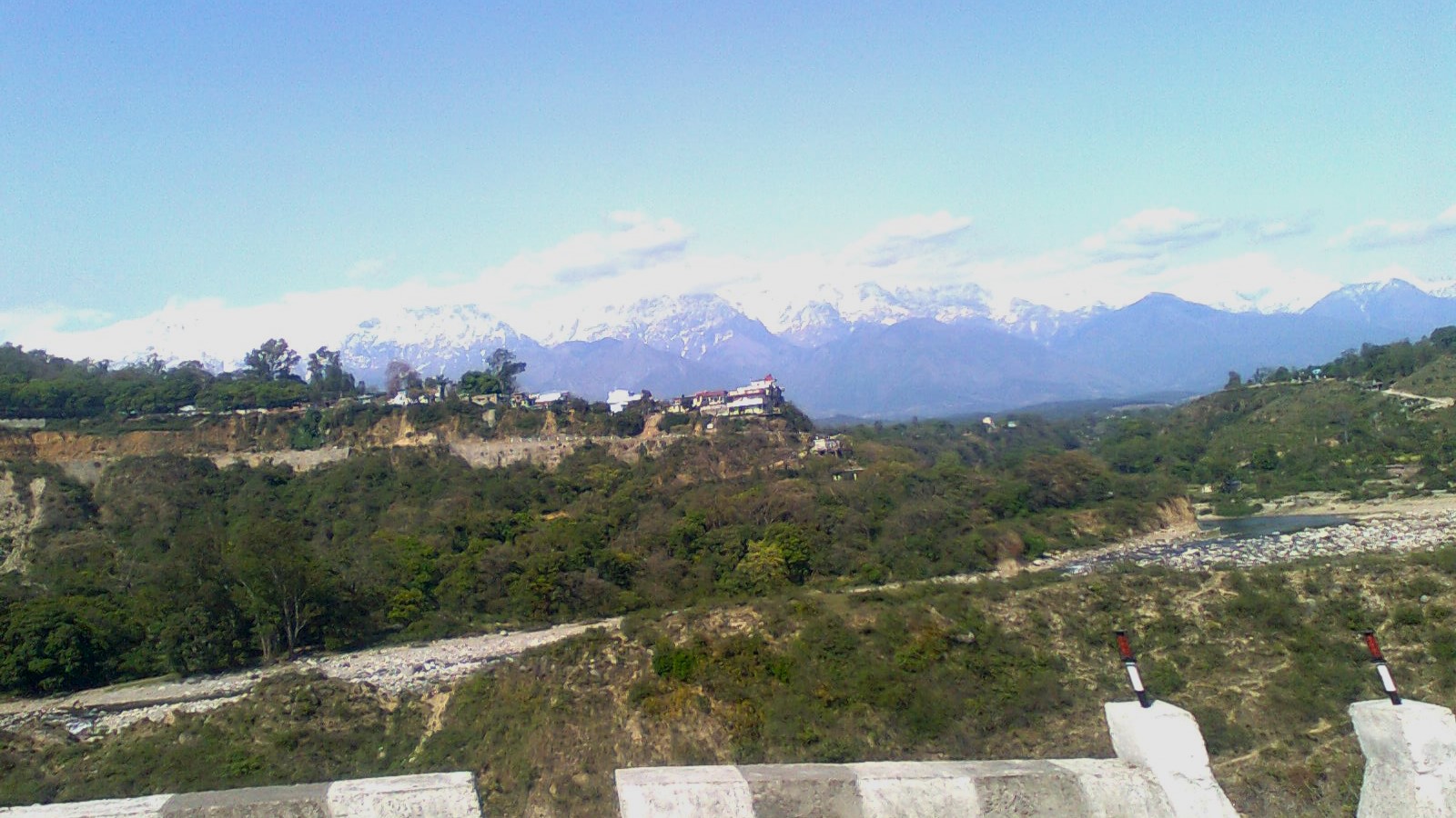
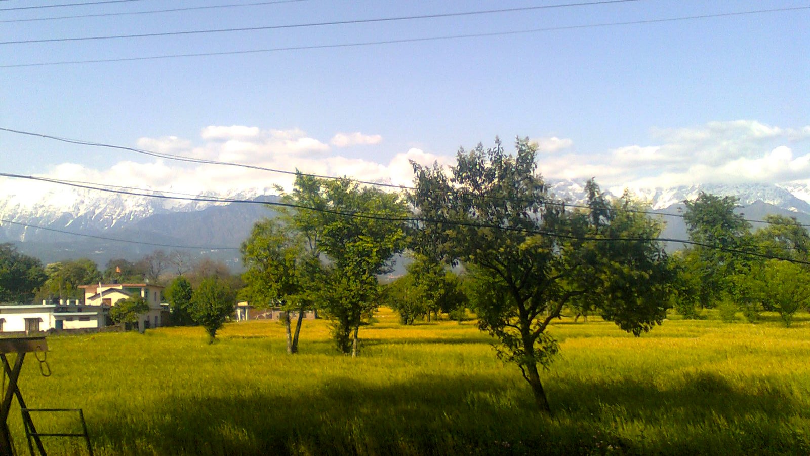
By 9AM, I was on my way to Dharamshala in a Himachal Road Transport bus, again in an ordinary bus type. I remember first passing through Nangal, where the Bhakra-Nangal dam, that I remembered from my school textbooks, is located. Soon, we were climbing the hills, and passed through Una, which I knew because it was the hometown of a senior colleague of mine. By 3 PM though, as the bus swerved through corners, I remember seeing the snowcapped mountains from above the tops of coniferous trees in the distance.
Dhauladhar range as seen from the bus
View while approaching Dharamshala
The bus kept pushing up the hills and taking one hair-pin bend after another, and yet the mountains kept their distance. But that was until 3.30PM, when suddenly, I could see the snow-capped mountain within touching distance. Within the next half hour, I was at the foothills of the Dhauladhar mountain range, the one that I had been seeing for around three hours. I was at Dharamshala.
The first thing I did was talk to a cab driver about a day tour package for the next day, which would include McLeodgunj and Kangra – it would set me back by 700 rupees. Then, I walked a couple hundred metres up the main road and booked a room, that I got for a really cheap price, not more than a 1000 rupees. Then, I settled down for the evening, watching the IPL on TV, then ordering dinner, and going to sleep after a really, really long day.
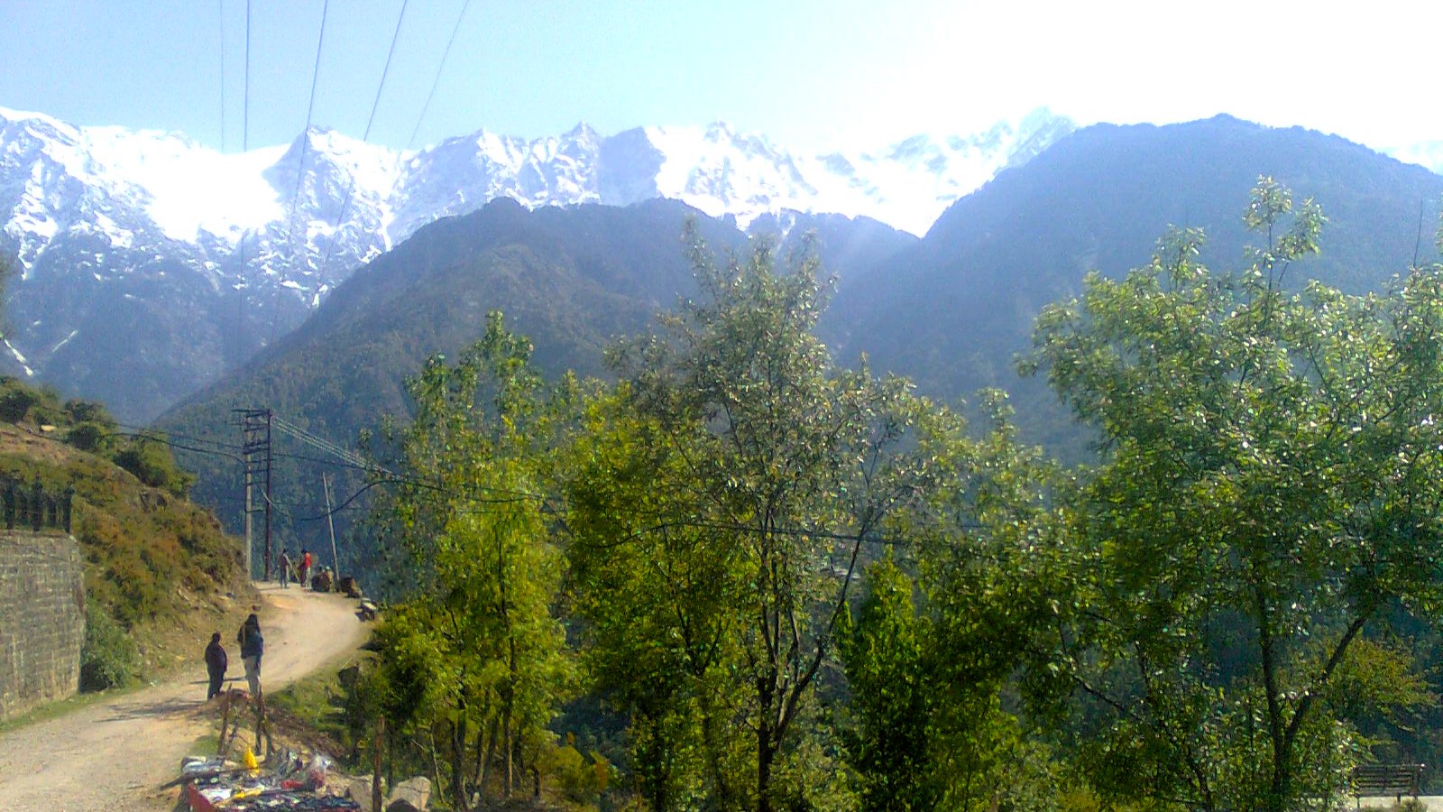
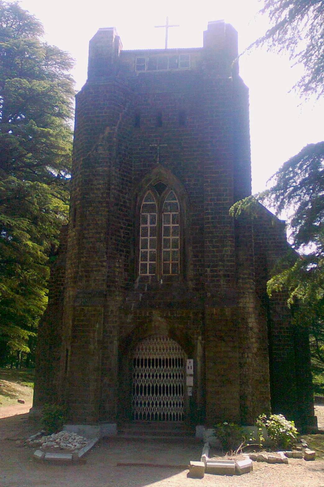
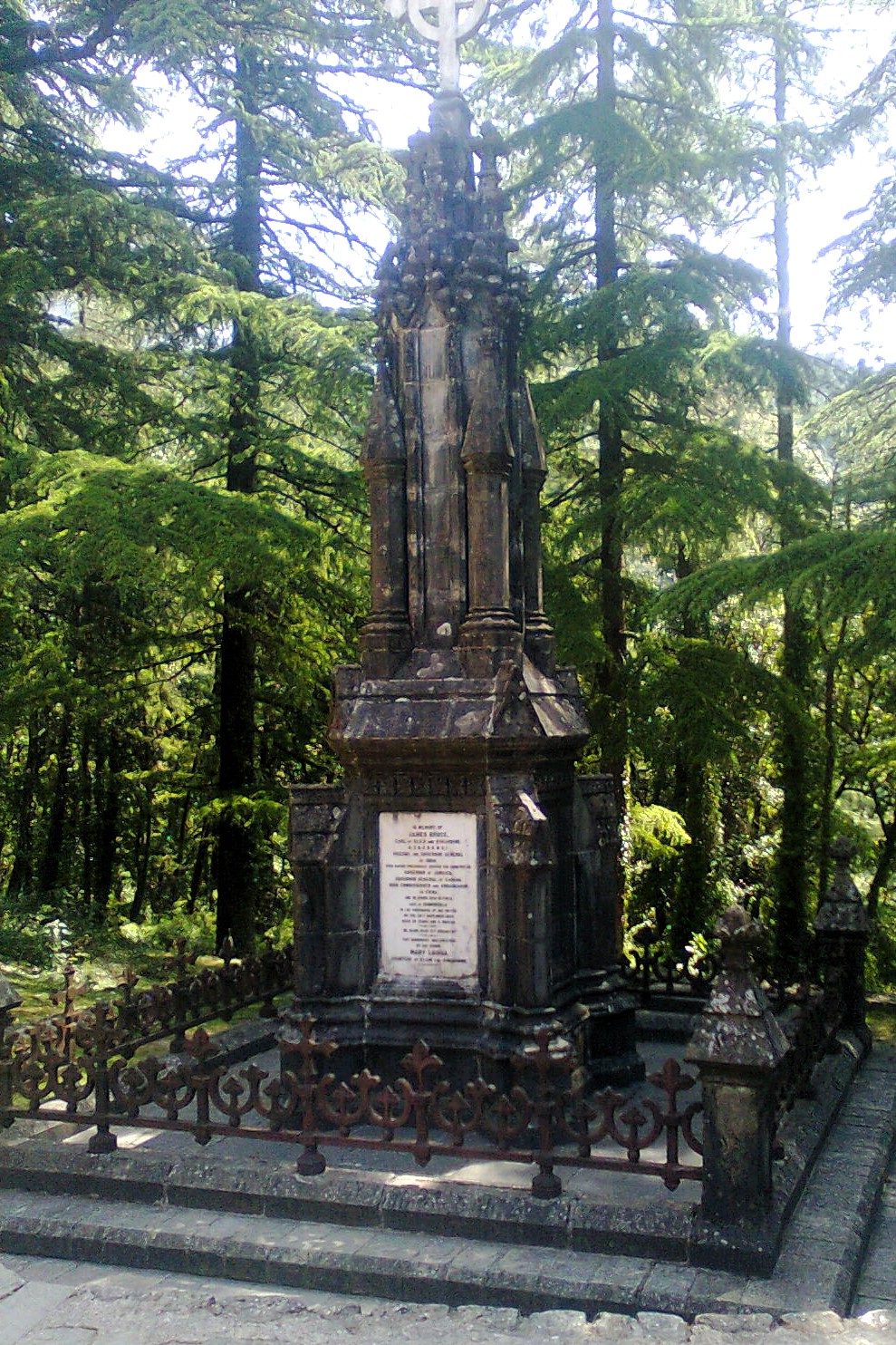
Next morning I was feeling a little feverish. So, reaching the busstop at 9 AM, I first booked a return ticket to Delhi, this time on an AC bus, for the same evening, and then caught up with the cab driver that I had talked to the previous evening. The cab driver first took me to Naddi View Point, from where I took in breathtaking views of the Dahuladhar mountain range. Next, I stopped at the Church of St. John in the Wilderness, an Anglican Church built in 1852 AD in the Neo-Gothic style. James Bruce, the 8th Earl of Elgin, and the Viceroy and Governer-General of India from 1862 to 1863 is buried in the churchyard.
Naddi View Point
Church of St. John in the WildernessMemorial to James Bruce, 8th Earl of Elgin
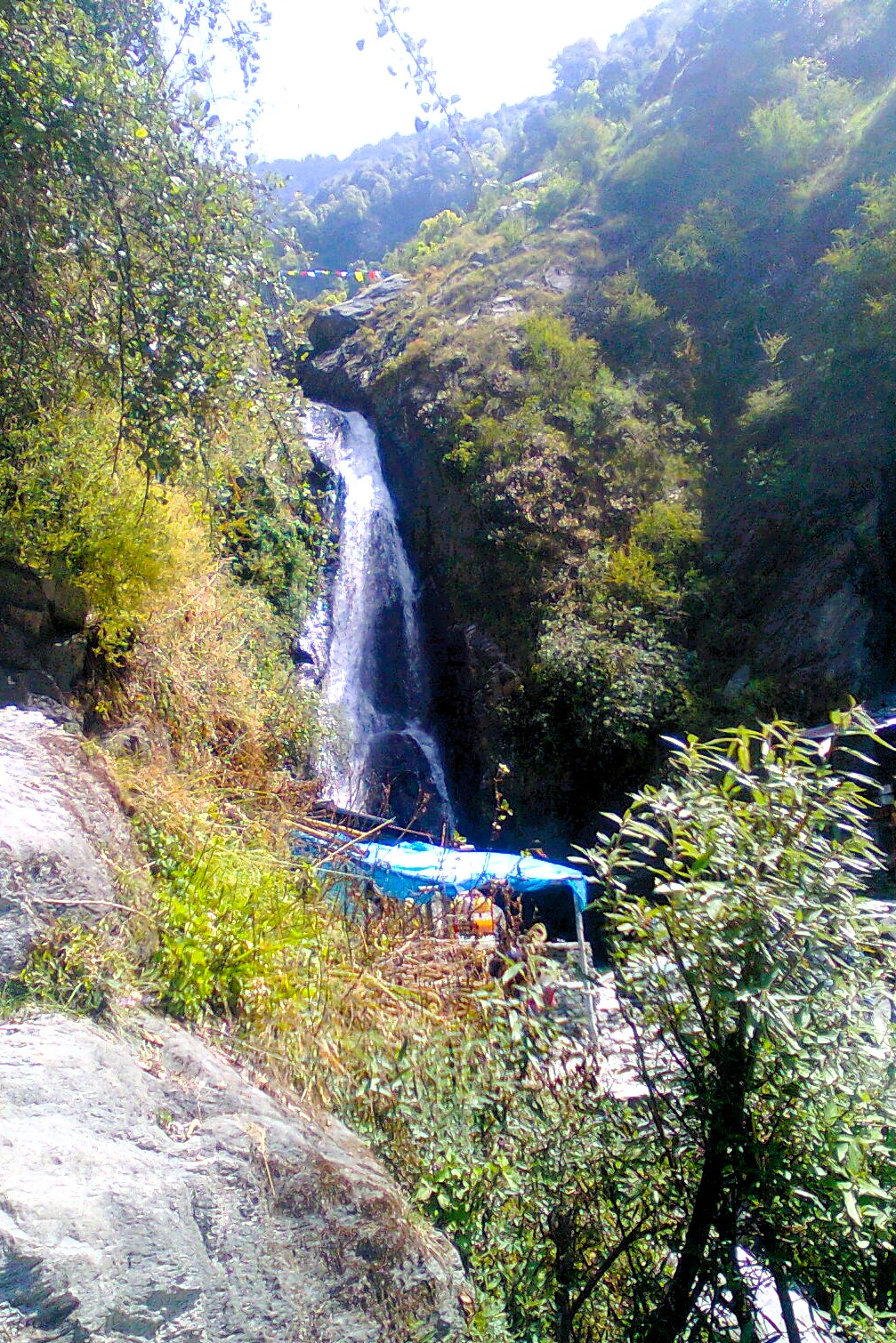
Then pushing on towards McLeodgunj, I stopped next at the Bhagsu Nag temple. Legend has it that Bhagsu, sent by the ogre king of Rajasthan to fetch water for his drought-ridden kingdom, had to fight to death the Nags, or the snakes, on his return with a pail of water stolen from the perennial streams of the Dhauladhar mountains. Impressed with his dedication to the people of his kingdom, the lord of the snakes, Lord Shiva, bestowed immortality on Bhagsu in the form of the remembrance of both of their names in conjunction, hence, Bhagsu Nag.
Bhagsu Nag temple
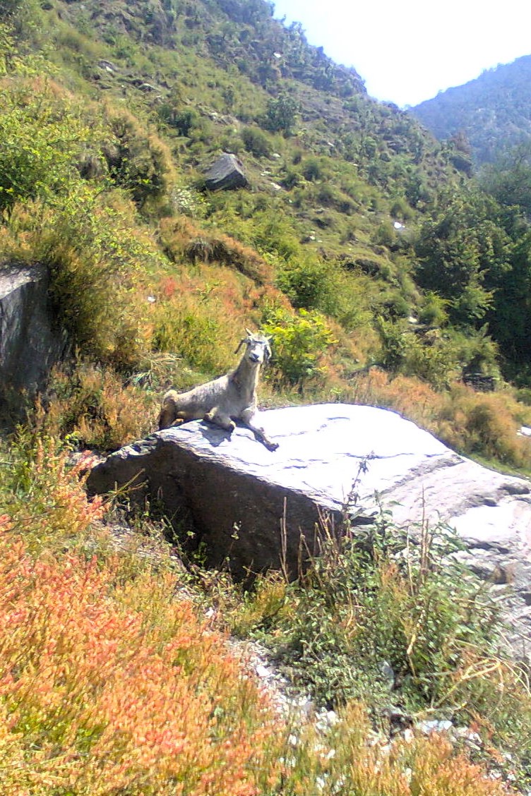
An wizened goat stares on the walk to the waterfallThe Bhagsu Nag waterfall
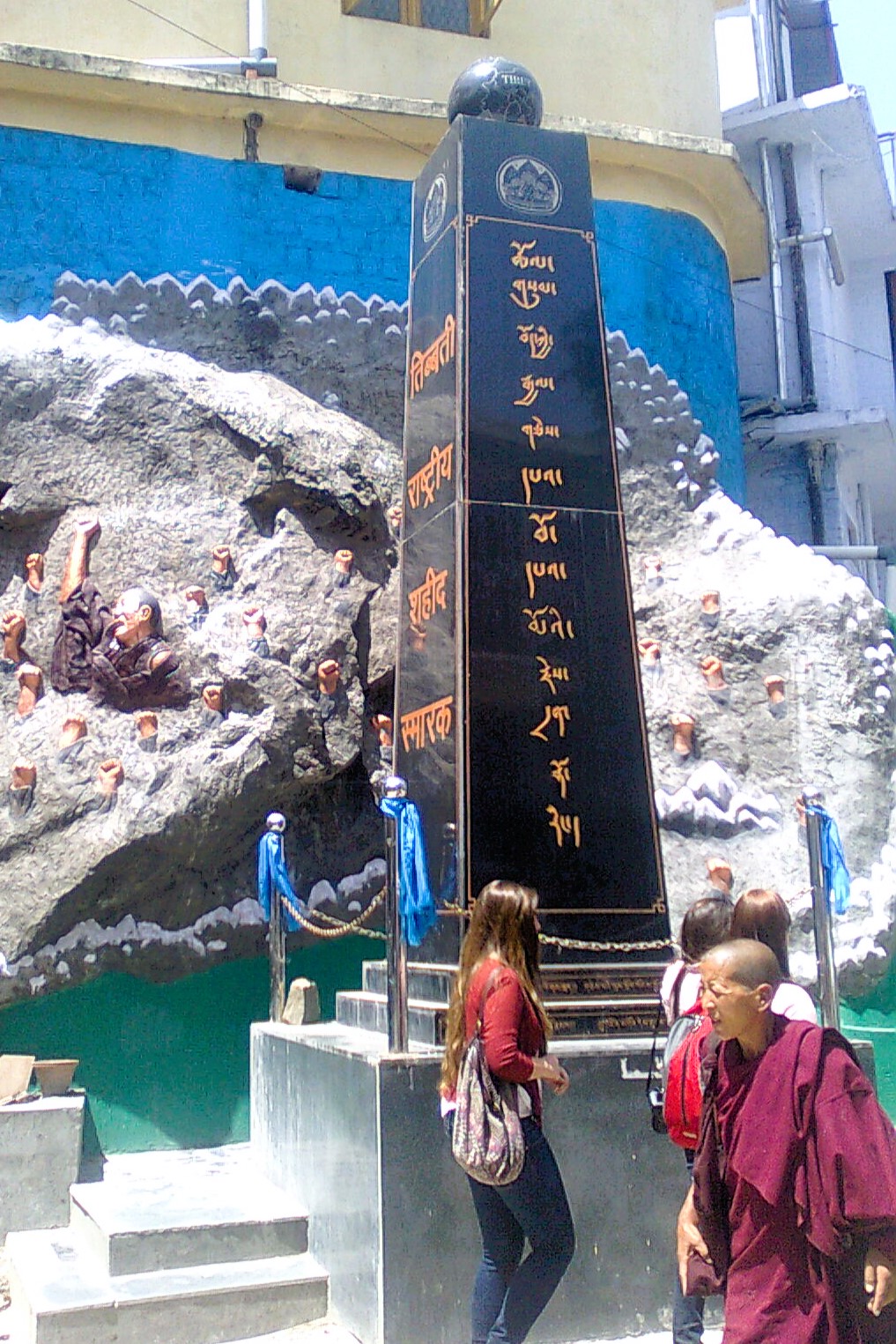
After taking a walk to the waterfall behind the Bhagsu Nag temple, I proceeded to the Namgyal Monastery, which is the personal monastery of the Dalai Lama. Founded in the 1560s, the monastery was relocated to Dharamshala from Lhasa following the Tibet Uprising in 1959. Paying my respects at the temple, and conversing with a monk, I proceeded to Kangra, stopping by some tea gardens on the way.
At the Namgyal MonasteryAt the Namgyal Monastery
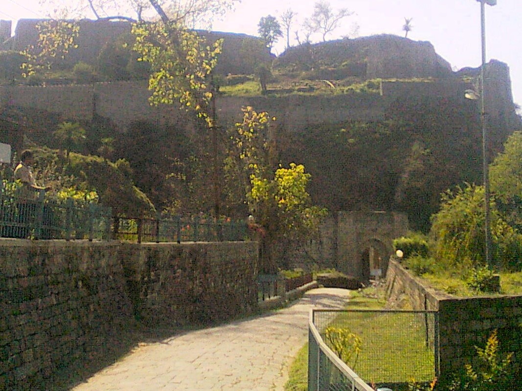
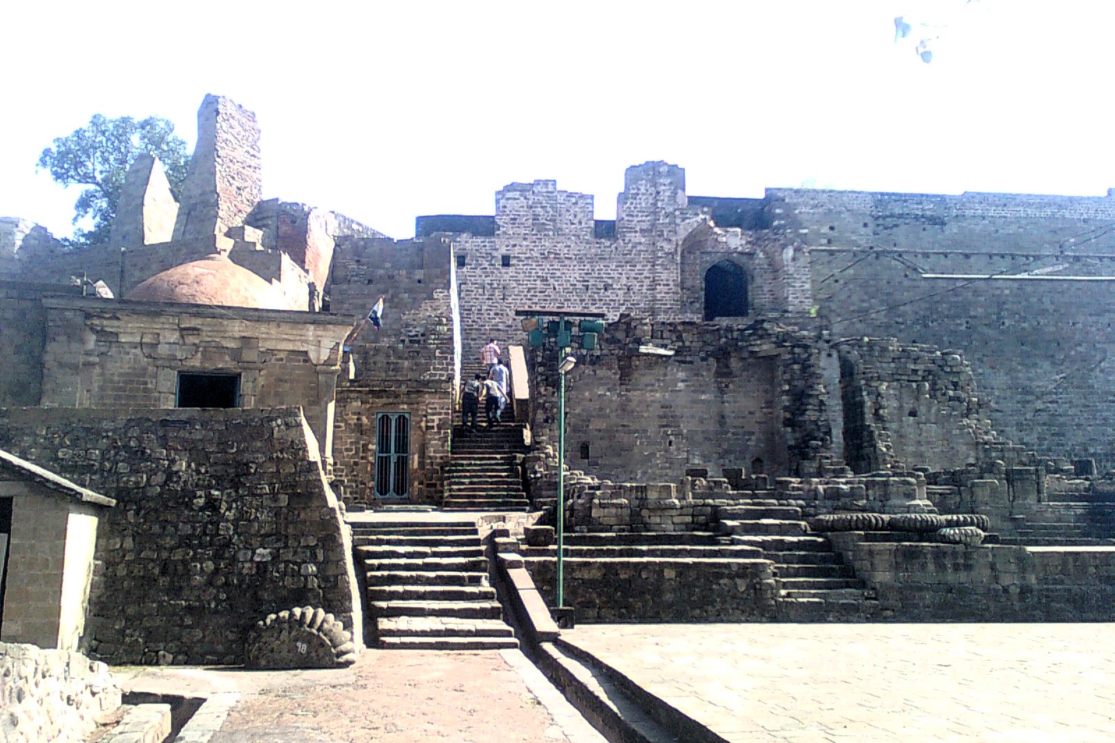
Once at Kangra, I visited the Kangra fort built by the Katoch dynasty, with the earliest existing remains inside the fort dateable to the 9th-10th century. The fort yielded to the attacks, first of Mahmud of Ghazni in 1009 AD, then to Tughlaqs in the 14th century, and then Sher Shah Suri’s general in 1540 AD. In 1620, the Kangra kingdom was annexed by to the Mughal empire by Jahangir, but wrested back by Raja Sansar Chand in 1786 AD after decline of the Mughal empire. Following siege by Gurkhas, Sansar Chand took the help of Maharaja Ranjit Singh of the Sikh Empire to ward off the attack, and yielded the fort to the latter.
The fort was annexed by the British from the Sikhs in 1846 and occupied by British garrisons until 1905 when it was heavily damaged by an earthquake. Today, the fort, the largest of the Himalayan forts, lies in ruins, as a proud testament to the illustrious past of the Kangra Valley. Standing at the edge of a cliff, one can only marvel at the breathtaking views of the valley. The Kangra fort was the one where my love for forts was first ignited.
Entrance to the Kangra fortInside Kangra fort
View of the valley from the edge of Kangra fort
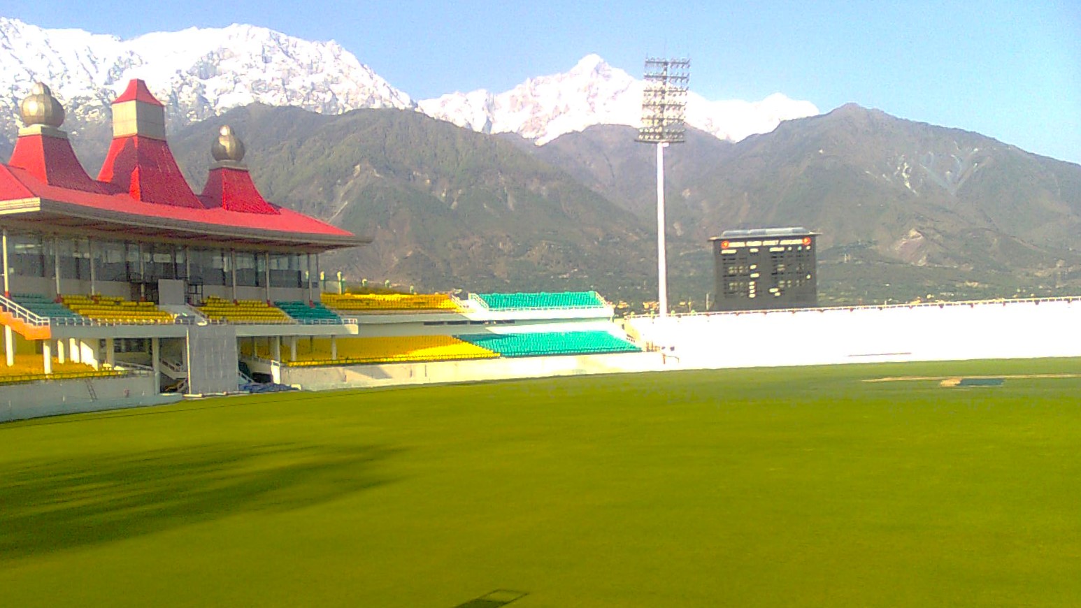
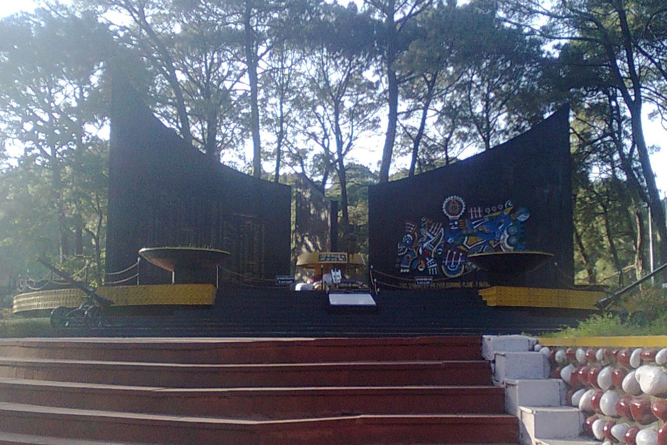
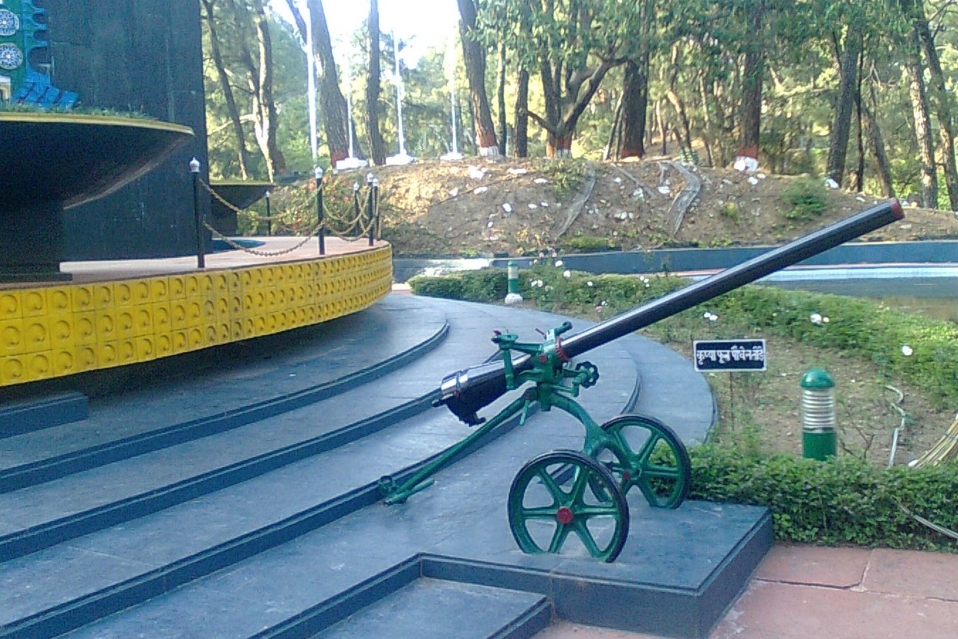
It was now 3 PM, and I headed back towards Dharamshala stopping at the picturesque Dharamshala Cricket Stadium which had just come into national limelight after hosting matches in the IPL. Then, stopping at the War Memorial, I was dropped by the cab driver at the bus station, where I boarded the bus back to Delhi around 7. The next morning I was back in Delhi, glad to have the Sunday to recover from a very tiring yet whirlwind first solo trip.
The HPCA Stadium at Dharamshala
War Memorial in DharamshalaWar Memorial in Dharamshala